Showing 10989 items matching " land"
-
 The Beechworth Burke Museum
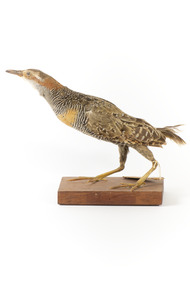
Animal specimen - Buff-Banded Rail, Trustees of the Australian Museum, 1860-1880
The Buff-banded Rail is located on mainland Australia. It can also be found in south-east Asia, New Guinea and New Zealand. These birds are often seen individually or in pairs walking through the dense reeds and vegetations of wetlands or crops. This rail has a slow walk and often flicks its tail, which is raised, as they move. They are omnivore scavengers who feed on a large variety of invertebrates, fruit, seeds and vegetables. This specimen is part of a collection of almost 200 animal specimens that were originally acquired as skins from various institutions across Australia, including the Australian Museum in Sydney and the National Museum of Victoria (known as Museums Victoria since 1983), as well as individuals such as amateur anthropologist Reynell Eveleigh Johns between 1860-1880. These skins were then mounted by members of the Burke Museum Committee and put-on display in the formal space of the Museum’s original exhibition hall where they continue to be on display. This display of taxidermy mounts initially served to instruct visitors to the Burke Museum of the natural world around them, today it serves as an insight into the collecting habits of the 19th century.This specimen is part of a significant and rare taxidermy mount collection in the Burke Museum. This collection is scientifically and culturally important for reminding us of how science continues to shape our understanding of the modern world. They demonstrate a capacity to hold evidence of how Australia’s fauna history existed in the past and are potentially important for future environmental research. This collection continues to be on display in the Museum and has become a key part to interpreting the collecting habits of the 19th century.This specimen is in a standing position with its neck stretched forwards on a wooden platform. The Buff-Branded Rail has a pale grey/yellow eyebrow over the orange glass eyes and a pale grey bill. It also has an orange and brown coloured band on its breast. This bird is multicoloured with streaks of chestnut brown, black, white and a faint orange-brown. This specimen has a paper identification tag tied to its left leg.20D. / Land Raid / See Catalogue, page, 35. /taxidermy mount, taxidermy, animalia, burke museum, beechworth, australian museum, skin, reynell eveleigh johns, bird, landrail, buff-banded rail -
 Ringwood and District Historical Society
Photograph, Maroondah Hwy near Oban Road, 28th January 1991, 1991
Digital photographLand developers wanted to make a commercial building but refused -
 Ringwood and District Historical Society
Photograph, Maroondah Highway West, Ringwood- c1920. F. Kenworthy, Ringwood. Garage and Motorbody Works
Black and white photograph (2 copies- 1 large, 1 small)Image shows Kenworthy building with vacant land opposite. -
 National Wool Museum
Booklet, Waybills
Wool waybills booklet produced by Winchcombe, Carson Ltd. Booklet found intact among other papers in an old box on a farm on the central coast of NSW in the early 1990s and many hundreds of km from Gulargambone (Barry Blair).Messrs J H Landers & Co, Lanauria, Gulargambonewool - transportation wool sales, winchcombe, carson limited, lanauria, gulargambone, wool - transportation, wool sales -
 Whitehorse Historical Society Inc.
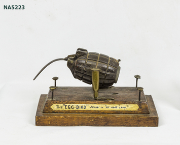
Artwork, other - French Art WWI, "The Egg Bird"
Example of WWI French Art, using found material.Contemporary label, Whimsical article made from weapons (hand grenade + Bullet casing) + uniform buttons.Example of WWI French Art consisting of hand grenade "bird" mounted on wooden base using .303 calibre cartridges as pivot surrounded by 4 British Buttons as "fence".Contemporary label: The Egg-Bird" found in "No-Man's Land"french art - mounted with contemporary label.. -
 National Vietnam Veterans Museum (NVVM)
Postcard, Asia-Pacific Color Productions Ltd, Postcard -Foldout booklet
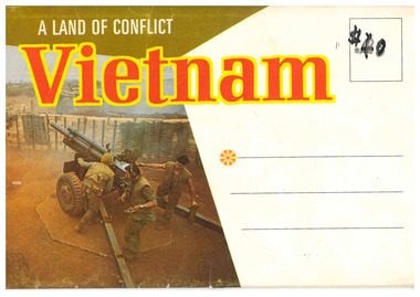
Cover khaki and white. Picture of field gun, three soldiers. Vietnam written in red with yellow outline. Postcard pack consisting of 14 (including front cover) scenes of military life and work in VietnamA Land of Conflict Vietnam Back - Base Camp, An Khepostcard, vietnam, soldiers, julian peter mcnamara, mcnamara, australian army, 3794332, trooper, royal australian armoured corps, national service, b squadron, a squadron, 1st armoured regiment -
 Cockatoo History & Heritage Group
photograph, Desmond, home of O'Hara family
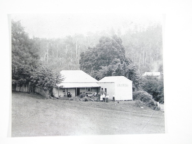
"Desmond", on the Cockatoo Creek, on land which now forms part of Alma Treloar Reserve, was the home of the O'Hara family ca. 1910. The poet John Bernard O'Hara, used to visit his mother there, and remembered many wonderful holidays with the "city folk" who travelled to Cockatoo on "Puffing Billy" and camped along the creek. The family in the foreground is most likely the O'Hara family.The photograph is significant because it shows a Cockatoo home of around 1910.Black and white photograph of "Desmond", home of the O'Hara family, with a family group in foreground. Situated on Cockatoo Creek, on land now known as Alma Treloar Reserve. Circa 1910.cockatoo homes, "desmond", o'hara family, cockatoo creek, john bernard o'hara. -
 Kew Historical Society Inc
Plan - Subdivision Plan, High Street, Kew, 1920-1935
Pru Sanderson, in her groundbreaking ‘City of Kew Urban Conservation Study : Volume 2 - Development History’ (1988), summarised the periods of urban development and subdivisions of land in Kew. The periods that she identified included 1845-1880, 1880-1893, 1893-1921, 1921-1933, 1933-1943, and Post-War Development. These periods were selected as they represented periods of rapid growth or decline in urban development. An obvious starting point for Sanderson’s groupings involved population growth and the associated economic cycles. These cycles also highlighted urban expansion onto land that was predominantly rural, although in other cases it represented the decline and breakup of large estates. A number of the plans in the Kew Historical Society’s collection can also be found in other collections, such as those of the State Library of Victoria and the Boroondara Library Service. A number are however unique to the collection.The Kew Historical Society collection includes almost 100 subdivision plans pertaining to suburbs of the City of Melbourne. Most of these are of Kew, Kew East or Studley Park, although a smaller number are plans of Camberwell, Deepdene, Balwyn and Hawthorn. It is believed that the majority of the plans were gifted to the Society by persons connected with the real estate firm - J. R. Mathers and McMillan, 136 Cotham Road, Kew. The Plans in the collection are rarely in pristine form, being working plans on which the agent would write notes and record lots sold and the prices of these. The subdivision plans are historically significant examples of the growth of urban Melbourne from the beginning of the 20th Century up until the 1980s. A number of the plans are double-sided and often include a photograph on the reverse. A number of the latter are by noted photographers such as J.E. Barnes.A roughly drawn and faded actual or projected subdivision of a parcel of land bordering on High and Mary Streets. The plan shows five allotments facing High Street and at their rear, another allotment facing Mary Street. In 1906, when the Board of Works surveyors completed Detail Plan 1589, the allotment in Mary Street is shown to include a building. The section of land attached to this building is shown to be undeveloped, thus making a further subdivision possible.subdivision plans - kew, high street -- kew (vic.), mary street -- kew (vic.) -
Whitehorse Historical Society Inc.
Document, Nunawading South State School
Documents relating to purchase of land to build Nunawading South State School. Land purchased from K.E. & L.A. Jones. Photocopies of photos of the land before and during building. Road Plan. Notice from Native Plants Preservation Society.nunawading south state school no. 4808, k.e. & l.a. jones, victoria. education department, native plants preservation society of victoria -
Whitehorse Historical Society Inc.
Legal record - Land Title, Certificate of Title
Certificate of Title to Roger Robert Charles Jeanne de Stoop and Wivine de Stoop for land in Joseph Street Blackburn, and transfer of land to Tadedor Constructions Pty Limited, also transfer of land from Tadedor Constructions to the City of Nunawading.Certificate of Title to Roger Robert Charles Jeanne de Stoop and Wivine de Stoop for land in Joseph Street Blackburn, and transfer of land to Tadedor Constructions Pty Limited, also transfer of land from Tadedor Constructions to the City of Nunawading.Certificate of Title to Roger Robert Charles Jeanne de Stoop and Wivine de Stoop for land in Joseph Street Blackburn, and transfer of land to Tadedor Constructions Pty Limited, also transfer of land from Tadedor Constructions to the City of Nunawading.de stoop, wivine, de stoop, roger, land titles, virgilia street blackburn, city of nunawading, tadedor constructions pty limited -
Whitehorse Historical Society Inc.
Document - Interview Transcript, Bob and Barb Gardiner Interview, 15/11/2019
Bob and Barb Gardiner are long time members of the Whitehorse Historical Society. Bob Gardiner represented Australia as a walker at the Tokyo 1964 and Mexico City 1968 Olympic Games. The Gardiners built on former Schwerkolt land in 1961 in May Court.Bob and Barb Gardiner are long time members of the Whitehorse Historical Society. Bob Gardiner represented Australia as a walker at the Tokyo 1964 and Mexico City 1968 Olympic Games. The Gardiners built on former Schwerkolt land in 1961 in May Court. non-fictionBob and Barb Gardiner are long time members of the Whitehorse Historical Society. Bob Gardiner represented Australia as a walker at the Tokyo 1964 and Mexico City 1968 Olympic Games. The Gardiners built on former Schwerkolt land in 1961 in May Court. gardiner bob, gardiner barb, olympic games, may court mitcham no 7, bannister giselda -
Whitehorse Historical Society Inc.
Article, Mary Matheson, 1992
In 1914, Captain Charles and Mary Matheson purchased an orchard in Springvale Road, Forest Hill.In 1914, Captain Charles and Mary Matheson purchased an orchard in Springvale Road, Forest Hill. Her husband served with the Navy leaving Mary responsible for the orchard for 40 years. She supported the Presbyterian Church and donated land to establish the Strathdon Community.In 1914, Captain Charles and Mary Matheson purchased an orchard in Springvale Road, Forest Hill. matheson, mary, matheson, charles, matheson orchard, presbyterian church, strathdon community -
 Warrnambool and District Historical Society Inc.
Map - Maps, Soldiers Settlement WW2, Circa 1950
The soldiers' settlement scheme operated after the first and second world wars in an effort to more closely settle the land and also give opportunities to returned soldiers. Crown land and other larger estates were acquired for the purpose. Most of these maps relate to the area north of Warrnambool where many of the subdivisions were parts of larger estates.These maps pertaining to the Soldiers' Settlement program, relate to an interesting part of Australian and local history. As such they have historic and social interest and significance.A collection of 25 paper maps which relate to to the soldiers settlement post World War 2. Some have details of the people allocated the land and some smaller maps have the printed details of the applicants requirements.Text is black on white paper which in some cases is quite aged. The maps are as follows: .1 Narrapumelap Estate ( Ripon & Hampden) .2 Narrapumelap Estate Part 2 (Villers & Ripon) .3 Narrapumelap Estate Part 3 ( Villiers & Ripon) .4 Burrumbeet Estate ( Ripon) .5 ' Berrambool' Estate 9 Hampden & Villiers) .6 ' Hopkins Hill' Estate Villiers 4011 acres .7 Caramut North No 2 Estate ( Villiers ) .8 ' Morpor' Estate ( Villiers) 4172 acres .9 ' Morgiana' Estate ( Normandy) 3453 acres .10 ' Chatsworth House' ( Villiers) 9341 Acres .11 ' East Elwood' Estate Villiers 2407 acres .12 Grey's Estate ( Mornington) 1151acres .13 ' Rowes Estate' ( Buln Buln Gippsland 733 acres .14 'Tarrone' Estate No 2 Part map .15 'Chaldon Meade' Estate (Bourke) Bulla 517 acres .16 ' Terranallum South' Estate Hampden 3757 acres .17 ' Brung Brungle' Estate Dundas 695 .18 ' Armidale ' Estate ( Dundas)2108 acres .19 ' Moyne Falls' Estate ( Villiers) 627 acres .20' Yulong' Estate 9 Lowan 6321 acres .21 Murray Valley Irrigation District 9 Moira)113 acres .22 Murray Valley Irrigation District 103 acres .23 ' Mount Fyans' Estate ( Hampden) .24 ' Barwidgee ' Estate ( Villiers) 4277 acres .25 'Pine Hills' Estate 2nd portion ( Lowan) 6190 acres narrapumelap, berrambool, hopkins hill, caramut north, morpor, chatsworth house, east elwood, terrinallum, moyne falls, tarrone, caramut soldiers settlers, burrumbeet, morgiana, grey's estate mornington, chaldon meade, brung brungle -
 Surrey Hills Historical Society Collection
Book, Surrey Hills: in celebration of the centennial 1883-1983, 1983
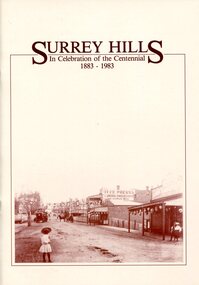
A pictorial history of Surrey Hills based on information collected and based at the Surrey Hills Neighbourhood Centre. It includes early rural properties and diaries, the coming of the railway, land sub-division and early homes, schools, parks and recreation.A pictorial history of Surrey Hills based on information collected and based at the Surrey Hills Neighbourhood Centre. It includes early rural properties and diaries, the coming of the railway, land sub-division and early homes, schools, parks and recreation.surrey hills, railways, land use, migrants, spanish communities, transport, houses, wattle park, festivals and celebrations, churches, education, water supply, fire stations, hospitals, (mr) george klepper, ainger family, (mr) john woodhead, (mr) h. breedon, medical services, real estate agents, businesses, musical events and activities, entertainment, parks and reserves, scouts, guides -
Whitehorse Historical Society Inc.
Letter - Correspondence, State School Heatherdale, 1879, 1879
Copy of letter to G.W. Brown Esq [Secretary, Education Department] dated 19 Dec 1879 from William WittCopy of letter to G.W. Brown Esq [Secretary, Education Department] dated 19 Dec 1879 from William Witt re rental of land and building to the Education Department for a state school at Heatherdale; with document entitled 'Nunawading North' detailing activities on the site to 1885.Copy of letter to G.W. Brown Esq [Secretary, Education Department] dated 19 Dec 1879 from William Witt heatherdale primary school, primary schools, witt, william, brown, g.w., victoria. education department -
 Bendigo Historical Society Inc.
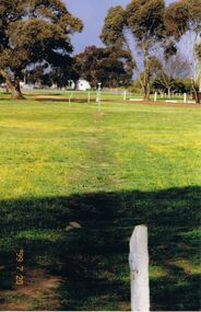
Photograph - CASTLEMAINE GAS COMPANY COLLECTION: PHOTO PADDOCK, 20/07/1999
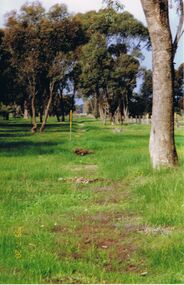
Photo of a paddock, a fence running on the right hand side. Date stamp at bottom left 20/07/1999. Location unknown.Kodakplace, land, paddock -
 Bendigo Historical Society Inc.
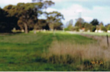
Photograph - CASTLEMAINE GAS COMPANY COLLECTION: PHOTO PADDOCK, 20/07/1999
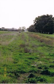
Photo of a paddock, trees in the background few amrking poles and a building. Date stamp at bottom left 20/07/1999Kodakplace, land, paddock -
 Bendigo Historical Society Inc.
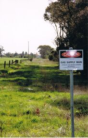
Photograph - CASTLEMAINE GAS COMPANY COLLECTION: PHOTO PADDOCK, 20/07/1999
Photo of a paddock, sign ''Caution gas main'' at the centre, on the right hand side a road and on the left a fence and a power pole. Date stamp at bottom left 20/07/1999. location unknown.Kodakplace, land, paddock -
 Bendigo Historical Society Inc.
Photograph - CASTLEMAINE GAS COMPANY COLLECTION: PHOTO PADDOCK, 20/07/1999
Photo of a paddock. Date stamp at bottom right 20/07/1999. Location unknown.Kodakplace, land, paddock -
 Bendigo Historical Society Inc.
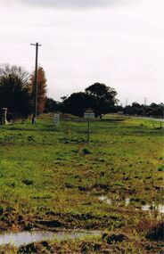
Photograph - CASTLEMAINE GAS COMPANY COLLECTION: PHOTO PADDOCK, 20/07/1999
Photo of a paddock with a sign at right ''Caution Gas Supply Main'' date stamp at bottom left 20/07/1999. Location unknownKodakplace, land, paddock -
 Bendigo Historical Society Inc.
Photograph - CASTLEMAINE GAS COMPANY COLLECTION: PHOTO PADDOCK, 20/07/1999
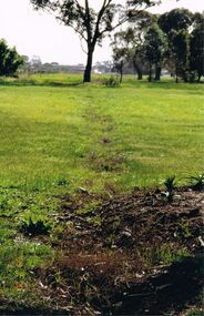
Photo of paddock with a trench line marked, a yellow and gray marker at the centre. Date stamp at bottom 20/07/1999. Location unknown.Kodakplace, land, paddock -
 Bendigo Historical Society Inc.
Photograph - CASTLEMAINE GAS COMPANY COLLECTION: PHOTO PADDOCK, 20/07/1999
Photo of a paddock, trees on the left, a building in the background left hand side. A date stamp in yellow at bottom left 20/07/1999Kodakplace, land, paddock -
 Bendigo Historical Society Inc.
Photograph - CASTLEMAINE GAS COMPANY COLLECTION: PHOTO PADDOCK, 20/07/1999
Photo of a paddock with what looks like the tracing of a trench. Trees in the background. At bottom left date stamp in yellow 20/07/1999. Location unknown.Kodakplace, land, paddock -
 Bendigo Historical Society Inc.
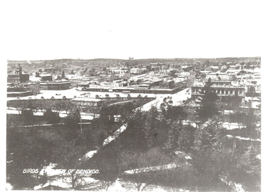
Photograph - BENDIGO: BIRDS EYE VIEW, late 1800's
black and white copy: elevated view of Bendigo from Lower Pall Mall. Titled 'Birds eye view of Bendigo' on image. Treed area in foreground, townscape behind, ranges on skyline. In grey lead on back: view of Bendigo from Lower Pall Mallunknownplace, land, bendigo -
 Bendigo Historical Society Inc.
Painting - BARNADOWN WATERCOLOUR
Watercolour - Along the River Bank by John.B.Perry showing open style hay shed, log rail fence & native australian trees. Markings: Along the River Bank. Campaspe river. Barnadown water colour by John. B.Perry.John.B.Perryplace, land, riverbank site -
 Bendigo Historical Society Inc.
Document - OLD TOM LEASE MAP
Hand Drawn map of Old Tom Lease - Parish of Huntly, County of Bendigo, Mining district of Sandhurst.place, land, mining -
 Latrobe Regional Gallery
MEYER, Mary. Born 1878. Died 1975, Seascape, Not dated
PaintingNot signed. Not dated.sea, land, seascape -
 Bendigo Historical Society Inc.
Administrative record - Order for surveys and reports 1926-1940
Green cover book with brown leather spine. Orders for surveys or reports, under the following headings: nature of instructions, correspondence number, when returned. amount of survey fee, by whom paid, date of account passed, remarks. The following surveyors are used: William Archdall, Castlemaine - Garnet G. Birch, Bendigo - J.H. Brown, St. Arnaud - A.A. Briggs. Echuca - A.D. Thomson, Mildura - Tom Lowndes, Kerang - R.A. Black, Nyah West.survey, land, government -
 Bendigo Historical Society Inc.
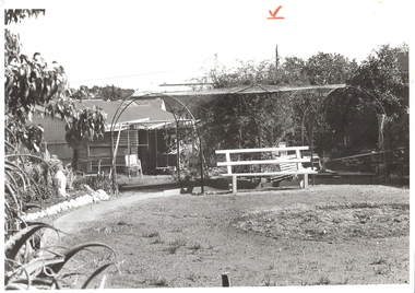
Photograph - ARBOR: BACK YARD, 1960 's ?
BHS Collectionblack and white photograph. Back garden with arbor, seats, rock edging, houses at back, power pole with wires at back. Red crayon 'V' top centre.unknownplace, land, back yard -
 Orbost & District Historical Society
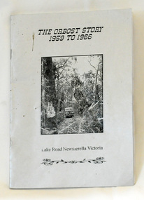
book, Johnson, Brenda, The Orbost Story 1959 to 1966, after 2000
This story was written by Brenda Johnson and details her time in Orbost from 1959 -1966 settling on land at Lake Road in Newmerella.This book is a useful and interesting reference tool on life in Newmerella in the mid 20th century.A thin stapled paperback book of 31 pp. It is titled "The Orbost Story 1959 to 1966 Lake Road Newmerella Victoria". The cover is shiny silver with black print. In the centre is a black/white photograph of the block with numbers ( 2 3 ?) carved into a tree. There is a Land Rover in the background.Stapled inside back cover - "Bob Johnson" with telephone details and email address.newmerella-history johnson-brenda rural farming