Showing 11523 items matching "maps"
-
 Stawell Historical Society Inc
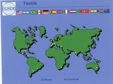
Photograph - Aunde Album 29, Textile Plants, 2002
Aunde / Norwellan Textiles North Western Woolen Mills became Norwellan Textiles then AUNDEColour landscape photo: Map of the world dots of locations and countries maps.Textile AUNDE logo 19 Plants, 14 Countries.industry, aunde -
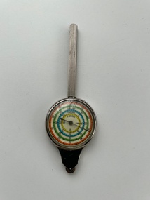 Moorabbin Air Museum
Instrument (Item) - Curvimeter (Opisometer) , Map Measuring Instrument For Measuring Curved Lines On A Map
-
 Bendigo Historical Society Inc.
Map - CAMPBELL COLLECTION: BENDIGO AND DISTRICT MAPS
Map. Bendigo & District. The same as 10104.1. The map is in a very damaged condition.map, bendigo, allotments -
 Kew Historical Society Inc
Plan - Subdivision Plan, Argyle Road, Heather Grove, Victor Avenue, Kew, c.1937
The Kew Historical Society's map collection includes a substantial number of real estate subdivision plans, mainly of Kew but also of surrounding suburbs in Melbourne. Most of the subdivision plans date from the 1920s and 1930s when the districts old homes and local farmland were being split up to accommodate residential growth in the postwar period. These early plans were assembled by a local firm, Jas R Mather & McMillan, which had an office in Cotham Road. Many of the plans, and sometimes photos, were annotated by the agents.Subdivision plans are historically important documents used as evidence for the growth of suburbs in Australia. They frequently provide information about when the land was sold as well as evidence relating to surveyors and real estate and financial agents. The numerous subdivision plans in the Kew Historical Society's collection represent working documents, ranging from the initial sketches made in planning a subdivision to printed plans on which auctioneers or agents listed the prices for which individual lots were sold. In a number of cases, the reverse of a subdivision plan in the collection includes a photograph of a house that was also for sale by the agent. These photographs provide significant heritage information relating house design and decoration, fencing and household gardens.The photograph may also be aesthetically significant depending on the importance of the photographic atelier.Undated blue subdivision plan in Kew of 14 lots facing Argyle Road, Heather Grove and Victor Road. The Plan identifies Tuxen & Miller as the surveyors. [Formerly catalogued as MAP.0059]subdivision plans - kew, argyle road - kew, heather grove - kew, victor avenue - kew -
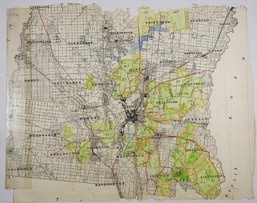
 Bendigo Historical Society Inc.
Map - PARISHES OF CORNELLA AND TOOLLEEN, Circa 1880
Map: Parishes of Cornella and Toolleen, Compilation of 2 hand draughted parish plans applied to vanvas backing. Originally in Map Cupboard. Relocated to Map Drawer 5 on 5.22.9.22. Too long for the map cupboard.map, parish plan, cornella , toolleen -
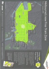 Melbourne Tram Museum
Map, Public Transport Victoria (PTV), "Melbourne's new Free Tram Zone", 2015
... Maps ...Printed A4 sheet - single sided off white sheet titled ""Melbourne's Free Tram Zone Map"., details the extent of the free tram zone or showing the tram lines that the free travel is allowed, locations, land marks, contact numbers and has the PTV logo in the top right hand corner and the Myki locos along with Yarra Trams and contact details for information. Dated 1/1/2015.trams, tramways, yarra trams, ptv, maps, free tram, melbourne -
 Yarra Ranges Regional Museum
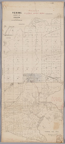
Map, District of Yering, 1 Dec 1885
Canvas backed paper map of District of Yering, Country of Evelyn, showing proposed waterworks for township of Lilydale. Signed by Hodgson & Smith, water supply engineers. Proposed waterworks for the township of Lilydale. Signed by Hodgson & Smith, water supply engineers. Proposed water main shown with of reservoir etc. Canvas backed paper map of District of Yering, Country of Evelyn, showing proposed waterworks for township of Lilydale. Signed by Hodgson & Smith, water supply engineers. Proposed waterworks for the township of Lilydale. Signed by Hodgson & Smith, water supply engineers. Proposed water main shown with of reservoir etc. evelyn, lilydale, waterworks and irrigation -
 Falls Creek Historical Society
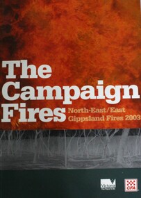
Book - The Campaign Fires - North-East/East Gippsland Fires 2003, Lyndel Hunter
A description of efforts to fight the bushfires in Gippsland in 2003, including maps and illustrations. This volume was published as a tribute to the work of staff and volunteers who put themselves at risk to protect local communities. It shows the impact on those communities in Victoria and the support they gave to those involved in fighting largest bushfires in Victoria for 60 years. The Alpine bushfires started on 8th January 2003, a day of Total Fire Ban. Lightning ignited 87 fires in the North-East and East Gippsland regions. Eight of these fires were unable to be contained; they joined together to form the largest fire in Victoria since the Black Friday fires in 1939. The majority of the area burnt in Victoria was public land, 1.19 million hectares of parks and forests, including 60 per cent of the Alpine National Park and 81 per cent of the Mt Buffalo National Park. Firefighting efforts were made difficult in hard-to-access, remote forest terrain. Approximately 90,000 hectares of private land was burnt.This book is significant because it documents the 2003 Victorian Bushfires and serves as a tribute to the CFA staff and volunteers who fought them.This publication of 119 pages features text, colour images, maps and detailed information related to the 2003 bushfires in Victoria.At bottom of front cover:- CFA Victoria Logo Victorian Government Logovictorian fires 2003, cfa (vic) -
 Stanley Athenaeum & Public Room
Leisure object - Euchre cards
757 Deer brand playing cards New Zealand Playing cards, emblem and map of New Zealand -
 Victorian Aboriginal Corporation for Languages
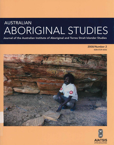
Periodical, Australian Institute of Aboriginal and Torres Strait Islander Studies, Australian Aboriginal studies : journal of the Australian Institute of Aboriginal and Torres Strait Islander Studies, 2008
Mawul Rom Project: Openness, obligation and reconciliation Morgan Brigg (Universtiy of Queensland) and Anke Tonnaer (University of Aarhus, Denmark) Aboriginal Australian initiatives to restore balanced relationships with White Australians have recently become part of reconciliation efforts. This paper provides a contextualised report on one such initiative, the Mawul Rom crosscultural mediation project. Viewing Mawul Rom as a diplomatic venture in the lineage of adjustment and earlier Rom rituals raises questions about receptiveness, individual responsibility and the role of Indigenous ceremony in reconciliation efforts. Yolngu ceremonial leaders successfully draw participants into relationship and personally commit them to the tasks of cross-cultural advocacy and reconciliation. But Mawul Rom must also negotiate a paradox because emphasis on the cultural difference of ceremony risks increasing the very social distance that the ritual attempts to confront. Managing this tension will be a key challenge if Mawul Rom is to become an effective diplomatic mechanism for cross-cultural conflict resolution and reconciliation. Living in two camps: the strategies Goldfields Aboriginal people use to manage in the customary economy and the mainstream economy at the same time Howard Sercombe (Strathclyde University, Glasgow) The economic sustainability of Aboriginal households has been a matter of public concern across a range of contexts. This research, conducted in the Eastern Goldfields of Western Australia, shows how economically successful Aboriginal persons manage ?dual economic engagement?, or involvement in the customary economy and the mainstream economy at the same time. The two economies sometimes reinforce each other but are more often in conflict, and management of conflicting obligations requires high degrees of skill and innovation. As well as creating financially sustainable households, the participants contributed significantly to the health of their extended families and communities. The research also shows that many Aboriginal people, no matter what their material and personal resources, are conscious of how fragile and unpredictable their economic lives can be, and that involvement in the customary economy is a kind of mutual insurance to guarantee survival if times get tough. Indigenous population data for evaluation and performance measurement: A cautionary note Gaminiratne Wijesekere (Dept. of Families, Housing, Community Services and Indigenous Affairs, Canberra) I outline the status of population census counts for Indigenous peoples, identifying information on Indigenous births and deaths, and internal migration estimates. I comment on the ?experimental? Indigenous population projections and question the rationale for having two sets of projections. Program managers and evaluators need to be mindful of limitations of the data when using these projections for monitoring, evaluating and measuring Indigenous programs. Reaching out to a younger generation using a 3D computer game for storytelling: Vincent Serico?s legacy Theodor G Wyeld (Flinders University, Adeliade) and Brett Leavy (CyberDreaming Australia) Sadly, Vincent Serico (1949?2008), artist, activist and humanist, recently passed away. Born in southern Queensland in Wakka Wakka/Kabi Kabi Country (Carnarvon Gorge region) in 1949, Vincent was a member of the Stolen Generations. He was separated from his family by White administration at four years of age. He grew up on the Cherbourg Aboriginal Reserve in the 1950s, when the policies of segregation and assimilation were at their peak. Only returning to his Country in his early forties, Vincent started painting his stories and the stories that had been passed on to him about the region. These paintings manifest Vincent?s sanctity for tradition, storytelling, language, spirit and beliefs. A team of researchers was honoured and fortunate to have worked closely with Vincent to develop a 3D simulation of his Country using a 3D computer game toolkit. Embedded in this simulation of his Country, in the locations that their stories speak to, are some of Vincent?s important contemporary art works. They are accompanied by a narration of Vincent?s oral history about the places, people and events depicted. Vincent was deeply concerned about members of the younger generation around him ?losing their way? in modern times. In a similar vein, Brett Leavy (Kooma) sees the 3D game engine as an opportunity to engage the younger generation in its own cultural heritage in an activity that capitalises on a common pastime. Vincent was an enthusiastic advocate of this approach. Working in consultation with Vincent and the research team, CyberDreaming developed a simulation of Vincent?s Country for young Aboriginal and non-Aboriginal persons from the Carnarvon Gorge region to explore Vincent?s life stories of the region. The use of Vincent?s contemporary paintings as storyboards provides a traditional medium for the local people to interactively re-engage with traditional values. Called Serico?s World, it represents a legacy to his life?s works, joys and regrets. Here we discuss the background to this project and Vincent?s contribution. A singular beeswax representation of Namarrkon, the Lightning Man, from western Arnhem Land RG Gunn (La Trobe University) and RL Whear (Jawoyn Association) Samples from a beeswax representation of Namarrkon, the Lightning Man, from western Arnhem Land were analysed for radiocarbon and dated to be about 150 years old. An underlying beeswax figure was found to be approximately 1100 years old. The Dreaming Being Namarrkon is well known throughout Arnhem Land, although his sphere of activity is concentrated around the northern half of the Arnhem Land plateau. Namarrkon is well represented in rock-paintings in this area and continues to be well represented in contemporary canvas-paintings by artists from the broader plateau region. We conclude that representations of Namarrkon in both painted and beeswax forms appear to be parallel manifestations of the late Holocene regionalisation of Arnhem Land. ?Missing the point? or ?what to believe ? the theory or the data?: Rationales for the production of Kimberley points Kim Akerman (Moonah) In a recent article, Rodney Harrison presented an interesting view on the role glass Kimberley points played in the lives of the Aborigines who made and used them. Harrison employed ethnographic and historical data to argue that glass Kimberley points were not part of the normal suite of post-contact artefacts used primarily for hunting and fighting or Indigenous exchange purposes, but primarily were created to service a non-Indigenous market for aesthetically pleasing artefacts. Harrison asserted that this market determined the form that these points took. A critical analysis of the data does not substantiate either of these claims. Here I do not deal with Harrison?s theoretical material or arguments; I focus on the ethnographic and historical material that he has either omitted or failed to appreciate in developing his thesis and which, in turn, renders it invalid. The intensity of raw material utilisation as an indication of occupational history in surface stone artefact assemblages from the Strathbogie Ranges, central Victoria Justin Ian Shiner (La Trobe University, Bundoora) Stone artefact assemblages are a major source of information on past human?landscape relationships throughout much of Australia. These relationships are not well understood in the Strathbogie Ranges of central Victoria, where few detailed analyses of stone artefact assemblages have been undertaken. The purpose of this paper is to redress this situation through the analysis of two surface stone artefact assemblages recorded in early 2000 during a wider investigation of the region?s potential for postgraduate archaeological fieldwork. Analysis of raw material utilisation is used to assess the characteristics of the occupational histories of two locations with similar landscape settings. The analysis indicates variability in the intensity of raw material use between the assemblages, which suggests subtle differences in the occupational history of each location. The results of this work provide a direction for future stone artefact studies within this poorly understood region.document reproductions, maps, b&w photographs, colour photographskimberley, mawul rom project, 3d computer game, storytelling, vincent serico, beeswax, namarrkon, artefact assemblages, strathbogie ranges, groote eylandt, budd billy ii -
 Victorian Aboriginal Corporation for Languages
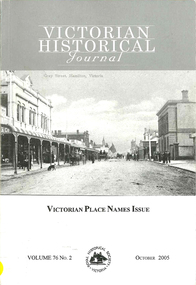
Periodical, Royal Historical Society of Victoria, Victorian historical journal : Victorian place names issue, 2005
maps, b&w photographs, word lists, document reproductions -
Victorian Aboriginal Corporation for Languages
Book, Ken Simpson et al, The Claremont field guide to the birds of Australia, 2003
The most comprehensive one-volume book of identificationColour illustrations, b&w illustrations, word lists, mapsbirds, australia, identification -
 Victorian Aboriginal Corporation for Languages
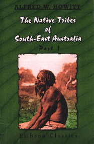
Book, A W Howitt, The native tribes of South-East Australia : part 1, 2003
Alfred William Howitt 1830-1908 was a pioneer anthropologist. ?The Native Tribes of South-East Australia? is not only a great classic anthropological work, it contains an enormous wealth of material of interest to anyone interested in Australian history, particularly the people of Koorie descent. His work has been presented here in total as originally produced.maps, b&w illustrations, b&w photographs, tablesdieri, wonkanguru, yuin, wonkamala, kulin, kurnai, wiradjuri, kamilaroi, wotjobaluk, wurrunjerri, wimbaio, yaurorka, urabunna, yantruwunta -
 Victorian Aboriginal Corporation for Languages
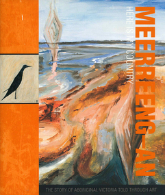
Book, Chris Keeler, Meerreeng-an here is my country : the story of Aboriginal Victoria told through art, 2010
maps, b&w illustrations, colour illustrations, colour photographsbangerang, bidawal, boonwurrung, dharwurd wurrung, dja dja wurrung, djab wurrung, gunnai kurnai, jardwadjali, jadawadjali, keerray woorroong, latji latji, peek wurrong, taungurung, wathaurung, wergaia, wotjobaluk, wurundjeri, yorta yorta -
Victorian Aboriginal Corporation for Languages
Conference proceedings, Jon Reyhner, Teaching Indigenous languages, 2012
Teaching Indigenous Languages is a compilation of papers presented at the Fourth Annual Stabilizing Indigenous Languages Symposium sponsored by Northern Arizona University's Center for Excellence in Education and Dept. of Modern Languages on May 1-3, 1997 at the University's du Bois Conference Center in Flagstaff, Arizonamaps, b&w illustrations, b&w photographs, gamesmaori, apache, arapaho, navajo, cherokee, language and literacy development, bilingual education, indigenous language teaching, language education and technology, language renewal -
Victorian Aboriginal Corporation for Languages
Conference proceedings, Nicholas Ostler, Endangered languages and literacy : proceedings of the Fourth FEL Conference, University of North Carolina, Charlotte, 21-24 September 2000, 2000
Main headings: Opening the book; Literacy from within; Choosing an orthography; Literacy & Dialect diversity; Promoting literacy; Cautionary notesmaps, b&w photographs, b&w illustrations, tablesendangered languages, language revival, orthography, literacy -
Victorian Aboriginal Corporation for Languages
Conference proceedings, Tjeerd de Graaf, Endangered languages and language learning : proceedings of the FEL XII, 24-27 September 2008 Fryske Akademy, It Aljemint, Ljouwert/?Leeuwarden, The Netherlands, 2008
Learning the details, Different approaches in the classroom, School contexts, Innovative methods, Multilingualism and diaspora, Policy overviewmaps, b&w photographs, colour photographs, tables, graphsmultilingualism, education, bilingualism, language endangerment, language transmission -
Victorian Aboriginal Corporation for Languages
Conference proceedings, Maya Khemlani David, Working together for endangered languages : research challenges and social impacts : proceedings of the XIth FEL Conference, University of Malaya, Kuala Lumpur, Malaysia, 26-28 October 2007, 2007
maps, b&w photographs, colour photographs, illustrations, graphsendangered languages, language revival, education, language research -
Victorian Aboriginal Corporation for Languages
Conference proceedings, Mary Jane Norris, Endangered languages beyond boundaries : community connections, collaborative approaches and cross-disciplinary research =? Langues en pe?ril au-dela? des frontie?res : connexions communautaires, approches collaboratives, et rechecrche interdisciplinaire : proceedings of the 17th FEL Conference Carleton University, Ottawa, Ontario Canada 1-4 October 2013, 2013
Session 1: Collaborations with language and cultural organizations, and governments Session 2: Collaborations with universities, researchers, institutes and schools Session 3: Strategies/issues across language, culture, geography, place and generations I: standardization and dialects Session 4: Strategies issues across language, culture, geography, place and generations II: Minority languages, regions and rural/urban areas Session 6: Language and culture connections: Health, well-being, and educational outcomes Session 7: Strategies/issues across language, culture, geography, place and generations III: Generations and families Session 8: Language assessment, documentation and diversity: Indicators of vitality, endangerment and the implications of data collection Session 5: Poster sessions I: Hard copy: Community connections, collaborative approaches, cross-disciplinary research Session 5: Poster session II: Electronic: Collaborative approaches with information and computer technologiesmaps, b&w photographs, colour photographs, illustrations, graphscollaboration, community involvement, cross disciplinary research -
Victorian Aboriginal Corporation for Languages
Book, Nicholas Thieberger, Paper and talk : a manual for reconstituting materials in Australian Indigenous languages from historical sources, 1995
Collection of essays about language and language sources.Sheet music, b&w photographs, maps, word listslinguistics, murri, endangered languages -
 Victorian Aboriginal Corporation for Languages
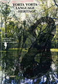
Book, Heather Bowe et al, Yorta Yorta language heritage, 1997
An account of the Yorta Yorta language, with a full Yorta Yorta-English dictionary, a detailed grammar section, background information about previous language revival projects, hymns, historical records and place names. A chapter devoted to Yabula Yabula is also included.Maps, b&w photographs, dictionary, word lists, worksheets,yorta yorta, yabula yabula, bangerang, language revival, geraldine briggs, hymns, murray goulburn, cummeragunja, maloga mission, place names -
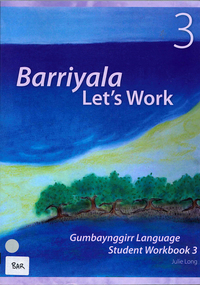 Victorian Aboriginal Corporation for Languages
Book, Julie Long, Barriyala - let's work : Gumbaynggirr language student workbook 3, 2007
Workbook with songs, games and activities for primary school children.Colour illustrations, b&w illustrations, word lists, mapsgumbaynggirr, nambucca heads, junga-ngarraangala gumbaynggirr, muurrbay, primary school, workbook -
 Victorian Aboriginal Corporation for Languages
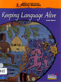
Book, Trish Albert, Keeping language alive, 2008
Maps, colour photographs, colour illustrations, sheet music, gamesguugu yimithirr, wiradjuri, torres strait creole -
 Victorian Aboriginal Corporation for Languages
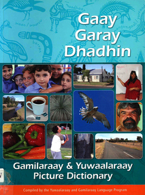
Book, Gaay garay dhadhin : Gamilaraay &? Yuwaalaraay picture dictionary, 2006
A wonderful source of reference for teachers and students alike. The seventh in this innovative series.Colour photographs, b&w illustrations, maps, word listsgamilaraay, yuwaalaraay -
 Victorian Aboriginal Corporation for Languages
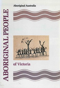
Book, Jon Altman et al, Aboriginal people of the Northern Territory, 2004
Looks at the culture and history of some of the Northern Territory Aboriginal groups.colour photographs, b&w photographs, illustrations, maps, tables -
Victorian Aboriginal Corporation for Languages
Book, Jon Altman et al, Aboriginal people of the Northern Territory, 1998
Looks at the culture and history of some of the Northern Territory Aboriginal groups.colour photographs, b&w photographs, illustrations, maps, tables -
Victorian Aboriginal Corporation for Languages
Book, Jon Altman et al, Aboriginal people of the Northern Territory, 1992
Looks at the culture and history of some of the Northern Territory Aboriginal groups.colour photographs, b&w photographs, illustrations, maps, tables -
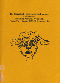 Victorian Aboriginal Corporation for Languages
Book, Ian D Clark, The journals of George Augustus Robinson, Chief Protector, Port Phillip Aboriginal Protectorate : volume one : 1 January 1839 - 30 September 1840, 1998
Transcription of G. A. Robinson?s journals for the period 01/01/1839 - 30/09/1840. Includes some reproductions of sketches, and some wordlists of Aboriginal languages and Aboriginal personal and place names.maps, document reproductions, b&w illustrations, word listsgeorge augustus robinson, port phillip, colonisation -
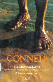 Victorian Aboriginal Corporation for Languages
Book, Eve Mumewa D Fesl, Conned!, 1993
Language is power. It is used to describe and direct events fictional and true. This book describes how historians have manufactured a flattering Australian race relations history. Conned! challenges established perceptions of Indigenous Australians.maps, b&w illustrations, b&w photographs, chartsaboriginal languages association, atsic, education, electoral system, moravian -
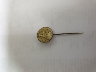 Clayton RSL Sub Branch
Button, Anzac pin
early metal WW1 Anzac Day pinbrass looking pin with round head and long pin. HYAMS, Frederick collection"A" embossed over a map of Australia with Anzac Day stamped under the "A"