
Showing 2418 items matching " facilities"
-
 Kew Historical Society Inc
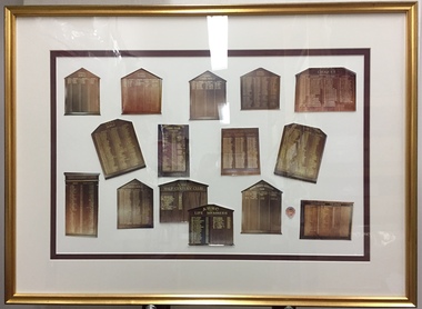
Photograph - Framed Photographs, Auburn Heights Recreation Club Honour Boards, c.2000
... Sports Clubs in Kew in the final decades of the 19th century and in the early 20th century were often umbrella organisations with facilities for a number of sports. Typically in Kew, this included teams in lawn bowls, tennis and croquet. ...Sports Clubs in Kew in the final decades of the 19th century and in the early 20th century were often umbrella organisations with facilities for a number of sports. Typically in Kew, this included teams in lawn bowls, tennis and croquet. ...Sports Clubs in Kew in the final decades of the 19th century and in the early 20th century were often umbrella organisations with facilities for a number of sports. Typically in Kew, this included teams in lawn bowls, tennis and croquet. The Kew Bowling Club was formed in 1880 while the privately owned Auburn Heights Recreation Club was opened in 1904. By 1998, the two Clubs decided to amalgamate at the Auburn Heights site in Barkers Road, forming the Kew Heights Sports Club. The combined club was itself taken over by the Melbourne Cricket Club in 2012 becoming MCC Kew Sports Club. In 2017 MCC Kew closed and its landholding was subsequently sold to Carey Baptist Grammar School. Both the Kew and Auburn Heights Clubs assembled important collections. These historically significant and large collections were donated to the Society in 2020. The collections include manuscripts, pictures, trophies, plans, honour boards etc. References Barnard FGA 1910, 'Sports and Pastimes' in Jubilee History of Kew Victoria: Its origin & progress 1803-1910. Chapman J & C 1999, The history of the Auburn Heights Recreation Club, 1904 to 1908. Reeve S 2012, City of Boroondara: Thematic Environmental History, p.216.The combined collections of the four sporting clubs making up the collection number hundreds of items that are historically significant locally. They are also significant to the sporting history of the greater Melbourne area and to the sports of lawn bowls and tennis in Australia in the 19th and 20th centuries. The collection illuminates two of the Victorian historic themes - 'Building community life' through forming community organisations and 'Shaping cultural and creative life' by participating in sport and recreation.Framed and glazed photograph of the fifteen honour boards of the Auburn Heights Recreation Club including those for bowling, tennis and croquet. Three of the boards are preserved in the Kew Historical Society collection. auburn heights ladies' bowling club - barkers road - kew (vic), honour boards, auburn heights men's bowling club - barkers road - kew (vic), auburn heights croquet club - barkers road - kew (vic), auburne heights recreation club - barkers road - kew (vic), auburn heights tennis club - barkers road - kew (vic) -
 Kew Historical Society Inc
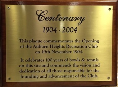
Plaque, Auburn Heights Recreation Club 1904-2004, 1994
... Sports Clubs in Kew in the final decades of the 19th century and in the early 20th century were often umbrella organisations with facilities for a number of sports. Typically in Kew, this included teams in lawn bowls, tennis and croquet. ...Sports Clubs in Kew in the final decades of the 19th century and in the early 20th century were often umbrella organisations with facilities for a number of sports. Typically in Kew, this included teams in lawn bowls, tennis and croquet. ...Sports Clubs in Kew in the final decades of the 19th century and in the early 20th century were often umbrella organisations with facilities for a number of sports. Typically in Kew, this included teams in lawn bowls, tennis and croquet. The Kew Bowling Club was formed in 1880 while the privately owned Auburn Heights Recreation Club was opened in 1904. By 1998, the two Clubs decided to amalgamate at the Auburn Heights site in Barkers Road, forming the Kew Heights Sports Club. The combined club was itself taken over by the Melbourne Cricket Club in 2012 becoming MCC Kew Sports Club. In 2017 MCC Kew closed and its landholding was subsequently sold to Carey Baptist Grammar School. Both the Kew and Auburn Heights Clubs assembled important collections. These historically significant and large collections were donated to the Society in 2020. The collections include manuscripts, pictures, trophies, plans, honour boards etc. References Barnard FGA 1910, 'Sports and Pastimes' in Jubilee History of Kew Victoria: Its origin & progress 1803-1910. Chapman J & C 1999, The history of the Auburn Heights Recreation Club, 1904 to 1908. Reeve S 2012, City of Boroondara: Thematic Environmental History, p.216.The combined collections of the four sporting clubs making up the collection number hundreds of items that are historically significant locally. They are also significant to the sporting history of the greater Melbourne area and to the sports of lawn bowls and tennis in Australia in the 19th and 20th centuries. The collection illuminates two of the Victorian historic themes - 'Building community life' through forming community organisations and 'Shaping cultural and creative life' by participating in sport and recreation.Small brass plaque, mounted on wood, commemorating one hundred years since the foundation of the Auburn Heights Recreation Club.auburne heights recreation club - barkers road - kew (vic) -
 Kew Historical Society Inc
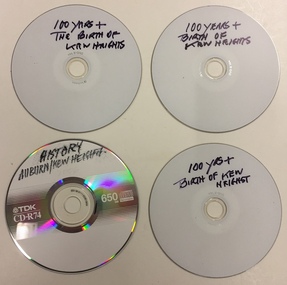
Document - CD-ROMs, Auburn Heights Recreation Club Histories, c.1998
... Sports Clubs in Kew in the final decades of the 19th century and in the early 20th century were often umbrella organisations with facilities for a number of sports. Typically in Kew, this included teams in lawn bowls, tennis and croquet. ...Sports Clubs in Kew in the final decades of the 19th century and in the early 20th century were often umbrella organisations with facilities for a number of sports. Typically in Kew, this included teams in lawn bowls, tennis and croquet. ...Sports Clubs in Kew in the final decades of the 19th century and in the early 20th century were often umbrella organisations with facilities for a number of sports. Typically in Kew, this included teams in lawn bowls, tennis and croquet. The Kew Bowling Club was formed in 1880 while the privately owned Auburn Heights Recreation Club was opened in 1904. By 1998, the two Clubs decided to amalgamate at the Auburn Heights site in Barkers Road, forming the Kew Heights Sports Club. The combined club was itself taken over by the Melbourne Cricket Club in 2012 becoming MCC Kew Sports Club. In 2017 MCC Kew closed and its landholding was subsequently sold to Carey Baptist Grammar School. Both the Kew and Auburn Heights Clubs assembled important collections. These historically significant and large collections were donated to the Society in 2020. The collections include manuscripts, pictures, trophies, plans, honour boards etc. References Barnard FGA 1910, 'Sports and Pastimes' in Jubilee History of Kew Victoria: Its origin & progress 1803-1910. Chapman J & C 1999, The history of the Auburn Heights Recreation Club, 1904 to 1908. Reeve S 2012, City of Boroondara: Thematic Environmental History, p.216.The combined collections of the four sporting clubs making up the collection number hundreds of items that are historically significant locally. They are also significant to the sporting history of the greater Melbourne area and to the sports of lawn bowls and tennis in Australia in the 19th and 20th centuries. The collection illuminates two of the Victorian historic themes - 'Building community life' through forming community organisations and 'Shaping cultural and creative life' by participating in sport and recreation.Four CD-ROMs variously containing historical material/files relating to the history of the Auburn Heights Recreation Club and the birth of the new Kew Heights Sports Club.auburne heights recreation club - barkers road - kew (vic), kew heights sports club - barkers road - kew (vic) -
 Kew Historical Society Inc
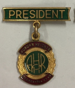
Badge - Badge of Office, President Auburn Heights Recreation Club, 1980-1990
... Sports Clubs in Kew in the final decades of the 19th century and in the early 20th century were often umbrella organisations with facilities for a number of sports. Typically in Kew, this included teams in lawn bowls, tennis and croquet. ...Sports Clubs in Kew in the final decades of the 19th century and in the early 20th century were often umbrella organisations with facilities for a number of sports. Typically in Kew, this included teams in lawn bowls, tennis and croquet. ...Sports Clubs in Kew in the final decades of the 19th century and in the early 20th century were often umbrella organisations with facilities for a number of sports. Typically in Kew, this included teams in lawn bowls, tennis and croquet. The Kew Bowling Club was formed in 1880 while the privately owned Auburn Heights Recreation Club was opened in 1904. By 1998, the two Clubs decided to amalgamate at the Auburn Heights site in Barkers Road, forming the Kew Heights Sports Club. The combined club was itself taken over by the Melbourne Cricket Club in 2012 becoming MCC Kew Sports Club. In 2017 MCC Kew closed and its landholding was subsequently sold to Carey Baptist Grammar School. Both the Kew and Auburn Heights Clubs assembled important collections. These historically significant and large collections were donated to the Society in 2020. The collections include manuscripts, pictures, trophies, plans, honour boards etc. References Barnard FGA 1910, 'Sports and Pastimes' in Jubilee History of Kew Victoria: Its origin & progress 1803-1910. Chapman J & C 1999, The history of the Auburn Heights Recreation Club, 1904 to 1908. Reeve S 2012, City of Boroondara: Thematic Environmental History, p.216.The combined collections of the four sporting clubs making up the collection number hundreds of items that are historically significant locally. They are also significant to the sporting history of the greater Melbourne area and to the sports of lawn bowls and tennis in Australia in the 19th and 20th centuries. The collection illuminates two of the Victorian historic themes - 'Building community life' through forming community organisations and 'Shaping cultural and creative life' by participating in sport and recreation.Gilt and enamel badge worn by of the president of the Auburn Heights Recreation Club. auburne heights recreation club - barkers road - kew (vic), badges of office -
 Kew Historical Society Inc
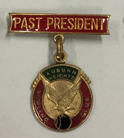
Badge - Badge of Office, Past-President Auburn Heights Bowling Club, 1970-1980
... Sports Clubs in Kew in the final decades of the 19th century and in the early 20th century were often umbrella organisations with facilities for a number of sports. Typically in Kew, this included teams in lawn bowls, tennis and croquet. ...Sports Clubs in Kew in the final decades of the 19th century and in the early 20th century were often umbrella organisations with facilities for a number of sports. Typically in Kew, this included teams in lawn bowls, tennis and croquet. ...Sports Clubs in Kew in the final decades of the 19th century and in the early 20th century were often umbrella organisations with facilities for a number of sports. Typically in Kew, this included teams in lawn bowls, tennis and croquet. The Kew Bowling Club was formed in 1880 while the privately owned Auburn Heights Recreation Club was opened in 1904. By 1998, the two Clubs decided to amalgamate at the Auburn Heights site in Barkers Road, forming the Kew Heights Sports Club. The combined club was itself taken over by the Melbourne Cricket Club in 2012 becoming MCC Kew Sports Club. In 2017 MCC Kew closed and its landholding was subsequently sold to Carey Baptist Grammar School. Both the Kew and Auburn Heights Clubs assembled important collections. These historically significant and large collections were donated to the Society in 2020. The collections include manuscripts, pictures, trophies, plans, honour boards etc. References Barnard FGA 1910, 'Sports and Pastimes' in Jubilee History of Kew Victoria: Its origin & progress 1803-1910. Chapman J & C 1999, The history of the Auburn Heights Recreation Club, 1904 to 1908. Reeve S 2012, City of Boroondara: Thematic Environmental History, p.216.The combined collections of the four sporting clubs making up the collection number hundreds of items that are historically significant locally. They are also significant to the sporting history of the greater Melbourne area and to the sports of lawn bowls and tennis in Australia in the 19th and 20th centuries. The collection illuminates two of the Victorian historic themes - 'Building community life' through forming community organisations and 'Shaping cultural and creative life' by participating in sport and recreation.One of five metal and enamel medallions, labelled singly AHRC President, AHBC Past President, AHBC Vice President, AHBC Secretary, AHRC Life Member; and AHRC tiepin.auburne heights recreation club - barkers road - kew (vic), badges of office -
 Kew Historical Society Inc
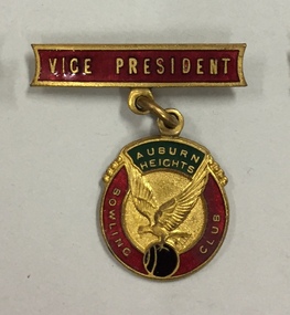
Badge - Badge of Office, Vice-President Auburn Heights Bowling Club, 1980-1990
... Sports Clubs in Kew in the final decades of the 19th century and in the early 20th century were often umbrella organisations with facilities for a number of sports. Typically in Kew, this included teams in lawn bowls, tennis and croquet. ...Sports Clubs in Kew in the final decades of the 19th century and in the early 20th century were often umbrella organisations with facilities for a number of sports. Typically in Kew, this included teams in lawn bowls, tennis and croquet. ...Sports Clubs in Kew in the final decades of the 19th century and in the early 20th century were often umbrella organisations with facilities for a number of sports. Typically in Kew, this included teams in lawn bowls, tennis and croquet. The Kew Bowling Club was formed in 1880 while the privately owned Auburn Heights Recreation Club was opened in 1904. By 1998, the two Clubs decided to amalgamate at the Auburn Heights site in Barkers Road, forming the Kew Heights Sports Club. The combined club was itself taken over by the Melbourne Cricket Club in 2012 becoming MCC Kew Sports Club. In 2017 MCC Kew closed and its landholding was subsequently sold to Carey Baptist Grammar School. Both the Kew and Auburn Heights Clubs assembled important collections. These historically significant and large collections were donated to the Society in 2020. The collections include manuscripts, pictures, trophies, plans, honour boards etc. References Barnard FGA 1910, 'Sports and Pastimes' in Jubilee History of Kew Victoria: Its origin & progress 1803-1910. Chapman J & C 1999, The history of the Auburn Heights Recreation Club, 1904 to 1908. Reeve S 2012, City of Boroondara: Thematic Environmental History, p.216.The combined collections of the four sporting clubs making up the collection number hundreds of items that are historically significant locally. They are also significant to the sporting history of the greater Melbourne area and to the sports of lawn bowls and tennis in Australia in the 19th and 20th centuries. The collection illuminates two of the Victorian historic themes - 'Building community life' through forming community organisations and 'Shaping cultural and creative life' by participating in sport and recreation.One of five metal and enamel medallions, labelled singly AHRC President, AHBC Past President, AHBC Vice President, AHBC Secretary, AHRC Life Member; and AHRC tiepin.auburne heights recreation club - barkers road - kew (vic), badges of office -
 Kew Historical Society Inc
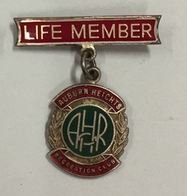
Badge, Life Member Auburn Heights Recreation Club, 1980-1990
... Sports Clubs in Kew in the final decades of the 19th century and in the early 20th century were often umbrella organisations with facilities for a number of sports. Typically in Kew, this included teams in lawn bowls, tennis and croquet. ...Sports Clubs in Kew in the final decades of the 19th century and in the early 20th century were often umbrella organisations with facilities for a number of sports. Typically in Kew, this included teams in lawn bowls, tennis and croquet. ...Sports Clubs in Kew in the final decades of the 19th century and in the early 20th century were often umbrella organisations with facilities for a number of sports. Typically in Kew, this included teams in lawn bowls, tennis and croquet. The Kew Bowling Club was formed in 1880 while the privately owned Auburn Heights Recreation Club was opened in 1904. By 1998, the two Clubs decided to amalgamate at the Auburn Heights site in Barkers Road, forming the Kew Heights Sports Club. The combined club was itself taken over by the Melbourne Cricket Club in 2012 becoming MCC Kew Sports Club. In 2017 MCC Kew closed and its landholding was subsequently sold to Carey Baptist Grammar School. Both the Kew and Auburn Heights Clubs assembled important collections. These historically significant and large collections were donated to the Society in 2020. The collections include manuscripts, pictures, trophies, plans, honour boards etc. References Barnard FGA 1910, 'Sports and Pastimes' in Jubilee History of Kew Victoria: Its origin & progress 1803-1910. Chapman J & C 1999, The history of the Auburn Heights Recreation Club, 1904 to 1908. Reeve S 2012, City of Boroondara: Thematic Environmental History, p.216.The combined collections of the four sporting clubs making up the collection number hundreds of items that are historically significant locally. They are also significant to the sporting history of the greater Melbourne area and to the sports of lawn bowls and tennis in Australia in the 19th and 20th centuries. The collection illuminates two of the Victorian historic themes - 'Building community life' through forming community organisations and 'Shaping cultural and creative life' by participating in sport and recreation.One of five metal and enamel medallions, labelled singly AHRC President, AHBC Past President, AHBC Vice President, AHBC Secretary, AHRC Life Member; and AHRC tiepin.auburne heights recreation club - barkers road - kew (vic), badges -sports clubs -
 Kew Historical Society Inc
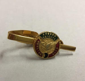
Souvenir, Tiepin Auburn Heights Bowling Club, 1980-1990
... Sports Clubs in Kew in the final decades of the 19th century and in the early 20th century were often umbrella organisations with facilities for a number of sports. Typically in Kew, this included teams in lawn bowls, tennis and croquet. ...Sports Clubs in Kew in the final decades of the 19th century and in the early 20th century were often umbrella organisations with facilities for a number of sports. Typically in Kew, this included teams in lawn bowls, tennis and croquet. ...Sports Clubs in Kew in the final decades of the 19th century and in the early 20th century were often umbrella organisations with facilities for a number of sports. Typically in Kew, this included teams in lawn bowls, tennis and croquet. The Kew Bowling Club was formed in 1880 while the privately owned Auburn Heights Recreation Club was opened in 1904. By 1998, the two Clubs decided to amalgamate at the Auburn Heights site in Barkers Road, forming the Kew Heights Sports Club. The combined club was itself taken over by the Melbourne Cricket Club in 2012 becoming MCC Kew Sports Club. In 2017 MCC Kew closed and its landholding was subsequently sold to Carey Baptist Grammar School. Both the Kew and Auburn Heights Clubs assembled important collections. These historically significant and large collections were donated to the Society in 2020. The collections include manuscripts, pictures, trophies, plans, honour boards etc. References Barnard FGA 1910, 'Sports and Pastimes' in Jubilee History of Kew Victoria: Its origin & progress 1803-1910. Chapman J & C 1999, The history of the Auburn Heights Recreation Club, 1904 to 1908. Reeve S 2012, City of Boroondara: Thematic Environmental History, p.216.The combined collections of the four sporting clubs making up the collection number hundreds of items that are historically significant locally. They are also significant to the sporting history of the greater Melbourne area and to the sports of lawn bowls and tennis in Australia in the 19th and 20th centuries. The collection illuminates two of the Victorian historic themes - 'Building community life' through forming community organisations and 'Shaping cultural and creative life' by participating in sport and recreation.One of five metal and enamel medallions, labelled singly AHRC President, AHBC Past President, AHBC Vice President, AHBC Secretary, AHRC Life Member; and AHRC tiepin.auburn heights bowling club - barkers road - kew (vic), souvenirs, badges -
 Kew Historical Society Inc
Document, Auburn Heights Ladies Lawn Bowling Club, Records of Office and Achievements, 1933-1973
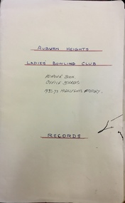
... Sports Clubs in Kew in the final decades of the 19th century and in the early 20th century were often umbrella organisations with facilities for a number of sports. Typically in Kew, this included teams in lawn bowls, tennis and croquet. ...Sports Clubs in Kew in the final decades of the 19th century and in the early 20th century were often umbrella organisations with facilities for a number of sports. Typically in Kew, this included teams in lawn bowls, tennis and croquet. ...Sports Clubs in Kew in the final decades of the 19th century and in the early 20th century were often umbrella organisations with facilities for a number of sports. Typically in Kew, this included teams in lawn bowls, tennis and croquet. The Kew Bowling Club was formed in 1880 while the privately owned Auburn Heights Recreation Club was opened in 1904. By 1998, the two Clubs decided to amalgamate at the Auburn Heights site in Barkers Road, forming the Kew Heights Sports Club. The combined club was itself taken over by the Melbourne Cricket Club in 2012 becoming MCC Kew Sports Club. In 2017 MCC Kew closed and its landholding was subsequently sold to Carey Baptist Grammar School. Both the Kew and Auburn Heights Clubs assembled important collections. These historically significant and large collections were donated to the Society in 2020. The collections include manuscripts, pictures, trophies, plans, honour boards etc. References Barnard FGA 1910, 'Sports and Pastimes' in Jubilee History of Kew Victoria: Its origin & progress 1803-1910. Chapman J & C 1999, The history of the Auburn Heights Recreation Club, 1904 to 1908. Reeve S 2012, City of Boroondara: Thematic Environmental History, p.216.The combined collections of the four sporting clubs making up the collection number hundreds of items that are historically significant locally. They are also significant to the sporting history of the greater Melbourne area and to the sports of lawn bowls and tennis in Australia in the 19th and 20th centuries. The collection illuminates two of the Victorian historic themes - 'Building community life' through forming community organisations and 'Shaping cultural and creative life' by participating in sport and recreation.Unbound document providing information about the Honour Book, Office Bearers, and history of the Auburn Heights Ladies' Bowling Club from 1933 to 1973.auburn heights ladies' bowling club - barkers road - kew (vic) -
 Kew Historical Society Inc
Flag, Auburn Heights Recreation Club, 1988-1998
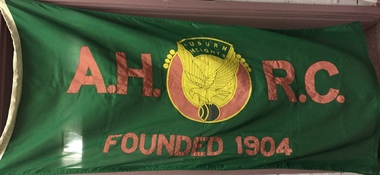
... Sports Clubs in Kew in the final decades of the 19th century and in the early 20th century were often umbrella organisations with facilities for a number of sports. Typically in Kew, this included teams in lawn bowls, tennis and croquet. ...Sports Clubs in Kew in the final decades of the 19th century and in the early 20th century were often umbrella organisations with facilities for a number of sports. Typically in Kew, this included teams in lawn bowls, tennis and croquet. ...Sports Clubs in Kew in the final decades of the 19th century and in the early 20th century were often umbrella organisations with facilities for a number of sports. Typically in Kew, this included teams in lawn bowls, tennis and croquet. The Kew Bowling Club was formed in 1880 while the privately owned Auburn Heights Recreation Club was opened in 1904. By 1998, the two Clubs decided to amalgamate at the Auburn Heights site in Barkers Road, forming the Kew Heights Sports Club. The combined club was itself taken over by the Melbourne Cricket Club in 2012 becoming MCC Kew Sports Club. In 2017 MCC Kew closed and its landholding was subsequently sold to Carey Baptist Grammar School. Both the Kew and Auburn Heights Clubs assembled important collections. These historically significant and large collections were donated to the Society in 2020. The collections include manuscripts, pictures, trophies, plans, honour boards etc. References Barnard FGA 1910, 'Sports and Pastimes' in Jubilee History of Kew Victoria: Its origin & progress 1803-1910. Chapman J & C 1999, The history of the Auburn Heights Recreation Club, 1904 to 1908. Reeve S 2012, City of Boroondara: Thematic Environmental History, p.216.The combined collections of the four sporting clubs making up the collection number hundreds of items that are historically significant locally. They are also significant to the sporting history of the greater Melbourne area and to the sports of lawn bowls and tennis in Australia in the 19th and 20th centuries. The collection illuminates two of the Victorian historic themes - 'Building community life' through forming community organisations and 'Shaping cultural and creative life' by participating in sport and recreation.Red and green flag of the Auburn Heights Recreation Club. In the centre of the flag is a dove holding aloft a bowling ball.A.H.R.C / FOUNDED 1904 / Auburn Heightsauburn heights recreation club - barkers road - kew (vic), flags -
 Kew Historical Society Inc
Badge - Badge of Office, Secretary Auburn Heights Bowling Club, 1980-1990
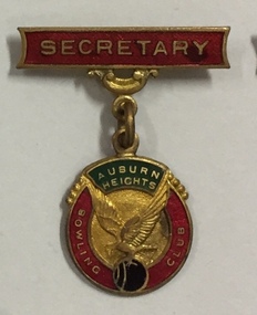
... Sports Clubs in Kew in the final decades of the 19th century and in the early 20th century were often umbrella organisations with facilities for a number of sports. Typically in Kew, this included teams in lawn bowls, tennis and croquet. ...Sports Clubs in Kew in the final decades of the 19th century and in the early 20th century were often umbrella organisations with facilities for a number of sports. Typically in Kew, this included teams in lawn bowls, tennis and croquet. ...Sports Clubs in Kew in the final decades of the 19th century and in the early 20th century were often umbrella organisations with facilities for a number of sports. Typically in Kew, this included teams in lawn bowls, tennis and croquet. The Kew Bowling Club was formed in 1880 while the privately owned Auburn Heights Recreation Club was opened in 1904. By 1998, the two Clubs decided to amalgamate at the Auburn Heights site in Barkers Road, forming the Kew Heights Sports Club. The combined club was itself taken over by the Melbourne Cricket Club in 2012 becoming MCC Kew Sports Club. In 2017 MCC Kew closed and its landholding was subsequently sold to Carey Baptist Grammar School. Both the Kew and Auburn Heights Clubs assembled important collections. These historically significant and large collections were donated to the Society in 2020. The collections include manuscripts, pictures, trophies, plans, honour boards etc. References Barnard FGA 1910, 'Sports and Pastimes' in Jubilee History of Kew Victoria: Its origin & progress 1803-1910. Chapman J & C 1999, The history of the Auburn Heights Recreation Club, 1904 to 1908. Reeve S 2012, City of Boroondara: Thematic Environmental History, p.216.The combined collections of the four sporting clubs making up the collection number hundreds of items that are historically significant locally. They are also significant to the sporting history of the greater Melbourne area and to the sports of lawn bowls and tennis in Australia in the 19th and 20th centuries. The collection illuminates two of the Victorian historic themes - 'Building community life' through forming community organisations and 'Shaping cultural and creative life' by participating in sport and recreation.One of five metal and enamel medallions, labelled singly AHRC President, AHBC Past President, AHBC Vice President, AHBC Secretary, AHRC Life Member; and AHRC tiepin.AHBC / SECRETARYauburne heights recreation club - barkers road - kew (vic), badges of office -
 Kew Historical Society Inc
Photograph - Framed Photographs, Kew Heights Sports Club Honour Boards, c.2010
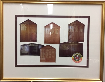
... Sports Clubs in Kew in the final decades of the 19th century and in the early 20th century were often umbrella organisations with facilities for a number of sports. Typically in Kew, this included teams in lawn bowls, tennis and croquet. ...Sports Clubs in Kew in the final decades of the 19th century and in the early 20th century were often umbrella organisations with facilities for a number of sports. Typically in Kew, this included teams in lawn bowls, tennis and croquet. ...Sports Clubs in Kew in the final decades of the 19th century and in the early 20th century were often umbrella organisations with facilities for a number of sports. Typically in Kew, this included teams in lawn bowls, tennis and croquet. The Kew Bowling Club was formed in 1880 while the privately owned Auburn Heights Recreation Club was opened in 1904. By 1998, the two Clubs decided to amalgamate at the Auburn Heights site in Barkers Road, forming the Kew Heights Sports Club. The combined club was itself taken over by the Melbourne Cricket Club in 2012 becoming MCC Kew Sports Club. In 2017 MCC Kew closed and its landholding was subsequently sold to Carey Baptist Grammar School. Both the Kew and Auburn Heights Clubs assembled important collections. These historically significant and large collections were donated to the Society in 2020. The collections include manuscripts, pictures, trophies, plans, honour boards etc. References Barnard FGA 1910, 'Sports and Pastimes' in Jubilee History of Kew Victoria: Its origin & progress 1803-1910. Chapman J & C 1999, The history of the Auburn Heights Recreation Club, 1904 to 1908. Reeve S 2012, City of Boroondara: Thematic Environmental History, p.216.The combined collections of the four sporting clubs making up the collection number hundreds of items that are historically significant locally. They are also significant to the sporting history of the greater Melbourne area and to the sports of lawn bowls and tennis in Australia in the 19th and 20th centuries. The collection illuminates two of the Victorian historic themes - 'Building community life' through forming community organisations and 'Shaping cultural and creative life' by participating in sport and recreation.Framed and glazed photograph of six honour boards of the Kew Heights Sports Club. kew heights sports club - barkers road - kew (vic) -
 Kew Historical Society Inc
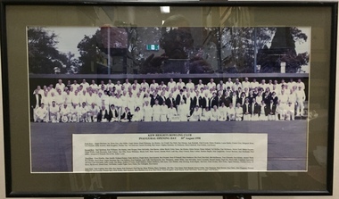
Photograph, Kew Heights Bowling Club Inaugural Opening Day 30th August 1998, 30/08/1998
... Sports Clubs in Kew in the final decades of the 19th century and in the early 20th century were often umbrella organisations with facilities for a number of sports. Typically in Kew, this included teams in lawn bowls, tennis and croquet. ...Sports Clubs in Kew in the final decades of the 19th century and in the early 20th century were often umbrella organisations with facilities for a number of sports. Typically in Kew, this included teams in lawn bowls, tennis and croquet. ...Sports Clubs in Kew in the final decades of the 19th century and in the early 20th century were often umbrella organisations with facilities for a number of sports. Typically in Kew, this included teams in lawn bowls, tennis and croquet. The Kew Bowling Club was formed in 1880 while the privately owned Auburn Heights Recreation Club was opened in 1904. By 1998, the two Clubs decided to amalgamate at the Auburn Heights site in Barkers Road, forming the Kew Heights Sports Club. The combined club was itself taken over by the Melbourne Cricket Club in 2012 becoming MCC Kew Sports Club. In 2017 MCC Kew closed and its landholding was subsequently sold to Carey Baptist Grammar School. Both the Kew and Auburn Heights Clubs assembled important collections. These historically significant and large collections were donated to the Society in 2020. The collections include manuscripts, pictures, trophies, plans, honour boards etc. References Barnard FGA 1910, 'Sports and Pastimes' in Jubilee History of Kew Victoria: Its origin & progress 1803-1910. Chapman J & C 1999, The history of the Auburn Heights Recreation Club, 1904 to 1908. Reeve S 2012, City of Boroondara: Thematic Environmental History, p.216.The combined collections of the four sporting clubs making up the collection number hundreds of items that are historically significant locally. They are also significant to the sporting history of the greater Melbourne area and to the sports of lawn bowls and tennis in Australia in the 19th and 20th centuries. The collection illuminates two of the Victorian historic themes - 'Building community life' through forming community organisations and 'Shaping cultural and creative life' by participating in sport and recreation.Framed and glazed photograph of the combined members of the Kew and Auburn Heights Bowling Clubs following their amalgamation. kew heights sports club - barkers road - kew (vic) -
 Ballarat Heritage Services
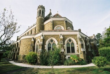
Photograph - Photograph - Colour, L.J. Gervasoni, Loretto Chapel, Ballarat, 2005, 13/04/2005
... The interior of the Chapel was restored in 1999 through the bequest of past pupil, Lucy Kerley and maintenance is continued with a bequest from past pupil, Eileen Macintyre (McGrath) (https://loreto.vic.edu.au/loreto-college/facilities/loreto-chapel/, accessed 06 June 2019_ ...The interior of the Chapel was restored in 1999 through the bequest of past pupil, Lucy Kerley and maintenance is continued with a bequest from past pupil, Eileen Macintyre (McGrath) (https://loreto.vic.edu.au/loreto-college/facilities/loreto-chapel/, accessed 06 June 2019_ loreto chapel ballarat children's chapel william tappin george loromer english gothic elizabeth wolff-metternich Colour photograph of a chapel at Loretto convent, Ballarat. ...The Loreto Chapel, or Children’s Chapel as it was known, was built between 1898 and 1902. The architect was William Tappin and the builder, George Lorimer. It is built in an English Gothic style with French influence. The stone is Barrabool Hills sandstone from near Geelong with white Oamaru, New Zealand, stone detailing. Building was interrupted through lack of funds but the project was finally completed with a large bequest from the German Countess Elizabeth Wolff-Metternich, who had been a student at the Convent in 1898. The Countess tragically died on a return visit to her family in Germany. The inside of the Chapel is decorated in soft pastel colours with artwork and statuary donated to the sisters by Ballarat and Irish families. The Rose Window over the Organ Gallery depicts St. Cecilia, patron saint of music, surrounded by symbols of the four Evangelists, Matthew, Mark, Luke and John. The windows over the altar depict the instruments of the Passion of Christ. The marble altar features the Nativity scene as was requested by the children. The interior of the Chapel was restored in 1999 through the bequest of past pupil, Lucy Kerley and maintenance is continued with a bequest from past pupil, Eileen Macintyre (McGrath) (https://loreto.vic.edu.au/loreto-college/facilities/loreto-chapel/, accessed 06 June 2019_ Colour photograph of a chapel at Loretto convent, Ballarat. The chapel is made of Barrabool sandstone. loreto chapel, ballarat, children's chapel, william tappin, george loromer, english gothic, elizabeth wolff-metternich -
 Melbourne Legacy
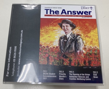
Audio - Newsletter, The Answer June/July 2021 Audio Version, 2021
... It provides the veterans and their families a safe haven to access essential support services such as advocacy, case management and referral pathways whilst inviting them to relax within a 'club' like environment equipped with lounging and children's play areas, and both kitchen and bathroom facilities. It was named in honour of an Australian Army nurse who was the lone survivor of the Bangka Island massacre, and who dedicated her life to nursing. ...It provides the veterans and their families a safe haven to access essential support services such as advocacy, case management and referral pathways whilst inviting them to relax within a 'club' like environment equipped with lounging and children's play areas, and both kitchen and bathroom facilities. It was named in honour of an Australian Army nurse who was the lone survivor of the Bangka Island massacre, and who dedicated her life to nursing. ...The Answer is a newsletter in magazine format that is sent to the widows that are helped by Melbourne Legacy. For the widows who are sight impaired a copy of the newsletter is audio described onto CD by Vision Australia and posted to them. It contains information about meetings and activities. This edition contained articles on the Legacy Anzac Biscuit Bake Off, the opening of the Vivian Bullwinkel Veterans and Families Wellbeing Centre, and a planting of a Lone Pine seedling at Cobram Secondary College. Plus photos of our programs such as the Student Anzac ceremony, Path of the Horse family day, the walking group, the stamp ladies, adults with a disability program days, widows club gatherings. The Vivian Bullwinkel Veterans and Families Wellbeing Centre on the 3rd floor of Legacy House was opened on the 13 April 2021. It provides the veterans and their families a safe haven to access essential support services such as advocacy, case management and referral pathways whilst inviting them to relax within a 'club' like environment equipped with lounging and children's play areas, and both kitchen and bathroom facilities. It was named in honour of an Australian Army nurse who was the lone survivor of the Bangka Island massacre, and who dedicated her life to nursing. The exceptional portrait of Vivian Bullwinkel on the cover was painted by George Petrou. A record that Melbourne Legacy helps coordinate and organise events and activities for the widows, and provides items of interest for their enjoyment.Compact disc x 2 in a case that contains the audio recording of The Answer from June/July 2021.activities, answer, widows -
 Bendigo Historical Society Inc.
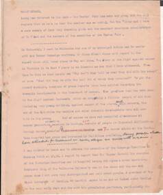
Document - NORMAN OLIVER COLLECTION: MAYOR SPEAKS, UNDATED
... Topics discussed : the Cancer Campaign success and recent advances in treatment and facilities, a discussion with a Mr Larritt, the grandson of Bendigo's first surveyor, and the work his grandfather performed, especially regarding the reservations chosen for the Hospital and the Home and Hospital for the Aged, the Art Gallery's Dobell exhibition, Commonwealth Youth Sunday on May 2nd, the promotion of Bendigo by the Victorian Promotion Committee, and Anzac Day business. ...Topics discussed : the Cancer Campaign success and recent advances in treatment and facilities, a discussion with a Mr Larritt, the grandson of Bendigo's first surveyor, and the work his grandfather performed, especially regarding the reservations chosen for the Hospital and the Home and Hospital for the Aged, the Art Gallery's Dobell exhibition, Commonwealth Youth Sunday on May 2nd, the promotion of Bendigo by the Victorian Promotion Committee, and Anzac Day business. ...The Norman Oliver collection. Norman Oliver was three times Mayor of Bendigo - 1950-51, 1964-65, 1970-71. Three typed pages of speech notes. Undated but information suggests 1965. Corrections made in blue and red ink. Mentions that the Easter Fair has recently ended. Topics discussed : the Cancer Campaign success and recent advances in treatment and facilities, a discussion with a Mr Larritt, the grandson of Bendigo's first surveyor, and the work his grandfather performed, especially regarding the reservations chosen for the Hospital and the Home and Hospital for the Aged, the Art Gallery's Dobell exhibition, Commonwealth Youth Sunday on May 2nd, the promotion of Bendigo by the Victorian Promotion Committee, and Anzac Day business. Oliver states that 'in 1914 the citizens of Bendigo presented the 7th Bn AIF with a set of bugles. One of the bugles used by 'Pompey' Simpson in the landing of Gallipoli and in France until he was wounded in 1917, when it was used by Wally Granland until the Armistice. On Anzac Eve at the 9PM ritual to the Fallen, the bugle will be used for the first time since the first war ..by Bugler John Murphy of Southern Command.' The HMAS Bendigo Assoc. reunion and information.bendigo, council, speech notes, norman joseph oliver , councillor norman oliver. mayor of bendigo. anti-cancer appeal. victorian inland meat authority. anzac day. -
 Puffing Billy Railway
Great Train Race Sign, 1982
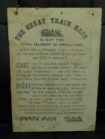
... Start 9 am at Belgrave Railway Station and enjoy a Sunday morning jog thru the scenic Dandenongs - join your family & friends at beautiful emerald lake finish - enjoy BBQ facilities & other family attractions Prizes outright winner ( not Puffing Billy ) will receive two return tickets to USA on Pan Am Team Prize the four runners with the fastest aggregate team time will each win a return air ticket to Sydney on TAA to compete in the 1982 "the Sun City to surf" Random draws of entrants will be made at 11Am for the many other valuable;e prizes - all proceeds to aid the restoration of Puffing Billy's big brother G42 PAN AM TAA Trans Australia Airlines ...Start 9 am at Belgrave Railway Station and enjoy a Sunday morning jog thru the scenic Dandenongs - join your family & friends at beautiful emerald lake finish - enjoy BBQ facilities & other family attractions Prizes outright winner ( not Puffing Billy ) will receive two return tickets to USA on Pan Am Team Prize the four runners with the fastest aggregate team time will each win a return air ticket to Sydney on TAA to compete in the 1982 "the Sun City to surf" Random draws of entrants will be made at 11Am for the many other valuable;e prizes - all proceeds to aid the restoration of Puffing Billy's big brother G42 PAN AM TAA Trans Australia Airlines Great Train Race Sign - Black printed ink Paper sign glued on to Masonite wood Great Train Race Sign ...an original Great Train Race publicity sign - from inaugural first great train race held on 16 May 1982 ran by the Puffing Billy Preservation society to raise funds for the restoration of G42 Garratt Locomotive Historic - Puffing Billy Railway - PBRS fPublicity event signGreat Train Race Sign - Black printed ink Paper sign glued on to Masonite wood The Great Train Race - 16 May 1982 - 13.5km Belgrave to Emerald Lake a fun run with a difference - "Race Puffing Billy " can you beat Victorias famous 76 year old train ? are you fit enough? Start 9 am at Belgrave Railway Station and enjoy a Sunday morning jog thru the scenic Dandenongs - join your family & friends at beautiful emerald lake finish - enjoy BBQ facilities & other family attractions Prizes outright winner ( not Puffing Billy ) will receive two return tickets to USA on Pan Am Team Prize the four runners with the fastest aggregate team time will each win a return air ticket to Sydney on TAA to compete in the 1982 "the Sun City to surf" Random draws of entrants will be made at 11Am for the many other valuable;e prizes - all proceeds to aid the restoration of Puffing Billy's big brother G42 PAN AM TAA Trans Australia Airlines -
 Sunshine and District Historical Society Incorporated
Administrative record - City of Sunshine - Commissioner Mr Alexander Alex George Gillon Collection 1976 - 1982 - Attachments for the ordinary meeting 13th November 1979, City of Sunshine, 13th November 1979
... Attachments for the Ordinary Meeting 13th November 1979 Legislative Council Letter Dated 23rd October 1997 Constitution of Melbourne & Metropolitan Board of Works Municipal Officers' Association of Australia Lettered Dated 22nd October 1979 Municipal Officers' (City of Sunshine) Award 1973 Minister for Health Letter City of Sunshine Concerns Regarding Charging Fees Provided by General Practitioners Footscray Society for the Aged Letter Dated 4th October 1979 Application for Assistance from City of Sunshine 30 Bed Nursing Home and Day Care Centre Town Planning Appeals Tribunal Lt 1 Derrimut Street Albion Melbourne & Metropolitan Board of Works Letter Dated 24th October 1979 Sunview Estate Stage 2 Provision of Water & Sewerage Facilities Melbourne & Metropolitan Board of Works Letter Dated 88 Station Road Deer Park Widening Slater & Gordon Letter Dated 18th September 1979 88 Station Road Deer Park...Derrimut Street Albion Station Road Deer Park Attachments for the Ordinary Meeting 13th November 1979 Legislative Council Letter Dated 23rd October 1997 Constitution of Melbourne & Metropolitan Board of Works Municipal Officers' Association of Australia Lettered Dated 22nd October 1979 Municipal Officers' (City of Sunshine) Award 1973 Minister for Health Letter City of Sunshine Concerns Regarding Charging Fees Provided by General Practitioners Footscray Society for the Aged Letter Dated 4th October 1979 Application for Assistance from City of Sunshine 30 Bed Nursing Home and Day Care Centre Town Planning Appeals Tribunal Lt 1 Derrimut Street Albion Melbourne & Metropolitan Board of Works Letter Dated 24th October 1979 Sunview Estate Stage 2 Provision of Water & Sewerage Facilities Melbourne & Metropolitan Board of Works Letter Dated 88 Station Road Deer Park Widening Slater & Gordon Letter Dated 18th September 1979 88 Station Road Deer Park Foolscap sized document. ...Attachments for the Ordinary Meeting 13th November 1979 Legislative Council Letter Dated 23rd October 1997 Constitution of Melbourne & Metropolitan Board of Works Municipal Officers' Association of Australia Lettered Dated 22nd October 1979 Municipal Officers' (City of Sunshine) Award 1973 Minister for Health Letter City of Sunshine Concerns Regarding Charging Fees Provided by General Practitioners Footscray Society for the Aged Letter Dated 4th October 1979 Application for Assistance from City of Sunshine 30 Bed Nursing Home and Day Care Centre Town Planning Appeals Tribunal Lt 1 Derrimut Street Albion Melbourne & Metropolitan Board of Works Letter Dated 24th October 1979 Sunview Estate Stage 2 Provision of Water & Sewerage Facilities Melbourne & Metropolitan Board of Works Letter Dated 88 Station Road Deer Park Widening Slater & Gordon Letter Dated 18th September 1979 88 Station Road Deer Parkderrimut street, albion, station road, deer park -
 Flagstaff Hill Maritime Museum and Village
Instrument - Chronometer or Marine Clock
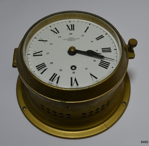
... The company also performs chronometer testing facilities for the State’s Weights and Measures office. ...The company also performs chronometer testing facilities for the State’s Weights and Measures office. ...This chronometer was made around 1936 and has been on display at Flagstaff Hill for over 40 years as part of the exhibit of the ‘Reginald M’, an Australian-built, 19ss, coastal trader vessel. A chronometer is an accurate mechanical instrument used for measuring time. It is constructed carefully to remain stable even under the changing conditions of seafaring life such as temperature, humidity and air pressure. The Master or Navigator of a ship could use the chronometer and the positions of celestial bodies to calculate the ship’s latitude at sea. In 1905 the business Chronometerwerke GmbH was formed in Frankfurt, Germany, to supply the country with high-quality mechanical chronometers and ship clocks for their maritime trade, making the country independent of other international suppliers such as those in England. In 1938 the firm was renamed Wempe Chronometerwerke. The business continues today. Its products now include its well-known chronometers, battery-powered ship clocks, ship’s bell clocks, barometers, barographs, thermometers, hygrometers, comfort meters to measure temperature and humidity, and wristwatches. The company also performs chronometer testing facilities for the State’s Weights and Measures office. The article written by Givi in July 2022 “The Basics of Marine Meteorology – a Guide for Seafarers” refers to the weather’s signs and patterns being repeated over and over, and the recording of these observations helps forecasters predict changes in the weather. The chronometer is an example of a mechanical navigational marine instrument in use in the early to the mid-20th century. The maker is significant as part of a German government initiative to be self-sufficient in the production of good quality marine technology. This chronometer is significant as part of the exhibit, the Australian-built vessel, 1922 coastal trader ‘Reginald M’, listed on the Australian Register of Historic Vessels and on display for over 40 years.Marine chronometer or marine clock, brass case, glass cover, Roman numerals, 24-hour numbers beside them. Two black hands, a keyhole for winding and ventilation holes in the side. The base has a collar with four machined mounting holes. Inscriptions are on the clock’s face."Made in Germany" and "WEMPE / CHRONOMETERWERKE / HAMBURG"flagstaff hill, flagstaff hill maritime museum and village, warrnambool, maritime museum, maritime village, great ocean road, shipwreck coast, marine meteorology, horology, chronometer, marine technology, latitude, marine navigation, mechanical instrument, scientific instrument, ship clock, chromometerwerke gmbh, wempe chronometerwerke, marine clock -
 Eltham District Historical Society Inc
Photograph, Liz Pidgeon, Heritage Excursion; Eltham Lower Park Walk and Talk, 1 July 2017, 1 July 2017
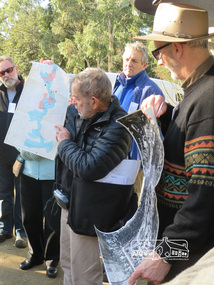
... The park combines formal elements and sporting facilities with remnant bushland that is of environmental significance. ...The park combines formal elements and sporting facilities with remnant bushland that is of environmental significance. ...Local Historian Russell Yeoman and EDHS President Jim Connor with a map and aerial photograph of the area the heritage walk will cover. Newsletter No., 234, June 2017 Heritage Excursion - Saturday 1st July - Eltham Lower Park - Walk and Talk Eltham Lower Park has played an important part in the history of our area since the early days of European settlement when it was used by local residents as an informal racecourse. Prior to that its location at the junction of the Diamond Creek and the Yarra River made it an important meeting place for the Wurundjeri people. The park combines formal elements and sporting facilities with remnant bushland that is of environmental significance. It is home to sporting and horse riding clubs, popular play spaces and the Diamond Valley Miniature Railway, which attracts large numbers of visitors. The park will be the venue for our July excursion which will comprise a walk of about 3.5 km around the park and adjacent areas. Along the way we will discuss the history and natural history of the area. The path along the creek and the river provides a pleasant and scenic walk. This walk on Saturday 1st July is about 3.5 km in length and will take 2 to 2.5 hours. It will start at 2pm at the Main Road car park at the front of the park. (Melway ref 21 H 10). Born Digitalheritage excursion, activities, eltham district historical society, eltham lower park, russell yeoman, jim connor, guide -
 Eltham District Historical Society Inc
Photograph, Liz Pidgeon, Heritage Excursion; Eltham Lower Park Walk and Talk, 1 July 2017, 1 July 2017
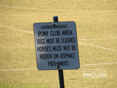
... The park combines formal elements and sporting facilities with remnant bushland that is of environmental significance. ...The park combines formal elements and sporting facilities with remnant bushland that is of environmental significance. ...Sign: Nillumbik Shire Council Pony Club area dogs must be leashed horses must not be ridden on asphalt pathways Newsletter No., 234, June 2017 Heritage Excursion - Saturday 1st July - Eltham Lower Park - Walk and Talk Eltham Lower Park has played an important part in the history of our area since the early days of European settlement when it was used by local residents as an informal racecourse. Prior to that its location at the junction of the Diamond Creek and the Yarra River made it an important meeting place for the Wurundjeri people. The park combines formal elements and sporting facilities with remnant bushland that is of environmental significance. It is home to sporting and horse riding clubs, popular play spaces and the Diamond Valley Miniature Railway, which attracts large numbers of visitors. The park will be the venue for our July excursion which will comprise a walk of about 3.5 km around the park and adjacent areas. Along the way we will discuss the history and natural history of the area. The path along the creek and the river provides a pleasant and scenic walk. This walk on Saturday 1st July is about 3.5 km in length and will take 2 to 2.5 hours. It will start at 2pm at the Main Road car park at the front of the park. (Melway ref 21 H 10). Born Digitalelection day, heritage excursion, activities, eltham district historical society, eltham lower park, sign, eltham pony club -
 Eltham District Historical Society Inc
Photograph, Liz Pidgeon, Heritage Excursion; Eltham Lower Park Walk and Talk, 1 July 2017, 1 July 2017
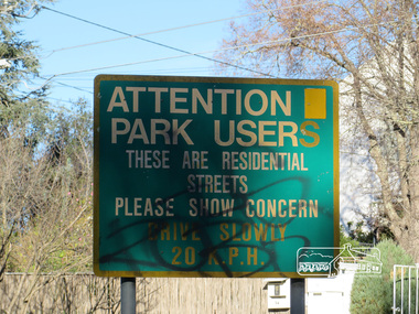
... The park combines formal elements and sporting facilities with remnant bushland that is of environmental significance. ...The park combines formal elements and sporting facilities with remnant bushland that is of environmental significance. ...Street signage: Attention park users these are residential streets please show concern drive slowly 20 m.p.h with graffiti Newsletter No., 234, June 2017 Heritage Excursion - Saturday 1st July - Eltham Lower Park - Walk and Talk Eltham Lower Park has played an important part in the history of our area since the early days of European settlement when it was used by local residents as an informal racecourse. Prior to that its location at the junction of the Diamond Creek and the Yarra River made it an important meeting place for the Wurundjeri people. The park combines formal elements and sporting facilities with remnant bushland that is of environmental significance. It is home to sporting and horse riding clubs, popular play spaces and the Diamond Valley Miniature Railway, which attracts large numbers of visitors. The park will be the venue for our July excursion which will comprise a walk of about 3.5 km around the park and adjacent areas. Along the way we will discuss the history and natural history of the area. The path along the creek and the river provides a pleasant and scenic walk. This walk on Saturday 1st July is about 3.5 km in length and will take 2 to 2.5 hours. It will start at 2pm at the Main Road car park at the front of the park. (Melway ref 21 H 10). Born Digitalheritage excursion, activities, eltham district historical society, eltham lower park, sign, grafitti -
 Eltham District Historical Society Inc
Photograph - Black and White Print, Lewis Tulk, Parade Ground, Gillwell Park, Gembrook, Vic, c.1960
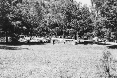
... It covers over 95 hectares of natural bushland, and features a range of facilities including campsites, activity areas, a dining hall, and accommodation options. ...It covers over 95 hectares of natural bushland, and features a range of facilities including campsites, activity areas, a dining hall, and accommodation options. ...The Parade Ground was where the annual presentations of awards were made. On the right is the little Chapel. Gilwell Park is a campsite and outdoor recreation area located in Gembrook, Victoria, Australia. It is primarily used by the scouting community as a training and camping facility. The site is owned and operated by Scouts Victoria, and is one of the largest and most popular campsites in the state. It covers over 95 hectares of natural bushland, and features a range of facilities including campsites, activity areas, a dining hall, and accommodation options. Gilwell Park has a long history within the scouting movement, and is named after the original Gilwell Park located in Epping Forest, England. The English site is considered the spiritual home of scouting, and was where the first Wood Badge training course was held in 1919. Today, Gilwell Park at Gembrook offers a range of training courses and programs for scouts, leaders, and other community groups. It is also a popular destination for school camps, corporate team-building events, and outdoor enthusiasts looking to explore the natural beauty of the region. [Source: ChatGPT Open AI - Gilwell Park in Australia.. (2023, March 23). Retrieved from https://chat.openai.com/chat] Donated by Lewis Tulk, former Scout Area Training Commisioner for Leaders. Lewis did his training at Gillwell Park in London.On reverse of print, stamped with film no. 6927scouts victoria, gillwell park, gembrook, scout leader training, lewis tulk collection -
 Eltham District Historical Society Inc
Photograph - Negative, Lewis Tulk, Outdoor Chapel, Gillwell Park, Gembrook, Vic, c.May 1957
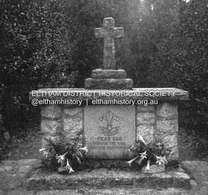
... It covers over 95 hectares of natural bushland, and features a range of facilities including campsites, activity areas, a dining hall, and accommodation options. ...It covers over 95 hectares of natural bushland, and features a range of facilities including campsites, activity areas, a dining hall, and accommodation options. ...Outdoor Chapel, Gilwell Park Scout Association State Training Centre - mainly for leaders Gilwell Park is a campsite and outdoor recreation area located in Gembrook, Victoria, Australia. It is primarily used by the scouting community as a training and camping facility. The site is owned and operated by Scouts Victoria, and is one of the largest and most popular campsites in the state. It covers over 95 hectares of natural bushland, and features a range of facilities including campsites, activity areas, a dining hall, and accommodation options. Gilwell Park has a long history within the scouting movement, and is named after the original Gilwell Park located in Epping Forest, England. The English site is considered the spiritual home of scouting, and was where the first Wood Badge training course was held in 1919. Today, Gilwell Park at Gembrook offers a range of training courses and programs for scouts, leaders, and other community groups. It is also a popular destination for school camps, corporate team-building events, and outdoor enthusiasts looking to explore the natural beauty of the region. [Source: ChatGPT Open AI - Gilwell Park in Australia.. (2023, March 23). Retrieved from https://chat.openai.com/chat] Donated by Lewis Tulk, former Scout Area Training Commisioner for Leaders. Lewis did his training at Gillwell Park in London.Print copy stamped "17" on reverselewis tulk collection, scouts victoria, gillwell park, gembrook, scout leader training -
 Eltham District Historical Society Inc
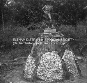
Photograph - Negative, Lewis Tulk, Outdoor Chapel, Gillwell Park, Gembrook, Vic, c.May 1957
... It covers over 95 hectares of natural bushland, and features a range of facilities including campsites, activity areas, a dining hall, and accommodation options. ...It covers over 95 hectares of natural bushland, and features a range of facilities including campsites, activity areas, a dining hall, and accommodation options. ...At entrance to Chapel Outdoor Chapel, Gilwell Park Scout Association State Training Centre - mainly for leaders Gilwell Park is a campsite and outdoor recreation area located in Gembrook, Victoria, Australia. It is primarily used by the scouting community as a training and camping facility. The site is owned and operated by Scouts Victoria, and is one of the largest and most popular campsites in the state. It covers over 95 hectares of natural bushland, and features a range of facilities including campsites, activity areas, a dining hall, and accommodation options. Gilwell Park has a long history within the scouting movement, and is named after the original Gilwell Park located in Epping Forest, England. The English site is considered the spiritual home of scouting, and was where the first Wood Badge training course was held in 1919. Today, Gilwell Park at Gembrook offers a range of training courses and programs for scouts, leaders, and other community groups. It is also a popular destination for school camps, corporate team-building events, and outdoor enthusiasts looking to explore the natural beauty of the region. [Source: ChatGPT Open AI - Gilwell Park in Australia.. (2023, March 23). Retrieved from https://chat.openai.com/chat] Donated by Lewis Tulk, former Scout Area Training Commisioner for Leaders. Lewis did his training at Gillwell Park in London.Print copy stamped "17" on reverselewis tulk collection, scouts victoria, gillwell park, gembrook, scout leader training -
 Returned Nurses RSL Sub-branch
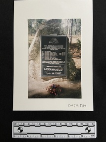
Photograph - 6x4 coloured photograph
... The Memorial Park is a unique design of individual plaques, set amongst the trees and located along the lines of the original locations of units stations at the Rocky Creek Medical and other facilities during the Second World War. Built on the old camp site of the Convalescent Depot of the 2/2nd Australian General Hospital, where thousands received treatment in 1942-1945. ...The Memorial Park is a unique design of individual plaques, set amongst the trees and located along the lines of the original locations of units stations at the Rocky Creek Medical and other facilities during the Second World War. Built on the old camp site of the Convalescent Depot of the 2/2nd Australian General Hospital, where thousands received treatment in 1942-1945. ...War memorial for units that served in World War II. It is located in the Rocky Creek Memorial Park in Tolga (Far North Queensland). 'Memorial information: Dedicated 15th August 1995. The Memorial Park is a unique design of individual plaques, set amongst the trees and located along the lines of the original locations of units stations at the Rocky Creek Medical and other facilities during the Second World War. Built on the old camp site of the Convalescent Depot of the 2/2nd Australian General Hospital, where thousands received treatment in 1942-1945. Atherton Shire Council supplies plaques and a local businessman supplies boulders. In 1997 there were 3 plaques and by August 2000 there were 36. The numbers will have increased since these figures. The park has been chosen as the appropriate location due to the cultural, spiritual, historical and sentimental value to the local community. Several Army Divisions camped on the Atherton Tablelands during 1942-45. Approximately 60,000 Australian soldiers were treated for war related conditions at these hospitals, by a caring and efficient staff of approximately 2,000. Many were rehabilitated at the adjoining 2/1 Convalescence Depot. The complex was recognised as the largest military hospital in the Southern Hemisphere.' [Taken from the ANZAC Square website]Coloured photograph of a large memorial plaque set on stone for units that served in World War II, trees behind in the distance. A floral wreath has been placed at its base.'Rocky Creek Memorial / Park - Tolga FNQ' [Handwritten in pencil on the back of the photograph]rocky creek memorial park, war memorials, world war 1939-1945, ww2, wwii -
 Kiewa Valley Historical Society
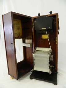
Meter Ammeter Recorder, Circa 1950
... This tester has its own inbuilt ink supply facilities and a mechanical clockwork device that unwinds a roll of paper onto a second roll at a rate of 10 mm per hour. ...This tester has its own inbuilt ink supply facilities and a mechanical clockwork device that unwinds a roll of paper onto a second roll at a rate of 10 mm per hour. ...This testing voltmeter recorder was last certified by SEC Vic laboratories on the 17/4/77. It was used extensively as mobile recorder placed for periods of one month at locations experiencing unacceptable fluctuations of power. These locations would cover the North East regions of Victoria. They cover voltage drops at domestic and business properties especially those that were experiencing regular fluctuations(daily) at approximately the same time of the day. As the electrical network is required to operate within a set level of voltage, fluctuations outside of this has to be investigated and necessary remedial action taken. This is especially so for rural properties where power "drainage" can occur through animal/bird and tree interference. It can also be the result of defective wiring and overloading at peek operational times (milking machines).This mobile voltage recorder is very significant to the Kiewa Valley because it highlights the difficulties that can occur in maintaining a power supply that experiences fluctuating power demands by the rural industries that it supplies. The requirement of a mobile testing apparatus to cover the various sections in the Kiewa Valley and other rural areas in the northeast region is one of necessity as electricity once connected to a rural property is a labour saving supply as generators on rural properties require a higher degree of maintenance an ultimately at a higher cost. The testing of the SEC Vic supplied electricity to rural properties,those who had previously run on generators, had to be quick and unassuming with certainty of correct supply levels.The mechanism of this voltage recorder has been installed(by the manufacturer) into its own protective wooden box. This box has a front (swing open) lockable section which permits direct access to the installed measuring equipment (for servicing and data collection). The top section of the box has two screw on terminals for access to the machine being tested. This tester has its own inbuilt ink supply facilities and a mechanical clockwork device that unwinds a roll of paper onto a second roll at a rate of 10 mm per hour. The recording chart is marked with time slots against voltage. There is a recording arm which has an ink pen at the end. Both arm and pen carry the ink supply from the ink reservoir, located on the left side of the cabinet door in specially constructed bottle holder( three small bottle capacity). To record a suspect power problem to a home or business establishment the voltmeter is connected to a power supply outlet being tested and wind the recording clockwork mechanism (gives a four week running time). Before leaving the recorder in situ the electrician checks to see if the chart is recording the correct voltage and that the clock mechanism is advancing correctly.On the front of the access "door" at the top a metal label "RECORDING AMMETER" below this "MURDAY SYSTEM" below this "ALTERNATING CURRENT" and below this the manufacturer's registered number "No. 139156" Below this is a metal tag with State Electricity Commission of Victoria Electrical Engineer's Section equipment number "338" Below these tags and above the viewing window is the manufacturer's dtails "EVERSHED & VIGNOLES Led LONDON"sec vic kiewa hydro scheme, alternate energy supplies, alpine feasibility studies temperature, rainfall, power outages -
 Bendigo Historical Society Inc.
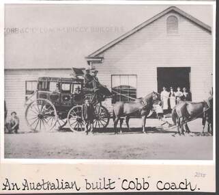
Photograph - COBB & CO., AN AUSTRALIAN BUILT 'COBB' COACH
... .- Coachworks were established in Bathurst, Bourke, Goulburn, Hay and Charleville, business boomed and the name of ‘Cobb & Co’ became the byword for cutting edge communications and transport facilities across eastern Australia.''Cobb & Co Factories Shortly after its arrival in Bathurst, Cobb & Co established the first of five coach works, both to supply its own transportation and as a commercial venture. ....- Coachworks were established in Bathurst, Bourke, Goulburn, Hay and Charleville, business boomed and the name of ‘Cobb & Co’ became the byword for cutting edge communications and transport facilities across eastern Australia.''Cobb & Co Factories Shortly after its arrival in Bathurst, Cobb & Co established the first of five coach works, both to supply its own transportation and as a commercial venture. ...black and white image ( copy ) : image shows Cobb & Co., coach, passengers, men up front, team of horses. Coach is standing in front of weatherboard building, large open doorway, four men standing in it. On bottom : An Austrralian built 'Cobb' coach. / Sign on roof states 'Cobb & Co Ltd Coach & Buggy Builders .- Coachworks were established in Bathurst, Bourke, Goulburn, Hay and Charleville, business boomed and the name of ‘Cobb & Co’ became the byword for cutting edge communications and transport facilities across eastern Australia.''Cobb & Co Factories Shortly after its arrival in Bathurst, Cobb & Co established the first of five coach works, both to supply its own transportation and as a commercial venture. The factory was situated at the Black Bull Inn, on the corner of Howick and Bentinck Streets, and a variety of prize-winning horse-drawn conveyances were built on the site (including an unsuccessful single-wheel vehicle to cater for rough and steep country). The factory was transferred to new premises in William Street in 1876, by which time Cobb & Co factories were also operating in Hay, Goulburn and Bourke in New South Wales and at Charleville in Queensland.///The horses are wearing blinkersbusiness, transport, cobb & co., cobb & co. -
 Eltham District Historical Society Inc
Film - Video (VHS), Phil Burke et al, Shire of Eltham Grants Commsission Submission (Series 69, Item 7), 1993
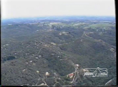
... Provision of recreational facilities in hilly areas requires the acquisition of expensive river flats (views of cricket ground surrounded by hills) and where not possible, costly earthmoving required. ...Provision of recreational facilities in hilly areas requires the acquisition of expensive river flats (views of cricket ground surrounded by hills) and where not possible, costly earthmoving required. ...Shire of Eltham Archives: Series 69, Item 7 Opens with aerial views of the Shire, 85% of the shire covered by the Green wedge principal. Discusses the obligations required of the Shire to maintain the Green Wedge. The Shire covers over 27,000 hectares with a population in excess of 45,000 residents, more than 70% living in the southern 10% of the Shire in suburbs of Eltham, Montmorency, Lower Plenty and Research. 85% of the Shire in the more sparsely populated northern area which is covered by the Green Wedge. Council is committed to providing a parity of services to all residents such as garbage collection and maintenance of roads. Views of rubbish collection trucks in Montmorency. It is emphasised that the cost of these services in highly populated areas is relatively low whereas in the sparsely populated Green Wedge areas, considerable. There are hundreds of kilometres of roads throughout the Shire, many unmade and maintenance is high to check overhanging trees and erosion especially on the steep hills is expensive and disproportionate to servicing the population in the dense urban areas. Shows views of hilly gravel roads and graders at work maintaining them. Shows scenes of assessing planning applications in these rural areas which takes significantly more time as well as other services provided such as Meals on Wheels, building permits, Ranger services. Provision of recreational facilities in hilly areas requires the acquisition of expensive river flats (views of cricket ground surrounded by hills) and where not possible, costly earthmoving required. Also, views highlighting extensive tracks of natural habitat home to significant bird, animal and plant life. Shire emphasises its commitment highlighted by the Eltham Copper Butterfly which the Shire maintains small pockets of bushland to ensure its survival at significant expense (views of Pauline Toner Copper Butterfly Reserve.) Short interview with Pat Vaughan, Environmental Officer for the Shire discussing the Eltham Copper Butterfly who also mentions many other species in the Shire of high significance from bats to mammals to plants as well as the importance of the Green Wedge to Melbourne – the lungs of Melbourne - and ensuring the protection of very important habitat which requires a great deal of planning and management to look after. Views of Wingrove Park to emphasise this maintenance by machinery in some areas is too damaging and introduced species, etc must be removed by hand. Balancing the services and facilities expected by the community with the needs of the environment requires careful planning demands requires careful planning and the principals of the Green Wedge require constant attention in the face of growing need for housing. Director of Planning & Environment, Richard Allen advises there are approximately 1,300 planning permits and development applications each year ranging from simple subdivision, boundary realignments to further complicated non-urban developments for agricultural pursuits and the level of expertise required from architectural and engineering to land degradation, flora and fauna. Video finishes with aerial views and parklands, streetscapes and rural areas. VHS Video cassette Converted to MP4 file format 00:07:39; 89MBshire of eltham, video recording, shire of eltham archives, eltham shire council, eltham, building permits, cricket ground, development applications, eltham copper butterfly, garbage collection, graders, green wedge, lower plenty, meals on wheels, montmorency, pat vaughan, pauline toner reserve, planning applications, planning permits, ranger services, recreational facilities, research, richard allen, roads, rural areas, wingrove park, victoria grants commission -
 Federation University Historical Collection
Document - Document - Report, VIOSH: Fire Protection; Identify exposures to Property Loss and Business Interruption, 1980, 1980
... The College operations include Engineering, Science, Education, Physical Education and School of Arts Facilities. It was opened in 1969 with the completion of the Engineering, Metallurgy and Geology Buildings. ...The College operations include Engineering, Science, Education, Physical Education and School of Arts Facilities. It was opened in 1969 with the completion of the Engineering, Metallurgy and Geology Buildings. ...Victorian Institute of Occupational Safety and Health (VIOSH) Australia is the Asia-Pacific centre for teaching and research in occupational health and safety (OHS) and is known as one of Australia's leaders on the field. VIOSH has a global reputation for its innovative approach within the field of OHS management. VIOSH had its first intake of students in 1979. At that time the Institution was known as the Ballarat College of Advanced Education. In 1990 it became known as Ballarat University College, then in 1994 as University of Ballarat. It was 2014 that it became Federation University. VIOSH Australia students are safety managers, senior advisors and experienced OHS professionals. They come from all over Australia and industry. Students are taught active research and enquiry; rather than textbook learning and a one-size fits all approach. VIOSH accepts people into the Graduate Diploma of Occupational Hazard Management who have no undergraduate degree - on the basis of extensive work experience and knowledge. This report is prepared by Bruce S Webber, M.I.E. Aust. in consultation with Alan Webb, Buildings Officer at Ballarat College of Advanced Education, Gear Avenue, Mount Helen. The College operations include Engineering, Science, Education, Physical Education and School of Arts Facilities. It was opened in 1969 with the completion of the Engineering, Metallurgy and Geology Buildings. This report was made upon observations of the conditions and information provided at the time the College was inspected.Thirty-five A4 sheets, spiral bound. Contents in two sections. Typed.Cover has Logo for Reed Stenhouse at bottomviosh, victorian institute of occupational safety and health, ballarat college of advanced education, fire protection, property loss exposures, engineering, science, physical education, school of arts, metallurgy, geology, reed stenhouse report, alan webb, buildings officer, bruce webber
