Showing 3717 items
matching beach
-
 Port Melbourne Historical & Preservation Society
Photograph - Foundation stone and plaque, Victorian Seamen's Institute, Beach Street, Port Melbourne, 1888
During demolition of the 1937 Missions to Seamen building in October 1995, this stone was removed intact by developers Mirvac Victoria, and place in the care of the PMH&PS. It is now located as part of the seawall around the car park in front of Nott St. There is a photo of the item on the database, taken in the 1990s while the stone was stored at St Joseph's school in Stokes St.Two photographs taken September 2015 by member Bob Gooding .02 The foundation stone .03 the accompanying plaque - Cornerstone 1888, originally laid at the Victorian Seamen's Institute corner Nott and Beach Street (Fox Hay building today). Was relocated to interior wall near the chapel doors when the new Mission building at corner of Beach Street and Swallow Street was built in 1937.Engraved in gold lettering on a black background: This memorial stone was laid by His Excellenvy Sir Henry B Loch GGMGKCB, Governor of Victoria on Wednesday the 5th day of September AD 1888missions to seamen, sir henry b loch -
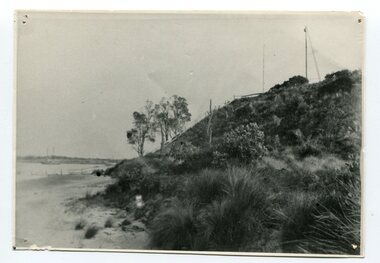
 Lakes Entrance Historical Society
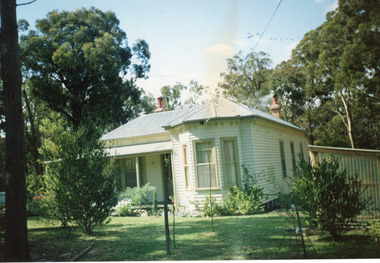
Photograph - Housing, 1990
Moved to present site 1989c by Tony TrompColour photograph of a single storey timber dwelling with corrugated iron hipped roof, bay window at front room, veranda on two sides, unique sunshade over SW window, internal chimneys with chimney pots. Set in bushland with native plant garden, at 357 Lake Tyers Beach Road. Painted cream with fawn trim. Relocated from Esplanade. Lake Tyers Beach Victoriahouses, architecture -
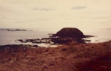
 Lakes Entrance Historical Society
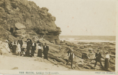
Postcard - Red Bluff 1910 c, Stanley Vogt, 1910c
Paired with image 03731.1 for display in 150 years Lakes Entrance 1858 to 2008 held in October 2008Sepia toned postcard west side of Red Bluff showing a group of eight men and five women and a child. Sand washed away exposing vast rocky beach, short vegetation on rocky bluff. Women wearing full length skirts and wide brim hats with veils, men in three piece suits dark in colour on ninety mile beach Lake Tyers VictoriaThe Bluff Lakes Entrancetopography, fashion -
 Port Fairy Historical Society Museum and Archives
Photograph
South Beach Developementsouth beach, development, digger -
 Port Fairy Historical Society Museum and Archives
Photograph
South Beach Developmentsouth beach, development, digger, drain, ocean drive -
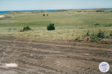
 Port Fairy Historical Society Museum and Archives
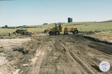
Photograph
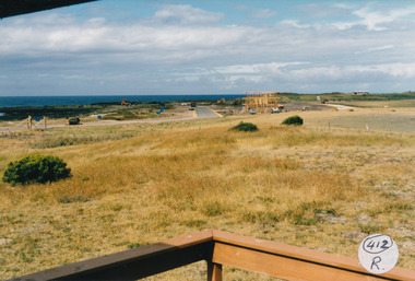
South Beach Development south beach, development, grader, water tower, street, building -
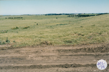
 Port Fairy Historical Society Museum and Archives
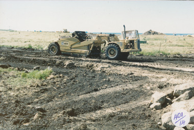
Photograph
South Beach Development south beach, development, road, road making, equipment, street -
 Port Fairy Historical Society Museum and Archives
Photograph
South Beach Developement south beach, development, road, streets -
 Port Fairy Historical Society Museum and Archives
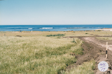
Photograph
South Beach Development south beach, development, road making, street, ocean, sea -
 Port Fairy Historical Society Museum and Archives
Photograph
South Beach Development south beach, development, road, road making -
 Port Fairy Historical Society Museum and Archives
Photograph
South Beach Development south beach, development, west, works -
 Port Fairy Historical Society Museum and Archives
Photograph
South Beach Developement south beach, development, streets, seaview, west port fairy -
 Port Fairy Historical Society Museum and Archives
Photograph
South Beach Development Coloured photograph of Tip truck with load of bluestone in foreground whale bone on a mound in front of house407/23 (Label has now been removed (2021)ocean drive, truck, bluestone, whale bone, south beach, development -
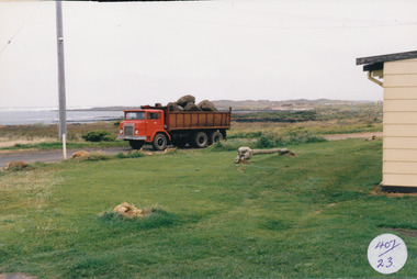
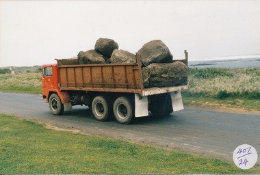 Port Fairy Historical Society Museum and Archives
Photograph
South Beach Development Coloured photograph of Large tip truck with load of bluestone sea in background407/24 (since removed) south beach, development, truck, bluestone, ocean, sea -
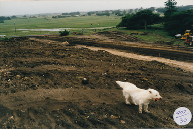 Port Fairy Historical Society Museum and Archives
Photograph
South Beach Development Coloured photograph of Earthworks in foreground with white dog swamp in background407/30 (since removed 2021)south beach, development, earth works, dog -
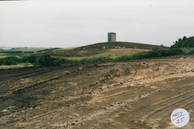 Port Fairy Historical Society Museum and Archives
Photograph
South Beach Development Coloured photograph of Earthworks in foreground with Port Fairy Water tower in background407/25 (since removed 2021)south beach, development, water tower, road making, street, earth works -
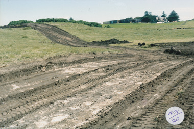
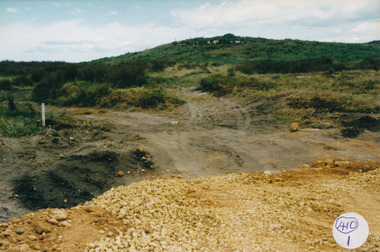 Port Fairy Historical Society Museum and Archives
Photograph
South Beach Development Coloured photograph of Large hill with track leading to the left during construction410/1 (since removed 2021)south beach, development, ocean drive, street making, roadmaking -
 Port Fairy Historical Society Museum and Archives
Photograph
South Beach Developement Coloured photograph of Rocky outcrop looking towards dunessouth beach, development, bluestone, west -
 Port Fairy Historical Society Museum and Archives
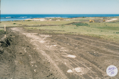
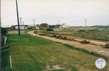
Photograph
South Beach Development Coloured photograph of Ocean Drive being graded and widened408/6 since been removed (2021)south beach, development, road making, ocean drive -
 Port Fairy Historical Society Museum and Archives
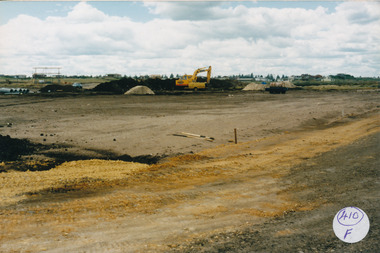
Photograph
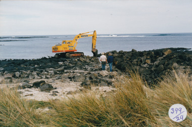
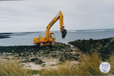
South Beach Development Coloured photograph of Drainage works with pipes at the left and large machine 410/F (sticky label now removed 2021)south beach, development, earth works, equipment, digger -
 Port Fairy Historical Society Museum and Archives
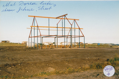
Photograph
South Beach Development south beach, development, mal dora, house, building, jehu street -
 Port Fairy Historical Society Museum and Archives
Photograph
South Beach Developement south beach, development, house, building, street, road -
 Port Fairy Historical Society Museum and Archives
Photograph
South Beach Development south beach, development, ocean drive, mal dorea, house building, road, street -
 Port Fairy Historical Society Museum and Archives
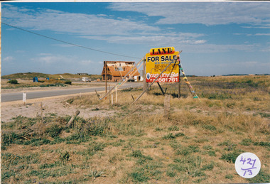
Photograph
South Beach Development south beach, development, sale, sign, mal dora, house, building -
 Port Fairy Historical Society Museum and Archives
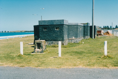
Photograph
Amenities at East Beachtoilets, showers, east beach, ocean, sea -
 Port Fairy Historical Society Museum and Archives
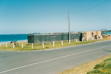
Photograph
Amenities East Beach toilet, amenities, east beach, car park -
 Port Fairy Historical Society Museum and Archives
Photograph
South Beach 2000south beach, 2000, rocks, ocean, sea, dune -
 Orbost & District Historical Society
black and white photograph, C1890
Marlo was once a very busy port. Goods needed by the early settlers were carted by sea-going vessels to Marlo. At the Marlo wharf goods were unloaded from the large vessels onto barges and towed by paddle steamers to Orbost. (information - In Times Gone By - Deborah Hall)This item is a pictorial record of Marlo in the late 19th century.A black / white photograph of a beach with a sloping hillside covered in thick vegetation. There is a pole at the top with a light on it. It overlooks the jetty. A sailing ship can be seen in the background - left.on back - "Marlo showing light on pole on the point above the jetty about 1890"marlo-19th-century marlo-jetty -
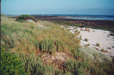
 Phillip Island and District Historical Society Inc.
Photograph, Summerlands and The Nobbies, 1980s
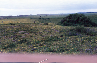
4 Coloured photographs of The Nobbies, track to the Blowhole showing erosion, Summerlands Beach showing the Penguin Parade and houses on the Summerlands Estate taken from Phelan’s Bluff.the nobbies, summerlands beach, phillip island, summerlands estate, phillip island, penguin parade -
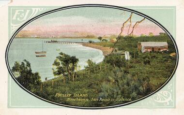 Phillip Island and District Historical Society Inc.
Photograph - Post Card, 1900's
Donated by Jean ParleColoured Postcard with oval photograph of Newhaven with San Remo in the distance. Two boates moored close to Newhaven beach with Jetty behind. Three buildings, a fence and trees."Phillip Island Newhaven, San Remo in distance." 'F & J"newhaven foreshore, phillip island, jean parle