Showing 2911 items matching "gervasoni"
-
 Ballarat Heritage Services
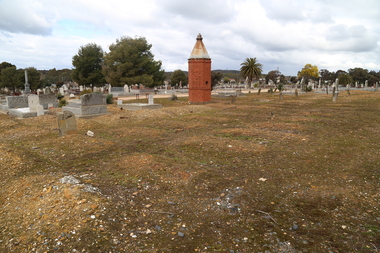
Photograph - Photograph - Colour, Clare Gervasoni, Chinese Section in the Bendigo Cemetery, 2018, 01/09/2018
Colour photograph of the Chinese section in the Bendigo Cemetery.bendigo cemetery, graves, headstones, chinese, lee kie -
 Ballarat Heritage Services
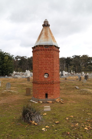
Photograph - Photograph - Colour, Clare Gervasoni, Chinese Section in the Bendigo Cemetery, 2018, 01/09/2018
Colour photograph of the Chinese section in the Bendigo Cemetery.A plaque states: This Pomelo Tree (known to the Chinese as the tree of life) was planted on 9 October 1996 in recognition and to the memory of the many Chinese buried at or in close proximity to this site during the 19th and 20th centuries. bendigo cemetery, graves, headstones, chinese, oven -
 Ballarat Heritage Services
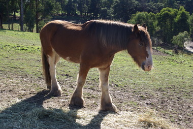
Photograph - Photographs - Colour, Clare Gervasoni, Sovereign Hill Horses at Rest, 2020, 17/05/2020
These photographs were taken during the Covid19 Lockdown, when Sovereign Hill had been closed for a couple of months. The horses were obviously missing the tourists as they came to the fence whenever they saw a person walking past their paddock.Colour photographs of Sovereign Hill horses at rest in the paddock. horses, sovereign hill, horse transport, clydesdale -
 Ballarat Heritage Services
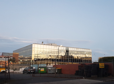
Photograph - Colour, Ballarat State Offices 'The Glasshouse', 2020, 19/06/2020
Colour photograph of the Ballarat State Offices in Mair Street, Ballarat.ballarat state offices, glass house, mair street -
 Ballarat Heritage Services
Photograph - Colour, Former Ballarat Jam Factory, 2020, 20/06/2020
Colour photograph of the Former Ballarat Jam Factory.ballarat jam factory, industrial heritage, davey street ballarat -
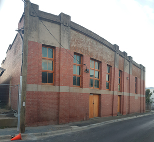
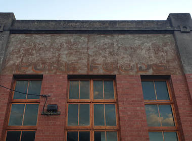 Ballarat Heritage Services
Photograph - Photograph - Colour, 'Ghost Sign' on the Former Ballarat Jam Factory, 2020, 20/06/2020
Colour photograph of the Former Ballarat Jam Factory.ballarat jam factory, industrial heritage, davey street ballarat -
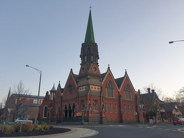 Ballarat Heritage Services
Photograph - Colour, Former Ballarat Congregational Church, 2020, 20/06/2020
Colour photograph of the Former Ballarat Congregational Church"Ballarat Jam Company"ballarat congregational church, mair street -
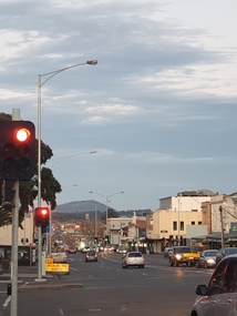 Ballarat Heritage Services
Photograph - Photograph - Colour, Mair Street Ballarat, 2020, 20/06/2020
Colour photograph of Mair Street Ballarat near the intersection of Doveton Street.mair street ballarat -
 Ballarat Heritage Services
Photograph, John Hepburn of Smeaton House, Smeaton
Captain Hepburn was a squatter who held the license for Smeaton Estate. Colour photographs of Smeaton House, Smeaton,and the grave of Elizabeth and John Hepburn. john hepburn, elizabeth hepburn, squatter, smeaton -
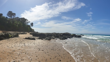
 Ballarat Heritage Services
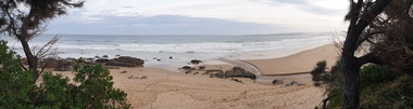
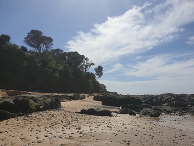
Photograph, Clare Gervasoni, Wild Dog Creek at Apollo Bay, 19/09/2020
Colour photograph of Wild Dog Creek flowing in to the beach at Apollo Bay near the rocky outcrop known as Match Point.apollo bay, wild dog creek, match point, beach, coast -
 Ballarat Heritage Services
Photograph - seascape, Clare Gervasoni, Wild Dog Creek at Apollo Bay, 19/09/2020
Colour photograph of Wild Dog Creek flowing in to the beach near the rocky outcrop known as Match Point, Apollo Bay.apollo bay, wild dog creek, match point, beach, coast -
 Ballarat Heritage Services
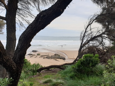
Photograph, Clare Gervasoni, Apollo Bay, 19/09/2020
Colour photograph of the beach at Apollo Bay.apollo bay, beach, coast -
 Ballarat Heritage Services
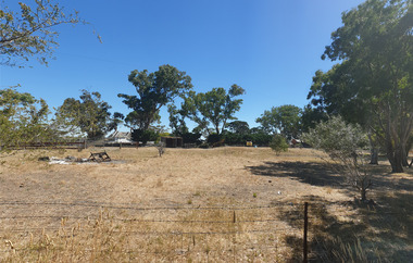
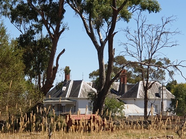
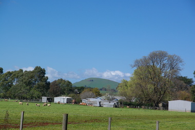
Photograph, Clare Gervasoni, Brookside, 21/01/2021
The farm known as Brookside.brookside, farm -
 Ballarat Heritage Services
Photograph, Clare Gervasoni, Brookside Homestead, 21/01/2021
The Brookside Private Reformatory for Protestant Girls was established on 29 December 1887 by Mrs W. T. Rowe. It was initially established at Glenfine, and soon moved to more extensive premises in the town of Cape Clear, near Scarsdale. The establishement of private reformatories had been made possible by The Juvenile Offenders' Act 1887 , which was assented to only weeks before the opening of Brookside. The Mintaro Reformatory Home for Girls at Monegeetta, Lancefield was established in 1903 by the Methodist Home Mission Department to take the girls from the Brookside Reformatory at Cape Clear when it closed in 1903. Brookside Homestead taken from the public roadway.brookside, farm, homestead -
Ballarat Heritage Services
Photograph, Clare Gervasoni, Brookside Farm Looking Towards the Creek, 21/01/2021
A video of Brookside Homestead looking towards the Creek, taken from the public roadway.brookside, farm, homestead -
 Ballarat Heritage Services
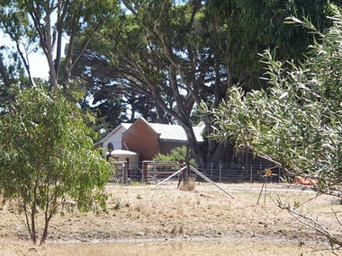
Photograph, Clare Gervasoni, Stable Complex at Brookside, 21/01/2021
Brookside Homestead taken from the public roadway.brookside, farm, stable -
 Ballarat Heritage Services
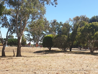
Photograph, Clare Gervasoni, Gates into Brookside Farm, 21/01/2021
A photograph and two videos showing the gates into Brookside Homestead taken from the public roadway.brookside, farm, stable -
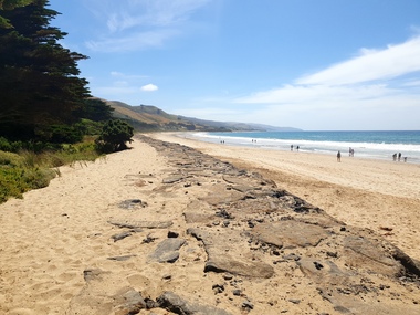
 Ballarat Heritage Services
Photograph, Clare Gervasoni, Rocks Near Wild Dog Creek, Apollo Bay, 24/01/2022
Colour photograph of rocks on the beach at Apollo Bay at a rocky outcrop known as Match Point.apollo bay, match point, beach, coast, rocks -
 Ballarat Heritage Services
Photograph, Clare Gervasoni, Rocks Near Wild Dog Creek, Apollo Bay, 24/01/2022
Colour photograph of rocks on the beach at Apollo Bay at a rocky outcrop known as Match Point.apollo bay, match point, beach, coast, rocks -
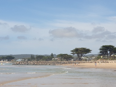 Ballarat Heritage Services
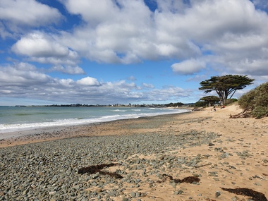
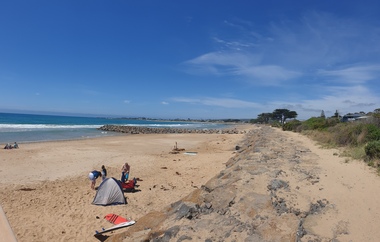
Photograph, Clare Gervasoni, Apollo Bay, Victoria, 24/01/2022
In 2021, the Department of Environment, Land, Water and Planning (DELWP) constructed two new groynes and a section of rock seawall at Apollo Bay to help manage the impacts of coastal erosion. The new 70-meter-long rock groynes run perpendicular to the shoreline and be located just south of the Milford St revetment and to the south of Milford Creek. Sections of rock seawall will be constructed between the two Groynes with an aim to protect the dune, walking path, cypress trees and road from erosion. Colour photograph of a coastal scene at Apollo Bay, featuring new rock groynes to protect the Great Ocean Road from erosion. apollo bay, beach, coast, groyne, rockwall -
 Ballarat Heritage Services
Photograph, Clare Gervasoni, Apollo Bay, Victoria, 24/01/2022
In 2021, the Department of Environment, Land, Water and Planning (DELWP) constructed two new groynes and a section of rock seawall at Apollo Bay to help manage the impacts of coastal erosion. The new 70-meter-long rock groynes run perpendicular to the shoreline and be located just south of the Milford St revetment and to the south of Milford Creek. Sections of rock seawall will be constructed between the two Groynes with an aim to protect the dune, walking path, cypress trees and road from erosion. Colour photograph of a coastal scene at Apollo Bay, featuring new rock wall and groynes to protect the Great Ocean Road from erosion. apollo bay, beach, coast, groyne, rockwall -
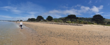
 Ballarat Heritage Services
Photograph, Clare Gervasoni, Sea Wall at Apollo Bay, Victoria, 24/01/2022
In 2021, the Department of Environment, Land, Water and Planning (DELWP) constructed two new groynes and a section of rock seawall at Apollo Bay to help manage the impacts of coastal erosion. The new 70-meter-long rock groynes run perpendicular to the shoreline and be located just south of the Milford St revetment and to the south of Milford Creek. Sections of rock seawall will be constructed between the two Groynes with an aim to protect the dune, walking path, cypress trees and road from erosion. Colour photograph of a coastal scene at Apollo Bay, featuring new rock wall and groynes to protect the Great Ocean Road from erosion. apollo bay, beach, coast, groyne, rockwall, sea wall -
 Ballarat Heritage Services
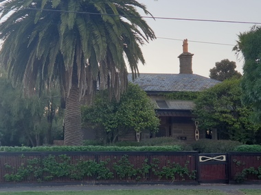
Photograph, Clare Gervasoni, Bluestone House in Ascot Street, Ballarat, 13/03/2022
A number of early Ballarat houses are constructed of Bluestone. Bluestone house with slate roof in Ascot St, Ballarat.bluestone, slate, ascot street, ballarat, palm tree -
 Ballarat Heritage Services
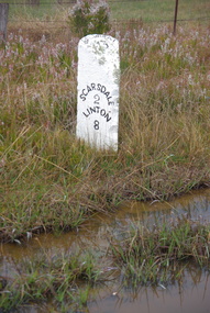
Photograph, LJ Gervasoni, Scarsdale/Linton Milepost (or Milestone), 20-06/2009
Stone mileposts dating from the 1870s are found on the Glenelg Highway. Stone and iron mileposts are now a rarity, and have remanining markers have become a tourist attaction in many smaller towns with remnant markers. The stone mileposts on the Glenelg Highway are listed on the Victorian Heritage Reigister as being significant to the State of Victoria. Their primary purpose is to inform the travelling public of distances and directions to various destinations. The stone milepost in the current City of Ballarat are located on the Glenelg Highway (between Ballarat and Scarsdale), Smythes Creek and Delacombe, and have been registered by Heritage Victoria, (HO155) Other stone mileposts are located In Golden Plains Shire at Smythesdale (Victorian Heritage Register H1701) Metrication in Australia caused former mile markers to be gradually replaced with 10 km markers on highways and country roads, which are referred to as "kilometre plates".Colour photograph of a stone mile post on between Ballarat, Scarsdale and Lintonmilepost, mile post, scarsdale, linton, ballarat, mile marker, stone milepost, milestone -
 Ballarat Heritage Services
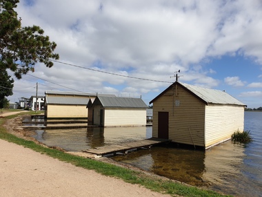
Photograph - Boathouse, Clare Gervasoni, Boathouses on Lake Wendouree, Ballarat, 2021
Lake Wendouree was originally known as Yuille's Swamp.Colour photograph of a boathouse on Lake Wendouree.. lake wendouree, boathouse -
 Ballarat Heritage Services
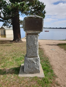
Photograph - Boathouse, Clare Gervasoni, Cairn displaying the place were William Cross Yuille Camped, 2021
Lake Wendouree was originally known as Yuille's Swamp.Colour photograph of a cairn displaying the place were William Cross Yuille CampedNear this spot was the camp of the first resident of Ballarat William Cross Yuille in March 1938. Presented by Cr A.J. Darling. Mayor of Ballarat 1034. Ballt Historical Socylake wendouree, william cross yuille, a.j. darling, yuille's swamp, marker -
 Ballarat Heritage Services
Photograph, Clare Gervasoni, Christmas Tree, 25/12/2020
Colour photograph of a Christmas tree and gifts.christmas, christmas tree, gifts, presents -
 Ballarat Heritage Services
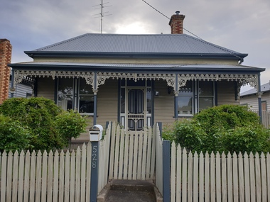
Photograph, Clare Gervasoni, Houses in LaTrobe St, Ballarat, 12/10/2020
Colour photographs of houses in LaTrobe St, Ballaratlatrobe street, ballarat, architecture -
 Ballarat Heritage Services
Photograph, Clare Gervasoni, Smeaton From Elizabeth Street, 2009
The Wright family of Clunes lived in Elizabeth Street.Colour photograph of the township of Smeaton from Elizabeth Street.smeaton, elizabeth street, frank wright