Showing 2318 items matching " infrastructure"
-
 Eltham District Historical Society Inc
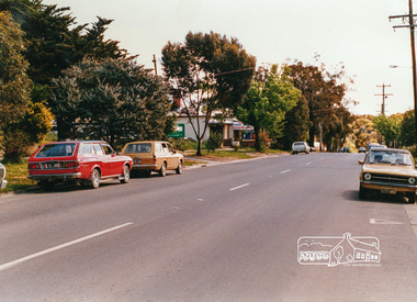
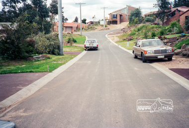
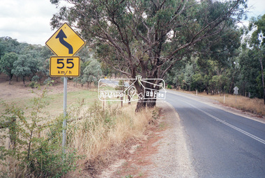
Photograph, Looking west near 942 Main Road, Hurstbridge, c. Oct 1987, 1987
Yvonne's Dressmaking and Alteration Service at 942 Main Road. Formerly a bakery, the building was demolished in 1990 and is now the site of Hurstbridge Saddlery. The milkbar is down the road, brick wall with a blue sign on it. There's still an older house next to the milkbar, but that's hidden from view in this shot as it's further back from the road. Date based on other similar display panels visible in images of the Shire of Eltham display at the Eltham Community Festival, 7 November 1987. Shire of Eltham Engineering Department Providing the resources to undertake • Survey, design, consultation • Road construction and maintenance • Bridge construction and maintenance • Street sweeping • Drain and pit cleaning • Traffic engineering installation and maintenance • Garbage collection • Tip management, land reclamation and beautification • Maintenance of community buildings • Provision of community and recreation facilitiesPhoto print mounted on carddisplay panel, eltham festival, heidelberg-kinglake road, hurstbridge, hurstbridge milk bar, infrastructure, main road, mm, shire of eltham, yvonne's dressmaking and alteration service -
 Eltham District Historical Society Inc
Negative - Photograph, Unidentified street scene, possibly Eltham, 15 Oct. 1990
Roll of 35mm colour negative film, 3 strips Kodak GA100 5095infrastructure, roadworks - gutters, shire of eltham, streets -
 Eltham District Historical Society Inc
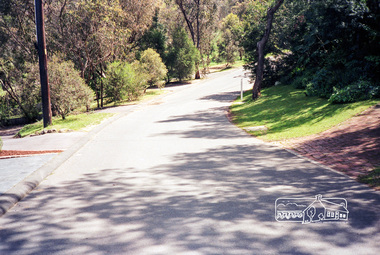
Photograph, Scarlet Ash Court, Eltham, 15 October 1990, 1990
Roll of 35mm colour negative film, 3 strips Also photo print Kodak GA100 5095eltham, infrastructure, roadworks - gutters, scarlet ash court, shire of eltham, stokes orchard estate, streets -
 Eltham District Historical Society Inc
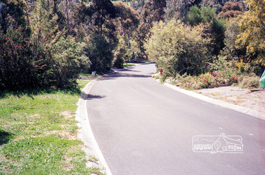
Photograph, Caltowie Court, Research, 15 October 1990, 1990
Roll of 35mm colour negative film, 3 strips Also photo print Kodak GA100 5095caltowie court, infrastructure, research (vic.), roadworks - gutters, shire of eltham, streets -
 Eltham District Historical Society Inc
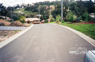
Photograph, Cressy Street, Montmorency, 15 October 1990, 1990
Roll of 35mm colour negative film, 3 strips Also photo print Kodak GA100 5095cressy street, infrastructure, montmorency, roadworks - gutters, shire of eltham, streets -
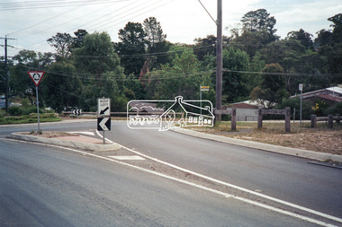
 Eltham District Historical Society Inc
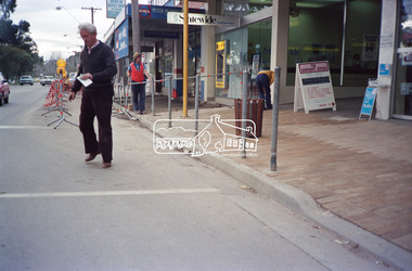
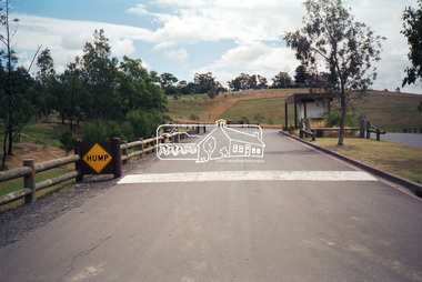
Photograph, Footpath upgrade outside Midway Arcade, Main Road shops near Pryor Street, Eltham, c.1986, 1986c
Footpath upgrade in shopping precinctRoll of 35mm colour negative film, 4 strips Fuji 100-Sinfrastructure, main road, midway arcade, shops, pryor street -
 Eltham District Historical Society Inc
Photograph, Looking south towards the Kangaroo Ground Horse and Pony Club, Kangaroo Ground-St Andrews Road, Kangaroo Ground, c.1989, 1989
Roll of 35mm colour negative film, 5 strips Kodak GA100 5095infrastructure, kangaroo ground, kangaroo ground horse and pony club, kangaroo ground-st andrews road, streets -
 Eltham District Historical Society Inc
Photograph, Looking south along Kangaroo Ground-Warrandyte Road just east of Heidelberg-Kinglake Road, Kangaroo Ground, c.1989, 1989
Roll of 35mm colour negative film, 5 strips Kodak GA100 5095infrastructure, kangaroo ground, kangaroo ground-warrandyte road, streets -
 Eltham District Historical Society Inc
Photograph, Looking northwest along Kangaroo Ground-Warrandyte Road, Kangaroo Ground, c.1989, 1989
Roll of 35mm colour negative film, 5 strips Kodak GA100 5095infrastructure, kangaroo ground, kangaroo ground-warrandyte road, streets -
 Eltham District Historical Society Inc
Photograph, Looking northwest along Kangaroo Ground-Warrandyte Road, Kangaroo Ground, c.1989, 1989
Roll of 35mm colour negative film, 5 strips Kodak GA100 5095infrastructure, kangaroo ground, kangaroo ground-warrandyte road, streets -
 Eltham District Historical Society Inc
Photograph, Looking northeast across Main Road from intersection with Raglan Road, Research, c.1989, 1989
Roll of 35mm colour negative film, 5 strips Kodak GA100 5095infrastructure, main road, raglan road, research (vic.), streets -
 Eltham District Historical Society Inc
Photograph, Looking northwest across Main Road from intersection withf Raglan Road towards Ingrams Road, Research, c.1989, 1989
Roll of 35mm colour negative film, 5 strips Kodak GA100 5095infrastructure, ingrams road, main road, raglan road, research (vic.), streets -
 Eltham District Historical Society Inc
Photograph, Looking west along Main Road at intersection with Research-Warrandyte Road, Research, c.1989, 1989
Roll of 35mm colour negative film, 5 strips Kodak GA100 5095infrastructure, main road, research (vic.), research-warrandyte road, streets -
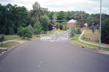 Eltham District Historical Society Inc
Photograph, Looking southeast along Leane Drive towards Main Road, Eltham, c.1989, 1989
Roll of 35mm colour negative film, 5 strips Also colour print Kodak GA100 5095alan marshall reserve, eltham, infrastructure, leane drive, main road, streets -
 Eltham District Historical Society Inc
Photograph, Looking south across Main Road near Diamond Street, Eltham, c.1989, 1989
Roll of 35mm colour negative film, 5 strips Also colour print Kodak GA100 5095diamond street, eltham, infrastructure, main road, streets -
 Eltham District Historical Society Inc
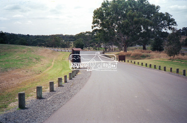
Photograph, Westerfolds Park, Templestowe, c.1989, 1989
This section of roadway/carpark/trail has changed since photo was taken; new entrance to parkRoll of 35mm colour negative film, 5 strips Also colour print Kodak GA100 5095 Also colour printinfrastructure, speedhumps, streets, templestowe, westerfolds park -
 Eltham District Historical Society Inc
Photograph, Westerfolds Park, Templestowe, c.1989, 1989
Roll of 35mm colour negative film, 5 strips Also colour print Kodak GA100 5095 Also colour printinfrastructure, speedhumps, streets, templestowe, westerfolds park -
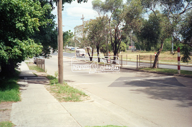
 Eltham District Historical Society Inc
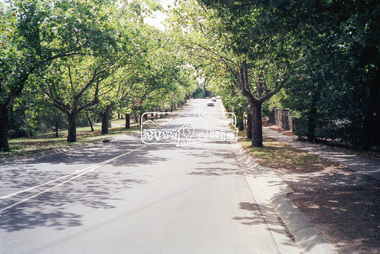
Photograph, Looking north along Main Road and the Avenue of Honour from near Dalton Street, Eltham South, c.1989, 1989
Roll of 35mm colour negative film, 5 strips Also colour print Kodak GA100 5095avenue of honour, dalton street, eltham, infrastructure, main road, streets -
 Eltham District Historical Society Inc
Photograph, Looking south along Main Road from the Avenue of Honour near Dalton Street, Eltham South, c.1989, 1989
Roll of 35mm colour negative film, 5 stripsKodak GA100 5095avenue of honour, dalton street, eltham, infrastructure, main road, streets -
 Marysville & District Historical Society
Photograph (item) - Colour photograph, September 2008
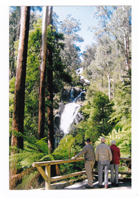
A colour photograph of three men standing at the viewing platform looking at Steavenson Falls in Marysville in Victoria.A colour photograph of three men standing at the viewing platform looking at Steavenson Falls in Marysville in Victoria. This infrastructure was destroyed in the 2009 Black Saturday bushfires. The Steavenson Falls is named after the Victorian Assistant Commissioner of Roads and Bridges, John Steavenson who arrived in Victoria in the early 1860s.September 2008steavenson falls, waterfalls, marysville, victoria, john steavenson, 2009 black saturday bushfires -
 Mission to Seafarers Victoria
Book, Jill Barnard et al, Welcome and Farewell: The Story of Station Pier, 2004
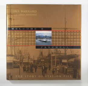
In the mid-nineteenth century, Victoria’s primitive maritime infrastructure was not coping with the volume of passenger and cargo traffic arriving in and departing from the burgeoning gold-fevered colony. However, the opening of Railway Pier at Port Melbourne in 1854 greatly improved the situation. Railway Pier serviced the steamships, which plied Port Phillip Bay and the Victorian coastal waters beyond, and also offered berths for vessels on the regular runs to other Australian colonies and to overseas destinations. However, as the larger and more powerful steamships of the early twentieth century found berthing increasingly difficult at Railway Pier, the need for a more modern pier became apparent. By 1930, the new Station Pier had replaced its predecessor. Itself extended and upgraded several times including during the past decade, Station pier still offers every contemporary convenience to shipping services using its busy facilities, just as did its predecessor Railway Pier, 150 years ago. The Victorian Government commissioned Welcome & Farewell to celebrate the 150 years since the opening of the Railway Pier. In doing so, it was mindful that the story of the site is not limited to its contribution to national and state economies, or to its physical development. The Government wanted a history that would also speak to ordinary Victorians, and other Australians, of their own experiences of this significant place. For indeed the Station Pier site has played its part in almost every milestone or phase in our history: at moments of celebration and commemoration, during economic booms and depressions, during times of war and peace. It has also won a place in the hearts of ordinary individuals affected by the welcomes and farewells they have experienced there: those for visiting royalty and celebrities, for servicemen and medical personnel off to war or returning home, for migrants from distant countries and refugees from war zones, for friends and family travelling for personal, professional or cultural reasons. Welcome & Farewell thoughtfully examines Station Pier’s significance and offers a splendid visual panorama of the experiences lived out there between 1854 and 2004.Illustrated large-format book with 224 pages [36] p. of plates. : ill., maps, ports.Bibliography: p. 199-201non-fictionIn the mid-nineteenth century, Victoria’s primitive maritime infrastructure was not coping with the volume of passenger and cargo traffic arriving in and departing from the burgeoning gold-fevered colony. However, the opening of Railway Pier at Port Melbourne in 1854 greatly improved the situation. Railway Pier serviced the steamships, which plied Port Phillip Bay and the Victorian coastal waters beyond, and also offered berths for vessels on the regular runs to other Australian colonies and to overseas destinations. However, as the larger and more powerful steamships of the early twentieth century found berthing increasingly difficult at Railway Pier, the need for a more modern pier became apparent. By 1930, the new Station Pier had replaced its predecessor. Itself extended and upgraded several times including during the past decade, Station pier still offers every contemporary convenience to shipping services using its busy facilities, just as did its predecessor Railway Pier, 150 years ago. The Victorian Government commissioned Welcome & Farewell to celebrate the 150 years since the opening of the Railway Pier. In doing so, it was mindful that the story of the site is not limited to its contribution to national and state economies, or to its physical development. The Government wanted a history that would also speak to ordinary Victorians, and other Australians, of their own experiences of this significant place. For indeed the Station Pier site has played its part in almost every milestone or phase in our history: at moments of celebration and commemoration, during economic booms and depressions, during times of war and peace. It has also won a place in the hearts of ordinary individuals affected by the welcomes and farewells they have experienced there: those for visiting royalty and celebrities, for servicemen and medical personnel off to war or returning home, for migrants from distant countries and refugees from war zones, for friends and family travelling for personal, professional or cultural reasons. Welcome & Farewell thoughtfully examines Station Pier’s significance and offers a splendid visual panorama of the experiences lived out there between 1854 and 2004.port melbourne, station pier -
 Greensborough Historical Society
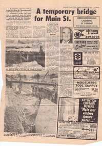
Newspaper clipping, A temporary bridge for Main Street, 24/10/1978
Leading up to the opening of Greensborough Plaza, traffic along Main Street was affected by the part closure due to the construction of a road bridge over the railway line.Significant infrastructure changes in Greensborough at the time of the opening of Greensborough Plaza in 1978.Photocopy of news clipping (Item 958). Text and black and white images. -
 Greensborough Historical Society
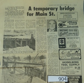
Newspaper clipping, A temporary bridge for Main Street, 24/10/1978
Leading up to the opening of Greensborough Plaza, traffic along Main Street was affected by the part closure due to the construction of a road bridge over the railway line.Significant infrastructure changes in Greensborough at the time of the opening of Greensborough Plaza in 1978.Original news clipping (Item 904) and photocopy of same (Item 958). Text and black and white images.main street greensborough, para road, railway, greensborough plaza -
 Kiewa Valley Historical Society
Meter Millivolt, after 1950
This milli-volt meter was manufactured after 1950 and used by the SEC Vic (Kiewa Hydro Electricity Scheme) from that date until late 1900's. It was used to measure very small voltages associated with the operation of the various Hydro Generators. The readings were able to be shown by the resistor in use in the current circuit. During this time period, high quality testing instruments were either sourced from Europe or England.This milli-volt meter is very significant to the Kiewa Valley as it was used by those electrical technicians, who were part of the Kiewa Hydro Scheme. An "off spin" from the Scheme was the beginning of an explosion in "human" resources into the Kiewa Valley. This influx of population transformed the region from that of a basically quiet rural region to one which evolved into both industrial and larger residential community. This evolution in the Kiewa Valley created a change, not only in the "physical" landscape(better roads and infrastructure), but also the socio-economic growth within the Valley allowing other "tourist" based industries to expand within the valley and Alpine areas.This millivolts DC meter was used in the 1950's. It is contained in a wooden box and has two coloured (red/black, positive and negative) screw tight knobs which have bake-lite connections. It also has a covered (black tin) view meter marked from zero to 10 millivolts. Underneath this and within a round bake-lite is a small adjustment screw. The top of the box is fastened onto the main structure by six brass screws. The back of the structure is fastened by eight brass screws and there are four small bake-lite rest knobs.On the face of the millivolt compartment , and at the top "TO BE USED WITH DIAL HORIZONTAL TEMP. COEF. +- .08 % PER oC. Underneath the scale "MILLIVOLTS D.C. F.G." (LEAD RESIS. .05 OHMS)" underneath and to the left "MADE IN ENGLAND BY" "EVERSHED & VIGNOLES Ltd" and to the right "No. 857842" underneath Regd. TRADE MARK MEGGERkiewa valley tourism, victorian alps, alternate energy supplies, alpine population growth -
 Kiewa Valley Historical Society
Meteorological Conditions - Bogong High Plains
The amount of rain and snow during the year and over the years was recorded regularly. This was done at several sites and was important for the building of the Kiewa Hydro Electric Scheme which involved dams, power stations and racelines.The KHES depended on accurate and detailed measurements of rain and snow on the Bogong High Plains in order to plan and construct high functioning infrastructure. Photocopy of pages re the Meteorological conditions on the Bogong High Plains including the decades from the 1930s to 1980s. Snow depths are also documented.kiewa hydro electric scheme, meteorological conditions on the bogong high plains, snow depth on the bogong high plains -
 Kiewa Valley Historical Society
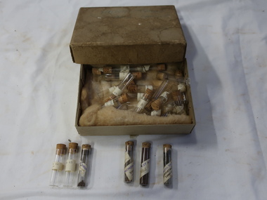
Sample Tubes
Part of Geological investigation into the characteristics of the rock formations and ground water.Water supply and infrastructure requires prior investigation before construction work can commence.Very small glass tubes (about 30) with cork toppers. Each tube is labelled. Resting on wool in a cardboard box with a lid. Stored in an old thick cardboard box with a very faint 'Harrietville ... Samples' on its lid.On the tubes - place and number "Harrietville / samples"geological samples, harrietville water -
 Kiewa Valley Historical Society
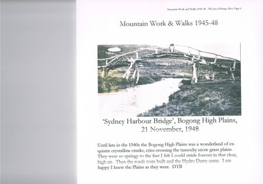
Journal - Reference, Mountain Work and Walks 1945-48,The Joy of Being Alive, circa 1950s
This journal detailing the author and friends walks and observations together with black and white photographs of the Kiewa Valley and the Bogong high plains regions during various "walks during the years 1945 to 1948. These walks were undertaken during the various Hydro - electricity generating plants and infra structures were being installed. It relays how the walker and adventurer enjoyed the pristine Alpine regions of Victoria. The wilderness and higher sense of adventure encountered by the author and his "walking party" is now no longer that intense. The isolation of the region was, at that time, still a barrier for the casual adventurer and required a dedication of the "pioneer" mountain walker.The significance of this journal is that both the photographs and accounts of those intrepid adventurers walking throughout the Victorian Alps and the Bogong High Plains details the countryside in one of the remaining years of relative pristine and minimal "tourist" developed regions of rural Victorian. The necessity of greater electrical power supply to the rapidly growing demand from cities and larger towns, post World War II immigration, had resulted in drastic changes to the infrastructure of the Victorian Alpine regions and particularly the Kiewa Valley. The photographs and the written accounts of the "adventurers" in this journal presents the last phases of the " Australian rough outback environment" and also the typical "bush wise" city/town dweller that although lived in towns and cities still had the adventurers heart of their fore fathers.This item has been photocopied by the author of his journal, consisting 27 pages of A4 size paper. A covering letter by the author is at the front of this loose leafed journal. The journal is bound in a yellow plastic cover with spirals. At the back is a 2 page biography of Myrtle Emily (Grigg) Deamer 1922-2006, then a photo of Meg with baby Bryn and son Tony followed by a letter from David BottomleyThe author's correspondence and covering letter has his signature "D Bottomley"alpine country, bush walking, bogong mountain, alpine adventures -
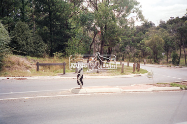
 Eltham District Historical Society Inc
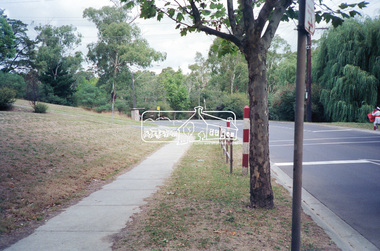
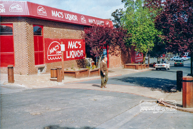
Photograph, Pedestrian access upgrade, Pryor Street, Eltham, c. Oct 1987
Looking down Pryor Street towards the intersection with Main Road, Mac's Liquor on left. Shows upgraded footpath area with new paving and planter boxesColour photographeltham, main road, shire of eltham, infrastructure development -
 Warrnambool and District Historical Society Inc.
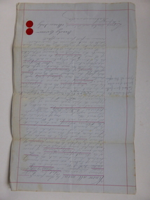
Document, Gauley contracts .1 & .2, C 1878
In 1858 a tramway was constructed to move goods between Warrnambool township and jetty on Lady Bay which was over a mile away The terminus was established on the southern side of Merri Street. and the track went around the edge of Lake Pertobe reserve. Large stores were also built near where the present railway station is situated to hold produce and carriages. These documents relate to contracts between Marion Gauley ,contractor of Warrnambool and the borough of Warrnambool for the operation of horse work with the tramway. John McDermid sadler,and William Stevens farmer of Russell's Creek are acting as surety for the contract.The tramway was an important part of Warrnambool's infrastructure and history and the documents also include names of local people. Of particular interest is the fact that the contract in this case was given to a woman which would have been a little uncommon at that time.001259.1 Pale blue lined paper with red lined outline.Hand written in black pen with names and some other words underlined in red. Two signatures on bottom right with red seal beside each. Witness signature below on left hand side. One page only 001259.2 Pale blue lined paper with red lined outline.Hand written in black pen with names and some other words underlined in red. Two signatures on bottom right with red seal beside each. Witness signature below on left hand side. Of the four pages of the document , only the first page is used. 001259.1 Signed Roady Carew and Moses Daly. Richard Daly is crossed out in the document and Marion Gauley is inserted in greylead. September 1878 001259.2 John McDermid saddler William Stevens, Marion Gauley. Ninth of December 1878. warrnambool, warrnambool tramway, marion gauley, john mcdermid, william stevens