Showing 173 items
matching land division
-
 Eltham District Historical Society Inc
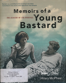
Book, Miegunyah Press, Memoirs of a Young Bastard: the diaries of Tim Burstall compiled by Hilary McPhee, 2012
Diaries of Tim Burstall November 1953 to December 1954. Tim Burstall lived in Eltham. Tim Burstall, the celebrated director of Stork, Alvin Purple and numerous other definitive 'ocker' comedies, is credited with shaking the moribund Australian film industry out of its torpor. But long before that, in the early 1950s, he began keeping a diary to record the world of the group of 'arties' and 'intellectuals' he was living among in Eltham, then a rural area outside Melbourne, where cheap land was available for mudbrick houses and studios, and where suburban rigidities could be mercilessly flouted. Burstall was in his mid-twenties, with two young sons and an open marriage with his wife, Betty. Eager to become a writer, to go against the grain, he kept a record almost daily-of the parties and the talk in pubs and studios, about art and politics and sex, of Communist Party branch meetings and film societies, of political rallies and the first Herald Outdoor Art Show. Somehow, while holding down a public relations job in the Antarctic Division and juggling his love affairs and obsession with the beautiful, brainy Fay, he wrote 500 words almost every day. Betty, according to the diaries, kept the show on the road, feeding friends after the pub, milking goats and working in her pottery making bowls and mugs, which Tim sometimes decorated at weekends. These Memoirs of a Young Bastard, as Burstall dubbed himself and them, are among the most evocative Australian diaries of modern times. Burstall can write. He has an eye for the telling detail, an unerring ear for cant and pomposity and, most endearingly, an ability to mock himself-always from the perspective of a bloke of his generation. Source: Publisherxxiv, 343 p., [18] p. of plates : ill., maps, ports., facsims. ; 27 cm.ISBN 9780522858143diary, motion picture director, film director, author -
 Melbourne Tram Museum
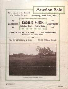
Ephemera - Real estate sale, Arthur Tucett & Son, "Labassa Estate" - Balaclava Road, East St Kilda, Nov. 1913
Pamphlet advertising the sale of land at the Labassa Estate, Balaclava Road 29-11-1913. Promotes the tram service, St Kilda Esplanade with a photo of PMTT 15 at the entry to Labassa at the corner of Orrong Road and Balaclava Road. Has a plan for the sub-division in to 46 allotments, terms of sale, and restrictions of what could be built on the land. The original Labassia Mansion is now owned by the National Trust.Demonstrates the style of land sale pamphlet including the availability of tram services to prospective purchasers.Pamphlet - folded - printed in two colours of cream coloured paper with photographs and plans.sale of land, trams, balaclava, balaclava road, real estate, labassa, orrong road -
 Melbourne Tram Museum
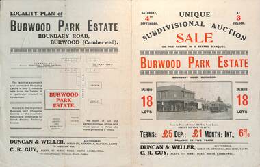
Ephemera - Real estate sale, Duncan & Weller Auctioneers, "Burwood Park Estate" Boundary Road, 1926
Pamphlet advertising the sale of land at the Burwood Park Estate, Boundary Road Burwood, Saturday 4th September. Does not give the year, most likely 1926. Promotes the tram service, nearby shops, the suitability of the soil for gardening and other facilities. Has a photo of possibly W 259 at the terminus. The plan of sub-division shows 18 lots for sale.Demonstrates the style of land sale pamphlet including the availability of tram services to prospective purchasers.Pamphlet - folded - printed in two colours of cream coloured paper with photographs and plans.sale of land, trams, real estate, burwood park, burwood -
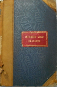
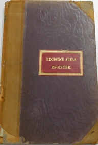
 Bendigo Historical Society Inc.
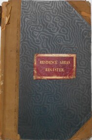
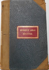
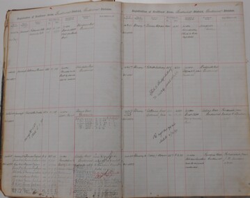
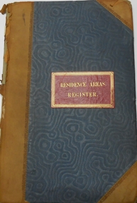
Document - RESIDENCE AREAS REGISTER: SANDHURST VOLUME 12, 1889 - 1890
Register: hard covered register, blue material with dark buff spine and corners. Contains A-Z index in front section linked with registration details of residence areas in the Sandhurst district, Sandhurst division. Written on front cover in gold ' Residence Areas Register' On spine '12' Dates from 22 December 1889 to 17 June 1890.place, bendigo, residence areas, bendigo, sandhurst, land sales, register -
 Bendigo Historical Society Inc.
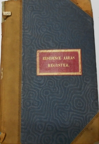
Document - RESIDENCE AREAS REGISTER: SANDHURST VOLUME 10, 1888 - 1889
Register: hard covered register, blue material with dark buff spine and corners. Contains A-Z index in front section linked with registration details of residence areas in the Sandhurst district, Sandhurst division. Written on front cover in gold ' Residence Areas Register' On spine '10' Dates from July 24, 1888, to January 29, 1889place, bendigo, sandhurst, land sales, residence areas, register -
 Bendigo Historical Society Inc.
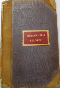
Document - RESIDENCE AREA REGISTERS: SANDHURST VOLUME 11, 1889
Register: hard covered register, blue material with dark buff spine and corners. Contains A-Z index in front section linked with registration details of residence areas in the Sandhurst district, Sandhurst division. Written on front cover in gold ' Residence Areas Register' On spine '11' Dates from 31 January 1889 to 24 December 1889/place, bendigo, sandhurst, land sales, residence areas, register -
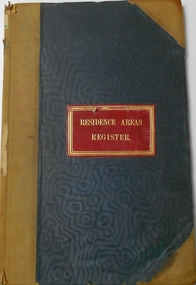
 Bendigo Historical Society Inc.
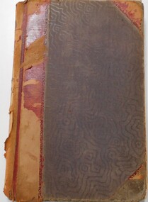
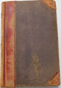
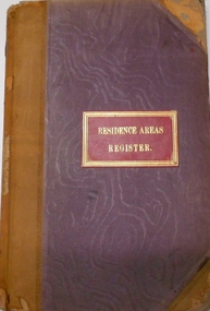
Document - RESIDENCE AREAS REGISTER: SANDHURST VOLUME 13, 1890 - 1892
Register: hard covered register, maroon material with red spine and corners. Contains A-Z index in front section linked with registration details of residence areas in the Sandhurst district, Sandhurst division. Written on front cover in gold ' Residence Areas Register' Pages 1 - 401. Dates from 19 June 1890 to 1 February 1892. Inside front cover, loose index sheets for Volume 13.place, residence areas, bendigo, sandhurst, land sales, land registers -
 Bendigo Historical Society Inc.
Document - RESIDENCE AREAS REGISTER SANDHURST : : VOLUME 15, 1893 to 1894
Register: faded patterned maroon cover with solid maroon binding on spine. Lined pages containing registration details of residence Sandhurst district, Sandhurst Division. Alphabetical index with smaller pages loose inside front cover. Dates from 26 June 1893 to 5 October 1894.place, bendigo, sandhurst, land sales, residence areas register -
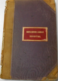
 Bendigo Historical Society Inc.
Document - RESIDENCE AREAS REGISTER SANDHURST : VOLUME 18, 1901 - 1914
Register: Residence Areas Register Sandhurst: Volume 18, brown hard cover register, maroon and buff coloured spine, containing pages nos. 1 - 802. Entries of residence licenses, Bendigo district, Sandhurst Division, 24 August 1905 to 4 February 1914, plus entries of rent paid subsequently. Not indexed. Nos. 13279 to 17302. On spine ' Register of residence areas'place, residence areas, bendigo, sandhurst, land sales, rents -
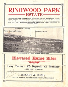 Ringwood and District Historical Society
Flyer, Sub-divisional residential land sale advertisement - Ringwood Park Estate, Ringwood, Vic. - circa 1922
... no.5249) Sub-divisional residential land sale advertisement ...Folded double-sided page with black and white photographs of local views with black and red print advertising elevated home sites, including terms of sale, locality map, and description of local facilities and services, with blocks marked as SOLD subsequent to auction sale December 1922. (See Record ID no.5249)Subdivision includes Wonga Road (later Loughnan Road), William Street, Andrew Street, Munro Street and Harrison Street. Estate Agents - Keogh & King, 70 Elizabeth Street, Melbourne, Telephone 6938. -
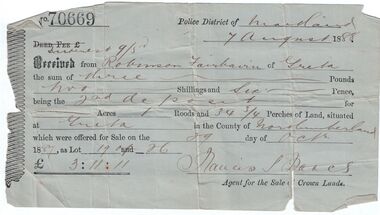 Bendigo Historical Society Inc.
Administrative record - Land purchase records - Maitland NSW, 1888-1889
Northumberland County was one of the original Nineteen Counties in New South Wales and is now one of the 141 Cadastral divisions of New South Wales. The Greta area was first colonized by Europeans around Anvil Creek in the 1830s. When the town was surveyed in 1842 it was given the name Greta, possibly after a small river in Cumberland, England. Coal mining was established in the area in 1862 with the development of a railway station.Robinson Fairbairn Collection: Two documents. 1. Receipt for payment from Robinson Fairbairn of Greta for purchase of land at Greta, NSW. Dated 7th August 1888. Receipt for £3/11/11 includes Interest noted at top. 2. Invoice to Mr. Robinson Fairburn for land purchase in account with Sparke and Clift, Auctioneers, West Maitland. mining, robinson fairbairn collection, maitland, northumberland, greta nsw, sparke and clift, coal -
 Bendigo Historical Society Inc.
Document - RESIDENCE AREAS REGISTER: SANDHURST VOLUME 3, 1883
Register: hard covered register, blue coloured material with dark buff spine and corners. Contains A-Z index in front section linked with registration details of residence areas in the Sandhurst district, Sandhurst division. 'Residence Areas Register' on front cover, ' No. 3' on spine. Register has blue lined pages 1 - 50 detailing residence areas. Dates from 16 June 1883 to 3 October 1883place, residence areas, bendigo, sandhurst, land sales, land registrations -
 Bendigo Historical Society Inc.
Document - RESIDENCE AREAS REGISTER: SANDHURST VOLUME 2, 1883
Register: hard covered register, blue material with dark buff spine and corners. Contains A-Z index in front section linked with registration details of residence areas in the Sandhurst district, Sandhurst division. ' Residence Areas Register' on front cover ' No. 2' on spine. Register has blue lined pages 1 - 50 with details of property registrations. Dates from 30 March 1883 to 16 June 1883.place, residence areas, bendigo, sandhurst, land sales, land registrations -
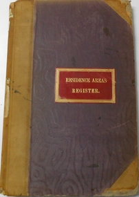
 Bendigo Historical Society Inc.
Document - RESIDENCE AREAS REGISTER: SANDHURST VOLUME 1, 1882 - 1883
Register: hard covered register, blue material with dark buff spine and corners. Contains A-Z index in front section linked with registration details of residence areas in the Sandhurst district, Sandhurst division. 'Residence Areas Register' on front cover, 'No. 1 'on spine. Register has lined pages 1 - 202 containing details of registrations. Dates from 1 April 1882 to 19 January 1883.place, residence areas, bendigo, sandhurst, land sales, land registrations -
 Bendigo Historical Society Inc.
Document - RESIDENCE AREAS REGISTER: SANDHURST VOLUME 6
Register: hard covered register, maroon material with dark buff spine and corners. Contains A-Z index in front section linked with registration details of residence areas in the Sandhurst district, Sandhurst division. Blue lined pages number 1 - 150 detailing land registrations. Dates from 1 December 1885 to August 1886.place, bendigo, sandhurst, land registrations, residence areas, land sales -
 Bendigo Historical Society Inc.
Document - RESIDENCE AREAS REGISTER: SANDHURST VOLUME 5, 1885
Register: hard covered register, maroon material with dark buff spine and corners. Contains A-Z index in front section linked with registration details of residence areas in the Sandhurst district, Sandhurst division. Written on front cover in gold 'Residence Areas Register' and 'No. 5' on spine. Dates from 23 March 1885 to 30 November 1885. Register has blue lined pages 1 - 202 with details of land registrations.bendigo, land register -
 Bendigo Historical Society Inc.
Document - RESIDENCE AREAS REGISTER: SANDHURST VOLUME 4, 1885
Register: hard covered register, maroon coloured material with dark buff spine and corners. Contains A-Z index in front section linked with registration details of residence areas in the Sandhurst district, Sandhurst division. Written on front cover in gold 'Residence Areas Register' on spine ' No. 4' Blue lined pages numbered 1 - 202 containing details of land registrations. Dates 4 October 1883 to 23 March 1885.place, residence areas, bendigo, sandhurst, land registrations, land sales -
 Bendigo Historical Society Inc.
Book - RESIDENCE AREAS REGISTER: SANDHURST VOLUME 9, 1888
Register: hard covered register, blue material with dark buff spine and corners. Contains A-Z index in front section linked with registration details of residence areas in the Sandhurst district, Sandhurst division. Written on front cover in gold ' Residence Areas Register' On spine '9' Dates from 12 April 1888 to 24 July 1888.place, residence areas, bendigo, sandhurst, land sales -
 Bendigo Historical Society Inc.
Document - RESIDENCE AREAS REGISTER: SANDHURST VOLUME 8, 1887 - 1888
Register: hard covered register, maroon material with dark buff spine and corners. Contains A-Z index in front section linked with registration details of residence areas in the Sandhurst district, Sandhurst division. Written on front cover in gold ' Residence Areas Register' on spine '8' Dates from 16 June 1887 to 12 April 1888.place, residence areas, bendigo, sandhurst, land sales -
 Bendigo Historical Society Inc.
Document - RESIDENCE AREAS REGISTER: SANDHURST VOLUME 7, 1886 - 1887
Register: hard covered register, maroon material with dark buff spine and corners. Contains A-Z index in front section linked with registration details of residence areas in the Sandhurst district, Sandhurst division. Written on front cover in gold ' Residence Areas Register' on spine 'No. 7' Blue lined paper pages 1 - 148. Dates from 30 August 1866 to 15 June 1887.place, bendigo, sandhurst, land sales, residence areas, residence register -
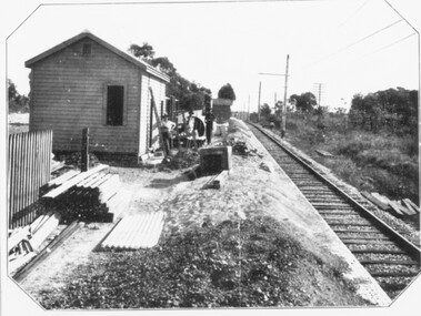 Ringwood and District Historical Society
Photograph, Constructing Ringwood East railway station - 1925
... . Photo taken from Ringwood East railway station. Sub-division.... Photo taken from Ringwood East railway station. Sub-division ...Black and white photographs - 2 copies, same sizeTyped below one photograph, "Constructing Ringwood East railway station - 1925". Backing sheet of other photograph reads, "Ringwood East railway station - Higher than Croydon or Ringwood. Photo taken from Ringwood East railway station. Sub-division plan land sale Ringwood East Railway Station Estate 1925?" -
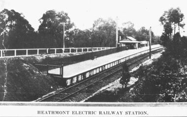 Ringwood and District Historical Society
Photograph, Heathmont Railway Station, 1926. Image taken from a land sale brochure advertising Charm-View Estate Sub-division opposite the station
Black and white photographs (2 copies - same size)Written under photograph - HEATHMONT ELECTRIC RAILWAY STATION. Written on back of photograph, "Photo taken from Sub. Div. Land Sale - Heathmont Electric Railway Station right opposite Estate. Charm-View Estate. Heathmont (For private Sale), 1926?" -
 Alfred Hospital Nurses League - Nursing Archive
Book - Illustrated book, Annabelle Brayley, Our Vietnam Nurses, 2016
When Australia joined the Vietnam War, civilian nurses were there to save lives and comfort the wounded. Working incredibly long hours and surrounded by chaos and turmoil, these brave nurses and medics were integral to our war effort. These fifteen stories show a side to the Vietnam War that has received little recognition but played an important part in shaping Australia's presence in the war.Illustrated book. Front cover has two coloured photographs: one is of a group of soldiers with three helicopters about to land (members of 5 platoon B Company 7RAR wait for US Army helicopters waiting to take them back to Nui Dat after completion of Operation Ulmarra) The other is of two women wearing green uniforms and peaked caps holding a baby and standing in front of a building with a corrugated roof (RAANC Margaret Ahern and Terrie Roche with children of Hoa Long village) Title (green and black ink) and author's name (light brown ink) are printed between these photos. This information is printed in similar colours on the spine, along with a small photograph of two women in uniform (RAANC Margaret Ahern and Terrie Roche) and the publisher's name. The back cover has a summary of the book printed below five photographs, nurse (Janice Hilton) with patient; nurse (June Minchow) with patient; man (Phil Badcock) and woman (RAANC Di Lawrence); unidentified nurse with four patients strapped to stretchers inside an RAAF Hercules aircraft; two nurses (Von Clinch and Maureen Spicer) with children (at Bien Hoa provincial hospital). non-fictionWhen Australia joined the Vietnam War, civilian nurses were there to save lives and comfort the wounded. Working incredibly long hours and surrounded by chaos and turmoil, these brave nurses and medics were integral to our war effort. These fifteen stories show a side to the Vietnam War that has received little recognition but played an important part in shaping Australia's presence in the war.royal australian army nursing corps, butterwowth air base, military nursing-australia\military nursing-vietnam, vietnam war 1961-1975-medical care, military hospitals-vietnam, military camps-malaysia, military camps-philippines-clark field