
Showing 291 items matching "indigenous people"
-
 Eltham District Historical Society Inc
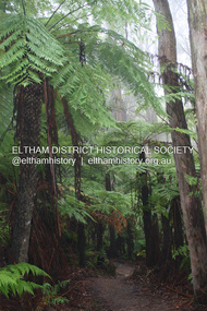
Photograph - Digital Photograph, Alan King, Kinglake National Park, 27 March 2008
... Thanks to the vision and hard work of a band of local people, the park was created from what was rapidly becoming degraded land. Seeing a threat to Kinglake’s indigenous flora and fauna, several prominent local people campaigned for a national park, which was established in 1928.1 Since then, the park has grown through donations and acquisitions of land, from around 13,800 acres of land (5585ha) to 22,360 hectares. ...Thanks to the vision and hard work of a band of local people, the park was created from what was rapidly becoming degraded land. Seeing a threat to Kinglake’s indigenous flora and fauna, several prominent local people campaigned for a national park, which was established in 1928.1 Since then, the park has grown through donations and acquisitions of land, from around 13,800 acres of land (5585ha) to 22,360 hectares. ...Fern gullies around Jehosaphat Gully Covered under National Estate. Published: Nillumbik Now and Then / Marguerite Marshall 2008; photographs Alan King with Marguerite Marshall.; p125 The magnificent Kinglake National Park, fringing Nillumbik’s north, is the largest national park close to Melbourne. Thanks to the vision and hard work of a band of local people, the park was created from what was rapidly becoming degraded land. Seeing a threat to Kinglake’s indigenous flora and fauna, several prominent local people campaigned for a national park, which was established in 1928.1 Since then, the park has grown through donations and acquisitions of land, from around 13,800 acres of land (5585ha) to 22,360 hectares. The Sugarloaf and Everard Blocks – of almost 8000 hectares – stand in Nillumbik and the park extends into Mitchell and Murrundindi Shires and the City of Whittlesea. Mt Everard commemorates William Hugh Everard, State member for Evelyn when the park was established. Before 1928, European settlers had degraded the Kinglake area, which was named after the celebrated English author and lawyer, Alexander William Kinglake. Remains of gold shafts and diggings in the park are reminders of Kinglake’s first settlers, who hoped to strike it rich at the gold diggings. But like other gold fields in this shire, they proved not very lucrative and soon timber cutting replaced mining in importance. However, before long, the accessible timber supply ran out, so in the 1920s agriculture took over – particularly potatoes and berry fruits – which involved large-scale clearing.2 The park’s instigator was retired Melbourne University Professor of Music, William Laver.3 As chair of the Kinglake Progress Association he began negotiations to have crown lands on the southern scarp of the Great Dividing Range reserved as a national park. Even before the park was proclaimed, from 1927, KPA members cut tracks to the major scenic points. Professor Laver was one of several people who gave land for the park, donating around 50 acres (20ha), including the Jehosaphat Gully.4 Laver chaired the park’s first Committee of Management, which raised money to employ a ranger and provide facilities, including tracks and roads for fire protection vehicles, toilets and shelters. The committee charged fees for firewood collection, some grazing of livestock, and visitor entrance, and obtained small State Government and Eltham Shire grants. In 1957 the State Government provided revenue for national parks. Then, in 1975, the State Government took over the management and the Committee of Management became an advisory committee, which disbanded in 1978. Originally, the park covered crown land in the Shires of Eltham and Whittlesea; then Wombelano Falls in Yea and other areas were added. In 1970 the park extended into the Shires of Eltham, Healesville, Whittlesea and Yea.5 Bush fires have been an ongoing problem. In 1939 hundreds of eucalypts and acacias had to be sown around the Jehosaphat Gully to rejuvenate the forest. To manage bushfires, the Committee of Management, then the State Government, worked closely with the Forestry Commission, shire councils and local fire brigades. Early national parks focussed on recreation. But by the 1980s, conservation, education and scientific research became more important, playing a vital role in preserving representative samples of the natural environment. Each year many thousands of people use the park’s extensive network of walking tracks amongst the protected plant and animal life as well as camping, cycling and horse riding. The park, along the slopes of the Great Dividing Range, has lookouts revealing magnificent views of the Melbourne skyline, Port Phillip Bay, the Yarra Valley and the You Yangs. Vegetation in the Masons Falls area includes messmate forest, Austral grass-trees, ferns and Hazel Pomaderris. In spring, orchids, lilies, everlasting daisies, correas, grevillea and heath appear. Around Jehosaphat Gully are wet and dry forest, fern gullies and banksia. Animal life includes wallabies, kangaroos, koalas, echidnas, possums, gliders and bandicoots. Male lyrebirds can be heard mimicking in the Jehosaphat Gully, particularly in the Everard Block in winter.This collection of almost 130 photos about places and people within the Shire of Nillumbik, an urban and rural municipality in Melbourne's north, contributes to an understanding of the history of the Shire. Published in 2008 immediately prior to the Black Saturday bushfires of February 7, 2009, it documents sites that were impacted, and in some cases destroyed by the fires. It includes photographs taken especially for the publication, creating a unique time capsule representing the Shire in the early 21st century. It remains the most recent comprehenesive publication devoted to the Shire's history connecting local residents to the past. nillumbik now and then (marshall-king) collection, kinglake national park, jehosaphat gully -
 Eltham District Historical Society Inc
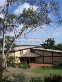
Photograph - Digital Photograph, Marguerite Marshall, Eltham Community and Reception Centre, 2 October 2006
... indigenous and other native species, some exotic plants are protected as an important link with the site’s past. Planted at the front around 1920, is a large Peppercorn tree with two joined trunks growing from the base, and close by is a Bhutan Cypress (Cupressus torulosa). Three other Peppercorn trees fringe the drive. The building includes two halls – the larger seating 250 people...indigenous and other native species, some exotic plants are protected as an important link with the site’s past. Planted at the front around 1920, is a large Peppercorn tree with two joined trunks growing from the base, and close by is a Bhutan Cypress (Cupressus torulosa). Three other Peppercorn trees fringe the drive. The building includes two halls – the larger seating 250 people ...The Eltham Community and Reception Centre was Australia's first public mud-brick building. Commissioned in 1977 by Eltham Shire Council, led by Shire president (and architect) Robert Marshall, architects Whitford and Peck were asked to design a multipurpose facility in mud-brick and timber. The official opening was performed by the Hon. R.J. Hamer; E.D., M.P., Premier of Victorai on Saturday, April 22, 1978. Architects: Whitford & Peck Pty Ltd Quantity Surveyor: D.J. Cant & Associates Structural Civil Engineers: Charlett & Moore Pty Ltd Landscape: Peter Glass, Dennis Edwards Mech Elec: Lobley Treidel & Partners Pty Ltd Acoustics: Riley Barden & Kirkhope Builder: L.U. Simon Pty Ltd Covered under Heritage Overlay, Nillumbik Planning Scheme. Published: Nillumbik Now and Then / Marguerite Marshall 2008; photographs Alan King with Marguerite Marshall.; p177 The Wiggles performed there, so has the ABC’s Play School. New citizens have made their vows, volunteers have been honoured, school children have performed, weddings celebrated and people mourned at funerals. Since 1978 the Eltham Community and Reception Centre at the corner of Pitt Street and Main Road, has provided a beautiful and quintessential Eltham environment for people from all over Melbourne. Recognised as Australia’s first public mud-brick building, the centre was built partly on the site of the parsonage of the former Methodist Church (now the Uniting Church).1 Commissioned by the Eltham Council headed by President Robert Marshall, architects Whitford and Peck were asked to design a multipurpose facility in mud-brick and timber. Following public consultation, it was agreed to build a centre for dances, exhibitions, films, plays or concerts. The results – at a cost of around $620,000 – captured the Eltham rustic style. The building – in soft tones of mud-brick and timber and immense floor-to-ceiling windows – overlooks the Diamond Creek and sporting fields. Eltham’s strong artistic heritage is reflected in the centre. Although the lighting is not ideal for a gallery and labels cannot be placed on walls, the centre hosts the Nillumbik Art Awards and displays around ten to 20% of the Nillumbik Shire Art Collection, usually for around a year at a time.2 On permanent display, close to the entrance, is local artist Clifton Pugh’s White Choughs in the Landscape. Further to the right is the Walter Withers Gallery, named after a local member of the Heidelberg School of artists. As part of the Eltham Gateway opposite the Eltham Hotel, the centre stands on what was once part of the Eltham Town Centre along this section of Main Road, then known as Maria Street. On the same site once stood the house and flour mill owned by Henry Dendy, best known as the founder of Brighton, although he lived longer in Eltham. Beside the drive is a wheel-rim tool with accompanying plaque, illustrating a technology important during the horse-powered age and now almost completely gone, as has the blacksmith’s shop that had housed it nearby. The implement is a platform for fitting iron tyres to the wooden rims of cartwheels. Beneath it is a capsule placed in 1985 to commemorate Victoria’s 150 years, which is to be opened in 2035. Although the plants, forming part of the landscaping by Peter Glass and Denis Edwards, are largely indigenous and other native species, some exotic plants are protected as an important link with the site’s past. Planted at the front around 1920, is a large Peppercorn tree with two joined trunks growing from the base, and close by is a Bhutan Cypress (Cupressus torulosa). Three other Peppercorn trees fringe the drive. The building includes two halls – the larger seating 250 people – and a large foyer overlooking trees and ovals. Both halls have retractable rear walls providing varying spaces as required, and guests can use several external decks. A site for outdoor theatre has been carved out of the natural slope outside the entrance. The Bricklayers Union refused to use the traditional mud-bricks, which weigh more than 22kg. As a result the mud-bricks were redesigned to reduce their weight and were laid back-to-back to produce a wall of normal thickness.3 The centre’s massive timber frame is reminiscent of timber bridge construction, with infill panels of mud-brick.4 In accord with the rustic style are colossal rough-sawn posts, bolts and steel brackets. The combination of mud-brick, exposed feature timber framing and creative design in this centre, characterises Eltham’s innovative buildings and the social movement behind them from the 1940s to the 1970s.This collection of almost 130 photos about places and people within the Shire of Nillumbik, an urban and rural municipality in Melbourne's north, contributes to an understanding of the history of the Shire. Published in 2008 immediately prior to the Black Saturday bushfires of February 7, 2009, it documents sites that were impacted, and in some cases destroyed by the fires. It includes photographs taken especially for the publication, creating a unique time capsule representing the Shire in the early 21st century. It remains the most recent comprehenesive publication devoted to the Shire's history connecting local residents to the past. nillumbik now and then (marshall-king) collection, eltham community and reception centre, mudbrick construction -
 Eltham District Historical Society Inc
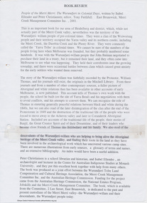
Booklet - Folder, Indigenous History, 2001
... Book review of People of the Merri Merri: the Wurundjeri in Colonial Days by Isabel Ellender and Peter Christiansen harry gilham collection indigenous history merri creek wurundjeri 1 pages Indigenous History Booklet Folder ...Book review of People of the Merri Merri: the Wurundjeri in Colonial Days by Isabel Ellender and Peter Christiansen 1 pagesharry gilham collection, indigenous history, merri creek, wurundjeri -
 Kiewa Valley Historical Society
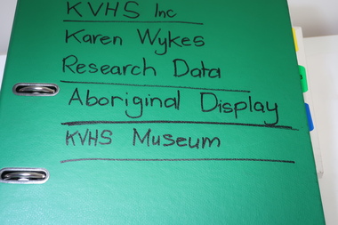
Folder - Aboriginal Research and Papers: Aboriginal Cultural Issues
... People of the Kiewa Valley and Bogong High Plains" interpretive display in the KVHS Inc. Museum Added to the front of this folder is 7 A4 pages stapled together and titled "Memory Joggers on Aboriginal Cultural Issues" by Russell Bellingham Source material for Indigenous display in the KVHS museum Indigenous Bogong moths Aboriginal Bellingham Dhudhuroa Yaithmathang Russell's name in ink at top of the first page Large green plastic arch-lever folder with two rings. ...This folder includes Information researched and collected by Karen Wykes to create the information panels used in the "First People of the Kiewa Valley and Bogong High Plains" interpretive display in the KVHS Inc. Museum Added to the front of this folder is 7 A4 pages stapled together and titled "Memory Joggers on Aboriginal Cultural Issues" by Russell BellinghamSource material for Indigenous display in the KVHS museumLarge green plastic arch-lever folder with two rings. On the front cover written in black texta - KVHS Inc / Karen Wykes / Research Data / Aboriginal Display / KVHS Museum Also: Stapled together 7 A4 pages titled "Memory Joggers on Aboriginal Cultural Issues" by Russell BellinghamRussell's name in ink at top of the first pageindigenous, bogong moths, aboriginal, bellingham, dhudhuroa, yaithmathang -
 Raymond Island Historical Society
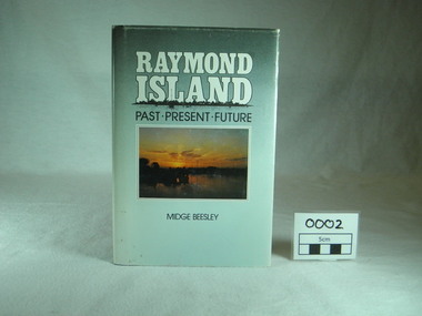
Book, Midge Beesley, Raymond Island:past present future, 1986
... Monograph publication 291 pages Hardback Loose cover Maps Sunset picture of lake from Raymond Island on front cover Photographs of people, buildings, Raymond Island ferries, boats. Contents: Raymond Island early settlers, indigenous history, Island identities, Raymond Island State School, a'Beckett Park, Raymond Island Ferry, The Presbyterian Church, raymond Island Advancement League ...Includes stories of Island identities, maps, photographs Local significance Out of print publication park gippsland lakes raymond island raymond island state school a beckett raymond island ferry early settlers raymond island advancement league Monograph publication 291 pages Hardback Loose cover Maps Sunset picture of lake from Raymond Island on front cover Photographs of people, buildings, Raymond Island ferries, boats. Contents: Raymond Island early settlers, indigenous history, Island identities, Raymond Island State School, a'Beckett Park, Raymond Island Ferry, The Presbyterian Church, raymond Island Advancement League Raymond Island:past present future Book Midge Beesley James Yeates Midge Beesley ...Local history of Raymond Island. Includes stories of Island identities, maps, photographsLocal significance Out of print publicationMonograph publication 291 pages Hardback Loose cover Maps Sunset picture of lake from Raymond Island on front cover Photographs of people, buildings, Raymond Island ferries, boats. Contents: Raymond Island early settlers, indigenous history, Island identities, Raymond Island State School, a'Beckett Park, Raymond Island Ferry, The Presbyterian Church, raymond Island Advancement League park, gippsland lakes, raymond island, raymond island state school, a beckett, raymond island ferry, early, settlers, raymond island advancement league -
 Eltham District Historical Society Inc
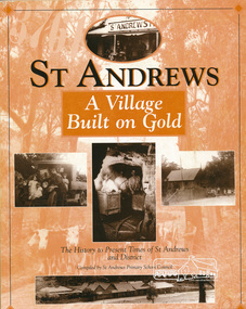
Book, St Andrews Primary School Council, St Andrews: A Village Built on Gold : the history to present day of St Andrews and District compiled by St Andrews Primary School Council, 1998
... People Mining- What a rush! The School The Church Queenstown Cemetery The Hotels The Police Paddocks The Families Queenstown in the early twentieth century The Queenstown Bush Fire Brigade The 1st Queenstown Scout troop Queenstown, the 1940s and 1950s The Characters Odds and Sods St Andrews - The Present Times The Future St Andres Primary School in 1998 This book is significant in that it documents the history of the St Andrews community from the indigenous presence through its foundation during the Victorian Gold Rush through to local bushfires and predictions of the future by local primary schools students in 1998. ...This history of the Victorian town of St. Andrews (formerly Queenstown) and its surroundings was written to celebrate the 140th anniversary of St Andrews Primary School. Describes the displacement of the Aboriginal inhabitants of the area, European settlement and the Gold Rushes and the Caledonia diggings. Discusses establishment of the school, church and cemetery and various other notable events. The school in 1998 and speculations on the future by primary school pupils. Contents: Introduction The First People Mining- What a rush! The School The Church Queenstown Cemetery The Hotels The Police Paddocks The Families Queenstown in the early twentieth century The Queenstown Bush Fire Brigade The 1st Queenstown Scout troop Queenstown, the 1940s and 1950s The Characters Odds and Sods St Andrews - The Present Times The Future St Andres Primary School in 1998This book is significant in that it documents the history of the St Andrews community from the indigenous presence through its foundation during the Victorian Gold Rush through to local bushfires and predictions of the future by local primary schools students in 1998. It remains the only significant secondary source publication written specifically on this rural community.158 p. : ill., ports ISBN 0646353756st andrews, queenstown -
 Eltham District Historical Society Inc
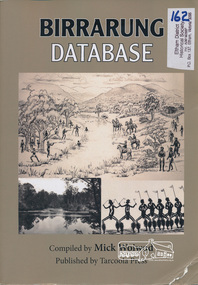
Book, Tarcoola Press, Birrarung Database compiled by Mick Woiwod, 2012
... people. Includes a compilation of those difficult to locate "brief snatches of the action" collated under headings with in each instance, the provenance as to source and / or author included. Themes include: agriculture, law, ceremony, language, reconciliation, retribution, lifestyle, art & craft, climate, personalities, disease, death and the river's flora and fauna. Sister publication to "Coranderrk database". wurundjeri yarra river indigenous ...A compilation of Woiwod's research material, with information on the history of the Wurundjeri people of the Yarra Valley, from the time of first European contact. Its prime focus is the Yarra River as it has been understood by its Wurundjeri people. Includes a compilation of those difficult to locate "brief snatches of the action" collated under headings with in each instance, the provenance as to source and / or author included. Themes include: agriculture, law, ceremony, language, reconciliation, retribution, lifestyle, art & craft, climate, personalities, disease, death and the river's flora and fauna. Sister publication to "Coranderrk database". 318 pages : illustrations, maps ; 30 cm + 1 CD-ROM (4 3/4 in.) PDF or Microsoft Office Word 97-2003.ISBN 9780987157423wurundjeri, yarra river, indigenous history, wurundjeri woi wurrung, aboriginal australians -
 Geoffrey Kaye Museum of Anaesthetic History
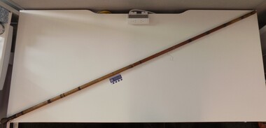
Weapon - Blow pipe, Mah Meri, c. 1936
... Used by the Mah Meri people, Kuala Langat, Selangor (Malaysia), 1936. While Malaysian, this blow-gun is analogous to that used by Indigenous groups from South America with curare. ...Used by the Mah Meri people, Kuala Langat, Selangor (Malaysia), 1936. While Malaysian, this blow-gun is analogous to that used by Indigenous groups from South America with curare. ...Used by the Mah Meri people, Kuala Langat, Selangor (Malaysia), 1936. While Malaysian, this blow-gun is analogous to that used by Indigenous groups from South America with curare. The gun is of bamboo, with a highly polished inner tube of the same. The darts are reeds, made directional by knobs of a tudor wood, with poison made from the ipoh tree and the Strychnos vine The blowpipe examined in this report consists of a long bamboo tube with engraved floral motifs on the outside and a second bamboo tube inside. The mouthpiece is attached to the inner tube and the whole piece can be removed from the outer casing. There is a quiver, filled with darts, a small poisons receptacle, and a single dart and hollow bamboo tube, stored outside the quiver. The objects were donated as a whole to the museum in 1948 by Dr Thomas Edward Marshall. The engravings on the outer case originate from the Mah Meri community in Kuala Langat, Selangor, Malaysia. The floral ‘motif is of a vine with small incisions to reflect the properties/identity of the plant (poisonous/harmful)’. These motifs are generally handed down through the generations and can be used for kinship identification. They are also believed to enhance the performance of the blowpipe. The outer casing is made up of several pieces of bamboo fused together. Broken or damaged blowpipes were not discarded. Broken sections of a pipe could be removed and replaced as required, and the observably different bamboo sections suggest this has taken place at some point. Sap from the perah tree is used to seal or glue the pieces together and the glue is reversible by heating. The Mah Meri created a poison from the ipoh tree for use in hunting. The poison acted swiftly to kill the animal and did not result in secondary poisoning. The way in which the Mah Meri hunted is analogous with other blowpipe hunting practices elsewhere in the world. Blowpipe hunting practices represent a starting point for the introduction of standardised muscle relaxants into surgery during the 20th Century. In parts of South America, plant poisons were used to tip the darts and kill prey. These poisons are known as curare. The crucial ingredient in curare was Chondrodendron tomentosum root. Raw curare formed the basis for Intocostrin, the first standardised, mass produced muscle relaxant. The introduction of muscle relaxants dramatically changed surgery, allowing for more precise surgery and better patient outcomes. Bamboo blowpipes can be found in many museum and heritage collections, particularly those with strong colonial origins or influence. Blowpipes from Borneo seem to be well represented, along with those from Guyana. Blowpipes from Malaysia appear to be less common. More research is required to establish the rarity or representativeness of the blowpipe. Ownership of the blowpipe can be traced back from the museum to Dr Thomas Marshall. It has also been established the blowpipe’s point of origin is among the Mah Meri people of Kuala Langat, near Kuala Lumpur. There is no information regarding the way in which Marshall came into possession of the blowpipe. Provenance cannot be fully established. Despite these difficulties, the blowpipe represents a full set of hunting implements. It is accompanied by a quiver, also decorated with a floral motif, a set of bamboo darts, and a poison receptacle. The quiver also has a waist strap which enabled the owner to strap it to themselves, preventing its loss while hunting. Each object within the set is in good condition, although the inner tubing is beginning to split lengthwise and should not be removed from its outer casing. While the blowpipe and accompanying objects are not of South American origin, the techniques and poisons used are analogous and this object has high interpretative capacity. Hollow bamboo blowpipe with mouthpiece at one end. Two different types of organic fibre have been used at difference points along the shaft to secure different segments of the blowpipe. The item consists of two tubes a thin and unpolished inner tube that has degraded and can no longer be removed, and a polished and decorated outer casing. The outer casing is made up of different sections of polished bamboo, some pieces have developed a deep red hue which is likely the result of prolonged polishing and regular heating over many years, other sections are a lighter yellow indicating that they are newer pieces of bamboo. The entire outer tube is covered in a varied sequence of genomic patterns. The exact meaning of these patterns is unknown however they are passed down through family lineage, the exact family of origin is unknown. Connected to the mouthpiece if it is removed from the inner casing is a piece of cloth with the numbers 2241 written in black ink, their purpose is unknown.curare, malaysia, bamboo -
 Monbulk RSL Sub Branch
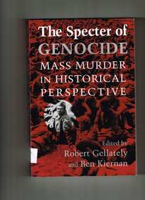
Book, Robert Gellately, The specter of genocide : mass murder in historical perspective, 2003
... Several authors explore colonialism and address the fate of the indigenous peoples in Africa, North America, and Australia. ...eading international experts offer an up-to-date, comprehensive history and analyses of multiple cases of genocide and genocidal acts, with a focus on the twentieth century and extensive coverage of the post-1945 period - including the atrocities in the former Yugoslavia, Bali, Cambodia, Ethiopia, Rwanda, East Timor, and Guatemala. "This collection of essays by leading international experts offers an up-to-date, comprehensive history and analysis of multiple cases of genocide and genocidal acts, with a focus on the twentieth century. The book contains studies of the Armenian genocide, the victims of Stalinist terror, the Holocaust, and imperial Japan. Several authors explore colonialism and address the fate of the indigenous peoples in Africa, North America, and Australia. As well, there is extensive coverage of the post-1945 period, including the atrocities in the former Yugoslavia, Bali, Cambodia, Ethiopia, Rwanda, East Timor, and Guatemala. The book emphasizes the importance of comparative analysis and theoretical discussion, and it raises new questions about the difficult challenges for modernity constituted by genocide and other mass crimes.Index, p.396.eading international experts offer an up-to-date, comprehensive history and analyses of multiple cases of genocide and genocidal acts, with a focus on the twentieth century and extensive coverage of the post-1945 period - including the atrocities in the former Yugoslavia, Bali, Cambodia, Ethiopia, Rwanda, East Timor, and Guatemala. "This collection of essays by leading international experts offers an up-to-date, comprehensive history and analysis of multiple cases of genocide and genocidal acts, with a focus on the twentieth century. The book contains studies of the Armenian genocide, the victims of Stalinist terror, the Holocaust, and imperial Japan. Several authors explore colonialism and address the fate of the indigenous peoples in Africa, North America, and Australia. As well, there is extensive coverage of the post-1945 period, including the atrocities in the former Yugoslavia, Bali, Cambodia, Ethiopia, Rwanda, East Timor, and Guatemala. The book emphasizes the importance of comparative analysis and theoretical discussion, and it raises new questions about the difficult challenges for modernity constituted by genocide and other mass crimes.crimes against humanity, genocide - history -
 Royal Australian and New Zealand College of Obstetricians & Gynaecologists (RANZCOG)
Flag - Aboriginal flag presented to Sister Alison Christine Bush on her induction as an Honorary Fellow of RANZCOG
... It was in this environment, a teaching hospital of the University of Sydney, which valued its association with the nearby urban Indigenous community of Redfern, and which received numerous complex referrals from rural New South Wales, that Alison became a valued advocate for Indigenous people. In all situations, she eloquently demonstrated the importance of cultural sensitivity and respect, bringing calm to sometimes chaotic situations. ...Alison’s professional career began at Marrickville Hospital, Sydney, in 1960, and following further studies in midwifery and infant welfare in New Zealand, she began her illustrious years at Royal Prince Alfred Hospital in 1969. It was in this environment, a teaching hospital of the University of Sydney, which valued its association with the nearby urban Indigenous community of Redfern, and which received numerous complex referrals from rural New South Wales, that Alison became a valued advocate for Indigenous people. In all situations, she eloquently demonstrated the importance of cultural sensitivity and respect, bringing calm to sometimes chaotic situations. Alison received many awards such as this one. (O&G Magazine) Following her appointment in 1993 as the Aboriginal liaison midwife, she also provided consultation and education across all hospital departments and to community agencies, ever in demand for her expertise both within the hospital and the broader community. Across these years, she undertook a substantial responsibility in teaching and skills transfer, and in serving on a range of advisory and planning committees for the State of New South Wales and the nation.This Aboriginal flag was presented by Sister Alison Christine Bush RN CM ECC to RANZCOG President Dr Michael O'Connor in Canberra 30 April 1998. At this ASM, Sister Alison Bush, an Aboriginal midwife, was presented an Honorary Fellowship of the RANZCOG. -
 Galen Catholic College
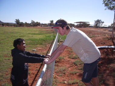
Santa Teresa Mission Visit, 2007
... Galen Catholic College Galen College Santa Teresa Nothern Territory Indigenous Peoples Indigenous Communities 2007 Mission Santa Teresa Mission Visit, 2007 Santa Teresa Mission Visit, 2007 ...Over a number of years, Galen Catholic College sent small groups of students to the Santa Teresa Mission near Alice Springs. These photos were taken during our visit to the Santa Teresa Mission in 2007. galen catholic college, galen college, santa teresa, nothern territory, indigenous peoples, indigenous communities, 2007, mission -
 National Vietnam Veterans Museum (NVVM)
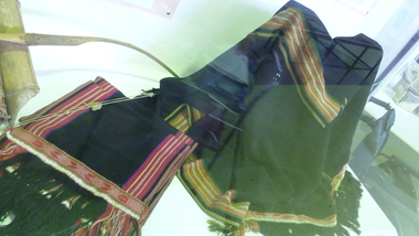
Clothing - Montagnard traditional costume
... Montagnard people were the indigenous non-Vietnamese ethnic minorities living in the Central Highlands of Vietnam. ...Montagnard people were the indigenous non-Vietnamese ethnic minorities living in the Central Highlands of Vietnam. ...Montagnard people were the indigenous non-Vietnamese ethnic minorities living in the Central Highlands of Vietnam. Australian Army Captain Barry Petersen was sent to Vietnam in 1963 as part of the elite Australian Army Training Team to train Montagnard rebels in how to deal with the guerrilla tactics used by Viet Cong insurgents. The laplap is an integral part of the traditional ceremonial costume of various Montagnard groups, particularly the Rhade tribe, with whom Petersen lived and worked, learning their language and wearing their traditional clothing.Top and shawl black. Embroidery and weaving in white, red and ocremontagnard, ceremonial costume, laplap, loincloth, petersen, barry petersen, rhade, rade -
Port Melbourne Historical & Preservation Society
Manual, Terri Janke et al, First Peoples: A Roadmap for Enhancing Indigenous Engagement in Museums and Galleries, 2018
... "First Peoples: A Roadmap for Enhancing Indigenous Engagement in Museums and Galleries" Guide prepared by Terri Janke on behalf of AMAGA (Australian Museums and galleries Association), to advise on how best to advance Indigenous engagement and employment in the museums and galleries sector....Celebrations Fetes and Exhibitions Indigenous Australians Museums Terri JANKE Sarah GRANT First Peoples Australian Museums and Galleries Association (AMAGA) "First Peoples: A Roadmap for Enhancing Indigenous Engagement in Museums and Galleries" Guide prepared by Terri Janke on behalf of AMAGA (Australian Museums and galleries Association), to advise on how best to advance Indigenous engagement and employment in the museums and galleries sector. ..."First Peoples: A Roadmap for Enhancing Indigenous Engagement in Museums and Galleries" Guide prepared by Terri Janke on behalf of AMAGA (Australian Museums and galleries Association), to advise on how best to advance Indigenous engagement and employment in the museums and galleries sector.celebrations fetes and exhibitions, indigenous australians, museums, terri janke, sarah grant, first peoples, australian museums and galleries association (amaga) -
Port Melbourne Historical & Preservation Society
Book, Meyer Eidelson, "Yalukit Willam - The River People of Port Phillip", Feb 2015
... Written as part of the City's reconciliation program and with the assistance of Carolyn Briggs over a two year program. parks and gardens natural environment meyer eidelson carolyn briggs derrimut yalukit willam clan boon wurrung kulin nation bunjil george robinson ben bow louisa briggs wilbraham frederick evelyn liardet wfe liardet josephine liardet emerald hill william buckley kurburu (the bear) Indigenous Australians Signed IFC by author, and Carolyn Briggs, Boon Wurrung Foundation, "yours with respect" "Yalukit Willam - The River People of Port Phillip" by Meyer Eidelson: illustrated soft cover, 99 pages plus fold out map at back cover is WFE Liardet watercolour of Emerald Hill corroboree and history of Koori activity pre and during European occupation "Yalukit Willam - The River People of Port Phillip" Book Meyer Eidelson Green Scribble City of Port Phillip ...Written as part of the City's reconciliation program and with the assistance of Carolyn Briggs over a two year program."Yalukit Willam - The River People of Port Phillip" by Meyer Eidelson: illustrated soft cover, 99 pages plus fold out map at back cover is WFE Liardet watercolour of Emerald Hill corroboree and history of Koori activity pre and during European occupationSigned IFC by author, and Carolyn Briggs, Boon Wurrung Foundation, "yours with respect"parks and gardens, natural environment, meyer eidelson, carolyn briggs, derrimut, yalukit willam clan, boon wurrung, kulin nation, bunjil, george robinson, ben bow, louisa briggs, wilbraham frederick evelyn liardet, wfe liardet, josephine liardet, emerald hill, william buckley, kurburu (the bear), indigenous australians -
Port Melbourne Historical & Preservation Society
Book, Margaret Bride et al, The Borough and Its People, 2013
... Built Environment Armed Services Maritime Melbourne and Metropolitan Board of Works Arts and Entertainment Piers and Wharves Transport Natural Environment Transport - Aviation and Aerodrome Advertising Built Environment - Commercial Celebrations Fetes and Exhibitions Religion Industry Engineering Education Families Garden City Sandridge Lagoon Politics Sport Margaret BRIDE nee POLSON Graham BRIDE Indigenous Australians The Borough and Its People. 1839 -1939 Port Melbourne Book with blue front cover and narrow band of 5 photos 3to 5 cms from top. ...The Borough and Its People. 1839 -1939 Port Melbourne Book with blue front cover and narrow band of 5 photos 3to 5 cms from top. Back cover similar in layout plus description of book's theme and contents . PMHPS logo and Port Phillip Council logo on back cover.built environment, armed services, maritime, melbourne and metropolitan board of works, arts and entertainment, piers and wharves, transport, natural environment, transport - aviation and aerodrome, advertising, built environment - commercial, celebrations fetes and exhibitions, religion, industry, engineering, education, families, garden city, sandridge lagoon, politics, sport, margaret bride nee polson, graham bride, indigenous australians -
Port Melbourne Historical & Preservation Society
Poster - Map showing ancesttral family estates of Melbourne's first people pre European Settlement, Marcus Lee Design, This once as it was - the ancestral family estates of Melbourne's first people, 2016
... Indigenous Australians Natural Environment Arweet DERRMUT Point Ormond St Kilda Yuro Yuroke Bunjil Burrarung River Queensbridge Falls This once as it was - the ancestral family estates of Melbourne's first people. ...This once as it was - the ancestral family estates of Melbourne's first people. Colour map with text. Pre European settlement. Based on Colonial survey maps of Port Phillip Bay region. 1837 and 1864indigenous australians, natural environment, arweet derrmut, point ormond, st kilda, yuro yuroke, bunjil, burrarung river, queensbridge falls -
Port Melbourne Historical & Preservation Society
Book, Gary Presland, "First People. The Eastern Kulin of Melbourne, Poprt Phillip and Central Victoria", 2010
... Indigenous Australians Natural Environment Kulin Nation Gary PRESLAND COPYRIGHT Gary Presland "First People. ...COPYRIGHT Gary Presland "First People. The Eastern Kulin of Melbourne, Port Phillip and Central Victoria" This book is, in effect, a second edition of "Aboriginal Melbourne - the Lost Land of the Kulin People" written by Gary Presland 25 years earlierindigenous australians, natural environment, kulin nation, gary presland -
Port Melbourne Historical & Preservation Society
Photograph - Rockery, newly planted garden area, Port Melbourne Uniting Church, Heather Wale, c. 2002
... Indigenous Australians Parks and Gardens Religion - Uniting Church Wurundjeri Bunnerwrung One of four photos taken early 2003 of newly planted garden area in front of Port Melbourne Uniting Church, where a 2001 plaque acknowledges the traditional custodians of the land (Wurundjeri and Bunnerwrung peoples): rockery Photograph Rockery, newly planted garden area, Port Melbourne Uniting Church Heather Wale ...One of four photos taken early 2003 of newly planted garden area in front of Port Melbourne Uniting Church, where a 2001 plaque acknowledges the traditional custodians of the land (Wurundjeri and Bunnerwrung peoples): rockeryindigenous australians, parks and gardens, religion - uniting church, wurundjeri, bunnerwrung -
Port Melbourne Historical & Preservation Society
Photograph - Rockery, newly planted garden area, Port Melbourne Uniting Church, Heather Wale, c. 2002
... Indigenous Australians Parks and Gardens Religion - Uniting Church Wurundjeri Bunnerwrung One of four photos taken early 2003 of newly planted garden area in front of Port Melbourne Uniting Church, where a 2001 plaque acknowledges the traditional custodians of the land (Wurundjeri and Bunnerwrung peoples): rockery, close-up Photograph Rockery, newly planted garden area, Port Melbourne Uniting Church Heather Wale ...One of four photos taken early 2003 of newly planted garden area in front of Port Melbourne Uniting Church, where a 2001 plaque acknowledges the traditional custodians of the land (Wurundjeri and Bunnerwrung peoples): rockery, close-upindigenous australians, parks and gardens, religion - uniting church, wurundjeri, bunnerwrung -
Port Melbourne Historical & Preservation Society
Photograph - Plaque, newly planted garden area, Port Melbourne Uniting Church, Heather Wale, c. 2002
... Indigenous Australians Parks and Gardens Religion - Uniting Church Wurundjeri Bunnerwrung One of four photos taken early 2003 of newly planted garden area in front of Port Melbourne Uniting Church, where a 2001 plaque acknowledges the traditional custodians of the land (Wurundjeri and Bunnerwrung peoples): plaque Photograph Plaque, newly planted garden area, Port Melbourne Uniting Church Heather Wale ...One of four photos taken early 2003 of newly planted garden area in front of Port Melbourne Uniting Church, where a 2001 plaque acknowledges the traditional custodians of the land (Wurundjeri and Bunnerwrung peoples): plaqueindigenous australians, parks and gardens, religion - uniting church, wurundjeri, bunnerwrung -
Port Melbourne Historical & Preservation Society
Photograph - Plaque, newly planted garden area, Port Melbourne Uniting Church, Heather Wale, c. 2002
... Indigenous Australians Parks and Gardens Religion - Uniting Church Wurundjeri Bunnerwrung One of four photos taken early 2003 of newly planted garden area in front of Port Melbourne Uniting Church, where a 2001 plaque acknowledges the traditional custodians of the land (Wurundjeri and Bunnerwrung peoples): plaque close-up Photograph Plaque, newly planted garden area, Port Melbourne Uniting Church Heather Wale ...One of four photos taken early 2003 of newly planted garden area in front of Port Melbourne Uniting Church, where a 2001 plaque acknowledges the traditional custodians of the land (Wurundjeri and Bunnerwrung peoples): plaque close-upindigenous australians, parks and gardens, religion - uniting church, wurundjeri, bunnerwrung -
Port Melbourne Historical & Preservation Society
Book, Ian McFarlane et al, "My Heart is Breaking", 1993
... Indigenous Australians Public Records Office Victoria Australian Archives "My Heart is Breaking" - A Joint Guide to Records about Aboriginal People" in the PROV and the Australian Archives. ..."My Heart is Breaking" - A Joint Guide to Records about Aboriginal People" in the PROV and the Australian Archives. A4, earth tones, with photo of Susan from the Gippsland tribe, with baby. 192 pagesindigenous australians, public records office victoria, australian archives -
 Eltham District Historical Society Inc
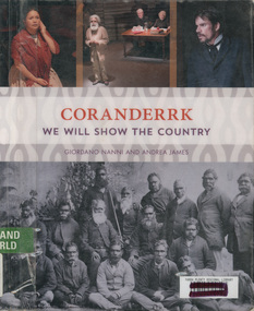
Book, Giordano Nanni et al, Coranderrk; We will show the country, 2013
... People...Healesville...indigenous...Retrieved from http://www.minutesofevidence.com.au/education/coranderrk-we-will-show-the-country-book/ Aboriginal Australians Coranderrk First Nations People Healesville indigenous history Performance Play Ex Yarra Plenty Regional Library copy Paperback 224 pages; 23 x 18.8 x 1.6cm Coranderrk; We will show the country Book Book Giordano Nanni Andrea James Aboriginal Studies Press ...Comprises twenty-three extracts from the Minutes of Evidence of the Coranderrk Inquiry, accompanied by an analysis of the historical text and context. The book relies strongly on primary-source materials and accurately references historical analysis from scholarly and Aboriginal perspectives. This book is derived from a verbatim-theatre performance in which professional actors portrayed the witnesses who gave evidence before the 1881 Coranderrk Inquiry.; Inscriptions and Markings: illustrations, photographs, facsimiles, maps, portraits About the book One of the first sustained campaigns for justice, land rights and self-determination in colonial Australia was undertaken by the Aboriginal people of Coranderrk reserve in central Victoria. Despite having created an award-winning farm they were targeted for removal to make way for white settlement. As skilled communicators and negotiators, they lobbied the government, in alliance with their white supporters, and succeeded in triggering a Parliamentary Inquiry in 1881. Coranderrk – We Will Show The Country derives from a unique verbatim-theatre performance where professional actors brought to life the witnesses who gave evidence before the 1881 Parliamentary Coranderrk Inquiry. Rescued from dusty archives, and including renowned Wurundjeri leader, William Barak, those witnesses continue to speak to contemporary audiences. Here, their powerful petitioning can be read alongside that of their non-Aboriginal allies, and those who would move them off their land. The book features a concise and accessible history of the Coranderrk Aboriginal Station and of the events that led to the appointment of the 1881 Parliamentary Coranderrk Inquiry. The book also contains a special edition of the verbatim script which has been annotated and referenced so as to provide a blueprint of how the original minutes of evidence from the 1881 Parliamentary Coranderrk Inquiry were adapted into a theatre script. Each scene of the play has also been introduced with a short biography of each character and a discussion of the key themes raised in their testimony. Supplementing the verbatim script of the performance, the book includes a range of historical images and stills from the ILBIJERRI Theatre Company’s production. Coranderrk – We Will Show The Country celebrates the spirit of collaboration between black and white in pursuit of justice, and offers an engaging way to learn about our past – and to think about our future. Coranderrk - We Will Show The Country. (2023, October 19). Retrieved from http://www.minutesofevidence.com.au/education/coranderrk-we-will-show-the-country-book/Ex Yarra Plenty Regional Library copyaboriginal australians, coranderrk, first nations people, healesville, indigenous history, performance, play -
 Eltham District Historical Society Inc
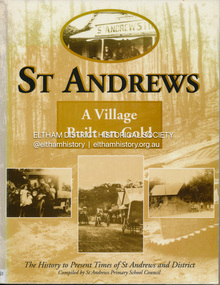
Book, St Andrews Primary School Council, St Andrews: A Village Built on Gold : the history to present day of St Andrews and District compiled by St Andrews Primary School Council, 2008
... People Mining- What a rush! The School The Church Queenstown Cemetery The Hotels The Police Paddocks The Families Queenstown in the early twentieth century The Queenstown Bush Fire Brigade The 1st Queenstown Scout troop Queenstown, the 1940s and 1950s The Characters Odds and Sods St Andrews - The Present Times The Future St Andres Primary School in 1998 This book is significant in that it documents the history of the St Andrews community from the indigenous presence through its foundation during the Victorian Gold Rush through to local bushfires and predictions of the future by local primary schools students in 1998. ...This history of the Victorian town of St. Andrews (formerly Queenstown) and its surroundings was written to celebrate the 140th anniversary of St Andrews Primary School. Describes the displacement of the Aboriginal inhabitants of the area, European settlement and the Gold Rushes and the Caledonia diggings. Discusses establishment of the school, church and cemetery and various other notable events. The school in 1998 and speculations on the future by primary school pupils. Contents: Introduction The First People Mining- What a rush! The School The Church Queenstown Cemetery The Hotels The Police Paddocks The Families Queenstown in the early twentieth century The Queenstown Bush Fire Brigade The 1st Queenstown Scout troop Queenstown, the 1940s and 1950s The Characters Odds and Sods St Andrews - The Present Times The Future St Andres Primary School in 1998This book is significant in that it documents the history of the St Andrews community from the indigenous presence through its foundation during the Victorian Gold Rush through to local bushfires and predictions of the future by local primary schools students in 1998. It remains the only significant secondary source publication written specifically on this rural community.Reprint edition with index 158 p. : ill., ports ; indexEx Eltham College copy Bendigo bank donation label inside cover Title page with stampings for D.D. Davey Senior Library Rear page date due slip st andrews, queenstown -
Eltham District Historical Society Inc
Document - Folder, Pederson, Pamela
... people", Diamond Valley Leader, 23 November 2005. Pamela Pedersen to carry Commonwealth Games torch baton.. Newspaper article: "Family of champions", Diamond Valley News, 15 August 2007. Pamela Pedersen's life and family. Newspaper article: "Giant steps", Diamond Valley News, 15 August 2007. Cover picture and summary for article within newspaper. Pamela Pedersen Pastor Sir Doug Nicholls Heidelberg Women's Athletics Club Adam Petersen Victorian Aboriginal Community Controlled Health Organisation Kim Petersen Indigenous ...Pamela Pedersen, daughter of Pastor Sir Doug Nicholls, became an athlete, and lives in Eltham Contents Newspaper article: "An inner flame for her people", Diamond Valley Leader, 23 November 2005. Pamela Pedersen to carry Commonwealth Games torch baton.. Newspaper article: "Family of champions", Diamond Valley News, 15 August 2007. Pamela Pedersen's life and family. Newspaper article: "Giant steps", Diamond Valley News, 15 August 2007. Cover picture and summary for article within newspaper.Newspaper clippings, A4 photocopies, etcpamela pedersen, pastor sir doug nicholls, heidelberg women's athletics club, adam petersen, victorian aboriginal community controlled health organisation, kim petersen, indigenous sportsperson of the year 2005, yorta yorta elder, children's koori court -
 Eltham District Historical Society Inc
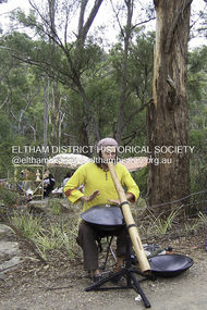
Photograph - Digital Photograph, Marguerite Marshall, Jesse Tree playing the Didgeridoo and Swiss Hang Drum at St Andrews Market, 29 March 2008
... indigenous species. The old Yellow Box trees fully recovered and are expected to give shade for many years to come. This collection of almost 130 photos about places and people within the Shire of Nillumbik, an urban and rural municipality in Melbourne's north, contributes to an understanding of the history of the Shire. ...Published: Nillumbik Now and Then / Marguerite Marshall 2008; photographs Alan King with Marguerite Marshall.; p175 It’s Saturday morning and thousands of people are visiting St Andrews Market at the corner of Heidelberg-Kinglake Road and Proctor Street. It’s hard to find a park. Cars are banked up along the narrow road and crammed in a nearby parking area. Yet, at the market, people look relaxed and happy amongst the yellow box gums on the site where the Wurundjeri people used to gather. Stone artefacts unearthed there by Koorie researcher, Isabel Ellender, indicate the site was once a Wurundjeri meeting place, according to Aboriginal Affairs Victoria. Acoustic sounds mingle with quiet conversations. A guitarist blows a mouth organ while his bare toes tickle chimes. A tiny busker, perhaps five years old, plays a violin while sounds of a harp emerge from the hall. One stallholder, selling delicious-looking pastries, chats to another in Spanish, then to me in broad Australian. ‘I was born in Fitzroy but my mother came from Mexico and my dad from Serbia,’ she smiles. A New Zealander fell in love with Mongolia and now imports their hand-made embroidered clothes and Yurts (tents) and runs adventure tours. A young woman visited Morocco and when friends admired the shoes she bought, she decided to import them and sell them at the market. Oxfam sells Fair Trade toys and clothes and displays a petition to Make Poverty History. Other stalls sell Himalayan salt, jewellery made from seeds from northern Australia, glass paper-weights from China as well as locally grown vegetables, flowers and organic freshly baked bread. A woman sits in a state of bliss under the hands of a masseur. Another offers Reiki or spiritual healing. A juggler tosses devil sticks – ‘not really about the devil,’ he smiles. This skill was practised thousands of years ago in Egypt and South America he says. At the Chai Tent people lounge on cushions in leisurely conversation. The idea for the market was first mooted among friends over a meal at the home of famous jazz and gospel singer Judy Jacques.2 Jacques remembers a discussion with several local artists including Marlene Pugh, Eric Beach, Les Kossatz, Ray Newell and Peter Wallace. ‘We decided we wanted a meeting place, where all the different factions of locals could meet on common ground, sell their goodies and get to know one another,’ Jacques recalls. They chose the site opposite another meeting place, St Andrews Pub. A week later Jacques rode her horse around the district and encouraged her neighbours to come along to the site to buy or sell. On February 23, 1973, about 20 stallholders arrived with tables. They traded ‘second-hand clothes, vegetables, meat, cheese, eggs, chickens, goats, scones, tea, garden pots and peacock feathers’. Now around 2000 people visit each Saturday. People usually linger until dusk. The market – with around 150 stalls of wares from a wide variety of cultures – stands alongside Montsalvat as the most popular tourist attraction in Nillumbik. By the 1990s St Andrews Market was in danger of being loved to death, as the site was becoming seriously degraded. The market was spreading in all directions and the degradation with it. A local council arborist’s report in 1994 noted exposed tree roots from erosion and compaction. The Department of Sustainability and Environment threatened to close the market if the degradation was not rectified. After many months of research, discussions and lobbying by a few residents, the council formed a Committee of Management, with an Advisory Committee, and introduced an Environment Levy. The State Government, the council and the market, funded terracing of the site to stop erosion, and retain moisture and nutrients. Vehicles were excluded from some sensitive areas and other crucial zones reserved for re-vegetation. Volunteers planted more than 3000 locally grown indigenous species. The old Yellow Box trees fully recovered and are expected to give shade for many years to come.This collection of almost 130 photos about places and people within the Shire of Nillumbik, an urban and rural municipality in Melbourne's north, contributes to an understanding of the history of the Shire. Published in 2008 immediately prior to the Black Saturday bushfires of February 7, 2009, it documents sites that were impacted, and in some cases destroyed by the fires. It includes photographs taken especially for the publication, creating a unique time capsule representing the Shire in the early 21st century. It remains the most recent comprehenesive publication devoted to the Shire's history connecting local residents to the past. nillumbik now and then (marshall-king) collection, didgeridoo, jesse tree, st andrews market, swiss hang drum -
 Eltham District Historical Society Inc
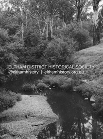
Photograph - Digital Photograph, Alan King, Diamond Creek, Barak Bushlands, Eltham, 2008
... indigenous plants and animals. Working together has also strengthened the local community, This collection of almost 130 photos about places and people within the Shire of Nillumbik, an urban and rural municipality in Melbourne's north, contributes to an understanding of the history of the Shire. ...A habitat corridor and it strengthens the community. Published: Nillumbik Now and Then / Marguerite Marshall 2008; photographs Alan King with Marguerite Marshall.; p185 Barak Bushlands lie west of the Diamond Creek on the corner of Falkiner Street and busy, noisy Main Road. They form part of an important habitat corridor linking the Yarra River to the Kinglake National Park.1 Manna Gums, tawny frogmouths and platypuses are some of the indigenous plants and animals that have made their home there. The bushlands are the result of more than nine years of hard work by the local community with the Nillumbik Council, to transform a degraded flood plain into this refuge of natural beauty. In 1997, shortly after moving into the new Riverside Estate on Falkiner Street, Eltham, several residents noticed the sorry state of the Diamond Creek and surrounding area. Part of it was used as a cow paddock and although small patches of vegetation survived, the area was infested with weeds, rabbits, rubbish and drainage from the housing estate. At various times the 4.4 hectares had been used as a market garden and for shire stock piles. The residents began to restore the area by revegetating land along the Diamond Creek. In 1998 they established the Friends of the Diamond Creek Falkiner Street Reserve2 and 35 families joined from the 90-house Estate. Carolyn Mellor, as the Friends’ Land Manager, undertook a four-year horticulture course to guide this massive project for a volunteer organisation. Since 1999, she has been the Friends’ President. In 1999 the Friends urged the Nillumbik Council to undertake a feasibility study into establishing a wetland system and urban forest. Work began in 2002 with Nillumbik Council funding the project, supplemented by government grants. The Friends also received grants from Melbourne Water and Parks Victoria. Aided by the Friends and other community members, the Council created the Barak Bushlands consisting of a forest, a wetland, a bridge, a path and open space. The beautiful wetland treats most of the estate’s stormwater runoff. Storm water is filtered through plants in the wetland ponds then is released slowly into the billabong, before flowing into the Diamond Creek. The wetland also helps to minimise flooding and the improved water quality provides a flora and fauna habitat. The Friends and other volunteers planted more than 27,000 plants, more than one third of which they grew from seeds they collected at Lower Eltham and Wingrove Parks. Eltham High School students planted thousands of these through a Year Eight program introduced for this purpose. Other groups who assisted were: Green Corps, local Scouts and Guides – 2nd Montmorency, 1st Diamond Creek and 1st Eltham Cub Packs, Eltham College students, Eltham East Primary School, Landcare members, Eltham Lions Club and the Eltham Baptist Church. To maintain enthusiasm for the mammoth task, the Friends and other volunteers ‘adopted’ trees to water and wrote their names on the stakes. In 2004, to recognise the area’s original occupiers, the reserve was named Barak Bushlands. William Barak, who lived from 1824 to 1903, was the last chief of the Yarra Yarra tribe of the Wurundjeri-willam people. Traces of these original inhabitants remain in scar trees (bark sections removed to make a shield or canoe). That same year the Friends’ group was a finalist in the prestigious Federal Government, Banksia Environmental Awards. The Friends have also participated in Clean Up Australia, removing tonnes of rubbish and regularly testing the billabong, wetland and creek, for pollutants. For years the Friends, together with the Australian Platypus Conservancy, have tagged, measured and checked the health of platypuses from the Diamond and Mullum Mullum Creeks. With Latrobe University the Friends have conducted night walks to view owls, possums, bats and sugar gliders. Challenges for the council and the Friends continue with a large rabbit population, some vandalism, weed eradication and maintenance. However, thanks to this community effort, locals can now escape confined urban living on small blocks of land and enjoy the beauty of indigenous plants and animals. Working together has also strengthened the local community,This collection of almost 130 photos about places and people within the Shire of Nillumbik, an urban and rural municipality in Melbourne's north, contributes to an understanding of the history of the Shire. Published in 2008 immediately prior to the Black Saturday bushfires of February 7, 2009, it documents sites that were impacted, and in some cases destroyed by the fires. It includes photographs taken especially for the publication, creating a unique time capsule representing the Shire in the early 21st century. It remains the most recent comprehenesive publication devoted to the Shire's history connecting local residents to the past. nillumbik now and then (marshall-king) collection, barak bushlands, diamond creek (creek), eltham -
 National Wool Museum
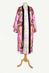
Textile - Cloak, Dr Deanne Gilson, Gum Blossom and Bottle Brush in Dilly Bag Cloak (Women Basket Making and Sharing Knowledge), 2022
... Representing our women past, present and future, her Spirit, our culture, our Country (spelt with a capital for its importance and this is part of First Peoples protocols on acknowledging Country, our strength, our resilience and healing towards a sustainable future). The colours of this cloak refer to natural pink ochre and indigenous flowering plants on Wadawurrung Dja. ...Representing our women past, present and future, her Spirit, our culture, our Country (spelt with a capital for its importance and this is part of First Peoples protocols on acknowledging Country, our strength, our resilience and healing towards a sustainable future). The colours of this cloak refer to natural pink ochre and indigenous flowering plants on Wadawurrung Dja. ...Standing proud, still here, the spirit of ten ancestral matriarchs adorned in contemporary ceremonial cloaks. Representing our women past, present and future, her Spirit, our culture, our Country (spelt with a capital for its importance and this is part of First Peoples protocols on acknowledging Country, our strength, our resilience and healing towards a sustainable future). The colours of this cloak refer to natural pink ochre and indigenous flowering plants on Wadawurrung Dja. The pink ochre is sourced by Deanne Gilson at Black Hill in Ballarat, Victoria. Men also made woven dilly bags to hold their possessions in. The basket making was an ongoing aspect of daily life for Wadawurrung people and often done in cooler months when the weather was too bad to go outside. Many women and family groups had their own style and techniques that were traded amongst other groups. Wadawurrung women had a particular stitch they used and incorporated elaborate symbols into the basket designs. Tammy Gilson’s weaving represents this stitch. This cloak pays homage to them and the changing seasons as they created, particularly the cooler months leading into the warmer season when several gum blossom flower. This cloak was worn once by artist Deanne Gilson at a formal opening at the Art Gallery of Ballarat in 2022. A Welcome to Country ceremony was performed while wearing it.Pink native flower in baskets motif on a pink background on outer cloak, pink and white diamond and circle design in lining. Solid black trimming. Cloak is machine sewn and handstitched with hand stitching on shoulder seam.deanne gilson, wadawurrung dja, first nations art -
 National Wool Museum
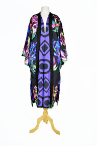
Textile - Cloak, Dr Deanne Gilson, Nan’s Purple Orchid Cloak (Indigenous orchid season), 2022
... Peoples protocols on acknowledging Country, our strength, our resilience and healing towards a sustainable future). Deanne states that this is her favourite season and she loves painting the small orchids as they flower after the cold season begins to clear. Deanne Gilson Wadawurrung Dja First Nations Art Cloak murnong Black cloak with pink and purple toned flower motif on outer cloak, purple and black diamond, and circle design in lining. Solid black trimming. Cloak is machine sewn and handstitched with hand stitching on shoulder seam. Nan’s Purple Orchid Cloak (Indigenous ...Standing proud, still here, the spirit of ten ancestral matriarchs adorned in contemporary ceremonial cloaks. Representing our women past, present and future, her Spirit, our culture, our Country (spelt with a capital for its importance and this is part of First Peoples protocols on acknowledging Country, our strength, our resilience and healing towards a sustainable future). Deanne states that this is her favourite season and she loves painting the small orchids as they flower after the cold season begins to clear.Black cloak with pink and purple toned flower motif on outer cloak, purple and black diamond, and circle design in lining. Solid black trimming. Cloak is machine sewn and handstitched with hand stitching on shoulder seam.deanne gilson, wadawurrung dja, first nations art, cloak, murnong -
 Stawell Historical Society Inc
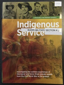
Book - Educational, Indigenous Service, 2013
... Australian Government Department of Veterans Affairs, Shrine of Remembrance Melbourne Photos of Service people overlaid with Aboriginal flag Colours Indigenous Service Book Educational ...A Resource for Primary Schools, investigating the wartie experiences of Aboriginal and Torres Strait Islander People, from the First World War to the present.Photos of Service people overlaid with Aboriginal flag ColoursAustralian Government Department of Veterans Affairs, Shrine of Remembrance Melbourne
