Showing 10912 items
matching lander
-
 Bendigo Historical Society Inc.
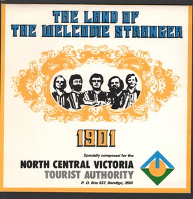
Ephemera - Edith Perry Collection: 45 record and sleeve "The Land of the Welcome Stranger" by (group) 1901, specially composed for the North Central Victoria Tourist Authority, 1966
The Land of the Welcome Stranger music CD 45 record and sleeve "The Land of the Welcome Stranger" by a fiver piece male band "1901", specially composed for the North Central Victoria Tourist Authority date of production not stated. -
 Orbost & District Historical Society
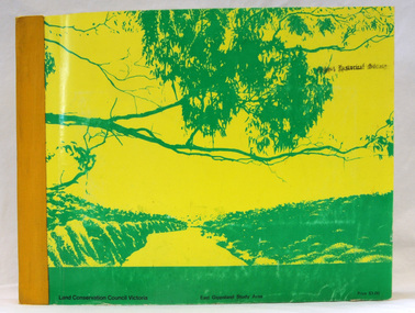
book, Report on the East Gippsland Study Area, June 1974
In 1961 Bruce Evans was elected to the Victorian Legislative Assembly as the member for Gippsland East. He was the party's deputy leader from 1964 to 1970 and its whip from 1970 until his retirement in 1992. "The Land Conservation Council was established by the Land Conservation Act 1970. As one of its three functions, it makes recommendations to the Minister for Planning and Environment with respect to the use of public land, in order to provide for the balanced use of land in Victoria. This report contains the Council’s final recommendations concerning the use of public land in the East Gippsland study area, the boundaries of which correspond to those of the Shire of Orbost. The recommendations in the text are grouped under major headings, such as Parks, State Forest, and so on. " The Council met on seven occasions during the year, and also made visits of inspection to each study area. The Chairman visited Shire Councils in study areas to explain the role and the functions of the Land Conservation Council and to invite submissions on the use of public land in these areas. This is the fourth annual report by the council. This is a useful research tool.A large book 236 pp book with a yellow / gold cover with a green bush scene . The binding is orange. It contains folded maps and information on public land use in East Gippsland.inside - "With Compliments - Bruce Evans, M.P."east-gippsland-study-area conservation public-land-use -
 Wangaratta RSL Sub Branch
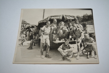
Photograph
Image mostly likely taken in the Middle East depicting group of eight soldiers eating and drinking at rear of stationary land rover. Soldiers' surnames are listed on rear with exception of one, entitled "self" and possibly Albert Robert WILLS VX5275, who sent image to parent/s. Soldiers possibly served with the 2/5 Infantry Battation which was raised in Victoria in 1939 and were deployed to North Africa and New Guinea.Black and white photograph of soldiers eating and drink at rear of stationary land rover.Handwritten on back - Taken whilst on the tour. Here we were 5-6000ft above sea level. Sgts Johnston, Ridge, ? Ptes ?Evans, Miller, Self, Murnane, ?Clem, Humphries Love Son xxxww2, 2/5 aust. infantry battalion, north africa, albert robert wills, sgt johnston, sgt ridge, private evans, private miller, private murnane, private clem, private humphries -
 Whitehorse Historical Society Inc.
Article, Whitehorse vision for Healesville, 2014
City of Whitehorse Vision for Healesville Freeway Reservation.City of Whitehorse Vision for Healesville Freeway Reservation to include open space, sustained natural environment and some residential development covering 19% of the land.City of Whitehorse Vision for Healesville Freeway Reservation.healesville freeway reservation, city of whitehorse -
 Whitehorse Historical Society Inc.
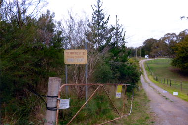
Photograph, Nethercote property, 2012
The land photographed is widely known as Nethercotes. In 1920 Arthur Nethercote, import agent, bought the land which was situated in Boronia Road near Dandenong Creek. Originally a flower farm, the Nethercotes became poultry farmers. The property contained a five-roomed weatherboard house which they called Weston Favell. Dated before 1883 (from newspapers found in the ceiling) it is the more dilapidated house photographed. The other house called Greenways was built for a son. Gerald Letts bought the property and when he died the Board of Works purchased the land, intending to use it as part of the proposed Healesville Freeway, meanwhile the property was leased to the Box Hill Institute's equine department. In 2013 the Board of Works announced that the freeway would not go ahead.Coloured photographs of the two houses and land at the Nethercote property, Vermont. Now owned by the board of Works and leased to the Box Hill Institute.nethercote property, vermont, board of works, proposed healesville freeway, box hill institute -
 Bacchus Marsh & District Historical Society
Map, Subdivision of the Manor House Property Bacchus Marsh c.1908
This land sales plan shows allotments of land offered for sale in the inner township area of Bacchus Marsh in 1908. The land put up for sale was from the estate of the late Mr and Mrs J.E. Crook. That being James Elijah Crook and his wife Harriet, (nee Athorn). The Crooks had been resident in Bacchus Marsh since the 1840s and were prominent members of the community. They were prominent in the business, social and civic affairs of the town and district. In the 1850s the Crooks acquired the Manor House and nearby land once owned by the Bacchus family. James Crook died in 1889. When Harriet Crook died in February 1908 their estate was offered for sale. This included the large stone home known as the Manor House and various parcels of land including around 50 allotments of land near the Manor House, bounded by Young, Lerderderg, Crook and Main Streets. Most of these allotments of land were sold in October 1908. The Manor House itself was passed in at the sale and continued to be owned by the Crook family for several decades after 1908.A single page map on a single page of a bound volume of maps. The map shows portions of land for sale from the subdivision of the Manor House property in Bacchus Marsh in 1908. The names of most of the buyers of the portions of land have been hand-written into the various allotments they purchased. The maps are pasted into a bound volume containing 76 maps or plans in total. High resolution digital image stored on BMDHS computer network. bacchus marsh victoria maps, land sales bacchus marsh, manor house bacchus marsh, crook family bacchus marsh -
 City of Moorabbin Historical Society (Operating the Box Cottage Museum)
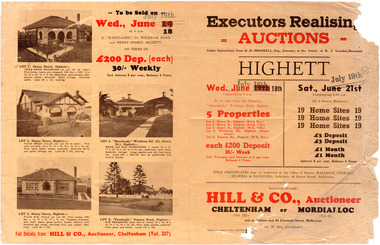
Flyer - Executors Realising Auction for land in Highett, 1941
The Great Depression of Australia halted the sale of land in most circumstances - this sale was just after the end of the depression years of 1930 to 1939.Example of the progress of the Municipality of MoorabbinAdvertising flyer for auction of real estate sales - plan of building blocks for saleSale of land in Highett - Hill & Co (A. W. Hill, Auctioneer) - brochure has pictures of the houses on the properties being offered for saleviola crescent, wickham road, henry street, real estate, highett, moorabbin, auctions, benjamin lowden -
 Greensborough Historical Society
Document - Planning Document, Diamond Valley Civic Centre and Neighbourhood Unit: Planning Proposal, 1960s
This document proposes the change of land use from farming and quarrying to residential. This also includes the proposal for a Civic Centre in the (then) Shire of Diamond Valley. The plans listed in the 'Schedule of Plans' on last page are missing.Includes proposal for the Aqueduct to be converted to an underground system. Includes statistics relating to population increase. Dark brown plastic folder. 23 foolscap-size pages. Maps, Application for Permits to subdivide land in the Greensborough area.partington family, mitchell family, whittingham family, albion reid, diamond valley civic centre, shire of diamond valley -
 Surrey Hills Historical Society Collection
Book, Discovery Prahran - Area Two, 1999
This booklet provides a general picture of Prahran as it developed from the first Crown land sales of 1840 to its amalgamation with the City of Malvern in 1994This booklet provides a general picture of Prahran as it developed from the first Crown land sales of 1840 to its amalgamation with the City of Malvern in 1994prahran (vic) - history, toorak (vic) - history, armadale (vic) - history, (ms) betty malone -
Whitehorse Historical Society Inc.
Document, Extracts from Nunawading Council minutes, 1949
Extracts from Nunawading Council minutesExtracts from Nunawading Council minutes: (1) June 1949 Ambulance station requested (2) 24 June War service homes will be erected on land acquired by the Commonwealth Government, bordered by Duckman Street, Amery Avenue, Hirst Street & Middleborough Road (3) 1 July Proposal to build Infant Welfare Centre at Nunawading on land at rear of Municipal Chambers.Extracts from Nunawading Council minutescity of nunawading, war service homes, duckham street, blackburn, amery avenue, blackburn, hirst street, blackburn, middleborough road, blackburn, infant welfare centres, mitcham scout group, mitcham guide group, charlotte street, blackburn south, ayr street, blackburn south -
Whitehorse Historical Society Inc.
Document, James Cowley Morgan Fisher, n.d
Document re James Cowley Morgan Fisher, Thomas Bowen and Charles Carter .Document re James Cowley Morgan Fisher, Thomas Bowen and Charles Carter and land at Dorset & Canterbury Road and LL Road (Boronia Road) and Canterbury Road.Document re James Cowley Morgan Fisher, Thomas Bowen and Charles Carter .fisher, james cowley morgan, bowen, thomas, carter, charles, l l vale road vermont, boronia road, vermont, vermont, dorset road, bayswater, canterbury road, vermont, bayswater -
Whitehorse Historical Society Inc.
Article, Unfolding a Family Vision, 2001
Photocopy of newspaper article with photos of the Matheson FamilyPhotocopy of newspaper article with photos of the Matheson Family who donated land originally for the Strathdon Community Aged Care Complex, Forest Hill, by Sandro Olivio.Photocopy of newspaper article with photos of the Matheson Family matheson family, strathdon community, aged people, miller, marny, matheson, mac, matheson, john, matheson, mary -
 Bacchus Marsh & District Historical Society
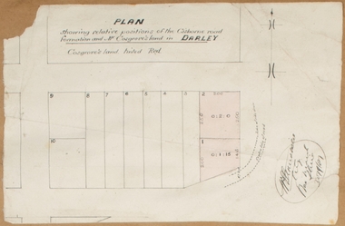
Map, Plan showing relative positions of the Gisborne road formation and Mr. Cosgrove's land in Darley. 1907
No background information about the roadworks referred to in this plan has been found. The portion of land referred to as 'Cosgroves' in this plan is located close to the present day Darley Park Recreation Park in Darley, near Bacchus Marsh. The land indicated appears to be close to the corner of Grey Street and Gisborne Road. James Cosgrove who died in 1923 aged 65 owned a farm of 52 acres in this area of Darley.Single page map showing a proposed deviation of the Gisborne road in Darley and its position relative to land owned by Mr. Cosgrove. The land owned by Cosgrove is shaded in pink. No scale indicated. Part of a set of maps which are pasted into a bound volume containing 76 maps or plans in total. High resolution digital image stored on BMDHS computer network. Signature (illegible), Eng, Bac Marsh Shire, 30/9/07bacchus marsh roads and streets, darley victoria maps -
 St Kilda Historical Society
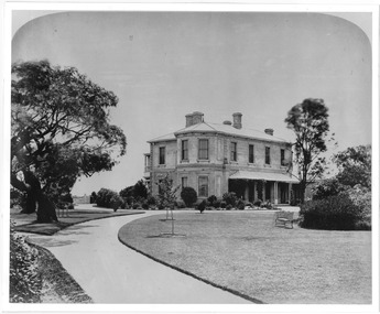
Photograph, Ascog, Southey St, Elwood, c.1872
Ascog Southie St. Residence in 1872 of Gavin Gibson, Merchant. Demolished. Land subdivided and now inclues Avoca Avenue and courtblack and white photograph, unmounted, copy, good conditionOn back: Ascog Southie St. Residence in 1872 of Gavin Gibson Merchant. Demolished and land subdivided and now inclues Avoca Avenue and court -
 Bendigo Historical Society Inc.
Administrative record - Land Sales Register
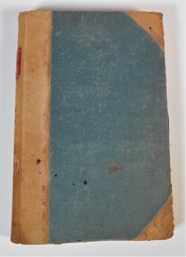
Large cloth bound ledger, hard board cover, front and back. Over a hundred pages not all numbered. Handwritten. Dates from 1906 - 1922. ledger filled with names, addresses, financial details, and glued in posters of land sales associated with clients. Castlemaine is listed as the area for the ledger and also St Anaud, Maryborough, Avoca, Inglewood, Dunolly, Daylesford, Maldon, Heathcote, Woodend. Scratched on the front cover is a faded reading of 'Castlemaine.' Written onto the spine is written in blue texta, 'Land Sales, C'Maine,' and also '8.6.1906 to 23.2.1922.' land sales, register, castlemaine -
 City of Moorabbin Historical Society (Operating the Box Cottage Museum)
Flyer - Patterson Station Estate, 1927
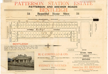
The train line from the city to Frankston was electrified in 1922 which intensified the sale in the municipality of Moorabbin, particularly land which was in the vicinity of the railway stations.Example of the progress of the Municipality of MoorabbinThe train line from the city to Frankston was electrified in 1922 which intensified the sale in the municipality of Moorabbin, particularly land which was in the vicinity of the railway stations.Patterson Station Estate, Bentleigh - 51 home sites - Auction Saturday 26 May 1927 - H. C. Costello & Co.patterson road, purton avenue (now bendigo street), brewer road, real estate, bentleigh, patterson, auction -
 City of Moorabbin Historical Society (Operating the Box Cottage Museum)
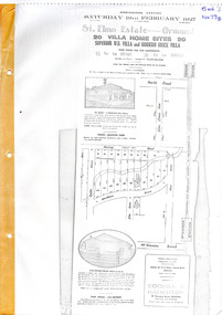
Flyer - St Elmo Estate, McKinnon / Ormond, 1927
The train line from the city to Frankston was electrified in 1922 which intensified the sale in the municipality of Moorabbin, particularly land which was in the vicinity of the railway stations.Example of the progress of the Municipality of MoorabbinThe train line from the city to Frankston was electrified in 1922 which intensified the sale in the municipality of Moorabbin, particularly land which was in the vicinity of the railway stations.St Elmo Estate, McKinnon Auction 19 February 1927 20 Villa Home Sites Superior W.B. Villa "St Elmo" and Modern Brick Villamurray road, hawthorn grove, ormond, mckinnon, real estate, auction -
 Peterborough History Group
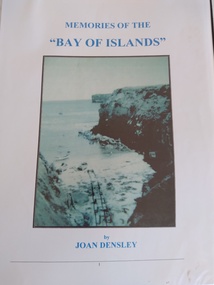
Book, Memories of the Bay of Islands + Crofts Bay Huts
Early use of Crown Land for holiday makers prior to the Great Ocean Road extension, when leaseholders were forced to relinquish their land and houses. Includes a list of the names of occupants at that time. Also includes letters from the Crown Lands Dept about the efforts to retain the Crofts Bay Huts.Significant because it is an eyewitness description of the huts which were demolished in the mid 1970's. Also describes holiday activities and mentions other families in the area.Folder containing the photocopy of the book by Joan Densley and the separate story of the Crofts Bay huts.including copies of Crown Land documents and letters. Includes copy of photographs of the huts and beach.peterborough, crofts bay, bay of islands, joan densley, great ocean road, crofts bay huts, bay of islands huts -
 Whitehorse Historical Society Inc.
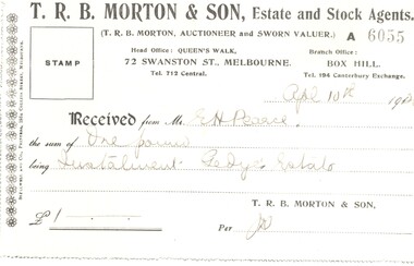
Legal record - Ephemera, E. H. Pearce, 1920
A receipt for one pound.A receipt for one pound as a deposit on land at the Gedye's Estate issued by T. R. B. Morton & Son to E. H. Pearce on 4 Apr 1920.A receipt for one pound. pearce, edward h., gedye's estate, morton, thomas richards burrowes & son -
 Ringwood and District Historical Society
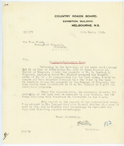
Letter, From Country Roads Board re compensation for road-widening land from Mr Bamford in 1929
1929 saw the establishment of the Ringwood Bowls Club initially located on the land now occupied by the Eastland Shopping Centre. It moved to its current location in Loughnan Road, Ringwood in 1997.From Country Roads Board re compensation for road-widening land from Mr Bamford. Dated 14th March 1929.city of ringwood bowls club, ringwood bowling club, ringwood bowls club, lawn bowls, bowling -
 City of Moorabbin Historical Society (Operating the Box Cottage Museum)
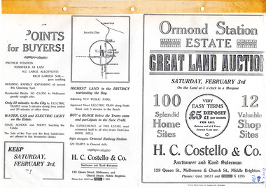
Flyer - Ormond Station Estate, Ormond, 1923
At the end of World War One, there was a renewed interest in residential land and a number of estates opened up in the Municipality of Moorabbin.Example of the progress of the Municipality of MoorabbinAdvertising flyer for auction of real estate sales - plan of building blocks for saleOrmond Station Estate, Ormond - Great Land Auction - 100 Home sites 12 shop sites - Auction Saturday 3rd February 1923malane st, foch st, coane st, beatty crescent, ormond, real estate, auction -
 Buninyong & District Historical Society
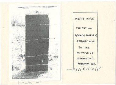
Photograph - Photograph of Buninyong from Mt. Innes, 1993. mounted on paper, Monument to George Innes, Mt. Innes, 1993
historic, public land, landscape, B/W photograph of George Innes monument on Mt. Innes, now known as Birdwood Park, mounted next to drawing showing inscription, which is illegible in photo. George Innes donated the land for the reserve.Mount Innes The gift of George Innes Esq. Cairney Hill to the borough of Buninyong February 1894buninyong, mt. innes, george innes -
 Sunbury Family History and Heritage Society Inc.
Photograph, 2000
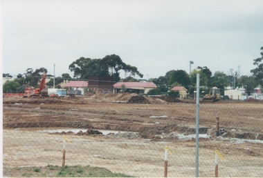
Excavation work to remove the grasslands and trees on the railway land on the west side of the Sunbury Station to make way for commercial development on that side of the line.A coloured photograph of excavation work in operation on land which has cyclone fencing around its perimeter. There are buildings in the middle distance beyond the work site.sunbury railway station -
 Kiewa Valley Historical Society
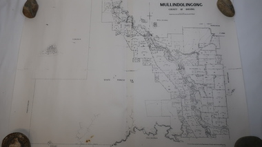
Map - Mullindolingong
Land owners of land in the Kiewa Valley in 1928The Kiewa Valley was farming country with families settling in the area prior to 1928 Two sheets the same: (one old with paper joined together and the other is a copy without any joins. 21 6 1928 dated Map of Mullindolingong / County of Bogong showing land owners along the Kiewa River and beyond.Produced by the Department of Lands and Survey, Melbournemullindolingong, kiewa valley, land owners, families of the kiewa valley -
Whitehorse Historical Society Inc.
Document, Community participation with land use
Community participation with land use - a Nunawading example.Community participation with land use - a Nunawading example. Edited version of a paper presented at 'Land for Leisure', annual conference of the Royal Australian Institute of Parks and Recreation, Burnie, 1978. Includes introduction and colour thumbnail prints of slides which were part of the presentation. 3 Cds contain images NP2904-2906.Community participation with land use - a Nunawading example. community gardens, city of nunawading. parks and recreation -
 Westbourne Grammar Heritage Collection
Photograph - The Site for Westbourne 1977
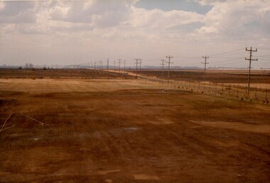
In 1975 a School Council subcomittee was formed to select a new principal to instigate the development of secondary schooling at Williamstown Grammar. By 1977 the appointed principal, John Roberts Pascoe, had worked tirelessly assessing options in and around Williamstown and looking for support for the school's expansion plans. He found that support in the Werribee Council and Werribee community, which recognised the potential of an independent school for the expanding area. In 1977, based on demographic research and feasibility studies, fifty acres of land was purchased on Sayers Rd. at Truganina (then Werribee). This photograph shows that land, the site for the new secondary school for Williamstown Grammar, looking east at the corner of Sayers Rd & Marquands Rd, which would be a very different view today.Colour photograph of a cloudy sky and cleared land with a perspective line of telegraph poles extending from the right into the middle background.campus, secondary, expansion -
Whitehorse Historical Society Inc.
Article, Death of pioneer apiarist, 18/07/1979 12:00:00 AM
Death notice for Thomas William Morton.Death notice for Thomas William Morton, prominent Mitcham resident who came to the district 50 years ago and settled on land belonging to the original Schwerkolt Family.Death notice for Thomas William Morton. morton, thomas william -
 Whitehorse Historical Society Inc.
Document, Alan Rawle Coad, 1919 - 2012
A profile of the life of Alan Rowle Coad .CA profile of the life of Alan Rowle Coad who lived in Clive Street Mitcham and known as 'Old Salty' due to his expertise in restoring saline land to productivity.A profile of the life of Alan Rowle Coad .Ccoad, alan rawle, clive street, mitcham -
 Greensborough Historical Society
Folder, Investors in the Grace Park area - Fricker Brothers 1957, 2018_05
Collection of records regarding the acquisition of land by the Fricker brothers in the Grace Park area of Greensborough, and their sub-division and sale between 1957 and 1975. Researched and edited by Peter Simmenauer Folder containing Certificates of Title, photocopies of Death Certificate and Probate documents, list of land sales and historical notes, researched and edited by Peter Simmenauer grace park, fricker avenue greensborough, desmond court greensborough, desmond fricker -
 Chelsea & District Historical Society Inc
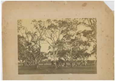
Photograph - Mr Hugh Brown's Farm, "Pine Vale", c 1865
Mr Hugh Brown farm, collecting logs for fence and preparing the ground to grow fruit trees. Mr Brown planted 8 acres of fruit trees. Hugh Brown (1830-1930), born in Ireland, arrived in Adelaide in 1855 and in the Mordialloc district in 1856. Mr Brown brought land in 1866 and built his farmhouse “Pine Vale” in 1870 near the site of the present Mordialloc Secondary College (then part of the property) and extended his property when the swampland was made open for selection in 1871. The property was a market garden and orchard. Hugh Brown married Zillah Baxter (1866) and they had six sons, five living to adulthood. The Brown family increased their land holding until they held a major part of the farmland between Mordialloc Creek to almost the Aspendale Railway Station. The property was a market garden and orchard. Mr Brown took an active interest in the public life of the community, a Justice of the Peace; Councillor of Dandenong Shire for over 30 years, was twice Shire President; and a founding member of the Mordialloc Mechanics Institute. Black and white studio photo of Mr Hugh Brown's farm. Gum trees and cleared land.hugh brown, mordialloc, pioneer, pine vale, farm, orchard, fruit trees, cattle, wagon track, fence