Showing 384 items matching "mining plan"
-
 Federation University Historical Collection
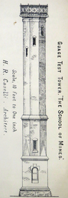
Architectural Plan, Ballarat School of Mines Gauge Tower Architectural Plan, c1883
The Ballarat School of Mines was the first of its type in Australia. The Albert Street frontage was the 'working end' of the campus with the mining laboratory, gauge tower and caretakers cottage. All the structures in the foreground have been demolished to make way for the Flecknoe Building and the M.B. John Building. Harry Brew, the well known Ballarat School of Mines caretaker, lived in the small weatherboard building to the right of the photograph. He was appointed to the staff at the Ballarat School of Mines in 1936.Printed copy of an architectural plan for the Ballarat School of Mines Gauge Tower as printed in the 1879 Ballarat School of Mines Annual Report.henry caselli, henry richards caselli, architectural plan, ballarat school of mines, gauge tower -
 Federation University Historical Collection
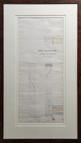
Drawing - Architectural Plan, Ballarat School of Mines Gauge Tower Architectural Plan by Henry Richards Caselli, 04/11/1880
The Ballarat School of Mines was the first of its type in Australia. The Albert Street frontage was the 'working end' of the campus with the mining laboratory, gauge tower and caretakers cottage. All the structures in the foreground have been demolished to make way for the Flecknoe Building and the M.B. John Building. The gauge tower is also depicted in the 1881 Annual Report.Original double mounted and framed architectural plan for the Ballarat School of Mines Gauge Tower. The plan includes sections and elecation. Some areas have been coloured, and the drawing is at a scale of four feet to one inch. Verso in ink "Gauge Tower School of Mines" Signed left "H.R. Caselli architect 4.11.80henry caselli, henry richards caselli, architectural plan, ballarat school of mines, gauge tower, buildings, architect -
 Federation University Historical Collection
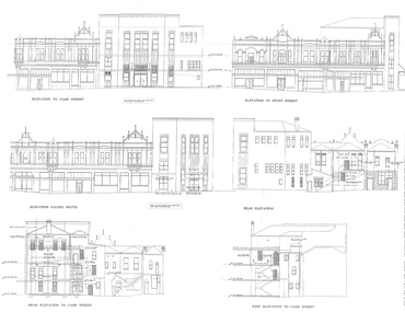
Plans, University of Ballarat Arts Academy Plans, c2000
Copies of the plans for the University of Ballarat Arts Academy, Camp Street, Ballarat.new north building, new south building, mining exchange, ballarat post office, former ballarat court house, former ballarat library -
 Federation University Historical Collection
Report, Integrated Tourism Strategy Plan for the Goldfields Region of Victoria: Volume II: Appendices - Miscellaneous, 10/1995
Black plastic ring binding on an A4 report.goldfields of victoria, goldfields tourism, marketing, goldfields campaign, mining tourism, torusim, tourism strategy, ballarat, bendigo, avoca, maryborough, castlemaine, maldon, community survey -
Federation University Historical Collection
Report, Integrated Tourism Strategy Plan for the Goldfields Region of Victoria, 1994
Black ring binding on an A4 report.goldfields of victoria, goldfields tourism, marketing, goldfields campaign, mining tourism, torusim, tourism strategy, ballarat, bendigo, avoca, maryborough, castlemaine, maldon, community survey, michael pearlman, anastasia molloy, jack harvey, avoca -
Federation University Historical Collection
Book, Jacobs Lewis Vines Architects and Conservation Planners, Historic Sites Survey: Ballarat Study Area, 1980, 1980
This survey was commissioned by the Land Conservation Council, Australian Heritage Commission and the Ministry for Conservation 114 page report on historic sites in the Ballarat region. It includes information on sites, a schexdule of sites, silte selection and designated areas (ie around towns)historic sites, ballarat, wendy jacobs, miles lewis, gary vines, berringa, buninyong, creswick, dunnstown, fiery creek, lal lal, langi logan, cathcart, mount cole, mount egerton, nerrina, gong gong, wombat state forest, railways, explorers routes, early roads, land conservation council, ausralian hertiage commission, department of planning, icomos (burra) charter, nigel lewis, richard aitken, freehold land, public land, langi ghiran, new jubille mine, birthday tunnel mine, pitfield plains, smythesdale, buninyong company, mount clear, mt clear, canadian gully, warrenheip distillery, thomas mitchell, waterloo, trawalla, beaufort, raglan, internment camps, forestry, mining, mining, mt egerton, mary hollick collection, jubilee mine, burra charter, historica areas data form, explorers, egerton company, black horse mine, mt egerton government battery, kaolin mines, anderson brothers, barkstead, anderson's tramway, clarkesdale, berry leads, birthday tunnel mine berringa, warrenheip, australasian company, mount mercer, lanvi-kal-kal, water race -
Federation University Historical Collection
Booklet, Wendy Morris, A Guide to Maldon, 1983, 1983
Soft covered booklet featuring an aerial view of the town of Maldon on the cover. heritage, tourism, maldon, mining, streetscape, townscape, gardens, quartz reef mining, geology, maldon goldmines, maldon hospital, kangaroo hotel, architecture, conservation and planning, cast iron, forests, mount tarrangower, nuggetty ranges, beehive -
 Flagstaff Hill Maritime Museum and Village
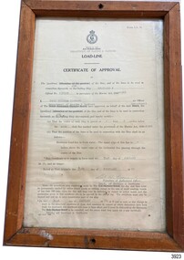
Document - Certificate of Approval, Load Line, 25-02-1970
This Certificate, Load-Line, gave approval for the vessel Reginald M to load cargo up to a certain line, marked by a disc attached to the ship and inspected by the South Australian Harbors Board. The vessel had a long and varied life of service. This Certificate relates to early 1970, before the ship was sold to the Lyall Mining and Rail Company. The Load Line on the Reginald M was carved on the ship, inside the hull and not removeable. The REGINALD M - The vessel “Reginald M” was a two-masted coastal ketch, owned and built by Mr. Jack (John) Murch of Birkenhead, Port of Adelaide, South Australia. Its construction took approximately 6 months and it was launched at Largs Bay in 1922. The Reginald M’s purpose was to serve the coastal trade of South Australia, to carry cargo cheaply and efficiently. It is believed that the keel was in fact hewn from two telegraph poles! Its builder frequented all the salvage yards for materials and fittings. Reginald M had a very shallow draft and a flat bottom that enabled it to come close to shore and to sit high and dry at low tide or to be beached on sand. The flat bottom was also to make the ship able to skim over reefs. Wagons could load and unload direct from her side. Her cargo included Guano, Barley, Wool, Horses, Cattle, Timber, Explosives, Potatoes, Shell Grit and Gypsum. After a variety of services, in late 1970 Reginald M was sold to the Mt. Lyell Mining and Railway Company and was used by them as a barge to carry explosives. In 1972 the Navy League of Strahan, Tasmania, purchased her for use by the Strahan Sea Cadet Unit to use at Macquarie Harbour and renamed her T.S. Macquarie. However this plan for use of Reginald M did not come to pass. In 1974 Mr. Andrew Rennie, of East Brighton, Melbourne, bought her for a similar purpose. , paying $5,000 and donating a ‘Cadet of the Year” trophy to the Sea Cadets. He sailed her from Strahan to Melbourne, planning to use her for pleasure sailing. Also in 1975 Reginald M was sold to Melbourne Ferry Company at auction. Later in 1975 the Reginald M was bought by Flagstaff Maritime Museum for $20,000 . She has been restored and is now one of the exhibits in the Village lagoon or lake. It was restored in 2006 using funds from a $4,000 government grant.This Certificate is significant because of its association with the last working days of REGINALD M. REGNIALD M was a coastal trading ketch from South Australia built in 1922. It was one of very few sailing coastal trading vessels still existing until 2016, and its flat bottom, single chine shape illustrated a very simple but robust method of construction, compared to other round bilged examples of trading vessels. The vessel is listed on the Australian Register of Historic Vessels (ARHV Number: HV000562.)Certificate, rectangular, behind glass in wooden frame. Certificate is an official printed form, some information is over-typed, other information is hand written and signed. Frame has a central hole in top and bottom. The Certificate relates to Load Level of the vessel Reginald M and refers to the exact placement of a disc within the vessel that indicates the maximum load in fresh water. . Issued to the vessel 'Reginald M', Official Number 137228. . Issued by the Sough Australian Harbors Board . Valid from 25-02-1970 to 31-01-1974. . Signed by Neil Cormack, 25th February 1970Certificate of Approval - Load Line for sailing vessel Reginald M, Official Number 137228. Logo of the South Australian Harbors Board. Issued by Department of Marine & Harbors, Port Adelaide, 25th February 1970. In force until 31st January 1974. Signed by Neil William Cormack, authorised officer for Department of Marine & Harbors. Typed onto form: "AUX [SAILING SIP]" "REGINALD M" "137228" "1968" " Neil William Cormack" "Department of Marine & Harbors" "1 [foot] 3 [inches below the] main [deck]" "31st JANUARY 74" "25th FEBRUARY 70" Signature: "Neil W Cormack"flagstaff hill, warrnambool, maritime village, maritime museum, flagstaff hill maritime museum & village, shipwreck coast, great ocean road, coastal trader, reginald m, ketch, john murch, ch murch, reg webb, carribie station, mt lyell copper company, melbourne ferry company, certificate of approval, load line, 137228, load line disc, 25-02-1970, neil w cormack, neil william cormack, south australian harbors board, department of marine and harbors, harbours -
 Bendigo Historical Society Inc.
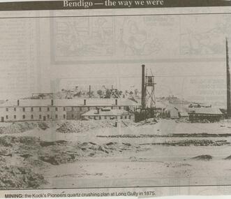
Newspaper - JENNY FOLEY COLLECTION: MINING
Bendigo Advertise ''The way we were'' from 2000. Mining: the Kock's Pioneers quartz crushing plan at Long Gully in 1875. The clip is in a folder.newspaper, bendigo advertiser, the way we were -
 Bendigo Historical Society Inc.
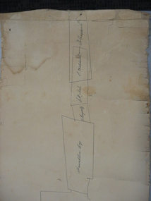
Document - PLAN SHOWING THE VARIOUS CLAIMS ON THE NEW CHUM VICTORIA , ST MUNGO & DEVONSHIRE REEFS BENDIGO
Map of mines - calico scroll showing locations of various claims .printed in black ink on off-white Calico with turned wooden ends on scroll -missing one wooden end , some stains and creasing / Plan showing the various Claims on the New Chum Victoria , St Mungo & Devonshire reefs BendigoW Holmes , printer & lithographer , Sandhurstorganization, mining, industrial, w holmes , printer & lithographer , sandhurst/new cum , victoria st mungo & devonshire reefs bendigo -
Bendigo Historical Society Inc.
Book - MINING IN BENDIGO COLLECTION: BOOK - CAN WE HELP YOU?
Small, faded greenish book titled 'Can We Help You?' issued by Geo. Brown, Secretary for Mines under the authority of The Hon. H. E. Bolte, M. L. A., Minister of Mines. Mines Department Melbourne, Victoria 1949,(Sixth Edition). Printed by J. J. Gourley, Government Printer, Melbourne. In the front of the book is a Plan showing location of Mines Department Head Office, Geological Museum & Laboratory. Book is set out in a question and answer format. Book covers subjects on mininng and petroleum leases and licences.book, book, can we help you?, geo brown, the hon h e bolte, mines department melb, j j gourley, mines department head office geological museum & laboratory, royal mint melbourne -
 Bendigo Historical Society Inc.
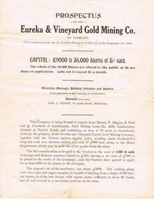
Document - JOSEPH DAVIES COLLECTION: PROSPECTUS OF THE EUREKA & VINEYARD GOLD MINING CO. N. L, 1900's
Printed Prospectus of the Eureka & Vineyard Gold Mining Co. N. L. Prospectus mentions previous owners, cost and capability of machinery, plans for working, yields, and mentions full reports photographs of plant and reef outcrop are at the office. Also mentioned are the price of shares and Calls not to exceed 3d a month.document, certificate, shares, joseph davies collection - prospectus of the eureka & vineyard gold mining co nl, geo j keogh, t odgers, b ford, q crawford, gold mining lease no 4430, mines department, vineyard reef, eureka reef -
 Bendigo Historical Society Inc.
Document - DOCUMENTS RELATING TO: THE BENDIGO AND DISTRICT TOURIST ASSOCIATION, July 7th, 1970
Various documents relating to the Bendigo and District Tourist Association. Includes Minutes of five meetings of the Board (1970/1971); Notice of AGM 1969; Annual Report 1971; Articles of Association (as amended 14/9/1971); single page headed ''Development of Nell Gwynne and Victoria Hill Sites'' - extensive plans for a 'tourist site with museum, cemetery, chapple (sic), rotunda. Theatre, façade of Charing Cross, a flying-fox from Nell Gwynne to Victoria Hill (no date); Mining Sub-Committee Report and Recommendation (Tourist Development Committee) 1967 re Resolution that ''Quartz Hill'' be developed as a mining tourist attraction (details provided ($75.000 est.); Draft Proposals for Brochure (authored by Miles Lewis, Carlton) - brochure to promote the idea of a museum and tourist development at the Nell Gwynne site; letter to Bendigo businesses re seeking funds for tourist development - Daryl McClure, Hon Sec June 1970.;bendigo, tourism, bendigo and district tourist association -
Bendigo Historical Society Inc.
Book - 'BULLETINS OF THE GEOLOGICAL SURVEY OF VICTORIA NO. 30'. THE PEARL AND HERCULES AND ENERGETIC MINES, BENDIGO, 1914
Bulletins of the Geological Survey of Victoria No. 30. The Pearl and Hercules and Energetic Mines, Bendigo, with plans and sections. By W. Baraganath Underground maps of the 4 (four) mines referred to in this book. Priced six pence Inscribed on the front cover: A. Richardson, 29 Harrison Street, Bendigo.Department of Mines. By W. Baraganathbendigo, mining, early history., mining, pearl, hercules and energetic mines. -
 Bendigo Historical Society Inc.
Document - KANGAROO FLAT GOLD MINE COLLECTION: ENGINEERING FEASIBILITYY STUDY CENTRAL DEBORAH GOLD MINE
40 page engineering feasibility study, with plans, for the development of the Central Deborah Tourist Mine, prepared by John Connell-Mott, Hay and Anderson, Hatch, Jacobs, consulting engineers, dated February 20th 1981. Enlargement of the shaft, lift installation, ventilation, dewatering, electrical installation are discussed. Latest costings range from $689,000 to $790,000.bendigo, gold mining, central deborah gold mine -
Bendigo Historical Society Inc.
Letter - KANGAROO FLAT GOLD MINE COLLECTION: WESTERN MINING CORPORATION TO J.O. REYNOLDS, 11th June 1980
Letter addressed to D. McClure, M.L.A., June 11th, 1980 from Western Mining Corporation Limted. Letter outlines the plan to 'use a commercial elevator rather than a winding system for placing tourists into the underground exhibition'. Western Mining Corporation intended to make a donation to fund this venture but 'the money involved is rather more than we had in mind'. The original quote was $45,000 but is going to be in the range of $200,000 to $300,000. A two page file note on a telephone conversation between Daryl McClure and J.O. Reynolds of WMC re the Central Deborah Gold Mine is appended to the letter.bendigo, gold mining, central deborah gold mine, bendigo, central deborah gold mine, gold mining, western mining corporation, daryl mcclure, j. reynolds, arvi parbo. -
 Bendigo Historical Society Inc.
Document - DEBORAH REEF PROJECT ENVIRONMENT EFFECTS STATEMENT
Two page document. On top, first page ' Bendigo Mining N.L., Deborah Reef Project, Environment Effects Statement, Summary Brochure'. Poppet head on top LH corner of document. A map of central Bendigo is drawn on page 1 and shows the location of the proposed processing plant near the Airport. Further maps on page 2 and 3 show the North Deborah Mine Site, the pipeline route and the airfield site. The summary brochure provides an outline of the material contained in the Environment Effects Statement and proposed planning scheme amendments upon which, the Deborah Reef Project will be assessed. Page four lists the issues that impact on this submission: planning and land use; socio economic environment; traffic; discharges to air; water management; explosives storage and handling; subsidence; heritage; flora and fauna and landscape and visual assessment. The 16th March, 1989, is the date given for submissions to be lodged in regard to this project.Bendigo Mining N.Lbendigo, mining, deborah reef project -
 Bendigo Historical Society Inc.
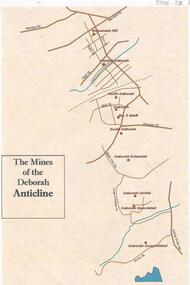
Document - THE MINES OF THE DEBORAH ANTICLINE
Plan of the mines along the Deborah Anticline: Deborah Consolidated, Deborah Associated, Deborah United, Deborah Extended, South Deborah, No. 2 shaft, Deborah North Deborah, Central Deborah, Monument Hill are all sited on the plan.Philip Wilkin, volunteer, BHSbendigo, mining, deborah line of reef -
 Bendigo Historical Society Inc.
Document - ALBERT RICHARDSON COLLECTION: HERCULES MINE REPORT 1936
a. four page handwritten report on the Hercules Mine, half yearly reports 1936. Extract: Reef worked below the 1620 feet level has been opened up at 1,840 feet. Profit has been earned but values are now unprofitable. At the Stanfield shaft, erection of plan was completed and shaft sunk to 344 feet. X cuts put out at 230 and 310 feet. Angus Mackay Chairman. b. Summary of sale of mine from Bendigo Advertiser 19.6.1950, handwritten by Albert Richardson, re the sale of the mining equipment at the Hercules Mine. ' Winding engines sold for £200 Compressor £425 and the oregon poppet legs for £41. The three main buildings went for £435 , the office and store room for £80, and die room for £12 Most spirited bidding was for 5 tons of firewood which finally went for £12Albert Richardsonbendigo, mining, hercules mine -
 Bendigo Historical Society Inc.
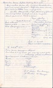
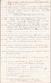
Document - ALBERT RICHARDSON COLLECTION: HERCULES AND ENERGETIC
a. Five page handwritten document titled 'Mine Manager John Truscott's Report Hercules and Energetic' Other reports included from Mine Managers on the Hercules and Energetic Mines are: J. Woolcock's report 4.3.1895, F. Youlden 1898 and J. Roberts 1911. b. One page hand drawn plan of titled ' Hercules transverse plotted by A.E. R., .D., A.A., page 23, 24.3.37. Hercules Long, by A.E.K. , W.R.N 24.3.37. Plans show measurements of tramway, height of poppet head, position of ore bins and other buildings on mine site.Albert Richardsonbendigo, mining, hercules and energetic mine -
Bendigo Historical Society Inc.
Document - STRUCTURE OF BENDIGO GOLDFIELD BULLETIN NO. 47
Booklet, 36 pages, that describes the structure of the Bendigo Goldfield. Booklet is enclosed in an envelope. On front of booklet : 1923 Victoria, Department of Mines, Bulletins of the Geological Survey of Victoria, W. Baragwanath, Director. Structure of Bendigo Goldfield, by H. Herman, late Director of Geological Survey. Maps under catalogue number 3769 accompanied the booklet and are listed as 'plates' on the contents page. Plans and Sections to accompany Bulletin No 47, Structure of Bendigo Gold-Field, by H Herman, B.C.E., M.M.E., F.G.S., late Director of Geological Survey.Geological Survey of Victoriabendigo, gold mining, structure of goldfield, bendigo, goldfield, gold mining, geology -
 Bendigo Historical Society Inc.
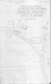
Photograph - DIAMOND HILL 1936, PLAN OF OCCUPATION
Print of 'Application of J. Hattam, plan of occupation parish of Sandhurst, County of Bendigo' Plan shows Post Office site, large dam, 'formerly cultivated site near Post Office'. A un-named gully is marked.bendigo, mining, diamond hill -
 Bendigo Historical Society Inc.
Map - BENDIGO GOLDFIELDS MAP
Map of the Bendigo Goldfield, showing reef lines, mines and significant geographical features such as Monument Hill, Quartz Hill and Diamond Hill. On the back of map 'Department of Mines, Victoria. Plan of Bendigo Goldfield.bendigo, mining, bendigo goldfields -
 Bendigo Historical Society Inc.
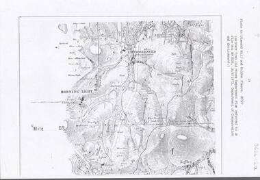
Document - DIAMOND HILL AREA MAP
Map copy, 2 pages, from 'Old Mines Department Plan, Dept of Conservation and Environment File No W91006, 16.6.1972' Map shows Golden Gully area with 'Town and Country Hotel' on north side and further south, with shafts and mine names marked.bendigo, mining, diamond hill -
Bendigo Historical Society Inc.
Map - HUSTLER'S & CHRISTMAS LINES OF REEFS - PLAN OF LINES OF SECTION OF REEFS
Underground Survey of Mines Bendigo. Plan of Cross Section Lines Shewing Connections with Trigonometrical Stations and Base Lines. 13/3/99 Signed ? Stirling. Places and mines mentioned Speciman Hill, Tambour Major, Lansell's 180, Victory and Pandora, Great Extended Hustler's, Windmill Hill on Victoria Reef. Next part of map is a Plan of Lines of Section between the Hustler's and Christmas Lines of Reefs. 8/3/99. Signed ?. Transverse Section. Shows Tambour Major Co., near the Christmas Line of Reef, Crosscuts and their depth, geological features and stone encountered. Then shows Thistle Line, Charshalton Line, Napoleon Line, Nell Gwynne Line, New Chum Line, Lansell's No 180 with levels, depths and geological features. Drawing is continued in three parts to fit on paper. Lansell's East Shaft with levels and depths, geological features and stone encountered. Sheepshead Line, Old Shaft, Garden Gully Line, Victory and Pabndora Co with crosscuts, depths, geological features and stone encountered. Paddy's Gully Line, Derby Line, Millers Line, Hustler's Line, Great Extended Hustler's Co with levels, depths, geological features and stone encountered. A note beside a Saddle Reef: 360,000 pounds paid in dividends from this reef. Average ounces per ton gold noted where found. Reference Table for stone and geological features. Datum Line 700 feet above Sea Level Unscannedmining, parish map, hustler's & christmas lines of reefs, plan of lines of section of reefs, ? stirling, specimen hill, tambour major, lansell's 180, victory & pandora, great extended hustler's, windmill hill, victoria reef, tambour major co, christmas line, hustler's line, thistle line, carshalton line, napoleon line, nell gwynne line, new chum line, lansell's no 180, lansell's east shaft, sheepshead line, old shaft, garden gully line, paddy's gully line, derby line, miller's line, hustler's line, great extended hustler's co -
 Bendigo Historical Society Inc.
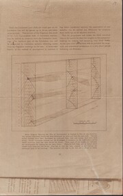
Document - CARSHALTON MINE - BLOCK DIAGRAM SHOWING THE PLAN OF DEVELOPMENT
Beige sheet of paper of Block Diagram Showing the Plan of Development as Applied to Part of one Anticline. The diagram goes down for 20 levels. Also mentions the Napoleon Line and the G. G. Consolidated Shaft.place, mining site, carshalton mine, carshalton main shaft, napoleon line, g. g.consolidated shaft, block diagram showing the plan of development as applied to part of one anticline -
 Bendigo Historical Society Inc.
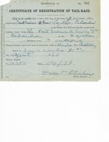
Document - MCCOLL, RANKIN AND STANISTREET COLLECTION: RENT RECEIPTS, 1930/40
1. Rent receipts, permissive occupancy, Monument Hill Consolidated. 2. Right to occupy a residence area, Victoria Phillipa Evans 127 Breen Street Bendigo. 3. Plan for applied Lease 10423. 5. Certificate of Registration of tail race. Loose documents.MCCOLL RANKIN & STANISTREETorganization, business, industrial - mining, mccoll rankin & stanistreet -
 Bendigo Historical Society Inc.
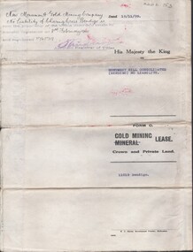
Document - MCCOLL, RANKIN AND STANISTREET COLLECTION: INDENTURE NO. 11019 BENDIGO, 1939
Document: Monument Hill Consolidated (Bendigo) N/L. 11019 gold mining lease 15/11/1939. Plan included. New Monument. Signature - Assistant Registrar of Titles. J. V. Sweeney.MCCOLL RANKIN & STANISTREETorganization, business, gold mining lease, mccoll ranking & stanistreet -
 Bendigo Historical Society Inc.
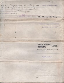
Document - MCCOLL, RANKIN AND STANISTREET COLLECTION: INDENTURE NO. 11020 BENDIGO, 15/11/1939
Document: Monument Hill consolidated (Bendigo) N/L. 11020 gold mining lease 15/11/1939, Plan included.Central Deb. 23208 A Phillips ----- Signature Asst. Registrar of Titles, J. V. Sweeney.MCCOLL RANKIN & STANISTREETorganization, business, gold mining lease, mccoll ranking & stanistreet -
 Bendigo Historical Society Inc.
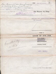
Document - MCCOLL, RANKIN AND STANISTREET COLLECTION: INDENTURED NO. 10879 BENDIGO, 1936
Document: Monument Hill consolidated (Bendigo) N/L. 10879 lease of site for machinery 2/9/1936., Plan included. Signature - Asst. Registrar of Titles.MCCOLL RANKIN & STANISTREETorganization, business, gold mining lease, mccoll rankin & stanistreet