Showing 488 items matching "north avenue"
-
 Ringwood and District Historical Society
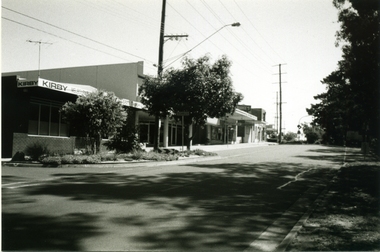
Photograph-B&W, Joan Walker, East Ringwood 2000- Railway Avenue looking West (Kirby Homecare,Wright Bros.Op Shop,& Bike Shop), 2000
East Ringwood 2000- Railway Avenue looking West (Kirby Homecare,Wright Bros.Op Shop,& Bike Shop)- B&W Photo from Album 6501 -
 Ringwood and District Historical Society
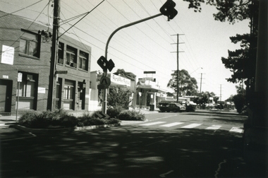
Photograph-B&W, Joan Walker, East Ringwood 2000- Railway Avenue looking West (Dr's McCubbin,McDonald,Mc Neil,Ziccone,Worboys,Brownless) & Dentist O'Connor, 2000
East Ringwood 2000- Railway Avenue looking West (Dr's McCubbin,McDonald,Mc Neil,Ziccone,Worboys,Brownless) & Dentist O'Connor- B&W Photo from Album 6501 -
 Ringwood and District Historical Society
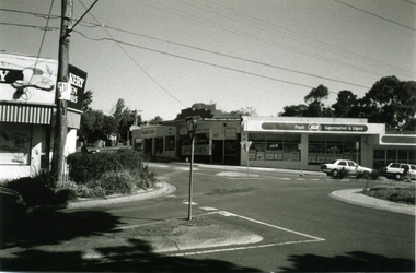
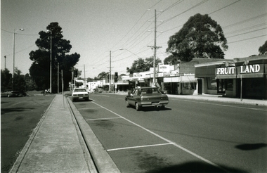
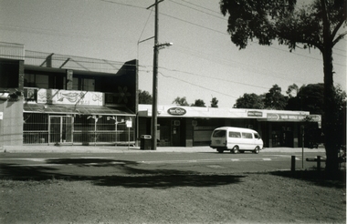
Photograph-B&W, Joan Walker, East Ringwood 2000-Roundabout in Railway Avenue cnr Wenwood Street looking West (Bakery,Paul's IGA), 2000
East Ringwood 2000-Roundabout in Railway Avenue cnr Wenwood Street looking West (Bakery,Paul's IGA)- B&W Photo from Album 6501 -
 Ringwood and District Historical Society
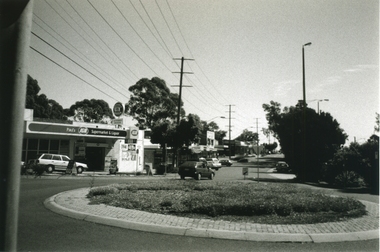
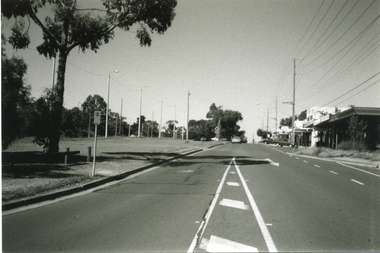
Photograph-B&W, Joan Walker, East Ringwood 2000- Roundabout in Railway Avenue cnr Wenwood Street looking West (railway line on right hand side), 2000
East Ringwood 2000- Roundabout in Railway Avenue cnr Wenwood Street looking West (railway line on right hand side)- B&W Photo from Album 6501 -
 Ringwood and District Historical Society
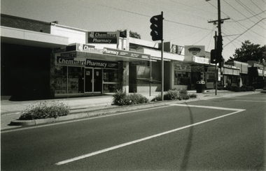
Photograph-B&W, Joan Walker, East Ringwood 2000- Railway Avenue looking West opposite the Railway Station, 2000
East Ringwood 2000- Railway Avenue looking West opposite the Railway Station- B&W Photo from Album 6501 -
 Ringwood and District Historical Society
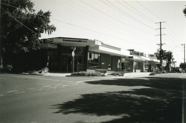
Photograph-B&W, Joan Walker, East Ringwood 2000- Railway Avenue cnr Stanley Avenue (Commonwealth Bank on corner) opposite railway station, 2000
East Ringwood 2000- Railway Avenue cnr Stanley Avenue (Commonwealth Bank on corner) opposite railway station- B&W Photo from Album 6501 -
 Ringwood and District Historical Society
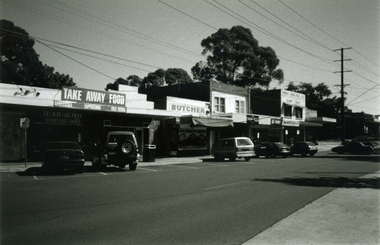
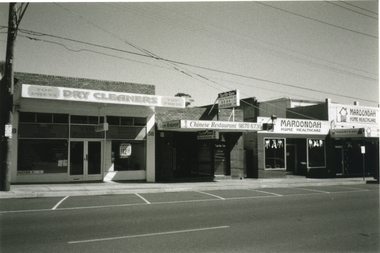
Photograph-B&W, Joan Walker, East Ringwood 2000- Shops in Railway Avenue looking West, 2000
East Ringwood 2000- Shops in Railway Avenue looking West- B&W Photo from Album 6501 -
 Ringwood and District Historical Society
Photograph-B&W, Joan Walker, East Ringwood 2000- Shops in Railway Avenue looking West, 2000
East Ringwood 2000- Shops in Railway Avenue looking West- B&W Photo from Album 6501 -
 Ringwood and District Historical Society
Photograph-B&W, Joan Walker, East Ringwood 2000-Railway Avenue looking East from Laurence Grove, 2000
East Ringwood 2000-Railway Avenue looking East from Laurence Grove- B&W Photo from Album 6501 -
 Ringwood and District Historical Society
Photograph-B&W, Joan Walker, East Ringwood 2000-Railway Avenue looking East from Laurence Grove, 2000
East Ringwood 2000-Railway Avenue looking East from Laurence Grove- B&W Photo from Album 6501 -
 Ringwood and District Historical Society
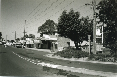
Photograph-B&W, Joan Walker, East Ringwood 2000-Cnr Laurence Grove & Railway Avenue looking West (Hairdresser on West Corner), 2000
East Ringwood 2000-Cnr Laurence Grove & Railway Avenue looking West (Hairdresser on West Corner)- B&W Photo from Album 6501 -
 Ringwood and District Historical Society
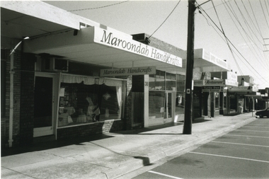
Photograph-B&W, Joan Walker, East Ringwood 2000-Maroondah Handicrafts in Railway Avenue, 2000
East Ringwood 2000-Maroondah Handicrafts in Railway Avenue- B&W Photo from Album 6501 -
 Ringwood and District Historical Society
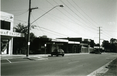
Photograph-B&W, Joan Walker, East Ringwood 2000-Shops in Railway Avenue, 2000
East Ringwood 2000-Shops in Railway Avenue- B&W Photo from Album 6501 -
 Ringwood and District Historical Society
Photograph-B&W, Joan Walker, East Ringwood 2000-Shops in Railway Avenue, 2000
East Ringwood 2000-Shops in Railway Avenue- B&W Photo from Album 6501 -
 Ringwood and District Historical Society
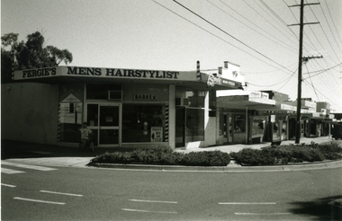
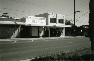
Photograph-B&W, Joan Walker, East Ringwood 2000-Shops in Railway Avenue looking South West, 2000
East Ringwood 2000-Shops in Railway Avenue looking South West- B&W Photo from Album 6501 -
 Ringwood and District Historical Society
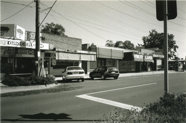
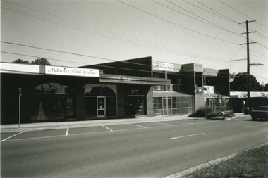
Photograph-B&W, Joan Walker, East Ringwood 2000-Shops in Railway Avenue (Dublin Road end), 2000
East Ringwood 2000-Shops in Railway Avenue (Dublin Road end)- B&W Photo from Album 6501 -
 Ringwood and District Historical Society
Photograph-B&W, Joan Walker, East Ringwood 2000-Shops in Railway Avenue (Dublin Road end), 2000
East Ringwood 2000-Shops in Railway Avenue (Dublin Road end)- B&W Photo from Album 6501 -
 Ringwood and District Historical Society
Photograph-B&W, Joan Walker, East Ringwood 2000-Railway Avenue Looking East from Dublin Road, 2000
East Ringwood 2000-Railway Avenue Looking East from Dublin Road- B&W Photo from Album 6501 -
 Ringwood and District Historical Society
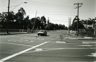
Photograph-B&W, Joan Walker, East Ringwood 2000-Railway Crossing and the corner of Dublin Road & Railway Avenue, 2000
East Ringwood 2000-Railway Crossing and the corner of Dublin Road & Railway Avenue- B&W Photo from Album 6501 -
 Ringwood and District Historical Society
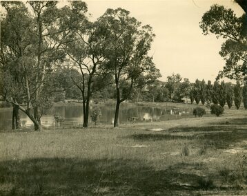
Photograph, R. Pullin, Ringwood Lake 1946, 1946
Ringwood Lake 1946, photograph by R. Pullin looking across lake from east side. Maroondah Highway can be seen on right hand side with avenue of poplars. -
 Ringwood and District Historical Society
Photograph, 150 Ringwood Primary School students 1994 next to red brick school in Greenwood Avenue, 1994
Colour photograph - approximately 150 Ringwood Primary School students 1994 next to red brick school in Greenwood Avenue -
Ringwood and District Historical Society
Envelope, Packet: Greenwood Sub-division (plans, 1924 notes etc)
"Greenwood" subdivision, Greenwood Avenue & Station Street 22 pages plus several subdivisional plans. -
 Ringwood and District Historical Society
Photograph, View of buildings on Maroondah Highway, Ringwood, taken overlooking railway yard from Station Street and Greenwood Avenue - 1914
Enlarged copy of smaller archived photograph - view of buildings on Maroondah Hwy taken overlooking railway yard from Station Street and Greenwood Avenue, 1914. Black and white photo on heavy cardboard backing. -
 Ringwood and District Historical Society
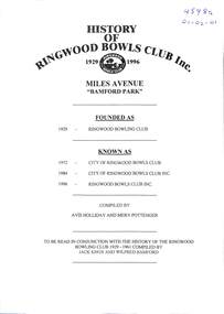
Book, History of Ringwood Bowls Club 1929 - 2004 (multiple different copies)
History of Ringwood Bowls Club, Bamford Park, Miles Avenue, founded as Ringwood Bowling Club. There are four variations of the history, all kept in white binders with inserts containing various aspects of historical material. All four have been converted into searchable, digital format. 4598a Kept at RDHS Archives (01-02-01). Compiled in 1996 by A. Holliday and M. Pottenger, including earlier compilation in 1961 by Jack Knox and Wilfred Bamford. Contains a lot of historical documents. 4598b Kept at Ringwood Bowls Club premises. Mostly officebearers, awards and championships. 4598c Kept at Ringwood Bowls Club and RDHS archives premises. Mostly Ladies Section from 1959 to 2004. 4598d Kept at Ringwood Bowls Club and RDHS archives premises. From 1996 to 2004, mixed Ladies and Men's Sections. -
 Ringwood and District Historical Society
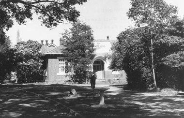
Photograph, Foundation stone for Ringwood State School No. 2997, laid by Mrs. J.K. Turnbull on 15th August, 1889
Photograph of Foundation stone for Ringwood State School No. 2997 was laid by Mrs. J.K. Turnbull on 15th August, 1889, marking the opening of the school situated in Whitehorse Road at the corner of Ringwood Street (1889-1922). Mrs. Turnbull was the wife of the Ringwood Station Master. The stone was removed after the school closed in 1922 and re-laid in 1962 by the School Committee at this subsequent Greenwood Avenue school site and is pictured here being viewed near the entrance in 1973 by Mr. Ron Pullin, Archivist, Ringwood Historical Research Group".Sign below photograph reads, "Foundation stone of Ringwood State School (late Ringwood St.). Now in grounds of Greenwood Avenue Ringwood State School". Inscription on stone, "This foundation stone was laid by Mrs. J.K. Turnbull on 15th August 1889". Printed on plaque below stone, "No.2997 - Ringwood State School 1889-1922. Situated in Ringwood Street, East Side sixty yards north of Maroondah Highway. Foundation stone removed 19?? re-erected by the School Committee 1962". -
 Ringwood and District Historical Society
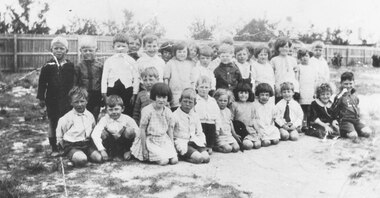
Photograph, Ringwood Primary School, Greenwood Avenue, c.1922 - A junior school class
Written on backing sheet, "A Greenwood Ave. class". c.1922. -
 Ringwood and District Historical Society
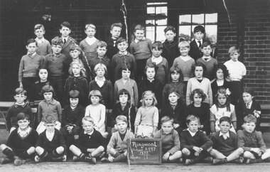
Photograph, Ringwood Primary School no.2997, Greenwood Avenue, Ringwood - 1933. - Grade 2 Class Photograph
The same wording as the sign is written on backing sheet of photograph. -
 Ringwood and District Historical Society
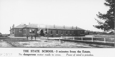
Photograph, Ringwood State School photograph for land sale - Bestpart Estate, Ringwood - 1925
Written on back of photograph, "State School, Greenwood Avenue. Foundation stone re-erected in Greenwood Avenue. Transferred from old site Ringwood Street and Whitehorse Road". -
 Ringwood and District Historical Society
Photograph, Jewkes pine forest in Mullum Road. Ringwood. 1958
Written next to photograph, "Jewkes pine forest in Mullum Road. Looking down from Wonga Road to Collett Avenue, 1958." -
 Ringwood and District Historical Society
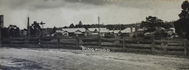
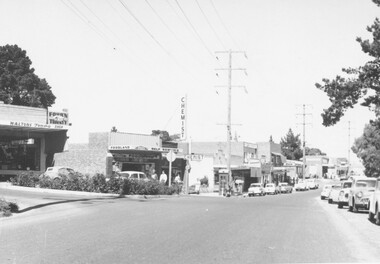
Photograph, Ringwood East, Railway Avenue, 1960
Written on back of photograph, "Ringwood East, Railway Avenue, 1960".