Showing 40539 items matching "roads and streets"
-
 University of Melbourne, Burnley Campus Archives
Photograph - Black and white print, 946/11, 30 March 1948
"30/3/48." Road from Swan Street. road, swan street, e. m. gibson collection -
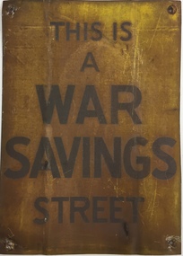 Kew Historical Society Inc
Sign, Commonwealth of Australia, This is a War Savings Street, 1939-1945
Elizabeth Nelson on eMelbourne has written that: "War Savings Streets were street-based savings groups that participated in the national war savings campaign during World War II. In May 1940 the Australian Government launched its Savings Certificates scheme which encouraged civilians to invest in the national war effort. Organisers of the savings campaign targeted Melbourne's suburbs individually with the aim of enlisting street savings groups. Each street group had a volunteer secretary who regularly sold war savings certificates to, and collected money from, other residents. The large number of war savings streets operating successfully in Melbourne made a significant contribution to the war effort."War Savings Street Street sign, presented to residents of Argyle Road, Kew (Vic) in 1942.Handwritten on reverse "Argyle Road Kew [Vic] 1942"second world war 1939-1945 - kew (vic), second world war 1939-1945 - fundraising, war savings street signs, ww2 -- savings certificates scheme -
 Ringwood and District Historical Society
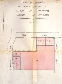
Document, Plan of Subdivision - Part of Crown Allotment 10A, Parish of Ringwood, County of Mornington - 1957
Map of residential allotments in Wantirna Road and Reilly Street, Ringwood, and Philip Street, Heathmont, Vic.Footnote includes "Lots numbered 5 to 11 and 16 to 23 both inclusive are not included in this plan. Signature of Consulting Engineer - Alan J. Brown BCE, LS, MVIS, Licensed Surveyor, Dillons Buildings, 1 Riversdale Road, Camberwell (Phone) WF3528 dated 1-4-1957. -
 Ringwood and District Historical Society
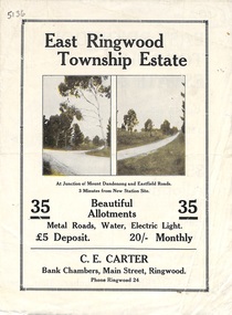
Flyer, Subdivisional Land Sale Brochure, East Ringwood Township Estate, Vic. - 1923
Bi-folded double sided land subdivision sale advertisement with location map and summary of local facilities and services. Includes two additional images of allotment plan with subsequent handwritten notations.Subdivision includes Mount Dandenong Road, Grey Street, and Eastfield Road. Agent - C.E. Carter, Bank Chambers, Main Street, Ringwood. Phone Ringwood 24. -
 Ringwood and District Historical Society
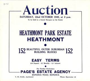
Flyer, Land Auction Sale Brochure, Heathmont Park Estate, Heathmont, Vic. - 1949
Double sided multi-fold advertisement for auction sale of residential allotments, including summary of subdivision features and local facilities. Auction on Saturday, 22nd October, 1949, at 2 p.m.Subdivision includes Great Ryrie Street, Erica Crescent, Neil Street, Frances Street, Viviani Crescent, and Canterbury Road. Agent - Page's Estate Agency, Boronia Road, Boronia. Phone Bayswater 42. -
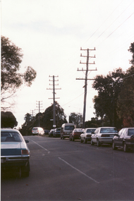 Whitehorse Historical Society Inc.
Photograph, Cnr. Cochrane & Whitehorse Road, 1/06/1999 12:00:00 AM
Coloured photo looking towards Mitcham Road from Corner Cochrane Street and Whitehorse Road, Mitcham.whitehorse road mitcham, cochrane street mitcham, overhead powerlines -
 Surrey Hills Historical Society Collection
Photograph, Grovedale Road Quarry in the 1920s - looking north, c1920
The quarry was part of John Butler Maling's property. He was one of the original settlers of the area and farmed the area between Weybridge Street and Whitehorse Road. Clay was quarried from part of this area and used to make the bricks used in the construction of his home, known as 'Ancyra'. This is still extant at the corner of Weybridge and James Streets. Maling grazed cows and used the quarry as a water source. He was the uncle of John Butler Maling, Mayor of Camberwell. He was married to Kate Conlon in 1882. They had 3 children: Silas Young, Alick and Zillah. Maling was born in c1829 in Shepreth, Cambridgeshire; he died in Surrey Hills on 9 October 1912 and is buried in Box Hill Cemetery - CE-*-0586. Mrs Kate Maling (born c1859 in Co Meath, Ireland) died at the property on 8 March 1921. She is buried in Brighton General Cemetery. Probate was valued at over 10,000 pounds and included other properties in Sandringham, Hawthorn and Macedon. At the time of her death the Surrey Hills property was described as being 23 cres with 2 brick houses, 1 cow, 2 heifers and 40 fowls or chickens. The property was subdivided after her death. The quarry was filled in after several drownings or near drownings and the land is now occupied by a park and playground maintained by the City of Boroondara. Beckett Park is sited on horizon to the left beyond the trees. This documents the landscape prior to close settlement and is material to early building and farming in the Surrey Hills area.Black and white photo of the quarry between Grovedale Road and James Street taken in the 1920s and looking north. In the foreground is an area of water with high banks dividing the horizontal centre. Beyond are paddocks and trees behind which is a row of at least 3 single-storey houses. Light poles can be seen along a distant street. There are many mature trees in the background. The houses and trees are positioned along Whitehorse Road in the vicinity of Westminster Street. Shadows indicate the photo was taken in early morning or evening.quarries, grovedale road, james street, surrey hills, balwyn, clay quarries, ancyra, kate conlon, kate maling, john butler maling, farming -
 Ringwood and District Historical Society
Map - State Aerial Survey, Dandenong Ranges Area, Parishes of Warrandyte and Ringwood - 1956
Map of central and southern areas of Ringwood and part of Ringwood East and Heathmont compiled by Dept of Lands and Survey, July 1956, from aerial photographs and Cadastral Survey information. Subsequent hand-drawn addition of streets showing layout of "Township of Ballyduffy Estate 1858-60", an earlier proposed subdivision that did not eventuate. (See attached 5009b Ballyshanassy_ Melbourne’s lost suburb.pdf for Ballyduffy historical naming relevance). Ballyduffy Estate streets include City Road, West Prussia Road, Duffy Street, Ireland Street, Evans Street, Victoria Street, Regina Street, Short Road, Prussia Road, Duffy Street East, Ireland Street East, Evans Street East, Chapman Street. Misc Topo 93 Sheet 22, Ringwood A4B2. Scale: 4 chains to 1 inch. Contour interval 20 feet. -
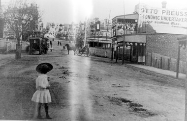 Surrey Hills Historical Society Collection
Photograph, Empire Day in Surrey Hills circa 1912
Empire Day celebrations were held from 1908-1912. Prior to the opening of the railway in 1893 the only public transport to Surrey Hills was the Melbourne-Lilydale horse coach which travelled to Surrey Hills down Victoria Street and Mont Albert Road. The fare to Union Road was 9 pence. Photo 16-4a was the number given to the original print provided by the State Savings Bank. Ken Hall made a negative from it, and the reprint of this was given the number 1459. This number was chosen as the catalogue number to avoid confusion with SHP4a. Photo provided by Surrey Hills branch of State Savings Bank of Victoria in 1978 for launch of Surrey Hills Neighbourhood Centre and was one of the first photos in the collection. The inscriptions on the reverse may indicate it was used in the Surrey Hills Neighbourhood News.Black and white photo of Union Road looking south towards Canterbury Road. The street is decorated with lanterns and the Union Jack and other flags for Empire Day celebrations. There is a young girl in the foreground looking towards the railway crossing where there is a horse drawn cab and a horse drawn cart. Business signage includes that for a butcher, Sneddon's Real Estate and Otto Preuss, Economic Undertaker.On rear: "113% "; "Enlarge to 172 mm" and 2 arrows, all in blue biro.union road, empire day celebrations, horse drawn vehicles, undertaker, sneddon real estate, businesses, union road shops, otto preuss -
 Ringwood and District Historical Society
Flyer, Land Sale Advertisement - State School Estate, Ringwood, Victoria - 1923
The date of the flyer as circa 1920 can be estimated from the references to the (decision on) "electrification of the Croydon Railway Line" which eventually occurred in 1923, letting of tenders for the state school building which opened in 1924, and the "proposed new railway station" (East Ringwood) which opened in 1925, Advertisement for State School Estate, Ringwood - 26 residential allotments for sale near East Ringwood State School development site and 7 minutes walk from proposed new railway station (East Ringwood). Includes location map and terms of sale.Locality plan includes King Street and Government Roads (Later Everard Road, Holland Road, Purser Avenue, and Charles Street). (Agents) J.B. McAlpin, Estate Agent and Subdivisional Manager, Ringwood (Opposite Station), and F.V. Parker, Estate Agent, Main Street, Ringwood. -
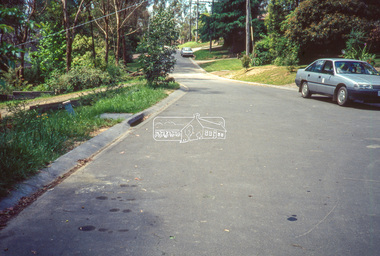 Eltham District Historical Society Inc
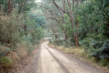
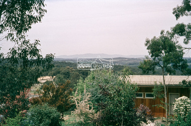
Slide - Photograph, Unidentified location, Eltham district, 1993
... streets ...35mm colour positive transparency Mount - Black and Whiteunidentified, infrastructure, streets, roads -
 Eltham District Historical Society Inc
Slide - Photograph, Unidentified location, Eltham district, 1993
... streets ...35mm colour positive transparency Mount - Black and Whiteunidentified, infrastructure, streets, roads -
 Eltham District Historical Society Inc
Slide - Photograph, Unidentified location, Eltham district, 1993
... streets ...35mm colour positive transparency Mount - Black and Whiteunidentified, infrastructure, streets, roads -
 Eltham District Historical Society Inc
Slide - Photograph, Unidentified location, Eltham district, 1993
... streets ...35mm colour positive transparency Mount - Black and Whiteunidentified, infrastructure, streets, roads -
 Eltham District Historical Society Inc
Slide - Photograph, Unidentified location, Eltham district, 1993
... streets ...35mm colour positive transparency Mount - Black and Whiteunidentified, infrastructure, streets, roads -
 Eltham District Historical Society Inc
Slide - Photograph, Unidentified location, Eltham district, 1993
... streets ...35mm colour positive transparency Mount - Black and Whiteunidentified, infrastructure, streets, roads -
 Eltham District Historical Society Inc
Slide - Photograph, Unidentified location, Eltham district, 1993
... streets ...35mm colour positive transparency Mount - Black and Whiteinfrastructure, streets, roads, unidentified -
 Eltham District Historical Society Inc
Slide - Photograph, Unidentified location, Eltham district, 1993
... streets ...35mm colour positive transparency Mount - Black and Whiteinfrastructure, streets, roads, unidentified -
 Eltham District Historical Society Inc
Slide - Photograph, Unidentified location, Eltham district, 1993
... streets ...35mm colour positive transparency Mount - Black and Whiteinfrastructure, streets, roads, unidentified -
 Eltham District Historical Society Inc
Slide - Photograph, Unidentified location, Eltham district, 1993
... streets ...35mm colour positive transparency Mount - Black and Whiteinfrastructure, streets, roads, unidentified -
 Eltham District Historical Society Inc
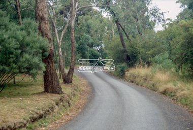
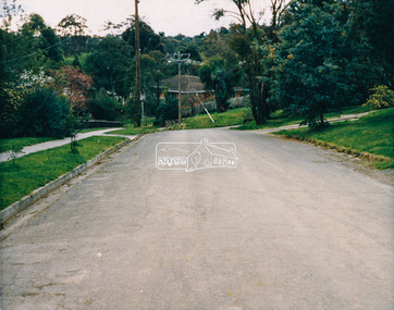
Slide - Photograph, Unidentified location, Eltham district, possibly Research / Kangaroo Ground, c.1990
... streets ...35mm colour positive transparency Mount - Perutz GreyInscribed (i) RYinfrastructure, streets, roads, unidentified -
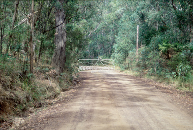
 Eltham District Historical Society Inc
Slide - Photograph, Unidentified location, Eltham district, possibly Research / Kangaroo Ground, c.1990
... streets ...35mm colour positive transparency Mount - Perutz GreyInscribed (i) RYinfrastructure, streets, roads, unidentified -
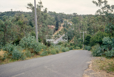
 Eltham District Historical Society Inc
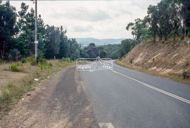
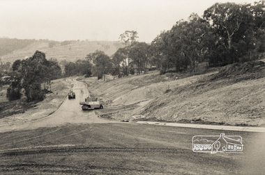
Photograph, Road construction
... roads ...Unidentified local view of road construction, no date.Photographroads, streets, shire of eltham, road construction -
 Eltham District Historical Society Inc
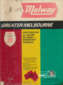
Book, Melway Publishing, Melway Greater Melbourne Street Directory, edition 20, 1990, 1990
... streets ...Coloured detailed maps accessed by a street or location index.500 p. : col. maps ; Flexible cover edition with fitted clear plastic jacket.ISSN 03113957streets, roads, maps, melway -
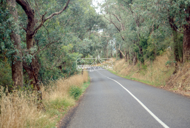
 Eltham District Historical Society Inc
Photograph - Colour Print, Eltham Shire Council, Unidentified road, Eltham district, c.Oct. 1987
... Roads ...Date based on other similar display panels visible in images of the Shire of Eltham display at the Eltham Community Festival, 7 November 1987. 20 x 25 cm Shire of Eltham Engineering Department Providing the resources to undertake • Survey, design, consultation • Road construction and maintenance • Bridge construction and maintenance • Street sweeping • Drain and pit cleaning • Traffic engineering installation and maintenance • Garbage collection • Tip management, land reclamation and beautification • Maintenance of community buildings • Provision of community and recreation facilitiesunidentified, display panel, eltham festival, footpaths and gutters, infrastructure, residential, roads, shire of eltham, streets, 1987 -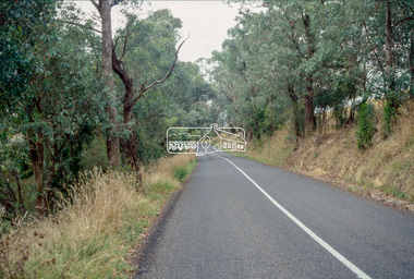
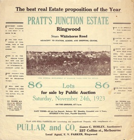 Ringwood and District Historical Society
Flyer, Brochure for Land Sale By Public Auction, Pratt's Junction Estate, Ringwood, Victoria - 1923
Folded double-sided brochure advertising 86 residential lots for sale by Public Auction at 3pm, Saturday, November 24th, 1923, with town photographs, map of subdivision and summary of local features and services. Subdivision plan includes Whitehorse Road, Oliver Street, Georges Road, Junction Street, and six room weatherboard villa for sale. Local Agent - F.V. Parker, Ringwood. -
Canterbury History Group
Photograph - Street view of the corner of Maling Road and Bryson Street depicting the shop No. 92. Maling Road, Jan Pigot, 1994
Coloured photograph of the street view of the corner of Maling Road and Bryson Street depicting Buckley's Supermarket at shop No. 92. Maling Road This is also the corner of the building named The Block 1907.canterbury, maling road, shops, bryson street, buckley family, the block -
 Whitehorse Historical Society Inc.
Photograph, Brunswick Road, Mitcham, 8/09/1958 12:00:00 AM
Black and white photo of Brunswick Road, Mitcham. (Was previously Northcote Road.) Comments as for Forster Street Mitcham. - NP1075.o'rourke, l.