Showing 4272 items
matching street plan
-
 Ringwood and District Historical Society
Map - Plan of Survey, Part of Crown Portion 12, Parish of Ringwood, Victoria - circa 1930
Map of area bounded by Ringwood Street, Melbourne Street and Adelaide Street, showing details of Adelaide Street allotments and existing outbuildings. Certificate of Title numbers include Ringwood Street C/T 3418-553, C/T 3563-433, Adelaide Street C/T 7151-047, C/T 7038-465, C/T 7098-464, C/T 7098-465, C/T 3604-635, C/T 8066-900, C/T 3866-118, C/T 3609-728, and C/T Vol 3670 Fol 133992.Subsequent additional notations identifying 1971 closure of Melbourne Street North, and properties of Hone, Patendon, Pines Hosptial, Mail Office, Presbyterian Church and Falconers Grocery Shop on Whitehorse Road corner. -
 Ringwood and District Historical Society
Plan - Proposed Ringwood East Railway Station, VR Ringwood-Croydon (Dublin Road) - 1923
Technical drawing of "Proposed Station At 16Mls 38Chs 89Lks (Dublin Road)" inluding boundary line, red shaded platform with station buildings, and green shaded possible future "up" track. Surrounding streets include Dublin Road, Patterson Street, and subsequent hand-written additions of Railway Avenue, Lawrence Grove, Stanley Avenue, Wenwood Street, and Lois Street. Land title details of Patterson Street properties mainly illegible.Scale: 40'=1". Possible future (platform) extension for 8 car trains (and) extension for 10 car trains. -
 Ringwood and District Historical Society
Document - Folder, Commercial and Retail Property Sales Information, Civic Place and Melbourne Street, Ringwood - 1998
45 photocopied pages including - Plan of Subdivision No.LP80718, Parish of Ringwood, Victoria, Crown Portion 12(Part) and part of a former government road Ref Vol 8668 Fol 745. - Vendors Statement, Planning Certificate and Heritage Council (Victoria) Certificate issued for 20 Melbourne Street, Ringwood. - Maroondah City Council Land Information Certificate for 149 149A and 149B Maroondah Highway; number 8 Civic Mall; and numbers 16, 20, 22 & 24 Melbourne Street Mall. - Yarra Valley Water statements relating to encumbrances for Shop 11, 149 Maroondah Highway; Shop 10, 149A Maroondah Highway; Shop 9, 149B Maroondah Highway; numer 8 Civic Place; Unit 3, 20 Melbourne Street; Office 4, 20 Melbourne Street; Shop 7, 22 Melbourne Street; and Shop 8, 24 Melbourne Street. - Land Tax Certificate pertaining to Commonwealth Bank, Civic Place, Ringwood. - Certificate of Title Vol 8892 Fol 906, Lot One on Plan of Subdivision No. 80718, Parish of Ringwood - Hanover Developments P/L - 29th June, 1971. -
 Mission to Seafarers Victoria
Slide - Glass slide, Black and white, circa 1921
This image provides an additional later modified building view to that of the image of the original single storey building image published on back page of the 1910 MTS Annual Report. According to the Annual Report of 1915 the plans to build a residence on top ( the 2nd storey ) of the Port Melbourne building got the go ahead to commence and opened 1916. Originally designed by architect, Frederick Williams, who built the first brick Mission at Port Melbourne in the 19th C. Walter Butler was commissioned for the second storey.The Port Melbourne building in the image established in the 19th C., still survives. It was a key centre of operations for the Mission prior to the building of the Mission near Australian Wharf in 1907 and prior to the eventual opening of the current "Central Mission" in 1917. NB operations of The Port Melbourne Branch Mission were eventually transferred to the King George V memorial Building, dedicated in December 1937 but demolished in 1995. The Mission depicted here still survives as part of an apartment complex on the corner of Nott st.Positive photograph on medium format glass slide ; b & w image of brick building taken from a corner street level view, with upper storey at one end on glass transparency with a flagpole and flag (Flying Angel) just discernible. The slide is edged with adhesive tape.missions to seamen institute, mission building, frederick williams, walter butler, port melbourne, beach road, mission to seafarers, nott street -
 Flagstaff Hill Maritime Museum and Village
Photograph - Portrait, William Roy Angus, c. 1920's
This is a photograph of (William) Roy Angus, at his desk as a medical student in Adelaide, South Australia. It was donated to Flagstaff Hill Maritime Museum and Village by the family. He later qualified as Doctor William Roy Angus, Surgeon and Oculist. It is part of the “W.R. Angus Collection” which includes historical medical equipment, surgical instruments and materials once belonging to Dr Edward Ryan and Dr Thomas Francis Ryan, (both of Nhill, Victoria) as well as Dr Angus’ own belongings. The Collection’s history spans the medical practices of the two Doctors Ryan, from 1885-1926 plus that of Dr Angus, up until 1969. ABOUT THE “W.R. ANGUS COLLECTION” updated 20-01-2023 Doctor William Roy Angus M.B., B.S., Adel., 1923, F.R.C.S. Edin.,1928 (also known as Dr Roy Angus) was born in Murrumbeena, Victoria on 28th June 1901 and lived until 1970. He qualified as a doctor, M.B.B.S. (Bachelor of Medicine-Bachelor of Surgery) in the 1923 at University of Adelaide, was Resident Medical Officer at the Royal Adelaide Hospital in 1924 and for a period was house surgeon to Sir (then Mr.) Henry Simpson Newland, from whom he acquired his interest in plastic surgery. He was also House Surgeon to Dr J.J. O’Grady, under whom he did his early Ophthalmological training. Dr Angus was briefly an Assistant to Dr Riddell of Kapunda, then commenced private practice at Curramulka, Yorke Peninsula, SA, where he was a physician, surgeon and chemist. In 1926, he was appointed as the new Medical Assistant to Dr Thomas Francis Ryan (T.F. Ryan, or Tom), in Nhill, Victoria, whose practice had been established by his brother, Dr Edward Ryan. Consequently, a considerable amount of eye work was done. Dr Angus’ experiences included radiology and pharmacy. In 1927 he was Acting House Surgeon in Dr Tom Ryan’s six-month trip abroad. Dr Angus had become engaged to Gladys Forsyth and they decided he further his studies overseas in the UK in 1927, sailing in the ship SS Banffshire. He studied at London University College Hospital and at Edinburgh Royal Infirmary and in 1928, was awarded FRCS (Fellow from the Royal College of Surgeons), Edinburgh, Scotland. He worked his passage back to Australia as a Ship’s Surgeon on the Australian Commonwealth Line T.S.S. Largs Bay, which was purchased by the White Star Line in 1928. He returned to South Australia, where he practised general surgery 1928-1932. He was a surgeon at the Curramulka Hospital, Yorke Peninsula, South Australia. Dr Angus was a ‘flying doctor’ for the A.I.M. (Australian Inland Ministry) Aerial Medical Service in 1928. Its first station was in the remote town of Oodnadatta, where Dr Angus was stationed. He was locum tenens there on North-South Railway at 21 Mile Camp. He took up this ‘flying doctor’ position in response to a call from Dr John Flynn; the organisation was later known as the Flying Doctor Service, then the Royal Flying Doctor Service. His work during this time involved general surgery, eye work, plastic surgery, radiology, pathology and even dental surgery. Dr Angus married Gladys in 1929, in Ballarat. (They went on to have one son (Graham 1932, born in SA) and two daughters (Helen (died 12/07/1996) and Berenice (Berry), both born at Mira, Nhill ). According to Berry, her mother Gladys made a lot of their clothes. She was very talented and did some lovely embroidery including lingerie for her trousseau and beautifully handmade baby clothes. In 1933 Dr Angus returned to Nhill and purchased a share of the Nelson Street practice and Mira hospital (a 2-bed ward at the Nelson Street Practice) from Dr Les Middleton one of the Middleton Brothers, the current owners of what previously once Dr Tom Ryan’s practice, where Dr Angus was previously Medical Assistant. Dr Tom and his brother had worked as surgeons including in eye surgery. Dr Tom Ryan performed many of his operations in the Mira private hospital on his premises. He had been House Surgeon at the Nhill Hospital from 1902-1926. Dr Tom Ryan had one of the only two pieces of radiology equipment in Victoria during his practicing years – The Royal Melbourne Hospital had the other one. Over the years Dr Tom Ryan had gradually set up what was effectively a training school for country general-practitioner-surgeons. Each patient was carefully examined, including using the X-ray machine, and any surgery was discussed and planned with Dr Ryan’s assistants several days in advance. Dr Angus gained experience in using the X-ray machine there during his time as assistant to Dr Ryan. The doctors Ryan were related to the Ryan Eye Doctors in Melbourne. When Dr Angus bought into the Nelson Street premises in Nhill he was also appointed as the Nhill Hospital’s Honorary House Surgeon 1933-1938. His practitioner’s plate from his Nhill surgery is now mounted on the doorway to the Port Medical Office at Flagstaff Hill Maritime Village, Warrnambool. When Dr Angus took up practice in Dr Edward and Dr Tom Ryan’s old premises, he obtained their extensive collection of historical medical equipment and materials spanning 1884-1926. A large part of this collection is now on display at the Port Medical Office at Flagstaff Hill Maritime Village in Warrnambool. In 1939 Dr Angus and his family moved to Warrnambool where he purchased “Birchwood,” the 1852 home and medical practice of Dr John Hunter Henderson, at 214 Koroit Street. (This property was sold in1965 to the State Government and is now the site of the Warrnambool Police Station. and an ALDI store is on the land that was once their tennis court). The Angus family could afford gardeners, cooks and maids; their home was a popular place for visiting dignitaries to stay whilst visiting Warrnambool. Dr Angus had his own silkworm farm at home in a Mulberry tree. His young daughter used his centrifuge for spinning the silk. Dr Angus was appointed on a part-time basis as Port Medical Officer (Health Officer) in Warrnambool and held this position until the 1940s when the government no longer required the service of a Port Medical Officer in Warrnambool; he was thus Warrnambool’s last serving Port Medical Officer. (Masters of immigrant ships arriving in port reported incidents of diseases, illness and death and the Port Medical Officer made a decision on whether the ship required Quarantine and for how long, in this way preventing contagious illness from spreading from new immigrants to the residents already in the colony.) Dr Angus was a member of the Australian Medical Association, for 35 years and a surgeon at the Warrnambool Base Hospital from 1939-1942, Soon after his move to Warrnambool, war was declared. Dr Angus joined the Australian Department of Defence as a Surgeon Captain during WWII 1942-45, in Ballarat, Victoria, and in Bonegilla, N.S.W., at 106 A.G.H., completing his service just before the end of the war due to suffering from a heart attack. During his twelve moth convalescence and rehabilitation, he carved an intricate and ‘most artistic’ chess set from the material that dentures were made from. He returned to Warrnambool to commence practice as an ophthalmologist, pioneering artificial eye improvements. He was an Honorary Consultant Ophthalmologist at Warrnambool Base Hospital for 31 years. He made monthly visits to Portland as a visiting surgeon, to perform eye surgery. He represented the Victorian South-West subdivision of the Australian Medical Association as its secretary between 1949 and 1956 and as chairman from 1956 to 1958. Altogether he had interests in nine various medical organisations. In his personal life, Dr Angus was a Presbyterian and treated Sunday as a Sabbath, a day of rest. He would visit 3 or 4 country patients on a Sunday, taking his children along ‘for the ride’ and visiting with him. Sunday evenings he would play the pianola or piano and sing Scottish songs to his family. He loved Scottish music. He owned a farm in the Heytesbury district, where he found his hobbies of metalwork and carpentry useful in the workshop. He also enjoyed painting, mainly watercolour, and took part in many exhibitions. One of Dr Angus’ patients was Margaret MacKenzie, author of a book on local shipwrecks that she’d seen as an eyewitness from the late 1880’s in Peterborough, Victoria. In the early 1950’s Dr Angus, painted a picture of a shipwreck for the cover jacket of Margaret’s book, Shipwrecks and More Shipwrecks. She was blind in later life and her daughter wrote the actual book for her. Dr Angus and his wife Gladys were very involved in Warrnambool’s society with a strong interest in civic affairs. He had an interest in people and the community They were both involved in the creation of Flagstaff Hill, including the layout of the gardens. After serving in the Army, Dr Angus studied ophthalmology and became a Clinical Assistant at the Royal Melbourne Eye and Ear Hospital. He had been interested in an article on cartilage grafting by Dr Lyndon Peer of St. Barnabas Medical Centre, New Jersey, U.S., which he happened to see in a dental journal. After thought and research, Dr Angus decided to try his idea of living intrascleral implants and was able to present a paper on his results at the Combined Scientific Meeting of the O.S.A. at Surfers’ Paradise in 1962. This was followed by a further report on the results of the different methods used, given in Adelaide at the O.S.A. meeting in 1965. In 1967, during an extended holiday abroad, he was invited to spend time at the Barraquer Institute in Barcelona. While there, showed a film of his operation with slides and, translated by Professor Barraquer, gave an abridged lecture. He was elected as a member of the Instituto Barraquer, one of only a few Australians to receive the honour. He received many requests for copies of his paper. He was also invited to lecture and show the films in England and at the St Barnabas Medical Centre in New Jersey. He completed his work on Living Intrascleral Implants and gave his final paper and film Inaugural Meeting of the Australian College of Ophthalmologists in Melbourne in October 1969. Angus received accolades from the Ophthalmological Society of Australasia for this work. Two weeks after presenting his paper in Melbourne in 1969 Dr Angus became critically ill. He died on 28th March 1970. His family requested his practitioner’s plate, medical instruments and some personal belongings to be displayed in the Port Medical Office surgery at Flagstaff Hill Maritime Village, and be called the “W. R. Angus Collection”. The W.R. Angus Collection is significant for still being located at the site it is connected with, Doctor Angus being the last Port Medical Officer in Warrnambool. The collection of medical instruments and other equipment is culturally significant, being a historical example of medicine from the late 19th to mid-20th century. Dr Angus assisted Dr Tom Ryan, a pioneer in the use of X-rays and in ocular surgery. Photograph, black and white, of (William) Roy Angus as a student at his desk in his study, pre 1923. Part of the W.R. Angus Collection.flagstaff hill, warrnambool, shipwrecked coast, flagstaff hill maritime museum, maritime museum, shipwreck coast, flagstaff hill maritime village, great ocean road, dr w r angus, dr ryan, surgical instrument, t.s.s. largs bay, warrnambool base hospital, nhill base hospital, mira hospital, flying doctor, roy angus photograph, roy angus student, photographic history, w.r. angus collection, w.r. angus biography, pianola, piano, scotland, scottish music -
 Flagstaff Hill Maritime Museum and Village
Document - Navigation Chart, The Melbourne Harbor Trust Commissioners
Navigation Chart - The Melbourne Harbor Trust Commissioners - General Plan - Shewing proposed Harbor Improvements. Hobson's Bay and Citywarrnambool, shipwrecked-coast, flagstaff-hill, flagstaff-hill-maritime-museum, maritime-museum, shipwreck-coast, flagstaff-hill-maritime-village, shipwrecked-artefact, navigation chart, hobson's bay, the melbourne harbor trust -
 Flagstaff Hill Maritime Museum and Village
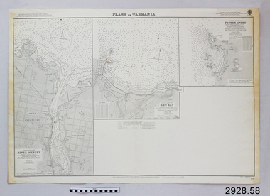
Document - Navigation Chart, Plans in Tasmania - Foster Inlet, River Mersey and Emu Bay
Navigation Chart - Plans in Tasmania - Foster Inlet, River Mersey and Emu Baywarrnambool, shipwrecked-coast, flagstaff-hill, flagstaff-hill-maritime-museum, maritime-museum, shipwreck-coast, flagstaff-hill-maritime-village, shipwrecked-artefact, river mersey, foster inlet, emu bay, navigation chart -
 Ringwood and District Historical Society
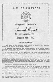
Pamphlet, F.P. Dwerryhouse, Town Clerk and Treasurer, Ringwood Council's Annual Report To The Ratepayers (December 1962), 1962
City of Ringwood community information report issued December 1962, including financial summary and sections covering Valuations, Private Street Construction, Other New Works, Sewerage, Planning Scheme, Annual Special Clearance of Refuse, Elderly Citizens' Village, Elderly Citizens' Clubrooms, Fire Hazards, and list of Council Representatives.Vale - ex-Cr. A.T. Miles, Mr. A.F.B. Long, Mr. F.R. Lucas.rinx -
 Ringwood and District Historical Society
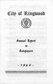
Pamphlet, F.P. Dwerryhouse, Town Clerk and Treasurer, City of Ringwood Annual Report To The Ratepayers - 1964, 1964
City of Ringwood community information report for 1964, including sections covering Valuations-Rates, Sanitary Service - Sewerage, Private Street Construction, Loughnan Hill Road Scheme, Other New Works, Planning Scheme, Fire Hazards, Fly Control, Dogs, Annual Special Clearance of Refuse, Garbage Removal, Immunisation, Street Lighting, House Numbers, Home Help, Scholarships, Rubbish Dumping, Vandalism, and list of Council Representatives.rinx -
 Ringwood and District Historical Society
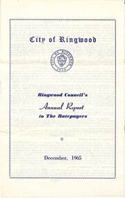
Pamphlet, F.P. Dwerryhouse, Town Clerk and Treasurer, Ringwood Council's Annual Report To The Ratepayers - December 1965, 1965
City of Ringwood community information annual report for 1965, including sections covering Ringwood Planning Scheme, Extensions to Lionswood Village, Building Activity, Private Street Construction, Other Road Works, Drainage Works, Town Planning, Retention of Native Flora, General Rate Notice, Sanitary Service Charge, Dandenong Valley Authority Rate, Decimal Currency Conversion, Children's Playgrounds, Annual Special Clearance of Refuse, Garbage Removal, Immunisations, Infant Welfare Centres, Home Help Service, House Numbering, Dogs, Horse Riding, Fire Hazards and Burning Off, Secondary School Grants, and list of Council Representatives.rinx -
 Ringwood and District Historical Society
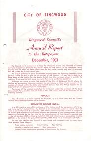
Pamphlet, Ringwood Council's Annual Report To The Ratepayers (December 1963)
City of Ringwood community information report issued December 1963, including financial summary and sections covering Valuations, Private Street Construction, Other New Works, Planning Scheme, Elderly Citizen' Village and Clubrooms, Cool Store Site, Wantirna Road (bridge) Widening, Fire Hazards, Fly Control, Dogs, Refuse, Garbage Removal, Immunization, and List of Council Representatives.Tributes to the late Frank Russell Lucas, original Borough Engineer, and ex-Councillor R.O. Spencer.rinx -
 Ringwood and District Historical Society
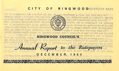
Pamphlet, Ringwood Council's Annual Report To The Ratepayers - December 1968, 1968
City of Ringwood community information annual report for 1968, including sections covering Finance, General Valuation and Rater Payments, Property Ownership Changes, Refuse, Sanitary Serviced, Sewerage Connections to MMBW, Dandenong Valley Authority, Residential Flat Control Planning Scheme, Immunisation, Home Help, Elderly Citizens' Clubrooms, Library, Civic Centre, Golf Course, Sale of Council Land, Swimming Centre, Holiday Play Centre, Civic Week, Lake Reserve Improvements, Rubbish Dumping, Street Trees, Vandalism, White Ants, Street Construction, Fire Hazards, Dog Nuisance, House Numbering, Citizens' Advisory Service, Infant Welfare Centres, and a list of departing and current Council Representatives. Also includes general reminders regarding rat extermination, free firewood for age pensioners, overhanging vegetation, and spouses voting rights.Obituary - Mr. F.P. Dwerryhouse, Town Clerk for the past 9-1/2 years passed away on 6th December after a short illness.rinx -
 Ringwood and District Historical Society
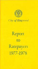
Booklet, City of Ringwood Report to Ratepayers 1977-1978, 1977
Yellow covered community information booklet for Ringwood residents covering Council Representatives' and Service Organisations' contact details, Major Works, Planning (Ringwood Business Centre), Recreation, Litter, Rubbish Tip, Construction of Private Streets (Greenway/Dickasons Road Group), Health and Community Services, Municipal Elections, Rates, Dog Registrations, Overhanging Foliage, Building By-laws, Vandalism, House Numbering, Fire Hazards, Council Finances, and other points of general interest. and local services, sporting, and cultural facilities. Includes two City of Ringwood Free Tipping Vouchers valid until the end of 1978.Mayor's Message - Cr. Lawrie Lawrenson.rinx -
 Ringwood and District Historical Society
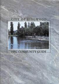
Book, City of Ringwood, City of Ringwood 1992 Community Guide, 1992
... STRATEGIC BIKE PLAN 11 STREET INDEX A-L 25 STREET INDEX L-Z 28... & HIGHLAND CARNIVAL 13 RINGWOOD GOLF COURSE 7 STRATEGIC BIKE PLAN 11 ...Community information book issued by City of Ringwood for 1992 - covering the facilities and activities of the Ringwood Council and other local organisations and associations. Includes two Aquatic Centre entry vouchers valid until June 30th, 1992.CONTENTS: (page no.) 1991/92 COUNCIL REPRESENTATIVES 4 1992 CALENDAR 51 AQUATIC CENTRE 8 AQUATIC CENTRE VOUCHERS 49 CHIEF EXECUTIVE'S REPORT 6 CIVIC CENTRE TELEPHONE INDEX — DIRECT DIALLING 53 COMMUNITY DIRECTORY 35-47 COMMUNITY SERVICES 17-19 COUNCIL & COMMITTEE CYCLES 4 COUNCIL FINANCES & 1991/92 RATES 16 COUNCILLORS 3 FUNCTIONAL RESPONSIBILITIES 15 HISTORY OF RINGWOOD 5 HOUSING & RESIDENTIAL DEVELOPMENT 29-30 INFRASTRUCTURE 34 LOCAL, STATE & FEDERAL GOVERNMENT ELECTIONS 32 MANAGEMENT TEAM 14 MAYORAL MESSAGE – Cr. Max Williams 1 NEIGHBOURHOOD MAP 26-27 NOTES 52 PAPER & CARDBOARD COLLECTION SERVICE 22 PARKS & RESERVES — PUBLIC FACILITIES 31 PROTECTING OUR COMMUNITY 23-24 PROTECTING THE ENVIRONMENT 20-21 RINGWOOD FESTIVAL & HIGHLAND CARNIVAL 13 RINGWOOD GOLF COURSE 7 STRATEGIC BIKE PLAN 11 STREET INDEX A-L 25 STREET INDEX L-Z 28 THE LIBRARY 12 THE RINGWOOD CONVENTION & PERFORMING ARTS CENTRE 10 TRAFFIC MANAGEMENT 33 YOUR PERSONAL DIRECTORY 50 rinx -
 Ringwood and District Historical Society
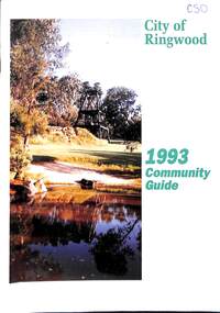
Book, City of Ringwood, City of Ringwood 1993 Community Guide, 1993
Community information book issued by City of Ringwood for 1993 - covering the facilities and activities of the Ringwood Council and other local organisations and associations. Includes two Ringwood Aquatic Centre bonus entry vouchers valid until June 30th, 1993. Cover photographs: Front - Poppet Head, Ringwood Lake; Back - Opening of North Ringwood Child Care Centre. CONTENTS: (page no.) Message from the Mayor – Cr. Greg Adkins, J.P. 3 Councillors 4 Council & Committee Cycle 5 Council Elections 6 History of Ringwood 7 Chief Executive's Report 8 The Management Team 9 Functional Responsibilities 10 Community Liaison 11 Council Expenditure for 1992/93 12 Rates and Valuations 13 COUNCIL SERVICES Community Services 14 Protecting the Environment 17 Protecting Our Community 19 Town Planning 21 Building 22 Design and Investigation 23 Works 24 Street Index - Electoral Wards 25 Neighbourhood Map 26 and 27 COUNCIL RECREAION AND LEISURE FACILITIES Ringwood Golf Course 29 Aquatic Centre 30 The Ringwood Convention Centre 32 Ringwood Library 34 Ringwood Recreation 35 Parks and Reserves 30 Community Directory 38-50 Community Information Data Bank 51 Aquatic Centre Vouchers 51rinx -
 Ringwood and District Historical Society
Pamphlet, Subdivisional Auction Sale, Bedford Park, Ringwood - 1924
Bedford Park subdivisional development did not eventuate. The land adjoining the railway line became parkland with provision for sporting facilities and the remainder was purchased by the Education Department as the site for Ringwood High School/Secondary College. Double sided bifolded auction sale advertisement including subdivision features and local facilitiesSubdivision plan includes Bedford Road, Graham Road, Joyce Street, Anderson Street, and Adams Street -
 Ringwood and District Historical Society
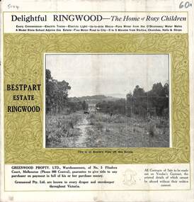
Pamphlet, Land Sale Brochure, Bestpart Estate, Ringwood - circa 1925
Twelve page land sale brochure including photographs, subdivision features and local facilities. Additional flyer with conditions of sale and prices for estate blocks.Subdivision plan includes Bedford Road, Greenwood Avenue, Caroline Street, Wilanna Street, Henry Street, Haig Street -
 Ringwood and District Historical Society
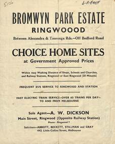
Flyer, Bromwyn Park Estate, Ringwood - 1946 - Avertising Brochures and Map
Two pages of subdivision features, services and locationSubdivision plan includes Alexandra Road, Marwarra Street, Tooronga Road, Hilary Grove, Morcom Avenue. -
 Ringwood and District Historical Society
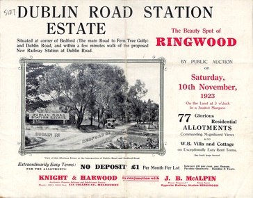
Pamphlet, Land Sale Brochure, Dublin Road Station Estate - 1923
"Extracts from Recent Daily Newspaper - Ringwood Train Service - STATION WANTED AT RINGWOOD EAST. A deputation from the Ringwood East Railway League and Progress Association waited on the chairman of the Railway Commissioners yesterday afternoon and asked that a railway station be erected at Dublin-road, a mile and a quarter from Ringwood. The deputation urged that there were 81 passengers who, if the station were provided, would make daily use of it, and that as the Commissioners had purchased a site for a station at Dublin-road it was evident they had at one time considered it the most suitable site. The Chairman of Commissioners stated that the estimated cost of the station was £3700. Land owners in the locality should pay a proportion of the cost. Members of the deputation replied that there would be no difficulty in raising the money."Multi-fold brochure advertising public auction of residential allotments on Saturday, 10th November, 1923. Brochure includes subdivision features, local facilities and photographic images of the area and details of proposed new railway station at Dublin Road.Subdivision plan includes Dublin Road, Alexandra Road, Vonadawn Avenue, Green Street, Howard Avenue, Wood Street, and Bedford Road (Main Ferntree Gully Road). Auctioneer - Knight & Harwood, 315 Collins Street, Melbourne, Phones Central 10615, 10616. Agent - J.B. McAlpin, Opposite Railway Station, Ringwood, Phone Ringwood 7. -
 Ringwood and District Historical Society
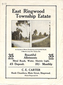
Flyer, Subdivisional Land Sale Brochure, East Ringwood Township Estate, Vic. - 1923
Bi-folded double sided land subdivision sale advertisement with location map and summary of local facilities and services. Includes two additional images of allotment plan with subsequent handwritten notations.Subdivision includes Mount Dandenong Road, Grey Street, and Eastfield Road. Agent - C.E. Carter, Bank Chambers, Main Street, Ringwood. Phone Ringwood 24. -
 Ringwood and District Historical Society
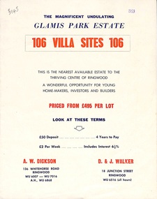
Flyer, Land Sale Brochure, Glamis Park Estate (Wantirna, Vic.) - 1959
Street name Carnarvon Avenue on the subdivision plan became Selkirk Avenue at some stage during or subsequent to development of the Estate.Bi-folded advertisement for sale of residential allotments, including summary of subdivision features and local facilities.Subdivision includes Wantirna streets - Wantirna Road, Carnarvon Avenue, Inchcape Avenue, St Thomas Avenue, St Davids Drive, Dudley Avenue, Angus Avenue. Agents - A.W. Dickson, 136 Whitehorse Road, Ringwood, Telephone WU 6007, WU 7016, A.H. WU 6868. D. & J. Walker, 18 Junction Street, Ringwood, Telephone WU 6516 (all hours). -
 Ringwood and District Historical Society
Article - Newspaper Clipping, Land Sale Advertisements, Golden Hill Estate, Ringwood - 1965, 1966, and Plan of Survey of Lot 8, Mullum Mullum Road Ringwood, 1970
Newspaper clippings from Melbourne Sun newspaper (11th December 1965 and 15th January 1966) advertising sale of land - Golden Hill Estate, Ringwood, with summary of features and aerial photograph including artistic representation of street layout. Subdivision includes Mullum Mullum Road, Sonia Street, Jill Court, Linda Drive, Eve Court, Alma Court, and Jacynthe Court. Attachments include reference to Lot 46 as site of original Peter Vergers' orchard residence and subsequent 1970 surveyor's Plan of Survey of Lot 8 Mullum Mullum Road Ringwood, LP 67513, Cert of Title 8581/429.Agent - Aaron, King & Co., Suite 2, 33 Queens Road, Melbourne. (Phone) 26-2443, A.H. 850-2195. Plan of Survey signed on 25.7.1970 by Roger M. Gamble, Land Surveyor, 28 Summit Crescent, Ringwood 3134. -
 Ringwood and District Historical Society
Flyer, Subdivisional Land Auction Sale Brochure, Grand Central Estate, Ringwood, Vic. - 1925
Douglas Street shown in the estate plan did not eventuate, but was developed as a public reserve. Refer also to Reg. No. 5149 for 1924 auction sale of land also titled Grand View Estate situated further north in Ringwood.Double sided multi-folded page advertising public auction sale on Saturday, 31st October, 1925, of residential allotments highlighting local facilities, services and layout of the estate. Includes panoramic view of Ringwood and other local photographic images.Subdivision includes Great Ryrie Street, Heathmont Road, Douglas Street, Garden Street, and Bellevue Avenue. Agents - Knight & Harwood, 315 Collins Street, Melbourne, Phone 10615, 10616 Central, in conjunction with J.B. McAlpin, Opposite Railway Station, Ringwood. Phone Ringwood 7. -
 Ringwood and District Historical Society
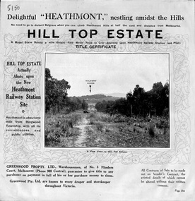
Pamphlet, Atlas Press Pty. Ltd., Melbourne, Land Sale Brochure, Hill Top Estate, Heathmont, Vic. - circa 1925
Twelve page land sale brochure promoting Heathmont and Ringwood area including photographs, subdivision features and local facilities. Subdivision plan includes Heathmont Road, Balfour Avenue, Edith Street, Edna Street, and Great Ryrie Street. -
 Ringwood and District Historical Society
Flyer, Land Sale Brochure, Heathmont Estate, Vic. - circa 1960
Advertisement for sale of residential lots - Heathmont Estate, opposite Heathmont Railway Station, with map and locality plan.Subdivision includes Canterbury Road, Royal Avenue, Coleman Street, Stoda Street, Herman Street, and Campbell Street. Agent - A.W. Dickson, opposite Station, Ringwood. Phone WU6007. -
 Ringwood and District Historical Society
Flyer, Executor's Auction Subdivision Advertisement, Lilydale Road and Oban Road, Ringwood East, Vic. - 1937
Single page advertisement for Executor's Auction of land in Ringwood East on Saturday, May 29, 1937 with locality map showing 26 building sites for auction highlighted in brown, and brief summary of local services available. Subdivision includes Old Lilydale Road, Joseph Street, Dynes Street, Albert Street (later Wyrunga Street), Carcoola Road, and Mount Dandeong Road. (Carcoola Road incorrectly shown as Oban Road on the subdivision plan). Auctioneer - C.E. Carter, (Phone Ringwood 24. -
 Ringwood and District Historical Society
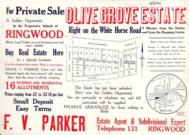
Flyer, Land Sale Advertisement, Olive Grove Estate, Ringwood, Vic. - 1926
Further development of 9 shop sites took place along Whitehorse Road (later street numbers 58 to 64 Whitehorse Road) between New Street and Olive Grove around 1950 - See Victorian Collections reference 5227.Single sided page with red and blue print advertising Olive Grove Estate business and residential allotments, including subdivision plan and summary of local services.Subdivision includes Whitehorse Road, New Street, and Olive Grove. Agent - F.V. Parker, Telephone 131, Ringwood. -
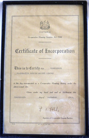 Warrnambool and District Historical Society Inc.
Certificate - Warrnambool Co-operative Housing Society Limited Certificate of Incorporation, 1951
Co-operative housing societies were loan societies established in the mid to late 20th century. They were based on the structure of a group of borrowers approximately 40, who lived within a radius of thirty miles joining a co-operative. They had the right to select their own site, plans and amount that they would like to spend. The co-operatives were administered by accounting firms. There were conditions placed on the borrowers in regard to amounts able to be borrowed and size of dwelling and percentage of cost which could be borrowed.The era of post-World War Two saw a shortage in a number of areas one of which was housing. The co-operative Housing scheme was preferred by many as it avoided the block approach which had been used by the Housing commission. The co-operative housing scheme proved to be of benefit to many families around that time.Framed certificate with black text Stylised frame around text. Paper is cream.H.E Daw Gov Print., Melb. Victorian Government seal in bottom Right hand corner. Registrar of Co-operative housing societies, Victoria. warrnambool, co-operative housing society 1951 -
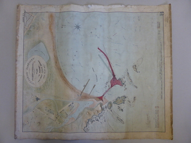 Warrnambool and District Historical Society Inc.
Map, Warrnambool Harbour 1879, 1879
This map shows the plans by eminent harbour engineer, Sir John Coode in 1879. Construction of the breakwater commenced in 1884 and was completed in 1890. Coode first visited Australia in 1872 when he commenced work with the Melbourne Harbour Trust to report on ways to improve Melbourne Port. He is considered one of the most eminent harbour engineers of the 19th century. His original plans for Warrnambool were revised because of cost but then subsequently found to be inadequate and later extended. This was not successful either and the harbour continues to have silting problems to this day. The Warrnambool Breakwater is of historical importance to Victoria and as this map depicts the original plans, it too has great historical significance. It is also significant with its association with Sir John Coode, who was one of the most important port engineers of the 19th century. He worked to improve ports along the Victorian coast including Portland, Geelong, Port Fairy and Lakes Entrance. While this map demonstrates the engineering skills of the era, it also reflects the limitations when natural elements are involved. Its Historical importance also lies in the depiction of items on the map which relate to Warrnambool’s early history. Paper on linen map coloured, and depicting the harbour area of Warrnambool with the proposed breakwater plan in red. It has Victorian Harbours information in oval at top of map. It shows depths of some areas.In oval at top, “Victorian Harbours Warrnambool plan to accompany Sir John Coode report dated 28th Feb 1879. Drawing No 2. Scale 500 feet to 1 inch at bottom centre. Sir John Coode signature in bottom left corner. A 33 A on bottom left reversesir john goode, warrnambool harbour map, warrnambool harbour map 1879, port of warrnambool map 1879 -
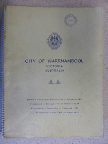 Warrnambool and District Historical Society Inc.
Book, City of Warrnambool, 1961
This book is a report on the development of the city of Warrnambool in 1960. The seven sections it covers are, 1 Town Planning and beautification 2 Culture and Education 3 Town promotion and tourism 4 Recreation and youth work 5 Industrial development 6 Town Development 7 Community organization. There is a very comprehensive study on each of the sections. The population at this time was 15697. This report has social, historical and research significance. It is a comprehensive study of the city as it was in 1960, listing clubs, organisations schools and sporting clubs. It provides information on any development such as the Olympic pool and St Pius X1 school in West Warrnambool and the building of the Pontings store on the Lava St corner. It relates facets of our history which have changed dramatically in the last 60 years with the report on Peter Hand’s tobacconist having 3 vehicles covering the district travelling 4700 miles a month selling cigarettes. It provides statistical evidence for organisations such as Australia Post, train and freight services and the hospitals.Large yellow soft card cover with spiral binding. Title and city details are printed in blue on cover with city logo towards top of front cover. Pages are not numbered. It is divided into seven sections, each denoted by blue page with section title printed in blue on page.Circular stamp on front cover,” Warrnambool Standard Proprietary Limited.” K L Arnel town clerk. warrnambool 1960, warrnambool directory 1960