Showing 659 items matching "survey plan"
-
 Bacchus Marsh & District Historical Society
Map, Plan of the property of Messers Atkins and Clarke to be sold at the Mansion, Bacchus Marsh 19th April 1856. Copy 1
... did the survey work for the plan (R.C. Bagot) and who... did the survey work for the plan (R.C. Bagot) and who ...This plan of land allotments for sale indicates the property once owned by the Bacchus family in and around the township area of Bacchus Marsh. The Bacchus family sold their property in Bacchus Marsh to John Atkins and Robert Nalder Clarke in March 1851. Atkins and Clarke kept the property for a number of years until April 1856 when these allotments were put up for sale.This plan is almost identical to another copy held by the Bacchus Marsh and District Historical Society, VC Record 452, BMDHS collection). This plan, VC Record 707 Copy 1, contains a little more detail overall than VC Record 452 Copy 2, such as who did the survey work for the plan (R.C. Bagot) and who the selling agents were, (W.M. Tennent), and on the right side of the plan near the Lerderderg River is indicated the general area for a second parcel of land from this sale which is to be sold. There is also a compass illustration indicating north and south compass points.This is a very early land sales plan for the township of Bacchus Marsh and it therefore provides some clues as to how the early urban development of the township took place. Upon seeing the map in 1911 Bacchus Marsh Express newspaper editor Christopher Crisp wrote "The sale appears to have created the present township, which had a nucleus in earlier times further east", Express, 30 September, 1911, page 3.A single page paper plan showing allotments of land for sale. The subdivided land shown was owned by John Atkins and Robert Nalder Clarke, but previously owned by the Bacchus Family and was in and around their Manor House (Mansion) property in Bacchus Marsh.There are 5 portions of land further divided into numerous small portions. The land for sale is bounded by the present day streets of Main Street, Young Street, McFarland Street, Morton Streets, Crook Street, and part of the eastern section extends to the Lerderderg River. Scale: 8 chains to 1 inch The plan is pasted into a bound volume containing 76 maps or plans in total. BMDHS Loc: AR/B12/S4 Bacchus Marsh Township and Nearby Districts Maps Volume In-house Digital copies: BMDHS, Computer Network: Maps\Bacchus Marsh Township and Nearby Districts Maps VolumeHeading: Plan of the first portion of land. The property of Messers Atkins and Clarke situate at Bacchus Marsh. To be sold by W.M. Tennent & Co. at the Mansion on the Ground on Saturday the 19th April 1856. Below heading: Jas Ferguson, Lithographer On upper right side: Subdivided by R.C. Bagot London and Liverpool Chambers, Melbourne. 'Thos Taubman'. Post Office Stamp: BACCHUS MARSH VICTORIA MY 6, 63bacchus marsh victoria maps, bacchus family, land sales, manor house bacchus marsh -
 Bendigo Historical Society Inc.
Document - HANRO COLLECTION: PLANS AND REPORT FROM FIRE ENGINEERS AND SURVEYORS, 1954/1960
... to Detail Block Plans & Fire Surveys. Correspondence from... to Detail Block Plans & Fire Surveys. Correspondence from ...Plans and Report from Fire Engineers and Surveyors:- Green Card has a rectangular box with an ornate border in the centre of the front page. Inside the border is typed in black *Plans, Hanro (Aust) Knitting Mills Limited, Bendigo Victoria Australia. At the bottom:- Mahlstedt's (Vic) Pty Ltd. (est. 1884). Consulting Fire Engineers and Surveyors. Temple Court, 422 Collins Street., Melbourne C.1. Telephone 673069. Inside the folder is the Key to Detail Block Plans & Fire Surveys. Correspondence from Mahlstedt's Pty Ltd to Edward Lumley and Sons, Insurance Brokers regarding a new survey and the changes to the building with respect to fire hazard. Main report recommendations and general information on the building. Blue print of Shirt Factory, Inglewood Road No. 1061 by Welmar Ltd Bendigo. Small blue print of the main buildings showing different work areas. Blue print No.1119 of John Brown Industries Ltd Alley Street Bendigo showing work areas. Box 116AMahlstedt's (Vic) Pty Ltdhanro, clothing, plans and reports, edward lumley & sons pty ltd. hanro knitting mills. mahlstedt's (vic) pty ltd. welmar ltd bendigo. john brown industries ltd. -
 Southern Sherbrooke Historical Society Inc.
Information Folder - Germans Gully & Church of Freedom
... , Belgrave Heights, from Victorian Government website -plan of survey..., Belgrave Heights, from Victorian Government website -plan of survey ...Information folder containing items pertaining to the history of Germans Gully & Church of Freedom. Contents: -2 photos, gates of Church of Freedom -photocopy, sketch by Barbara Smith dated 29 October 02 of stone huts formerly on the property -article, "Fool around with scarlett!", Australian Post, 6 July 1972, re. John Wilson (colour copies in A3 folio #1 marked VSSH 71) -letter, Mother Superior Anne Beatrice, Church of Freedom LTD to Cr. M. Douglas, dated October 1983, requesting an audience with the council of the Shire of Sherbrooke. Attatched are biographical notes on John Wilson and his family -Memorandum of Association, Church of Freedom -Property report, 141 Mt Morton Rd, Belgrave Heights, from Victorian Government website -plan of survey, Crown Allotment 70, Parish of Narree Worran, showing Mt Morton Rd -Letter, dated 3 October 2005, from Gore Historical Museum & Hokonui Heritage Research Centre, Gore, New Zealand, to Mrs Eva Evans, Milton, New Zealand, re. John Charles Wilson, and covering the next three items -Funeral notice for John Wilson -Biographical entry for John Wilson from "Southern People - A Dictionary of Otago Southland Biography", 2 sheets -Biographical details from "Waitaki & Districts - A History", 1 sheetjohn wilson, church of freedom, germans gully, international bio colour naturopathic centre, wilson family -
Bendigo Historical Society Inc.
Map - HUSTLER'S & CHRISTMAS LINES OF REEFS - PLAN OF LINES OF SECTION OF REEFS
... Underground Survey of Mines Bendigo. Plan of Cross Section... Underground Survey of Mines Bendigo. Plan of Cross Section Lines ...Underground Survey of Mines Bendigo. Plan of Cross Section Lines Shewing Connections with Trigonometrical Stations and Base Lines. 13/3/99 Signed ? Stirling. Places and mines mentioned Speciman Hill, Tambour Major, Lansell's 180, Victory and Pandora, Great Extended Hustler's, Windmill Hill on Victoria Reef. Next part of map is a Plan of Lines of Section between the Hustler's and Christmas Lines of Reefs. 8/3/99. Signed ?. Transverse Section. Shows Tambour Major Co., near the Christmas Line of Reef, Crosscuts and their depth, geological features and stone encountered. Then shows Thistle Line, Charshalton Line, Napoleon Line, Nell Gwynne Line, New Chum Line, Lansell's No 180 with levels, depths and geological features. Drawing is continued in three parts to fit on paper. Lansell's East Shaft with levels and depths, geological features and stone encountered. Sheepshead Line, Old Shaft, Garden Gully Line, Victory and Pabndora Co with crosscuts, depths, geological features and stone encountered. Paddy's Gully Line, Derby Line, Millers Line, Hustler's Line, Great Extended Hustler's Co with levels, depths, geological features and stone encountered. A note beside a Saddle Reef: 360,000 pounds paid in dividends from this reef. Average ounces per ton gold noted where found. Reference Table for stone and geological features. Datum Line 700 feet above Sea Level Unscannedmining, parish map, hustler's & christmas lines of reefs, plan of lines of section of reefs, ? stirling, specimen hill, tambour major, lansell's 180, victory & pandora, great extended hustler's, windmill hill, victoria reef, tambour major co, christmas line, hustler's line, thistle line, carshalton line, napoleon line, nell gwynne line, new chum line, lansell's no 180, lansell's east shaft, sheepshead line, old shaft, garden gully line, paddy's gully line, derby line, miller's line, hustler's line, great extended hustler's co -
 The Beechworth Burke Museum
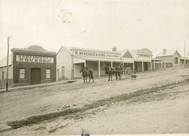
Photograph, 1910
Taken in 1910, this photograph depicts a scene of Bridge road in Newtown, Beechworth. Walking on the road are two men on horseback, one of which is pulling a carriage with a small dog standing beside it. Behind them are a line of small buildings and shops. Small industries began to expand dramatically in Beechworth, particularly during the 1860s, leading to a strengthening of the towns economy. As early as 1853, areas surrounding the waterway known as Spring Creek were surveyed with the intent of mapping out plans for new roads and building allotments. Land was sold and new buildings were erected, creating an expansion of the Beechworth township and retail services. One building shown in this photograph is Straughair and Duncan's Beechworth Foundry. This business was established in 1858 through the partnership of Mark Straughair and John Duncan. It dealt mostly in the manufacturing of castings and mining machinery, receiving orders from all over the Ovens district. The Business eventually collapsed after the deaths of Straughair in 1882 and Duncan in 1896 but was reopened by W.H. Phillips in 1905. The two other buildings are both associated with the name McKenzie. Evidence suggests that the McKenzie family has a long association with the town of Beechworth. This photograph is historically significant as it provides insight into the nineteenth and twentieth century industrial expansions that happened in the area of Newtown, leading to the urbanisation of Beechworth. Black and white rectangular photograph printed on matte photographic paper mounted on card.Reverse: Newton / 1997.2648 / 33 Newton Beechworth / 84-219-1 / McKenzies / BMM3055 / newtown beechworth, bridge road, 1910, j. duncan, r. mckenzie, m. straughair, industrial growth, ford street, beechworth foundry, straughair and duncan, mckenzie and sons grainstore, mckenzie family store -
 Orbost & District Historical Society
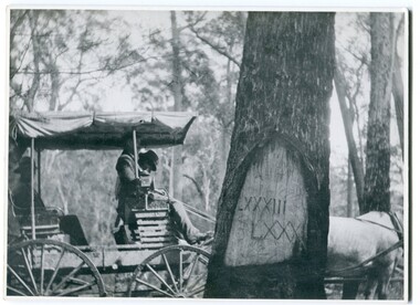
black and white photograph, 1913
When marking a boundary for a registered plan, a surveyor would place “Reference Marks” with a stated bearing and distance to a boundary corner. These trees were typically marked by cutting the bark of the tree in a shield or blaze. Until July 1886, surveyors were only able to use trees as reference marks to boundary corners. After July 1886 surveyors were able to use “permanent marks” which were either a glass bottle, gas pipe or iron bolt (for homestead surveys only). This photograph shows the reference tree, 83 miles from Marlo via the original surveyed road v ia Sydenham Inlet and Tamboon, south of Mount Drummer to the New South Wales border - now the Princes Highway.This is a pictorial record of an old survet tree. Knowledge of their location, abundance and condition not only provide important insights to past survey practice, but also provide a lasting legacy of a regions land-use history. Old survey trees serve as one of the few remaining physical legacies of early European land settlement history.A large black / white photograph of a horse and buggy pulled up alongside a reference tree which has notches and markings of Roman numerals.on back - " Refernce tree 83 miles from Marlo........to N.S.W. Border"survey-tree reference-tree -
 The Beechworth Burke Museum
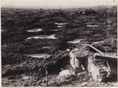
Photograph, c. 1917
This photograph depicts the third battle of Ypres (Battle of Passchendaele). Depicted is a trench battlefield that has been turned to mud. Two army tank vehicles have been buried in the mud of the trenches. A single soldier stands in the background surveying the battlefield.After mid-1917, and following mutinies in the over-strained French Army, the British Forces had to assume an even greater role in the war on the Western Front. For Field Marshal Sir Douglas Haig, the British commander-in-chief, this provided an opportunity to launch an offensive that he had long wanted. Attacking from Ypres in Belgium, he planned to drive the Germans from the surrounding dominant ridges and even hoped to reach the Belgian coast. Following on the success at Messines in June, he unleashed his great attack on 31 July 1917. Fighting went on, often in appalling weather and despite crippling losses, until November. Finally, with the army stuck in muddy fields churned up by the artillery fire, the bloody offensive came to an untidy close. Many would afterwards call this offensive, actually a series of battles, after the name of the village that had become the last objective – 'Passchendaele'. In the Battle off Passchendaele, the 1st, 2nd and 3rd Australian Divisions captured Broodseinde Ridge on 4 October 1917. It was a vital victory. But, then it began to rain. Five days later the 2nd Australian Division suffered heavily in a further attack in the mud. Finally, on 12 October, another attack, involving the 3rd Division assisted by the 4th, was made against the village of Passchendaele atop the main ridge. In the face of heavy fire, the men fought in the mire while struggling to keep up with their artillery barrages. Ground was taken but it could not be held. In wretched conditions, with casualties mounting at an appalling rate, the Australians had to fall back. The troops were finally exhausted and could do no more; by 15 November they handed over to the Canadians.Black and white rectangular reproduced photograph printed on mate photographic paperReverse: 6523/ (A copyright and reproduction notice from the Australian War Museum, printed upside-down in blue ink)/military album, burke museum, beechworth, military vehicle, trenches, trench warfare, wwi, world war one, world war 1, ypres, belgium -
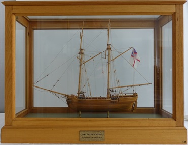 Flagstaff Hill Maritime Museum and Village
Craft - Ship Model, Port Jackson Schooner
This ship model is of a Colonial Port Jackson schooner, originally designed by the British Admiralty in 1803 as a response to the request of New South Wales' Governor Arthur Phillip. The drafts for the original plans are in Greenwich, UK, in the National Maritime Museum. The model is a Ledition edition, number 2 of 5, modelled by Bill Leonard. The model is rigged and decked in the manner of David McGregor. The flag on model of Port Jackson schooner is that of the British White Ensign which was used as the flag design of the Royal Australian Navy from 1911 - 1967. In 1785 the First Fleet arrived in the new British colony of Port Jackson (now Sydney Harbour) in New South Wales and Arthur Phillip was appointed as the first Governor. The following year Governor Phillip asked the English Royal Navy to provide drafts and materials for two ships for use in the Port Jackson colony for exploring and surveying rivers. The vessels needed a shallow draught and to be made from local cedar timber. He asked for the frames of the schooners to be provided along with shipwrights to assemble them. Many years later, in 1803, Governor Phillip’s request was fulfilled but he had already resigned from his post. The drafts titled ‘Schooner for Port Jackson’ were despatched by the Royal Navy from England to Australia. The original draft is still in the National Maritime Museum in Greenwich, UK. Meanwhile, the NSW Government had already built various other ships before 1803. In 1797 His Majesty’s Dockyard was opened at Port Jackson for building larger vessels. The Royal Navy’s 1803 design of a ‘Schooner for Port Jackson’ has been recognised on the obverse of Australia’s twenty dollar banknote since 1994. A sketch of the schooner is beside the portrait of Mrs Mary Reibey, who arrived as a convict and rose to become a respected and successful owner of a cargo shipping business. Her fleet included the Mercury, a schooner similar to the 1803 design for the Port Jackson schooner. Although the 1803 plans for a ‘Schooner for Port Jackson’ are commonly believed to be used for the first ship built in Australia, no records have been found of any ships being built according to these plans. However, it can be claimed that the plans were the ‘first Royal Navy plans made for a ship for use at Port Jackson, and to be built at Port Jackson, in Australia’. William (Bill) Leonard passed away on March 1st 1995.This ship model is significant for its representation of an early Australian colonial schooner. The 1803 Royal Navy’s plans for the colonial ‘Schooner for Port Jackson, were for the first ship specifically designed by the Royal Navy to be built and used in Port Jackson, for use in exploration and surveying of Australian ports and rivers. The plans are associated with Australia’s colonial settlement in the late 1700s. This ship model is significant for its association with the emblems of Australia’s history on the twenty dollar banknote. The colonial Port Jackson schooner is considered significant to Australian history, and represented on the 1994 twenty dollar banknote and its new version being rolled out in October 2019.Ship model of a colonial Port Jackson Schooner. Two-masted sailing ship displaying the flag named The British White Ensign. Mode of light coloured stained timberl is mounted on brass legs inside a glass case with timber frame and base. Metal engraved plaque states that the model is as designed by The Admiralty in 1803. Model is a number 2 of 5 in a limited edition, made by Bill Leonard.Engraved on metal plaque "PORT JACKSON SCHOONER / As Designed By The Admiralty. 1803"flagstaff hill, warrnambool, shipwrecked-coast, flagstaff-hill, flagstaff-hill-maritime-museum, maritime-museum, shipwreck-coast, flagstaff-hill-maritime-village, ship model port jackson schooner, sailing ship, limited edition model, model maker bill leonard, david mcgregor design, maritime trade, maritime vessel, colonial port jackson schooner, pacific island trade in early 1800s, sydney cove, governor arthur phillip, governor philip gidley king, a schooner for port jackson, national maritime museum greenwich, australian $20 banknote -
 Ringwood and District Historical Society
Map - Ringwood Animal Welfare Clinic, 1958 Land Survey Drawing, Ringwood, Victoria
Plan of driveway and property east of Heatherdale Road and Canterbury Road corner, with details of house, shed, bungalow, dog pen, kennels and enclosures.Survey by H.L.M. 31-7-58. Scale 20'=1" -
 Bendigo Military Museum
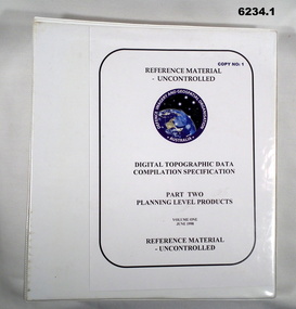
Manual - Digital Topographic Data Compilation Specification - Part 2 Planning Level Products, June 1998
The purpose of this document is to provide digital Topographic data compilation specifications for the Australian Defence Force (ADF) which are applicable to all areas of the Area of Direct Military Interest (ADMI) for the collection of features and attributes to populate the ADF topographic database.6234.1 A four ringed Folder containing A4 Paper, White, Metal Bindings, Chapters 1 to 8 6234.2 A four ringed Folder containing A4 Paper, White, Metal Bindings, Chapters 8 to 13 and Annexesroyal australian survey corps, rasvy, fortuna, army survey regiment, army svy regt, asr, director of survey - army -
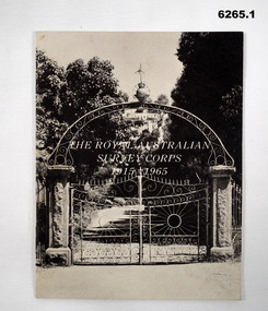 Bendigo Military Museum
Booklet - The Royal Australian Survey Corps 1915-1965, Army Headquarters Survey Regiment, 14.11.1965
A booklet produced to commemorate the 50th (Jubilee) Anniversary of the Royal Australian Survey Corps, contains an historical record of the Corps units, nominal roll of AHQ Survey Regiment unit members during the Jubilee year, photos and plans of Fortuna Villa.Booklet, 16 pages 6265.1 Front cover has black and white photo of the gated entrance to Fortuna Villa 6265.2 Front cover has an extract from the 1:100,000 map of Canberra, ACT. 6265.2 Internal contents are a reprint of 6265.1Inside of the booklet is signed by LtCol JK Nolan CO AHQ Svy Regt, later Director of the Survey Corps.royal australian survey corps, rasvy, fortuna, army survey regiment, army svy regt, asr -
 Bendigo Military Museum
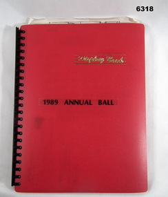
Administrative record - Army Survey Regiment Officers Mess Ball 1989, Army Survey Regiment, 25 Feb 1989
The Army Survey Regiment held Annual Balls at Fortuna Villa. This folder contains the documentation for the Logistics and activities associated with the planning and running of the Ball in 1989.A4 Plastic bound Red Display Folder containing documentation for the 1989 Annual Ball, Letters, signals and photosroyal australian survey corps, rasvy, fortuna, army survey regiment, army svy regt, asr -
 Bendigo Military Museum
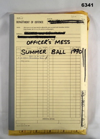
Administrative record - Army Survey Regiment Officers Mess Ball 1990, Army Survey Regiment, Bendigo, 12 Feb - 8 Mar 1990
The Army Survey Regiment held Annual Balls at Fortuna Villa. This folder contains the documentation for the Logistics and activities associated with the planning and running of the Officers Mess Summer Ball held in 1990.Manilla Correspondence Folder with grey cloth binding containing correspondence about the Army Survey Regiment Officers Mess Summer Ball of 1990.royal australian survey corps, rasvy, fortuna, army survey regiment, army svy regt, asr -
 Bendigo Military Museum
Administrative record - Army Survey Regiment Officers Mess Ball 1991, Army Survey Regiment, Bendigo, February 1991
The Army Survey Regiment held Annual Balls at Fortuna Villa. This folder contains the documentation for the Logistics and activities associated with the planning and running of the Officers Mess Ball held in 1991.Carboard Folder, blue, containing correspondence, invitations, photos and diagrams.royal australian survey corps, rasvy, fortuna, army survey regiment, army svy regt, asr -
 Bendigo Military Museum
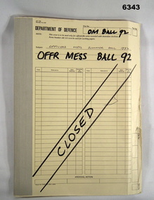
Administrative record - Army Survey Regiment Officers Mess Ball 1992, Army Survey Regiment, Bendigo, 1992
The Army Survey Regiment held Annual Balls at Fortuna Villa. This folder contains the documentation for the Logistics and activities associated with the planning and running of the Officers Mess Ball held in 1992.Correspondence Manilla Folder with cloth binding, Contains correspondence, photographs and diagrams.royal australian survey corps, rasvy, fortuna, army survey regiment, asr -
 Bendigo Military Museum
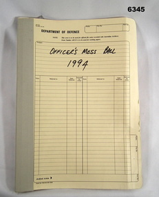
Administrative record - Army Survey Regiment Officers Mess Ball 1994, Army Survey Regiment, Bendigo, February 1994
The Army Survey Regiment held Annual Balls at Fortuna Villa. This folder contains the documentation for the Logistics and activities associated with the planning and running of the Officers Mess Ball held in 1994.Cloth bound manilla Correspondence File containing A4 paper documentsroyal australian survey corps, rasvy, fortuna, army survey regiment, army svy regt, asr -
 Bendigo Military Museum
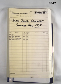
Administrative record - Army Survey Regiment Officers Mess Ball 1995, Army Survey Regiment, Bendigo, 1995
The Army Survey Regiment held Annual Balls at Fortuna Villa. This folder contains the documentation for the Logistics and activities associated with the planning and running of the Officers and Sergeants Mess Ball held in 1995. The folder also contains an after action review of the ball.Cloth bound manila Correspondence Folder containing minutes and correspondence for the Officers and Sergeants Mess Summer Ball of 1995royal australian survey corps, rasvy, fortuna, army survey regiment, army svy regt, asr -
 Bendigo Military Museum
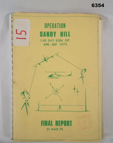
Administrative record - Operation Report - Operation Sandy Hill 1Fd Svy Sqn Apr - Sep 1975, 1 Fd Svy Sqn, 1976
Comprehensive Operation Report on Operation Sandy Hill conducted by 1Fd Svy Sqn Apr-Sep 1975 Part 1 Forward, Part 2 Planning and Mounting, Part 3 Final Report OC 1 Fd Svy Sqn, Part 4 Report Abn/EDM Gp, Part 5 Report Recon, Stn Marking and Traversing Gp, Part 6 Admin Report, Part 7 Report OC 171 Op Spt Sqn, Part 8 Computations and Results, Part 9 Observations and Recommendations.A4 size report held together with a plastic spiral binding, Light Cardboard cover includes many foldout Annexes"15" on front cover. Rubber stamp "Army Survey Regiment Map Library"royal australian survey corps, rasvy, fortuna, army survey regiment, army svy regt, asr -
 Bendigo Military Museum
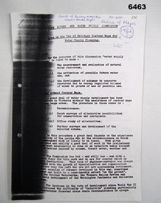
Administrative record - Use of Military maps for water supply planning, 1962
... then be used for water supply planning. Royal Australian Survey Corps ...These are typed notes on the use of Military maps for water supply planning. This demonstrates the value of Military Mapping containing accurate relief information that can then be used for water supply planning.5 x A4 pages of typed notes, poorly photocopiedroyal australian survey corps, rasvy, fortuna, army survey regiment, army svy regt, asr, state rivers and water supply commission -
 Bendigo Military Museum
Photograph - Co-ordinatorgraph Map Grid Production, Army Survey Regiment, Fortuna Bendigo, c1960s to 1970s
This is a set of seven photographs of map grid production using co-ordinatorgraphs at the Army Survey Regiment, Fortuna Bendigo. c1960s to 1970s. The Aristo Co-ordinatorgraph introduced in 1962 was a large heavy steel framed light table with a scribing head that moved in a XY direction using a vernier calibrated measuring scale to 0.001 of an inch. Whilst hand operated it was much quicker and accurate than manual grid and graticule calculation, plotting and scribing. Mapping PNG presented the Regiment with many challenges. WO1 Farrington and CPL John Dean developed computer software for the digitally controlled co-ordinatorgraph, the Calcomp 718 Flatbed Plotter. Much time was saved by automatically plotted cartographic grids and graticules, and automatically draw base compilation sheets complete with aerial triangulated stereo model control. This could be used for a number of maps and was the first step towards map automation. The history of co-ordinatorgraphs is covered in more detail with additional historic photographs, in pages 50 to 51 and page 88 of Valerie Lovejoy’s book 'Mapmakers of Fortuna – A history of the Army Survey Regiment’ ISBN: 0-646-42120-4. SGT Bill Boyd appearing in photo .1P reach the rank of WO1 and for 11 years was the technical warrant officer at the Detachment Army Survey Regiment located at Bonegilla, Victoria. He was awarded the OAM, the Order of Australia Medal for the development of the Flexiflow quality control system. This system comprised a series of job plans and charts linked to a task allocation to resource magnetic planning board. Using critical path analysis and task prioritisation, complex job planning was efficiently scheduled, and re-prioritisations readily made. Reproduction requirements were effectively coordinated by way of weekly courier to the Army Survey Regiment. Supervisors and technicians fully embraced the system as they could understand their role, others around them and the positive production achievements. Bendigo. See page 178 of Valerie Lovejoy’s book for more information on WO1 Boyd’s contribution to RA Svy.This is a set of seven photographs of map grid production using co-ordinatorgraphs at the Army Survey Regiment, Fortuna Bendigo. c1960s to 1970s. The photographs were printed on photographic paper and are part of the Army Survey Regiment’s Collection. The photographs were scanned at 300 dpi. .1) - Photo, black & white, c1960s, L to R: SGT Bill Boyd demonstrating Aristo Co-ordinatorgraph equipment to unidentified technicians (x3) .2) - Photo, black & white, c1960s, Aristo Co-ordinatorgraph equipment. .3) - Photo, black & white, c1960s, unidentified technician operating Aristo Co-ordinatorgraph equipment. .4) - Photo, black & white, c1960s, L to R: PTE Desi Asaris and CPL Kalen Sargent operating Aristo Co-ordinatorgraph equipment. .5) - Photo, black & white, Photo, black & white, c1970s, John Bloor operating Calcomp co-ordinatorgraph equipment. .6) - Photo, black & white, Photo, black & white, c1970s, unidentified technician operating Calcomp co-ordinatorgraph equipment. .7) - Photo, black & white, Photo, black & white, c1970s, L to R: SGT Andy Covington and SGT John Waight operating Calcomp co-ordinatorgraph equipment..7P annotated on back ‘Covington & Waight’.royal australian survey corps, rasvy, army survey regiment, army svy regt, fortuna, asr, carto, air survey -
 Bendigo Military Museum
Photograph - Johnson Ground Elevation Meter (JGEM) Survey Vehicle - Army Survey Regiment, Fortuna, Bendigo, c1960s
This is a set of 16 photograph of the Royal Australian Survey Corps’ Johnson Ground Elevation Meter (JGEM) Survey Vehicle taken at the Army Survey Regiment, Fortuna, Bendigo. The JGEM vehicle was extensively used by RA Svy within Australia from the late 1960s. A limited number of Ground Elevation Meter (GEM) station wagon type vehicles were manufactured by General Motors Corporation (GMC) in the USA for the United States Geological Survey, Canada’s mapping agencies, RA Svy and National Mapping (Natmap). The GEM was a four-wheel drive, four-wheel steer vehicle. Four-wheel steering was necessary to avoid systematic errors caused by non-tracking of front and rear wheels on conventionally steered vehicles. The manufacturer substituted the rear axle with a front axle and connected them to form the four-wheel steering mechanism. The two Australian GEM vehicles, referred to as Johnson GEMs (JGEMs) were converted into right-hand drive. After delivery in 1964, acceptance Natmap and RA Svy testing and operator training was undertaken at the Army's School of Military Survey located at Balcombe, Victoria. A small fifth wheel was mounted on a cantilever arm suspension midway between the front and rear wheels on the right side of the vehicle. It was lowered to and raised from its operating position by use of a constant pressure air cylinder. A telescopic bar, suspended between the front and rear axles, provided the reference datum for the angle measurement. The wheel provided the velocity or distance signal through a pulse generator system. A sensitive pendulum mounted on this bar provided the angle measurement for each minute distance traversed. The JGEM contained electromechanical instruments used to determine relative elevations, by trigonometric principles, along a traversed path. These relative elevations were obtained through apparatus which measures the instantaneous angle of inclination of the road and the instantaneous velocity of the meter along such a path. Road routes over which the JGEM operated were planned so that each started and ended as near as practicable to an existing point of known elevation (formally referred to as a level traverse bench mark). The difference in height from the bench mark and the road surface alongside the JGEM’s fifth wheel was measured with a level and staff. Along each route, mapping control photo reference points where new elevation values were required were identified on aerial photographs. Under favourable conditions it was possible to survey as much as 160km in an ordinary working day. The first of RA Svy’s JGEM operations was undertaken in 1:250,000 scale map areas of Queensland. CPL John Hook was the JGEM’s main operator in the early 1970s undertaking operations covering 1:250,000 scale map blocks over northern Victoria and central NSW, each requiring 36 points (9 runs of photography and 4 points across. SPR Lyn Thompson and SPR Bob McDonagh teamed with CPL Hook on some of these JGEM operations. When RA Svy was integrated into the Royal Australian Engineers in 1996, the JGEM vehicle with the Survey Corps collection was donated to its museum. It is believed to be the last of the original manufactured fleet in existence. The JGEM has undergone extensive refurbishment to achieve roadworthiness and is currently housed at The Australian Army Museum of Military Engineering, Hoslworthy Barracks, NSW. It can be viewed by making an appointment with the museum’s curator.This is a set of 16 photograph of the Royal Australian Survey Corps’ Johnson Ground Elevation Meter (JGEM) Survey Vehicle taken at the Army Survey Regiment, Fortuna, Bendigo. The photographs were on 35mm slide film and were scanned at 96 dpi. They are part of the Army Survey Regiment’s Collection. .1) - Photo, colour, c1960s, Johnson Ground Elevation Meter (JGEM) Survey Vehicle .2) - Photo, colour, c1960s, JGEM instrumentation, on-board computer. .3) - Photo, colour, c1960s, JGEM instrumentation. .4) - Photo, colour, c1960s, JGEM instrumentation, on-board computer. .5) - Photo, colour, c1960s, JGEM tyre pressure controller .6) - Photo, colour, c1960s, JGEM rear doors, SGT Geoff Briggs. .7) - Photo, colour, c1960s, JGEM 5th wheel distance/angle measurement device in lowered position, SGT Geoff Briggs. .8) - Photo, colour, c1960s, JGEM 5th wheel distance/angle measurement device in lowered position. .9) & .10) - Photo, colour, c1960s, JGEM tyre pressure system, SGT Geoff Briggs. .11) - Photo, colour, c1960s, JGEM tyre pressure system. SGT Geoff Briggs. .12) - Photo, colour, c1960s, JGEM levelling scope, levelling staff, unidentified technicians. .13) & .14) - Photo, colour, c1960s, JGEM levelling scope, unidentified technician. .15) & .16) - Photo, colour, c1960s, probably survey operation adjusted height plotted on block base sheet. .1P to .16P - Some of the equipment is annotated on the frame of the 35mm slides.royal australian survey corps, rasvy, army survey regiment, army svy regt, fortuna, asr, surveying -
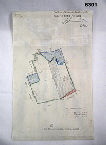 Bendigo Military Museum
Plan - Victorian Titles Office - Fortuna Lot Plan, Victorian Titles Office, 3 Dec 1975
Title plan of Fortuna property depicting the initial acquisition in 1951 plus additional areas acquired during 1955 and 1957. The accompanying notes show details of the acquisitions, when they occurred and the costs. The plan is foolscap in size whilst the Notes are a single smaller sheet. Includes one foolscap size page, probably part of a larger (more page) document.Title plan of Fortuna property depicting the initial acquisition in 1951 plus additional areas acquired during 1955 and 1957. The accompanying notes show details of the acquisitions, when they occurred and the costs. The plan is foolscap in size whilst the Notes are a single smaller sheet.Top right hand corner - "Certificate of Title entered in the Register Book Vol. 8159 Fol. 690, Signature Illegible, Assistant Registrar of Titles". Towards the bottom right hand corner - "No ENDOURSEMENTS (some unreadable Signatures) H.D. Draper 24.11.75, R.B? 26.11.75, ? 3.12.75. Near bottom of Page - Initials?" "THE MEASUREMENTS ARE IN LINKS"royal australian survey corps, rasvy, fortuna, army survey regiment, army svy regt, asr -
 Warrnambool and District Historical Society Inc.
Documents, Swintons Paper att 18/53 Merri St. Contract. Map. Notes, 1959
... .2 ‘Plan of Survey of Part of Crown Allotment 18 Section 3..., warrnambool .2 ‘Plan of Survey of Part of Crown Allotment 18 Section 3 ...These documents relate to the sale of land in Merri Street Warrnambool in 1959 by Swintons Pty Ltd of Warrnambool. The buyer of the land was George O’Grady, a Warrnambool baker. The land sold for £4000 and there was a shed on the land (called the ‘Office’) which George O’Grady indicated he wished to be included in the sale. William and Ann Swinton migrated to Australia in 1854 and for a decade William Swinton worked as a builder and carpenter in the Warrnambool area, erecting many buildings, including the Wangoom Presbyterian Church. In 1865 he opened a store in Timor Street Warrnambool, selling groceries, hardware, china and glassware. By 1888 the business was known as William Swinton and Sons. Branch stores were opened in Wangoom, Cudgee, Nullawarre, South Warrnambool and West Warrnambool. After William Swinton died his son Robert became the first managing director of Swintons Pty Ltd. In 1934 the business split with George Swinton and Sons selling clothing, furnishings and glassware and Swintons Pty Ltd selling seeds, produce and hardware. Today the Swinton family still operates a furniture and bedding shop in Timor St Warrnambool.These items are of some interest as being connected to the Warrnambool business of Swintons Pty Ltd. They will be of interest to researchers. The current Swinton business in Timor Street is the oldest family business in Warrnambool and, with the name Swinton associated with businesses in Timor Street Warrnambool for 152 years it is amongst the oldest family businesses in Australia.The items here relate to the sale of land by Swintons Pty Ltd., Warrnambool. .1 These are three pages of white paper with typed material, a lawyer’s signature in blue ink, one green stamp and a sketch of the land location. .2 This is a sheet of thick paper containing a plan of the land sold. The paper has printed material and a sketch of the land with part of it coloured in pink. .3 This is a small piece of paper torn at the bottom right edge. It has handwritten material (a letter) in blue ink..2 ‘Plan of Survey of Part of Crown Allotment 18 Section 3 Township of .2 ‘Plan of Survey of Part of Crown Allotment 18 Section 3 Township of Warrnambool Parish of Wangoom County of Villiers’ .3 ‘Tuesday Dear Mr Swinton I am writing to say that I would like to have the ‘Office’ Thanking You George O’Grady’swinton family,, warrnambool -
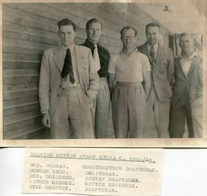 Kiewa Valley Historical Society
Set of 4 photographs of SECV Clerical staff, 1940 - 1941
The Kiewa Hydroelectric Scheme is the largest hydro-electric scheme in Victoria and the second largest in mainland Australia after the Snowy Mountains Scheme. The scheme is situated in the Australian Alps in north-eastern Victoria about 350 km from Melbourne and is wholly owned by AGL Energy. The scheme was originally constructed between 1938 and 1961 by the State Electricity Commission of Victoria although it was privatised in the 1990s. The scheme was originally developed solely for electricity generation, unlike the Snowy Mountains Scheme, which was also intended to direct water west of the Snowy Mountains for purposes of irrigation. From 1937 to 1944 the construction of dams at Pretty Valley, Rocky Valley and the Junction Dam were undertaken requiring large numbers of planning and support staff to see the projects successfully completed. Planning and support staff were the backbone of the successful completion of the Kiewa Valley Hydro Electric Scheme and contributed significantly to the development of the Kiewa Valley area. Many descendants of the men in the photographs still living and working in the local areaSet of 4 black and white photographs of SECV clerical staff – Circa 1940/1941Typed on note glued to back of each photo, Numbers handwritten in blue ink in top left hand corner 1. DRAWING OFFICE STAFF KIEWA C. 1940-41 Bob Morgan – Construction Draftsman; Duncan Kerr – Draftsman; Rob Hollands – Survey Draftsman; Arthur Keeble – Office Engineer; Bill Godfrey – Draftsman 2. CLERICAL OFFICE STAFF KIEWA Peter Harnetty – Clerical; Bert Connors – Clerical; John Martin – Stores Clerical; Ken Calder – Head Storekeeper; Bill black – Construction Records 3. CLERICAL OFFICE STAFF KIEWA Jack Norman, Herb Kendall, Jack Bray – Stores Clerical; Ken Calder – Head Storekeeper; Jim Swain, George Milner – Stores Clerical; Jim Gleeson – Storekeeper; John Martin – Stores Clerical 4. OFFICE STAFF KIEWA C. 1940 Don Faulkner – Cadet Engineer; Tas Davies – Survey Draftsman; Bob Morgan – Construction Darftsman; R.J. Martin, Arthur Keeble – Office Engineers; Rob Hollands – Survey Draftsman; Jack Wollard – Head Surveyor; Harry Wilson – Plan Officer. Printing Plans Handwritten in red ink on back of photo 4 – Refer Rob Hollands secv clerical staff -
 Kiewa Valley Historical Society
Photographs and copies of photographs of the pack horses and early horsemen who transported supplies to outposts in the Bogong High Plains, via cattle tracks before access roads were made
... and communications for outlying outposts, surveying and early planning ...In the mid to late 1930’s survey outposts were established to plot the early stages of the Kiewa Hydro Electric System for the SECV in the Bogong High Plains. Before any roads were built, the old cattleman’s tracks were used with packhorses to deliver supplies, wages and mail and collect timesheets and correspondence from the workmen and dam builders living in canvas tents and at the outlying survey posts. The trip up the mountain was long and hard and dangerous for both horse and man Most of the men of the survey teams were not bush-men and were often ill equipped for the harsh weather and living conditions of bush camping, often arriving in their city clothes ready for work. The tent city at Bogong was destroyed by bush fires in 1939 after which an access road was built from Mt Beauty to transport building materials for more permanent dwellings for workmen. Pack horses continued to be used for transporting goods etc. to workers further up the mountain.Without the work of horsemen and their pack horses providing supplies and communications for outlying outposts, surveying and early planning for the Kiewa Valley Hydro Electric scheme could not have gone ahead and the dams and power stations which support the system could not have been constructed. The Hydro-electric scheme, and the workers who planned and built it play a major part in the early history of the Kiewa Valley and many original families still remain living, or have ties with the local area.: Set of 21 black and white photographs and copies of photographs depicting the pack horses and the men who handled them, transporting supplies and correspondence to the outlying camps and survey posts in the Bogong High Plains, via the rough cattlemen’s tracks. Photographs also show the early tent camps of the workers. Some photos mounted on A4 white paper. Some photos enlarged to A3 poster size for display1. Handwritten on back – Max Lawrence 2. -8 No inscriptions 9. Handwritten on back- Packing in supplies for early workers of the Kiewa Hydro scheme. There were no roads in the early days of the scheme 10. Printed on bottom of photo- Roper’s cattle on road below Howman’s Gap 11. Handwritten on back – Roper’s et al about to leave for the high plains 12. Printed under photo- Syd Ryder at the Pretty Valley Cut-Out (JBR) 13-16. No markings 17. Printed under photo- Gwen Talbot visits the Camp area. 1937 18. Handwritten on back- 14/1 Barbara Talbot 19. No markings 20-21. No markings 22. Printed under photo- STATE ELECTRICITY COMMISSION OF VICTORIA. Date: 15-3-45 Time: 8.0pm No: K 1838 Kiewa Hydro-Electric Works, Investigations 1944-1945 – Survey Camp at Young’s Hut pack horses; bogong high plains; survey posts; supplies delivery -
 Kiewa Valley Historical Society
Evacuation Plans for children during WWII, 1941
During World War 2 the State Emergency Council for Civil Defence (Victoria) sent out forms to Municipal Councils requesting a survey to be carried out regarding the suitability of householders to accommodate persons, especially children, in the more dangerous parts of Victoria. Also, surveying parents as to their wishes regarding the evacuation of their own children if necessary. The documents list householders living in the Kiewa Valley including Gundowring giving an insight into the families (size, age, religion, sex), the homes (size, number and type of rooms), Water supply, Conveyance (motor or horse drawn), distance from railway station and school. Papers created by the State Emergency Council for Civil Defence, Premier's Department 1941 requesting Municipal Councils to survey people in case of the billeting of persons who may be evacuated from the more dangerous parts of Victoria. The Accommodation Survey lists the householder, details of the house, how many people living there and how many could be accommodated.There are also forms asking householders if they wish their children to be evacuated if necessary.Forms filled out in ink. world war ii; evacuation plans; kiewa valley; gundowring -
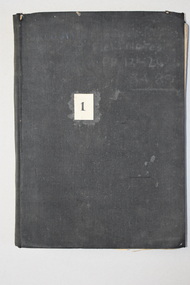
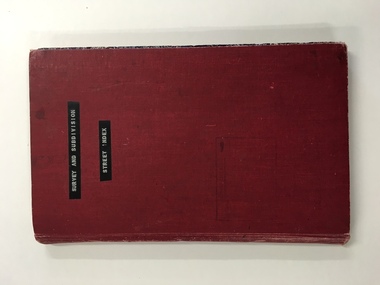 Warrnambool and District Historical Society Inc.
Register, Survey & subdivision street index, 1930s
This is a book with the City of Warrnambool surveys and subdivisions listed under the street names. It covers the period from 1938 to 1975. The information is listed under the headings of plan number, street name, section, allotment, date and remarks. The information contained therein would now be held as electronic data in the Council Records Department. Warrnambool, founded in 1847, became a municipality in 1856, a Borough in 1863, a Town in 1883 and a City in 1918. This book is of considerable interest because it lists Warrnambool streets from 1938 to 1975 and gives details of the subdivisions and surveys during that time. It will be very useful for researchers. This is a foolscap-size hard-cover book with a red cover with a mottled-blue pattern paper inside the covers. It has 95 pages with ruled red and blue lines. It has a handwritten alphabet index throughout the pages. The contents are handwritten in blue, green and black ink. The inside binding has been mended with adhesive tape and one page is loose. The book lists subdivisions in the City of Warrnambool under the heading of the street names and covers 1938 to 1975. The cover is somewhat grubby.Front Cover (in plastic tape): ‘Survey and Subdivision. Street Index’warrnambool city council, warrnambool streets and subdivisions -
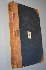
 Warrnambool and District Historical Society Inc.
Ledger, Chadwick Copying Book Co, Letter book 1905, 1902
This letter book has maps, letters and plans dating from 1902 to 1905. It came from the office of John William Crawley, Junior, an engineer, architect and surveyor in private practice in Warrnambool and also the engineer for the Shire of Warrnambool from 1895 to 1935. His father, brother and son were all engineers and worked in that capacity or as Shire Secretary for the Shire of Warrnambool, with the Crawley family recording a total of 132 years of service to the Shire of Warrnambool. The Shire of Warrnambool existed from 1863 to 1994. This letter book was passed on to John Crawley’s son, Rolf, engineer for the Shire of Warrnambool from 1935 to 1968. The letter book then came into the possession of Michael Hand who took over the private surveying business of Rolf Crawley in Warrnambool. The Warrnambool and District Historical Society acquired the letter book, along with several other Crawley ledgers, from the Michael Hand estate. This letter book is of considerable importance as it contains the letters, maps and plans produced by John William Crawley Junior, a Shire of Warrnambool engineer for 40 years. It will be useful to researchers. This is a black hard cover letter book of 505 pages, plus an alphabetical index at the back of the book. The letter book contains handwritten letters, sketch maps and plans. There is gold lettering on the spine.‘1’ ‘Invoice’ ‘Chadwick Copying Book Co. Springfield Mass.’ john william crawley, junior, warrnambool, rolf crawley, warrnambool, shire of warrnambool, history of warrnambool -
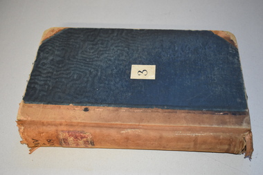
 Warrnambool and District Historical Society Inc.
Ledger, Letter book 1892-1904, 1892
This letter book has letters, sketch maps and plans and dates from 1892 to 1904. It came from the office of John William Crawley, Junior, an engineer, architect and surveyor in private practice in Warrnambool and also the engineer of the Shire of Warrnambool from 1895 to 1935. His father, brother and son were also engineers and worked in that capacity or as the Shire Secretary for the Shire of Warrnambool, with the Crawley family recording a total of 132 years of service to the Shire. This letter book was passed on to John Crawley’s son, Rolf Crawley, Engineer for the Shire of Warrnambool from 1935 to 1968. The letter book then came into the possession of Michael Hand who took over the private surveying business of Rolf Crawley in Warrnambool. The Warrnambool and District Historical Society has acquired the letter book, one of several Crawley ledgers, from the Michael Hand estate. This letter book is of considerable significance as it contains maps, plans, sketches and written information which is the work of John William Crawley Junior, the engineer for the Shire of Warrnambool for 40 years. It will be very useful to researchers. This is a hard cover letter book of 500 pages. The cover is black with leather binding on the edges of the cover and on the spine. The pages contain an alphabetical listing of the letters, handwritten letters and many sketch maps and plans. There are several loose pages of plans and diagrams at the back of the book. The inside of the covers has a blue mottled pattern. The edges of the cover are torn. There is a mauve stamp on the first page. ‘Letter Book 1892 to 1901’ ‘Rolf L. Crawley, Civil Engineer, Drainage and Water Supply Engineer, Licensed Surveyor, Registered Architect, Warrnambool’ john william crawley, junior, warrnambool, rolf crawley, warrnambool, shire of warrnambool -
 Warrnambool and District Historical Society Inc.
Letter Book 3, 1901 - 1908, 1900
This letter book has letters, plans and maps and dates from 1901 to 1908. It came from the office of John William Crawley, Junior, an engineer, architect and surveyor in private practice in Warrnambool and also the engineer for the Shire of Warrnambool from 1895 to 1935. His father, brother and son were also engineers and worked in that capacity or as the Shire Secretary for the Shire of Warrnambool, with the Crawley family recording a total of 132 years of service to the Shire. The letter book was passed on to John Crawley’s son, Rolf, engineer for the Shire of Warrnambool from 1935 to 1968. The letter book then came into the possession of Michael Hand who took over the private surveying business of Rolf Crawley in Warrnambool. The Warrnambool and District Historical Society has acquired the letter book, one of several Crawley ledgers, from the Michael Hand estate. The Shire of Warrnambool existed from 1863 to 1994. This letter book is of considerable significance as it contains maps, plans and letters produced by John William Crawley Junior, the engineer for the Shire of Warrnambool for 40 years. It will be very useful for research. This is a hard cover letter book of 717 pages. It has a black cover with brown leather binding on the cover edges and spine. The leather is worn away in places. The letter book contains an alphabetical index, handwritten letters, sketch plans and maps. There is a mauve stamp on the inside front cover. ‘3’ ‘Letter Book 1901 to 1908’ ‘Letter Book J.Wm. Crawley’ ‘Rolf L. Crawley, Civil Engineer, Drainage and Water Supply Engineer, Licensed Surveyor, Registered Architect, Warrnambool’ john william crawley junior, warrnambool, rolf crawley, warrnambool, history of warrnambool