Showing 1533 items
matching farming
-
 Surrey Hills Historical Society Collection
Photograph, Subdivision sale of Black's Mont Albert farm in 1924, 1924
Photo was taken in 1924 when the land was subdivided. Black's dairy farm occupied the area just east of Hamilton Street to near Elgar Road. It was subdivided into 88 house allotments along Churchill Street, Bruce Street, Black Street, Proudfoot Street and View Street. The solicitors were Proudfoot & Horton, 360 Collins Street; estate agents were Duncan & Weller, 29 Queen Street. The real estate subdivision notice on the SLV website states that Neil Black had been the owner for 50 years. To date no trace of a Neil Black has been found. Box Hill rate books simply give BLACK as the owner in 1877 (no first name); the entry for 1878-1884 states Robert Black. The 1909 electoral roll has entries for Mont Albert Road for Robert Black (farmer), Thomas Black (carter) & Elizabeth Black (HD). The 1912 electoral roll has entries for Mont Albert Road for Robert Black (farmer), Thomas Black (labourer), John Arthur Black (carter) & Elizabeth Black (HD). Robert Black died in 1920 (b. 1836) and is buried in Box Hill Cemetery (CE-*-0057). His parents were John and Margaret Black. He married Lizzie Foley in 1878. She was the daughter of Margaret & John Foley, born in 1859. She died in 1902 aged 43 years and is buried in the same grave, although the cemetery records record her age as 0 years (presumably as no age or date of birth were given at the time of burial). Children: 1. James Hughbert (1880-1954) 2. John Arthur (1881-1959) 3. Alice (1882-1883) - died aged 6 months 4. Laura Elizabeth (1883-1951) 5. Thomas (1885-1965) 6. Isabella (1887-1963) 7. Eleanor (1889-1963) 8. Ada Maud (1890-1968) 9. Robert (1892-1930). BDM Victoria states places of birth as Box Hill, Surrey Hills or Mont Albert. Many of the family are buried in Box Hill Cemetery. None of the girls appear to have married. Communication from a descendant of John Arthur Black gives the following: "John Arthur Black, son of Robert & Lizzie Foley, married Gladys Anne Layton had 4 children, Robert, Elenore, Marion (Follett) & Annie; they had farm on Stud Road, Dandenong where they milked 30 cows that he retired to after being a earth-moving contractor with draft horses and dug irrigation ditches around Shepparton." This is important as documentation of the area's transformation from farming land to residential land use.Black and white photo of a large 3-poled tent in an area of flat land with eucalypts in the background. There is a large crowd of people, mainly men but also women and children. There are also 3 cars to the RHS.black's dairy farm, dairying, farms, churchill street, black street, proudfoot street, bruce street, view street, neil black, proudfoot & horton, duncan & weller, robert black, lizzie black, lizzie foley, james hubert black, john arthur black, alice black, laura elizabeth black, thomas black, isabella black, eleanor black, ada maud black, robert black jnr, box hill cemetery, land sales -
 Surrey Hills Historical Society Collection
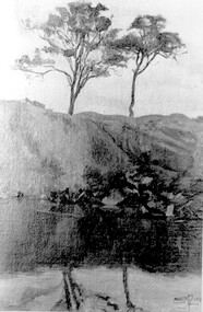
Photograph, Muriel Pornitz (deceased), Quarry on site of Grovedale Road - James Street Park
The photo is of a painting of the dam formed on land between Grovedale Road and James Street, Surrey Hills. It was painted in 1927 by Miss Muriel Pornitz, an art teacher, who lived in Grovedale Road. The land had been part of Mr James Maling Snr’s property and in the 1880s clay was removed to build houses, including his own located on the corner of Weybridge and James Streets. Maling grazed cattle on this area and used it as a dam. The land was subsequently made into parkland, the quarry / dam having been filled in after several drownings had occurred in the 1920s/1930s. See also SHP94, another copy of the same. Muriel Hedwig Lucy Pornitz lived at 22 Grovedale Road, Surrey Hills. She was born c1894 in Balwyn; died in Kew on 1 December 1982. She was the daughter of Konrad Pornitz (1864-1903) and his wife Charlotte Richardson Gooderidge (1863-1942), known as Tottie, who married in 1890. Konrad Pornitz is listed in the 1892 directory as living in Edgevale Road, Kew and the business Pornitz and Ross at 291 & 293 Little Collins Street, importers and commission merchants. The 1896 directory gives the Kew address as 176 Edgevale Road, Kew, however the business Pornitz and Ross was dissolved on 1st day of October 1892, by mutual agreement. Legal notice advised that: Mr Pornitz will hereafter carry on the business on his own behalf at the same address, under the style "Pornitz and Ross". Muriel is buried in Box Hill Cemetery (B-086-0042) along with Ulrich Horst Holm Pornitz known as Horst or Bon (d 1957) and Edith Olga Pornitz (d 1951), her brother and sister. A further sibling (Konrad b 1891) died in infancy. He is buried with his mother in Boroondara (Kew) Cemetery - C/E A 0366. Konrad died at his home 'Yarran' in Lane Cove Road, North Sydney on 31 October 1903; reported in the Sydney Morning Herald. Buried Gore Hill Cemetery, St Leonards, North Sydney. The headstone reveals he was born in Chemnitz, Saxony in 1863. Muriel was also known as Muriel Pornett. She studied at the South Australian School of Arts & Crafts in 1911 under James Ashton and Fred Britton, and at the Australian School of Etching in Sydney. She was also an illustrator and cartoonist. The photo, and the painting from which it is derived, documents the landscape prior to close settlement and is material to early building and farming in the Surrey Hills area.A black and white photograph of a painting of a landscape of parkland. Two trees are on top of a rise and are reflected at the bottom in water. The signature of the artist is in the bottom right corner: "AUST MP 192" (and the rest is cut off).(miss) muriel pornitz, grovedale road, james street, surrey hills, artists, parks and reserves, (mr) john butler maling, snr, quarry, dam, (miss) muriel hedwig lucy pornitz, box hill cemetery, muriel pornett -
 Surrey Hills Historical Society Collection
Photograph, Grovedale Road Quarry in the 1920s - looking south, c1920
The quarry was part of John Butler Maling's property. He was one of the original settlers of the area and farmed the area between Weybridge Street and Whitehorse Road. Clay was quarried from part of this area and used to make the bricks used in the construction of his home, known as 'Ancyra'. This is still extant at the corner of Weybridge and James Streets. Maling grazed cows and used the quarry as a water source. He was the uncle of John Butler Maling, Mayor of Camberwell. He was married to Kate Conlon in 1882. They had 3 children: Silas Young, Alick and Zillah. Maling was born in c1829 in Shepreth, Cambridgeshire; he died in Surrey Hills on 9 October 1912 and is buried in Box Hill Cemetery - CE-*-0586. Mrs Kate Maling (born c1859 in Co Meath, Ireland) died at the property on 8 March 1921. She is buried in Brighton General Cemetery. Probate was valued at over 10,000 pounds and included other properties in Sandringham, Hawthorn and Macedon. At the time of her death the Surrey Hills property was described as being 23 acres with 2 brick houses, 1 cow, 2 heifers and 40 fowls or chickens. The property was subdivided after her death. The property was subdivided into 110 house blocks in c1923 - see Maling's Estate subdivision flyer on the State Library of Victoria's website. This shows that the Grovedale Park site had been acquired by Camberwell Council by this time. An attached newspaper clipping documents prices realised for a cross-section of blocks. The MMBW map of 1925, also on the SLV website, shows the outline of the clayhole / quarry. The quarry was filled in after several drownings or near drownings and the land is now occupied by a park and playground, known as Grovedale Road Park, maintained by the City of Boroondara. Beckett Park is sited on horizon to the left beyond the trees. This documents the landscape prior to close settlement and is material to early building and farming in the Surrey Hills area.Black and white photo of the quarry between Grovedale Road and James Street taken in the 1920s and looking south. In the foreground is an area of water with reeds in the LH corner. Beyond on the high banks there are single storey houses in the background and (?) some light poles. An object that looks like a tank on posts is in a cutting on the far bank.quarries, grovedale road, james street, clay quarries, farming, kate conlon, kate maling, john butler maling, ancyra -
 Surrey Hills Historical Society Collection
Photograph, Grovedale Road Quarry in the 1920s - looking north, c1920
The quarry was part of John Butler Maling's property. He was one of the original settlers of the area and farmed the area between Weybridge Street and Whitehorse Road. Clay was quarried from part of this area and used to make the bricks used in the construction of his home, known as 'Ancyra'. This is still extant at the corner of Weybridge and James Streets. Maling grazed cows and used the quarry as a water source. He was the uncle of John Butler Maling, Mayor of Camberwell. He was married to Kate Conlon in 1882. They had 3 children: Silas Young, Alick and Zillah. Maling was born in c1829 in Shepreth, Cambridgeshire; he died in Surrey Hills on 9 October 1912 and is buried in Box Hill Cemetery - CE-*-0586. Mrs Kate Maling (born c1859 in Co Meath, Ireland) died at the property on 8 March 1921. She is buried in Brighton General Cemetery. Probate was valued at over 10,000 pounds and included other properties in Sandringham, Hawthorn and Macedon. At the time of her death the Surrey Hills property was described as being 23 cres with 2 brick houses, 1 cow, 2 heifers and 40 fowls or chickens. The property was subdivided after her death. The quarry was filled in after several drownings or near drownings and the land is now occupied by a park and playground maintained by the City of Boroondara. Beckett Park is sited on horizon to the left beyond the trees. This documents the landscape prior to close settlement and is material to early building and farming in the Surrey Hills area.Black and white photo of the quarry between Grovedale Road and James Street taken in the 1920s and looking north. In the foreground is an area of water with high banks dividing the horizontal centre. Beyond are paddocks and trees behind which is a row of at least 3 single-storey houses. Light poles can be seen along a distant street. There are many mature trees in the background. The houses and trees are positioned along Whitehorse Road in the vicinity of Westminster Street. Shadows indicate the photo was taken in early morning or evening.quarries, grovedale road, james street, surrey hills, balwyn, clay quarries, ancyra, kate conlon, kate maling, john butler maling, farming -
 Surrey Hills Historical Society Collection
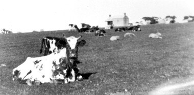
Photograph, Norman Carter, Part of Black's dairy farm in Mont Albert in the 1920s, 1920s
Photo is likely to have been taken pre-1924 when the land was subdivided. Donor information is that this was taken from a home in Churchill Street, Mont Albert; it would be looking south towards Mont Albert Road. Black's dairy farm occupied the area just east of Hamilton Street to near Elgar Road. It was subdivided into 88 house allotments along Churchill Street, Bruce Street, Black Street, Proudfoot Street and View Street. The solicitors were Proudfoot & Horton, 360 Collins Street; estate agents were Duncan & Weller, 29 Queen Street. The real estate subdivision notice on the SLV website states that Neil Black had been the owner for 50 years. To date no trace of a Neil Black has been found. Box Hill rate books simply give BLACK as the owner in 1877 (no first name); the entry for 1878-1884 states Robert Black. The 1909 electoral roll has entries for Mont Albert Road for Robert Black (farmer), Thomas Black (carter) & Elizabeth Black (HD). The 1912 electoral roll has entries for Mont Albert Road for Robert Black (farmer), Thomas Black (labourer), John Arthur Black (carter) & Elizabeth Black (HD). Robert Black died in 1920 (b. 1836) and is buried in Box Hill Cemetery (CE-*-0057). His parents were John and Margaret Black. He married Lizzie Foley in 1878. She was the daughter of Margaret & John Foley, born in 1859. She died in 1902 aged 43 years and is probably buried in the same grave, although the cemetery records record her age as 0 years. Children: 1. James Hughbert (1880-1954) 2. John Arthur (1881-1959) 3. Alice (1882-1883) - died aged 6 months 4. Laura Elizabeth (1883-1951) 5. Thomas (1885-1965) 6. Isabella (1887-1963) 7. Eleanor (1889-1963) 8. Ada Maud (1890-1968) 9. Robert (1892-1930). BDM Victoria states places of birth as Box Hill, Surrey Hills or Mont Albert. Many of the family are buried in Box Hill Cemetery. None of the girls appear to have married. Communication from a descendant of John Arthur Black gives the following: "John Arthur Black, son of Robert & Lizzie Foley, married Gladys Anne Layton had 4 children, Robert, Elenore, Marion (Follett) & Annie; they had farm on Stud Road, Dandenong where they milked 30 cows that he retired to after being a earth-moving contractor with draft horses and dug irrigation ditches around Shepparton." This is important as documentation of the area's early farming land use.Black and white photo of a paddock with cows and sheep grazing. On the horizon is a simple cottage with a small veranda and 2 chimneys and scattered trees.black's dairy farm, dairying, farms, churchill street, black street, proudfoot street, bruce street, view street, neil black, proudfoot & horton, duncan & weller, robert black, lizzie black, lizzie foley, james hubert black, john arthur black, alice black, laura elizabeth black, thomas black, isabella black, eleanor black, ada maud black, robert black jnr, box hill cemetery -
 National Wool Museum
Photograph - Farming Property, J W Allen, 1900 - 1940
This item is part of a collection of seven black and white glass lantern slides previously housed together in a glass plate box. The slides are part of a greater collection of around forty three black and white glass lantern slides, along with other photographs and photo albums related to this collection. This item is associated with the New South Wales Graziers Association world tour of merino sheep 1928/9. The slides were possibly used as supporting material in presentations made by J W Allen when on tour.Black and white glass lantern slide with paper edging showing a fence line with trees. Two men are standing near the fence.agriculture, new south wales graziers association, travel, sheep, breeding, photography, glass lantern slides, j w allen -
 Port Fairy Historical Society Museum and Archives
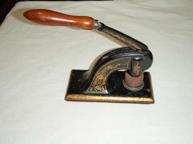
Equipment - Company seal
Used in the office of the Port Fairy Butter Factory which was located on Gipps Street facing the end of Bank Street.Black cast iron seal with wooden handle. Decorated with gold designPort Fairy Cheese and Butter Factory Company, Port Fairy Limitedport fairy cheese and butter factory company, port fairy dairy farming, butter, factory, gipps street, company seal -
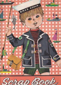 Carlton Football Club
Scrap Book, Dedicated to Carlton Player John Goold
John Goold double Premiership PlayerA scrap Book dedicated to twice Premiership Player 1968 - 1970 John Goold Career : 1963 - 1970 Debut : Round 7, 1963 vs Footscray, aged 21 years, 338 days Carlton Player No. 754 Games : 108 Goals : 3 Last Game : Grand Final, 1970 vs Collingwood, aged 29 years, 90 days Guernsey No. 11 Height : 184 cm (6 ft ½ in.) Weight : 76 kg (12 stone, 0 lbs.) DOB : June 27, 1941 Premiership Player 1968, 1970 Carlton Hall of Fame All Australian 1966 A brilliant, flamboyant, two-time Premiership player for Carlton during the Barassi years in the ‘swingin’ sixties,’ John William Crosbie Goold became almost as famous for his dapper appearance off the field, as for his exploits on it. At the height of his football career, he was also a prominent ladies fashion designer – which led to him being dubbed ‘Mr Elegance’ by leading football commentator Lou Richards. Supporters and team-mates however, called him ‘Rags’ or ‘Ragsy,’ because of his involvement in the clothing, or ‘rag’ trade. Goold first came under notice as an outstanding junior athlete at Melbourne Grammar School. A true all-round sportsman, he shone at tennis, athletics, football and cricket. He was also a keen horseman who loved the game of polo and the rough and tumble of fox hunting. While at school he was a fervent Melbourne supporter, but strangely, never had much confidence in his football ability. “If I thought I was good enough, I would certainly have gone to Melbourne,” he said many years later. “But I honestly didn’t think I would ever amount to anything in this game. Cricket and tennis were the games that really interested me.’ However, after graduating from MGS, Goold went home to Healesville to star in the Bloods’ 1962 Yarra Valley Football Association Premiership team – an achievement that brought tempting offers from more than one VFL club. “Incentives were offered elsewhere,” he recalled, “but I gravitated to Carlton – partly because the deep blue of their guernsey attracted me, but mostly because of the good advice I got from people who even then were longsighted enough to predict that big things were ahead for this club.” The Blues were confident enough in Goold’s potential to offer him the guernsey number 11 previously worn with distinction by the likes of Jack Hale, Jim Knight, Ron Hines and Laurie Kerr, and his first senior game came in round 7, 1963 against Footscray at the Western Oval. He played on a half-forward flank alongside Brownlow Medallists Gordon Collis and John James on that Saturday afternoon, and kicked his first career goal in an 8-point win. Little did he know though, that it would be another six seasons before he would again experience the thrill of sending a football spinning between the big posts, because his future lay in defence. By his own admission, Goold struggled to find his feet in VFL football during his first two seasons, until the shock appointment of Ron Barassi as captain-coach of Carlton in 1965 began steering his career back on track. “I think you could say that 1965 was my first year of League football,” he said, “That’s the way I felt - that’s the way I reacted to Barassi.” Under Barassi, Goold rapidly developed into a superb running half-back flanker. Tenacious, and an often freakish high mark, he was unmistakable on the field thanks to his mane of dark hair, his loping running style and somewhat awkward kicking action. Furthermore, he had boundless courage. There is no doubt that he would have played many more games had he not been regularly pole-axed under the high ball – a fact he later freely admitted. “I was always getting knocked out,” he said, “and spent half my bloody time in hospital.” In the second half of 1965, an injury to centre half-back Gordon Collis forced Barassi to use Goold in the key defensive post. While it curtailed his rebounding instincts somewhat, ‘Ragsy’ rose to the challenge and rarely lowered his colours. Testament to his improvement, he finished third behind John Nicholls and Sergio Silvagni in Carlton’s 1965 Best and Fairest award, and followed up by being selected in the Victorian team for the 1966 Hobart Carnival. There, he had a superb series in which he was runner-up to West Australian Barry Cable in voting for the Tassie Medal, and capped it off by being named on a half-back flank in the All Australian team. Barassi’s influence at Carlton bore fruit in his third year, when the Blues returned to finals football at last. Richmond, Carlton, Geelong and Collingwood fought out the 1967 Premiership, and Ragsy Goold won the hearts of the Carlton faithful with two lion-hearted performances. Although Carlton was knocked out of contention by successive losses to Richmond and Geelong, Goold was tireless throughout both games, and it was obvious that he thrived on the added pressure of finals football. Precisely twelve months later, the bitter taste of those defeats was washed away when Barassi’s Blues edged out Essendon by 3 points in the 1968 Grand Final, and ended 21 years of despair at Princes Park. To win Carlton’s ninth VFL flag, the Blues had had to defeat the minor premier Bombers twice during the finals – and did so, thanks to a watertight defence led by Goold, and a dominant ruck division headed by John Nicholls. In round 5, 1969, Carlton hosted South Melbourne at Princes Park in a match significant for a number of reasons. As he regularly did, Ron Barassi swung his team around prior to the opening bounce, and Goold found himself in the unaccustomed role of ruck-rover. While the Blues set about establishing a good break on the scoreboard, Ragsy relished the freedom to kick two first half goals - his first majors for 78 games. Just before half-time however, he was flattened in a pack, concussed again, and replaced during the long break by Barry Gill. Alex Jesaulenko was substituted at the same time – by a shy, ambitious youngster named Bruce Doull, making his senior debut for Carlton in guernsey number 4. In September, 1969 the Navy Blues began their third straight finals campaign with an impressive 6-goal Semi Final win over Collingwood in front of more than 108,000 fans at the MCG. A fortnight later, Richmond stunned the flag favourites with a withering last quarter in the Grand Final, and knocked Carlton out of the Premiership race again at the last hurdle. Half-way through the year, Carlton's club doctor discovered that Goold had been playing with shin splints in both of his lower legs. The pain they caused was considerable, but Ragsy soldiered on and held down centre half-back throughout the season. John Goold’s VFL career at Carlton culminated in the fabled 1970 Grand Final triumph over Collingwood. What is not so well known is that Ragsy was only cleared to play in that game on the morning of the match. After narrowly losing to Collingwood in the second Semi Final, the Navy Blues destroyed St Kilda by 62 points in the Preliminary Final, and earned another shot at the Magpies in the decider. But one of Carlton’s problems was that Goold had been kicked on a shin against St Kilda, causing a burst blood vessel and serious swelling. Despite the best efforts of the club medical staff, Ragsy had only a slim chance of playing in the Grand Final right up until game day, when his worried coach reluctantly allowed him to take his place in the side. Later, Barassi justified his decision by saying that in his opinion, a less than fully fit Goold was still worth his place in the team. By half time in the Grand Final however, he was probably questioning that judgement - because Carlton had been totally outplayed, and trailed an impressive, cohesive Collingwood by 44 points. Therefore, Carlton’s magnificent comeback – orchestrated by Barassi, and sparked by the fairytale exploits of 19th man Ted Hopkins – is one of the greatest of all football stories. Against enormous odds, the Navy Blues fought their way back into the contest, and eventually, rolled over the top of the frantic Magpies to snatch victory by 10 points in the last few minutes of the match. Hopkins ended up with four goals, Barassi was hailed a genius, and Ragsy Goold was carted off to hospital immediately after the game to have further urgent treatment. While there, he decided that there was no better time to end his VFL career – especially because his burgeoning business interests were demanding more and more of his time. In the years after his football career ended, John Goold created a remarkably successful business empire. In 1971 he sold his fashion label and took up farming at Mortlake in western Victoria, where he coached the local football team for three seasons. Later, he formed a diversified pastoral company, and purchased a magnificent complex called Ballangeich Run at nearby Ellerslie. While his passion for farming and livestock grew, he began breeding top quality polo ponies, and represented Australia in international competition. During the 1997 and 1998 seasons, John's son Ed Goold played reserve grade football for Carlton. MEMORIES.... Ragsy Goold; the name stirs memories form my long ago childhood. Ragsy, with his unique kicking style, where he'd hold the ball (always a drop punt - in a time when the drop kick and the torpedo punt still reigned supreme) at the point of the ball, elbows bent and he'd lavishly drop the ball, his right arm then flinging back and up dramatically. That was the thing about Ragsy (so named because he worked in the clothing, or 'rag' trade), he was always dramatic. He always ensured his ankle guards and wrist guard were glowing white to match the great white CFC monogram he wore proudly on his chest, and with his long flowing locks, cut a dynamic figure through a young boy's mind. Ragsy was my idol. I loved his dashes from half back, his long accurate drop punts, most of all I loved his flair for the game. Ragsy played the game as an entertainer as well as a sportsman - he leapt high to punch or mark, and always seemed to have a bit of the thoroughbred about him - which is probably why after he retired, he took up fox chasing, polo, and riding his beloved thoroughbreds across the paddocks and over the fences of his property, I think he may have even represented Australia at the sport – really, that’s sort of how he played as a footballer. All sinewy muscle, long legs and famous leaps for the saving punch. Ragsy was part of the great backline that helped revive Carlton's fortunes. Legendary players Wes Lofts, Ian Collins, Kevin 'Racehorse' Hall, Vinnie Waite among them. All great teams have a great defence and the defence that Ragsy was an integral part of was no different. Where others provided the biffo, the muscle or the defensive pressure, Ragsy provided the dash, the flair, the sense of adventure that all great backlines must have. AND MORE.... I have had many favourite players while following the Blues, but there will always be a special spot for Ragsy Goold - running the lines, all long hair and flashing white guards. As a young man I moved to Carlton and began acting in a place called one-c-one. One night after a play, I was walking home. It was winter, and I was wearing my favouritte overcoat, a genuine ankle length tweed affair I had picked up in an Op Shop in Oakleigh for three dollars. As I strutted across Lygon Street, a deep male voice behind me called, 'hey laddie, how much for the overcoat?' I turned, and there was my childhood idol, Ragsy Goold, two beautiful women in tow, smiling and waiting for my answer. I loved that coat too much to part with it, even to Ragsy, so I shook my head - and he smiled, then walked off. I stood for a moment in the middle of the street shaking my head in disbelief. Ragsy bloody Goold had just offered to buy my overcoat! I knew at that point, as a young man of about twenty three, that life was going to be full of surprises and very entertaining - a bit like John ‘Ragsy’ Goold. ONE MORE.... A cold, wet day in the mid 1960's at the MCG and Victoria were playing South Australia (?) The ball that day was like a piece of soap, with players finding it impossible to mark. Just before half time a long kick sailed toward the mud heap that was the centre of the ground, and the pack rose to meet it. From this group of players an arm shot straight up, and the ball instantly came to a dead stop. The footy stuck in the player's palm as if the hand was coated in Tarzan's Grip. After all these years, it's the only recollection I have of that match, and that player was 'Mr. Elegance' John Goold. HUMOROUS HUNGRY.... Former opponent Richmond's Kevin Bartlett on Radio SEN in 2012 received a phone call from John. After the call Kevin told his listeners how "Mr Elegance" would always be dressed in a nice suit, shirt-tie and highly polished shoes. He then cracked a joke saying something like; "You know, John was so 'posh' that he used to play football wearing a cravat!" Milestones 50 Games: Round 15, 1967 vs Melbourne 100 Games: Round 13, 1970 vs Geelong Career Highlights 1965 - Percy Bentley Trophy - 3rd Best & Fairest 1966 - 5th Best & Fairest 1967 - Maurie Sankey Memorial Trophy - 4th Best & Fairest (on count back) 1968 - Premiership Player 1970 - 7th Best & Fairest 1970 - Premiership PlayerFoolscap Scrap Book -
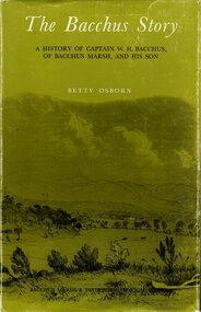 Bacchus Marsh & District Historical Society
Book, The Bacchus Story: A History of Captain W. H. Bacchus of Bacchus Marsh and His Son, 1973
William Bacchus was one of the first European colonists to live in the township which was later named after him. He arrived in land occupied by the Wurundjeri and Wadawurrung peoples in 1838 and established a large sheep farm. He died in 1849 and his son Henry Bacchus continued his farming interests in the district until his death in 1887. This work is a biographical portrait of William and Henry Bacchus and of the early European occupation in the Bacchus Marsh district. PUBLICATION DETAILS: Bacchus Marsh, Vic., Bacchus Marsh and District Historical Society Inc., 1973:118 pages, 23 cm.non-fictionWilliam Bacchus was one of the first European colonists to live in the township which was later named after him. He arrived in land occupied by the Wurundjeri and Wadawurrung peoples in 1838 and established a large sheep farm. He died in 1849 and his son Henry Bacchus continued his farming interests in the district until his death in 1887. This work is a biographical portrait of William and Henry Bacchus and of the early European occupation in the Bacchus Marsh district. PUBLICATION DETAILS: Bacchus Marsh, Vic., Bacchus Marsh and District Historical Society Inc., 1973: william bacchus, bacchus family, henry bacchus, bacchus marsh, bmdhs publication -
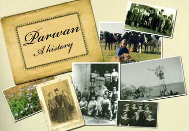 Bacchus Marsh & District Historical Society
Book, Parwan: A History, 2010
Explores the history of the small farming community on the outskirts of Bacchus Marsh. It contains a plethora of fascinating details about the early years of this farming community from the 1830s until the early 2000s. There is a brief section at the beginning which looks at the history of the area prior to the colonial era. The book contains numerous sections about families and individual people who have lived in the Parwan area and includes many images of places and people. Citation: Parwan: A History by Dianne Van Leuvan. Published by Parwan History Group, Bacchus Marsh, Vic., 2010.Paperback printed book. 128 pages. with illustrations and photographs, some coloured. Includes facsimiles, maps, and index. Includes a separate folded sheet inside a pocket which has a reproduction of a map of the Parwan Parish in the County of Grant. On the reverse of this sheet are two reproductions. One is a land auction plan for February 1910 advertising the sale of portions of land from the Nerowie Estate. The other reproduction is a section of a map showing some of the blocks of land in the Nerowie Estate which has the heading, 'Nerowie Titles 1898'. A pocket inside the back cover contains a separate booklet which is an index, and two pages of 'Additional Information'.non-fictionExplores the history of the small farming community on the outskirts of Bacchus Marsh. It contains a plethora of fascinating details about the early years of this farming community from the 1830s until the early 2000s. There is a brief section at the beginning which looks at the history of the area prior to the colonial era. The book contains numerous sections about families and individual people who have lived in the Parwan area and includes many images of places and people. Citation: Parwan: A History by Dianne Van Leuvan. Published by Parwan History Group, Bacchus Marsh, Vic., 2010.parwan vic. history -
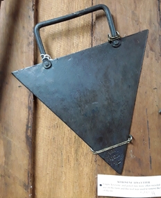
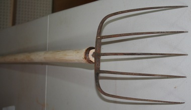 Trafalgar Holden Museum
Tool - 5 Prong wooden handled steel tyne pitch fork
Agricultural tool used on farms during the late 1800"sObject holds farming significance supplied by Holden and FrostWooden handled five prong steel forkagricultural, fork -
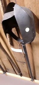
 Mont De Lancey
Tool - Kerosene Tin Cutter, Chapman and Co, Unknown
Used in the late 19th or early 20th century.A large triangular shaped metal blade tin cutter for manually opening kerosene and petrol tin lids which were often recycled for use on farms in the 19th and early 20th century. It has a rectangular shaped tubular steel handle attached to the top side by two rivets. On one of the triangular points of the blade is the manufacturer's brand ' Chapman and Co, Enfield S.A'. It was Australian made.'Chapman and Co, Enfield S..A'. tin openers, tools, tin cutter, farming equipment -
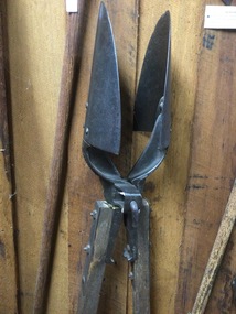
 Mont De Lancey
Tool - Post Hole Digger, Unknown
Used in the 19th or early 20th centuryA long handled steel vintage post hole digger with two large curved split blades. Each blade is attached to the top of the handle by three screws. It has a rotating action with the digger boring into the earth as the handle is turned. There is an attachment at the end of the steel handle for a missing turning handle.'S' is stamped on the top of the handle.tools, agricultural tools, farming equipment, garden tools -
 Mont De Lancey
Tool - Post Hole Digger, F.E. Kohler & Co, Unknown
Manufactured by F.E. Kohler & Co, Canton, OhioA vintage post hole digger with two long wooden handles and two metal scooped blades. It is operated with a lever action, with the two handles pulled apart to take a 'bite' of earth. The handles are attached by a nut and bolt. There is a crowbar on the end of one handle and a rammer on the end of the other. The brand is F.E. Kohler & Co, Canton, Ohio.'Kohler Little Giant' patented.tools, agricultural tools, farming equipment, garden tools -
 Wodonga & District Historical Society Inc
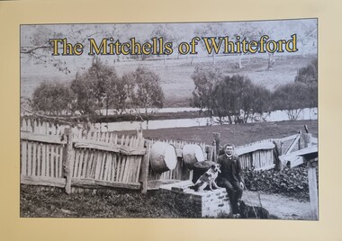
Book - The Mitchells of Whiteford, Paul Mitchell, 2020
"Whiteford is a mystical place. A small farm in north-east Victoria, rising from the rich flats of the Mitta Mitta River a few kilometres upstream from its confluence with the mighty Murray River. Taken up in 1879 from the large Bethanga run, Whiteford was home to the Mitchell family until it was flooded by the Hume Weir around 1934. Through this collection of family photos and small stories, we might glimpse something of family and farming in the fertile Mitta Mitta Valley before it was flooded by the Hume Weir" - Paul Mitchell, author.A family history of the Mitchell family of Whiteford, Victoria. This publication includes stories and many black and white images of the Mitchell family and their home."Whiteford is a mystical place. A small farm in north-east Victoria, rising from the rich flats of the Mitta Mitta River a few kilometres upstream from its confluence with the mighty Murray River. Taken up in 1879 from the large Bethanga run, Whiteford was home to the Mitchell family until it was flooded by the Hume Weir around 1934. Through this collection of family photos and small stories, we might glimpse something of family and farming in the fertile Mitta Mitta Valley before it was flooded by the Hume Weir" - Paul Mitchell, author.mitta mitta history, mitchell family history, whiteford mitta mitta valley -
 Wodonga & District Historical Society Inc
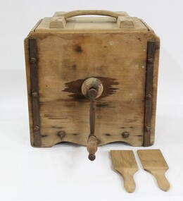
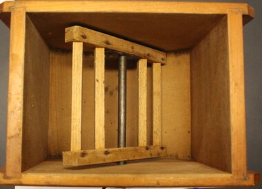
Functional object - Butter Churn c. late 1800 - early 1900s, E. Cherry & Sons
North east Victoria was a major dairy producing region in the late nineteenth century. The first iteration of the Wodonga Butter Factory Ltd was established in 1892. Dairy was sent from farmers across the district for processing at the factory in Wodonga in the 1890s. Victorian creameries regularly exported frozen butter to London, stock was transported by rail for sale in Melbourne, and of course sold and consumed locally. E.W. Mann, of the prominent local Wodonga family, was a shareholder and was closely involved in the establishment of the Wodonga Butter Company. Many families living on farms also owned their own cow, and had equipment to process their own dairy products at home. This item has strong links to the history of Wodonga and north east Victoria. It has interpretative potential in the areas of local agricultural history, and the social history of food and farming.A wooden butter churn with metal turning handle, and two butter paddles and removal lid.butter, butter churn, dairy, cream, milk, cow, agriculture, farms, farmers, farm, food, social history, food history -
 Wodonga & District Historical Society Inc
Domestic object - Small Butter Churn, E. Cherry & Sons, c1880 - 1920
North east Victoria was a major dairy producing region in the late nineteenth century. The Wodonga Butter Factory Ltd was established in 1892. Many families living in the town or on farms also owned their own cow for family needs and produced their milk and butter. This churn is representative of the equipment they used to process their own dairy products at home. This churn was made by E. Cherry & Sons which was established in Gisborne, Victoria in 1858. Edward Cherry (1830-1910) arrived in Australia from Hertfordshire, England, in 1855. The business manufactured churns and in 1875 opened a larger factory. On his death, the business was taken over by his son and continued to operate until the 1970s.This item has strong links to the history of Wodonga and north east Victoria. It has interpretative potential in the areas of local agricultural history, and the social history of food and farming.A wooden butter churn with metal turning handle and removable lid. The wooden paddle inside is attached to the turning handle which rotates to churn the butter. The model number is T1. It was probably made by E Cherry & Sons of Gisborne although the brand is blurred.On one side in black: "T 1"butter churns, dairying industry, domestic appliances, e. cherry churns -
 Wodonga & District Historical Society Inc
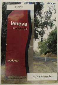
Book - Leneva Wodonga - As We Remember, Leonie Goyne, 2008
A history of the area of Leneva in Wodonga, Victoria. Memories of a changing farming community within the Rural City of Wodonga in North-East Victoria.non-fiction A history of the area of Leneva in Wodonga, Victoria. Memories of a changing farming community within the Rural City of Wodonga in North-East Victoria.leneva wodonga, leneva history -
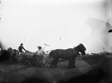
 Wodonga & District Historical Society Inc
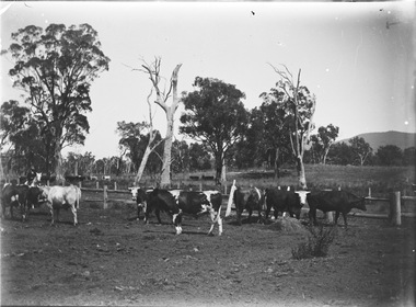
Negative - Haeusler Glass Negatives Collection - Cows in a paddock, c1910
The Wodonga Historical Society Haeusler Collection provides invaluable insight into life in late nineteenth and early twentieth century north east Victoria. The collection comprises manuscripts, personal artefacts used by the Haeusler family on their farm in Wodonga, and a set of glass negatives which offer a unique visual snapshot of the domestic and social lives of the Haeusler family and local Wodonga community. The Haeusler family migrated from Prussia (Germany) to South Australia in the 1840s and 1850s, before purchasing 100 acres of Crown Land made available under the Victorian Lands Act 1862 (also known as ‘Duffy’s Land Act’) in 1866 in what is now Wodonga West. The Haeusler family were one of several German families to migrate from South Australia to Wodonga in the 1860s. This digital image was produced from one of the glass negatives that form part of the collection, probably taken by Louis Haeusler (b.1887) with the photographic equipment in the Wodonga Historical Society Haeusler Collection. This item is unique and has well documented provenance and a known owner. It forms part of a significant and representative historical collection which reflects the local history of Wodonga. It contributes to our understanding of domestic and family life in early twentieth century Wodonga, as well as providing interpretative capacity for themes including local history and social history.Digital image created from the Haeusler Glass negative collection. A herd of cows in a paddock. There is a man on horseback on the left hand side of the image.wodonga pioneers, haeusler family, glass negatives, dry plate photography, farming wodonga -
 Wodonga & District Historical Society Inc
Negative - Haeusler Glass Negatives Collection - Men with horses in a paddock, c1910
The Wodonga Historical Society Haeusler Collection provides invaluable insight into life in late nineteenth and early twentieth century north east Victoria. The collection comprises manuscripts, personal artefacts used by the Haeusler family on their farm in Wodonga, and a set of glass negatives which offer a unique visual snapshot of the domestic and social lives of the Haeusler family and local Wodonga community. The Haeusler family migrated from Prussia (Germany) to South Australia in the 1840s and 1850s, before purchasing 100 acres of Crown Land made available under the Victorian Lands Act 1862 (also known as ‘Duffy’s Land Act’) in 1866 in what is now Wodonga West. The Haeusler family were one of several German families to migrate from South Australia to Wodonga in the 1860s. This digital image was produced from one of the glass negatives that form part of the collection, probably taken by Louis Haeusler (b.1887) with the photographic equipment in the Wodonga Historical Society Haeusler Collection.This item is unique and has well documented provenance and a known owner. It forms part of a significant and representative historical collection which reflects the local history of Wodonga. It contributes to our understanding of domestic and family life in early twentieth century Wodonga, as well as providing interpretative capacity for themes including local history and social history.Digital image created from the Haeusler Glass negative collection. 3 men with horses and farm machinery in a paddock.wodonga pioneers, haeusler family, glass negatives, dry plate photography, wodonga families, early farming -
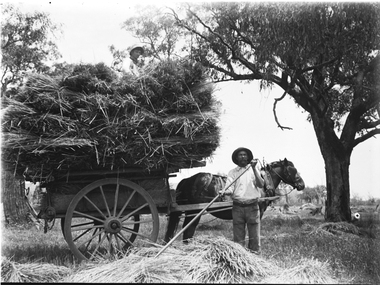 Wodonga & District Historical Society Inc
Negative - Haeusler Glass Negatives Collection - Sam Parker's Farm c1910
The Wodonga Historical Society Haeusler Collection provides invaluable insight into life in late nineteenth and early twentieth century north east Victoria. The collection comprises manuscripts, personal artefacts used by the Haeusler family on their farm in Wodonga, and a set of glass negatives which offer a unique visual snapshot of the domestic and social lives of the Haeusler family and local Wodonga community. The Haeusler family migrated from Prussia (Germany) to South Australia in the 1840s and 1850s, before purchasing 100 acres of Crown Land made available under the Victorian Lands Act 1862 (also known as ‘Duffy’s Land Act’) in 1866 in what is now Wodonga West. The Haeusler family were one of several German families to migrate from South Australia to Wodonga in the 1860s. This digital image was produced from one of the glass negatives that form part of the collection, probably taken by Louis Haeusler (b.1887) with the photographic equipment in the Wodonga Historical Society Haeusler Collection. Parker Family - Samuel Skelton Parker, Jack Parker’s father, migrated to Australia from Ballymena, Country Antrim, Ireland in 1884. He married Bridget Cusack from County Clare in 1883. They had children William, James, Jack, Samuel and Rachel. After working on a station in northern NSW, they moved to Barnawartha and set up a butchery and later a bakery. In 1890 the family moved to Wodonga, buying a property in West Wodonga, which he called “Park Hall” after his home in Ireland. The property is now the location of the Wodonga Golf Club in Parkers Road, West Wodonga.This item is unique and has well documented provenance and a known owner. It forms part of a significant and representative historical collection which reflects the local history of Wodonga. It contributes to our understanding of domestic and family life in early twentieth century Wodonga, as well as providing interpretative capacity for themes including local history and social history.Digital image created from the Haeusler Glass negative collection. A man spreading hay with a rake in the foreground. A horse and cart loaded with hay is behind him.wodonga pioneers, haeusler family, glass negatives, dry plate photography, wodonga families, early farming -
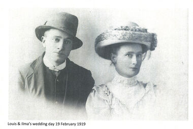 Wodonga & District Historical Society Inc
Negative - Haeusler Glass Negatives Collection - Louis Haeusler and Ilma's Wedding Day 19 February 1919
The Wodonga Historical Society Haeusler Collection provides invaluable insight into life in late nineteenth and early twentieth century north east Victoria. The collection comprises manuscripts, personal artefacts used by the Haeusler family on their farm in Wodonga, and a set of glass negatives which offer a unique visual snapshot of the domestic and social lives of the Haeusler family and local Wodonga community. The Haeusler family migrated from Prussia (Germany) to South Australia in the 1840s and 1850s, before purchasing 100 acres of Crown Land made available under the Victorian Lands Act 1862 (also known as ‘Duffy’s Land Act’) in 1866 in what is now Wodonga West. The Haeusler family were one of several German families to migrate from South Australia to Wodonga in the 1860s. Louis Alfred Haeusler was the 6h child of Johann Heinrich Ferdinand Haeusler and Ernestina Wilhelmine nee Rogasch. He married Ilma Margaret Ernestine Tasker in the Presbyterian Church in Tallangatta on 19th February 1919. Ilma was born in Tallangatta, Victoria in 1900 to Michael John Tasker and Louisa Ida nee Schultz. Ilma died in childbirth in 1928 giving birth to a stillborn child. She was survived by her husband, Louis Alfred Haeusler and one surviving son, John Alfred Lyell who was born in 1922.This item is unique and has well documented provenance and a known owner. It forms part of a significant and representative historical collection which reflects the local history of Wodonga. It contributes to our understanding of domestic and family life in early twentieth century Wodonga, as well as providing interpretative capacity for themes including local history and social history.Digital image created from the Haeusler Glass negative collection. A portrait of Louis Haeusler and Ilma Tasker taken on their Wedding Day on 19 February 1919.wodonga pioneers, haeusler family, glass negatives, dry plate photography, wodonga families, early farming -
 Wodonga & District Historical Society Inc
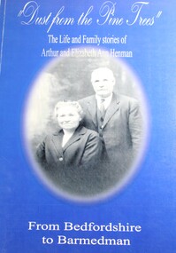
Book - Dust From the Pine Trees : The Life and Family Stories of Arthur and Elizabeth Ann Henman - From Bedfordshire to Barmedman, Lila McCann & Betty Lawrence
The story of the life, family and achievements of Arthur Henman, born in 1861 in Lidlington, Bedfordshire, England and his wife Elizabeth Ann nee Pollard of Bonegilla, Victoria. For a time on arrival in Australia at the age of 17, Arthur had a contract to supply timber to the New South Wales Railway Department. After marrying in 1888, Arthur and Elizabeth became successful dairy farmers in Glen Innes, northern New South Wales, before deciding to come to the Barmedman district. They took up the property, now well known as "Pine Valley." They had a pioneer's task to face for a thick belt of green timber stretched from the back door of their first home to Temora. Undaunted by the task, but with great determination and courage, they fashioned a first class property out of the wild and waste of those days and made valuable contribution to the fledgling communities until retirement from active farming in 1923 when they moved to Sydney.non-fictionThe story of the life, family and achievements of Arthur Henman, born in 1861 in Lidlington, Bedfordshire, England and his wife Elizabeth Ann nee Pollard of Bonegilla, Victoria. For a time on arrival in Australia at the age of 17, Arthur had a contract to supply timber to the New South Wales Railway Department. After marrying in 1888, Arthur and Elizabeth became successful dairy farmers in Glen Innes, northern New South Wales, before deciding to come to the Barmedman district. They took up the property, now well known as "Pine Valley." They had a pioneer's task to face for a thick belt of green timber stretched from the back door of their first home to Temora. Undaunted by the task, but with great determination and courage, they fashioned a first class property out of the wild and waste of those days and made valuable contribution to the fledgling communities until retirement from active farming in 1923 when they moved to Sydney.pioneers australia, pioneers nsw, arthur henman, elizabeth ann pollard, barmedman district nsw -
 City of Kingston
Photograph - Colour, 29 January 1993
Bonbeach, Carrum and Patterson Lakes are suburbs in the City of Kingston. Bonbeach and Carrum were holiday destinations in early 20th century and over time the housing has converted to permanent residential structures. In Patterson Lakes, the area consists predominantly of newer housing developments and the tidal canal system which is accessible to many dwellings joins Port Phillip Bay.Bonbeach, Carrum and Patterson Lakes were previously part of the extensive Carrum Carrum Swamp. The area was once a source of fish and eels for the Mayone-Bulluk clan of the Bunurong people. Over time the area was drained and this allowed farming at Carrum and Bonbeach, although the area was prone to flooding. In the early 1920s and 30s the land was converted to residential dwellings. In 1973 investigations commenced nearby to Bonbeach and Carrum into the development of a unique residential area comprising canals and waterways. It was originally proposed to be known as "Gladesville". Circa 1974, the area was rezoned from rural to residential and named Patterson Lakes. Development has been continuous since the 1970s with staged construction of the waterways, residential housing, and supporting infrastructure and facilities.Laminated colour aerial photograph of the Bonbeach, Carrum and Patterson Lakes region within City of Kingston. This 1993 image includes Bonbeach High School prior to demolition, Bonbeach Primary School and Patterson River Golf Club. Sections of Patterson Lakes are not yet developed, including Rhode and Staten Islands. Long Island Point appears to be a recent development with many spare blocks and new houses under construction. The Patterson River marina is prominent and the river mouth as it meets Port Phillip Bay. The Carrum railway station is visible.Black type on white adhesive sticker: No. 6661 Black type on white adhesive sticker: 26E/6661, 29/1/93, 4.25 pm Black type on white adhesive sticker 29-1-93 Yellow circular adhesive stickerbonbeach, carrum, patterson lakes, patterson river, carrum carrum swamp, canals and waterways -
City of Kingston
Photograph - Colour, Circa 1993
Edithvale is a suburb in the City of Kingston. It is located between Aspendale and Chelsea on the Port Phillip Bay and built within remnant areas of the Carrum Carrum swamp. The foreshore precinct comprises a wide sandy beach, with low sand dunes and numerous historic boat sheds. The suburb consists of older style dwellings and former holiday houses, combined with mid-century housing and newer homes. The large blocks are increasingly subdivided and the existing dwellings demolished to accommodate units and townhouses, thus changing the landscape of the area and reducing the tree canopy.The beachside suburb of Edithvale was previously part of the extensive Carrum Carrum Swamp. The area was once a source of fish and eels for the Mayone-Bulluk clan of the Bunurong people. Over time the area was drained and predominantly devoted to dairy farming and holiday houses. The farms were gradually sold and subdivided with a large number of homes built after World War II and in the 1960s. Edithvale is mainly residential with a shopping strip along Nepean Highway but little significant industry was ever established in the area apart from a plaster works and confectionary factory, both now closed.Aerial colour photograph of Edithvale as viewed from Alexandra Avenue in the north to Ella Grove Chelsea/Edithvale in the south. The area is built-up with residential housing and facilities including Edithvale Primary School, numerous churches and the Edithvale Railway station. Large sections depict the remnant Carrum Carrum swamp. Edithvale Common and the former "Duck Inn" (Melbourne Water/Friends of Edithvale Seaford Wetlands) can be seen. Edithvale Recreational reserve, the valodrome and Edithvale Public Golf Course are prominent. The image shows vacant land in the area now known as Aspendale Gardens and the newer residential section of Chelsea Heights is not developed. A bike path has been established to cover the secondary drain. The Golf Links Court residential development located off Hughes Avenue is a large vacant block.Yellow circular adhesive sticker on plastic Black ink (marker): * (asterisk) Black type on white adhesive sticker: P000108edithvale, aspendale, chelsea, carrum carrum swamp -
City of Kingston
Photograph - Colour, 6 March 1993
Edithvale is a suburb in the City of Kingston. It is located between Aspendale and Chelsea on the Port Phillip Bay and built within remnant areas of the Carrum Carrum swamp. The foreshore precinct comprises a wide sandy beach, with low sand dunes and numerous historic boat sheds. The suburb consists of older style dwellings and former holiday houses, combined with mid-century housing and newer homes. The large blocks are increasingly subdivided and the existing dwellings demolished to accommodate units and townhouses, thus changing the landscape of the area and reducing the tree canopy.The beachside suburb of Edithvale was previously part of the extensive Carrum Carrum Swamp. The area was once a source of fish and eels for the Mayone-Bulluk clan of the Bunurong people. Over time the area was drained and predominantly devoted to dairy farming and holiday houses. The farms were gradually sold and subdivided with a large number of homes built after World War II and in the 1960s. Edithvale is mainly residential with a shopping strip along Nepean Highway but little significant industry was ever established in the area apart from a plaster works and confectionary factory, both now closed.Laminated aerial colour photograph of Edithvale as viewed from Alexandra Avenue in the north to Ella Grove Chelsea/Edithvale in the south. regents Park Aspendale can be seen in the top left. The area is built-up with residential housing and facilities including Edithvale Primary School, numerous churches and the Edithvale Railway station. Large sections depict the remnant Carrum Carrum swamp. Edithvale Common and the former "Duck Inn" (Melbourne Water/Friends of Edithvale Seaford Wetlands) can be seen. Edithvale Recreational reserve, the valodrome and Edithvale Public Golf Course are prominent. The image shows vacant land in the area now known as Aspendale Gardens and the newer residential section of Chelsea Heights is not developed. A bike path has been established to cover the secondary drain. The Golf Links Court residential development located off Hughes Avenue is a large vacant block.Black type on white adhesive label: 6-3-93 Black type on white adhesive label: 25/9211, 6/3/93, 11.20 am Black type on white adhesive label: 9211 Yellow circular adhesive sticker Black pencil: 9211 6-3-93 arrow pointing Nedthvale, carrum carrum swamp, aspendale, chelsea -
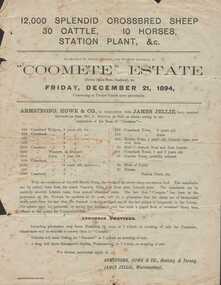 Warrnambool and District Historical Society Inc.
Document - Advertisement, Coomete estate, Sale of stock and plant, 1894
Augustus Bostock was the 9th child of Robert & Rachael Bostock of Vaucluse Epping Forest, Van Diemen’s Land. He was only 4 years old when his mother died. He was inspired by his father to seek his fortune in the Western District of Victoria. He arrived around 1850. He married Margaret Aitkin in July 1865. Augustus owned several properties in the district and leased others. He sat on the court of Warrnambool, Mortlake or Hexham as required. He resided at Marramook in Hawkesdale and later moved to Vaucluse in Hopetoun Road Warrnambool, where he died in 1920 at the age of 87. He was involved in many aspects of life in the Western District, racing, cricket, and social activities to name a few. This flyer is advertising the sale of 12000 sheep, 30 cattle, 10 horses and station plant at the expiration of the lease of Coomete. It states that Coomete has been in the possession of Mr. Augustus Bostock for over 30 yearsThis is one of a number of documents which relate to the Bostock family who were one of the most important pioneering families of the Western District. They owned and leased various properties around Warrnambool and were involved in many aspects of social and business life. This document contains a detailed view of the stock owned by Augustus Bostock at Coomete. From a social perspective the details provided show that it was an event of some importance in the farming area.Cream paper with heading and title in large font at the top with Coomete Estate in uppercase inside banner lines underneath with details of stock and numbers to be sold in smaller print below. Mercer printer Geelong. For further particulars apply to Armstrong, Howe & Co Geelong and Terang, James Jellie Warrnambool.coomete, warrnambool, augustus bostock, coomete lease, 1894 -
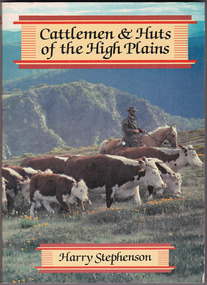 Marysville & District Historical Society
Book - Paperback book, Harry H. Stephenson, Cattlemen & Huts of the High Plains, 1980
A book that records the early development of Victoria's alpine regions by the pioneer cattlemen.Paperback book. The cover photograph shows snow plains, wildflowers, cattle, cattlemen and the mountain scenery across the Howqua Valley in Victoria.non-fictionA book that records the early development of Victoria's alpine regions by the pioneer cattlemen.cattle, victoria, beeding, history, hill farming, mountain life, cattlemen -
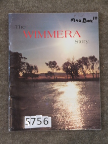 Stawell Historical Society Inc
Book, Regional Information Series, The Wimmera Story, 1983
Tourist information of the Wimmera This book was produced for Wimmera Tourism. Arthur Kuehne did the Stawell Preparations pages 44, 45 & 46Card Cover with colour photo of Natimuk Lake and Mt Arapiles in the background.The Wimmera Story. (in Black and red print.)stawell farming -
Nhill & District Historical Society Inc.
Book - W.L. Brockman: A Portrait by Ruth Johnston, W.L. Brockman: A Portrait
Biography / memoir of William Locke Brockman came to the Swan River Colony in the early 1830's with his wife and son. A successful farmer and businessman, his greatest achievements were in the political sphere, where he worked to bring representative government to Western Australia.W.L. Brockman: A Portrait by Ruth Johnstonwilliam locke brockman, swan river colony, 1830's - history, western australia - history, farming - history, political- history