Showing 2214 items
matching jubilee-fountain
-
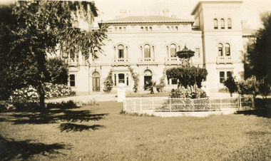 The Beechworth Burke Museum
Photograph, 1930
Mayday Hills Mental Hospital was originally constructed in 1864 under the name of the Beechworth Lunatic Asylum. It was built for locals in need of help who were kept in the local gaol. In its first decade, the residents of the hospital were used as menial labourers but over time, as mental healthcare progressed, were cared for in more nuanced ways. This site became a training hospital for nurses in the 1960's. Eventually, mental health patients were moved to other care facilities and Mayday Hills was operating as a geriatric care facility. It was closed in 1995, after which the buildings and their grounds were purchased to La Trobe University to be used as a campus. The university sold the site in 2011 to private ownership. This image depicts the front facade of the building and a portion of the gardens, including a fountain. Mayday Hills Mental Hospital is a historically significant site for many factors. It is representative of healthcare practice in nineteenth century Victoria. It contains rare examples of construction and architecture. It is also significant for aesthetic and technical reasons.Black and white photograph printed on matte photographic paperReverse: Mental Hospital/ Beechworth Lunatic Asylum/ Xmas 1930/ 8190 VELOX (Watermark)mayday, mayday hills hospital, mayday hills, mayday hills mental asylum, beechworth, beechworth asylum, beechworth lunatic asylum, beechworth hospital for the insane, garden, gardens & parks, architecture, historic victorian architecture, healthcare, health, fountain, la trobe university -
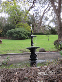 Eltham District Historical Society Inc
Photograph, Liz Pidgeon, Heritage Excursion; Back-track walk to Fitzsimons Lane, 2 July 2016, 2 July 2016
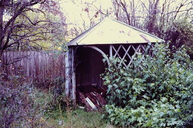
Water fountain on private property Newsletter No., 228, June 2016 Heritage Excursion – Back-track walk to Fitzsimons Lane – Saturday 2nd July Our July heritage excursion will be a walk to Yarra Hill Close and Fitzsimons Lane Bridge, based on the story on pages 3 and 4. Although the route is close to Fitzsimons Lane it will follow streets and paths that may not be familiar to many local residents. It will include commentary on the history of this corner of the Town of Eltham. This walk on Saturday 2nd July will follow a “there and back” route, that is returning over much the same course. It is about 2.5 km in length and will take 2 to 2.5 hours. It includes some hills. It will start at 2pm at the corner of Bolton Street and Old Eltham Road (Melway ref.21 F10).Born Digitalelection day, heritage excursion, activities, eltham district historical society, fitzsimons lane, water fountain -
 Stawell Historical Society Inc
Photograph, Armstrong’s Area Houses c 1990's -- 2 Photos -- Coloured
Residence Fountainhead Brewery Armstrong's Est. c 1872. The rear view photograph shows a more recent renovated building. Some evidence of demolition to rear of building (servants stairs etc.) Following notes taken from information in album 9 - "Compare earlier photos and note balcony etc. Later views, This photo early 2003. Owing to timber decay balcony was removed for safety. Finances permitting complete balcony will be replaced. Twin columns and iron lace are not original. Early description mentions statues in "niches" beside door. Female statue left is original. White pedestal at left was male stature damaged by a falling tree. Both statues were fountains." Photographs taken by Mr. Don Richard and held in Album 9b Armstrong’s Area.Two coloured photographs, of a brick double story building. The front view of the building has 4 windows and 2 doors. Two white columns at the entrance with decorative iron work support the roof of the porch with 2 white chairs and a table on top. Either side of the entrance door are 2 white wall indents "niches" with pot plants. The second photo show the back view of the two story building with a single story building attached that has a tin roof. A timber fence with a gate shows the side entrance to the single story building. 648M NHNN 8H01HPRO3 WIMMERA 1MHGINGstawell -
 Kew Historical Society Inc
Slide - 'Reno', St John 's Parade, 1977
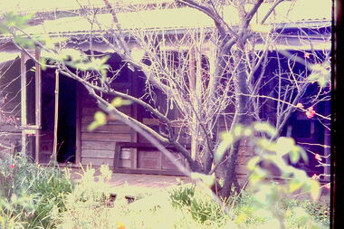
‘Reno’, stood on the east side of St John’s Parade. Its earliest recorded owner was the architect Samuel Cocking who lived there from c.1865 until his death in 1888. The original landholding was bordered by Cotham Road, Glenferrie Road, Wellington Street, and Charles Street. The southern portion of this land included a fine orchard, with many imported trees. The old summer house, at first in the orchard, was later removed to the house garden. The MMBW Detail Plan No.1576 (1904) shows the remaining portion of the original land holding, including a semi-circular pathway at the front, and garden features such as an aviary, a fountain and grotto, and a fernery. The garden including rare plants supplied by Baron Von Mueller, surrounds the cottage in a tangled frenzy. Despite a ‘local significance’ classification by the National Trust, the house was demolished in 1977.Rare photograph of an historically important weatherboard cottage in St John's Parade.Colour positive transparency (slide) of the verandah of 'Reno' in St John's Parade, Kew (demolished 1977). historic houses -- kew (vic.), reno -- st john's parade -- kew (vic.) -
 Kew Historical Society Inc
Slide - 'Reno', St John 's Parade, 1977
‘Reno’, stood on the east side of St John’s Parade. Its earliest recorded owner was the architect Samuel Cocking who lived there from c.1865 until his death in 1888. The original landholding was bordered by Cotham Road, Glenferrie Road, Wellington Street, and Charles Street. The southern portion of this land included a fine orchard, with many imported trees. The old summer house, at first in the orchard, was later removed to the house garden. The MMBW Detail Plan No.1576 (1904) shows the remaining portion of the original land holding, including a semi-circular pathway at the front, and garden features such as an aviary, a fountain and grotto, and a fernery. The garden including rare plants supplied by Baron Von Mueller, surrounds the cottage in a tangled frenzy. Despite a ‘local significance’ classification by the National Trust, the house was demolished in 1977.Rare photograph of an historically important weatherboard cottage in St John's Parade.Colour positive transparency (slide) of the a doorway of 'Reno' in St John's Parade, Kew (demolished 1977). historic houses -- kew (vic.), reno -- st john's parade -- kew (vic.) -
 Kew Historical Society Inc
Slide - 'Reno', St John 's Parade, 1977
‘Reno’, stood on the east side of St John’s Parade. Its earliest recorded owner was the architect Samuel Cocking who lived there from c.1865 until his death in 1888. The original landholding was bordered by Cotham Road, Glenferrie Road, Wellington Street, and Charles Street. The southern portion of this land included a fine orchard, with many imported trees. The old summer house, at first in the orchard, was later removed to the house garden. The MMBW Detail Plan No.1576 (1904) shows the remaining portion of the original land holding, including a semi-circular pathway at the front, and garden features such as an aviary, a fountain and grotto, and a fernery. The garden including rare plants supplied by Baron Von Mueller, surrounds the cottage in a tangled frenzy. Despite a ‘local significance’ classification by the National Trust, the house was demolished in 1977.Rare photograph of an historically important weatherboard cottage in St John's Parade.Colour positive transparency (slide) of the verandah of 'Reno' in St John's Parade, Kew (demolished 1977). historic houses -- kew (vic.), reno -- st john's parade -- kew (vic.) -
 Kew Historical Society Inc
Slide - Grotto of 'Reno', St John 's Parade, 1977
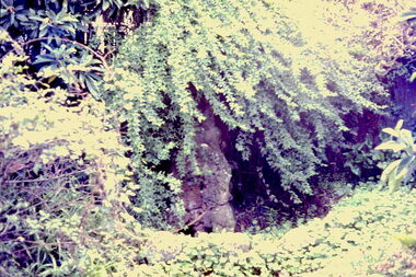
‘Reno’, stood on the east side of St John’s Parade. Its earliest recorded owner was the architect Samuel Cocking who lived there from c.1865 until his death in 1888. The original landholding was bordered by Cotham Road, Glenferrie Road, Wellington Street, and Charles Street. The southern portion of this land included a fine orchard, with many imported trees. The old summer house, at first in the orchard, was later removed to the house garden. The MMBW Detail Plan No.1576 (1904) shows the remaining portion of the original land holding, including a semi-circular pathway at the front, and garden features such as an aviary, a fountain and grotto, and a fernery. The garden including rare plants supplied by Baron Von Mueller, surrounds the cottage in a tangled frenzy. Despite a ‘local significance’ classification by the National Trust, the house was demolished in 1977.Rare photograph of an historically important weatherboard cottage in St John's Parade.Colour positive transparency (slide) of the grotto in the garden of 'Reno' in St John's Parade, Kew (demolished 1977). historic houses -- kew (vic.), reno -- st john's parade -- kew (vic.) -
 Kew Historical Society Inc
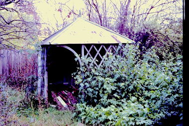
Slide - Former Summerhouse in the Garden of 'Reno', St John 's Parade, 1977
‘Reno’, stood on the east side of St John’s Parade. Its earliest recorded owner was the architect Samuel Cocking who lived there from c.1865 until his death in 1888. The original landholding was bordered by Cotham Road, Glenferrie Road, Wellington Street, and Charles Street. The southern portion of this land included a fine orchard, with many imported trees. The old summer house, at first in the orchard, was later removed to the house garden. The MMBW Detail Plan No.1576 (1904) shows the remaining portion of the original land holding, including a semi-circular pathway at the front, and garden features such as an aviary, a fountain and grotto, and a fernery. The garden including rare plants supplied by Baron Von Mueller, surrounds the cottage in a tangled frenzy. Despite a ‘local significance’ classification by the National Trust, the house was demolished in 1977.Rare photograph of an historically important weatherboard cottage in St John's Parade.Colour positive transparency (slide) of the former summerhouse in the garden of 'Reno' in St John's Parade, Kew (demolished 1977). historic houses -- kew (vic.), reno -- st john's parade -- kew (vic.) -
 Kew Historical Society Inc
Slide - 'Reno', St John 's Parade, 1977
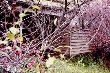
‘Reno’, stood on the east side of St John’s Parade. Its earliest recorded owner was the architect Samuel Cocking who lived there from c.1865 until his death in 1888. The original landholding was bordered by Cotham Road, Glenferrie Road, Wellington Street, and Charles Street. The southern portion of this land included a fine orchard, with many imported trees. The old summer house, at first in the orchard, was later removed to the house garden. The MMBW Detail Plan No.1576 (1904) shows the remaining portion of the original land holding, including a semi-circular pathway at the front, and garden features such as an aviary, a fountain and grotto, and a fernery. The garden including rare plants supplied by Baron Von Mueller, surrounds the cottage in a tangled frenzy. Despite a ‘local significance’ classification by the National Trust, the house was demolished in 1977.Rare photograph of an historically important weatherboard cottage in St John's Parade.Colour positive transparency (slide) of the garden of 'Reno' in St John's Parade, Kew (demolished 1977). historic houses -- kew (vic.), reno -- st john's parade -- kew (vic.) -
 Kew Historical Society Inc
Slide - Former Summerhouse in the Garden of 'Reno', St John 's Parade, 1977
‘Reno’, stood on the east side of St John’s Parade. Its earliest recorded owner was the architect Samuel Cocking who lived there from c.1865 until his death in 1888. The original landholding was bordered by Cotham Road, Glenferrie Road, Wellington Street, and Charles Street. The southern portion of this land included a fine orchard, with many imported trees. The old summer house, at first in the orchard, was later removed to the house garden. The MMBW Detail Plan No.1576 (1904) shows the remaining portion of the original land holding, including a semi-circular pathway at the front, and garden features such as an aviary, a fountain and grotto, and a fernery. The garden including rare plants supplied by Baron Von Mueller, surrounds the cottage in a tangled frenzy. Despite a ‘local significance’ classification by the National Trust, the house was demolished in 1977.Rare photograph of an historically important weatherboard cottage in St John's Parade.Colour positive transparency (slide) of the former summerhouse in the garden of 'Reno' in St John's Parade, Kew (demolished 1977). historic houses -- kew (vic.), reno -- st john's parade -- kew (vic.) -
 Kew Historical Society Inc
Photograph - 'Reno', 10 St John's Parade, John T Collins, 1977
‘Reno’, stood on the east side of St John’s Parade. Its earliest recorded owner was the architect Samuel Cocking who lived there from c.1865 until his death in 1888. The original landholding was bordered by Cotham Road, Glenferrie Road, Wellington Street, and Charles Street. The southern portion of this land included a fine orchard, with many imported trees. The old summer house, at first in the orchard, was later removed to the house garden. The MMBW Detail Plan No.1576 (1904) shows the remaining portion of the original land holding, including a semi-circular pathway at the front, and garden features such as an aviary, a fountain and grotto, and a fernery. The garden including rare plants supplied by Baron Von Mueller, surrounds the cottage in a tangled frenzy. Despite a ‘local significance’ classification by the National Trust, the house was demolished in 1977.Partial view, north side of the weatherboard cottage in St John's Parade, Kew, known as 'Reno' (demolished 1977). Architectural elements revealed in this photo by John T Collins include: two wing, hip roof construction; external buildings at angles to main wing; corrugated iron roofing [over shingles]; brick chimney external to building; unvarnished/unpainted external weatherboards. General dilapidated condition. "Kew 'Reno' 10 St Johns Pde / John Collins, 11 Anderson Road, Hawthorn East, 3123, Film 35B Exposure 27"reno - st john's parade -- kew (vic.), john t collins -
 Kew Historical Society Inc
Photograph - 'Reno', 10 St John's Parade, John T Collins, 1977
‘Reno’, stood on the east side of St John’s Parade. Its earliest recorded owner was the architect Samuel Cocking who lived there from c.1865 until his death in 1888. The original landholding was bordered by Cotham Road, Glenferrie Road, Wellington Street, and Charles Street. The southern portion of this land included a fine orchard, with many imported trees. The old summer house, at first in the orchard, was later removed to the house garden. The MMBW Detail Plan No.1576 (1904) shows the remaining portion of the original land holding, including a semi-circular pathway at the front, and garden features such as an aviary, a fountain and grotto, and a fernery. The garden including rare plants supplied by Baron Von Mueller, surrounds the cottage in a tangled frenzy. Despite a ‘local significance’ classification by the National Trust, the house was demolished in 1977.Partial view, side of the weatherboard cottage in St John's Parade, Kew, known as 'Reno' (demolished 1977). Architectural elements revealed in this photo by John T Collins include: hip roof construction; corrugated iron roofing [over shingles]; unvarnished/unpainted external weatherboards; Externally opening 1860s-style casement window. General dilapidated condition. "Kew 'Reno' 10 St Johns Pde / John Collins, 11 Anderson Road, Hawthorn East, 3123, Film 35B Exposure 26"reno - st john's parade -- kew (vic.), john t collins -
 Kew Historical Society Inc
Photograph - 'Reno', 10 St John's Parade, John T Collins, 1977
‘Reno’, stood on the east side of St John’s Parade. Its earliest recorded owner was the architect Samuel Cocking who lived there from c.1865 until his death in 1888. The original landholding was bordered by Cotham Road, Glenferrie Road, Wellington Street, and Charles Street. The southern portion of this land included a fine orchard, with many imported trees. The old summer house, at first in the orchard, was later removed to the house garden. The MMBW Detail Plan No.1576 (1904) shows the remaining portion of the original land holding, including a semi-circular pathway at the front, and garden features such as an aviary, a fountain and grotto, and a fernery. The garden including rare plants supplied by Baron Von Mueller, surrounds the cottage in a tangled frenzy. Despite a ‘local significance’ classification by the National Trust, the house was demolished in 1977.Side of the original, relocated summer house of 'Reno' at 10 St John's Parade, Kew, (demolished 1977). Architectural elements revealed in this photo by John T Collins include: four-sided construction; trellis and weatherboard walls; corrugated iron roofing. Re-use as woodshed. General dilapidated condition. "Kew 'Reno' 10 St Johns Pde / John Collins, 11 Anderson Road, Hawthorn East, 3123, Film 35B Exposure 24"reno - st john's parade -- kew (vic.), john t collins -
 Bendigo Historical Society Inc.
Document - CORNISH COLLECTION: COPIES OF ARTICLE/BOOK/DOCUMENT RE CORNISH CHURCH HISTORY/LIFE IN BENDIGO, 1866
Document. Various copies of article/book/document re Cornish church history/life in Bendigo; a; programme of celebratory activities for Jubilee of Methodist Church and Sunday School, McKenzie Street - 1916 (handwritten note: ''Former Bible Christian'') - various activities for the period Oct 1st to October 9th; shows poor photographic copy of church building and adjacent Sunday School; stapled is letter from Pastor (A E Wellard) and Officers of the church re the celebrations addressed to ''Dear Friend'' with reference to the inauguration of a Thanksgiving Fund.(original of this letter has been cut and repaired with tape (showing up on copy). B. article titled ''60 Years Ago'' - two pages from unknown source with reference to the White Hills Bible Christian Church and the establishment of the church following that in California Gully (Upper Road Methodist Church) - numerous names of choir, early pioneers, ministers of the church, superintendents; c. two pages of information about the ''Back to Upper Road - Diamond Jubilee church, May 1924. Church services on Sunday May 18th; Trustees' Tea Monday 19th May and Children's Day, Sunday May 25th (two services and evening Re-union Tea and Concert - names of ministers and organizers provided. Poor quality reproduction of buildings.buildings, church, methodist church, methodist church. bible christian church. -
 Whitehorse Historical Society Inc.
Document, Australian Red Cross Society, 1939 - 1997
Australian Red Cross Society. Mitcham Branch. Papers and Memorabilia.Australian Red Cross Society. Mitcham Branch. Papers and Memorabilia. Contents: 1. Minutes of [ordinary] meetings. 1950 - 1990 4 vols. 2. Minutes of annual meetings. 1950 - 1988 3. Membership Book. 1959 - 1964. 1 vol. 4. Attendance Book 1971 - 1997 (1947 - 1959 bound with (6) 2 vols 5. Accounts Book. 1939 - 1941 1 vol. 6. Record book of materials issued and garments returned. 1941 - 7. Photos: 50th anniversary, 4 Aug 1989. 7.1 D.Oldham cutting cake 7.2 D. Oldham, Dot Faulkner, Rose Abbott, Joan Aitt, Joan Taylor, Dick Bryant, Lorne Vaughan, Joy Chivers, Judith Fry, Olive Williams, Ruby Jeffs, Jean Gorsuch, Phyllis Thiele 8. Certificates, Badges and Medals 8.1.1 Certificate presented by the A.R.C.S. Vic Division to Mitcham Branch for assisting the Red Cross March Appeal on Button Day, 1958.| 8.1.2 Certificate [issued with medal] to Mrs Edith Bryant in commemoration of Her Majesty's Silver Jubilee, 6 Feb 1952 : 6 Feb 1977| 8.1.3 City of Nunawading Community Award 1986 [Certificate] presented to Edith Mary Bryant 26 Jan 1986. [Framed] with plaque, wooden representation of Australia with engraved plate attached. Device missing. 8.2 Badges and Medals| 8.2.1 A.R.C.S. Twenty years service (Mrs E. Coles) in box with: 8.2.2 Membership badge A.R.C.S.| 8.2.3 Membership badge A.R.C.S. Victorian Division 9 Publications:| 9.1 Thirty-seventh Annual Report and financial statement. 1950-1951. Australian R.C. Society 9.2 A.R.C. Soc Bulk Catering Manual. 1990Australian Red Cross Society. Mitcham Branch. Papers and Memorabilia. australian red cross society. mitcham branch, bryant, edith mary, coles, e (mrs), oldham, d, faulkner, dot, abbott, rose, aitt, joan, gorsuch, jean, thiele, phyllis, taylor, joan, bryant, dick, vaughan, lorne, chivers, joy, fry, judith, williams, olive, jeffs, ruby -
![Scene in the Carlton Gardens / [by] Nicholas Caire, circa 1876](/media/collectors/550653872162f11fb04854aa/items/57825eedd0cdd1176ce4cdaf/item-media/57825f52d0cdd1176ce50427/item-fit-380x285.jpg) Kew Historical Society Inc
Kew Historical Society IncPhotograph, Anglo-Australasian Photographic Company, Scene in the Carlton Gardens, c. 1876
Nicholas Caire was born on Guernsey in the Channel Islands in 1837. He arrived in Adelaide with his parents in about 1860. In 1867, following photographic journeys in Gippsland, he opened a studio in Adelaide. From 1870 to 1876 he lived and worked in Talbot in Central Victoria. In 1876 he purchased T. F. Chuck's studios in the Royal Arcade Melbourne. In 1885, following the introduction of dry plate photography, he began a series of landscape series, which were commercially successful. As a photographer, he travelled extensively through Victoria, photographing places few of his contemporaries had previously seen. He died in 1918. Reference: Jack Cato, 'Caire, Nicholas John (1837–1918)', Australian Dictionary of Biography.An original, rare photograph from the series 'Views of Victoria: General Series' by the photographer, Nicholas Caire (1837-1918). The series of 60 photographs that comprise the series was issued c. 1876 and reinforced a neo-Romantic view of the Australian landscape to which a growing nationalist movement would respond. Nicholas Caire was active as a photographer in Australia from 1858 until his death in 1918. His vision of the Australian bush and pioneer life had a counterpart in the works of Henry Lawson and other nationalist poets, authors and painters.‘Scene in the Carlton Gardens’ : Views of Victoria (General Series) No.40 : Albumen silver photograph | Photo on card with Title and Description on reverse | Mounted 24 x 30 cm; Photo 12 x 17 cm.On Reverse: ‘The Carlton Gardens are not so extensive as most of the other public gardens around Melbourne, and, being laid out on a flat piece of ground, have not the advantage of possessing much that is romantic in its scenery. The subject of this issue is the only interesting spot within the enclosure, which is the Rustic Fountain, surrounded by a small lake of water, on the banks of which grow some very beautiful specimens of the hanging willow. These Gardens are open to the public at all times.’nicholas caire (1837-1918), carton gardens, exhibition building, landscape photography - victoria -
 Warrnambool and District Historical Society Inc.
Watch, Watch from Nestor
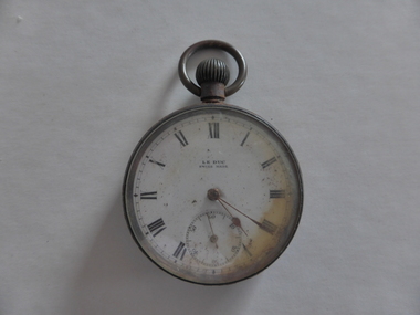
This watch belonged to Norman Borthwick of Ecklin, who, with his wife and two children, Janet, aged 7 and Jack, aged 6, were survivors of the sinking of the cruise boat, Nestor, on the Hopkins River in January 1921. The boat was on its regular trip from the Hopkins River boatsheds to Jubilee Park with 80 passengers. Ten people were drowned when the boat began to take water and sank about a kilometre upstream. Norman Borthwick was wearing the watch at the time and the hands have stopped at 5.20 p.m. on the day of the tragedy. A hero of the day was Constable Sharrock who drowned after saving the lives of several of those on boardThis watch is of great significance as it is an item that belonged to Norman Borthwick who was wearing the watch when he survived the sinking of the Nestor in the Hopkins River in 1921. This was one of the great tragic incidents in Warrnambool in the early 20th centuryThis is a Swiss-made watch made of gunmetal with a glass face and a metal winder at the top and a ring to attach the watch to a chain. The figures are Roman numerals and there is a separate minute hand dial. The watch is much rusted and is not able to be easily opened to see the mechanism. The gold-coloured hands point to the time of 20 past 5. The face of the watch is discoloured on the right hand side.‘Le Duc, Swiss made’nestor sinking, norman borthwick, constable sharrock -
 Eltham District Historical Society Inc
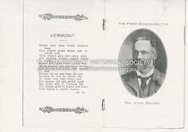
Document, The First Schoolmaster, Mr John Brown, Vermont State School, 1919
Photocopy from souvenir program for Vermont School Jubilee 1868-1919 featuring Mr John Broiwn, the first Schoolmaster. John Brown was the second Head Teacher at Eltham State School No. 209 (Eltham Primary) in Dalton Street having taken over from John Clarke in 1889. He died in office 23 Sept 1906 after a short severe illness at age 55 and is buried in Box Hill Cemetery (Evelyn Observer 28 Sep 1906 p2). The book "We did open a school in Little Eltham" incorrectly states his date of death as 16/12/1906.eltham state school no. 209, head teacher, john brown, vermont state school -
Stawell Historical Society Inc
Realia - Numismatics, Collection of assorted Jewelry, Badges & Coins
Found wrapped while metal detecting in Ironbark's. Royal Engineer's Bage and Royal Australian Engineer's Badge both c 1949 Brass Uniform badge with English Coat of Arms, city of Melbourne 1897 Queen Victorial Jubilee. 1902 Penny, Replica (Poor) Prussian Iron Cross 1913, Pair of Cufflinks, 1916 Halfpenny's Pair of White on Black Cameo earrings. Pair of Marquisate earrings, Spiral Sailing theme bracelet with 5 coloured images. Two Small blue badges with symbol and organ note. Red key shaped broach for lions 21 st Multiple district covention Sydney 1973.collection of Jewelery, Badges & Coins found in the Ironbarks -
 Ballarat Tramway Museum
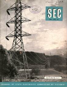
Magazine, State Electricity Commission of Victoria (SECV), SEC News, May June 1953
Published for the staff of the SEC, features the Kiewa Valley transmission line, North East towns and workers, industry, Bendigo Tram's Golden Jubilee, (AETA Visit, Mr George Laurens, Doug Dean, Tom Lynch and Basil Miller), electrical safety, meter reading in the country, sports, electric cooking, and sports section. In the retirements were Mr P Pithie, Senior Traffic Inspector Geelong, Mr V Pipps Depot Foreman Geelong and Mr S Watson, Geelong Senior depot clerk. On the inside cover are photos of the package power stations being installed at Geelong, Ballarat (Ballarat B) and Mildura.Demonstrates a SECV Staff magazine.Magazine, 36 pages, black and white production, centre stapled.Has RHSV stamp on the cover and "Case ViiiA" in inktramways, geelong, secv, retirements, ballarat b power station, power stations, bendigo -
 Melbourne Legacy
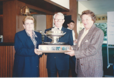
Photograph, Golf tournament, 1993
Huntingdale Golf club was the site of many social events for Legatees and Widows clubs. The label states this was Huntingdale Ladies Day in 1993. The photo shows Legatee Graeme McDougall representing the President presenting the trophy to Mrs Kunkel and Mrs Foster. The trophy was called the Legacy Huntingdale Jubilee Trophy. The day raised $7,500 for Legacy. The photos were in an album of photos from 1992 and 1993. An article in the Answer says that the association with the Huntingdale golf club began in 1933 and over the years over $255,000 has been raised for Legacy. The Open Mixes Foursomes was usually held in December and the Ladies Day was annually in October.A record of the type of activities Legacy provided as a social outlet for the widows and Legatees and for fundraising.Colour photo x 2 of ladies golf day presentation and a paper label.Paper label provides a caption for the photos.events, huntingdale golf club, golf, fundraising, trophy -
 Bendigo Historical Society Inc.
Photograph - ALEXANDRA FOUNTAIN
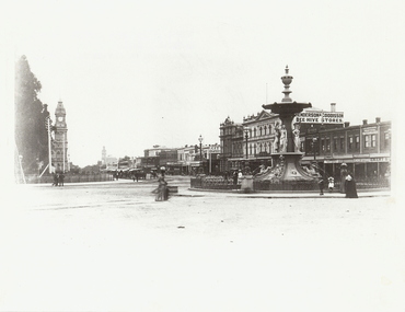
Black and white photograph. Alexandra Fountain, Pall Mall, Post Office, 2nd Shamrock Hotel. Bendigo School of Mines, Beehive Stores, Fence along Pall Mall. Horse cabs along Pall Mall. Men, women and children. Women wearing full length dresses. Inscriptions: in image - 'Henderson & Goodisson', 'City Drapery', 'Melbourne Cash Store', J Edwards Practical Watchmaker', ':Emery', 'A Lannduff', Karl Van Damme'. On back - rubber stamp, purple 'Royal Historical Society of Vic, Bendigo Branch, Dudley House, 60 View Street, Bendigo'.place, streetscape, alexandra fountain, photograph, photography, bendigo, alexandra fountain, pall mall, shamrock hotel, bendigo school of mines, beehive store, bendigo post office, bendigo clock, bendigo post office clock, bendigo citizens -
 Bendigo Historical Society Inc.
Newspaper - AILEEN AND JOHN ELLISON COLLECTION: BENDIGO ADVERTISER FRIDAY, APRIL 10, 1964
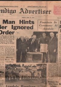
Bendigo advertiser from Friday, April 10, 1964. On the front page two photos and an article 'Axedale receives piped water after 19 year struggle' one photo shows the State opposition leader Mr. Stoneham operating a drinking fountain at the opening of the Axedale water reticulation system. At right the Minister for water supply Mr. Mibus. Others in the picture are: from left Councillors T. H. Grigg and J. Mills of Strathfieldsaye Shire and Mr. L. J. Ellison chairman of the Axedale Water trust. The other photo show Minister Mibus meeting with local children.newspaper, bendigo advertiser, axedale -
 Ballarat Tramway Museum
Slide - 35mm slide/s, Peter Moses, Jan. 1969
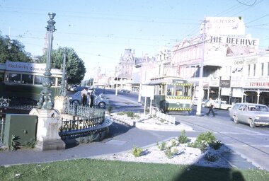
Photo of SEC Bendigo No. 6 crossing Mitchell St, north bound for North Bendigo, while a bogie tram waits to depart Charing Cross, east bound for Quarry Hill. Three SEC crew members standing by the front of the bogie tram and an inspector crossing the road near No. 6. Has part of the fountain in the view. Also in the photo are The Beehive building, and advertisement for Dewars whiskey and a shop front for "Ezywalkin" shoes. The bogie tram has a SEC roof advertisement "Electricity Best for cooking". Kodak cardboard mount slide, taken by Peter Moses, Jan. 1969.On the rear of the slide "Jan. 1969 Bendigo:" in blue ink, "P. Moses" in black ink and other side of the slide in red ink “22”.tramways, trams, bendigo, charing cross, tram 6 -
 Ballarat Tramway Museum
Photograph - Black & White Photograph/s, State Electricity Commission of Victoria (SECV), late 1940's
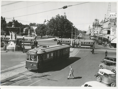
Black and White print contained within the Wal Jack Bendigo and Geelong Album, see Reg Item 5003 for more details. Photo of the Charing Cross with three bogie trams at the intersection, SEC publicity photo c1950. Two of the bogies crossing on the Eaglehawk - Quarry Hill line have white or cream strips on the lower edge of the body. No 26 has the destination of North Bendigo, though it is on Golden Square line with the driver standing just inside the doorway. In the background is the fountain, the Gardens and Pall Mall. SEC Publicity Photo, see Inscriptions for notes re photo. On the rear is the SEC Publicity Photo stamp, with negative number 21.1 written in, "Yallourn" in pencil and a typed piece of paper taped to the rear of the photo noting the Provincial tramways owned by the SEC, but that it is loss making.trams, tramways, bendigo, charing cross, secv, pall mall, tram 26 -
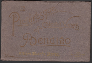 Bendigo Historical Society Inc.
Photograph - Picturesque Colored Views of Bendigo, 1909
Book of twelve coloured postcards - "12 Pictures of Colored Views of Bendigo". 1909 calendar printed in gold lettering on rear cover. Brown card cover with gold lettering. Abbott's Bush Stores (Williamson & Mollison Stores) 1909. Next St. Paul's Tower. Includes Post Office Bendigo, Albert Bush's Stores and Tea Warehouse x 2, Bendigo Fernery x 3, Easter Fair Procession, Queen's Monument Camp Reserve, Fern Pond Camp Reserve, Fountain Charing Cross, Mitchell street, Pall Mall, Town Hall, Hargreaves Street.bendigo, albert bush, tea warehouse -
 Melbourne Tram Museum
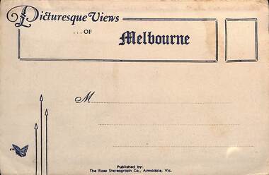
Postcard - Folder, Rose Stereograph Co, "Picturesque Views of Melbourne", mid 1930s
Comprises 12 photos of Melbourne, mid to late 1930s. Produced by Rose Stereograph of Armadale. 1 - Botanical Gardens and Government House Melbourne. - 2 - The MacRobertson Fountain Melbourne - Both the Fountain and the Shrine of Remembrance were completed in 1934. Government House tower features in the background. Also note the absence of any mature trees. See reference - completed 1934. 3 - Flinders Street Railway Station with a "W" class tram in Flinders Street and "Y" class tram in Swanston Street in the view 4 - St Kilda Road Melbourne - Looking south with the Queen Victoria Gardens in the left of the photo. 5 - Collins Street Melbourne - Showing the Regent Theatre, Manchester Unity Building and the Town Hall. 6 - Princes Bridge and city Skyline Melbourne - Shows; Princes Bridge, Yarra River, Excursion Ferry, Princes Walk, Flinders Street Railway Station, the Nicholas and Manchester Unity Buildings in Swanston Street and the Sargood Gardner building in Flinders Street. 7 - The Conservatory, Fitzroy Gardens Melbourne - 8 - The Cathedral Corner Melbourne - shows; Young & Jacksons Hotel, St Paul's Cathedral, The Gas & Fuel building, Ball & Walsh Department store and The State Theatre plus several "w" class trams in Swanston Street. 9 - St Kilda Road Melbourne - Looking south from Nolan Street. Note trees still present at the entrance area to the Shrine of Remembrance. 10 - Looking across Princes Bridge to St Kilda Road Melbourne - Looking south from the roof of the Nicolas Building showing; Princes Bridge, St. Kilda Road, The Shrine of Remembrance and the Victoria Barracks in the distance. 11 - Parliament House Melbourne - in Spring Street 12 - Captain Cook's Cottage, Fitzroy Gardens Melbourne - Erected in the gardens in 1934. Yields information about Melbourne city views and new attractions mid 1930s. Paper envelope folder with 6 photos on each side of a foldout section titled "Picturesque Views of Melbourne" melbourne, photo folders, postcards -
 Kew Historical Society Inc
Plan, Melbourne & Metropolitan Board of Works : Borough of Kew : Detail Plan No.1588, 1904
The Melbourne and Metropolitan Board of Works (MMBW) plans were produced from the 1890s to the 1950s. They were crucial to the design and development of Melbourne's sewerage and drainage system. The plans, at a scale of 40 feet to 1 inch (1:480), provide a detailed historical record of Melbourne streetscapes and environmental features. Each plan covers one or two street blocks (roughly six streets), showing details of buildings, including garden layouts and ownership boundaries, and features such as laneways, drains, bridges, parks, municipal boundaries and other prominent landmarks as they existed at the time each plan was produced. (Source: State Library of Victoria)This plan forms part of a large group of MMBW plans and maps that was donated to the Society by the Mr Poulter, City Engineer of the City of Kew in 1989. Within this collection, thirty-five hand-coloured plans, backed with linen, are of statewide significance as they include annotations that provide details of construction materials used in buildings in the first decade of the 20th century as well as additional information about land ownership and usage. The copies in the Public Record Office Victoria and the State Library of Victoria are monochrome versions which do not denote building materials so that the maps in this collection are invaluable and unique tools for researchers and heritage consultants. A number of the plans are not held in the collection of the State Library of Victoria so they have the additional attribute of rarity.Original survey plan, issued by the MMBW to a contractor with responsibility for constructing sewers in the area identified on the plan within the Borough of Kew. The plan was at some stage hand-coloured, possibly by the contractor, but more likely by officers working in the Engineering Department of the Borough and later Town, then City of Kew. The hand-coloured sections of buildings on the plan were used to denote masonry or brick constructions (pink), weatherboard constructions (yellow), and public buildings (grey). This plan shows the original configuration of the Kew Post Office, Court House and Police Station, which had opened in 1888. This configuration was to essentially remain until the purchase of the Court House and Police Station by the City of Boroondara in 2007 and its subsequent renovation. Interestingly, the MMBW surveyors incorrectly labelled parts of the complex. In the triangle in front of the Post Office, before the erection of the Kew Cenotaph in 1925, was located a lawn and the Queen Victoria Jubilee Fountain. While many of the shops on the south side of High street had been constructed by 1903 a number of sites were still used as vegetable gardens. Further along High Street, on the corner of Charles Street, the Salvation Army Barracks can be seen on the plan. These Barracks predate the later Citadel and ‘Young People’s Hall’ that were opened in 1919. At 22 Charles Street can be seen the house of James Venn Morgan. Hailed as the ‘father of Kew’, Morgan arrived in Melbourne in 1840. He was first engaged as a bookmaker, but a fortunate venture on the goldfields enabled him to purchase land in Kew. He conducted a market garden and dairy in Kew for many years.melbourne and metropolitan board of works, detail plans, maps - borough of kew, mmbw 1588, cartography -
 Bendigo Historical Society Inc.
Document - THE LUTHERAN CHURCH, GALVIN STREET, BENDIGO, 23 Feb, 1986
The Lutheran Church, Galvin Street, Bendigo. 1856 - 1986. Invitation to Jubilee Celebrations Commemorating the 130th Anniversary of the first Lutheran service in Bendigo, 24th February, 1856. Date: Sunday, 23rd February, 1986. Programme: Special Thanksgiving Service in Bethlehem Lutheran Church, Galvin (Calvin) Street. Guest Preacher: Dr. L. Grope, President, Lutheran Church of Australia. Picnic lunch in Rosalind Park. Historical & Choral Celebration in St. Paul's Anglican Cathedral, Myers Street, Melbourne Lutheran Singers will be in attendance and historical information will be given. A 42-page Dossier of Documentation will be available at $5.50 per copy.church, celebration, jubilee celebration, the lutheran church, bendigo. 1856 - 1986. invitation to jubilee celebrations commemorating 130th anniversary first lutheran service, 24th february, 1856. sunday, 23rd february, 1986. programme: special thanksgiving service bethlehem lutheran church, galvin (calvin) street. guest preacher: dr. l. grope, president, lutheran church of australia. picnic lunch rosalind park. historical & choral celebration in st. paul's anglican cathedral, myers street, melbourne lutheran singers historical information. 42-page dossier documentation $5.50 -
 Bendigo Historical Society Inc.
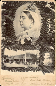
Photograph - SOUVENIR DIAMOND JUBILEE, 1897, POSTCARD, c.1897
Black and white photo of Queen Victoria, in profile, wearing official robes (with insignia VR) and a lace cap surmounted by a small crown. Head and shoulders only. She is surrounded by a wreath of fern leaves. The photo is a souvenir, produced by Albert Bush, whose photo is in the lower rh corner, also with a fern surround. To the left of him, is a photo of his corner store, with workers in the street at front (eighteen people). In front of the store is also a horse and carriage and a horse drawn wagon loaded with bags of produce (wheat?). The triple photos are a souvenir for Queen Victoria's Diamond Jubilee, 1897 and also an advertisement for Albert Bush's Grocery Store.topic