Showing 2090 items
matching bendigo maps
-
 Bendigo Historical Society Inc.
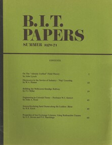
Book - BIT PAPERS, 1971
B.I.T. Papers Summer 1970-71, articles by various contributors, contents include, Building the Melbourne-Bendigo Railway, Engineering in Colonial Times, Source-Bordering Sand Dunes along the Loddon River & others, 66 pages with black and white photographs and maps..history, australian -
 Bendigo Historical Society Inc.
Book - 7 ROUTES SIGHTSEEING IN AND AROUND BENDIGO
7 Routes Sightseeing In And Around Bendigo, 32 pages with black and white maps and photographs. With IndexBendigo Chamber of Commerce & Industriesbendigo, tourism, guide -
 Bendigo Historical Society Inc.
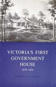
Book - VICTORIAS FIRST GOVERNMENT HOUSE
La Trobe cottage, Victoria's First Government House 1839 - 1854, commentary and catalogue, produced by the National Trust Of Australia (Victoria) with a map and black and white photographs.National Trust of Australiaaustralia, history, heritage places -
 Bendigo Historical Society Inc.
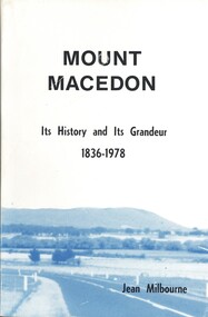
Book - MOUNT MACEDON, 1979
Mount Macedon, its history and its grandeur 1836 - 1978, 185 pages with maps and black and white photographs.Jean Milbournehistory, australian, mtmacedon, mtmacedon-history-properties -
 Bendigo Historical Society Inc.
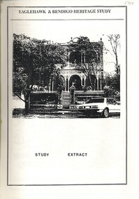
Book - EAGLEHAWK & BENDIGO HERITAGE - STUDY EXTRACT, 1993
Eaglehawk & Bendigo Heritage Study extract, with maps and black and white photographs.bendigo, buildings, heritage buildings -
 Bendigo Historical Society Inc.
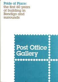
Book - PRIDE OF PLACE POST OFFICE GALLERY, 2011
Pride of Place, the first 60 years of buildings in Bendigo and surrounds, an exhibition at the Post Office Gallery, 27 pages with photographs & maps.Bendigo Art Gallerybendigo, buildings, heritage buildings, bendigo-history-architecture-buildings -
 Bendigo Historical Society Inc.
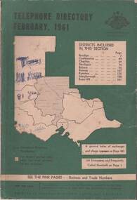
Book - TELEPHONE DIRECTORY FEBRUARY 1961, February 1961
Soft covered Telephone Directory February 1961. Districts covered are Bendigo, Castlemaine, Charlton, Deniliquin, Echuca, Kerang, Kyneton, Maryborough, Swan Hill. Cover has a green background with an outline of the map of Victoria in white. The Victorian Telephone directory boundaries are indicated and the district covered is shaded with black dots. Some handwritten jottings are written in ink on the cover. The directory contains both white and pink pages.book, bendigo, bendigo history & its people -
Bendigo Historical Society Inc.
Map - NEW MOON COMPANY, NO LIABILITY - PLAN OF THE MOON LINE 1906
... Inc. History House 11 Mackenzie Street Bendigo goldfields MAP ...Plan of the Moon Line of Reef 1906. Plan shows the line of reef and the leases with the distance along the reef. The Bendigo - Inglewood railway line is also drawn in. Leases mentioned are: Nth Johnsons, Johnson's Reef,Princess Dagman, Golden Age, Johnson's Reef Extd, Golden Pyke, Constellation, McDuff, Great Northern, Virginia, Specimen Hill, New Hopeful, New Argus, Clarence, North Argus, Moon, South New Moon, New Moon, Suffolk Tribute, North New Moon, New Moon Consolidated, New Moon United, Adelaide New Moon, Bendigo New Moon, The New Moon Northern Blocks, Central New Moon, Rising Moon, Full Moon, The Moon, Gt Extd New Moon, V Rymer.map, bendigo, goldfields, new moon company, no liability, plan of the moon line 1906, a richardson, nth johnsons, johnson's reef, princess dagman, golden age, johnson's reef extd, golden pyke, constellation, mcduff, great northern, virginia, specimen hill, new hopeful, new argus, clarence, north argus, moon, south new moon, new moon, suffolk tribute, north new moon, new moon consolidated, new moon united, adelaide new moon, bendigo new moon, the new moon northern blocks, central new moon, rising moon, full moon, the moon, gt extd new moon, v rymer. bendigo - inglewood railway -
Bendigo Historical Society Inc.
Document - NEW MOON MINE - NOTES ON THE NEW MOON MINE
Four typed copies of notes on the New Moon Mine on the Garden Gully Line of Reef. Notes include locality, depth of shaft, last year of production, size of lease, plant, Telephone and electric signalling, early history, gold obtained, prominence, gold production and dividends. Hand drawn locality map included.cottage, miners, new moon mine, notes on the new moon mine, h harkness & coy, thompson & co, telephone & electric signalling, 'robin hood' ground, bendigo amalgamated goldfields co, special edition australian mining standard 1/6/1899, mines dept booklet 'bendigo goldfields' 1936, mines dept annual and quarterly reports, annals of bendigo mining section 1907 = 1931, a richardson, souvenir 'declaration of 200th dividend' issued by directors of new moon co 1/12/1906, mines dept bulletin 47 'structure of bendigo goldfields' h herman 1923 -
Bendigo Historical Society Inc.
Map - HUSTLER'S REEF NO 1 MINE - EAST & WEST CROSS-CUTS OF THE HUSTLER'S REEF NO 1 MINE
... Underground Survey Office Bendigo Hustler's Line of Reefs Map showing ...Map showing the East & West Cross-cuts, North & South of Shaft of the Hustler's Reef No 1 Mine on the Hustler's Line of Reefs Bulletin No 33, Plate No XXII. Drawing shows where the different levels are, the stone encountered and smaller drawings of other sections near the shaft. Also shows some geographical features. Signed by H A Whitelaw, Underground Survey Office Bendigo, September, 1913. Geological Survey of Victoria emblem .mining, parish map, hustler's reef no 1 mine, east & west cross-cuts of the hustler's reef no 1 mine, geological survey of victoria, h a whitelaw, underground survey office bendigo, hustler's line of reefs -
Bendigo Historical Society Inc.
Map - HUSTLER'S REEF NO 1 MINE - TRANSVERSE SECTION OF THE HUSTLER'S REEF NO 1 MINE
... Bendigo Historical Society Inc. Bendigo Historical Society ...Map of a transverse Section of the Hustler's Reef No 1 Mine on the hustler's Line of Reefs Bulletin No 33, Plate No XXI. Map shows poppet legs at 801.07 feet above Sea Level and drawing of shaft with the different levels. Also shown are geological features and stone encountered. Geological Survey of Victoria emblem H Herman, Director, W Dickson, Secretary of Mines and The Hon. J. Drysdale Brown MLC Minister of Mines. Signed by H S Whitelaw, Underground Survey Office Bendigo, September, 1913. This item has not been scanned or photographed.mining, parish map, hustler's reef no 1 mine, hustler's line of reefs, transverse section of the hustler's reef no 1 mine, geological survey of victoria, underground survey office bendigo, h s whitelaw, h herman, w dickson, the hon j drysdale brown -
Bendigo Historical Society Inc.
Map - HUSTLER'S ROYAL RESERVE NO 2 CO. - LONGITUDINAL SECTION OF THE HUSTLER'S ROYAL RESERVE NO 2 CO
... Bendigo Historical Society Inc. Bendigo Historical Society ...Longitudinal Section of the Hustler's Royal Reserve No 2 Co. on the Hustler's Line of Reef Bulletin No 33, Plate No VIII. Note - Plates 4, 8, 13, 20, 26 & 31 form a Longutudinal Section from Fortuna Hustler's to Hustler's Consols Mine. Mines mentioned are the Hustler's Royal Reserve No 2 Main Shaft, Hustler's Royal Reserve No 2 Park Shaft, Royal Hustler's, Imperial Hustler's, Great Extended Hustler's Freehold and the Great Extended. Section shows depth of levels, datum lines and height of sill above sea levelyield in ozs od gold. Geological Survey of Victoria emblem. H. Herman, Director, W. Dickson, Secretary for Mines and The Hon. J. Drysdale Brown MLC, Minister for Mines and signed by H S Whitelaw, Underground Survey Office Bendigo, September 1913. This item has not been scanned or photographed.mining, parish map, hustler's royal reserve no 2, longitudinal section of the hustler's royal reserve no 2 co, hustler's royal reserve no 2 (main shaft), hustler's royal reserve no 2 (park shaft), royal hustler's, imperial hustler's, great extended hustler's freehold, great extended, geological survey of victoria, underground survey office bendigo, h s whitelaw, h herman, w dickson, the hon j drysdale brown -
Bendigo Historical Society Inc.
Map - HUSTLER'S ROYAL RESERVE NO 2 MINE - PLAN OF THE HUSTLER'S ROYAL RESERVE NO 2 MINE
... Bendigo Historical Society Inc. Bendigo Historical Society ...Plan of the Hustler's Royal Reserve No 2 Mine on the Hustler's Line of Reefs Bulletin No 33, Plate No VI. Boundary of Leases No 8898 and 8897 shown. Various levels shown and some geographical features. Geological Survey of Victoria emblem. H . Harman, Director, W. Dickson, Secretary for Mines and The Hon. J. Drysdale Brown, Minister of Mines and signed by H Whitdon, Underground Survey Office, Bendigo, September 1913. This item has not been scanned or photographed.mining, parish map, hustler's royal reserve no 2 mine, plan of hustler's royal reserve no 2 mine, hustler's line of reefs, geological survey of victoria, h herman, w dickson, the hon j drysdale brown mlc, h whitdon -
Bendigo Historical Society Inc.
Map - HUSTLER'S ROYAL RESERVE NO 2 MINE - PLAN OF THE HUSTLER'S ROYAL RESERVE NO 2 MINE
... Survey Office, Bendigo, September 1913. Map HUSTLER'S ROYAL ...Plan of the Hustler's Royal Reserve No 2 Mine Bulletin No 33, Plate No V. Plan shows the Hustler's Royal Reserve No 2 (Main Shaft), Hustler's Royal Reserve No 2 (Park Shaft.), the Royal Hustler's, the Imperial Hustler's and the Extended Hustler's Freehold on the Hustler's Line of Reefs. Also mentioned is the Lightning Hill Line of Reefs. Map shows some of the levels, approximate boundary of lease and the boundary of Lease No 8892 and 8897. There are also street names and the locations of jail, lagoons, Post Office, Rosalind Park and the State School, High School and Continuation School. Geological Survey of Victoria emblem. H. Herman Director, W. Dickson, Secretary of Mines and The Hon. J. Drysdale Brown MLC, Minister of Mines. Signed by zh Whitdan, Underground Survey Office, Bendigo, September 1913.mining, parish map, hustler's royal reserve no 2 mine, plan of the hustler's royal reserve no 2 mine, hustler's royal reserve no 2 (main shaft), hustler's royal reserve no 2 (park shaft), royal hustler's, imperial hustler's, extended hustler's freehold, geological survey of victoria, h herman, w dickson, the hon j drysdale brown, h whitdan, hustler's line of reefs, lightning hill line of reefs -
Bendigo Historical Society Inc.
Map - HUSTLER'S ROYAL RESERVE NO 2 CO - TRANSVERSE SECTION OF THE HUSTLER'S ROYAL RESERVE NO 2 CO
... Bendigo Historical Society Inc. Bendigo Historical Society ...Transverse Section of the Hustler's Royal Reserve No 2 Co Mine on the Hustler's Line of Reef Bendigo, Bulletin No 33, Plate No VII. Section shows the poppet legs and the sill of Shaft at 707.65 ft above sea level, depth of levels, stone encountered and geological features. Geological Survey of Victoria emblem. H. Herman Director, W. Dickson Secretary of Mines and The Hon. J. Drysdale Brown MLC, Minister of Mines. Signed by H S Whitelaw, Underground Survey Office Bendigo, September 1913. This item has not been scanned or photographed.mining, parish map, hustler's royal reserve no 2 co, transverse section of the hustler's royal reserve no 2 co, h s whitelaw, undergrou;nd survey office bendigo, geological survey of victoria, h herman, w dickson, the hon. j drysdale brown mlc -
Bendigo Historical Society Inc.
Map - HUSTLER'S ROYAL RESERVE NO 2 (PARK SHAFT.) - TRANSVERSE SECTION OF THE HUSTLER'S ROYAL RESERVE NO 2
... , Underground Survey Office, Bendigo September, 1913. Map HUSTLER'S ...Transverse section of the Hustler's Royal Reserve, No 2 (Park Shaft.) on the Hustler's Line of Reef. Bulletin No 33, Plate No IX. Section shows poppet legs and sill of shaft at 755.70 ft above sea level, depth of levels, type of stone encountered including lava and geological features. Geological Survey of Victoria emblem and beneath it H. Herman, Director, W. Dickson, Secretary of Mines and The Hon. J. Drysdale Brown MLC Minister of Mines and signed by H S Whitelaw, Underground Survey Office, Bendigo September, 1913.mining, parish map, hustler's royal reserve no 2 (park shaft.), transverse section of the hustler's royal reserve no 2 (park shaft.), h s whitelaw, underground survey office bendigo, geological survey of victoria, h herman, w dickson, the hon j drysdale brown mlc, hustler's line of reef -
Bendigo Historical Society Inc.
Map - UNITED HUSTLER'S & REDAN & K. K. MINES - PLAN OF THE UNITED HUSTLER'S & REDAN & K. K. MINES
... Bendigo Historical Society Inc. Bendigo Historical Society ...Plan of the United Hustler's & Redan & K. K. Mines Bulletin No 33 Plate No XXXI. Shows depth of levels, Probable positions of reefs and natural surface with the poppet legs at the two shafts. Sill of shaft of the K. K. Mine 773.56 ft above Sea Level and sill of shaft of the United Hustler's & Redan Mine 745.62 above Sea Level. Also mentioned is the average amount of gold obtained per ton. Note on the top of page - Plates 4, 8, 13, 20, 26 & 31 form a Longitudinal Section from Fortuna Hustler's to Hustler's Consols Mine. Geological Survey of Victoria emblem and signed by H S Whitelaw, Underground Survey Office, Bendigo, September 1913. This item has not been scanned or photographed.mining, parish map, united hustler's & redan & k. k. mines, plan of the united hustler's & redan & k. k. mines, geological survey of victoria, h s whitelaw, underground survey office bendigo -
Bendigo Historical Society Inc.
Map - UNITED HUSTLER'S & REDAN & K. K. MINES - PLAN OF UNITED HUSTLER'S & REDAN & K. K. MINES
... Bendigo Historical Society Inc. Bendigo Historical Society ...Plan of the United Hustler's & Redan & K. K. Mines on the Hustler's Line of Reefs Bulletin No 33 Plate No XXVII. Plan shows depth of levels, Long Gully, Hustler's Line of Reefs, Lightning Hill Line of Reefs and approximate Boundary of Lease. Also mentions Comet Co. Geological Survey of Victoria emblem and signed by H S Whitelaw, Underground Survey Office Bendigo September 1913.mining, parish map, united hustler's & redan & k. k. mines, long gully, hustler's line of reefs, lightning hill line of reefs, comet co, h s whitelaw, geological survey of victoria, underground survey office -
Bendigo Historical Society Inc.
Map - UNITED HUSTLER'S & REDAN & K. K. MINES - PLAN OF UNITED HUSTLER'S & REDAN & K. K. MINES
... Bendigo Historical Society Inc. Bendigo Historical Society ...Plan of the United Hustler's & Redan & K. K. Mines on the Hustler's Line of Reefs Bulletin No 33 Plate No XXVIII. Plan shows depth of levels, stone encountered and some geological features. Geological Survey of Victoria emblem and signed by H S Whitelaw, Underground Survey Office Bendigo, September 1913. This item has not been scanned or photographed.mining, parish map, united hustler's & redan & k. k. mines, united hustler's and redan shaft, k. k. shaft, h s whitelaw -
Bendigo Historical Society Inc.
Map - UNITED HUSTLER'S & REDAN MINE - TRANSVERSE SECTION UNITED HUSTLER'S & REDAN MINE
... Bendigo Historical Society Inc. Bendigo Historical Society ...Transverse Section of the United Hustler's & Redan Mine on the Hustler's Line of Reefs Bulletin No 33, Plate No XXIX. Map has drawing of poppet legs on the surface, depth of levels, type of stone encountered and some geological features. Sill of shaft 745.62 ft above sea level. Map has Geological Survey of Victoria emblem and signed by H S Whitelaw, Underground Survey Office Bendigo, 'September 1913. This item has not been scanned or photographed.mining, parish map, united hustler's & redan mine, hustler's line of reef, geological survey of victoria, h s whitelaw -
Bendigo Historical Society Inc.
Map - UNITED HUSTLER'S & REDAN MINE - TRANSVERSE SECTIONS N & S OF SHAFT UNITED HUSTLER'S & REDAN MINE
... Bendigo Historical Society Inc. Bendigo Historical Society ...Transverse Sections N & S of Shaft United Hustler's & Redan Mine on the Hustler's Line of Reef Bulletin No 33, Plate No XXX. Map shows some of the stone encountered on the levels and depth. Geological Survey of Victoria emblem and signed by H A Whitdan, Underground Survey Office Bendigo, September 1913.mining, parish map, united hustler's & redan mine, transverse sections n & s of shaft united hustler's & redan mine, hustler's line of reef -
Bendigo Historical Society Inc.
Map - K. K. MINE - TRANSVERSE SECTION K. K. MINE
Transverse Section of the K. K. Mine on the Hustler's Line of Reefs, Bulletin No 33, Plate No XXXII. Map shows the different levels and their depth. Also the different types of stone encountered and geological features such as spurs and faults. Has drawing of the poppet legs at the top of the shaft and sill of shaft 773.56 ft above sea level.Map has Geological Survey of Victoria crest and signed by H S Whitelaw, Underground Survey Office Bendigo, September, 1913. This item has not been scanned or photographed.cottage, miners, fortuna hustler's mine, transverse section of k. k. mine, hustler's line of reefs, geological survey of victoria, h s whitelaw -
Bendigo Historical Society Inc.
Map - FORTUNA HUSTLER'S MINE - PLAN OF FORTUNA HUSTLER'S MINE
... Inc. History House 11 Mackenzie Street Bendigo goldfields MAP ...Map and plan of the Fortuna Hustler's Mine on the Hustler's Line of Reefs. Bulletin No 33, Plate No 1. Plan gives depth of the different levels. Bendigo Railway Station is on the map and also a number of the streets. Carpenter Street is called Cemetery Road. Also on the Hustler's Line of Reef is the Summer Hill Shaft. Shown is the Hustler's Royal Reserve No 2 Lease. Map has the Geological Survey of Victoria crest. It is signed by H Whit ?an Underground Survey Office Bendigo, September 1913. This item has not been scanned or photographed.map, fortuna hustler's mine, plan of fortuna hustler's mine, hustler's royal reserve no 2 lease, summer hill shaft, hustler's line of reef -
 Bendigo Historical Society Inc.
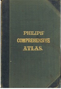
Book - LYDIA CHANCELLOR COLLECTION: PHILLIPS' COMPREHENSIVE ATLAS
... Inc. History House 11 Mackenzie Street Bendigo goldfields MAP ...A gray hard covered atlas titled ' Phillips' Comprehensive Atlas of Ancient and Modern Geography.' Edited by William Hughes, FRGS. London. George Phillip and Son, 32 Fleet St., Liverpool, Caxton Buildings, South John St., 1874. 42 pgs., maps, index. NB: In the inside cover of the book is a newspaper cutting of a letter from G. Wilson Brown Secretary, Education Department, Melbourne, 12th November, 1878 advertising 'an examination of Teachers and Candidates will be held at School 1,976, Sandhurst, on Thursday and Friday, 19th and 20th December, 1878, commencing at 9.30 a.m.'Edited by William Hughes, F.R.G.S.map, lydia chancellor collection, collection, atlas, maps, world, book, books -
Bendigo Historical Society Inc.
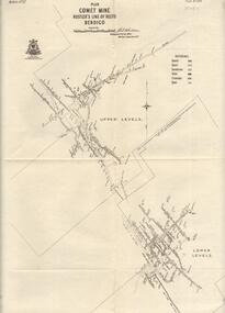
Map - COMET MINE - PLAN OF COMET MINE
... Bendigo Historical Society Inc. Bendigo Historical Society ...Plan of the Comet Mine on the Hustler's Line of Reefs Bulletin No 33, Plate No XXIV signed by H S Whitelaw, Underground Survey Office Bendigo, September 1913. Upper and Lower Levels and approximate boundaries shown. Depths shown.Geological Survey of Victoriamining, parish map, hustler's line of reefs, comet mine plan bulletin no 33 plate no xxiv -
 Bendigo Historical Society Inc.
Map - COMET MINE - PLAN OF COMET MINE
... Bendigo Historical Society Inc. Bendigo Historical Society ...Plan of the Comet Mine on the Hustler's Line of Reefs Bulletin No 33, Plate No XXIII. Map shows depths, Lightning Hill Anticline, Hustler's Anticline and approximate Lease Boundary. Signed by H. S. Whitelaw, Underground Survey Office Bendigo, September 1913. United Hustler's & Redan Co and Hustler's Reef Co also named on map. This item has not been scanned or photographed.Geological Survey of Victoriamining, parish map, hustler's line of reefs, comet line plan belletin no 33 plate no xxiii, lightning hill anticline, hustler's anticline, united hustler's & redan co, hustler's reef co, h s whitelaw, underground survey office bendigo september 1913 -
 Bendigo Historical Society Inc.
Map - GREAT EXTENDED HUSTLERS MINE - LOCALITY MAP OF GREAT EXTENDED HUSTLERS MINE
Location map showing the Hustlers line of mines and some other ones. Map has contours with heights. Mines are named and most of them have the depth printed beside the name. Street names are also included. Map is pasted onto a larger piece of paper.mine, gold, great extended hustlers., great extended hustlers mine, locality map of great extended hustlers mine, great extended hustlers trib shaft, hustlers extended, imperial hustlers shaft, royal hustlers shaft, hustlers royal reserve park shaft, hustlers royal reserve no 2, garden gully e shaft, the golden one shaft -
 Bendigo Historical Society Inc.
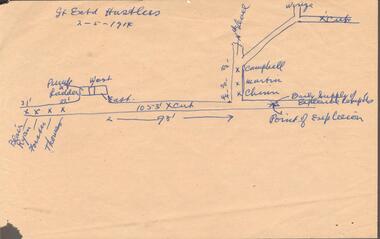
Document - GREAT EXTENDED HUSTLERS MINE - MAP WHERE EXPLOSION OCCURRED
Hand drawn map on beige paper where an explosion occurred in the mine killing seven men. They were Blair, Ryan, Forster, Thomas, Campbell, Martin and Chinn. Map shows where the men were, how far from the point of explosion.mine, gold, great extended hustlers., great extended hustlers mine, map where explosion occurred, blair, ryan, forster, thomas, campbell, martin, chinn -
 Bendigo Historical Society Inc.
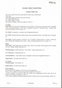
Document - GARDEN GULLY UNITED MINE - NOTES ON THE GARDEN GULLY UNITED MINE
One hand written and four typed copies of notes on the Garden Gully United Mine and a spare last typed page. Notes include depth of shafts, locality, early history,plant, leading mine, gold production, references on typed copies. One typed copy, with Typed at Mines Dep't written at the top has a number of corrections/inclusions and a hand drawn locality map attached to the back.mine, gold, garden gully united mine, garden gully united mine, garden gully line of reef, paddy's gully line, economic now crestknit knitting mills, roberts & sons, ladam's reef, tribute companies, possum shaft, rainbow shaft, gold production, leading mine, pandora reef, rosalind park, dr h l atkinson, i e dyason, w hunter, g lansell, e mueller, bendigo amalgamated company, bendigo city council, w h taylor, mines dept booklet 'bendigo goldfields' geo brown 1936, annals of bendigo 1873 & 1874, annals of bendigo dividend records from 1873 to 1935, a richardson, bendigo minicipal library booklet 'healthy golden bendigo' -
 Bendigo Historical Society Inc.
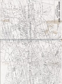
Map - MAP OF BENDIGO GOLDFIELDS
... MAP OF BENDIGO GOLDFIELDS...Map. Copy of a map of the Bendigo Goldfields issued... Inc. History House 11 Mackenzie Street Bendigo goldfields MAP ...Map. Copy of a map of the Bendigo Goldfields issued by the Dept. of Mines showing lines of reef, mines and streets. Scale 20 chains to 1 inch. Printed by Cambridge Press, Bendigo. Date unknownmap, bendigo, goldfields, map, goldfields, department of mines