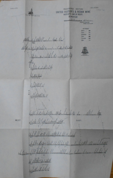
Physical description
Transverse Section of the United Hustler's & Redan Mine on the Hustler's Line of Reefs Bulletin No 33, Plate No XXIX. Map has drawing of poppet legs on the surface, depth of levels, type of stone encountered and some geological features. Sill of shaft 745.62 ft above sea level. Map has Geological Survey of Victoria emblem and signed by H S Whitelaw, Underground Survey Office Bendigo, 'September 1913.