Showing 110304 items matching "roads"
-
 Eltham District Historical Society Inc
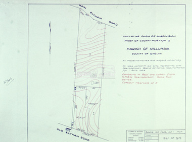
Slide - Photograph, Eltham Shire Council, Tentative Plan of Subdivision, Part of Crown Portion 2, Parish of Nillumbik, County of Evelyn, 1969
35mm colour positive transparency blue Agfacolour Service plastic mountB4, Fisher subdivision, Old Eltham Road and Main Road, 4 August 1969infrastructure, map, planning, subdivison lots, main road, old eltham road -
 Ringwood and District Historical Society
Photograph, Laying pipeline near Mt. Dandenong Road, in Whitehorse Road, Ringwood (undated)
Written on back of photograph, "Laying pipeline near Mt. Dandenong Road, in Whitehorse Road". -
 Lakes Entrance Historical Society
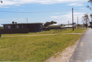
Photograph - Lake Tyers Aboriginal Trust Lake Tyers Victoria, 1/08/2008 12:00:00 AM
Rules Road at the Lake Tyers Aboriginal Trust Lake Tyers Victoria. This photograph was taken at the time of 150 years Lakes Entrance 1858 to 2008 display held in 2008Colour photograph of houses on Rules Road at the Lake Tyers Aboriginal Trust Lake Tyers Victoria. plus 2 other photos of the Lake Tyers Aboriginal Trust Lake Tyers Victoria.aboriginals, land settlement, events, houses -
 Whitehorse Historical Society Inc.
Article, Rezoning outrage, 22/09/1992 12:00:00 AM
Nunawading Council outraged by State Government's shock decision to immediately rezone land in the Eastern Arterial Road corridor without public consultation.Nunawading Council outraged by State Government's shock decision to immediately rezone land in the Eastern Arterial Road corridor without public consultation. The decision means the land set aside for the Eastern Arterial Road will be immediately rezoned to public open space by ministerial amendment jeopardising any future moves to construct the entire freeway. Council are considering Supreme Court action to stop the rezoning.Nunawading Council outraged by State Government's shock decision to immediately rezone land in the Eastern Arterial Road corridor without public consultation. local government, city of nunawading, eastern freeway, koonung mullum forestway association, mullum mullum creek -
 Mt Dandenong & District Historical Society Inc.
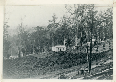
Photograph, Harry Walker's Home in Village Settlement 1908, c1908
View of Harry Walker's home taken from waht is now known as Ridge Road, Kalorama. Raspberry crops are in the foreground. This photograph has a detailed inscription on the back handwritten by John Lundy-Clarke in 1974.1908 view of H Walker’s home on Village Settle Lot 2 Section 1. Looking from what is now Ridge Road through the trees on Vil. Set Lot 18 to Barber’s house now known as “Forest Edge” on Vil Set Lot 25 down close to the Olinda Creek on Barbers Road. The Estate Agent’s modern office is on the edge of the patch of raspberries at the lower left as the C.R.B. Mt Dandenong Rd passes just behind Walker’s house crossing the picture behind the raspberries.walker, raspberry crop, forest edge, barber -
 Ringwood and District Historical Society
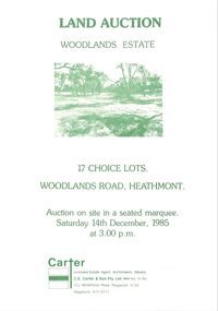
Pamphlet - Land Sales Brochure, Woodlands Estate, Heathmont, 1985
Bifold pamphlet with picture on front, one inside plus plan of Woodlands Road sub division and locality plan on back page. All in green print. Copy enclosed with handwritten sale prices. Auctioneer's notes (Richard Carter) indicate vendor - Estate of Phoebe Beard.Auction on site in a seated marquee, Saturday 14th December, 1985. Agent - C.E. Carter & Son Pty. Ltd., 122 Whitehorse Road, Ringwood, 3134. Telephone 870 6211. -
 City of Kingston
Photograph - Black and white, c. 1957
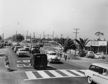
Copy black and white photograph of railway level crossing on Nepean Highway Moorabbin before excavations for the below ground rail crossing. The level crossing gates are closed and five cars are waiting, while other cars can be seen coming in the opposite direction. A woman with a child in a pram is walking along the road, and a number of men, probably construction workers, are standing behind a barricade on the right hand side of the road. Gilbey's Gin distillery is visible in the background. TCopy black and white photograph of railway level crossing on Nepean Highway Moorabbin before excavations for the below ground rail crossing. The level crossing gates are closed and five cars are waiting, while other cars can be seen coming in the opposite direction. A woman with a child in a pram is walking along the road, and a number of men, probably construction workers, are standing behind a barricade on the right hand side of the road. Gilbey's Gin distillery is visible in the background. Handwritten in blue ink on reverse: 57-465C Handwritten in red ink on reverse: 71% A red circle has been drawn around all handwritten text.moorabbin, railway station, railway crossing, suburbs, cars, local production -
 Orbost & District Historical Society
black and white photograph, February 1971
This photograph was taken near the Snowy River Bridge on the the old Princes Highway in Orbost, near the caravan park. The 1971 flood was the the worst flood on record. At Jarrahmond it was at least 11 metres and up to one and a half kilometres wide on the flats causing enormous damage to the flood plain. Records say that "The brown floodwater stain in Bass Strait could be seen from passing airliners." Considerable damage was done to railway infrastructure, roads and farms. More information from the APRIL, 2008 newsletter by John Phillips. (see orbosthistory.com.au)This is pictorial evidence of a significant local event. Floods have been an integral part of Orbost's history for hundreds of years.A black / white photograph of debris, fallen power lines, a tree across the highway and floodwaters across the road.on front at bottom - handwritten in upper case print - " 1971 FLOOD PRINCES HIGHWAY NEAR SNOWY BRIDGE"floods-orbost-1971 -
 Whitehorse Historical Society Inc.
Photograph, Pedestrian Crossing & Nunawading Railway Station, 1/06/2009
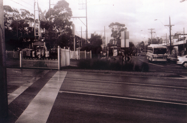
One of a collection of photographs taken of the Nunawading Railway Station prior to the lowering of the railway line and building of the new railway station on the western side of Springvale Road so that the Springvale Road Rail Crossing can be eliminated.Black & white photograph of the precinct surrounding the Nunawading Station and the Springvale Road Railway crossing. This photograph is looking over the south side of the intersection in Springvale, to the pedestrian crossing and the Railway Station. The shopping centre is on the right hand side. See NP 3545 to NP3567 for the complete set of photographsnunawading railway station, springvale road nunawading, redevelopment of railway line/springvale road. -
Whitehorse Historical Society Inc.
Map, Aerial photograph, c1950
Arial photo of Vermont South and Burwood East, Middleborough Road, Burwood Highway, Springvale Road, Highbury Road and environs.Aerial photo of Vermont South and Burwood East, Middleborough Road, Burwood Highway, Springvale Road, Highbury Road and environs.Arial photo of Vermont South and Burwood East, Middleborough Road, Burwood Highway, Springvale Road, Highbury Road and environs.vermont south, burwood east, aerial photographs -
Whitehorse Historical Society Inc.
Map, Springvale Road, 1987
Aerial photograph of cnr Springvale Road and Burwood Highway, south past Highbury Road and west past Blackburn Road.Aerial photograph of cnr Springvale Road and Burwood Highway, south past Highbury Road and west past Blackburn Road.Aerial photograph of cnr Springvale Road and Burwood Highway, south past Highbury Road and west past Blackburn Road.aerial photographs, blackburn road, burwood east, highbury road, burwood east, burwood highway, burwood east, springvale road, burwood east, burwood east -
 Whitehorse Historical Society Inc.
Photograph, Canterbury Road, Vermont, 1967
Part of Tim Shambrook's Collection for 'This is Vermont'. Not used.Coloured photo of Canterbury Road, Vermont, taken in 1967 showing one lane road and heavily treed side road.canterbury road, vermont, shambrook, tim -
 Camberwell Historical Society
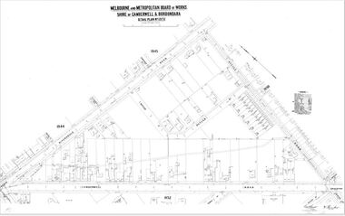
Map (Item) - MMBW map, Melbourne and Metropolitan Board of Works, Melbourne and Metropolitan Board of Works - Shire of Boroondara and Camberwell - Detail Plan no. 1851, July 1904
Lithographer JEM, exd. JWD, July 1904, no. 81, 40P. 15W.melbourne and metropolitan board of works, map, camberwell, cartography -
 Stawell Historical Society Inc
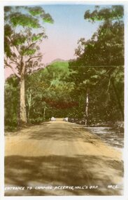
Postcard, Camping Ground Entrance at Halls Gap in the Grampians -- Postcard
Entrance to Camping Ground Halls Gap The Grampians.Colour photo of a tree lined dirt road with an entrance way at the end of the road. Very tall trees line the road.Entrance to camping reserve, Halls Gap. halls gap grampians -
Canterbury History Group
Photograph - Street view of shops on the corner of Canterbury Road and Balwyn Road, Jan Pigot, 1994
Coloured photograph of the street view of Carnell's Furniture shops at 173 Canterbury Road at the corner of Canterbury Road and Balwyn Road.canterbury, canterbury road, shops, balwyn road -
Canterbury History Group
Photograph - Street view of Canterbury Road showing the Post Office and Maling Road, Jan Pigot, 27/03/1993 12:00:00 AM
Coloured photograph of the street view of Canterbury Road and the T intersection of Maling Road and the Post Office at No.206 Canterbury Road.canterbury, canterbury road, post offices, railway lines -
 Falls Creek Historical Society
Booklet - Snow Driving - It's an Art
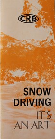
This brochure was produced by the Country Roads Board in 1976. It became the Board's most popular driver education publication. The brochure was reprinted after requests for 20,000 copies were received from interested authorities and individuals. A revised addition was released in 1978.This document is significant because it documents approaches taken towards safety as the ski fields became more popular, An orange and white brochure with black text. Produced by the Country Roads Board, it aims to educate the public about appropriate driving behaviours and precautions for driving in snow conditions.CRB Snow Driving - It's an Artcountry roads board, road safety, driving in snow conditions -
 Melbourne Tram Museum
Postcard - Nu-color-Vue - St Kilda Road, Shrine of Remembrance W2 453, Nucolorvue Publishing, 1970s
Postcard - image looking south in St Kilda Road, with the Shrine of Remembrance and BP House in the view. Tram W2 453 (City Route 6) and SW6 945 (Camberwell Route 72) has stopped at the safety zone tram stop.Demonstrates an iconic Melbourne image, St Kilda Road, the Shrine and W class tramsPostcard colour - serrated edge, Nu-color-Vue - St Kilda Road, Shrine of Remembrance W2 453, ML 156, NCV 1381 Divided back.trams, tramways, w2 class tram, shrine of remembrance, tram 453, st kilda road, tram 945 -
 Melbourne Tram Museum
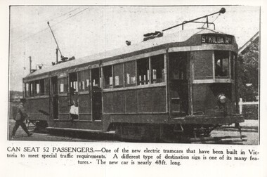
Photograph - Black and White, W Class Tram 220 - Newspaper photo 1924, 5-1-1924
Image shows a 1924 newspaper photo of one of the new W Class trams in service. The photo caption gives details of the tram including its length. It has the destination of St Kilda Road.The W Class Trams were a highly successful design of trams for Melbourne. W 220 was the second W Class tram built. Photo was taken in 1924 showing this tram with St Kilda Road on the destination board. Note there is no destination route number box.tramways, trams, st kilda road, tram 220, w class trams -
 Ringwood and District Historical Society
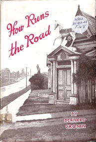
Book, How Runs the Road
Romance and appeal of roads and a look at the future of Australian roads and transport -
Canterbury History Group
Photograph - Canterbury Road, Canterbury, c1960
Canterbury Road at Balwyn Road intersection looking east. c1960.canterbury, canterbury road, malones hotel, railway crossing -
 University of Melbourne, Burnley Campus Archives
Photograph - Black and white print, Camberwell City Council, Two Suburban Houses, 1930
Note by T.H. Kneen 24 June 1992, "B91.424 and 425 are paired to show effect of lowering road level and consequent adjustment to access to the houses photographed. The handwriting is Mr. Jessep's."Black and white photograph. The front of the same 2 suburban houses as B91.424. The nature strip has been lowered to the same level as the road and each has a wooden paling front fence.suburban house, a.w. jessep, landscaping -
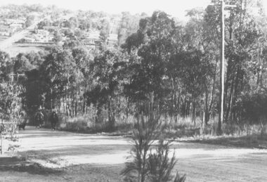
 Eltham District Historical Society Inc
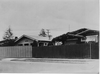
Photograph, Beard Street, Eltham, 3 Sep 1981
... roads ...Roll of film taken by Eltham Shire Council officers of roads and houses in the Eltham East area, 3 September 1981 prior to construction of new water main; including views of existing damage to footpaths and gutters and general views of Beard Street. These images provide a perspective of housing estate developments and changes in housing styles and road development which began sweeping in from the mid 1970s with increasing urbanisation of what was once more outlying suburbs and regions.35mm colour positive transparency (1 of 28) Mount - Kodak Kodachrome Cardeltham, infrastructure, roads, beard street, grove street, valonia drive, wycliffe crescent, livingstone road -
 Hume City Civic Collection
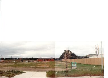
Photograph, early 1990s
The series of 5 photographs feature different views of the Woodlands housing development which opened up land bounded by Gap and Anderson Roads, Cornish Street and Elizabeth Drive in the early 1990s. It was a large housing development built close to Sunbury township.A coloured photograph of a new housing development taken in Anderson Road looking west towards Elizabeth Drive and the leisure centre. Some housing construction is in the middle distance.housing developments, anderson road, george evans collection -
 Ringwood and District Historical Society
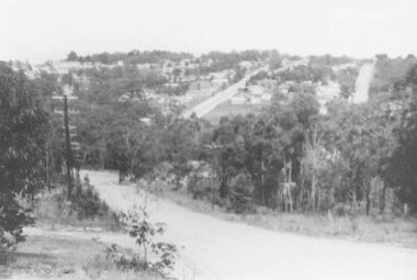
Photograph, View of Glenvale Road, Ringwood. Warnes Road in left background 1964
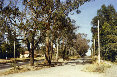
See Also #25Written on back of photograph, "1964 - View of Glenvale Road. Supplied by Garrett Gundry. Warnes Road in left background. Deep Creek Road in centre background." -
 Ringwood and District Historical Society
Photograph, View of Glenvale Road, Ringwood 1964
See Also #25Written on back of photograph, "1964 - View of Glenvale Road. Supplied by Garrett Gundry. Warnes Road in left background. Deep Creek Road in centre background." -
 Whitehorse Historical Society Inc.
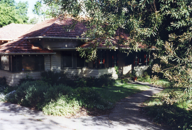
Photograph, 443 Mitcham Road, Mitcham, 1998
Eric Roger Webb moved to Mitcham with his family in about 1932. They lived at 443 Mitcham Road and owned all the land up to Simpson Street. The land was a grass paddock and he planted native trees and shrubs around the perimeter. The Webbs has three children: Eric, Dean and Donald. Mr Webb worked in the public service. He was a councillor of the Shire of Blackburn and Mitcham and later of the city of Nunawading between 1940 and 1949. He was also a Shire President from 1943-1944.Coloured photograph of a house at 443 Mitcham Road, Mitcham. Tiled roof, verandah, path leading to front door.443 mitcham road, mitcham, houses, webb, eric -
 Port Melbourne Historical & Preservation Society
Photograph - Norma Watters outside Williamstown Road home
The Watters family moved from Albert Park to Garden City Port Melbourne circa 1934 buying a Bank House at 128 Williamstown Road (later renumbered to 400). The family consisted of Bob Watters senior and his wife Ellen (nee Oakley), children Patsy (b 1920), Bob Junior (b 1922) and Norma (b1924). The children attended Albert Park Primary, Middle Park Central School and then MacRobertson Girls High School and Melbourne Boys High School.Digital photograph of Norma Watters outside her home at 124 Williamstown Road (later renumbered to 400) 1932norma watters -
 Ringwood and District Historical Society
Document - Subdivision Map, Part of Crown Portion 22 Parish of Ringwood, County of Mornington. Vol 1915 Fol 827 - LP2427
LANDATA Land Victoria 4-sheet plan dated January 2003 - copy of original 1889 subdivision, amended with 1947 amendments by Assistant Registrar of Titles.Sheet 1 includes Main Lilydale Road (later Old Lilydale Road), Wandin Road (later Mount Dandenong Road), and Joseph Street, Ringwood East. Additional Plan markings SP30844, SP32804, LP144251, PS332061, PS305232. Sheet 2 includes Main Lilydale Road (later Old Lilydale Road), Wandin Road (later Mount Dandenong Road), and Dynes Street, Ringwood East. Additional Plan markings LP43708, LP44231, LP124702. Sheet 3 includes Main Lilydale Road (later Old Lilydale Road), Dynes Street, Albert Street (later Wyrunga Street), and Carcoola Road, Ringwood East. Additional Plan markings LP114181, LP114180, LP18261, LP214030, LP67300, PS354509, PS335500. Sheet 4 includes Main Lilydale Road (later Old Lilydale Road), Albert Street (later Wyrunga Street), and Carcoola Road, Ringwood East. Additional Plan markings PS315494, PS319495. -
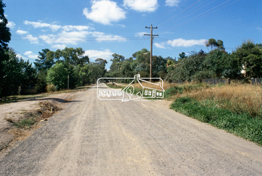 Eltham District Historical Society Inc
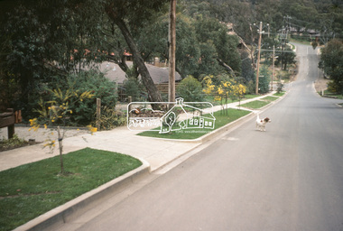
Slide, Beard Street, Eltham, Nov. 1981
... roads ...Roll of film taken by Eltham Shire Council officers (Nov. 1981) of the Beard street group, a private street scheme, before construction commenced in February 1982. They provide perspective of the changes in housing styles and road development that began sweeping in from the mid 1970s with increasing urbanisation of what was once more outlying suburbs and regions.35 mm colour positive transparency (1 of 27) Mount - Kodak Ektachrome CardProcessed 18 Jan 1982beard street, eltham, housing estate, infrastructure, private street scheme, roads