Showing 4760 items matching "1921-1923"
-
 Kew Historical Society Inc
Print, Rose Stereograph Company, Sacred Heart Church, Kew, Vic, Twentieth Century
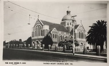
The history of the church goes back to 1872 when Jesuits purchased land in Walpole Street. By 1875 Archbishop Gould had laid a foundation stone on 14 February for a school. Early services for local Catholics were held in Richmond, Collingwood and later Hawthorn. By 1899 the land for the current church was purchased after a donation by Mr James Crotty of 3,000.00. The foundation stone was laid on 15 December 1918 by Archbishop Mannix. The dimensions of the church were to be 139 feet long by 77 feet wide with seating for 850 people. The cost of construction was 15,000.00. (Source: www.churchhistories.net.au )Sacred Heart Church, Kew, Vic., circa 1920-54. Photographic print of a Rose Stereograph Co. postcard in the State Library of Victoria collection.Inscription: The Rose Series P. 13053, Sacred Heart Church, Kew, Vic." Annotation in pencil: "KH-5. Foundation Stone laid 1918, completed 1921."churches -- kew (vic.), sacred heart church -- cotham road -- kew (vic.), catholic churches -- melbourne (vic.) -
 Bendigo Historical Society Inc.
Document - SCHOOL REPAIR INVOICES
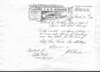
Eight Photocopies of J & E Kinder, Plumbers & Builders 161 View St Bendigo estimates for repairs at Gravel Hill School [1911] Violet Street School,[1928, 1933] Central School [1914] Teacher's residence [1923] and Public Works Dept [1930] .bendigo, industry -
 Port Melbourne Historical & Preservation Society
Photograph - Barlow family and 80 Dow Street, Port Melbourne, 1905
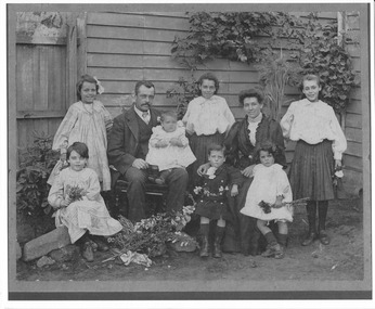
.01 - Small photo of 80 Dow street, Port Melbourne. Jim and Kate Barlow and family lived here from 1914 until 1923 .02 - Copy of photo of Barlow family who lived at 80 Dow Street, Port Melbourne taken 1905domestic life, families, jim barlow, kate barlow, rene barlow, nellie barlow, arthur barlow, lucy barlow, freda barlow craig, arch barlow, may barlow hampton, huton engineers port marine services pty ltd, stewart craig -
 Bendigo Historical Society Inc.
Map - GEOLOGICAL MAP OF BENDIGO GOLD FIELD
Map of Bendigo gold field showing anticlines, synclines, shaft, alluvial deposits and contour lines. Map is in two sections. This map forms part of the Geological Survey of Victoria, Structure of Bendigo Goldfield report, No. 47, 1923. H.Herman, late Director of Geological Survey.Geological Survey Victoriabendigo, gold mining, geological map -
 Emerald Museum & Nobelius Heritage Park
Photograph, Nightingale/Thompson Collection, 1923
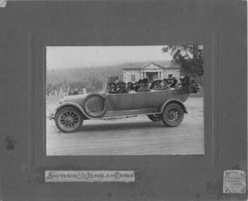
Professional photograph possibly taken by Middletons Touring Service of group in Middletons touring car. For further information see link: http://trove.nla.gov.au/ndp/del/article/86067542?searchTerm=middletons%20car%20touring%20service&searchLimits=Part of the Thompson collection cannot find any reference to persons under the Nightingale/Thompson family historySepia photograph mounted on brown card, showing group of people in 4 seater car On brown card: Souvenir - Jenolan Caves sticker on bottom R/H corner Middletons Touring Service Tel: 117 KAT On back of photograph: on 21st March 1923 Miss Louise and I wnt in our Middletons car (a Hudsons Car) this photo was taken at Hartly in front of the old court house and prison. Built by the convicts in 1833 on the way to the Jenolan Caves. This is a Birthday gift from Dear cousin Louie (name to be confirmed)thompson collection, nightingale -
 Melbourne Legacy
Letter - Document, letter, (H1), 1923
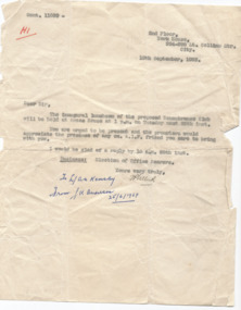
A letter that was sent to potential members of a new club being formed in Melbourne in September 1923. The text of the letter includes; 'The inaugural luncheon of the proposed Remembrance Club will be held at Anzac House at 1pm on Tuesday next 25th inst. You are urged to be present and the promoters would appreciate the presence of any ex-AIF friend you care to bring with you.' The Remembrance Club in Melbourne later became Legacy. The notation H1 in red pen shows that it was part of the archive project that was trying to capture the history of Legacy. Hence the notation of being forwarded from Legatee Kemsley to Anderson in 1969.This is one of the first documents that pertain to the Remembrance Club - later becoming Legacy. File copy of a letter about the inaugural meeting of the Remembrance Club in Melbourne.Handwritten H1 in red pen. Signed 'JP Hiller'(?) in black ink. Notation added later 'To L/ AN Kemsley, from LK Anderson 25/6/1969' from when it was added to archive.history, remembrance club -
 Melbourne Legacy
Document, Business Leadership: first Luncheon Address delivered to Legacy Club (H45), 1923
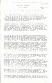
An address delivered by P.W. Powell (the first Secretary of the Club) in October 1923 to the newly formed Legacy Club. In it he notes that "The most important thing in the development of this Club is to formulate a sound constructive policy that will draw in the best type of member and make the Club a live force in the advancement of this country." The comradeship and cooperation developed by the troops during wartime should be applied in civilian life to the development of Australia. He finishes by calling for the Club to be named the Legacy Club "in token of the heritage that has been bequeathed to us by those who so nobly commended the work that is left to us to carry on."An insight into corporate and political thinking of the 1920s as the country transitioned from wartime to peacetime, and an insight into the thinking of one of the founder members of Melbourne Legacy.4 sheets of white copy paper, black typing.'H45' (see Item 00937)in blue ink on first pagehistory, founding legatee -
 Bendigo Historical Society Inc.
Book - WHITE HILLS READING ROOM COLLECTION: W. STUCKENSCHMIDT DIARY 1908-1940
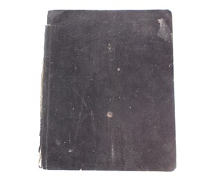
Small black cover book of W. Stuckenschmidt ''Loafer'' covering the years 1908 to 1940. No entries for years 1913 and 1914, from 1916 to 1921 and 1922 to 1939. White Hills and East Bendigo Heritage Study - Stage 2 2016 vol 2 citations FINAL_0.pdfclubs, social, white hills reading room -
 Bendigo Historical Society Inc.
Document - COHN BROTHERS COLLECTION: HANDWRITTEN MESSAGE DATED 1921
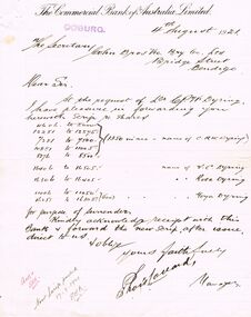
Handwritten message from The Commercial Bank of Australia on printed letterhead in Coburg Vic dated 4th August 1921. Sent to Cohn Bros Vic Bry Ltd Bridge Street Bendigo. Re shares held by Mr C W Dyring. Message signed by Chas Lovardbendigo, industry, cohn bros brewery, commercial bank of australia limited, coburg. cohn brewery -
 Kiewa Valley Historical Society
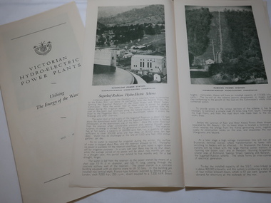
Leaflet - Victorian Hydro Electric Power Plants, Utilising The Energy of the Waters. May 1946
The SECV established in 1921 built many Power Plants including those on the Kiewa Hydro Electric Scheme.The article explains the power plants built on the Kiewa Hydro Electric Scheme.White paper folded into 4 panels with the cover including the SECV emblem and the titles .(3 copies). When unfolded the section beside the cover is a graph titled Kiewa Hydro Electric Scheme / Cross section of General Layout On the inside panel 3 is the title Kiewa Hydro Electric Scheme with a photo of No. 3 Power Stationpower plants, no. 3 power station kiewa scheme -
 Federation University Historical Collection
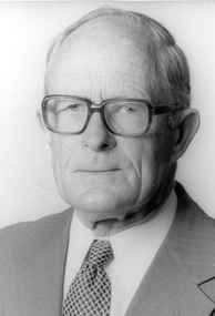
Photograph - Black and White, Lindsay Hillman
Lindsay Hillman enrolled as a student at the Ballarat School of Mines c 1921, and started teaching there in the 1930 s.Photographic Portraitballarat school of mines, lindsay hillman, alumni -
Beechworth RSL Sub-Branch
Certificate - Charter - Returned Sailors', Soldiers', & Airmen's Imperial League of Australia (Victoria Branch)
Standard charter certificate issued to Sub Branch on acceptance into the League 21 February 1921 (a replacement charter)The Charter Certificate replaced the original charter that was lostCertificate in wooden frame with glass and mounting attachment and string on the reverse -
 Bendigo Historical Society Inc.
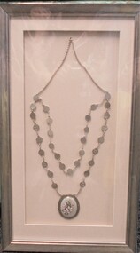
Medal - SOROPTIMIST COLLECTION: CHAIN OF OFFICE
Soroptimist International is a volunteer organisation for women and was formed in California in 1921. The first Australian group began in 1937.Rectangular silver frame with cream mount. Within the frame is a silver chain from which are suspeded 31 circular medallions. Each medallion is engraved with the names of a member of the Bendigo Soroptomist Club. A large, ornate oval floral medallion is suspended from the bottom of the chain. Around the oval is engraved on a silver surround ' Soroptomist International of Bendigo' Frame is wrapped in cellophane. On back of frame 'Truscott Art and Framing'. A grey jewellery poucn is enclosed in the cellophane wrapping, presumably it held the engraved medallions prior to the chain being made.organisation, community, soroptomist international -
 Melbourne Tram Museum
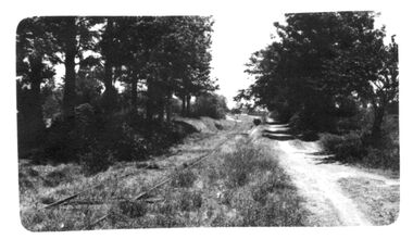
Photograph - Black and white - view of Sorrento tram track
Photograph of a view of the Sorrento tram track - based on the identification by the photo collector. The tram line closed in 1921.Yields information about the Sorrento tram line.Black and white photograph on paper. trams, tramways, sorrento, tram tracks -
 Uniting Church Archives - Synod of Victoria
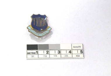
Badge
The Australian Young Women's Missionary Movement was formed in 1923.Young Women's Missionary Movement dark and light blue enamel badge in the shape of a shield with a ribbon shape at its base. There is vertical pin on the back."YWMM" "METHODIST CHURCH"young women's missionary movement -
Emerald Museum & Nobelius Heritage Park
Yarra Valley Mountain and District Football League Results1623 to 1946, Fixtures and Ladders
The reports are primarily historically and socially significant for understanding the local football community . Also gives some insight into the local families who were regularly involved with the Emerald Football Club.black plastic 4 ring binderlabeled "FTG News Results 1923 - 1925, 1936, 1838 - 1941, 1945 - 1946 Fixtures 1937 - 1974 YVMDFL Results and Ladders" been re-labeledemerald, football, match reports, fixtures, ladders, seniors, reserves, under 17, yarra valley mountain district football league -
 Kiewa Valley Historical Society
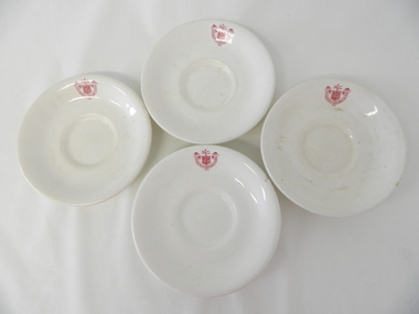
Saucer Ceramic, from 1921 to 1961
This item was used by the State Electricity Commission of Victoria in their mess rooms for their workers during the construction of the Kiewa Hydro Electricity Scheme. The imprint of the year "1921" was to identify the year that the SECV was formed and relieved the private VHEC(Victorian Hydro-Electric Company). As the scheme was of such a huge, isolated and time consuming nature the feeding of its workers was quite demanding of cutlery and crockery. The use of sturdy English cups and saucers was essential. The period of construction and the isolation of the Kiewa Valley area placed heavy demand for "solid" crockery that could wear abusive handling. This period in time was one when crockery, whether for domestic or commercial use, was imported from "mother" England. This scenario was more so for governmental bodies such as rail, jails and electricity providers than domestic users. The influx of cheaper Asian crockery had not yet begun.This type of crockery item was used by the thousands of SEC Victorian staff and construction workers involved in the building of the Kiewa Hydro Electricity Scheme, over the extensive period (1938 to 1961). This was a period when Government bodies and other semi- government organisations were still tied to the "establishments" of "mother" England. It was a period in Australia's development when the Asian influence was very weak and the established ties to England and Europe was still very strong. The majority of heavy equipment and machinery was either made in England or Europe. Local/European expertise in dam construction and water management in alpine terrain came from migrants or English and European specialist. The quality of workmanship from big steel manufacturing plants in England and Europe could not be matched from anywhere else in the developed world.This item is a white ceramic saucer (tea /coffee). It is made in England and is of strong and durable ceramic. The bottom cup indent is for either tea or coffee cups of a similar ceramic structure. The 5mm thickness of the ceramic suggests this saucer belongs to a commercial kitchen environment and not domestic. The indent bottom of the saucer is 5mm deep with a side curvature ratio of 2:5. The ceramic is glazed to a commercial standard (worker's mess). See also KVHS 0128 (A,C and D) The seal of the State Electricity Commission Of Victoria is imprinted on the top inside rim within a curved scroll. Snuggled within the borders of the scroll is a banner with the five stars of the southern cross and an arm with a closed fist projecting from the top with five lightning bolts projecting outwards. On the underside "Vitrified sold by Cafe & Hotel Supplies Pty Ltd Dunn Bennett & Co. Ltd. Burslem Made in England"saucer, plate, secv, state electricity commission of victoria, crockery, mt beauty chalet, bogong mess hall -
 Kiewa Valley Historical Society
Saucer Ceramic, from 1921 to 1961
This item was used by the State Electricity Commission of Victoria in their mess rooms for their workers during the construction of the Kiewa Hydro Electricity Scheme. The imprint of the year "1921" was to identify the year that the SECV was formed and relieved the private VHEC (Victorian Hydro-Electric Company). As the scheme was of such a huge, isolated and time consuming nature the feeding of its workers was quite demanding of cutlery and crockery. The use of sturdy English cups and saucers was essential. The period of construction and the isolation of the Kiewa Valley area placed heavy demand for "solid" crockery that could wear abusive handling. This period in time was one when crockery, whether for domestic or commercial use, was imported from "mother" England. This scenario was more so for governmental bodies such as rail, jails and electricity providers than domestic users. The influx of cheaper Asian crockery had not yet begun.This type of crockery item was used by the thousands of SEC Victorian staff and construction workers involved in the building of the Kiewa Hydro Electricity Scheme, over the extensive period (1938 to 1961). This was a period when Government bodies and other semi- government organisations were still tied to the "establishments" of "mother" England. It was a period in Australia's development when the Asian influence was very weak and the established ties to England and Europe was still very strong. The majority of heavy equipment and machinery was either made in England or Europe. Local/European expertise in dam construction and water management in alpine terrain came from migrants and specialist recruited from England and Europe. The quality of workmanship from big steel manufacturing plants in England and Europe could not be matched from anywhere else in the developed world.This item is a white ceramic saucer (tea /coffee). It is made in England and is of strong and durable ceramic. The bottom cup indent is for either tea or coffee cups of a similar ceramic structure. The 5mm thickness of the ceramic suggests this saucer belongs to a commercial kitchen environment and not domestic. The indent bottom of the saucer is 5mm deep with a side curvature ratio of 2:5. The ceramic is glazed to a commercial standard (worker's mess). See also KVHS 0128 ( A,B&D)The seal of the State Electricity Commission Of Victoria is imprinted on the top inside rim within a curved scroll. Snuggled within the borders of the scroll is a banner with the five stars of the southern cross and an arm with a closed fist projecting from the top with five lightning bolts projecting outwards. On the underside "Vitrified sold by Cafe & Hotel Supplies Pty Ltd Dunn Bennett & Co. Ltd. Burslem Made in England"saucer, plate, secv, state electricity commission of victoria, crockery, mt beauty chalet, bogong mess hall -
 Kiewa Valley Historical Society
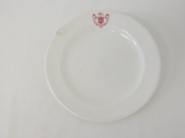
Plate Bread & Butter, Circa 1921
This item was used by the State Electricity Commission of Victoria in their mess rooms for their workers during the construction of the Kiewa Hydro Electricity Scheme. The imprint of the year "1921" was to identify the year that the SECV was formed and relieved the private VHEC (Victorian Hydro-Electric Company). As the scheme was of such a huge, isolated and time consuming nature the feeding of its workers was quite demanding of cutlery and crockery. The use of sturdy English cups and saucers was essential. The period of construction and the isolation of the Kiewa Valley area placed heavy demand for "solid" crockery that could wear abusive handling. This period in time was one when crockery, whether for domestic or commercial use, was imported from "mother" England. This scenario was more so for governmental bodies such as rail, jails and electricity providers than domestic users. The influx of cheaper Asian crockery had not yet begun.This type of crockery item was used by the thousands of SEC Victorian staff and construction workers involved in the building of the Kiewa Hydro Electricity Scheme, over the extensive period (1938 to 1961). This was a period when Government bodies and other semi- government organisations were still tide to the "establishments" of "mother" England. It was a period in Australia's development when the Asian influence was very weak and the established ties to England and Europe was still very strong. The majority of heavy equipment and machinery was either made in England or Europe. Local expertise in dam construction and water management in alpine terrain came from migrants for England and Europe. The quality of workmanship from big steel manufacturing plants in England and Europe could not be matched from anywhere else in the developed world.This item is a white ceramic plate (bread & butter). It is made in England and is of strong and durable ceramic. The bottom of the plate is flat with edges sloping out (to position the bread) and the extended rim is to catch any spillages. The 5mm thickness of the ceramic suggests this plate belongs to a commercial kitchen/eating establishment (mess) and not a domestic dining room. The indent bottom of the plate is 5mm deep with a side curvature ratio of 2:5. The ceramic is glazed to a commercial standard (see KVHS 0128 for its saucer part of a dinner set.The seal of the State Electricity Commission Of Victoria is imprinted on the top inside rim within a curved scroll. Snuggled within the borders of the scroll is a banner with the five stars of the southern cross and an arm with a closed fist projecting from the top with five lightning bolts projecting outwards. On the underside "Vitrified sold by Cafe & Hotel Supplies Pty Ltd Dunn Bennett & Co. Ltd. Burslem Made in England"saucer, plate, secv, state electricity commission of victoria, crockery -
Clunes Museum
Document - DOCUMENT - HISTORY, INTERKNIT
LAMINATED YELLOW CARD WITH SHORT HISTORY OF THE KNITTING MILL WHICH WAS HOUSED IN THE OLD SCHOOL BUILDING. 1919-1922 CUTTLE PTY LTD. 1923-1934 CLUNES KNITTING AND MANUFACTURING CO. LTD. 1934 ROBERTS FAMILY. 1938-1985 CLUNES INTERKNIT HOSIERY CO.cuttle pty ltd, south clunes school, clunes knitting and manufacturing co. pty ltd, mr roberts and family, clunes interknit hosiery co. -
Port Melbourne Historical & Preservation Society
Photograph - US seaman and ships at Town Pier, Port Melbourne, 1924 - 1925
Three photographs taken in 1925 of U.S. seaman and ships at Port Melbourne - Town Pier. .01 - U.S.Seaman Carl (?) Stewart, the donor's mothers cousin .02 - U.S. Auxiliaries - repair ships, "Medusa" (1923) .03 - U.S. Light Cruiser - Omaha Class (1920-23) piers and wharves - town pier, us medusa -
 Melbourne Tram Museum
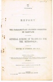
Document - Report, The Parliamentary Standing Committee on Railways, "General Scheme of Tramways for the Metropolis" & "East Northcote and Ivanhoe Railless Electric Tramways", 1922 and 1923
Set of two reports from The Parliamentary Standing Committee on Railways. .1 - 8 pages - stapled report titled "General Scheme of Tramways for the Metropolis", dated 24/7/1923, examining the MMTB's General Scheme for Tramways (See Reg Item 2088, 2089 and 2098), includes financial position of the Board, tramway or railways, the scheme itself, committee recommendations and view of the railway's commissioners. .2 - 8 pages - stapled report titled "East Northcote and Ivanhoe Railless Electric Tramways" - dated 26/10/1922 - looking at proposal for a Railless tramway (trolley bus), district to be served for residential districts, proposals, annual costs, expenses, alternative routes, betterment tax or municipal guarantee, effect on railway revenue, view of the committee and recommendations. Note: These document are available as a pdf on the Parliament of Victoria website..2 - has "Mr. Lormer" in ink on top left hand corner.trams, tramways, mmtb, general scheme, tramways, development, parliament, railways, finances, construction, trolley buses, railless, northcote, ivanhoe -
 Bendigo Historical Society Inc.
Document - BADHAM COLLECTION: EXHIBITION LABELS X 15 - CARDBOARDS
Exhibition labels x 15 - cardboards Railway Post Office stamps, 1865, and book 1951 - Courtesy Edna Westhead. Copy of 1887 Map of Railway Post Offices - Courtesy Edna Westhead Taken in 1921, Bendigo railway men celebrating 50 years since first train arrived in Bendigo in 1862 - Courtesy Bendigo Historical Society Book of Signals, 1949 - Courtesy Bernie Kingdon Book of Instruction Rolling Stock 1921, 1943 - Courtesy Bernie Kingdon Lost Property Book, 1886 - Courtesy Ross Rowley View of Bendigo Railway Station taken from St. Paul's tower, 1875 - Courtesy Bendigo Historical Society...document, memo, railway -
 Bendigo Historical Society Inc.
Photograph - HILDA HILL COLLECTION: BLACK AND WHITE PHOTOS, 1923-1925
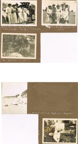
Series of Black & White Photos Hill Family & Friends. Hanging Rock Victoria Australia News Years Day 1925 Doreen, wearing all white dress and hat and holding dark coloured bag in right hand, Nora, also in all white outfit with large pockets and hat with dark coloured handbag held by her right hand and hat, Wal, dressed in grey suit white shirt and dark tie and dark hat, Jonah wearing white outfit with bands around the bottom and dark hat, & Elma skirt with circular bands and white blouse dark hat and paper in her left hand. Gentleman standing to the right wearing a dark suit and hat. Nora in white outfit and hat with dark bag in her left hand, Bill trench coat and light coloured hat, Elma wears a white dress with circular pattern and dark hat, Rob white trench coat over a dark suit white shirt and dark tie & Mev (not very clear) is wearing a white dress with a multi coloured jacket and dark hat, standing in front of a wooden tree enclosure, trees in distant background, January 1, 1923 Unknown Location. Kyneton Mineral Springs, five men and five women picnicking at Springs, fifth girls is taking the photo, January 1, 1923. girl sitting on the beach, wearing white clothing and a white hat, Down The Coast. Bunt and friend both dressed in dark trousers and white shirts, one with a striped tie, tree and house in background, rectangular open top tin also in background, 1924..australia, history, post war life -
 Queenscliffe Maritime Museum
Photograph - Mounted B&W photograph, unframed, SS Loongana
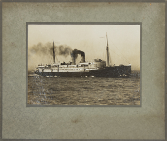
The SS Loongana operated in the Bass Strait from 1904 to 1934. She was replacied as a Tasmanian Ferry by the Nairana in 1921.A passanger ship which operated from Melbourne to Tasmania and to New Zealand beteen 1904 and 1934.A B&W photoraph mounted on cardboard backing of the SS Loongana under steam.ss loongana, bass strait, tasmanian ferries, port phillip -
 Hymettus Cottage & Garden Ballarat
Work on paper - Bookmark, Melbourne Legacy Bookmark
Legacy is a voluntary organisation of returned ex-servicemen formed in 1921 to care for the widows and children of those who served.A promotional bookmark issued by Legacy, a voluntary organisation of returned ex-servicemen formed in 1921 to care for the widows and children of those who served.. Part of a collection of bookmarks at Hymettus that covers a dozen examples of Legacy bookmarks in what is regarded as Australia's largest collection of bookmarks that numbered c.30,000 in 2024.legacy, charities, war service, volunteerism -
Phillip Island and District Historical Society Inc.
Book, ELIOT, George, mill on the floss
Labelled 'Phillip Island Historical Society, Cleeland Bequest'. Stamped 'Cowes Public Library'. Impression of inscription 'Marg..., Form VI, ...G.S., Geelong, March 3rd 1921'. -
 Stawell Historical Society Inc
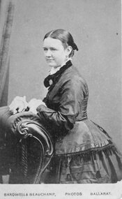
Photograph, Annie Foster Allard -- Studio Portrait
Portrait - Annie Foster Allard (died 21/12/1923)stawell -
 Stawell Historical Society Inc
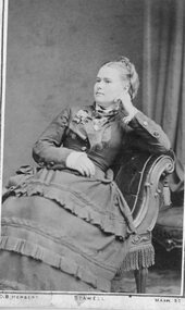
Photograph, Annie Foster Allard -- Studio Portrait
Portrait - Annie Foster Allard (died 21/12/1923)stawell -
 Lakes Entrance Historical Society
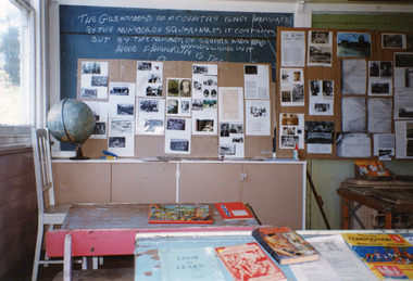
Photograph, 1995
Wairewa State School no 3739, opened 1923, closed 1973.Colour photograph of the inside of the Wairewa State School, East Gippslandschools