Showing 11556 items matching "maps"
-
 Bendigo Historical Society Inc.
Map - SANDHURST (PART), Circa 1880's
Map: Parish plan sowing an area along Specimen Hill Rd. ( number 211 in Map Cupboard 1)map, bendigo, parish plan, specimen hill rd. sandhurst , bendigo -
Bendigo Historical Society Inc.
Map - TARNAGULLA SHEET 1, Examined 25/08/1926
Map: Tarnagulla Sheet 1, Counties of Gladstone and Bendigo. Parish plan (number 304 in map cupboard 1)map, gladstone, parish plan, tarnagulla -
Bendigo Historical Society Inc.
Map - PARISH OF MARONG ALLOTMENTS, No date Visible
Map: Parish of Marong Allotments, County of Bendigo. Parish plan Blueprint (number 286 in map cupboard 1)map, bendigo, allotments, marong allotments -
Bendigo Historical Society Inc.
Map - FOSTERVILLE MAP, 19/08/1897
Map: Township of Fosterville, Parish of Ellesmere, County of Bendigo. Parish plan (number 277 in map cupboard 1)map, bendigo, township, fosterville, ellesmere -
Bendigo Historical Society Inc.
Map - YARRABERB, 17/12/1937
Map: Township of Yarraberb, Parish of Yarraberb, County of Bendigo. Parish plan (number 274 in map cupboard 1)map, bendigo, township, yarraberb -
Bendigo Historical Society Inc.
Map - NEWBRIDGE, August 17th 1875
Map: Township of Newbridge, Parish of Tarnagulla, County of Bendigo. Parish plan (number 272 in map cupboard 1)map, bendigo, township, newbridge -
Bendigo Historical Society Inc.
Map - AXEDALE, 12/07/1909
Map: Township of Axedale, Parish of Axedale, County of Bendigo. Parish plan (number 271 in map cupboard 1)map, bendigo, township, axedale -
Bendigo Historical Society Inc.
Map - CALAVIL, 28/08/1874
Map: Country Lands, Parish of Calavil, County of Bendigo. Parish plan (number 334 in map cupboard 1)map, bendigo, country lands, country lands, parish of calavil -
Stawell Historical Society Inc
Book - Family History, Reading Family History 1826 - 2001, March 11 2001
Updated family HistorySoft cover - Yellow - Red Script Title. UK Map in Red - Journeyline in red. Australa Map in Red.Oct 2004. Donated to Stawell Biarri Group for Genealogogy Inc. by Mrs Isobel Reading -
Whitehorse Historical Society Inc.
Map, Map of Nunawading, 1950?
Map of the entire City of Nunawading: complimentary map issued by Frank Fisher & Co real estate agents, Blackburn.Map of the entire City of Nunawading: complimentary map issued by Frank Fisher & Co real estate agents, Blackburn.Map of the entire City of Nunawading: complimentary map issued by Frank Fisher & Co real estate agents, Blackburn.nunawading, map -
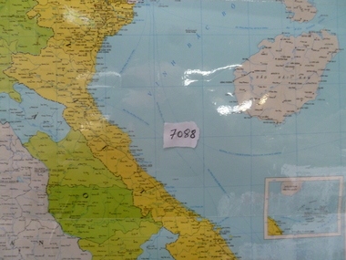 National Vietnam Veterans Museum (NVVM)
Map, Map of Vietnam, Lao, Campuchia
Laminated colour map of Vietnam, Laos and Campuchia. Map details rivers, hamlets, town and all geographical features.laos map, vietnam map, campuchia map -
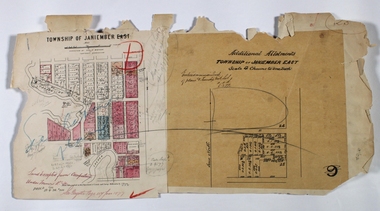 Bendigo Historical Society Inc.
Map - JANIEMBER EAST, 12/09/1876
Map: Two maps applied to the one backing, Township of Janiember East. Additional allotments, Townshihp of Janiember Eastmap, bendigo, janiember east, allotments janiember east, serpentine -
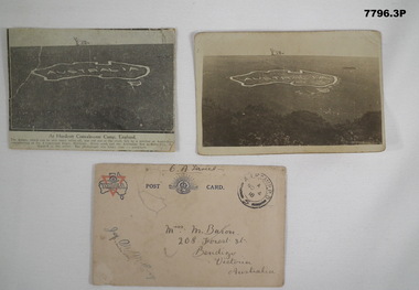 Bendigo Military Museum
Postcard - POSTCARD - HURDCOTT, AIF CAMP, UK, R. H. Baron, 3. 3/11/1918
Cards relate to R.H. Baron's time at Hurdcott AIF Camp during 1918. Part of the "Robert H. Baron", No. 3596, and Cooper Collection. See Catalogue No. 1981P for details of Baron's service.1. Black and white newspaper clipping pasted onto a piece of cream card. Clipping features a black and white photograph of a map of Australia carved into the side of a hill. Caption in black type below photograph. 2. Black and white postcard style photograph of a map of Australia carved into the side of a hill. 3. Plain cream coloured postcard with YMCA logo and AIF insignia at the top. Handwritten address on front and handwritten letter on back.1. Handwritten in black ink on back: 'This map has been cut in the hill and is only about 10 minutes walk from here, Bob' 3. Handwritten in black ink on front: 'Miss M. Baron, 208 Forest St. Bendigo, Victoria, Australia'. Stamped in black on top R.H.C. of front: 'Postmark - AIF Camp P.O. No.4, 18,' Handwritten in black ink on back: 'Letter to R.H. Baron's sister Myrtle from Hurdcott Camp dated 3.11.18.'robert h. baron, cooper collection, postcards, hurdcott aif camp -
Bendigo Historical Society Inc.
Map - CAMPBELL COLLECTION: BENDIGO AND DISTRICT MAPS
Map. Whirrakee, Parish of Whirrakee. Total area of map 4419 acres. Scale 20 chains to 1 inch. 23 allotments are sold, Eucalypt oil distillery on lower portion of map. Prepared in W.P.B. from Assessor's plan and Parish Plan. (number 350 in map cupboard 1)map, bendigo, allotments -
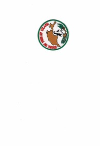 Phillip Island and District Historical Society Inc.
Badge, Circular Cloth Badges
Badges issued by the Shire of Phillip Island prior to 1994Historical2 Circular Cloth Badges for Shire of Phillip Island - 1 printed and the other embroideredShire of Phillip Island. Map of Phillip Island, Penguin, Banksia & Eucalypt leaves. shire of phillip island -
 Bendigo Military Museum
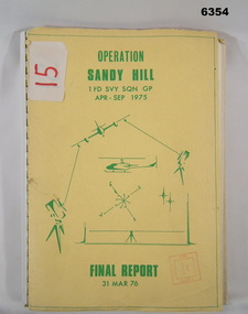
Administrative record - Operation Report - Operation Sandy Hill 1Fd Svy Sqn Apr - Sep 1975, 1 Fd Svy Sqn, 1976
Comprehensive Operation Report on Operation Sandy Hill conducted by 1Fd Svy Sqn Apr-Sep 1975 Part 1 Forward, Part 2 Planning and Mounting, Part 3 Final Report OC 1 Fd Svy Sqn, Part 4 Report Abn/EDM Gp, Part 5 Report Recon, Stn Marking and Traversing Gp, Part 6 Admin Report, Part 7 Report OC 171 Op Spt Sqn, Part 8 Computations and Results, Part 9 Observations and Recommendations.A4 size report held together with a plastic spiral binding, Light Cardboard cover includes many foldout Annexes"15" on front cover. Rubber stamp "Army Survey Regiment Map Library"royal australian survey corps, rasvy, fortuna, army survey regiment, army svy regt, asr -
 Mission to Seafarers Victoria
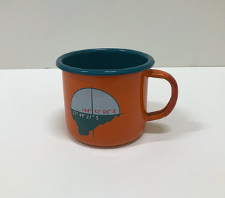
Souvenir - Cup, Margaret Woodward, 2015
Margaret Woodward is a an artist and an an associate professor of design at Charles Sturt University. Artist statement: "The Sea is All Around us is a multi-layered event which creates a memorable experience for those visiting the Dome Gallery and the Mission to Seafarers in Melbourne’s Docklands. The event acknowledges and raises awareness of the often difficult and dangerous working lives and journeys of seafarers by making visible their role in transporting commodities, materials and objects to and from Australia’s shores. This installation at the Dome Gallery in the Mission to Seafarers in Melbourne’s Docklands marks the third stage of an ongoing research project which seeks to reveal the ‘social life’ of souvenirs. Beyond their representational role souvenirs also trigger intangible, affective qualities – reminders of journeys and places, new associations with tastes, sounds and people, and thereby becoming objects which focus and hold memories. This installation invites seafarers and visitors to participate in a global project which aims to witness sea journeys and trace the mobile life of seafarers and souvenirs. For a fortnight in May 2015, the Dome Gallery became an architectural large scale compass, with the circular floor marking the intersection of its latitude and longitude (37 º 49'21" S 144º 57'03"E). Over these two weeks the Dome Gallery was inscribed with marks recording journeys made by seafarers, recording destination and departure ports, home lands and waterways, and in doing so making visible a small segment of the global patterns of seafaring. Custom-made souvenirs designed for the installation are given to seafarers as gestures of welcome and a memento of their visit. The souvenirs originating in Poland continue their journey by sea, to destinations beyond the Dome becoming part of the global network of seafaring, with an invitation for seafarers to record their future journeys using QR code scanning technologies. It is hoped that by releasing the 200 limited edition souvenirs accompanying the seafarers the mobile life of souvenirs and seafarers will also become visible. Like messages in bottles they leave our shores, becoming ambassadors, representing the Dome Gallery at the Mission to Seafarers, the waters of Port Phillip Bay, Australia’s red soil and vegetation, and carrying memories of visiting Melbourne." The Mission has always been open to the community and has a tradition of hosting cultural events: shows, concerts, exhibitions, festivals.Orange enamel and teal mug created for the art installation by artist Margaret Woodward at the Mission to Seafarers. On one side it is decorated with a compass and a latitude and longitude; on the opposite side, a leaf, a QR code on the bottom takes you to the website.Written at the bottom of the mug: Please scan to map the journey of this souvenir * www.sensingtheremote.net *2015cultural events, norla dome, mso, 2015, art installation, margaret woodward -
 Greensborough Historical Society
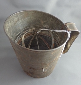
Flour Sifter, Kande, Metal flour sifter, 1954c
This sifter was used at Poulter Avenue Greensborough for over 55 years.Owned and used by the Colvin family for over 55 years.Metal sifter with metal handle and green painted winder. Some rust damage and a hole in wire."Kande" brand inside outline map of Australia, stamped on side with patent information.flour sifter -
 Ringwood and District Historical Society
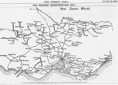
Photograph, Map showing Victoria's proposed railway system, 1890
Catalogue card reads, 'Map showing Victoria's proposed railway system, 1890. -
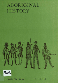 Victorian Aboriginal Corporation for Languages
Periodical, Australian National University Department of Pacific and Southeast Asian History, Aboriginal history, 1983
maps, b&w photographs, b&w illustrations, tables, sheet music -
 Victorian Aboriginal Corporation for Languages
Periodical with CD-ROM, Andrew Gunstone, Journal of Australian Indigenous issues, 2009
maps, b&w illustrations, b&w photographs, tables, CD-ROMworld indigenous peoples' conference on education, conference proceedings -
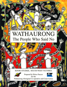 Victorian Aboriginal Corporation for Languages
Book, Bruce Pascoe et al, Wathaurong : the people who said no, 2003
The Wathaurong people of South Western Victoria said no to European invasion. Learn about this heroic resistance to the occupation of their lands. Can white and black live together or must we be always at war? The answer can only be given by young Australians. Includes a comprehensive historical timeline.maps, colour illustrations, b&w illustrations, colour photographs, word listswathaurong, wadtharung, port philllip bay, western port bay, lorne, south west victoria, battle creek, aire river, werribee, ballarat, wathaurong aboriginal cooperative, coast action, koori studies, john batman, william buckley, aboriginal studies policy, secondary school education, hissing swan, victorian history -
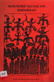 Victorian Aboriginal Corporation for Languages
Book, Nillumbik Reconciliation Group, Wurundjeri culture and resource kit, 1999
Contains culture,history, time lines, cross word puzzles etc.maps, b&w photographs, b&w illustrations, games, word listswurundjeri, woiwurrung, woiworung, kulin, yarra valley history, wurundjeri-willam, boon wurrung, bunurong, wathaurong, kurrung, taungurung, taungurong, yarra yarra, william barak, john batman, coranderrk, nillumbik shire council -
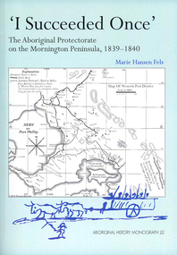 Victorian Aboriginal Corporation for Languages
Book, Marie Hansen Fels, I succeeded once : the Aboriginal Protectorate on the Mornington Peninsula, 1839-1840, 2011
1. The writings of William Thomas 2. The Context 3. The record of observation 4. Tubberubbabel, Protectorate head station 5. Kangerong, Protectorate second station 6. Buckkermitterwarrer, Protectorate third station 7. Kullurk, the Bonurong choice for a reserve 8. The raid into Gippsland and the massacres remembered 9. Manufacturing industry on the Mornington Peninsula, 'the successful plan at Arthurs Seat' 10. Death of Johnny and his burial on the foreshore at McCrae 11. The abduction between Arthurs Seat and Point Nepean, and Yankee Yankee's return 12. Thomas' translations.maps, document reproductions, b&w illustrations, colour illustrations, colour photographsboon wurrung, yarra mission, william thomas -
 Victorian Aboriginal Corporation for Languages
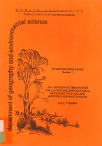
Book, Sue C Wesson, An overview of the sources for a language and clan atlas of Eastern Victoria and Southern New South Wales, 1994
This monograph concerns Eastern Victoria and Southern New South Wales and reviews the ethnographic record available for the study area. A test case is made of one tribe within the study area which requires further research. Overall, the literature review and the case study demonstrate that the ability to undertake detailed reconstructions, as Clark and Barwick have done for the other regions, can be undertaken in Eastern Victoria and Southern New South Wales, and this model will form the basis of future research.maps, b&w illustrations, b&w photographs, document reproductions, tableswoiworung, bunurong, taungurong, ngurai-illam-wurung, bidawal, maap, norman tindale, diane barwick, aldo massola, eve fesl, ian david clark, george augustus robinson, reverend john bulmer, robert brough smyth, alfred william howitt, moieties, clan names -
 Victorian Aboriginal Corporation for Languages
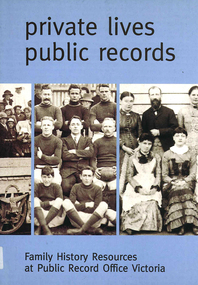
Book, Private lives, public records : family history resources at Public Record Office Victoria, 2003
Intended as a key resource for both first-time and experienced genealogists. It offers an introduction to the role, services and collection of Public Record Office Victoria, and a guide for family history researchers using the archives.colour photographs, b&w photographs, charts, letters, records, maps, plansgenealogy, local history, family history, public records, bibliographies, catalogues, victorian history -
 Greensborough Historical Society
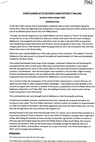
Article, Norm Colvin, Events leading up to the Plenty Ladies' Petition 1842, 2020_
This article, written and researched by Norm Colvin, GHS Secretary, identifies the people involved in the events leading to the petition to the Governor of Victoria, C. J. La Trobe, from 'Ladies resident on Plenty River' requesting protection from bushrangers, 5 May 1842. It identifies the bushrangers, the owners of the stations robbed, the group of men who rode out to assist and the identity of the "ladies" who signed the petition.This article identifies the people involved in the incidents, a list of locals in the 1840s.12 pages typescript, map.plenty river, bushrangers, petitions -
 Greensborough Historical Society
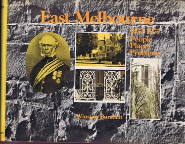
Book, Craftsmen Press, East Melbourne: 1837-1977: people, places, problems, 1977
A history of early development and more recent redevelopment in East Melbourne, from a town planning perspective.177 p., illus., maps.non-fictionA history of early development and more recent redevelopment in East Melbourne, from a town planning perspective.east melbourne, town planning, melbourne -
 Greensborough Historical Society
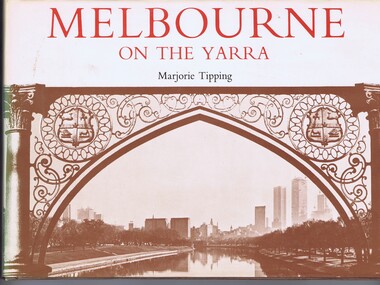
Book, Lansdowne Press, Melbourne on the Yarra, 1977
A pictorial history of Melbourne, illustrated with both old and new photographs96 p., illus., maps.non-fictionA pictorial history of Melbourne, illustrated with both old and new photographsmelbourne, yarra river -
 Greensborough Historical Society
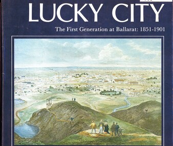
Book, Weston Bate, Lucky city: the first generation at Ballarat: 1851-1901, 1978
The history of Ballarat in its early goldmining days is entwined with the impact on the environment of the area.96 p., illus., maps.non-fictionThe history of Ballarat in its early goldmining days is entwined with the impact on the environment of the area.ballarat, gold rush, gold discoveries victoria