Showing 1773 items
matching maps and plans
-
 Bendigo Historical Society Inc.
Map - NOLAN, 11/04/1889
Map: Parish of Nolan, County of Bendigo. Parish plan (number 346 in map cupboard 1)map, bendigo, parish plan, nolan -
Bendigo Historical Society Inc.
Map - GOORNONG, 21/08/1888
Map: Parish of Goornong, County of Bendigo. Parish plan (number 345 in map cupboard 1)map, bendigo, parish plan, goornong -
Bendigo Historical Society Inc.
Map - ELMORE, 2/03/1880
Map: Parish of Elmore, County of Bendigo. Parish plan. (number 344 in map cupboard 1)map, bendigo, parish plan, elmore -
Bendigo Historical Society Inc.
Map - EGERTON, 22/03/1892
Map: Parish of Egerton, County of Bendigo. Parish plan (number 343 in map cupboard 1)map, bendigo, parish plan, egerton -
Bendigo Historical Society Inc.
Map - COUNTY OF BENDIGO, No date visible
Map. Plan showing all of the Parishes in the County of Bendigo (number 342 in map cupboard 1)map, bendigo, parishes, county of bendigo -
Bendigo Historical Society Inc.
Map - DIGGORA, 7/03/1892
Map: Parish of Diggora, County of Bendigo. Parish plan (number 341 in map cupboard 1)map, bendigo, parish plan, diggora -
Bendigo Historical Society Inc.
Map - KIMBOLTON, 20/12/1907
Map: Parish of Kimbolton, County of Bendigo. Parish plan. (number 339 in map cupboard 1)map, bendigo, parish plan, kimbolton -
Bendigo Historical Society Inc.
Map - EPPALOCK, 3/07/1890
Map: Parish of Eppalock. County of Bendigo. Parish plan (number 338 in map cupboard 1)map, bendigo, parish plan, eppalock -
Bendigo Historical Society Inc.
Map - LYELL, 24/09/1907
Map: Parish of Lyell, County of Bendigo. Parish plan (number 337 in map cupboard 1)map, bendigo, parish plan, lyell -
Bendigo Historical Society Inc.
Map - EGERTON, 28/01/1896
Map: Parish of Egerton, County of Bendigo. Parish plan. (number 335 in map cupboard 1)map, bendigo, parish plan, egerton -
Bendigo Historical Society Inc.
Map - BALLENDELLA, 12/06/1882
Map: Parish of Ballendella, County of Bendigo. Parish plan (number 333 in map cupboard 1)map, bendigo, parish plan, ballendella -
Bendigo Historical Society Inc.
Map - MARONG, 16/08/1881
Map: Parish of Marong, County of Bendigo. Parish plan (number 328 in map cupboard 1)map, bendigo, parish plan, marong -
Bendigo Historical Society Inc.
Map - EPPALOCK, 3/11/1882
Map: Parish of Eppalock, County of Bendigo. Parish plan (number 327 in map cupboard 1)map, bendigo, parish plan, eppalock -
Bendigo Historical Society Inc.
Map - FARADAY, 10/01/1879
Map: Parish of Faraday, County of Talbot. Parish plan. Earliest date on map December 1877.map, talbot, parish plan, faraday -
Bendigo Historical Society Inc.
Map - DARGILE, 14/10/1906
Map: Parish of Dargile, County of Rodney. Parish plan (number 324 in map cupboard 1)map, rodney, parish plan, dargile -
Bendigo Historical Society Inc.
Map - WELLSFORD, 15/10/1903
Map: Parish of Wellsford, County of Bendigo. Parish plan (number 321 in map cupboard 1)map, bendigo, parish plan, wellsford -
Bendigo Historical Society Inc.
Map - HEATHCOTE, 11/04/1935
Map: Parish of Heathcote, County of Dalhousie. Parish plan (number 320 in map cupboard 1)map, dalhousie, parish plan, heathcote -
Bendigo Historical Society Inc.
Map - TALAMBE, 26/11/1880
Map: Parish of Talambe, County of Bendigo. Parish plan (number 315 in map cupboard 1)map, bendigo, parish plan, talambe -
Bendigo Historical Society Inc.
Map - PANNOOBAMAWM, 6/11/1882
Map: Parish of Pannoobamawm, County of Bendigo, Parish plan (number 314 in map cupboard 1)map, bendigo, parish plan, pannoobamawm -
Bendigo Historical Society Inc.
Map - PANNOOBAMAWM, 7/12/1914
Map: Parish of Pannoobamawm, County of Bendigo. Parish plan (number 313 in map cupboard 1)map, bendigo, parish plan, pannoobamawm -
Bendigo Historical Society Inc.
Map - SEDGWICK, 5/04/1881
Map: Parish of Sedgwick, County of Bendigo. Parish plan (number 312 in map cupboard 1)map, bendigo, parish plan, sedgwick -
 Bendigo Historical Society Inc.
Map - MARONG, 21/01/1916
Map: Parish of Marong, County of Bendigo. Parish plan. Map dated 21/01/1916map, bendigo, parish plan, marong -
 Bendigo Historical Society Inc.
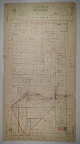
Map - YALLOOK, 25/02/1876
Map: Parish of Yallook, County of Bendigo. Parish plan. Map dated 25/02/1876.map, bendigo, parish plan, yallook -
 Bacchus Marsh & District Historical Society
Map, Bacchus Marsh Township and Nearby Districts Maps Volume
... Bacchus Marsh Township and Nearby Districts Maps Volume...Maps ...This volume of maps is believed to have been compiled by staff at the Shire of Bacchus Marsh and was presumably used to inform and assist Shire staff and Councillors in the carriage of their duties.This collection of maps are significant due to their rarity as many of them are unique maps made for local purposes in the Bacchus Marsh region. They are also of strong research value containing a wide variety of information including landholders, land sales, infrastructure, such as roads, bridges, public, commercial and private buildings, houses, land use, and geographic features over multiple decades from the late nineteen century into the middle part of the twentieth century.One bound volume of maps comprising cadastral maps, (indicating property owners and land boundaries), land plans and real estate auction plans and advertising material, and other maps indicating major infrastructure like proposed roads and irrigation areas. Most of the maps and plans are of Bacchus Marsh and nearby areas but some maps are of nearby towns such as Melton, Ballan and Blackwood. The volume comprises 52 pages. Most pages have a single map or plan pasted onto it but some contain 2 or 3 different maps. There are 81 maps in total. Map 1 Liquidators Sale 1896. Map 2. Woodside Estate Sale 1913. maps, maps bacchus marsh, maps bacchus marsh region -
Bendigo Historical Society Inc.
Map - BENDIGO SHEET 3
Map: copy of Parish plan, canvas backed. Map shows Bendigo city streets. ( number 126 in Map Cupboard 1)map, bendigo, city streets, bendigo, city streets -
 Bacchus Marsh & District Historical Society
Map, Gorrockburkchap Parish Map, County of Grant c.1915
The parish of Gorrockburkchap (sometimes spelled Gorrockburkghap) lies to the west and south west of the township of Bacchus Marsh. The locality of Rowsley is situated within this parish area.A single page paper map showing the parish plan for Gorrockburkchap in the County of Grant. The map is pasted into a bound volume containing 76 maps or plans in total. High resolution digital image stored on BMDHS computer network. gorrockburkchap parish maps, rowsley victoria maps -
 Bacchus Marsh & District Historical Society
Map, Gorrockburkchap Parish Map, County of Grant
The parish of Gorrockburkchap (sometimes spelled Gorrockburkghap) lies to the west and south west of the township of Bacchus Marsh. The locality of Rowsley is situated within this parish area.A single page paper map showing the parish plan for Gorrockburkchap in the County of Grant. The map is pasted into a bound volume containing 76 maps or plans in total. High resolution digital image stored on BMDHS computer network. gorrockburkchap parish maps, rowsley victoria maps -
Bendigo Historical Society Inc.
Map - LANGWORNOR SHEET 2, 26/06/1889
Map: Langwornor sheet 2, County of Dalhousie. Parish plan ( number 173 in Map Cupboard 1)map, dalhousie, parish plan, langwornor, county of dalhousie -
Bendigo Historical Society Inc.
Map - LANGWORNOR SHEET 1, No date visible
Map: Langwornor sheet 1, County of Dalhousie. Parish plan ( number 174 in Map Cupboard 1)map, dalhousie, parish plan, langwornor, county of dalhousie -
Bendigo Historical Society Inc.
Map - RESURVEY, PARISH OF SANDHURST, 1/08/1891
Map: Resurvey , Parish of Sandhurst sheet 3. Parish plan ( number 203 in Map Cupboard 1)map, bendigo, parish plan, parish of sandhurst resurvey