Showing 200 items
matching australian field regiment
-
 Bendigo Military Museum
Photograph - Demonstration of TI4100 GPS Receiver, Royal Australian Survey Corps, c1988
This is a set of two photographs of WO2 Graham Ragless from the Royal Australian Survey Corps demonstrating the operation of Global Positioning System equipment in c1988. The photos were probably taken at the School of Military Survey (SMS), Bonegilla, VIC. Texas Instruments TI4100 portable Global Positioning System (GPS) geodetic receivers were introduced from 1986–1988. The GPS receivers and Ferranti FILS3 helicopter and vehicle mounted Inertial Positioning System (IPS) replaced the TRANSIT satellite receivers. The equipment was deployed to establish the baseline for a GPS controlled air camera and photogrammetric system to significantly reduce the requirement for ground survey to accurately control air photography for topographic mapping. Personnel from the four field survey squadrons at this time were trained at the SMS to operate the TI4100 receivers. Field survey operations using GPS and IPS equipment followed in the late 1980s. This technology is described in more detail in the RA Svy booklet titled An Introduction to Topographic Mapping. See record ID - 6010. WO2 Graham Ragless progressed to the rank of WO1 and was appointed as RSM of the Army Survey Regiment from 1990 to 1992. Refer to item 6226.4P for more photographs of WO2 Graham Ragless demonstrating the TI4100.This is a set of two photographs of a technician from the Royal Australian Survey Corps demonstrating the operation of Global Positioning System equipment in c1988. Colour photos are on 35mm slide film and were scanned at 96 dpi. .1) and .2) - Photo, colour, c1988, WO2 Graham Ragless demonstrating the operation of a TI4100 GPS receiverThere are no annotations.royal australian survey corps, rasvy, army survey regiment, army svy regt, fortuna, asr, surveying -
 Bendigo Military Museum
Photograph - Royal Australian Survey Corps Surveyors in the Field – Project Cutlass, New Guinea, 1956 – 1957
This is a set of 23 photographs of surveyors and support staff in the field undertaking tasks in New Guinea 1956 – 1957. The surveyors were employed in the establishment of mapping and geodetic control for Project Cutlass, the “Ship-Shore” survey of the New Ireland province. In this survey operation surveyors used theodolites to observe horizontal and vertical angles and chains to measure base line distances between survey stations. Bob Skitch shown in photo .7P was in the 2nd year of his career in the Australian Army. He achieved the rank of Lieutenant-Colonel, and his last appointment was the CO of the Army Survey Regiment from 1976 to 1980.This is a set of 23 photographs of surveyors and support staff in the field undertaking duties during Project Cutlass located in New Ireland, New Guinea 1956 – 1957. The photographs were printed on photographic paper and are part of the Army Survey Regiment’s Collection. The photographs were scanned at 300 dpi. .1) - Photo, colour, 1956. Surveyors travelling main road from Kavieng to Namatanai, New Ireland. .2) - Photo, colour, 1956. Unidentified surveyors assessing recovery of their vehicle after bridge collapsed on west side of New Ireland. .3) - Photo, colour, 1956. Unidentified surveyors assessing recovery of their vehicle after bridge collapsed over flooded creek on west side of New Ireland. .4) - Photo, colour, 1956. Survey personnel L to R: Bev Uwins, John Lambie, Bob Thompson, New Ireland. .5) - Photo, colour, 1956. Survey base camp, New Ireland. .6) - Photo, black & white, 1956-1957. Geoff Helsham with possible human remains, New Ireland. .7) - Photo, black & white, 1956-1957. Bob Skitch undertaking survey observations using Wild T2 theodolite, New Ireland. .8) - Photo, black & white, 1956-1957. Chas Beach undertaking survey observations using Wild T2 theodolite, New Ireland. .9) & .10) - Photo, black & white, 1956-1957. Kev Parker (cook) New Ireland. .11) - Photo, colour, 1957. Brian Berkery taking a break, Top Manor Island, Lihir Island Group off New Ireland. Latitude -2° 46”, Longitude 152° 40”. .12) - Photo, colour, 1957. Survey base camp L to R: Chas Beach, Bev Uwins, Feni Islands, New Ireland. Latitude -4° 05”, Longitude 153° 45”. .13) - Photo, colour, 1957. A Hous Kiap. (Kiaps, known formally as district officers and patrol officers, were travelling representatives of the British and Australian governments), New Ireland. .14) & .15) - Photo, colour, 1957. L to R: Joe Farrington, Tom Royle Bob undertaking survey observations using theodolites from an improvised timber tower, New Ireland. .16) & .17) - Photo, colour, 1957. US Army ship FS216 used for ship-to-shore triangulation docked at Rabaul, New Britain. .18) - Photo, colour, 1957. US Army ship FS216 used for ship-to-shore triangulation docked at Kavieng, New Ireland. Sight target on top of mast. .19) - Photo, colour, 1957. Survey personnel onboard US Army ship FS392, L to R: Peter Frodsham, Bob Thompson, Doc Reid, John Underwood, remainder unidentified, New Ireland. .20) - Photo, colour, 1957. Survey base line party heading ashore, New Ireland. .21) - Photo, colour, 1957. Survey personnel rowing US Army assault boat L to R: Kev Parker, Chas Beach, folded up survey beacons overhanging stern, New Ireland. .22) - Photo, colour, 1957. Les Bailey onboard US Army ship departing Rabaul, New Britain for Brisbane. .23) - Photo, colour, 1957. Ron Newman onboard US Army ship departing Rabaul, New Britain for Brisbane. Active volcano in background..1P to .23P annotated on back – ‘Operation Cutlass’, personnel names, the year and the location. royal australian survey corps, rasvy, army survey regiment, fortuna, a, army svy regt, asr, surveying -
 Bendigo Military Museum
Photograph - Royal Australian Survey Corps Surveyors in the Field – Northern Territory and Queensland, 1959 – 1960
This is a set of 10 photographs of surveyors and support staff in the field undertaking duties in the Northern Territory and North Queensland in 1959 – 1960. The surveyors were employed in the establishment of mapping and geodetic control. In this era surveyors used theodolites to observe horizontal and vertical angles and tellurometers to measure base line distances between survey stations. Laplace survey observations seen in Photo .1P was a series of precise observations carried out at geodetic survey stations to determine astronomic latitudes, longitudes and azimuths to achieve maximum precision in the survey network. Laplace observations were necessary in a geodetic network at every 6th survey station, however the National Mapping Council specified at this time the spacing would be ideally between 4-6 survey stations. The cairn shown in photo .4P was built by RASvy as a landmark over a trigonometric survey station. It was dismantled in 1960 to enable re-occupation and survey observations. It was not restored to the condition shown in the photo.This is a set of 10 photographs of surveyors and support staff in the field undertaking duties in the Northern Territory (NT) and Queensland (QLD) in 1959 – 1960. The photographs were printed on photographic paper and are part of the Army Survey Regiment’s Collection. The photographs were scanned at 300 dpi. .1) - Photo, colour, 1959. Tony Slattery occupying a Laplace survey station on a hill in the Mount Young area of the NT. .2) - Photo, colour, 1959. Surveyors’ camp in the Mount Young area of the NT, L to R: Spencer Snow and Tony Slattery. .3) - Photo, colour, 1959. Surveyors’ camp in the Peckman Hill area, near Katherine in the NT. .4) - Photo, colour, 1959. Cairn on Trig Hill, Borroloola, NT. Built by Spencer Snow, Tom Royle and Jack McCabe. .5) - Photo, colour, 1959. Survey party taking a break next to their Austin Champ vehicle, in transit between Katherine, NT and Wyndam WA. L to R: Tony Slattery, Dave Owens, John Van De Graff. .6) - Photo, colour, 1960. Surveyors’ camp between Mount Isa, QLD and Borroloola, NT. L to R: Pat Cox and John Van De Graff prepare their meal on an open fire. .7) - Photo, colour, 1960. Surveyor - Dennis Woods undertaking survey observations, using MRA1 tellurometer to measure base-line distances NW of Mount Isa, QLD. .8) - Photo, colour, 1960. Unidentified surveyors assessing recovery of their stalled Studebaker truck vehicle after attempting a water crossing in the NT. .9) - Photo, colour, 1960. Unidentified surveyor making batches of bread at a camp in the NT. Seen in the photo placing a lid with hot coals onto the camp oven. .10) - Photo, colour, 1960. Unidentified survey party occupying a survey station on a hill in the Mount near the Lawn Hill area, NW of Mount Isa, QLD. A MRA1 tellurometer to measure base-line distances appear on the right side of the photo. .9) - Photo, colour, 1960. Unidentified surveyors assessing recovery of their stalled Studebaker truck vehicle after attempting a water crossing in the NT. .10) - Photo, colour, 1960. Unidentified surveyor making batches of bread at a camp in the NT. Seen in the photo placing a lid with hot coals onto the camp oven. .1P to .10P annotated on back – personnel names, the year and the location. royal australian survey corps, rasvy, army survey regiment, asr, army svy regt, fortuna, surveying -
 Bendigo Military Museum
Photograph - Royal Australian Survey Corps Surveyors in the Field – North Queensland, 1958
This is a set of seven photographs of surveyors and support staff in the field undertaking duties in North Queensland in 1958. The surveyors were employed in the establishment of mapping and geodetic control. In this era surveyors used theodolites to observe horizontal and vertical angles and chains to measure base line distances between survey stations. Bob Skitch shown in photos .4P to .6P was in the 2nd year of his career in the Australian Army. He achieved the rank of Lieutenant Colonel and his last appointment was the CO of the Army Survey Regiment from 1976 to 1980. The annotation on the back of photo .5P ‘Black foreground is where Bob Skitch boiled billy and started a grass fire’.This is a set of seven photographs of surveyors and support staff in the field undertaking duties in North Queensland in 1958. The photographs were printed on photographic paper and are part of the Army Survey Regiment’s Collection. The photographs were scanned at 300 dpi. .1) - Photo, colour, 1958. Surveyor in Nth QLD enjoying a bath. L to R: Don Cocker, Bob Thompson. .2) - Photo, colour, 1958. Don Cocker surveyor in Nth QLD, enjoying a bath. .3) - Photo, colour, 1958. Surveyors Nth QLD undertaking survey observations, using MRA1 tellurometer to measure base-line distances. L to R: Len Davies, Lou Sommer, John Van De Graff. MRA1 was covered to stop overheating. .4) - Photo, colour, 1958. Surveyors south of Richmond, QLD digging holes for the erection of a Bilby observation tower. L to R: John Van De Graff, Bob Skitch, Kev Moody, Mal Hayes, Don Gray .5) - Photo, colour, 1958. Surveyors south of Richmond, QLD erecting a Bilby observation tower. L to R: Tom Royle, Bob Skitch (on ground level), Mal Hayes. .6) - Photo, colour, 1958. Surveyors south of Richmond, QLD erecting a Bilby observation tower. L to R: Tom Royle, Bob Skitch, Mal Hayes, Jim McGill (on ground level). .7) - Photo, colour, 1958. Surveyors south of Richmond, QLD undertaking survey measurements from a Bilby observation tower..1P to .7P annotated on back – personnel names, the year and the location. Annotated on back of .5P ‘Black foreground is where Bob Skitch boiled billy and started a grass fire’.royal australian survey corps, rasvy, army survey regiment, asr, army svy regt, fortuna, surveying -
 Bendigo Military Museum
Photograph - Royal Australian Survey Corps Surveyors in the Field – Victoria, 1956 - 1958
This is a set of two photographs of surveyors and support staff in the field undertaking tasks in Victoria 1956 – 1958. The surveyors were employed in the establishment of mapping and geodetic control. In this era surveyors used theodolites to observe horizontal and vertical angles and chains to measure base line distances between survey stations. This is a set of 23 photographs of surveyors and support staff in the field undertaking duties in Victoria 1956 – 1958. The photographs were printed on photographic paper and are part of the Army Survey Regiment’s Collection. The photographs were scanned at 300 dpi. .1) - Photo, colour, 1956. Surveyors enjoying a tea break. L to R: Tom Gilbert (cook), Barry Broad, Tony Slattery, John Van De Graff. Taken at Boonoonar, a locality south of Mildura. .2) - Photo, colour, 1958. Surveyors taking a break from driving. L to R: Leo Bub, Bob Thompson. Taken at Puckapunyal..1P to .2P annotated on back – personnel names, the year and the location. royal australian survey corps, rasvy, army survey regiment, asr, army svy regt, fortuna, surveying -
 Bendigo Military Museum
Photograph - Royal Australian Survey Corps Surveyors in the Field – North Queensland and Torres Strait, 1961
This is a set of five photographs of surveyors and support staff in the field undertaking duties in North Queensland and Torres Strait in 1961. The surveyors were employed in the establishment of mapping and geodetic control. In this era surveyors used theodolites to observe horizontal and vertical angles and tellurometers to measure base line distances between survey stations. In photo .2P Joe Farrington is seen taking survey observations using a Tavistock V500 Series Tavistock theodolite at a survey station between the Edward River and Aurukun in the Cape York Peninsula. The Gulf of Carpentaria appears in the background. From 1957 helicopter transport of survey parties revolutionised transport in remote areas. The civilian helicopter was hired from TAA. This is a set of five photographs of surveyors and support staff in the field undertaking duties in North Queensland and Torres Strait in 1961. The photographs were printed on photographic paper and are part of the Army Survey Regiment’s Collection. The photographs were scanned at 300 dpi. .1) - Photo, colour, 1961. Andy Millar occupying a survey station on a hill in the Cape York Peninsula, QLD. .2) - Photo, colour, 1961. Joe Farrington taking observations with a V500 Series Tavistock geodetic theodolite at a survey station in the Cape York Peninsula, QLD. .3) - Photo, colour, 1961. Daryl Parker taking a break from survey observations on a hill located on Duaun Island QLD, in the Torres Strait, a few miles south of the PNG coastline. Hill height was 975 ft. .4) - Photo, colour, 1961. Three Torres Strait divers L to R: unidentified, Darku and Ray Mau Daryl standing behind a Tavistock geodetic theodolite on a hill located on Duaun Island QLD, in the Torres Strait, a few miles south of the PNG coastline. .5) - Photo, colour, 1961. Andy Millar holding meat from a small turtle on Duaun Island QLD, in the Torres Strait, a few miles south of the PNG coastline. An unidentified Duaun Island local appears in the background..1P to .5P annotated on back – personnel names, the year and the location. royal australian survey corps, rasvy, army survey regiment, asr, army svy regt, fortuna, surveying -
 Bendigo Military Museum
Photograph - Royal Australian Survey Corps Surveyors in the Field – PNG, 1962
This is a set of four photographs of surveyors and support staff in the field undertaking duties in Dogera, Milne Bay Province and Kerema, Gulf Province of PNG in 1962. The surveyors were employed in the establishment of mapping and geodetic control. In this era surveyors used theodolites to observe horizontal and vertical angles and tellurometers to measure base line distances between survey stations. From 1957 helicopter transport of survey parties revolutionised transport in remote areas.This is a set of four photographs of surveyors and support staff in the field undertaking duties in PNG in 1962. The photographs were printed on photographic paper and are part of the Army Survey Regiment’s Collection. The photographs were scanned at 300 dpi. .1) - Photo, colour, 1962. Unloading survey operation stores from a Landing Ship Medium (LSM) at Dogera, Milne Bay Province, PNG. .2) & .3) - Photo, colour, 1962. Hired civilian helicopter Bell 47G-2 helicopters operating at at Dogera, Milne Bay Province, PNG. .4) - Photo, colour, 1962. Survey party at survey station located near Kerema, Gulf Province southern PNG. L to R: Dave Owens, Keith Broadbent, with local villagers in background..1P to .4P annotated on back – personnel names, the year and the location. royal australian survey corps, rasvy, army survey regiment, asr, army svy regt, fortuna, surveying -
 Bendigo Military Museum
Photograph - Royal Australian Survey Corps - Map Production Processes, c1990
This is a collection of 20 photographs of Royal Australian Survey Corps phases of map production at the School of Military Survey, Bonegilla, the Army Survey Regiment, Bendigo, and the Army Map Depot, Bandiana circa 1990. Colour photos are on 35mm slide film and were scanned at 96 dpi. They are part of the Army Survey Regiment’s Collection. Photo .1P was probably taken on a survey station overlooking Lake Hume near Albury-Wodonga. The field party occupying the survey station was likely from a Map Control Survey course conducted by the School of Military Survey, Bonegilla. This survey station was part of a geodetic network used in field survey training and RASvy’s Lake Hume Test Range. Photos .3P to .16P were taken at the Army Survey Regiment, Bendigo and photos .17P & .18P were taken at the Army Map Depot, Bandiana. Photo .19P depicts a map of RASvy’s ARA units before the disbandment of 5th Field Survey Squadron, Perth and 2nd Field Survey Squadron, Sydney in 1990. This is a collection of 20 photographs of map production processes taken at the School of Military Survey, Bonegilla, the Army Survey Regiment, Bendigo, and the Army Map Depot, Bandiana circa 1990. Colour photos are on 35mm slide film and were scanned at 96 dpi. They are part of the Army Survey Regiment’s Collection. Photo .2P is printed on photographic and scanned at 300 dpi. .1) – Photo, colour, c1980s. Geodetic Surveying: AN/PRR-14 Geoceiver antenna on hill surrounding Lake Hume. Series 3 Land Rover, field party tent and survey station beacon in background. .2) – Photo, black & white, c1980s. Geodetic Surveying: AN/PRR-14 Geoceiver antennas set up at the School of Military Survey, Bonegilla, Victoria. .3) – Photo, colour, c1990. Aerotriangulation: Wild PUG4 point transfer device, SSGT Bruce Hammond. .4) – Photo, colour, c1990. Aerotriangulation: Zeiss (Jena) Stecometer, SSGT Bruce Hammond. .5) – Photo, colour, c1990. Aerotriangulation: computer tape maintenance, SSGT Noel McNamara. .6) – Photo, colour, c1990. AUTOMAP 2: computer tape maintenance, SPR Nadine (Paul) Read. .7) - Photo, colour, c1990s. AUTOMAP 2: Optronics 4040 scanning/film output in Lithographic Squadron, SGT Sherri (Dally) Burke. .8) - Photo, colour, c1990s. AUTOMAP 2: Benson verification plotter output, SPR Nadine (Paul) Read. .9) – Photo, colour, c1990. Aerotriangulation: data management, SGT Neil ‘Ned’ Kelly. .10) & .11) - Photo, colour, c1990s. AUTOMAP 2: Wild B8 Aviograph stereoplotter Feature Extraction, unidentified technician. .12) - Photo, colour, c1990s. AUTOMAP 2: Graphic Edit Workstation, SPR Nadine (Paul) Read. .13) - Photo, colour, c1990s. AUTOMAP 2: Graphic Edit Workstation, SPR Dawn Hoadley. .14) & .15) - Photo, colour, c1990s. AUTOMAP 2: Graphic Edit Workstation, unidentified technician. .16) – Photo, colour, c1990s. Heidelberg Speedmaster 102 computer-controlled five colour lithographic offset printing press. .17) & .18) – Photo, colour, c1990s. Army Map Depot, unidentified storeman, Bandiana. .19) – Photo, colour, c1990. RASvy ARA Unit Locations before disbandment of field units in Perth and Sydney. .20) – Photo, colour, c1990. Set of overlapping aerial photography..1P, .3P to .20P - Some equipment is identified on the frame of the 35mm slides.royal australian survey corps, rasvy, army survey regiment, army svy regt, fortuna, asr, school of military survey, army map depot -
 National Vietnam Veterans Museum (NVVM)
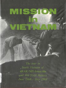
Book, Webb, J. R. Lt, Mission in Vietnam: The tour in South Vietnam of 4 RAR/NZ(ANZAC)Bn and 104 Field Battery, June 1968-May 1969 (Copy 2)
... Australia. Army. Royal Australian Regiment. Battalion ...This book is dedicated to those men of 4RAR/NZ(Anzac) Bn who died fighting for a free South Vietnam.This book is dedicated to those men of 4RAR/NZ(Anzac) Bn who died fighting for a free South Vietnam.australia. army. royal australian regiment. battalion, australia. army. field battery, 4rar/nz, 4 rar/nz (anzac), new zealand - deaths in vietnam -
 National Vietnam Veterans Museum (NVVM)
Book, Webb, J. R. Lt, Mission in Vietnam: The tour in South Vietnam of 4 RAR/NZ(ANZAC)Bn and 104 Field Battery, June 1968-May 1969 (Copy 1)
... Australia. Army. Royal Australian Regiment. Battalion ...This book is dedicated to those men of 4RAR/NZ(Anzac) Bn who died fighting for a free South Vietnam.This book is dedicated to those men of 4RAR/NZ(Anzac) Bn who died fighting for a free South Vietnam.australia. army. royal australian regiment. battalion, australia. army. field battery, 4 rar nz, 4 rar/nz (anzac), new zealand - deaths in vietnam -
 Bendigo Historical Society Inc.
Plan - FORTUNA COLLECTION: FORTUNA VILLA
Originally built by Christopher Ballestedt (1796-1869) and his son Theodore. The Ballestedt's pioneered open cut and quartz mining on the Bendigo gold field. They were very successful. After Christopher's death, Theodore continued until 1871 when he sold Fortuna, their mines and equipment to George Lansell for 30,000 pounds.4 large plan of Fortuna villa. Scale 1:50 Australian survey office - Victoria Department of Administrative services. Fortuna Bendigo - Army Survey Regiment. Dept. of Defence - Army. Terrestrial Photogrammetric Survey. Project number: 8001/2. Reg. File: 64/531. Survey File:631. Draftsman: M.A. Osciak. Surveyed by G. Tucker. Date of Survey: 14/05/79. There are 4 large such plans in a plastic bag the measurement of the plans is approx 115cm X 80 cm.plan, bendigo, fortuna villa -
 Bendigo Military Museum
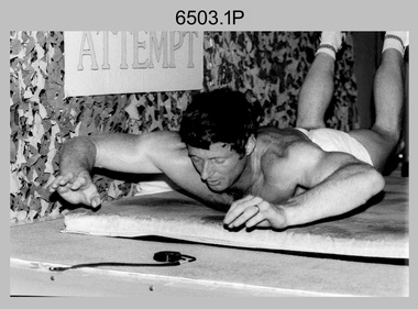
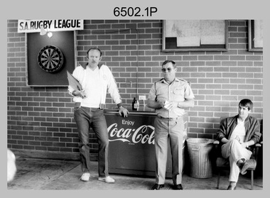
Photograph - 4th Field Survey Squadron – CPL John Ratcliffe World Record, Keswick Barracks, Adelaide SA, 1986
This is a set of 12 photographs of 4th Field Survey Squadron’s CPL John Ratcliffe setting a world record for an exercise routine comprising push-ups, sit-ups and double back-arches at Keswick Barracks, Adelaide in November 1986. A newspaper article of unknown origin titled “John sets world’s best time in routine” was published reporting the achievement. The article reported: “Corporal John Ratcliffe has smashed his personal best time, his greatest expectations and the 16-year-old Australian record for a push-up, sit-up and double back-arch routine. Corporal Ratcliffe, 37, set a world record by doing 1232 push-ups (clapping his chest with his hands between each one), 1936 back-arches and 440 sit-ups in one hour, 16 minutes and 29 seconds yesterday. Officials representing the Guinness Book of Records were present and passed his effort. The record was achieved by repeating a set of 14 push-ups, 22 double back-arches and 5 sit-ups, 88 times. The Australian record for the same routine was set in 1970 in the time of 1 hour 41 minutes. CPL Ratcliffe beat his personal best time by 13 minutes. “I could not do it without them” CPL Ratcliffe said of the crowd. Nearing the end of the routine when he was tiring, the crowd of more than 100 clapped and chanted encouragement. CPL Ratcliffe, who works in the Army’s surveying department, said the most important aspect of the exercise was raising money for Legacy, not getting his name in the record books.” This achievement was also reported in the Army Newspaper dated 11th Dec 1986. There are eight more photos that have not been published in the set of negatives.This is a set of 12 photographs of 4th Field Survey Squadron’s CPL John Ratcliffe setting a exercise routine world record at Keswick Barracks, Adelaide in November 1986. The black & white photographs are on 35mm negative film and are part of the Army Survey Regiment’s Collection. The photographs were scanned at 96 dpi. .1) to .9) - Photo, black & white, 1986. CPL John Ratcliffe during his exercise routine. .10) - Photo, black & white, 1986. CPL John Ratcliffe celebrates the new world record. L to R: Bob Rogister, Wally Chilcott. .11) - Photo, black & white, 1986. CPL John Ratcliffe celebrates the new world record. L to R: Peter Imeson, Bob Rogister, Wally Chilcott. .12) - Photo, black & white, 1986. CPL John Ratcliffe interviewed by media after setting the new world record. .1P to .12P – There are no other personnel identified. ‘CPL RATCLIFFE “WORLD RECORD”. NOV 1986’ annotated on negatives sleeve.royal australian survey corps, rasvy, 4 fd svy sqn -
 Bendigo Military Museum
Photograph - 4th Field Survey Squadron – MAJ Don Taylor Farewell, Keswick Barracks, Adelaide SA, 1986
This is a set of 21 photographs of a 4th Field Survey Squadron function held in 1986 to farewell its OC MAJ Don Taylor. MAJ Taylor served 27 years in the Australian Regular Army from 1960 to 1987.This is a set of 21 photographs of a 4th Field Survey Squadron function to farewell its OC MAJ Don Taylor, at Keswick Barracks, Adelaide SA in 1986. The black & white photographs are on 35mm negative film and are part of the Army Survey Regiment’s Collection. The photographs were scanned at 96 dpi. .1) - Photo, black & white, 1986. L to R: SSM WO1 Bill Griggs, OC MAJ Don Taylor, unidentified. .2) - Photo, black & white, 1986. Back row L to R: SGT Wally Chilcott, unidentified (x2), CPL Peter McCurdy, unidentified. Front row L to R: LT Greg Oaten, LT Malcolm Hentschel, SPR Steve Nokes. At front L to R: CPL John Ratcliffe, OC MAJ Don Taylor, SSM WO1 Bill Griggs. .3) - Photo, black & white, 1986. L to R: SSM WO1 Bill Griggs, CPL John Ratcliffe, OC MAJ Don Taylor, George Ricketts, unidentified (x2). .4) - Photo, black & white, 1986. L to R: LT Malcolm Hentschel, unidentified (x2), CPL John Ratcliffe, CPL Peter Hardy, SSM WO1 Bill Griggs, OC MAJ Don Taylor. .5) - Photo, black & white, 1986. L to R: LT Greg Oaten, LT Malcolm Hentschel, unidentified (x2), CPL John Ratcliffe, CPL Peter Hardy, SSM WO1 Bill Griggs, OC MAJ Don Taylor. .6) - Photo, black & white, 1986. L to R: SGT Bill Tewson, SGT Bob Croxton, CPL Dave Irving, WO2 Bob Rogister, unidentified (x3), SSGT Cam Chapman, Chris Hills, CPL Roger Graf. .7) - Photo, black & white, 1986. L to R: SSM WO1 Bill Griggs, LT Malcolm Hentschel, OC MAJ Don Taylor, SGT Mick Hogan. .8) - Photo, black & white, 1986. L to R: unidentified, LT Malcolm Hentschel, SSM WO1 Bill Griggs, Mick Hogan’s daughter? OC MAJ Don Taylor, SGT Mick Hogan. .9) - Photo, black & white, 1986. L to R: unidentified, SSM WO1 Bill Griggs, unidentified, SGT Bill Tewson, OC MAJ Don Taylor. .10) - Photo, black & white, 1986. L to R: unidentified, SGT Bill Tewson, SSM WO1 Bill Griggs, OC MAJ Don Taylor, SGT Mick Hogan and his wife. .11) - Photo, black & white, 1986. L to R: CAPT Steve Cooper, SSM WO1 Bill Griggs, OC MAJ Don Taylor. .12) - Photo, black & white, 1986. L to R: unidentified, CAPT Steve Cooper, SSM WO1 Bill Griggs, OC MAJ Don Taylor, SGT Mick Hogan. .13) - Photo, black & white, 1986. L to R: unidentified, CPL Peter McCurdy, SGT Bill Tewson, CAPT Steve Cooper, OC MAJ Don Taylor, SSM WO1 Bill Griggs. .14) - Photo, black & white, 1986. L to R: OC MAJ Don Taylor, unidentified (x5), CPL Chris ‘Charlie’ Brown, unidentified (seated), SPR Damian Killeen, remainder unidentified. .15) - Photo, black & white, 1986. L to R: unidentified, LT Malcolm Hentschel, SPR Steve Ellis, unidentified (x5), CPL Roger Graf. .16) - Photo, black & white, 1986. Unidentified personnel. SPR Richard Cocker takes aim at the dart board. .17) - Photo, black & white, 1986. L to R: SPR Steve Nokes, LT Greg Oaten, SPR Simon Reynolds, Chris Hills, LT Malcolm Hentschel, SGT Wally Chilcott. .18) - Photo, black & white, 1986. L to R: unidentified, SPR Richard Cocker, CPL Peter McCurdy, LT Greg Oaten, SPR Simon Reynolds, SGT Bob Croxton. .19) - Photo, black & white, 1986. L to R: CPL Chris ‘Charlie’ Brown, Mrs Kath Rogister, WO2 Bob Rogister, SSGT Cam Chapman, CAPT Terry Lord, unidentified. .20) - Photo, black & white, 1986. L to R: unidentified, CPL Peter Hardy, CPL Tracey (Beckwith) Phillips, unidentified (x4), CAPT Steve Cooper, Ken Jeffery, remainder unidentified. .21) - Photo, black & white, 1986. L to R: CPL C. Rimmington, SGT H. Young..1P to .21P – There are no personnel identified. ‘MAJ Don Taylor’s SQN Farewell. 1986’ annotated on negatives sleeve.royal australian survey corps, rasvy, 4 fd svy sqn -
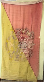 8th/13th Victorian Mounted Rifles Regimental Collection
Flag - 8/13 VMR flag
The 8th/13th Victorian Mounted Rifles was raised as a regiment of the Royal Australian Armoured Corps on 1 May 1948 with Headquarters in Melbourne and squadrons in Sale, Benalla/Wangaratta and Albury. In 1955 Regimental Headquarters moved to Wangaratta and a second squadron was located at Albury. The Sale squadron transferred to 4th/19th Prince of Wales’s Light Horse. In 1977 8/13 VMR Regiment was reduced to an independent squadron A Squadron 8th/13th Victorian Mounted Rifles and in 1991 was linked with 4th/19th Prince of Wales’s Light Horse forming the VMR Squadron of that regiment.Coloured flag, red and yellow field divided diagonally with badly faded 8/13 Victorian Mounted Rifles crest superimposed at centre.vmr, victorian mounted rifles, flag -
 Bendigo Military Museum
Photograph - 4th Field Survey Squadron OC’s Parades and Defence Force Service Medal Presentations, Keswick Barracks, Adelaide SA, 1986
This is a set of 27 photographs of a 4th Field Survey Squadron OC’s parade at Keswick Barracks, Adelaide SA in 1986. The OC - MAJ Don Taylor presented the Defence Force Service Medal to personnel in recognition of 15 years of efficient remunerated service, or the Clasp for 5 years of additional service. Photos .22P to .27P were taken on a separate OC’s Parade. OC MAJ Don Taylor is seen in photo .27P congratulating WO2 Russell ‘Rusty Williams, probably on his promotion to WO1. This is a set of 27 photographs of a 4th Field Survey Squadron OC’s parade and the presentation of the Defence Force Service Medal, at Keswick Barracks, Adelaide SA in 1986. The colour photographs are on 35mm negative film and are part of the Army Survey Regiment’s Collection. The photographs were scanned at 96 dpi. .1) - Photo, colour, 1986. L to R: WO2 Gary Warnest in background, SPR Steve Ellis, CPL John Ratcliffe, SPR John Keely. .2) - Photo, colour, 1986. L to R: CPL Jeff Prince, SPR Bruce Graham, SGT Stuart Symonds, CPL John Ratcliffe, SGT Peter Imeson. .3) - Photo, colour, 1986. 4 Fd Svy Sqn at ease. Centre rank L to R: SPR Steve Wainwright, CPL Jeff Prince, CPL Peter Hardy. Front rank L to R: SPR Todd Hayley, SPR Steve Ellis, CPL Dave Irving, SPR Richard Cocker, SPR Damien Killeen, remainder unidentified. .4) to .6) - Photo, colour, 1986. Parade handover L to R: SSM WO1 Bill Griggs, 2IC CAPT Steve Cooper. .7) - Photo, colour, 1986. Parade handover L to R: 2IC CAPT Steve Cooper, OC MAJ Don Taylor. .8) - Photo, colour, 1986. Parade handover L to R: OC MAJ Don Taylor, 2IC CAPT Steve Cooper. .9) - Photo, colour, 1986. Inspection L to R: CPL Jeff Prince, CPL John Ratcliffe, CPL Peter Hardy, OC MAJ Don Taylor, 2IC CAPT Steve Cooper, SSM WO1 Bill Griggs. .10) - Photo, colour, 1986. Inspection L to R: WO2 Gary Warnest, WO2 Bob Rogister, WO2 Russell ‘Rusty Williams, OC MAJ Don Taylor, SSM WO1 Bill Griggs, SGT Wally Chilcott. .11) - Photo, colour, 1986. Inspection L to R: WO2 P. Symmans, WO2 Gary Warnest, 2IC CAPT Steve Cooper, OC MAJ Don Taylor, SGT Wally Chilcott. .12) & .13 - Presentations L to R: SPR Simon Reynolds, OC MAJ Don Taylor. .14) & .15) - Photo, colour, 1986. Presentations: SSM WO1 Bill Griggs. .16) & .17) - Photo, colour, 1986. Presentations L to R: WO2 Russell ‘Rusty Williams, OC MAJ Don Taylor, SPR Simon Reynolds. .18) - Photo, colour, 1986. Presentations: WO2 Russell ‘Rusty Williams. .19) - Photo, colour, 1986. Presentations L to R: unidentified (x2), CPL Terry ‘TJ’ Wicker. .20) - Photo, colour, 1986. Presentations L to R: CPL Terry ‘TJ’ Wicker, OC MAJ Don Taylor, SPR Simon Reynolds, 2IC CAPT Steve Cooper. .21) - Photo, colour, 1986. Presentations L to R: CPL Terry ‘TJ’ Wicker, OC MAJ Don Taylor. 22) & .23) - Photo, colour, 1986. Parade right dress. Centre rank L to R: SPR Steve Wainwright, SPR Peter Tuddenham, CPL Jeff Prince, remainder unidentified. Front rank L to R: SPR Todd Hayley, CPL Chris ‘Charlie’ Brown, SPR Richard Cocker, unidentified, SPR Steve Nokes, CPL Dave Irving, SPR Steve Ellis remainder unidentified. .24) - Photo, colour, 1986. Presentations L to R: SPR Simon Reynolds, 2IC CAPT Steve Cooper, OC MAJ Don Taylor, CPL Dave Longbottom. .25) - Photo, colour, 1986. Presentations: CPL John Ratcliffe. .26) - Photo, colour, 1986. Presentations L to R: CPL John Ratcliffe, WO2 Russell ‘Rusty Williams. .27) - Photo, colour, 1986. Presentations L to R: SPR Steve Ellis, unidentified, WO2 Russell ‘Rusty Williams, SSM WO1 Bill Griggs, OC MAJ Don Taylor..1P to .27P – There are no personnel identified. ‘1986 Presentations’ annotated on negatives sleeve.royal australian survey corps, rasvy, 4 fd svy sqn -
 Bendigo Military Museum
Photograph - 4th Field Survey Squadron OC’s Parades and Defence Force Service Medal Presentations, Keswick Barracks, Adelaide SA, 1986
This is a set of 30 photographs of a 4th Field Survey Squadron OC’s parade at Keswick Barracks, Adelaide SA in 1986. The OC - MAJ Don Taylor presented the Defence Force Service Medal to personnel in recognition of 15 years of efficient remunerated service, or the Clasp for 5 years of additional service. This is a set of 30 photographs of a 4th Field Survey Squadron OC’s parade and the presentation of the Defence Force Service Medal, at Keswick Barracks, Adelaide SA in 1986. The colour photographs are on 35mm negative film and are part of the Army Survey Regiment’s Collection. The photographs were scanned at 96 dpi. .1) - Photo, colour, 1986. L to R: WO2 Bob Rogister in background, SPR Bruce Graham, SGT Stu Symonds, SGT Bob Croxton. .2) - Photo, colour, 1986. SGT Bob Croxton. .3) - Photo, colour, 1986. Parade handover L to R: OC MAJ Don Taylor, 2IC CAPT Steve Cooper, unidentified. .4) - Photo, colour, 1986. Inspection L to R: WO1 Bill Griggs (SSM), CAPT Steve Cooper (2IC), MAJ Don Taylor (OC), unidentified, SSGT Brett (Dutchy) Van Leeuwen, SGT Mick (Hoges) Hogan, SGT Peter Imeson, SGT (Jock) Young, PTE Paul Simpson, CPL (Tex) Houston. .5) - Photo, colour, 1986. Inspection L to R: SSM WO1 Bill Griggs, 2IC CAPT Steve Cooper, OC MAJ Don Taylor, PTE Paul Simpson, CPL Neale ‘Tex’ Houston. .6) - Photo, colour, 1986. Presentations L to R: SPR Todd Hayley, SGT Bob Croxton. .7) - Photo, colour, 1986. Presentations L to R: OC MAJ Don Taylor, SGT Bob Croxton. In background L to R: SSM WO1 Bill Griggs, SPR Todd Hayley. .8) - Photo, colour, 1986. Presentations: SGT Bob Croxton. In background: CPL Dave Irving. .9) - Photo, colour, 1986. Presentations L to R: SPR Simon Reynolds, 2IC CAPT Steve Cooper, OC MAJ Don Taylor, SGT Stu Symonds. In background: SSM WO1 Bill Griggs. .10) - Photo, colour, 1986. Presentations L to R: OC MAJ Don Taylor, SGT Stu Symonds. In background: SSM WO1 Bill Griggs. .11) - Photo, colour, 1986. Presentations: SGT Stu Symonds. In background L to R: SSM WO1 Bill Griggs, CPL Dave Irving. .12) - Photo, colour, 1986. Presentations: SGT Stu Symonds. In background: CPL Dave Irving. .13) - Photo, colour, 1986. Presentations L to R: SPR Simon Reynolds, OC MAJ Don Taylor, WO2 Gary Warnest. In background L to R: SPR Todd Hayley, CPL Dave Irving, remainder unidentified. .14) - Photo, colour, 1986. Presentations L to R: OC MAJ Don Taylor, WO2 Gary Warnest. .15) - Photo, colour, 1986. Presentations: WO2 Gary Warnest. In background: SSM WO1 Bill Griggs. .16) & .17) - Photo, colour, 1986. Presentations: WO2 Gary Warnest. In background: SPR Todd Hayley, CPL Dave Irving, CPL S. Asley. .18) - Photo, colour, 1986. L to R: SGT Stu Symonds, SGT Bob Croxton. .19) - Photo, colour, 1986. L to R: SPR Bruce Graham, SGT Stu Symonds, SGT Bob Croxton. .20) - Photo, colour, 1986. Parade handover L to R: 2IC CAPT Steve Cooper, OC MAJ Don Taylor. .21) - Photo, colour, 1986. Parade handover L to R: 2IC CAPT Steve Cooper, SSM WO1 Bill Griggs. In background L to R: SPR Todd Hayley, CPL Dave Irving. .22) & .23) - Photo, colour, 1986. SGT Bob Croxton. .24) & .25) - Photo, colour, 1986. SGT Stu Symonds. .26) & .27) - Photo, colour, 1986. WO2 Gary Warnest. .28) to .30) - Photo, colour, 1986. L to R: SGT Stu Symonds, WO2 Gary Warnest. SGT Bob Croxton..1P to .30P – There are no personnel identified. ‘1986 Presentations’ annotated on negatives sleeve.royal australian survey corps, rasvy, 4 fd svy sqn -
 Bendigo Military Museum
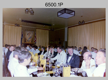
Photograph - 4th Field Survey Squadron Formal Dinner, Keswick Barracks, Adelaide SA, 1986
This is a set of 11 photographs of a 4th Field Survey Squadron Officers, Warrant Officers and Sergeants Formal Dinner held at Keswick Barracks, Adelaide SA in 1986. On this occasion WO1 Alex ‘Darby’ Munro and WO1 Geoff Briggs were farewelled. WO1 Munro retired from the Australian Regular Army after 30 years of service. WO1 Geoff Briggs continued his service and retired in 1991. It is apparent there were visiting personnel from the Army Survey Regiment and other unidentified units. See item 6501.35P for black & white photos taken at the dinner.This is a set of 11 photographs of a 4th Field Survey Squadron Officer, Warrant Officer and Sergeant’s Formal Dinner held at Keswick Barracks, Adelaide SA in 1986. The colour photographs are on 35mm negative film and are part of the Army Survey Regiment’s Collection. The photographs were scanned at 96 dpi. .1) - Photo, colour, 1986. Facing camera L to R: unidentified, Stevo Hinic, unidentified (x3), Bob Mason - Army Svy Regt’s RSM, unidentified, John Harrison, Roger Rees, Mick Hogan. .2) - Photo, colour, 1986. Facing camera L to R: unidentified, Malcolm Hentschel, unidentified, Bob Mason - Army Svy Regt’s RSM, unidentified, John Harrison, Roger Rees, Mick Hogan. Facing away from camera L to R: unidentified (x2), George Timmins. .3) - Photo, colour, 1986. Head table facing camera L to R: Ian Rose, Jorge Gruszka (Army Svy Regt’s CO), Don Taylor - OC, Darby Munro - Tech WO, Bill Griggs - SSM, Geoff Briggs, George Ricketts, unidentified RSM Keswick Barracks. .4) - Photo, colour, 1986. Left side of table: unidentified officer. Right side of table L to R: behind candles – Phil Smalley, Bob Mills, unidentified, Bob Garritty, Ian Rose. .5) - Photo, colour, 1986. Left table facing away from camera: Russell ‘Rusty’ Williams, unidentified. Left table facing camera L to R: unidentified, Peter Imeson, Dave Stephenson, Alan Brown, Bob Rogister, Wally Chilcott, unidentified, Barry Lutwyche OAM, Neil Jones, Bob Dickkenberg. .6) - Photo, colour, 1986. Head table facing camera L to R: Jorge Gruszka - CO Army Svy Regt , Don Taylor - OC, Darby Munro - Tech WO, Bill Griggs - SSM, Geoff Briggs, George Ricketts, unidentified RSM Keswick Barracks. Wearing suit in foreground - Bob Dickkenberg. .7) - Photo, colour, 1986. Left table facing away from camera: unidentified (x3), Gary Warnest, Ross Jenkins, Bruce ‘Stretch’ Gordon, unidentified (x2). Left table facing camera L to R: Bill Tewson, Peter Imeson, Dave Stephenson, Alan Brown, Bob Rogister, Wally Chilcott. .8) - Photo, colour, 1986. Left table facing camera L to R: Alan Brown, Bob Rogister, Wally Chilcott, unidentified, Barry Lutwyche OAM, Neil Jones, Bob Dickkenberg. .9) - Photo, colour, 1986. Facing away from camera: Dave Stephenson, unidentified (x2). Facing camera L to R: unidentified, Tony Gee, Brett ‘Dutchy’ Van Leeuwen, Bruce ‘Stretch’ Gordon, Ross Jenkins, Gary Warnest, unidentified (x2), Ray Sargeant, Stu Symonds. .10) - Photo, colour, 1986. Facing away from camera: Mick Hogan, Roger Rees, unidentified. Facing camera L to R: unidentified stewards (x2), unidentified (x2), Allan Adsett, Terry Lord, unidentified, Simon Reynolds – steward, George Timmins. .11) - Photo, colour, 1986. Head table L to R: Geoff Briggs, George Ricketts, unidentified RSM Keswick Barracks. Facing away from camera: unidentified, Neil Jones, remainder unidentified. Facing camera L to R: Steve Cooper, Darcy Patrick, Russell ‘Rusty’ Williams, John Scharber, Tony Gee, Brett ‘Dutchy’ Van Leeuwen..1P to .11P – There are no personnel identified. ‘1986 Formal Dinner’ annotated on negatives sleeve.royal australian survey corps, rasvy, 4 fd svy sqn -
 Bendigo Military Museum
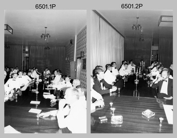
Photograph - 4th Field Survey Squadron Formal Dinner, Keswick Barracks, Adelaide SA, 1986
This is a set of 35 photographs of a 4th Field Survey Squadron Officers, Warrant Officers and Sergeants Formal Dinner held at Keswick Barracks, Adelaide SA in 1986. On this occasion WO1 Alex ‘Darby’ Munro and WO1 Geoff Briggs were farewelled. WO1 Munro retired from the Australian Regular Army after 30 years of service. WO1 Geoff Briggs continued his service and retired in 1991. It is apparent there were visiting personnel from the Army Survey Regiment and other unidentified units. See item 6500.11P for colour photos taken at the dinner.This is a set of 35 photographs of a 4th Field Survey Squadron Officer, Warrant Officer and Sergeant’s Formal Dinner held at Keswick Barracks, Adelaide SA in 1986. The black & white photographs are on 35mm negative film and are part of the Army Survey Regiment’s Collection. The photographs were scanned at 96 dpi. .1) - Photo, black & white, 1986. Closest to camera on left: Stevo Hinic, unidentified, Malcolm Hentschel, remainder unidentified. On right L to R: Bob Norwood, Phil Smalley, Bob Mills, unidentified, Bob Garritty, Ian Rose. .2) - Photo, black & white, 1986. On left L to R: unidentified (x2), Tony Gee, Brett ‘Dutchy’ Van Leeuwen, Gary Warnest, remainder unidentified. On right L to R: Barry Lutwyche OAM, Neil Jones, Bob Dikkenberg. .3) - Photo, black & white, 1986. Stewards relax at the bar after dinner. Simon Reynolds 2nd from right, remainder unidentified. .4) - Photo, black & white, 1986. At rear L to R: unidentified, Ian Rose. Left foreground L to R: Neil Jones, Bob Dikkenberg. Head table L to R: Jorge Gruszka - CO Army Svy Regt, Don Taylor - OC (standing), Darby Munro - Tech WO, Bill Griggs - SSM, Geoff Briggs, George Ricketts, unidentified RSM Keswick Barracks, On right L to R: unidentified, (x2), Steve Cooper. .5) - Photo, black & white, 1986. Closest to camera L to R: Bob Rogister, Wally Chilcott, unidentified, Barry Lutwyche OAM, Neil Jones. .6) - Photo, black & white, 1986. Facing camera L to R: Bill Tewson, Peter Imeson, Dave Stephenson, unidentified, Alan Brown. .7) - Photo, black & white, 1986. Facing camera L to R: unidentified (x2), John Harrison, Roger Rees, Mick Hogan. Back table L to R: Tony Gee, Bruce ‘Stretch’ Gordon, Ross Jenkins, Gary Warnest, unidentified, Ray Sargeant, Bill Tewson, Stu Symonds, unidentified. .8) - Photo, black & white, 1986. Head table L to R: Don Taylor - OC (standing), Darby Munro - Tech WO Bill Griggs – SSM, Geoff Briggs. .9) & .10) - Photo, black & white, 1986. Head table L to R: Bill Griggs – SSM, Geoff Briggs. .11) - Photo, black & white, 1986. Facing camera L to R: Malcolm Hentschel, unidentified, Bob Mason - Army Svy Regt’s RSM, unidentified (x2), John Harrison. .12) - Photo, black & white, 1986. Facing camera L to R: unidentified, Stevo Hinic, unidentified, Malcolm Hentschel. .13) - Photo, black & white, 1986. Geoff Briggs delivering his speech. .14) - Photo, black & white, 1986. Head table L to R: Jorge Gruszka - CO Army Svy Regt, Don Taylor - OC (standing), Darby Munro - Tech WO, Geoff Briggs delivering his speech, George Ricketts. .15) - Photo, black & white, 1986. Geoff Briggs delivering his speech. .16) - Photo, black & white, 1986. Facing camera L to R: Peter Imeson, Dave Stephenson, unidentified, Alan Brown, Bob Rogister, Wally Chilcott, unidentified, Barry Lutwyche OAM, Neil Jones, Bob Dikkenberg. .17) - Photo, black & white, 1986. A standing ovation at the conclusion of Geoff Briggs’ lengthy speech. Bill Griggs checks his watch. .18) - Photo, black & white, 1986. Guests standing for formal toasts. Closest to camera on left: unidentified, Stevo Hinic. At back Mr Vice – Mick Hogan. On right L to R: Allan Adsett, Terry Lord, Bob Norwood, Phil ‘Fred’ Smalley, Don Maskew, unidentified, Bob Garritty. .19) - Photo, black & white, 1986. Head table L to R: Jorge Gruszka - CO Army Svy Regt, Don Taylor - OC (standing), Darby Munro - Tech WO, WO Bill Griggs – SSM, Geoff Briggs, George Ricketts. .20) - Photo, black & white, 1986. Facing camera L to R: Brett ‘Dutchy’ Van Leeuwen, Bruce ‘Stretch’ Gordon, Ross Jenkins, Gary Warnest, unidentified (x2), Ray Sargeant, Stu Symonds, unidentified. .21) - Photo, black & white, 1986. Head table departs. On left: Stu Symonds. On right L to R: WO Bill Griggs – SSM, unidentified, Darby Munro - Tech WO, Geoff Briggs, unidentified RSM Keswick Barracks, George Ricketts. .22) - Photo, black & white, 1986. Mick Hogan - Mr Vice, takes charge. .23) - Photo, black & white, 1986. L to R: Mick Hogan - Mr Vice, Brett ‘Dutchy’ Van Leeuwen. .24) - Photo, black & white, 1986. L to R: Wally Chilcott, Mick Hogan - Mr Vice. .25) - Photo, black & white, 1986. L to R: Tony Gee, Bruce ‘Stretch’ Gordon, Ross Jenkins. .26) & .27)- Photo, black & white, 1986. L to R: unidentified RSM Keswick, Ian Rose, George Ricketts, Geoff Briggs, Bill Griggs – SSM, Darby Munro - Tech WO, Steve Cooper, Jorge Gruszka - CO Army Svy Regt, Don Taylor – OC. .28) - Photo, black & white, 1986. Facing camera L to R: Stevo Hinic, unidentified, Malcolm Hentschel. .29) - Photo, black & white, 1986. Facing camera L to R: Bill Tewson, Peter Imeson, Dave Stephenson. .30) - Photo, black & white, 1986. L to R: Darby Munro, Stu Symonds. .31) - Photo, black & white, 1986. Foreground L to R: unidentified (x2), John Harrison, Roger Rees. Background L to R: unidentified, Dave Stephenson, Stu Symonds, Peter Imeson, Bill Tewson. .32) - Photo, black & white, 1986. L to R: Wally Chilcott Mick Hogan - Mr Vice, unidentified, Brett ‘Dutchy’ Van Leeuwen, Darby Munro - Tech WO delivers a toast, unidentified, Bob Dikkenberg, unidentified, Neil Jones. .33) - Photo, black & white, 1986. L to R: John Harrison, Darby Munro - Tech WO, remainder unidentified. .34) - Photo, black & white, 1986. Guests relax at the bar after dinner. .35) - Photo, black & white, 1986. Guests relax at the bar after dinner. L to R: Steve Cooper, unidentified, Stevo Hinic, Allan Adsett, John Harrison, George Ricketts, unidentified, Darby Munro - Tech WO, unidentified (x3), Geoff Briggs, unidentified, Don Taylor – OC, Bill Griggs – SSM..1P to .35P – There are no personnel identified. ‘Farewells to:- WO1 BRIGGS & WO1 MUNRO 1986’ royal australian survey corps, rasvy, 4 fd svy sqn -
 Bendigo Military Museum
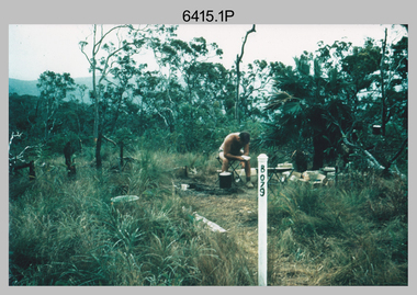
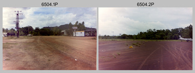
Photograph - 4th Field Survey Squadron – Operation NERVOSE 85 Reconnaissance, Northern Territory, 1985
This is a set of 13 photographs taken in 1985* during reconnaissance of locations in regions of the Northern Territory. Later that year, Operation NERVOSE 85 was mounted by 4 Fd Svy Sqn in the EAST ARNHEM, VICTORIA RIVER DOWNS AND DALY WATERS areas of the Northern Territory from 26 May to 18 Sep 85. The aim of Operation NERVOSE 85 was to finalise the horizontal and vertical control for mapping at a scale of 1:50,000, to field check 40x 1:50,000 preliminary maps and to obtain mapping photography in support of the RAAF TINDAL redevelopment project. *Note –These photos were most likely taken in 1985, contrary to the ‘1987’ date annotated on the negative sleeves. The Op NERVOSE 85 Project Report available on RASVY’s web site lists a nominal roll of personnel. Photos of 4 Fd Svy Sqn taken in 1985 and 1987 provide names of posted personnel. Several personnel identified in these photos were posted to 4 Fd Svy Sqn in 1985, not in 1987.This is a set of 13 photographs taken during 4th Field Survey Squadron’s reconnaissance of Operation NERVOSE 85 locations in the Northern Territory in 1985. The colour photographs are on 35mm negative film and are part of the Army Survey Regiment’s Collection. The photographs were scanned at 96 dpi. .1) to .4) - Photo, colour, 1985. Unknown location in the Northern Territory. .5) - Photo, colour, 1985. Unidentified personnel in the back of a police vehicle. .6P to .12) - Photo, colour, 1985. Unknown location in the Northern Territory. .13) - Photo, colour, 1985. L to R: Possibly MAJ A. Vickers RE - UK Exchange Officer from Army Svy Regt, unidentified officer. .1P to .13P – There are no personnel identified. ‘1987 OP NERVOSE – RECON PHOTOG.’ annotated on negative sleeve.royal australian survey corps, rasvy, 4 fd svy sqn, op nervose 85 -
 Bendigo Military Museum
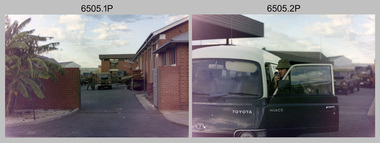
Photograph - 4th Field Survey Squadron – Operation NERVOSE Driver Training and Pre-Pack, Keswick Barracks, Adelaide SA, 1985
This is a set of 28 photographs taken in 1985* during 4th Field Survey Squadron’s driver training preparation and packing at Keswick Barracks, Adelaide SA, in preparation for Operation NERVOSE. Operation NERVOSE 85 was mounted by 4 Fd Svy Sqn in the EAST ARNHEM, VICTORIA RIVER DOWNS AND DALY WATERS areas of the Northern Territory from 26 May to 18 Sep 85. The aim of Operation NERVOSE 85 was to finalise the horizontal and vertical control for mapping at a scale of 1:50,000, to field check 40x 1:50,000 preliminary maps and to obtain mapping photography in support of the RAAF TINDAL redevelopment project. *Note –These photos were most likely taken in 1985, contrary to the ‘1987’ date annotated on the negative sleeves. The Op NERVOSE 85 Project Report available on RASVY’s web site lists a nominal roll of personnel. Photos of 4 Fd Svy Sqn taken in 1985 and 1987 provide names of posted personnel. Several personnel identified in these photos were posted to 4 Fd Svy Sqn in 1985, not in 1987. See items 6504.13P, 6506.16P and 6507.21P for more photos taken prior to and during Operation NERVOSE 85. This is a set of 28 photographs taken in 1985 during 4th Field Survey Squadron’s driver training preparation and packing at Keswick Barracks, Adelaide SA, in preparation for Operation NERVOSE. The colour photographs are on 35mm negative film and are part of the Army Survey Regiment’s Collection. The photographs were scanned at 96 dpi. .1) to .9) - Photo, colour, 1985. Driver training. Unidentified personnel. .10) - Photo, colour, 1985. Driver training. Bent trailer hitch shaft. .11) - Photo, colour, 1985. Theodolite set-up. L to R: CPL Kevin Whitty, CPL Alan ‘Hawkeye’ Hawkins. .12) to .14) - Photo, colour, 1985. Theodolite practice. L to R: CPL Alan ‘Hawkeye’ Hawkins, CPL Kevin Whitty. .15) - Photo, colour, 1985. Pre-packing and preparation. .16) - Photo, colour, 1985. Pre-packing and preparation. L to R: SGT Roger Rees, CPL P. Kennedy, unidentified. .17) - Photo, colour, 1985. Pre-packing and preparation. L to R: unidentified (x6), CPL Pat Drury. .18) - Photo, colour, 1985. Pre-packing and preparation. CPL Bill Choy. .19) - Photo, colour, 1985. Pre-packing and preparation. Unidentified personnel. .20) - Photo, colour, 1985. Pre-packing and preparation. L to R: LCPL Chris ‘Charlie’ Brown, WO2 Stevo Hinic, CPL Andy Lucas, SSGT George Timmins, unidentified (x3). .21) - Photo, colour, 1985. Pre-packing and preparation. L to R: MAJ Peter Bion – OC, unidentified officer, CPL Andy Lucas, SSGT George Timmins, WO2 Stevo Hinic, unidentified. .22) - Photo, colour, 1985. Pre-packing and preparation. L to R: MAJ Peter Bion – OC, unidentified officer, unidentified, SSGT George Timmins, WO2 Stevo Hinic, unidentified. .23) - Photo, colour, 1985. Pre-packing and preparation. L to R: unidentified, CPL Andy Lucas, MAJ Peter Bion – OC, unidentified officer, SSGT George Timmins, WO2 Stevo Hinic. .24) - Photo, colour, 1985. Pre-packing and preparation. L to R: SSGT George Timmins, CPL Bill Choy. .23) - Photo, colour, 1985. Pre-packing and preparation. L to R: Stevo Hinic, CPL Andy Lucas. .26) - Photo, colour, 1985. Pre-packing and preparation. L to R: CPL Kevin Whitty, SPR Dave Lambdon-Young. .27) & .28) - Photo, colour, 1985. Pre-packing and preparation. L to R: CPL Andy Lucas, Stevo Hinic..1P to .28P – There are no personnel identified. ‘1987 OP NERVOSE PRE-PACK.’ annotated on negative sleeve.royal australian survey corps, rasvy, 4 fd svy sqn, op nervose 85