Showing 277 items
matching geological map
-
 Bendigo Historical Society Inc.
Map - BENDIGO GOLD FIELD LONGITUDINAL VERTICAL PROJECTIONS
... , No. 47, 1923. H.Herman, late Director of Geological Survey. Map ...Bendigo gold field map showing vertical projections of portions of three anticlinal axial planes showing stratigraphical zones and caps of known saddle reefs. This map forms part of the Geological Survey of Victoria, Structure of Bendigo Goldfield report, No. 47, 1923. H.Herman, late Director of Geological Survey.Geological Survey Victoriabendigo, gold mining, vertical projections, bendigo, goldfield, gold mining, reef lines, mining companies, geological survey -
 Bendigo Historical Society Inc.
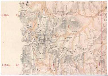
Map - DIAMOND HILL AREA
... centre on map. Shafts, mines and geological features are marked...., with the Trig Station mid centre on map. Shafts, mines and geological ...Copy of map of Diamond Hill area, with the Trig Station mid centre on map. Shafts, mines and geological features are marked.bendigo, mining, diamond hill -
 Bendigo Historical Society Inc.
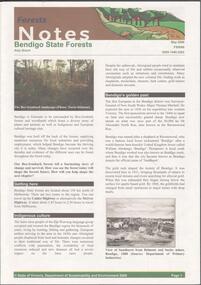
Document - BENDIGO STATE FORESTS - FORESTS NOTES
Forests Notes: Bendigo State forests newsletter published May 2006 by the State of Victoria, Department of sustainability and Environment. Getting there - indigenous culture - Bendigo's golden past - Geology and geomorphology - Discover nature treasures - Bendigo State forests - Activities to enjoy in State forests. Map of Bendigo State forests.government, state, department of sustainability -
Bendigo Historical Society Inc.
Map - HUSTLER'S & CHRISTMAS LINES OF REEFS - PLAN OF LINES OF SECTION OF REEFS
Underground Survey of Mines Bendigo. Plan of Cross Section Lines Shewing Connections with Trigonometrical Stations and Base Lines. 13/3/99 Signed ? Stirling. Places and mines mentioned Speciman Hill, Tambour Major, Lansell's 180, Victory and Pandora, Great Extended Hustler's, Windmill Hill on Victoria Reef. Next part of map is a Plan of Lines of Section between the Hustler's and Christmas Lines of Reefs. 8/3/99. Signed ?. Transverse Section. Shows Tambour Major Co., near the Christmas Line of Reef, Crosscuts and their depth, geological features and stone encountered. Then shows Thistle Line, Charshalton Line, Napoleon Line, Nell Gwynne Line, New Chum Line, Lansell's No 180 with levels, depths and geological features. Drawing is continued in three parts to fit on paper. Lansell's East Shaft with levels and depths, geological features and stone encountered. Sheepshead Line, Old Shaft, Garden Gully Line, Victory and Pabndora Co with crosscuts, depths, geological features and stone encountered. Paddy's Gully Line, Derby Line, Millers Line, Hustler's Line, Great Extended Hustler's Co with levels, depths, geological features and stone encountered. A note beside a Saddle Reef: 360,000 pounds paid in dividends from this reef. Average ounces per ton gold noted where found. Reference Table for stone and geological features. Datum Line 700 feet above Sea Level Unscannedmining, parish map, hustler's & christmas lines of reefs, plan of lines of section of reefs, ? stirling, specimen hill, tambour major, lansell's 180, victory & pandora, great extended hustler's, windmill hill, victoria reef, tambour major co, christmas line, hustler's line, thistle line, carshalton line, napoleon line, nell gwynne line, new chum line, lansell's no 180, lansell's east shaft, sheepshead line, old shaft, garden gully line, paddy's gully line, derby line, miller's line, hustler's line, great extended hustler's co -
 Bendigo Historical Society Inc.
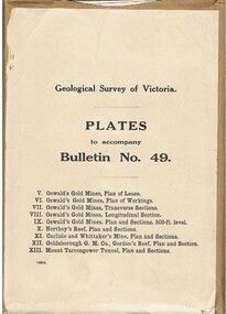
Book - MCCOLL, RANKIN AND STANISTREET COLLECTION: PLATES TO ACCOMPANY BULLETIN NO.49 MALDON GEOLOGICAL SURVEY OF VICTORIA
Book; Brown paper containers with plates (& maps) to accompany bulletin No49 of geological survey of Victoria. V Oswalds G.M. Plan of lease. VI. Oswalds G. M. Plan of workings. VII. Oswalds G. M. Transverse Sect. VIII. Oswalds G. M. Longit. Section. IX. Oswalds G. M. Plan & Sect. 500ft. Level. X. Northey's Reef plan & sections. XI. Carlisle and Whittaker's Mine Plan & Sections.XII. Goldsborough G. M. Co. Gordon's Reef, Plan & Section. XIII. Mount Tarrengower Tunnel Plan & Section.MCCOLL RANKIN & STANISTREETorganisation, industry, surveys, mccoll rankin & stanistreet -
 Bendigo Historical Society Inc.
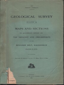
Document - MCCOLL, RANKIN AND STANISTREET COLLECTION: MAPS AND SECTIONS KALGOORLIE, 1929
Document: MCCOLL, RANKIN AND STANISTREET: green cover book Bulletin 94, Maps and Sections to accompany report on the geology and ore deposits of the Boulder Belt, Kalgoorlie. Plages IV - XV11.Government printer, Perthorganization, business, kalgoorlie, mccoll, rankin and stanistreet, kalgoorlie, maps and sections -
 Bendigo Historical Society Inc.
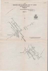
Map - STRUGNELL COLLECTION: HUSTLER'S LINE OF REEFS, September 1913
Map, Hustler's Line of Reefs, Hustler's Reef & Hustler's Reef No.1 Mines, Plan view . Plate No. XV (15).Sheet 1 Bulletin No. 33. Included is the emblem of the Geological Survey of Victoria. Signed by H.A.Whitelaw Underground Survey Office, Bendigo, Septembe ,1913.Underground Survey Office, Bendigo.map, bendigo, hustler's reef & hustler's reef 1 -
 Bendigo Historical Society Inc.
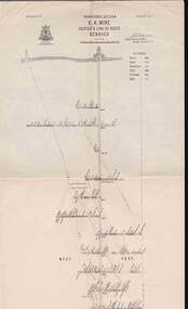
Map - STRUGNELL COLLECTION: HUSTLER'S LINE OF REEFS, September 1913
Map, Hustler's Line of Reefs, Hustler's Reef & Hustler's Reef No.1 Mines Plan.Plate No. XV1.(16) Sheet 2 .Bulletin No 33 Signed H.A.Whitelaw.Underground Survey Office, Bendigo, September,1913. Included is the emblem of the Geological Survey of Victoria. Drawing shows a plan view of reefs and shaft locations .Underground Survey Office, Bendigomap, bendigo, hustler's reef & hustler's reef 1 -
 Bendigo Historical Society Inc.
Map - STRUGNELL COLLECTION: HUSTLER'S LINE OF REEFS K.K.MINE, September 1913
Map, Hustler's Line of Reefs, K.K.Mine,Transverse section.Plate No.XXX11(32).Geological Survey of Victoria.Bulletin 33.Signed H.A.Whitelaw. Drawing shows the vertical shaft descending to over 1932 feet and appears to show samples of connecting horizontal shafts with their respective mineral contents and dotted lines appear to show connecting reefs .Underground Survey Office, Bendigo,map, bendigo, k.k.mine -
 Bendigo Historical Society Inc.
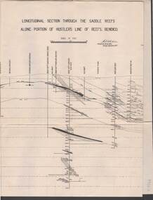
Map - STRUGNELL COLLECTION: HUSTLER'S LINE OF REEF, September 1913
Map, Longitudinal section through the Saddle Reefs along portion of Hustler's Line of Reefs, Bendigo. Plate No. XXX1V(34). Underground Survey Office,Bendigo, September 1913. Geological Society of Victoria.//Signed H.A.Whitelaw. Drawing shows the vertical shaft descending to over 3454 ftUnderground Survey Office, Bendigomap, bendigo, hustler's line of reefs -
 Bendigo Historical Society Inc.
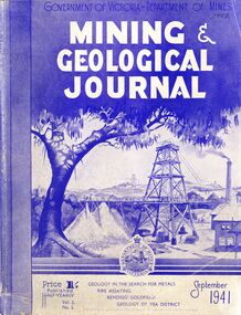
Book - MINING & GEOLOGICAL JOURNAL, September, 1941
Mining & Geological Journal September 1941, Geology in the search for metals, fire assaying, Bendigo goldfields, Geology of Yea district published half yearly by the Department of Mines Victoria contains photographs, maps and illustrations.gold, mining, journal -
 Bendigo Historical Society Inc.
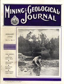
Book - MINING & GEOLOGICAL JOURNAL, 1940
Mining & Geological Journal January 1940 Vol.2 No.2 Mine reports Chewton Gold Field, Geological Glossary, Flotation Process, Wonthaggi Coal Field published hald yearly by he Department of Mines Victoria contains photographs, maps and illustrations.gold, mining, journal -
Bendigo Historical Society Inc.
Booklet - Bendigo Goldfield, Geological Survey Report No 93
Soft cover booklet of 50 pages. Geological Survey Report No 93. Bendigo Goldfield. Spring Gully, Golden Square, Eaglehawk By C.E. Willman and H.E.Wilkinson. Colour photo of the North Deborah mine poppet-head on a pale-yellow front cover. Illustrated with B&W photos, maps and sketches. Published 1992 by the Department of Manufacturing and Industry Development , Victoria Errata page pasted inside front cover. M & J Qualtrough sticker on title page. bendigo goldfield, geological survey -
 Monbulk RSL Sub Branch
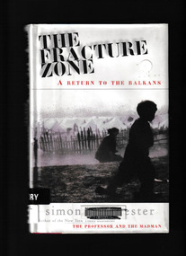
Book, Harper Collins, The fracture zone : a return to the Balkans, 1999
Winchester travels in a scimitar-shaped journey through Croatia, Bosnia, Montenegreo, Macedonia, Bulgaria and Greece to Turkey. He names his route the Fracture Zone, because this locale marks not only the meeting of two vast continental tectonic plates, perpetrators of geological chaos, but also the uneasy boundary between two great historical empires, the Hapsburg and the Ottoman." "The Fracture Zone weaves together history, travel and political perspective with the personal testaments of ordinary and extraordinary people. In this record of history, hatred and ruin, Simon Winchester details the conditions under which the area's refuges now live against a background of ancient political and spiritual struggleGlossary, maps, p.236.non-fictionWinchester travels in a scimitar-shaped journey through Croatia, Bosnia, Montenegreo, Macedonia, Bulgaria and Greece to Turkey. He names his route the Fracture Zone, because this locale marks not only the meeting of two vast continental tectonic plates, perpetrators of geological chaos, but also the uneasy boundary between two great historical empires, the Hapsburg and the Ottoman." "The Fracture Zone weaves together history, travel and political perspective with the personal testaments of ordinary and extraordinary people. In this record of history, hatred and ruin, Simon Winchester details the conditions under which the area's refuges now live against a background of ancient political and spiritual strugglebalkan peninsula - history, balkan peninsula - travel -
 Bendigo Historical Society Inc.
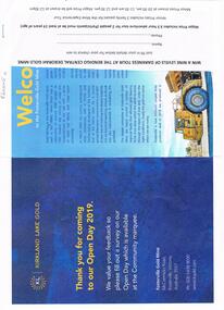
Document - FOSTERVILLE GOLD MINE COLLECTION: OPEN DAY 2019
Two page document for Kirkland Lake Gold Open day 2019. Open Day activities include: bus tours, technical services display, geology, exploration, processing, community and environment display, minerals council of Australia, Swick drilling, Central Deborah Gold Mine, Face painting, Goldfields Re-vegetation, Delecca's hire equipment, MacMahon underground mining services, Sandvik, and ISH24 safety specialists. Map of 'Fosterville Gold Mine Site Map' with activities highlighted. Fosterville is Victoria's larges gold producer and in 2918 a records 356,230 ounces at an average grade of 24.9 g per tonne. The mine has over 600 full time employees in 2019. Entry for '9 levels of darkness' tour at Central Deborah Mine attached.bendigo, mining, fosterville gold mine -
 Bendigo Historical Society Inc.
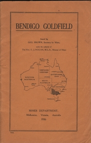
Book - BENDIGO GOLDFIELD
booklet, 51 pages. 'Bendigo Goldfield' issued by Geo Brown, Secretary for Mines. Mines Department 1936. Contains information on the geology of the Bendigo goldfield and major lines of reef and mines. Map of goldfield showing reef lines and mines attached to back cover.bendigo, mining, bendigo goldfield -
Bendigo Historical Society Inc.
Map - RAYWOOD GOLD FIELD MAP, 1902
Map. Raywood Gold Field Map. Linen backed map of Raywood and Neilborough Township and surrounds showing the location of varying underground workings. Surveyed by H S Whitelaw 1/6/02. It shows underground workings from The Perseverance Party and moreshed and Party and underground workings on the Old Pioneer Reef. Mentions the Parish of Yallook, Parish of Neilborough, Yarraberb, Mushroom Flat, Murray Valley Plain, Eaglehawk and Kerang Railway, Green Hill, Doughboy, Redmond's Gully, Pickpocket Lead, Raywood Lead, Inglewood Lead, Shaw's Road, Nuggety Shaft, Barkly Shaft, Maori Bendmap, gold field map, raywood gold field map, neilborough, h s whitelaw, geological survey of victoria bulletin no 12 plate 11 -
Clunes Museum
Map, Surface Geology Plan
... MARKED - LAMINATED Surface Geology Plan Map MAP ...Plans show various shaft locations.1 Photocopy of Plan Block 23/19 Scale 1 inch = 100 feet .2 Photocopy of Plan Block 19/19 Scale 1 inch = 100 feet .3 AERIAL PHOTOGRAPH WITH WORKINGS MARKED - LAMINATED.1 C-21 North Broken Hill Ltd Clunes Block 23/19 .2SOUTH CLUNES MINE Ltd Clunes Block 19/19north broken hill ltd, surface geology plan -
Tatura Irrigation & Wartime Camps Museum
Document, Geological Plan, Eildon Dam Site, 1945
To record details of geological aspects of EildonA series of maps illustrating rock formations etc., locations, boundaries and planswater/irrigation, documents, maps -
 Victorian Aboriginal Corporation for Languages
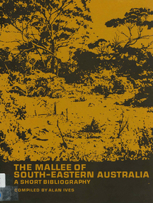
Book, The Mallee of south-eastern Australia : a short bibliography, 1973
mapsmallee region, south-eastern australia, geography, geology, climatology, water, agriculture, soils, botany, zoology, national parks, historical geography, australian literature, anthropology, sociology -
Clunes Museum
Map - SURVEYERS MAP OF CLUNES, J. FINNIE, 1883
... A SURVEYORS MAP OF CLUNES. GEOLOGICALLY AND TOPOGRAPHICALLY... MAP OF CLUNES. GEOLOGICALLY AND TOPOGRAPHICALLY SURVEYED ...A SURVEYORS MAP OF CLUNES. GEOLOGICALLY AND TOPOGRAPHICALLY SURVEYED BY R.A.F. MURRAY.LITHOGRAPHED BY R. SHEPHERD AND PRINTED BY J. FINNIE MINING DEPARTMENT, MELBOURNE,1883document, surveyers map of clunes, map of clunes -
Stawell Historical Society Inc
Book - Science, The Natural History of Western Victoria, 1974
... , when travlling with Major Mitchell. Contains fold out Maps..., when travlling with Major Mitchell. Contains fold out Maps ...Reports from Symposium of Australian Insitutes of Agricultural Science, held in Horsham 1971. 8 chapters, 7 of science 8th extracts from Stapylton's Journal of Western Victoria, when travlling with Major Mitchell. Contains fold out Maps & photos. 1) Geology & Geomorphology 2) Soils 3) Vegitation 4) Birds 6) Aborigines 7) the first hundred years of agricultural development 8) The Journal of Granville William Chetwynd StapyltonSoft Yellow Cover and Black with Black taped spineBarry Clugston -
Stawell Historical Society Inc
Map, Department of Mines Victoria, Alluvial Map Stawell Region, 1870's
... . Shows geological layout. Alluvial Map Stawell Region Map ...c1870 Coloured map showing Black Range North to Stawell and Illawarra. Shows geological layout.Department Mines Victoria 1952/G/2 mining, gold, map -
Stawell Historical Society Inc
Map, Stawell Gold Mine, Provisional Plan Wonga Area, c1980
c1980 Preliminary Provisional Reconnaissance Plan Showing Workings Above and Below water LevelWonga Area 1:1000 Base Geological Sheet mining, gold, map -
Stawell Historical Society Inc
Map, Western Mining Stawell, Germania Summary Plan & Geology Western Mining Corporation, September 1988
... grampians mining gold map Germania Summary Plan & Geology 2003-566 1 ...Germania Summary Plan & Geopogy Western Mining Corporation Stawell VicGermania Summary Plan & Geology 2003-566 1:1000 mining, gold, map -
Stawell Historical Society Inc
Map, Gold Mines of Australia, Geological Plan Wonga Mine Area Stawell Investigation, 1950
Plans Showing Stawell Investment 1950Gold Mines of Australia Ltd mining, gold, map -
Stawell Historical Society Inc
Map, Gold Mines of Australia, Stawell Investment Geological Plan. Mine Area showing Mineshafts
The Reefs Mine shaft locationsGold Mines of Australia Ltd mining, gold, map -
Koorie Heritage Trust
Book, Baragwanath, W, Memoirs of the Geological Survey of Victoria : No. 15 The Aberfeldy District, Gippsland, 1925
15 v. : ill., plates, maps, plans, diagrs. ; 34 cm. lcsh: 1. geology -- victoria -- periodicals. 2. geology -- victoria. i. geological survey of victoria. ii. victoria. dept. of mines. -
Southern Sherbrooke Historical Society Inc.
Information Folder - geology of Dandenong Ranges
Information folder containing items pertaining to the geology of the Dandenong Ranges, including material prepared by Betty Hotchin for a talk to the Kallista Tourism course. Contents:-/typescript, re. basic features/photocopy, "The Dandenongs volcano and settlement in its great forest" by John Lundy-Clarke, published by Lilydale and District Historical Society/2 maps, Dandenong Ranges/List of reference materialdandenong ranges, geology of dandenong ranges -
 Otway Districts Historical Society
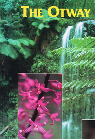
Book, Yaugher Print, The Otway Ranges, 1998
Flora and fauna found through the Otway Ranges interspersed with historical references from aboriginal occupation to the present day.The Otway Ranges.Trevor Pescott. 1st ed. Belmont (Vic); Yaugher Print; 1998. 112 p.; illus, map, bibliography. Soft cover. ISBN 0 9586562 1 5otway ranges; natural history; description; travel; geology; timber;