Physical description
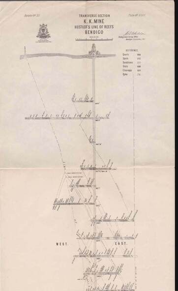
Map, Hustler's Line of Reefs, K.K.Mine,Transverse section.Plate No.XXX11(32).Geological Survey of Victoria.Bulletin 33.Signed H.A.Whitelaw. Drawing shows the vertical shaft descending to over 1932 feet and appears to show samples of connecting horizontal shafts with their respective mineral contents and dotted lines appear to show connecting reefs .
Inscriptions & markings
Underground Survey Office, Bendigo,