Showing 806 items matching "lake view"
-
 Ringwood and District Historical Society
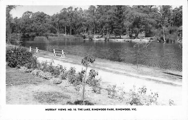
Photograph/Postcard, Postcard - Murray Views No.16. The Lake, Ringwood Park, Ringwood, Vic
... . Circa 1948. Postcard - Murray Views No.16. The Lake, Ringwood ...Black and white "Murray Views" postcard - View from eastern bank of Ringwood Park Lake, railway line hidden by trees in background. Circa 1948."1948" handwritten on back. -
 Ringwood and District Historical Society
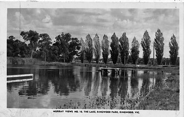
Photograph/Postcard, Postcard and souvenir photograph - Murray Views No.16. The Lake, Ringwood Park, Ringwood, Vic
... Views No.16. The Lake, Ringwood Park, Ringwood, Vic. Photograph ...Black and white "Murray Views" postcard and souvenir photograph - northward view across fly casting competition jetty on Ringwood Park Lake towards Maroondah Highway. Circa 1948. -
 Kiewa Valley Historical Society
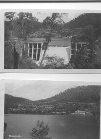
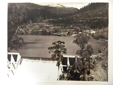
Two black and white photos, Photo downstream view of Junction Dam Wall and photo of Bogong Village and Lake Guy, c1950
Photo No. 1 - Junction Dam wall was commenced in February, 1940 and completed in March 1944. Type - reinforced concrete slab and buttress. Height 25.9m, and crest length 121.9m. Lewis Construction company had the original contract, but was replaced by the State Electricity Commission in 1942. Photo No. 2 - Bogong Village was the first village built to house workers and their families working on the Hydro electric scheme. Construction commenced 1940. The single men's quarters are slightly right of centre on the foreshore. Lake Guy was named after a former resident engineer.Shows the type of terrain where the village is located resulting in the tiered layout that was necessary in order to erect housing.set of 2 black and white photos - Photo No. 1 - downstream view of Junction Dam Wall Photo No. 2 - Lake Guy and Bogong Village. Both are on photographic paperPhoto No. 1 - Upper right hand corner, back of photo, handwritten in ink or biro, Bogong 1950 Photo No. 2 - Left lower corner, front of photo in white, Bogong.bogong village, lake guy, secv -
 Kiewa Valley Historical Society
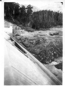
12 small black and white photgraphs of Junction Dam and surrounding area, Photo No. 1 c1940, all others c 1948
Junction Dam is a reinforced slab and buttress type construction and was commenced in February, 1940 by Lewis Construction Company. Stiff leg derricks were erected at appropriate locations at the site of the dam and used for the disposal of excavated material and the placing of concrete. A rock crushing and screening plant was established at a site a short distance upstream from the dam site and concrete was supplied from a central mixing plant placed close to the upstream toe of the structure. The SEC took over the construction in April 1942 and the dam wall was completed in March, 1944. Bogong township was commenced in early 1940 with the construction of a workmen's camp housing 96 men, (known as Junction camp). Construction of housing for families commenced shortly after. Forty houses, plus office, workshops, stores and laboratory accommodation were completed over the next 5 years,Of historical significance as a pictorial record of Junction Dam, Lake Guy and Bogong Village, as the photos were taken only 4 years after completion and one photo taken on completion of the dam wall but before the lake was filled with water.12 small black and white photographs of Junction Dam, Bogong Village and surrounding area.Photo 1 - On the back upper edge in pen 'Junction Dam'. Then '12' in pencil, circular stamp, printed in centre 'Print by Willson White Albury'. Photo 2 - On the back upper edge in pen 'Junction Dam October 1948'. Stamp as no. 1 photo. Stamp '998L' lower centre. Photo 3 - on the back upper edge in pen 'Junction Dam October 1948'. Circular stamp with 'Kodak Print' . Lower centre back is stamped 'velox' and '998L'. Photo 4 - upper back, in ink - 'Junction Dam Spion Kopje in background. October 1948'. Stamps as photo no. 4. Photo 5 - upper back, in ink - 'Lake Guy (orange filter) October 1948'. Centre back, in pencil '29' and circular stamp with words 'Print by Willson White Albury'. Photo 6 - upper back edge 'Junction, Bogong from Radio Receiving Shack Dec. 1948'. In pencil '14'. Photo 7 - On back of photo 'View of Mountains from Little Arthur Fire Track October 1948'. Two circular stamps with 'Kodak Print', another two stamps - 'Velox' and '998L'. Photo 8 - On back in ink 'Loone's Store Bogong with Spion Kopje in background. October 1948'. Lower down, stamps 'Velox' and '998L'. Part of circular stamp with one word 'Kodak'. Photo 9 - on back in ink 'Junction Camp, Bogong Village & Lake Guy from Little Arthur Fire Track. October 1948'. Stamped across writing '998L'. Lower down stamped 'Velox' and circular stamp with words 'Kodak Print'. Photo 10 - on back in ink 'Junction Camp & Bogong Village Lake Guy in Foreground. October 1948'. Stamps as photo 9. Photo 11 - on back in ink 'Junction Camp & Bogong Village, Lake Guy in Foreground. October 1948'. Lower stamp '998L'. Photo 12 - 'Junction of Rocky & Pretty Rivers with tennis courts in foreground October 1948' . Circular stamp with words, 'Print by Willson White Albury'. Number '29' written pencil.junction dam; bogong village; kiewa hydro electric scheme; lake guy -
 Kiewa Valley Historical Society
Photo - Early photo of Bogong Township x2
Bogong Village was built for the workers of the State Elecricity Commission of Victoria who were employed to construct the Kiewa Hydro electric Scheme. This photo shows their homes and offices etc., Lake Guy and the spillway during construction days.Bogong village was built as part of the Kiewa Hydro Electric Scheme. This photo gives a view of the village when it was at its peak. Large photo of Mt Bogong Township with snow on the mountain in the background and the spillway over-flowing in the foreground. Some small trees amongst those burnt by the 1939 bushfire. (2 photos - one an enlarged copy)bogong village. kiewa hydro electric scheme. s.e.c.v.. lake guy. -
 Warrnambool and District Historical Society Inc.
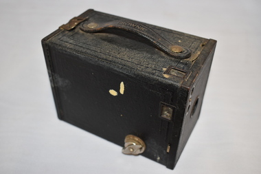
Functional object - Camera, Box Brownie Camera, c.1930
The Box Brownie camera was developed by Frank Brownell in the late 19th century. It was marketed by Eastman Kodak of U.S.A. and was a camera with a simple lens. It provided snapshots at a low cost and was the most widely-used camera by families in the first half of the 20th century. This item was the No. 2 model which was sold from 1901 to 1935. This item was given to Olive O’Donnell when she was ten years old. The donor was Miss Florence Lake of ‘Lyndoch’ in Warrnambool. She was noted for giving presents, usually at Christmas time, to the children of her employees and other children in the Warrnambool area. Olive O’Donnell’s father worked for Miss Lake for 45 years. The property of ‘Lyndoch’ near the mouth of the Hopkins River in Warrnambool was established by a Melbourne businessman, George Rolfe, late in the 19th century and Miss Lake was one of the two stepdaughters of George Rolfe who inherited the property. Miss Florence Lake built a house at Lyndoch which today forms part of the aged care facility established when the property was sold. This camera is of interest for two reasons: 1. It is an example of the Box Brownie camera which was a very popular camera owned by many Australians in the first half of the 20th century. 2. It is an example of the type of present given to children by the Warrnambool philanthropist, Florence Lake. She resided at ‘Lyndoch’ and was well-known in the Warrnambool community in the 20th century. This is a rectangular-shaped black metal box. A metal clip acts as an opening and closing device for inserting a film. A yellow and black film is enclosed at one end of the box. A handle is on the top of the box and is attached by metal clips. There are several viewing panels on the box and a metal mechanism for winding the film. The box is scuffed and stained. ‘Brownie’ ‘No 2 Brownie Model F Patented in U.S.A. Patents Pending.’ photography, household items, lyndoch, warrnambool, florence lake, warrnambool, olive o’donnell, warrnambool -
 Eltham District Historical Society Inc
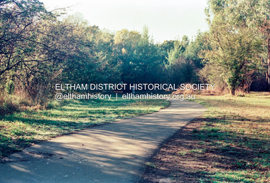
Photograph (Item) - Print, Mathew Wakefield, Untitled (Path through parklands), 1988
View looking east along present-day Wingrove Park Trail towards Dalton Street and Main Road. Mathew Wakefield 1988 Entrant No. 40 Ref: Series 34, Items 87, 88 The photographer noted that in a sad indictment of the local community, this German Shepherd dog and another had been abandoned by their owners to scavenge through the bins and chase the drunks around the lake at dawn. Both dogs were impounded and the owners never claimed them. As a consequence they were eventually both put down. SHIRE OF ELTHAM COMMUNITY PHOTOGRAPHIC SURVEY Photography is an artform which many of us practice, sometimes purely for artistic pursuit, sometimes to record the people and events in our lives. In 1988, as part of a local Bicentennial project, the Shire of Eltham conducted the Eltham Community Photographic Survey. Up to 100 entries were to be selected by a panel of photographers for entry into the Eltham Photographic Survey Exhibition. Entries had to be submitted by May 13, 1988. Entrants whose images were selected for the exhibition were contacted and requested to further submit an entry form providing entrant’s name, area of residence, age, and proposed captions. These details were then used to produce labels for the exhibition mounts. Where negatives had not been supplied, these were requested to support the display of printed enlargements mounted on 10” x 8” cardboard. The mounted prints were made available post exhibition for sale at $8.50 each for colour prints and $7.00 for B&W prints. Residents in the Shire were invited to collect a free roll of film and take a photograph of what they either liked or did not like about the area. A total of 160 entrants submitted multiple entries for the exhibition. Of those selected for exhibition, entrants ranged in age from 9 to 70 years. All custom colour and black and white printing for the exhibition was completed by Wattle Studios of Eltham. The Eltham Photographic Survey was jointly auspiced by the Shire of Eltham and Wattle Studios, of 953 Main Road, Eltham. The project was greatly assisted by: • David McRitchie, Media Studies Lecturer Victoria College, Rusden Campus. • Ian and Annette Toohill of Wattle Studios • Tracy Naughton, Eltham Community Arts Officer • Neville Emerson Pty. Ltd. • Superior Press, Eltham • Kodak Australasia Pty. Ltd. • Agfa Gevaert Ltd. • Townsend Colourtech Pty. Ltd. • The Australian Bicentennial Authority • Eleanor Bowers, Secretary, Eltham Arts Council The exhibition was placed on display in the Woolworths Arcade, Eltham between Monday June 6th and Saturday June 11, 1988. It was also intended to hold the exhibition at a venue in the Shire’s North Riding from Monday, June 20 to Friday June 24. It was then displayed at the Were Street Theatre, Montmorency from Friday, June 24 to Thursday, July 7. Series 34: Eltham Community Photographic Survey 1988 - Prints & Documentation Series consists of 117 photographs of Shire scenes taken by members of the community. Items I - 41 are larger photographs mounted on card, which were exhibited. Items 42 - 117 are unmounted copies, alternative takes and other entries. Corresponding negatives contained in Series 35: Eltham Community Photographic Survey 1988 – Negatives which consists of 267 colour and B&W negatives and one colour slide of Shire scenes taken by members of the community. The negatives are arranged by the entrant number of the photographer. The Eltham Community Photographic Survey collection is significant to the local community as it was curated by the local community - ordinary people of all ages - representing what they liked and did not like in the area where they lived. It represents an unfiltered representation of the Shire of Eltham as it was in 1988. It also represents one of many projects as part of the national programme of events and celebrations to commemorate the bicentenary. It is a time capsule of life in the 1980s of this urban and rural municipality in Melbourne's north. Rear: Entrant No., name and address in blue ink; also 'Series 34' and the 'Item No.' in orange inkshire of eltham archives, bicentennial project, eltham, eltham community photographic survey, series 34, series 35, dalton street, film - fuji 100, main road, mathew wakefield, scan - 35mm negative, wiingrove park trail -
 Eltham District Historical Society Inc
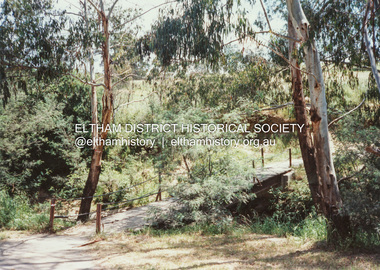
Photograph (Item) - Print, Sylvia Wiseman, Eltham Park, 1988
View looking towards footbridge across the Diamond Creek along the Diamond Creek Trail, north of Bridge Street. Eltham Town Park was partially constructed on a tip site. The park and lake were landscaped in 1973-1974. As early as late 1980 a proposal to rename it Alistair Knox Park was met with significant community resistance with a petition of 1600 signatures against however Council ultimately pushed the name through in 1987. Many residents continued to call it Eltham Town Park for some years later. Sylvia Wiseman 1988 Entrant No. 70 No negative The photographer noted that in a sad indictment of the local community, this German Shepherd dog and another had been abandoned by their owners to scavenge through the bins and chase the drunks around the lake at dawn. Both dogs were impounded and the owners never claimed them. As a consequence they were eventually both put down. SHIRE OF ELTHAM COMMUNITY PHOTOGRAPHIC SURVEY Photography is an artform which many of us practice, sometimes purely for artistic pursuit, sometimes to record the people and events in our lives. In 1988, as part of a local Bicentennial project, the Shire of Eltham conducted the Eltham Community Photographic Survey. Up to 100 entries were to be selected by a panel of photographers for entry into the Eltham Photographic Survey Exhibition. Entries had to be submitted by May 13, 1988. Entrants whose images were selected for the exhibition were contacted and requested to further submit an entry form providing entrant’s name, area of residence, age, and proposed captions. These details were then used to produce labels for the exhibition mounts. Where negatives had not been supplied, these were requested to support the display of printed enlargements mounted on 10” x 8” cardboard. The mounted prints were made available post exhibition for sale at $8.50 each for colour prints and $7.00 for B&W prints. Residents in the Shire were invited to collect a free roll of film and take a photograph of what they either liked or did not like about the area. A total of 160 entrants submitted multiple entries for the exhibition. Of those selected for exhibition, entrants ranged in age from 9 to 70 years. All custom colour and black and white printing for the exhibition was completed by Wattle Studios of Eltham. The Eltham Photographic Survey was jointly auspiced by the Shire of Eltham and Wattle Studios, of 953 Main Road, Eltham. The project was greatly assisted by: • David McRitchie, Media Studies Lecturer Victoria College, Rusden Campus. • Ian and Annette Toohill of Wattle Studios • Tracy Naughton, Eltham Community Arts Officer • Neville Emerson Pty. Ltd. • Superior Press, Eltham • Kodak Australasia Pty. Ltd. • Agfa Gevaert Ltd. • Townsend Colourtech Pty. Ltd. • The Australian Bicentennial Authority • Eleanor Bowers, Secretary, Eltham Arts Council The exhibition was placed on display in the Woolworths Arcade, Eltham between Monday June 6th and Saturday June 11, 1988. It was also intended to hold the exhibition at a venue in the Shire’s North Riding from Monday, June 20 to Friday June 24. It was then displayed at the Were Street Theatre, Montmorency from Friday, June 24 to Thursday, July 7. Series 34: Eltham Community Photographic Survey 1988 - Prints & Documentation Series consists of 117 photographs of Shire scenes taken by members of the community. Items I - 41 are larger photographs mounted on card, which were exhibited. Items 42 - 117 are unmounted copies, alternative takes and other entries. Corresponding negatives contained in Series 35: Eltham Community Photographic Survey 1988 – Negatives which consists of 267 colour and B&W negatives and one colour slide of Shire scenes taken by members of the community. The negatives are arranged by the entrant number of the photographer. The Eltham Community Photographic Survey collection is significant to the local community as it was curated by the local community - ordinary people of all ages - representing what they liked and did not like in the area where they lived. It represents an unfiltered representation of the Shire of Eltham as it was in 1988. It also represents one of many projects as part of the national programme of events and celebrations to commemorate the bicentenary. It is a time capsule of life in the 1980s of this urban and rural municipality in Melbourne's north. Rear: Entrant No., name and address in blue ink; also 'Series 34' and the 'Item No.' in orange inkshire of eltham archives, bicentennial project, eltham, eltham community photographic survey, series 34, alistair knox park, diamond creek (creek), diamond creek trail, eltham town park, footbridge, sylvia wiseman -
 Eltham District Historical Society Inc
Photograph (Item) - Print, Sylvia Wiseman, Eltham Park, 1988
View looking north along the Diamond Creek Trail, north of Bridge Street near footbridge across the Diamond Creek. Eltham Town Park was partially constructed on a tip site. The park and lake were landscaped in 1973-1974. As early as late 1980 a proposal to rename it Alistair Knox Park was met with significant community resistance with a petition of 1600 signatures against however Council ultimately pushed the name through in 1987. Many residents continued to call it Eltham Town Park for some years later. Sylvia Wiseman 1988 Entrant No. 70 No negative The photographer noted that in a sad indictment of the local community, this German Shepherd dog and another had been abandoned by their owners to scavenge through the bins and chase the drunks around the lake at dawn. Both dogs were impounded and the owners never claimed them. As a consequence they were eventually both put down. SHIRE OF ELTHAM COMMUNITY PHOTOGRAPHIC SURVEY Photography is an artform which many of us practice, sometimes purely for artistic pursuit, sometimes to record the people and events in our lives. In 1988, as part of a local Bicentennial project, the Shire of Eltham conducted the Eltham Community Photographic Survey. Up to 100 entries were to be selected by a panel of photographers for entry into the Eltham Photographic Survey Exhibition. Entries had to be submitted by May 13, 1988. Entrants whose images were selected for the exhibition were contacted and requested to further submit an entry form providing entrant’s name, area of residence, age, and proposed captions. These details were then used to produce labels for the exhibition mounts. Where negatives had not been supplied, these were requested to support the display of printed enlargements mounted on 10” x 8” cardboard. The mounted prints were made available post exhibition for sale at $8.50 each for colour prints and $7.00 for B&W prints. Residents in the Shire were invited to collect a free roll of film and take a photograph of what they either liked or did not like about the area. A total of 160 entrants submitted multiple entries for the exhibition. Of those selected for exhibition, entrants ranged in age from 9 to 70 years. All custom colour and black and white printing for the exhibition was completed by Wattle Studios of Eltham. The Eltham Photographic Survey was jointly auspiced by the Shire of Eltham and Wattle Studios, of 953 Main Road, Eltham. The project was greatly assisted by: • David McRitchie, Media Studies Lecturer Victoria College, Rusden Campus. • Ian and Annette Toohill of Wattle Studios • Tracy Naughton, Eltham Community Arts Officer • Neville Emerson Pty. Ltd. • Superior Press, Eltham • Kodak Australasia Pty. Ltd. • Agfa Gevaert Ltd. • Townsend Colourtech Pty. Ltd. • The Australian Bicentennial Authority • Eleanor Bowers, Secretary, Eltham Arts Council The exhibition was placed on display in the Woolworths Arcade, Eltham between Monday June 6th and Saturday June 11, 1988. It was also intended to hold the exhibition at a venue in the Shire’s North Riding from Monday, June 20 to Friday June 24. It was then displayed at the Were Street Theatre, Montmorency from Friday, June 24 to Thursday, July 7. Series 34: Eltham Community Photographic Survey 1988 - Prints & Documentation Series consists of 117 photographs of Shire scenes taken by members of the community. Items I - 41 are larger photographs mounted on card, which were exhibited. Items 42 - 117 are unmounted copies, alternative takes and other entries. Corresponding negatives contained in Series 35: Eltham Community Photographic Survey 1988 – Negatives which consists of 267 colour and B&W negatives and one colour slide of Shire scenes taken by members of the community. The negatives are arranged by the entrant number of the photographer. The Eltham Community Photographic Survey collection is significant to the local community as it was curated by the local community - ordinary people of all ages - representing what they liked and did not like in the area where they lived. It represents an unfiltered representation of the Shire of Eltham as it was in 1988. It also represents one of many projects as part of the national programme of events and celebrations to commemorate the bicentenary. It is a time capsule of life in the 1980s of this urban and rural municipality in Melbourne's north. Rear: Entrant No., name and address in blue ink; also 'Series 34' and the 'Item No.' in orange inkshire of eltham archives, bicentennial project, eltham, eltham community photographic survey, series 34, alistair knox park, diamond creek trail, eltham town park, sylvia wiseman -
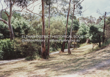
 Eltham District Historical Society Inc
Slide, Construction of Eltham Town Park, 22 Feb 1974
Construction of Eltham Town Park, later renamed Alistair Knox Park. View looking towards the intersection of Main Road and Bridge Street. The lake body has been formed and young trees planted.35 mm colour positive transparency Mount - Agfacolor Service (Blue)alistair knox park, eltham town park, bridge street, main road -
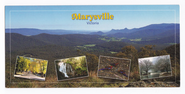 Marysville & District Historical Society
Postcard (item) - Colour postcard, Imagine That! Promotions, Marysville-Victoria, 2002
A colour photograph of the view from Keppel Lookout of Marysville and the Cathedral Range along with photographs of the main street in Marysville, Steavenson Falls, birdlife and snow in Marysville. A colour photograph of the view from Keppel Lookout of Marysville and the Cathedral Range along with photographs of the main street in Marysville, Steavenson Falls, birdlife and snow in Marysville. This postcard was produced by Imagine That! Promotions as a souvenir of Marysville.Marysville is a beautiful small country town approximately 100 km's from Melbourne. It is/ well known for its amazing autumn colours, prolific wildlife and is only half an hours drive/ from Lake Mountain, Australia's largest Cross Country Skiing Resort./ Featured is (Main Picture) Marysville with the picturesque Cathedral Range in the back-/ ground as seen from Keppel Lookout. From the left is Marysville's main street during/ Autumn, Steavenson Falls, Crimson Rosellas and Marysville covered by a low snowfall. Imagine That!/ Post Cards Imagine That! Promotions/ Country Victoria Collection/ Landscape 1/ c 2002/ Ph: (03) 5966 8523 Fax: (03) 5966 8458 Mob: 0418 593 534 Place/ Stamp/ Heremarysville, keppel lookout, cathedral range, murchison street, steavenson falls, scarlet rosella, snow, imagine that! promotions, postcard, souvenir -
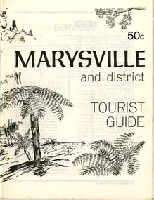 Marysville & District Historical Society
Booklet (Item) - Tourist guide, Ian and Danese Walshe et al, MARYSVILLE and district TOURIST GUIDE, 1982
A tourist guide outlining services, accommodation, activities and places of interest to visit in and around Marysville and the local district.A tourist guide outlining services, accommodation, activities and places of interest to visit in and around Marysville and the local district.marysville, victoria, australia, tourist guide, marysville hotel, castles' store, hawthorne's corner shop, tudor lodge, black spur motel and caravan park, buxton general store, golden fleece roadhouse, marysville garage, burrengeen park, lake mountain, steavenson falls, nanda binya lodge, alpenglow nursery, black spur inn hotel, silver stream trout farm, mccfarlane's grocery, barton's drapery, marysville newsagency, eildon explorer, beauty spot nursery, crossways, pumpernickel, mckenzie's tourist services, blue hills riding school, mountain view horse hire, pitt's garage, maryton park, j l gould sawmill, eildon deer park, eildon weir, maroondah dam, snob's creek, healesville sanctuary, graceburn park, cathedral range, beauty spot walk, tree fern gully walk, michaeldene track, keppel track, woods lookout track, cumberland scenic reserve, cambarville, the big tree, cora-lyn falls, barton's lookout, cumberland falls, sovereign view, wirreanda festival, scenic motel, tower motel, marylands guest house, kooringa guest house, marylyn guest house, mountain lodge, el kanah, marysville hotel motel, buxton hotel motel, black spur inn, buxton caravan park, marysville caravan park, the cumberland, marysville recreation and fun park -
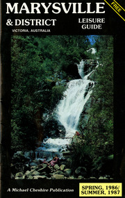 Marysville & District Historical Society
Booklet (Item) - Leisure guide, Michael Chesire & Associates Pty. Ltd, MARYSVILLE & DISTRICT LEISURE GUIDE-SPRING, 1986/SUMMBER, 1987, 1986
A free leisure guide to Marysville and the surrounding district published for Spring 1986, and Summer, 1987. This was produced by Michael Cheshire as a free publication to promote tourism in Marysville and the surrounding district. It includes maps of the Big River Valley, Cumberland Valley, Lady Talbot Forest Drive, the Marysville area, and the township of Marysville. It was released in the spring of 1986. A free leisure guide to Marysville and the surrounding district published for Spring 1986, and Summer 1987.Kilmore Historical Society *10/183 *MDL.1.marysville, victoria, australia, leisure guide, michael cheshire & associates pty ltd, marysville golf club, blackwood lodges, sir colin mackenzie fauna park, lake eildon, fraser national park, yarra valley wineries, marysville coach tours, kooringa, marylands guest house, lady talbot forest drive, wishing well, taggerty river recreation area, athols abbey, phantom falls, keppel falls, the beeches walking track, marylyn guest house, kufstein inn motel, the cumberland, marysville tourist & progress association, marysville newsagency & general store, crossways restaurant & motel, beauty spot walk, tree fern gully walk, michaeldene track, keppel track, woods lookout track, marysville hotel motel, lake mountain ski hire, marysville recreation and fun park, mytanta horseback safaris, upper big river valley, the big culvert, marysville mountain view horse hire, maryton park, amber view holiday lodges, cathedral restaurant, the top shop, tower motel, menzes garage, beauty spot nursery, marysville ski hire, lake mountain ski school, faraway forest, scenic motel, buxton trout farm, marysville hardware, timbertop steakhouse, marysville trout farm, healesville sanctuary, buxton hotel motel, nanda binya lodge, buxton antique and furniture mart, the black spur inn hotel, alexandra, lake mountain, j l gould sawmills pty. ltd., geoffrey pope & associates, marysville crafts & gifts, olde yarra track shoppe, cumberland scenic reserve, tudor lodge road house, fruit salad farm, highwayman's retreat -
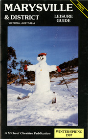 Marysville & District Historical Society
Booklet (Item) - Leisure guide, Michael Chesire & Associates Pty. Ltd, MARYSVILLE & DISTRICT LEISURE GUIDE-WINTER/SPRING 1987, 1987
A free leisure guide to Marysville and the surrounding district published for Winter and Spring, 1987. This was produced by Michael Cheshire as a free publication to promote tourism in Marysville and the surrounding district. It includes maps of the Big River Valley, Cumberland Valley, Lady Talbot Forest Drive, the Marysville area, and the township of Marysville. It was released in the winter of 1987. A free leisure guide to Marysville and the surrounding district published for Winter and Spring, 1987.marysville, victoria, australia, leisure guide, michael cheshire & associates pty ltd, marysville golf club, blackwood lodges, sir colin mackenzie fauna park, lake eildon, fraser national park, yarra valley wineries, marysville coach tours, kooringa, marylands guest house, lady talbot forest drive, wishing well, taggerty river recreation area, athols abbey, phantom falls, keppel falls, the beeches walking track, marylyn guest house, kufstein inn motel, the cumberland, marysville tourist & progress association, marysville newsagency & general store, crossways restaurant & motel, beauty spot walk, tree fern gully walk, michaeldene track, keppel track, woods lookout track, marysville hotel motel, lake mountain ski hire, marysville recreation and fun park, mytanta horseback safaris, upper big river valley, the big culvert, marysville mountain view horse hire, maryton park, amber view holiday lodges, cathedral restaurant, the top shop, tower motel, menzes garage, marysville ski hire, lake mountain ski school, faraway forest, scenic motel, buxton trout farm, marysville hardware, timbertop steakhouse, marysville trout farm, healesville sanctuary, buxton hotel motel, nanda binya lodge, buxton antique and furniture mart, the black spur inn hotel, alexandra, lake mountain, j l gould sawmills pty. ltd., geoffrey pope & associates, marysville crafts & gifts, olde yarra track shoppe, cumberland scenic reserve, tudor lodge road house, fruit salad farm, highwayman's retreat, beauty spot display gardens & nursery, ski lake mountain cross country ski hire & kitchen, buxton store, valley view marysville, acheron way, mt donna buang road, snow gum woodlands, alpine ash forests, mountain ash forests, stringybark forests, messmate forests, manna gum forests -
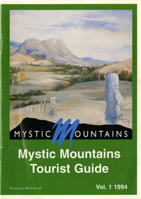 Marysville & District Historical Society
Ephemera (Item) - Tourist Guide, Michael Nash et al, Mystic Mountains Tourist Guide Vol. 1 1994, 1994
A tourist guide outlining services, accommodation, activities and places of interest to visit in and around Marysville and the local district.A tourist guide outlining services, accommodation, activities and places of interest to visit in and around Marysville and the local district.ACKNOWLEDGEMENTS:/ Marysville and District Tourist and Progress Association, Marysville/ Office of the Department of Conservation & Natural Resources, Shire/ of Alexandra Visitors Guide and all our advertisers whom without/ their support this publication would not have been possible.marysville, victoria, australia, tourist guide, mystic mountains, michael nash, dudley jones, marysville and district tourist and progress association, department of conservation & natural resources, shire of alexandra, paperwork professionals, pp art services, harrier printing, darrowby deer farm, heidi boesch, hidden talent craft gallery, olde yarra track shoppe, lady talbot forest drive, mathilde's of marysville country guest house, wishing well, taggerty river picnic area, taggery river, phantom falls, keppel falls, the beeches walking track, mount sugarloaf, beauty spot walk, tree fern gully walk, michaeldene track, keppel track, woods lookout track, marysville caravan park, baree mud brick cottages, cumberland scenic reserve, nanda binya lodge, cambarville, the big tree, barton's lookout, cumberland falls, our lady of the snows catholic church, anglican church christ, marysville christian fellowship, sovereign view, the big culvert, st fillan, steavenson's restaurant, the birches resort, cathedral range state park, tower motel, marysville post shop, lake mountain, wirreanda festival, cross country ski hire, marysville hotel motel, kerami house, marysville holiday cottages, missing links miniature golf, top shop pancake parlour, marylands guest house, dalrymples guest cottages, crossways country inn, esa camping & conference centre, scenic motel, the cumberland, maryton park holiday cottages, lomatia lodge holiday house, willowbank gallery and art centre, igloo roadhouse, a model tours, geoffrey pope & associates -
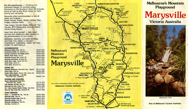 Marysville & District Historical Society
Ephemera (Item) - Tourist Guide, Melbourne's Mountain Playground Marysville Victoria Australia, Unknown
A fold out tourist guide to Marysville and the surrounding district.A fold out tourist guide to Marysville and the surrounding district.marysville, victoria, australia, steavenson falls, marysville golf club, cathedral range, blackwood holiday flats, cumberland holiday inn, kooringa conference and holiday centre, marylyn guest house, marysville caravan park, marysville hotel motel, nanda binya lodge, scenic motel, tower motel, cathedral restaurant, chris's place, danish coffee garden, tudor lodge roadhouse, buxton trout farm, silverstream trout farm, lake mountain ski hire, marysville fun park, mountain view horse hire, jl gould sawmills, marysville dairy, marysville drapery shop, marysville garage, marysville newsagency, top shop -
 Marysville & District Historical Society
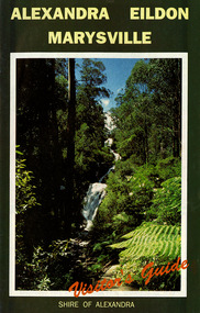
Ephemera (Item) - Visitor's Guide, Shire of Alexandra, ALEXANDRA EILDON MARYSVILLE Visitor's Guide, Unknown
A tourist guide for Alexandra, Eildon and Marysville produced by the Shire of Alexandra.A tourist guide for Alexandra, Eildon and Marysville produced by the Shire of Alexandra.alexandra, eildon, marysville, victoria, australia, tourist guide, steavenson falls, blackwood lodges, marysville hotel motel, the cumberland, gallery restaurant marysville, marysville gallery, cross country ski hire, marylyn guest house, marylands guest house, marysville crafts & gifts, hearts of oak antiques, geoffrey pope & associates, cedron house marysville, amber view holiday lodges marysville, marysville ski hire, lake mountain ski school, fruit salad farm, taggerty general store, arbor green galleries marysville, black spur roadhouse, black spur motel & caravan park, marysville caravan park, the hermitage narbethong, danish coffee garden, maryton park, buxton trout farm, lake mountain outdoor centre marysville, australian bush pioneer's farm, the camel farm and zoo buxton, marysville mountain view horse hire, marysville golf and bowls club, yarrolyn holiday park taggerty, riverland lodge taggerty, beauty spot walk, tree fern gully walk, michaeldene track, keppel track, woods lookout track -
 Marysville & District Historical Society
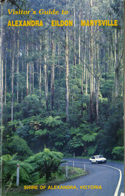
Ephemera (Item) - Visitor's Guide, Shire of Alexandra, Visitor's Guide to ALEXANDRA EILDON MARYSVILLE, Unknown
A tourist guide for Alexandra, Eildon and Marysville produced by the Shire of Alexandra.A tourist guide for Alexandra, Eildon and Marysville produced by the Shire of Alexandra.alexandra, eildon, marysville, victoria, australia, tourist guide, the cumberland, tudor lodge road house, the hermitage narbethong, blue views ski hire and holiday units narbethong, blackwood lodges marysville, marysville hotel motel, kufstein inn marysville, lake mountain, mary-lyn resort marysville, kooringa resort and conference centre marysville, mary's ville marysville, marysville crafts & gifts, geoffrey pope & associates, nanda binya lodge marysville, crossways country inn marysville, steavenson falls, scenic motel, marylands guest house, marysville holiday cottages, marysville newsagency & general store, el kanah, roseleigh holiday units, restaurant tirol, olde yarra track shoppe, marysville caravan park, dalrymples guest cottages, danish coffee garden, maryton park, tower motel, marysville golf and bowls club, taggerty general store, the camel farm and zoo buxton, buxton trout farm, yarrolyn holiday park, riverland lodge, marysville mountain view horse hire, beauty spot walk, tree fern gully walk, michaeldene track, keppel track, woods lookout track -
 Marysville & District Historical Society
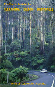
Ephemera (Item) - Visitor's Guide, Shire of Alexandra, Visitor's Guide to ALEXANDRA EILDON MARYSVILLE, Unknown
A tourist guide for Alexandra, Eildon and Marysville produced by the Shire of Alexandra.A tourist guide for Alexandra, Eildon and Marysville produced by the Shire of Alexandra.alexandra, eildon, marysville, victoria, australia, tourist guide, the cumberland, tudor lodge road house, the hermitage narbethong, blue views ski hire and holiday units narbethong, blackwood lodges marysville, marysville hotel motel, kufstein inn marysville, lake mountain, mary-lyn resort marysville, kooringa resort and conference centre marysville, mary's ville marysville, marysville crafts & gifts, geoffrey pope & associates, nanda binya lodge marysville, crossways country inn marysville, steavenson falls, scenic motel, marylands guest house, marysville holiday cottages, marysville newsagency & general store, el kanah, roseleigh holiday units, restaurant tirol, olde yarra track shoppe, marysville caravan park, dalrymples guest cottages, danish coffee garden, maryton park, tower motel, marysville golf and bowls club, taggerty general store, the camel farm and zoo buxton, buxton trout farm, yarrolyn holiday park, riverland lodge, marysville mountain view horse hire, beauty spot walk, tree fern gully walk, michaeldene track, keppel track, woods lookout track -
 Marysville & District Historical Society
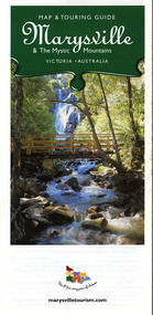
Map (Item) - Map and touring guide, Murrindindi Regional Tourism Association Inc, Marysville & The Mystic Mountains VICTORIA-AUSTRALIA, 08-2002
A fold out map and touring guide of Marysville and the surrounding district published in 2002 by Murrindindi Regional Tourism Association Inc.A fold out map and touring guide of Marysville and the surrounding district published in 2002 by Murrindindi Regional Tourism Association Inc.marysville, victoria, australia, map and touring guide, mystic mountains tourism, the beeches rainforest walk, lake mountain, cambarville, cathedral range state park, the cumberland, abbey green b&b cottages, anastasia fairytale cottage, ashlar cottage b&b, somerled mountain retreat, baree mudbrick cottages, blackwood cottages, camellia cottage, cathedral view b&b, cottage riverside, crossways country inn, dalrymples guest cottages, esa country ministries, hillcrest, keppels hotel motel, kerami house, lomatia lodge, lyell guest cottages, marylands country house, marysville caravan park, marysville holiday cottages, maryton park, melina cottage, moondai farm b&b, mountain lodge marysville, mount cathedral lodge, mystic mountains holiday cottages, nanda binya lodge, rendezvous on murchison, scenic b&b, the hermitage, tower motel, waratah house, willowbank at taggerty, woodlands of narbethong, keppels, lake mountain resort cafe, lanterns at willowbank, mantirri blueberry farm, marysville country bakery, the old woolshed cafe, clearstream olives, uncle fred & aunty val's old style lolly shop, acheron valley alpacas country store & gallery, bruno's art and sculpture garden, country touch, things of sand & stone, willowbank gallery, marysville auto & hardware, marysville newsagency & general store, marysville visitor information centre, narbethong visitor information centre, gallipoli park, keppels lookout, lady talbot drive, steavenson falls, steavenson river, taggerty river, acheron river, black spur trail riding centre, buxton trout farm, lake mountain resort ski hire, lake mountain ski school, marysville district country club, marysville ski centre, narbethong ski hire, rubicon horse riding, country touch tours, murrindindi regional tourism association inc -
 Marysville & District Historical Society
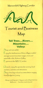
Map (Item) - Tourist and business map, Narbethong Community and Tourism Group, Narbethong Buxton Taggerty Tourist and Business Map, 04-2008
A tourist and business map of Narbethong, Buxton and Taggerty. This map was produced by the Narbethong Community and Tourism Group in April 2008. It was produced to promote the natural attractions, adventure activities and food trail from the Black Spur, through Narbethong, Buxton and Taggerty.A tourist and business map of Narbethong, Buxton and Taggerty.This publication has been produced by the Narbethong Community and Tourism/ Group (NCTG) to promote the natural attractions, adventure activities and food/ trail from the Black Spur, through Narbethong, Buxton and Taggerty./ the information provided in this publication has been supplied by the individual/ members. NCTG takes no responsibility for its accuracy./ April 2008narbethong, buxton, taggerty, victoria, australia, tourist and business map, narbethong community and tourism group, acheron valley, yarra track, wood's point, black spur, mystic mountains, the meeting of the waters, cathedral range, danico design counted cross stitch, things of sand & stone, buxton zoo nursery & oddz & enz, willowbank at taggerty, safe trek 4wd services, pnl 4wdriving, buxton trout and salmon farm, mystic mountains ski hire & outdoors, narbethong ski hire, highwood health centre, cathedral view natural therapies, narby cabinets, plants by shelian, gb timber, executive signs, rb automotive repairs, buxton car care, marysville towing & equipment hire, martyn slade building design, cathedral peak framing, black spur roadhouse & ski hire, tudor lodge roadhouse & ski hire, buxton roadhouse & persian bazzar, buxton post office general store & niche bar, igloo roadhouse, taggerty store, narby eggs, marapana agistment park, mantirri blueberry farm, carmyle farm, hazelwood hazelnuts, south cathedral lavender farm, cathedral cherries, black spur motel & caravan park, woodlands rainforest retreat, chestnut glade, black spur inn, wombat cottage, abbey lake luxury b & b spa cottages, blue views holiday cottages, camp narbethong, marapana farm stay b & b, mantirri blueberry farm b & b, little dene garden cottages, silverstream b & b cottages, nareen cabins, moondai farm b & b, south cathedral farm luxury b & b cottages, yarrolyn caravan park, sarsens rest, lomah retreat, pinjarra gardens, kingbilli country estate, henry viii manor house, buxton hotel, butters cafe of buxton, wagtail wines, little river wines, lanterns at willowbank, wirrawilla rainforest walk, wilhemina falls, the cascades -
 Marysville & District Historical Society
Map (Item) - Tourist and business map, Narbethong Community and Tourism Group, the Gateway TOURIST AND BUSINESS MAP, 08-2009
A tourist and business map of Narbethong, Buxton, and Taggerty. This map was produced by the Narbethong Community and Tourism Group Inc in August 2009. It was produced to promote the natural attractions, adventure activities, and food trail from the Black Spur, through Narbethong, Buxton, and Taggerty.A tourist and business map of Narbethong, Buxton and Taggerty.This publication has been produced by the Narbethong Community and Tourism Group Inc./ (NCTG) The information provided in this publication has been supplied by the individual/ members. NCTG takes no responsibility for its accuracy./ August 2009narbethong, buxton, taggerty, victoria, australia, tourist and business map, the gateway tourist and business map, black spur motel & caravan park, woodlands rainforest retreat, chestnut glade, black spur inn, wombat cottage, abbey lake luxury b&b spa cottages, camp narbethong, marapana farm stay b&b, mantirri b&b, little dene garden cottages, nareen cabins, silverstream b&b cottages, buxton hotel motel, south cathedral farm luxury b&b cottages, cathedral view b&b retreat, kingbilli country estate, cathedral valley farm, pinjarra gardens, willowbank at taggerty, sarsens rest, yarrolyn caravan park, danico design counted cross stitch, things of sand & stone, buxton zoo nursery, safetrek 4wd services, mystic mountains ski hire & outdoors, pnl 4wdriving, buxton trout and salmon farm, buxton bait and tackle, black spur roadhouse, tudor lodge service station roadhouse & ski hire, buxton roadhouse, buxton p.o. general store, igloo roadhouse, henry v111 manor house, buxton hotel, butters cafe, wagtail wines, little river wines, narby eggs, marapana agistment park, carmyle farm, hazelwood hazelnuts, cathedral view naturall therapies, cre8ing growth, linda hailey, naby cabinets, gb timber, narbethong timber & trading, rb automotive repairs, buxton car care, martyn slade building design, taggerty vet clinic -
 Marysville & District Historical Society
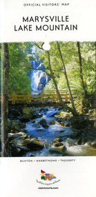
Map (Item) - Tourist map, Mystic Mountains Tourism, OFFICIAL VISITORS' MAP MARYSVILLE LAKE MOUNTAIN, Unknown
A visitors' map of Marysville and Lake Mountain produced by Mystic Mountains Tourism for Visit Victoria.A visitors' map of Marysville and Lake Mountain produced by Mystic Mountains Tourism for Visit Victoria.The Marysville and Lake Mountain Visitor Map and Touring Guide has been compiled and/ published by Mystic Mountains Tourism Inc. Copyright./ Production and artwork Graph Attack P/Lmarysville, lake mountain, victoria, australia, visitor's map, official visitors' map marysville lake mountain, buxton, narbethong, taggerty, visit victoria, mystic mountains tourism inc, graph attack p/l, mystic mountains, marysville triangle, marysville visitor information centre, marylands country house, black spur, steavenson falls, lady talbot drive, cambarville, cathedral ranges, wirreanda festival, lake mountain summit walk, summit walk loop, leadbeaters loop, day loop walk, buxton hotel, igloo roadhouse, karmann waters, silverstream b&b cottages, buxton trout and salmon farm, the niche wine bar, buxton post office & general store, choppers buxton roadhouse, woodlands rainforest bungalows, chestnut glade, black spur inn, wombat cottage, abbey lake luxury b&b spa cottages, mystic mountain ski hire & outdoors, pnl 4wdriving, blue views holiday units & ski hire, marapana agistment park & farm stay b&b, danico design, things of sand & stone, mantirri blueberry farm, allawah country cottages, amberview cottages, ashlar cottage b&b, black spur motel & caravan park, blackwood deluxe cottages, blackwood courtyard b&b, dalrymples guest cottages, delderfield, el kanah guest house, fruit salad farm, kerami guest house, keppels hotel, lake mountain-snow gum lodge, lomatia lodge, lyell guest cottages, magnolia house, keppel waters, lyrebird apartments, marysville caravan park, all view spa apartments, riverside cottages, maryton park b&b country cottages, melina cottage, mountain lodge, mystic mountains holiday cottages, nanda binya lodge, rendezvous luxury cottages, scenic b&b motel, the cumberland, south cathedral farm, tower motel, willowbank at taggerty, woodlands rainforest retreat, marysville & district country club inc, mystic mountains ski hire & outdoors, rubicon valley horse riding, marysville trout and salmon ponds, gallipoli park, keppels lookout, cambarville-yarra ranges national park, lake mountain-yarra ranges national park, lady talbot drive-yarra ranges national park, cathedral range state park, steavenson river, taggerty river, acheron river, lake mountain alpine resort, bruno's art and sculpture garden, manical mechanicals, uncle fred & aunty val's old style lolly shop, carmyle farm boutique, crossways historic country inn, fraga's, gilberts restaurant, heights licensed bistro, the old woolshed cafe, cathedral view natural therapies, crystal journey -
 Phillip Island and District Historical Society Inc.
Book, De COLANGE, Leo, picturesque world, or, Scenes in many lands, with one thousand illustrations on wood and steel of picturesque views from all parts of the world comprising mountain, lake and river scenery, parks, palaces, cathedrals, churches, castles, abbeys, and other views selected from the most noted and interesting parts of the world ; with original and authentic descriptions by the best authors, 1878-9
Labelled 'Cowes Free Public Library', 'Phillip Island Historical Society, Cleeland Bequest'. V.2 inscribed 'Jno. Cleeland, Wollomai' -
 Greensborough Historical Society
Photograph - Digital Image, Blue Lake: Views of lake, 19/06/2015
... of Greensborough. These photos show views of the lake.... of colour photographs Blue Lake: Views of lake. Photograph - Digital ...Blue Lake is in Yellow Gum Park in the Plenty Gorge, north of Greensborough. These photos show views of the lake.Digital copy of colour photographsyellow gum park, blue lake, plenty gorge park -
 Greensborough Historical Society
Photograph - Digital image, Marilyn Smith, Blue Lake: More views of the lake, 19/06/2015
... of Greensborough. These photos show views of the lake.... of colour photographs Blue Lake: More views of the lake. Photograph ...Blue Lake is in Yellow Gum Park in the Plenty Gorge, north of Greensborough. These photos show views of the lake.Digital copy of colour photographsyellow gum park, blue lake, plenty gorge park -
Glenelg Shire Council Cultural Collection
Photograph - Photograph - aerial view of Portland coast, c. 1954
... of 3 't' at regular intervals. Ocean, land with lakes ...Black and white aerial photograph of coastline around Portland. Black border, scale all sides, 5 rows of 3 't' at regular intervals. Ocean, land with lakesFront: '820 -8' - handwritten, white, lower border 'RUN 5' 'PORTLAND', printed, white, lower borderaerial photography, central portland, portland harbour, south west coastline -
Glenelg Shire Council Cultural Collection
Photograph - Photograph - aerial view of Portland, c. 1954
... intervals. Small area of ocean, rest land with lakes. Photograph ...Black and white aerial photograph of coastline around Portland. Black border, scale all sides, 5 rows of 3 't' at regular intervals. Small area of ocean, rest land with lakes.Front: '820 -9' - handwritten, white, border 'RUN 5' 'PORTLAND', printed, white, lower borderaerial photography, central portland, portland harbour, coastline -
Glenelg Shire Council Cultural Collection
Souvenir - Tea Towel, Designed in Australia by JONEFF, n.d
... , with red banner, 'Henty Bros. settled 1834'. Beneath this, 4 views... Lakes, Henty Beach, Grain Terminal, Aerieal view of Portland ...Linen souvenir tea towel, 'PORTLAND, VICTORIA, AUSTRALIA' printed in blue and red on white clouds. Depiction of Portland plus harbour, looking east, Portland's coat-of-arms beneath, with red banner, 'Henty Bros. settled 1834'. Beneath this, 4 views of Portland: Bridgewater Lakes, Henty Beach, Grain Terminal, Aerieal view of Portland. Blue background. Red border.