Showing 661 items
matching south gippsland
-
 Eltham District Historical Society Inc
Photograph - Aerial Photograph, Landata, Eltham; Crown Allotment 15, Section 5, Parish of Nillumbik (Stokes Orchard Estate), Oct. 1968
Centred on present day Diosma Rd, Stokes Pl, Nyora Rd and Eucalyptus Rd Historic Aerial Imagery Source: Landata.vic.gov.au Aerial Photo Details: Project No :656 Project : MELBOURNE 1968 PROJECT Run : 13A Frame : 64 Date : 10/1968 Film Type : B/W Camera : RC8 Flying Height : 5100 Scale : 9600 Film Number : 2172 GDA2020 : 37°42'46"S, 145°10'01"E MGA2020 : 338430, 5824467 (55) Melways : 22 D4 (ed. 42) A History of the Development of Crown Allotment 15, Section 5, Parish of Nillumbik – Stokes Orchard Crown Allotment 15, Section 5, Parish of Nillumbik (CA15) is a square allotment of 158 acres or approximately a quarter of a square mile. It lies just beyond the eastern end of Pitt Street, south of Nyora Road to the northern end of Eucalyptus Road and extends east from Eucalyptus Road to Reynolds Road. The topography of CA15 is generally steep, sloping up to a hill near the centre of the land, the ridgeline passing through the properties along the southern side of Diosma Road. Eucalyptus Road is a straight north-south road with its northern end at the north west corner of CA15. Until the end of the 1970s this road was an un-named Government Road and was largely not open to traffic. With residential development in the 1970s the road was constructed, and the council allocated the name obviously in recognition of the predominant species of the local bushland. CA15 was purchased from the Crown by George D’Arley Boursiquot, a prominent Melbourne printer, on 28th October 1852. On November 23, 1922, former Member for Gippsland and Melbourne Real Estate Agent, Hubert Patrick Keogh purchased the allotment then sold it March 13, 1925, to local farmer, Robert David Taylor, a former Shire of Eltham Councillor (1911-1920) and Shire President (1919). Taylor had extensive land holdings stretching west towards Bible Street and Main Road. The Taylor home was situated at the top of the hill in Bible Street at present day 82 Bible Street. At the time of Taylor’s purchase in 1925, CA15 was subdivided into 48 lots that could be described as small rural properties or large residential lots. A typical lot size was one hectare or 2.5 acres. The subdivision created two roads, Nyora Road, and Diosma Road, each following an irregular alignment between Eucalyptus and Reynolds Roads. However, the lots were not sold off separately nor were the roads constructed. The land effectively remained as one parcel for many further years. Robert David Taylor died November 30, 1934, and probate was granted to his son of the same name, Robert David Taylor of Bible Street, Salesman and William McLelland Vance Taylor of 73 Emmeline Street, Northcote, Clerk, with the transfer of the land into their names on July 8, 1935. Frank Stokes worked as a qualified accountant at Kennons leather factory in Burnley, while living at 1 Thomas Street, Mitcham. He suffered from migraines and wanted to return to working the land (he had previously worked on farms and orchards since coming to Australia from England in 1926, both in WA and Vic.). He first travelled to the district by train in July 1942 to find land with the intention to establish an orchard. By chance he met Arthur Bird of Bird Orchard (bounded by Pitt Street, Eucalyptus Road, and Wattle Grove) and they got talking over their common interest. Arthur put Frank up for the night and pointed out the land, 158 acres- part of the Taylor Estate- £900, Crown Allotment 15, Section 5, Parish of Nillumbik (CA15) somewhat diagonally opposite Bird Orchard. Stokes applied through the Riverina Agency to purchase the land who in turn applied for permission from Canberra to sell as there was a new government regulation introduced during the Second World War banning land sales except for immediate production. Stokes obtained a loan on his Mitcham house of £600 @ 5% and paid £450 deposit with quarterly payments of £15 spread over 5 years. Stokes was assisted and advised by Arthur Bird who farmed the neighbouring orchard. In early 1943 Stokes took possession and would catch the train out to Eltham on Fridays after work and began building a hut on the corner of Nyora Road and the Government Road (Eucalyptus Road) for shelter and to lock up tools. He established an orchard on the central western part of the land through the centre of which ran a natural waterway (part of the present-day linear park) and was able to pay a neighbour (Hawkins) to help with clearing and fencing 25 acres, and with a horse and single furrowed plough, planted approximately 2,500 fruit trees - cherries, peaches, plums, almonds, pears, apricots and lemons as well as a few apples and oranges; a massive task. Aerial photographs from the 1940s through to the 1990s clearly show the orchard with most of the larger CA15 site remaining as natural bushland. A huge problem was hares and rabbits eating all the new buds off the tiny trees. As well as laying poison he painted the trees with a mixture of cow manure and lime, often working by moonlight. Procurement of wire and wire netting was difficult because of the war but after much effort he obtained a permit from the Agricultural Department for supplies in March 1944. In February 1945 Stokes applied for a permit to build a “packing shed” as no house building was allowed. It was to be 33 feet x 21 feet and cost £312. It was constructed mostly from second-hand materials, which were hard to obtain, especially iron for roofing. Stokes finished work at Kennons on October 31, 1945, and in March 1946 he sold the family home at Mitcham for £1,230 plus £170 for furniture. On May 15, 1946, title to the CA15 property was issued to Frank Howard Alfred Stokes, Orchardist and Gladys Ethel Stokes, Married Woman, both of Pitt Street, Eltham. The family of five then moved into the very unfinished “packing shed” at Eltham, which was a struggle to weatherproof. Eventually rooms were divided off and lined with hessian bags and whitewashed. Their income was firewood (cut and sold), selling rockery stones and cut Sweet Bursaria. (It was discovered during the 1940s that Sweet Bursaria contained the sunscreen compound Aesculin. The RAAF utilised this compound from Sweet Bursaria during WW2 for pilots and gunners.) The orchard’s first fruit sale was a half-case of Le Vanq peaches in December 1947 for the price of 8 shillings. In 1956 plans for house were drawn and Glen Iris bricks purchased (1956 Olympic Rings variant). The building of the house commenced in 1957 - 12 feet of original packing shed was removed – and was completed in 1959. Water was connected from newly built pressure storage on the property at the end of 1959 and the electricity connection for the first time at 3pm on April 29, 1960. The house remains to present day (somewhat modified) at 1 Nyora Road, home to Nyora Studio Gallery. On occasions, spare remnants of the 1956 bricks have been known to be unearthed in gardens on the estate as they were utilised by Frank Stokes to fill in rabbit holes. On May 26, 1950, a parcel of land was compulsorily acquired by the Melbourne and Metropolitan Board of Works on the hilltop to establish an easement for a high-level service reservoir to augment Eltham’s water supply. The project also included pipe tracks for the necessary water mains. The reservoir has now been superseded by higher level water tanks east of Reynolds Road and its former site is now a public reserve. On November 27, 1964, the State Electricity Commission served notice to compulsorily acquire a further parcel through the eastern part of the land for a major electricity transmission line that augmented supply from the La Trobe Valley to Melbourne. The easement was registered February 11, 1966. The easement was widened July 18, 1969 for a second transmission line to be constructed. In 1971 Melbourne Metropolitan Planning Scheme amendments adopted Nyora Road as the boundary between a residential zone to the north and a rural zone to the south. This determined the future development of the land. In the mid-1970s the Shire of Eltham divided the orchard into numerous rate-able parcel lots, the 48 lots having been established in 1925 and the subsequent rates assessment proved unsustainable for Stokes. He commenced selling lots outside the boundary of the orchard, north of Diosma and South of Nyora. However shortly later the land between Nyora and Diosma Roads and west of the electricity easement was sold and subdivided into residential lots, a housing development by Macquarie Builders and marketed as the Stokes Orchard Estate. New streets were created, and most were named after trees, although one, Stokes Place, commemorates the former owners. The development was undertaken in two stages; Stage 1 (1975) encompassing Scarlet Ash Court, Ironbark Close and Peppermint Grove bounded by Nyora and Eucalyptus roads and Stage 2 (1978) encompassing Stokes Place, Orchard Way, The Crest and The Lookout bound by Nyora and Diosma roads. The developer, Macquarie Builders went bankrupt shortly after the release of Stage 2 leaving many purchasers to fend for themselves and arrange for their own independent builders. There were also difficulties with sewerage for the land immediately south of Diosma Road and so the conventional residential lots were abandoned in favour of larger lots. The development of Orchard Way, The Crest and The Lookout did not proceed as planned and the proposed lots were incorporated into five-acre parcels instead. These included a low-density group housing development by the Graves family and the award winning Choong House (1983) with Gordon Ford developed garden immediately next door situated on the ridge of the hill nestled amongst the original bush, Eucalypt trees and Sweet Bursaria. In 1994, Nillumbik Shire Council applied Significant Environment and Significant Landscape overlays upon the properties on the south side of Diosma Road to ensure protection of this natural bush garden environment. With the arrival of the sewer along Diosma Road in the 1990s, most of these five-acre parcels have since been subdivided multiple times. The Choong house presently sits on a 2.7-acre property, which in 2022 Nillumbik Council nominated for Cultural Significance Heritage protection and is considered potentially significant at State level. The Stokes family were also associated with the Eltham Christian Church. In the 1970s this church had met in temporary premises in Eltham. Lots of the original 1925 subdivision remained south of Nyora Road and a number of these lots were utilized for the Eltham Christian School, which was established by the Eltham Christian Church in 1981. The school operated on this site until 2000. The premises are now used by The Vine Baptist Church. By the mid-1980s the whole of CA15 had been developed for residential and school purposes, except for the sections north of Diosma Road and between the transmission lines and Reynolds Road. Sewerage issues had been resolved for the section north of Diosma Road and in 1987 it was in the process of being subdivided into residential lots. The development coincided with the discovery of colonies of the rare and endangered Eltham Copper Butterfly on the site. This resulted in a community and political campaign to save the butterfly habitat. With the co-operation of the land developer the subdivision was altered to create two bushland reserves in the critical butterfly habitat areas. In the late 1980s the State Government was investigating options for establishing a metropolitan ring road link between Diamond Creek and Ringwood. The chosen route was adjacent to Reynolds Road and so this created a freeze on development of CA15 between Reynolds Road and the electricity easement. The ring road proposal was eventually abandoned, and this part of the land was subdivided into low density residential lots. Diosma Road has been discontinued at the electricity easement and the eastern part incorporated into View Mount Court with access from Reynolds Road. The whole of CA15 has now been developed for residential or associated purposes, ranging from conventional density to quite low density south of Nyora Road. Some remnants of the orchard remain, a few cherry trees on the Graves property and a lone apple tree in Stokes Place. The butterfly reserves comprise significant areas of remnant bushland. Linear reserves through the estate link with central Eltham via the Woodridge linear reserve and with Research along the electricity easement. CA15 as it exists today has a complicated history of rural use, Government acquisition, urban development, and community action. References: • “Stokes Orchard, an incomplete history”; Russell Yeoman with Doug Orford • Correspondence, Beryl Bradbury (nee Stokes) • Aerial Photographs, 1931-1991, Landata (landata.vic.gov.au) • Certificate of Title, Vol. 4930 Fol. 985900 • Plan Number LP 10859 aerial photo, diosma road, eltham copper butterfly, eucalyptus road, ironbark close, nyora road, peppermint grove, peter & elizabeth pidgeon collection, power transmission lines, reynolds road, scarlet ash court, stokes orchard estate, stokes place, woodridge estate, frank stokes -
 Eltham District Historical Society Inc
Photograph - Aerial Photograph, Landata, Eltham; Crown Allotment 15, Section 5, Parish of Nillumbik (Stokes Orchard Estate), Oct. 1970
Centred on present day Diosma Rd, Stokes Pl, Nyora Rd and Eucalyptus Rd Historic Aerial Imagery Source: Landata.vic.gov.au Aerial Photo Details: Project No :1148 Project : MELBOURNE 1970 PROJECT Run : 27 Frame : 192 Date : 10/1970 Film Type : B/W Camera : RC8 Flying Height : 5100 Scale : 9600 Film Number : 2366 GDA2020 : 37°42'45"S, 145°10'05"E MGA2020 : 338533, 5824496 (55) Melways : 22 D4 (ed. 42) A History of the Development of Crown Allotment 15, Section 5, Parish of Nillumbik – Stokes Orchard Crown Allotment 15, Section 5, Parish of Nillumbik (CA15) is a square allotment of 158 acres or approximately a quarter of a square mile. It lies just beyond the eastern end of Pitt Street, south of Nyora Road to the northern end of Eucalyptus Road and extends east from Eucalyptus Road to Reynolds Road. The topography of CA15 is generally steep, sloping up to a hill near the centre of the land, the ridgeline passing through the properties along the southern side of Diosma Road. Eucalyptus Road is a straight north-south road with its northern end at the north west corner of CA15. Until the end of the 1970s this road was an un-named Government Road and was largely not open to traffic. With residential development in the 1970s the road was constructed, and the council allocated the name obviously in recognition of the predominant species of the local bushland. CA15 was purchased from the Crown by George D’Arley Boursiquot, a prominent Melbourne printer, on 28th October 1852. On November 23, 1922, former Member for Gippsland and Melbourne Real Estate Agent, Hubert Patrick Keogh purchased the allotment then sold it March 13, 1925, to local farmer, Robert David Taylor, a former Shire of Eltham Councillor (1911-1920) and Shire President (1919). Taylor had extensive land holdings stretching west towards Bible Street and Main Road. The Taylor home was situated at the top of the hill in Bible Street at present day 82 Bible Street. At the time of Taylor’s purchase in 1925, CA15 was subdivided into 48 lots that could be described as small rural properties or large residential lots. A typical lot size was one hectare or 2.5 acres. The subdivision created two roads, Nyora Road, and Diosma Road, each following an irregular alignment between Eucalyptus and Reynolds Roads. However, the lots were not sold off separately nor were the roads constructed. The land effectively remained as one parcel for many further years. Robert David Taylor died November 30, 1934, and probate was granted to his son of the same name, Robert David Taylor of Bible Street, Salesman and William McLelland Vance Taylor of 73 Emmeline Street, Northcote, Clerk, with the transfer of the land into their names on July 8, 1935. Frank Stokes worked as a qualified accountant at Kennons leather factory in Burnley, while living at 1 Thomas Street, Mitcham. He suffered from migraines and wanted to return to working the land (he had previously worked on farms and orchards since coming to Australia from England in 1926, both in WA and Vic.). He first travelled to the district by train in July 1942 to find land with the intention to establish an orchard. By chance he met Arthur Bird of Bird Orchard (bounded by Pitt Street, Eucalyptus Road, and Wattle Grove) and they got talking over their common interest. Arthur put Frank up for the night and pointed out the land, 158 acres- part of the Taylor Estate- £900, Crown Allotment 15, Section 5, Parish of Nillumbik (CA15) somewhat diagonally opposite Bird Orchard. Stokes applied through the Riverina Agency to purchase the land who in turn applied for permission from Canberra to sell as there was a new government regulation introduced during the Second World War banning land sales except for immediate production. Stokes obtained a loan on his Mitcham house of £600 @ 5% and paid £450 deposit with quarterly payments of £15 spread over 5 years. Stokes was assisted and advised by Arthur Bird who farmed the neighbouring orchard. In early 1943 Stokes took possession and would catch the train out to Eltham on Fridays after work and began building a hut on the corner of Nyora Road and the Government Road (Eucalyptus Road) for shelter and to lock up tools. He established an orchard on the central western part of the land through the centre of which ran a natural waterway (part of the present-day linear park) and was able to pay a neighbour (Hawkins) to help with clearing and fencing 25 acres, and with a horse and single furrowed plough, planted approximately 2,500 fruit trees - cherries, peaches, plums, almonds, pears, apricots and lemons as well as a few apples and oranges; a massive task. Aerial photographs from the 1940s through to the 1990s clearly show the orchard with most of the larger CA15 site remaining as natural bushland. A huge problem was hares and rabbits eating all the new buds off the tiny trees. As well as laying poison he painted the trees with a mixture of cow manure and lime, often working by moonlight. Procurement of wire and wire netting was difficult because of the war but after much effort he obtained a permit from the Agricultural Department for supplies in March 1944. In February 1945 Stokes applied for a permit to build a “packing shed” as no house building was allowed. It was to be 33 feet x 21 feet and cost £312. It was constructed mostly from second-hand materials, which were hard to obtain, especially iron for roofing. Stokes finished work at Kennons on October 31, 1945, and in March 1946 he sold the family home at Mitcham for £1,230 plus £170 for furniture. On May 15, 1946, title to the CA15 property was issued to Frank Howard Alfred Stokes, Orchardist and Gladys Ethel Stokes, Married Woman, both of Pitt Street, Eltham. The family of five then moved into the very unfinished “packing shed” at Eltham, which was a struggle to weatherproof. Eventually rooms were divided off and lined with hessian bags and whitewashed. Their income was firewood (cut and sold), selling rockery stones and cut Sweet Bursaria. (It was discovered during the 1940s that Sweet Bursaria contained the sunscreen compound Aesculin. The RAAF utilised this compound from Sweet Bursaria during WW2 for pilots and gunners.) The orchard’s first fruit sale was a half-case of Le Vanq peaches in December 1947 for the price of 8 shillings. In 1956 plans for house were drawn and Glen Iris bricks purchased (1956 Olympic Rings variant). The building of the house commenced in 1957 - 12 feet of original packing shed was removed – and was completed in 1959. Water was connected from newly built pressure storage on the property at the end of 1959 and the electricity connection for the first time at 3pm on April 29, 1960. The house remains to present day (somewhat modified) at 1 Nyora Road, home to Nyora Studio Gallery. On occasions, spare remnants of the 1956 bricks have been known to be unearthed in gardens on the estate as they were utilised by Frank Stokes to fill in rabbit holes. On May 26, 1950, a parcel of land was compulsorily acquired by the Melbourne and Metropolitan Board of Works on the hilltop to establish an easement for a high-level service reservoir to augment Eltham’s water supply. The project also included pipe tracks for the necessary water mains. The reservoir has now been superseded by higher level water tanks east of Reynolds Road and its former site is now a public reserve. On November 27, 1964, the State Electricity Commission served notice to compulsorily acquire a further parcel through the eastern part of the land for a major electricity transmission line that augmented supply from the La Trobe Valley to Melbourne. The easement was registered February 11, 1966. The easement was widened July 18, 1969 for a second transmission line to be constructed. In 1971 Melbourne Metropolitan Planning Scheme amendments adopted Nyora Road as the boundary between a residential zone to the north and a rural zone to the south. This determined the future development of the land. In the mid-1970s the Shire of Eltham divided the orchard into numerous rate-able parcel lots, the 48 lots having been established in 1925 and the subsequent rates assessment proved unsustainable for Stokes. He commenced selling lots outside the boundary of the orchard, north of Diosma and South of Nyora. However shortly later the land between Nyora and Diosma Roads and west of the electricity easement was sold and subdivided into residential lots, a housing development by Macquarie Builders and marketed as the Stokes Orchard Estate. New streets were created, and most were named after trees, although one, Stokes Place, commemorates the former owners. The development was undertaken in two stages; Stage 1 (1975) encompassing Scarlet Ash Court, Ironbark Close and Peppermint Grove bounded by Nyora and Eucalyptus roads and Stage 2 (1978) encompassing Stokes Place, Orchard Way, The Crest and The Lookout bound by Nyora and Diosma roads. The developer, Macquarie Builders went bankrupt shortly after the release of Stage 2 leaving many purchasers to fend for themselves and arrange for their own independent builders. There were also difficulties with sewerage for the land immediately south of Diosma Road and so the conventional residential lots were abandoned in favour of larger lots. The development of Orchard Way, The Crest and The Lookout did not proceed as planned and the proposed lots were incorporated into five-acre parcels instead. These included a low-density group housing development by the Graves family and the award winning Choong House (1983) with Gordon Ford developed garden immediately next door situated on the ridge of the hill nestled amongst the original bush, Eucalypt trees and Sweet Bursaria. In 1994, Nillumbik Shire Council applied Significant Environment and Significant Landscape overlays upon the properties on the south side of Diosma Road to ensure protection of this natural bush garden environment. With the arrival of the sewer along Diosma Road in the 1990s, most of these five-acre parcels have since been subdivided multiple times. The Choong house presently sits on a 2.7-acre property, which in 2022 Nillumbik Council nominated for Cultural Significance Heritage protection and is considered potentially significant at State level. The Stokes family were also associated with the Eltham Christian Church. In the 1970s this church had met in temporary premises in Eltham. Lots of the original 1925 subdivision remained south of Nyora Road and a number of these lots were utilized for the Eltham Christian School, which was established by the Eltham Christian Church in 1981. The school operated on this site until 2000. The premises are now used by The Vine Baptist Church. By the mid-1980s the whole of CA15 had been developed for residential and school purposes, except for the sections north of Diosma Road and between the transmission lines and Reynolds Road. Sewerage issues had been resolved for the section north of Diosma Road and in 1987 it was in the process of being subdivided into residential lots. The development coincided with the discovery of colonies of the rare and endangered Eltham Copper Butterfly on the site. This resulted in a community and political campaign to save the butterfly habitat. With the co-operation of the land developer the subdivision was altered to create two bushland reserves in the critical butterfly habitat areas. In the late 1980s the State Government was investigating options for establishing a metropolitan ring road link between Diamond Creek and Ringwood. The chosen route was adjacent to Reynolds Road and so this created a freeze on development of CA15 between Reynolds Road and the electricity easement. The ring road proposal was eventually abandoned, and this part of the land was subdivided into low density residential lots. Diosma Road has been discontinued at the electricity easement and the eastern part incorporated into View Mount Court with access from Reynolds Road. The whole of CA15 has now been developed for residential or associated purposes, ranging from conventional density to quite low density south of Nyora Road. Some remnants of the orchard remain, a few cherry trees on the Graves property and a lone apple tree in Stokes Place. The butterfly reserves comprise significant areas of remnant bushland. Linear reserves through the estate link with central Eltham via the Woodridge linear reserve and with Research along the electricity easement. CA15 as it exists today has a complicated history of rural use, Government acquisition, urban development, and community action. References: • “Stokes Orchard, an incomplete history”; Russell Yeoman with Doug Orford • Correspondence, Beryl Bradbury (nee Stokes) • Aerial Photographs, 1931-1991, Landata (landata.vic.gov.au) • Certificate of Title, Vol. 4930 Fol. 985900 • Plan Number LP 10859 aerial photo, diosma road, eltham copper butterfly, eucalyptus road, ironbark close, nyora road, peppermint grove, peter & elizabeth pidgeon collection, power transmission lines, reynolds road, scarlet ash court, stokes orchard estate, stokes place, woodridge estate, frank stokes -
 Eltham District Historical Society Inc
Photograph - Aerial Photograph, Landata, Eltham; Crown Allotment 15, Section 5, Parish of Nillumbik (Stokes Orchard Estate), Apr. 1972
Centred on present day Diosma Rd, Stokes Pl, Nyora Rd and Eucalyptus Rd Historic Aerial Imagery Source: Landata.vic.gov.au Aerial Photo Details: Project No :985 Project : MELBOURNE 1972 Run : 27 Frame : 45 Date : 04/1972 Film Type : B/W Camera : RC10 Flying Height : 5700 Scale : 9600 Film Number : 2636 GDA2020 : 37°42'53"S, 145°10'19"E MGA2020 : 338884, 5824261 (55) Melways : 22 E5 (ed. 42) A History of the Development of Crown Allotment 15, Section 5, Parish of Nillumbik – Stokes Orchard Crown Allotment 15, Section 5, Parish of Nillumbik (CA15) is a square allotment of 158 acres or approximately a quarter of a square mile. It lies just beyond the eastern end of Pitt Street, south of Nyora Road to the northern end of Eucalyptus Road and extends east from Eucalyptus Road to Reynolds Road. The topography of CA15 is generally steep, sloping up to a hill near the centre of the land, the ridgeline passing through the properties along the southern side of Diosma Road. Eucalyptus Road is a straight north-south road with its northern end at the north west corner of CA15. Until the end of the 1970s this road was an un-named Government Road and was largely not open to traffic. With residential development in the 1970s the road was constructed, and the council allocated the name obviously in recognition of the predominant species of the local bushland. CA15 was purchased from the Crown by George D’Arley Boursiquot, a prominent Melbourne printer, on 28th October 1852. On November 23, 1922, former Member for Gippsland and Melbourne Real Estate Agent, Hubert Patrick Keogh purchased the allotment then sold it March 13, 1925, to local farmer, Robert David Taylor, a former Shire of Eltham Councillor (1911-1920) and Shire President (1919). Taylor had extensive land holdings stretching west towards Bible Street and Main Road. The Taylor home was situated at the top of the hill in Bible Street at present day 82 Bible Street. At the time of Taylor’s purchase in 1925, CA15 was subdivided into 48 lots that could be described as small rural properties or large residential lots. A typical lot size was one hectare or 2.5 acres. The subdivision created two roads, Nyora Road, and Diosma Road, each following an irregular alignment between Eucalyptus and Reynolds Roads. However, the lots were not sold off separately nor were the roads constructed. The land effectively remained as one parcel for many further years. Robert David Taylor died November 30, 1934, and probate was granted to his son of the same name, Robert David Taylor of Bible Street, Salesman and William McLelland Vance Taylor of 73 Emmeline Street, Northcote, Clerk, with the transfer of the land into their names on July 8, 1935. Frank Stokes worked as a qualified accountant at Kennons leather factory in Burnley, while living at 1 Thomas Street, Mitcham. He suffered from migraines and wanted to return to working the land (he had previously worked on farms and orchards since coming to Australia from England in 1926, both in WA and Vic.). He first travelled to the district by train in July 1942 to find land with the intention to establish an orchard. By chance he met Arthur Bird of Bird Orchard (bounded by Pitt Street, Eucalyptus Road, and Wattle Grove) and they got talking over their common interest. Arthur put Frank up for the night and pointed out the land, 158 acres- part of the Taylor Estate- £900, Crown Allotment 15, Section 5, Parish of Nillumbik (CA15) somewhat diagonally opposite Bird Orchard. Stokes applied through the Riverina Agency to purchase the land who in turn applied for permission from Canberra to sell as there was a new government regulation introduced during the Second World War banning land sales except for immediate production. Stokes obtained a loan on his Mitcham house of £600 @ 5% and paid £450 deposit with quarterly payments of £15 spread over 5 years. Stokes was assisted and advised by Arthur Bird who farmed the neighbouring orchard. In early 1943 Stokes took possession and would catch the train out to Eltham on Fridays after work and began building a hut on the corner of Nyora Road and the Government Road (Eucalyptus Road) for shelter and to lock up tools. He established an orchard on the central western part of the land through the centre of which ran a natural waterway (part of the present-day linear park) and was able to pay a neighbour (Hawkins) to help with clearing and fencing 25 acres, and with a horse and single furrowed plough, planted approximately 2,500 fruit trees - cherries, peaches, plums, almonds, pears, apricots and lemons as well as a few apples and oranges; a massive task. Aerial photographs from the 1940s through to the 1990s clearly show the orchard with most of the larger CA15 site remaining as natural bushland. A huge problem was hares and rabbits eating all the new buds off the tiny trees. As well as laying poison he painted the trees with a mixture of cow manure and lime, often working by moonlight. Procurement of wire and wire netting was difficult because of the war but after much effort he obtained a permit from the Agricultural Department for supplies in March 1944. In February 1945 Stokes applied for a permit to build a “packing shed” as no house building was allowed. It was to be 33 feet x 21 feet and cost £312. It was constructed mostly from second-hand materials, which were hard to obtain, especially iron for roofing. Stokes finished work at Kennons on October 31, 1945, and in March 1946 he sold the family home at Mitcham for £1,230 plus £170 for furniture. On May 15, 1946, title to the CA15 property was issued to Frank Howard Alfred Stokes, Orchardist and Gladys Ethel Stokes, Married Woman, both of Pitt Street, Eltham. The family of five then moved into the very unfinished “packing shed” at Eltham, which was a struggle to weatherproof. Eventually rooms were divided off and lined with hessian bags and whitewashed. Their income was firewood (cut and sold), selling rockery stones and cut Sweet Bursaria. (It was discovered during the 1940s that Sweet Bursaria contained the sunscreen compound Aesculin. The RAAF utilised this compound from Sweet Bursaria during WW2 for pilots and gunners.) The orchard’s first fruit sale was a half-case of Le Vanq peaches in December 1947 for the price of 8 shillings. In 1956 plans for house were drawn and Glen Iris bricks purchased (1956 Olympic Rings variant). The building of the house commenced in 1957 - 12 feet of original packing shed was removed – and was completed in 1959. Water was connected from newly built pressure storage on the property at the end of 1959 and the electricity connection for the first time at 3pm on April 29, 1960. The house remains to present day (somewhat modified) at 1 Nyora Road, home to Nyora Studio Gallery. On occasions, spare remnants of the 1956 bricks have been known to be unearthed in gardens on the estate as they were utilised by Frank Stokes to fill in rabbit holes. On May 26, 1950, a parcel of land was compulsorily acquired by the Melbourne and Metropolitan Board of Works on the hilltop to establish an easement for a high-level service reservoir to augment Eltham’s water supply. The project also included pipe tracks for the necessary water mains. The reservoir has now been superseded by higher level water tanks east of Reynolds Road and its former site is now a public reserve. On November 27, 1964, the State Electricity Commission served notice to compulsorily acquire a further parcel through the eastern part of the land for a major electricity transmission line that augmented supply from the La Trobe Valley to Melbourne. The easement was registered February 11, 1966. The easement was widened July 18, 1969 for a second transmission line to be constructed. In 1971 Melbourne Metropolitan Planning Scheme amendments adopted Nyora Road as the boundary between a residential zone to the north and a rural zone to the south. This determined the future development of the land. In the mid-1970s the Shire of Eltham divided the orchard into numerous rate-able parcel lots, the 48 lots having been established in 1925 and the subsequent rates assessment proved unsustainable for Stokes. He commenced selling lots outside the boundary of the orchard, north of Diosma and South of Nyora. However shortly later the land between Nyora and Diosma Roads and west of the electricity easement was sold and subdivided into residential lots, a housing development by Macquarie Builders and marketed as the Stokes Orchard Estate. New streets were created, and most were named after trees, although one, Stokes Place, commemorates the former owners. The development was undertaken in two stages; Stage 1 (1975) encompassing Scarlet Ash Court, Ironbark Close and Peppermint Grove bounded by Nyora and Eucalyptus roads and Stage 2 (1978) encompassing Stokes Place, Orchard Way, The Crest and The Lookout bound by Nyora and Diosma roads. The developer, Macquarie Builders went bankrupt shortly after the release of Stage 2 leaving many purchasers to fend for themselves and arrange for their own independent builders. There were also difficulties with sewerage for the land immediately south of Diosma Road and so the conventional residential lots were abandoned in favour of larger lots. The development of Orchard Way, The Crest and The Lookout did not proceed as planned and the proposed lots were incorporated into five-acre parcels instead. These included a low-density group housing development by the Graves family and the award winning Choong House (1983) with Gordon Ford developed garden immediately next door situated on the ridge of the hill nestled amongst the original bush, Eucalypt trees and Sweet Bursaria. In 1994, Nillumbik Shire Council applied Significant Environment and Significant Landscape overlays upon the properties on the south side of Diosma Road to ensure protection of this natural bush garden environment. With the arrival of the sewer along Diosma Road in the 1990s, most of these five-acre parcels have since been subdivided multiple times. The Choong house presently sits on a 2.7-acre property, which in 2022 Nillumbik Council nominated for Cultural Significance Heritage protection and is considered potentially significant at State level. The Stokes family were also associated with the Eltham Christian Church. In the 1970s this church had met in temporary premises in Eltham. Lots of the original 1925 subdivision remained south of Nyora Road and a number of these lots were utilized for the Eltham Christian School, which was established by the Eltham Christian Church in 1981. The school operated on this site until 2000. The premises are now used by The Vine Baptist Church. By the mid-1980s the whole of CA15 had been developed for residential and school purposes, except for the sections north of Diosma Road and between the transmission lines and Reynolds Road. Sewerage issues had been resolved for the section north of Diosma Road and in 1987 it was in the process of being subdivided into residential lots. The development coincided with the discovery of colonies of the rare and endangered Eltham Copper Butterfly on the site. This resulted in a community and political campaign to save the butterfly habitat. With the co-operation of the land developer the subdivision was altered to create two bushland reserves in the critical butterfly habitat areas. In the late 1980s the State Government was investigating options for establishing a metropolitan ring road link between Diamond Creek and Ringwood. The chosen route was adjacent to Reynolds Road and so this created a freeze on development of CA15 between Reynolds Road and the electricity easement. The ring road proposal was eventually abandoned, and this part of the land was subdivided into low density residential lots. Diosma Road has been discontinued at the electricity easement and the eastern part incorporated into View Mount Court with access from Reynolds Road. The whole of CA15 has now been developed for residential or associated purposes, ranging from conventional density to quite low density south of Nyora Road. Some remnants of the orchard remain, a few cherry trees on the Graves property and a lone apple tree in Stokes Place. The butterfly reserves comprise significant areas of remnant bushland. Linear reserves through the estate link with central Eltham via the Woodridge linear reserve and with Research along the electricity easement. CA15 as it exists today has a complicated history of rural use, Government acquisition, urban development, and community action. References: • “Stokes Orchard, an incomplete history”; Russell Yeoman with Doug Orford • Correspondence, Beryl Bradbury (nee Stokes) • Aerial Photographs, 1931-1991, Landata (landata.vic.gov.au) • Certificate of Title, Vol. 4930 Fol. 985900 • Plan Number LP 10859 aerial photo, diosma road, eltham copper butterfly, eucalyptus road, ironbark close, nyora road, peppermint grove, peter & elizabeth pidgeon collection, power transmission lines, reynolds road, scarlet ash court, stokes orchard estate, stokes place, woodridge estate, frank stokes -
 Eltham District Historical Society Inc
Photograph - Aerial Photograph, Landata, Eltham; Crown Allotment 15, Section 5, Parish of Nillumbik (Stokes Orchard Estate), Mar. 1975
Centred on present day Diosma Rd, Stokes Pl, Nyora Rd and Eucalyptus Rd Historic Aerial Imagery Source: Landata.vic.gov.au Aerial Photo Details: Project No :1148 Project : MELBOURNE 1974 Run : 27 Frame : 152 Date : 03/1975 Film Type : B/W Camera : RC8 Flying Height : 5200 Scale : 10000 Film Number : 2935 GDA2020 : 37°42'52"S, 145°10'06"E MGA2020 : 338553, 5824293 (55) Melways : 22 D5 (ed. 42) A History of the Development of Crown Allotment 15, Section 5, Parish of Nillumbik – Stokes Orchard Crown Allotment 15, Section 5, Parish of Nillumbik (CA15) is a square allotment of 158 acres or approximately a quarter of a square mile. It lies just beyond the eastern end of Pitt Street, south of Nyora Road to the northern end of Eucalyptus Road and extends east from Eucalyptus Road to Reynolds Road. The topography of CA15 is generally steep, sloping up to a hill near the centre of the land, the ridgeline passing through the properties along the southern side of Diosma Road. Eucalyptus Road is a straight north-south road with its northern end at the north west corner of CA15. Until the end of the 1970s this road was an un-named Government Road and was largely not open to traffic. With residential development in the 1970s the road was constructed, and the council allocated the name obviously in recognition of the predominant species of the local bushland. CA15 was purchased from the Crown by George D’Arley Boursiquot, a prominent Melbourne printer, on 28th October 1852. On November 23, 1922, former Member for Gippsland and Melbourne Real Estate Agent, Hubert Patrick Keogh purchased the allotment then sold it March 13, 1925, to local farmer, Robert David Taylor, a former Shire of Eltham Councillor (1911-1920) and Shire President (1919). Taylor had extensive land holdings stretching west towards Bible Street and Main Road. The Taylor home was situated at the top of the hill in Bible Street at present day 82 Bible Street. At the time of Taylor’s purchase in 1925, CA15 was subdivided into 48 lots that could be described as small rural properties or large residential lots. A typical lot size was one hectare or 2.5 acres. The subdivision created two roads, Nyora Road, and Diosma Road, each following an irregular alignment between Eucalyptus and Reynolds Roads. However, the lots were not sold off separately nor were the roads constructed. The land effectively remained as one parcel for many further years. Robert David Taylor died November 30, 1934, and probate was granted to his son of the same name, Robert David Taylor of Bible Street, Salesman and William McLelland Vance Taylor of 73 Emmeline Street, Northcote, Clerk, with the transfer of the land into their names on July 8, 1935. Frank Stokes worked as a qualified accountant at Kennons leather factory in Burnley, while living at 1 Thomas Street, Mitcham. He suffered from migraines and wanted to return to working the land (he had previously worked on farms and orchards since coming to Australia from England in 1926, both in WA and Vic.). He first travelled to the district by train in July 1942 to find land with the intention to establish an orchard. By chance he met Arthur Bird of Bird Orchard (bounded by Pitt Street, Eucalyptus Road, and Wattle Grove) and they got talking over their common interest. Arthur put Frank up for the night and pointed out the land, 158 acres- part of the Taylor Estate- £900, Crown Allotment 15, Section 5, Parish of Nillumbik (CA15) somewhat diagonally opposite Bird Orchard. Stokes applied through the Riverina Agency to purchase the land who in turn applied for permission from Canberra to sell as there was a new government regulation introduced during the Second World War banning land sales except for immediate production. Stokes obtained a loan on his Mitcham house of £600 @ 5% and paid £450 deposit with quarterly payments of £15 spread over 5 years. Stokes was assisted and advised by Arthur Bird who farmed the neighbouring orchard. In early 1943 Stokes took possession and would catch the train out to Eltham on Fridays after work and began building a hut on the corner of Nyora Road and the Government Road (Eucalyptus Road) for shelter and to lock up tools. He established an orchard on the central western part of the land through the centre of which ran a natural waterway (part of the present-day linear park) and was able to pay a neighbour (Hawkins) to help with clearing and fencing 25 acres, and with a horse and single furrowed plough, planted approximately 2,500 fruit trees - cherries, peaches, plums, almonds, pears, apricots and lemons as well as a few apples and oranges; a massive task. Aerial photographs from the 1940s through to the 1990s clearly show the orchard with most of the larger CA15 site remaining as natural bushland. A huge problem was hares and rabbits eating all the new buds off the tiny trees. As well as laying poison he painted the trees with a mixture of cow manure and lime, often working by moonlight. Procurement of wire and wire netting was difficult because of the war but after much effort he obtained a permit from the Agricultural Department for supplies in March 1944. In February 1945 Stokes applied for a permit to build a “packing shed” as no house building was allowed. It was to be 33 feet x 21 feet and cost £312. It was constructed mostly from second-hand materials, which were hard to obtain, especially iron for roofing. Stokes finished work at Kennons on October 31, 1945, and in March 1946 he sold the family home at Mitcham for £1,230 plus £170 for furniture. On May 15, 1946, title to the CA15 property was issued to Frank Howard Alfred Stokes, Orchardist and Gladys Ethel Stokes, Married Woman, both of Pitt Street, Eltham. The family of five then moved into the very unfinished “packing shed” at Eltham, which was a struggle to weatherproof. Eventually rooms were divided off and lined with hessian bags and whitewashed. Their income was firewood (cut and sold), selling rockery stones and cut Sweet Bursaria. (It was discovered during the 1940s that Sweet Bursaria contained the sunscreen compound Aesculin. The RAAF utilised this compound from Sweet Bursaria during WW2 for pilots and gunners.) The orchard’s first fruit sale was a half-case of Le Vanq peaches in December 1947 for the price of 8 shillings. In 1956 plans for house were drawn and Glen Iris bricks purchased (1956 Olympic Rings variant). The building of the house commenced in 1957 - 12 feet of original packing shed was removed – and was completed in 1959. Water was connected from newly built pressure storage on the property at the end of 1959 and the electricity connection for the first time at 3pm on April 29, 1960. The house remains to present day (somewhat modified) at 1 Nyora Road, home to Nyora Studio Gallery. On occasions, spare remnants of the 1956 bricks have been known to be unearthed in gardens on the estate as they were utilised by Frank Stokes to fill in rabbit holes. On May 26, 1950, a parcel of land was compulsorily acquired by the Melbourne and Metropolitan Board of Works on the hilltop to establish an easement for a high-level service reservoir to augment Eltham’s water supply. The project also included pipe tracks for the necessary water mains. The reservoir has now been superseded by higher level water tanks east of Reynolds Road and its former site is now a public reserve. On November 27, 1964, the State Electricity Commission served notice to compulsorily acquire a further parcel through the eastern part of the land for a major electricity transmission line that augmented supply from the La Trobe Valley to Melbourne. The easement was registered February 11, 1966. The easement was widened July 18, 1969 for a second transmission line to be constructed. In 1971 Melbourne Metropolitan Planning Scheme amendments adopted Nyora Road as the boundary between a residential zone to the north and a rural zone to the south. This determined the future development of the land. In the mid-1970s the Shire of Eltham divided the orchard into numerous rate-able parcel lots, the 48 lots having been established in 1925 and the subsequent rates assessment proved unsustainable for Stokes. He commenced selling lots outside the boundary of the orchard, north of Diosma and South of Nyora. However shortly later the land between Nyora and Diosma Roads and west of the electricity easement was sold and subdivided into residential lots, a housing development by Macquarie Builders and marketed as the Stokes Orchard Estate. New streets were created, and most were named after trees, although one, Stokes Place, commemorates the former owners. The development was undertaken in two stages; Stage 1 (1975) encompassing Scarlet Ash Court, Ironbark Close and Peppermint Grove bounded by Nyora and Eucalyptus roads and Stage 2 (1978) encompassing Stokes Place, Orchard Way, The Crest and The Lookout bound by Nyora and Diosma roads. The developer, Macquarie Builders went bankrupt shortly after the release of Stage 2 leaving many purchasers to fend for themselves and arrange for their own independent builders. There were also difficulties with sewerage for the land immediately south of Diosma Road and so the conventional residential lots were abandoned in favour of larger lots. The development of Orchard Way, The Crest and The Lookout did not proceed as planned and the proposed lots were incorporated into five-acre parcels instead. These included a low-density group housing development by the Graves family and the award winning Choong House (1983) with Gordon Ford developed garden immediately next door situated on the ridge of the hill nestled amongst the original bush, Eucalypt trees and Sweet Bursaria. In 1994, Nillumbik Shire Council applied Significant Environment and Significant Landscape overlays upon the properties on the south side of Diosma Road to ensure protection of this natural bush garden environment. With the arrival of the sewer along Diosma Road in the 1990s, most of these five-acre parcels have since been subdivided multiple times. The Choong house presently sits on a 2.7-acre property, which in 2022 Nillumbik Council nominated for Cultural Significance Heritage protection and is considered potentially significant at State level. The Stokes family were also associated with the Eltham Christian Church. In the 1970s this church had met in temporary premises in Eltham. Lots of the original 1925 subdivision remained south of Nyora Road and a number of these lots were utilized for the Eltham Christian School, which was established by the Eltham Christian Church in 1981. The school operated on this site until 2000. The premises are now used by The Vine Baptist Church. By the mid-1980s the whole of CA15 had been developed for residential and school purposes, except for the sections north of Diosma Road and between the transmission lines and Reynolds Road. Sewerage issues had been resolved for the section north of Diosma Road and in 1987 it was in the process of being subdivided into residential lots. The development coincided with the discovery of colonies of the rare and endangered Eltham Copper Butterfly on the site. This resulted in a community and political campaign to save the butterfly habitat. With the co-operation of the land developer the subdivision was altered to create two bushland reserves in the critical butterfly habitat areas. In the late 1980s the State Government was investigating options for establishing a metropolitan ring road link between Diamond Creek and Ringwood. The chosen route was adjacent to Reynolds Road and so this created a freeze on development of CA15 between Reynolds Road and the electricity easement. The ring road proposal was eventually abandoned, and this part of the land was subdivided into low density residential lots. Diosma Road has been discontinued at the electricity easement and the eastern part incorporated into View Mount Court with access from Reynolds Road. The whole of CA15 has now been developed for residential or associated purposes, ranging from conventional density to quite low density south of Nyora Road. Some remnants of the orchard remain, a few cherry trees on the Graves property and a lone apple tree in Stokes Place. The butterfly reserves comprise significant areas of remnant bushland. Linear reserves through the estate link with central Eltham via the Woodridge linear reserve and with Research along the electricity easement. CA15 as it exists today has a complicated history of rural use, Government acquisition, urban development, and community action. References: • “Stokes Orchard, an incomplete history”; Russell Yeoman with Doug Orford • Correspondence, Beryl Bradbury (nee Stokes) • Aerial Photographs, 1931-1991, Landata (landata.vic.gov.au) • Certificate of Title, Vol. 4930 Fol. 985900 • Plan Number LP 10859 aerial photo, diosma road, eltham copper butterfly, eucalyptus road, ironbark close, nyora road, peppermint grove, peter & elizabeth pidgeon collection, power transmission lines, reynolds road, scarlet ash court, stokes orchard estate, stokes place, woodridge estate, frank stokes -
 Eltham District Historical Society Inc
Photograph - Aerial Photograph, Landata, Eltham; Crown Allotment 15, Section 5, Parish of Nillumbik (Stokes Orchard Estate), Nov. 1975
Centred on present day Diosma Rd, Stokes Pl, Nyora Rd and Eucalyptus Rd Historic Aerial Imagery Source: Landata.vic.gov.au Aerial Photo Details: Project No :1243 Project : (ALSO A.P. 1227) Run : 23 Frame : 86 Date : 11/1975 Film Type : B/W Camera : RC8 Flying Height : 5000 Scale : 10000 Film Number : 3058 GDA2020 : 37°42'46"S, 145°10'06"E MGA2020 : 338546, 5824486 (55) Melways : 22 D4 (ed. 42) A History of the Development of Crown Allotment 15, Section 5, Parish of Nillumbik – Stokes Orchard Crown Allotment 15, Section 5, Parish of Nillumbik (CA15) is a square allotment of 158 acres or approximately a quarter of a square mile. It lies just beyond the eastern end of Pitt Street, south of Nyora Road to the northern end of Eucalyptus Road and extends east from Eucalyptus Road to Reynolds Road. The topography of CA15 is generally steep, sloping up to a hill near the centre of the land, the ridgeline passing through the properties along the southern side of Diosma Road. Eucalyptus Road is a straight north-south road with its northern end at the north west corner of CA15. Until the end of the 1970s this road was an un-named Government Road and was largely not open to traffic. With residential development in the 1970s the road was constructed, and the council allocated the name obviously in recognition of the predominant species of the local bushland. CA15 was purchased from the Crown by George D’Arley Boursiquot, a prominent Melbourne printer, on 28th October 1852. On November 23, 1922, former Member for Gippsland and Melbourne Real Estate Agent, Hubert Patrick Keogh purchased the allotment then sold it March 13, 1925, to local farmer, Robert David Taylor, a former Shire of Eltham Councillor (1911-1920) and Shire President (1919). Taylor had extensive land holdings stretching west towards Bible Street and Main Road. The Taylor home was situated at the top of the hill in Bible Street at present day 82 Bible Street. At the time of Taylor’s purchase in 1925, CA15 was subdivided into 48 lots that could be described as small rural properties or large residential lots. A typical lot size was one hectare or 2.5 acres. The subdivision created two roads, Nyora Road, and Diosma Road, each following an irregular alignment between Eucalyptus and Reynolds Roads. However, the lots were not sold off separately nor were the roads constructed. The land effectively remained as one parcel for many further years. Robert David Taylor died November 30, 1934, and probate was granted to his son of the same name, Robert David Taylor of Bible Street, Salesman and William McLelland Vance Taylor of 73 Emmeline Street, Northcote, Clerk, with the transfer of the land into their names on July 8, 1935. Frank Stokes worked as a qualified accountant at Kennons leather factory in Burnley, while living at 1 Thomas Street, Mitcham. He suffered from migraines and wanted to return to working the land (he had previously worked on farms and orchards since coming to Australia from England in 1926, both in WA and Vic.). He first travelled to the district by train in July 1942 to find land with the intention to establish an orchard. By chance he met Arthur Bird of Bird Orchard (bounded by Pitt Street, Eucalyptus Road, and Wattle Grove) and they got talking over their common interest. Arthur put Frank up for the night and pointed out the land, 158 acres- part of the Taylor Estate- £900, Crown Allotment 15, Section 5, Parish of Nillumbik (CA15) somewhat diagonally opposite Bird Orchard. Stokes applied through the Riverina Agency to purchase the land who in turn applied for permission from Canberra to sell as there was a new government regulation introduced during the Second World War banning land sales except for immediate production. Stokes obtained a loan on his Mitcham house of £600 @ 5% and paid £450 deposit with quarterly payments of £15 spread over 5 years. Stokes was assisted and advised by Arthur Bird who farmed the neighbouring orchard. In early 1943 Stokes took possession and would catch the train out to Eltham on Fridays after work and began building a hut on the corner of Nyora Road and the Government Road (Eucalyptus Road) for shelter and to lock up tools. He established an orchard on the central western part of the land through the centre of which ran a natural waterway (part of the present-day linear park) and was able to pay a neighbour (Hawkins) to help with clearing and fencing 25 acres, and with a horse and single furrowed plough, planted approximately 2,500 fruit trees - cherries, peaches, plums, almonds, pears, apricots and lemons as well as a few apples and oranges; a massive task. Aerial photographs from the 1940s through to the 1990s clearly show the orchard with most of the larger CA15 site remaining as natural bushland. A huge problem was hares and rabbits eating all the new buds off the tiny trees. As well as laying poison he painted the trees with a mixture of cow manure and lime, often working by moonlight. Procurement of wire and wire netting was difficult because of the war but after much effort he obtained a permit from the Agricultural Department for supplies in March 1944. In February 1945 Stokes applied for a permit to build a “packing shed” as no house building was allowed. It was to be 33 feet x 21 feet and cost £312. It was constructed mostly from second-hand materials, which were hard to obtain, especially iron for roofing. Stokes finished work at Kennons on October 31, 1945, and in March 1946 he sold the family home at Mitcham for £1,230 plus £170 for furniture. On May 15, 1946, title to the CA15 property was issued to Frank Howard Alfred Stokes, Orchardist and Gladys Ethel Stokes, Married Woman, both of Pitt Street, Eltham. The family of five then moved into the very unfinished “packing shed” at Eltham, which was a struggle to weatherproof. Eventually rooms were divided off and lined with hessian bags and whitewashed. Their income was firewood (cut and sold), selling rockery stones and cut Sweet Bursaria. (It was discovered during the 1940s that Sweet Bursaria contained the sunscreen compound Aesculin. The RAAF utilised this compound from Sweet Bursaria during WW2 for pilots and gunners.) The orchard’s first fruit sale was a half-case of Le Vanq peaches in December 1947 for the price of 8 shillings. In 1956 plans for house were drawn and Glen Iris bricks purchased (1956 Olympic Rings variant). The building of the house commenced in 1957 - 12 feet of original packing shed was removed – and was completed in 1959. Water was connected from newly built pressure storage on the property at the end of 1959 and the electricity connection for the first time at 3pm on April 29, 1960. The house remains to present day (somewhat modified) at 1 Nyora Road, home to Nyora Studio Gallery. On occasions, spare remnants of the 1956 bricks have been known to be unearthed in gardens on the estate as they were utilised by Frank Stokes to fill in rabbit holes. On May 26, 1950, a parcel of land was compulsorily acquired by the Melbourne and Metropolitan Board of Works on the hilltop to establish an easement for a high-level service reservoir to augment Eltham’s water supply. The project also included pipe tracks for the necessary water mains. The reservoir has now been superseded by higher level water tanks east of Reynolds Road and its former site is now a public reserve. On November 27, 1964, the State Electricity Commission served notice to compulsorily acquire a further parcel through the eastern part of the land for a major electricity transmission line that augmented supply from the La Trobe Valley to Melbourne. The easement was registered February 11, 1966. The easement was widened July 18, 1969 for a second transmission line to be constructed. In 1971 Melbourne Metropolitan Planning Scheme amendments adopted Nyora Road as the boundary between a residential zone to the north and a rural zone to the south. This determined the future development of the land. In the mid-1970s the Shire of Eltham divided the orchard into numerous rate-able parcel lots, the 48 lots having been established in 1925 and the subsequent rates assessment proved unsustainable for Stokes. He commenced selling lots outside the boundary of the orchard, north of Diosma and South of Nyora. However shortly later the land between Nyora and Diosma Roads and west of the electricity easement was sold and subdivided into residential lots, a housing development by Macquarie Builders and marketed as the Stokes Orchard Estate. New streets were created, and most were named after trees, although one, Stokes Place, commemorates the former owners. The development was undertaken in two stages; Stage 1 (1975) encompassing Scarlet Ash Court, Ironbark Close and Peppermint Grove bounded by Nyora and Eucalyptus roads and Stage 2 (1978) encompassing Stokes Place, Orchard Way, The Crest and The Lookout bound by Nyora and Diosma roads. The developer, Macquarie Builders went bankrupt shortly after the release of Stage 2 leaving many purchasers to fend for themselves and arrange for their own independent builders. There were also difficulties with sewerage for the land immediately south of Diosma Road and so the conventional residential lots were abandoned in favour of larger lots. The development of Orchard Way, The Crest and The Lookout did not proceed as planned and the proposed lots were incorporated into five-acre parcels instead. These included a low-density group housing development by the Graves family and the award winning Choong House (1983) with Gordon Ford developed garden immediately next door situated on the ridge of the hill nestled amongst the original bush, Eucalypt trees and Sweet Bursaria. In 1994, Nillumbik Shire Council applied Significant Environment and Significant Landscape overlays upon the properties on the south side of Diosma Road to ensure protection of this natural bush garden environment. With the arrival of the sewer along Diosma Road in the 1990s, most of these five-acre parcels have since been subdivided multiple times. The Choong house presently sits on a 2.7-acre property, which in 2022 Nillumbik Council nominated for Cultural Significance Heritage protection and is considered potentially significant at State level. The Stokes family were also associated with the Eltham Christian Church. In the 1970s this church had met in temporary premises in Eltham. Lots of the original 1925 subdivision remained south of Nyora Road and a number of these lots were utilized for the Eltham Christian School, which was established by the Eltham Christian Church in 1981. The school operated on this site until 2000. The premises are now used by The Vine Baptist Church. By the mid-1980s the whole of CA15 had been developed for residential and school purposes, except for the sections north of Diosma Road and between the transmission lines and Reynolds Road. Sewerage issues had been resolved for the section north of Diosma Road and in 1987 it was in the process of being subdivided into residential lots. The development coincided with the discovery of colonies of the rare and endangered Eltham Copper Butterfly on the site. This resulted in a community and political campaign to save the butterfly habitat. With the co-operation of the land developer the subdivision was altered to create two bushland reserves in the critical butterfly habitat areas. In the late 1980s the State Government was investigating options for establishing a metropolitan ring road link between Diamond Creek and Ringwood. The chosen route was adjacent to Reynolds Road and so this created a freeze on development of CA15 between Reynolds Road and the electricity easement. The ring road proposal was eventually abandoned, and this part of the land was subdivided into low density residential lots. Diosma Road has been discontinued at the electricity easement and the eastern part incorporated into View Mount Court with access from Reynolds Road. The whole of CA15 has now been developed for residential or associated purposes, ranging from conventional density to quite low density south of Nyora Road. Some remnants of the orchard remain, a few cherry trees on the Graves property and a lone apple tree in Stokes Place. The butterfly reserves comprise significant areas of remnant bushland. Linear reserves through the estate link with central Eltham via the Woodridge linear reserve and with Research along the electricity easement. CA15 as it exists today has a complicated history of rural use, Government acquisition, urban development, and community action. References: • “Stokes Orchard, an incomplete history”; Russell Yeoman with Doug Orford • Correspondence, Beryl Bradbury (nee Stokes) • Aerial Photographs, 1931-1991, Landata (landata.vic.gov.au) • Certificate of Title, Vol. 4930 Fol. 985900 • Plan Number LP 10859 aerial photo, diosma road, eltham copper butterfly, eucalyptus road, ironbark close, nyora road, peppermint grove, peter & elizabeth pidgeon collection, power transmission lines, reynolds road, scarlet ash court, stokes orchard estate, stokes place, woodridge estate, frank stokes -
 Eltham District Historical Society Inc
Photograph - Aerial Photograph, Landata, Eltham; Crown Allotment 15, Section 5, Parish of Nillumbik (Stokes Orchard Estate), Apr. 1978
Centred on present day Diosma Rd, Stokes Pl, Nyora Rd and Eucalyptus Rd Historic Aerial Imagery Source: Landata.vic.gov.au Aerial Photo Details: Project No :1368 Project : DIAMOND CREEK Run : 5 Frame : 71 Date : 03/1975 Film Type : B/W Camera : RC8 Flying Height : 2200 Scale : 4000 Film Number : 3279 GDA2020 : 37°42'50"S, 145°09'36"E MGA2020 : 337821, 5824325 (55) Melways : 22 B5 (ed. 42) A History of the Development of Crown Allotment 15, Section 5, Parish of Nillumbik – Stokes Orchard Crown Allotment 15, Section 5, Parish of Nillumbik (CA15) is a square allotment of 158 acres or approximately a quarter of a square mile. It lies just beyond the eastern end of Pitt Street, south of Nyora Road to the northern end of Eucalyptus Road and extends east from Eucalyptus Road to Reynolds Road. The topography of CA15 is generally steep, sloping up to a hill near the centre of the land, the ridgeline passing through the properties along the southern side of Diosma Road. Eucalyptus Road is a straight north-south road with its northern end at the north west corner of CA15. Until the end of the 1970s this road was an un-named Government Road and was largely not open to traffic. With residential development in the 1970s the road was constructed, and the council allocated the name obviously in recognition of the predominant species of the local bushland. CA15 was purchased from the Crown by George D’Arley Boursiquot, a prominent Melbourne printer, on 28th October 1852. On November 23, 1922, former Member for Gippsland and Melbourne Real Estate Agent, Hubert Patrick Keogh purchased the allotment then sold it March 13, 1925, to local farmer, Robert David Taylor, a former Shire of Eltham Councillor (1911-1920) and Shire President (1919). Taylor had extensive land holdings stretching west towards Bible Street and Main Road. The Taylor home was situated at the top of the hill in Bible Street at present day 82 Bible Street. At the time of Taylor’s purchase in 1925, CA15 was subdivided into 48 lots that could be described as small rural properties or large residential lots. A typical lot size was one hectare or 2.5 acres. The subdivision created two roads, Nyora Road, and Diosma Road, each following an irregular alignment between Eucalyptus and Reynolds Roads. However, the lots were not sold off separately nor were the roads constructed. The land effectively remained as one parcel for many further years. Robert David Taylor died November 30, 1934, and probate was granted to his son of the same name, Robert David Taylor of Bible Street, Salesman and William McLelland Vance Taylor of 73 Emmeline Street, Northcote, Clerk, with the transfer of the land into their names on July 8, 1935. Frank Stokes worked as a qualified accountant at Kennons leather factory in Burnley, while living at 1 Thomas Street, Mitcham. He suffered from migraines and wanted to return to working the land (he had previously worked on farms and orchards since coming to Australia from England in 1926, both in WA and Vic.). He first travelled to the district by train in July 1942 to find land with the intention to establish an orchard. By chance he met Arthur Bird of Bird Orchard (bounded by Pitt Street, Eucalyptus Road, and Wattle Grove) and they got talking over their common interest. Arthur put Frank up for the night and pointed out the land, 158 acres- part of the Taylor Estate- £900, Crown Allotment 15, Section 5, Parish of Nillumbik (CA15) somewhat diagonally opposite Bird Orchard. Stokes applied through the Riverina Agency to purchase the land who in turn applied for permission from Canberra to sell as there was a new government regulation introduced during the Second World War banning land sales except for immediate production. Stokes obtained a loan on his Mitcham house of £600 @ 5% and paid £450 deposit with quarterly payments of £15 spread over 5 years. Stokes was assisted and advised by Arthur Bird who farmed the neighbouring orchard. In early 1943 Stokes took possession and would catch the train out to Eltham on Fridays after work and began building a hut on the corner of Nyora Road and the Government Road (Eucalyptus Road) for shelter and to lock up tools. He established an orchard on the central western part of the land through the centre of which ran a natural waterway (part of the present-day linear park) and was able to pay a neighbour (Hawkins) to help with clearing and fencing 25 acres, and with a horse and single furrowed plough, planted approximately 2,500 fruit trees - cherries, peaches, plums, almonds, pears, apricots and lemons as well as a few apples and oranges; a massive task. Aerial photographs from the 1940s through to the 1990s clearly show the orchard with most of the larger CA15 site remaining as natural bushland. A huge problem was hares and rabbits eating all the new buds off the tiny trees. As well as laying poison he painted the trees with a mixture of cow manure and lime, often working by moonlight. Procurement of wire and wire netting was difficult because of the war but after much effort he obtained a permit from the Agricultural Department for supplies in March 1944. In February 1945 Stokes applied for a permit to build a “packing shed” as no house building was allowed. It was to be 33 feet x 21 feet and cost £312. It was constructed mostly from second-hand materials, which were hard to obtain, especially iron for roofing. Stokes finished work at Kennons on October 31, 1945, and in March 1946 he sold the family home at Mitcham for £1,230 plus £170 for furniture. On May 15, 1946, title to the CA15 property was issued to Frank Howard Alfred Stokes, Orchardist and Gladys Ethel Stokes, Married Woman, both of Pitt Street, Eltham. The family of five then moved into the very unfinished “packing shed” at Eltham, which was a struggle to weatherproof. Eventually rooms were divided off and lined with hessian bags and whitewashed. Their income was firewood (cut and sold), selling rockery stones and cut Sweet Bursaria. (It was discovered during the 1940s that Sweet Bursaria contained the sunscreen compound Aesculin. The RAAF utilised this compound from Sweet Bursaria during WW2 for pilots and gunners.) The orchard’s first fruit sale was a half-case of Le Vanq peaches in December 1947 for the price of 8 shillings. In 1956 plans for house were drawn and Glen Iris bricks purchased (1956 Olympic Rings variant). The building of the house commenced in 1957 - 12 feet of original packing shed was removed – and was completed in 1959. Water was connected from newly built pressure storage on the property at the end of 1959 and the electricity connection for the first time at 3pm on April 29, 1960. The house remains to present day (somewhat modified) at 1 Nyora Road, home to Nyora Studio Gallery. On occasions, spare remnants of the 1956 bricks have been known to be unearthed in gardens on the estate as they were utilised by Frank Stokes to fill in rabbit holes. On May 26, 1950, a parcel of land was compulsorily acquired by the Melbourne and Metropolitan Board of Works on the hilltop to establish an easement for a high-level service reservoir to augment Eltham’s water supply. The project also included pipe tracks for the necessary water mains. The reservoir has now been superseded by higher level water tanks east of Reynolds Road and its former site is now a public reserve. On November 27, 1964, the State Electricity Commission served notice to compulsorily acquire a further parcel through the eastern part of the land for a major electricity transmission line that augmented supply from the La Trobe Valley to Melbourne. The easement was registered February 11, 1966. The easement was widened July 18, 1969 for a second transmission line to be constructed. In 1971 Melbourne Metropolitan Planning Scheme amendments adopted Nyora Road as the boundary between a residential zone to the north and a rural zone to the south. This determined the future development of the land. In the mid-1970s the Shire of Eltham divided the orchard into numerous rate-able parcel lots, the 48 lots having been established in 1925 and the subsequent rates assessment proved unsustainable for Stokes. He commenced selling lots outside the boundary of the orchard, north of Diosma and South of Nyora. However shortly later the land between Nyora and Diosma Roads and west of the electricity easement was sold and subdivided into residential lots, a housing development by Macquarie Builders and marketed as the Stokes Orchard Estate. New streets were created, and most were named after trees, although one, Stokes Place, commemorates the former owners. The development was undertaken in two stages; Stage 1 (1975) encompassing Scarlet Ash Court, Ironbark Close and Peppermint Grove bounded by Nyora and Eucalyptus roads and Stage 2 (1978) encompassing Stokes Place, Orchard Way, The Crest and The Lookout bound by Nyora and Diosma roads. The developer, Macquarie Builders went bankrupt shortly after the release of Stage 2 leaving many purchasers to fend for themselves and arrange for their own independent builders. There were also difficulties with sewerage for the land immediately south of Diosma Road and so the conventional residential lots were abandoned in favour of larger lots. The development of Orchard Way, The Crest and The Lookout did not proceed as planned and the proposed lots were incorporated into five-acre parcels instead. These included a low-density group housing development by the Graves family and the award winning Choong House (1983) with Gordon Ford developed garden immediately next door situated on the ridge of the hill nestled amongst the original bush, Eucalypt trees and Sweet Bursaria. In 1994, Nillumbik Shire Council applied Significant Environment and Significant Landscape overlays upon the properties on the south side of Diosma Road to ensure protection of this natural bush garden environment. With the arrival of the sewer along Diosma Road in the 1990s, most of these five-acre parcels have since been subdivided multiple times. The Choong house presently sits on a 2.7-acre property, which in 2022 Nillumbik Council nominated for Cultural Significance Heritage protection and is considered potentially significant at State level. The Stokes family were also associated with the Eltham Christian Church. In the 1970s this church had met in temporary premises in Eltham. Lots of the original 1925 subdivision remained south of Nyora Road and a number of these lots were utilized for the Eltham Christian School, which was established by the Eltham Christian Church in 1981. The school operated on this site until 2000. The premises are now used by The Vine Baptist Church. By the mid-1980s the whole of CA15 had been developed for residential and school purposes, except for the sections north of Diosma Road and between the transmission lines and Reynolds Road. Sewerage issues had been resolved for the section north of Diosma Road and in 1987 it was in the process of being subdivided into residential lots. The development coincided with the discovery of colonies of the rare and endangered Eltham Copper Butterfly on the site. This resulted in a community and political campaign to save the butterfly habitat. With the co-operation of the land developer the subdivision was altered to create two bushland reserves in the critical butterfly habitat areas. In the late 1980s the State Government was investigating options for establishing a metropolitan ring road link between Diamond Creek and Ringwood. The chosen route was adjacent to Reynolds Road and so this created a freeze on development of CA15 between Reynolds Road and the electricity easement. The ring road proposal was eventually abandoned, and this part of the land was subdivided into low density residential lots. Diosma Road has been discontinued at the electricity easement and the eastern part incorporated into View Mount Court with access from Reynolds Road. The whole of CA15 has now been developed for residential or associated purposes, ranging from conventional density to quite low density south of Nyora Road. Some remnants of the orchard remain, a few cherry trees on the Graves property and a lone apple tree in Stokes Place. The butterfly reserves comprise significant areas of remnant bushland. Linear reserves through the estate link with central Eltham via the Woodridge linear reserve and with Research along the electricity easement. CA15 as it exists today has a complicated history of rural use, Government acquisition, urban development, and community action. References: • “Stokes Orchard, an incomplete history”; Russell Yeoman with Doug Orford • Correspondence, Beryl Bradbury (nee Stokes) • Aerial Photographs, 1931-1991, Landata (landata.vic.gov.au) • Certificate of Title, Vol. 4930 Fol. 985900 • Plan Number LP 10859 aerial photo, diosma road, eltham copper butterfly, eucalyptus road, ironbark close, nyora road, peppermint grove, peter & elizabeth pidgeon collection, power transmission lines, reynolds road, scarlet ash court, stokes orchard estate, stokes place, woodridge estate, frank stokes -
 Eltham District Historical Society Inc
Photograph - Aerial Photograph, Landata, Eltham; Crown Allotment 15, Section 5, Parish of Nillumbik (Stokes Orchard Estate), Feb. 1979
Centred on present day Diosma Rd, Stokes Pl, Nyora Rd and Eucalyptus Rd Historic Aerial Imagery Source: Landata.vic.gov.au Aerial Photo Details: Project No :1716 Project : WESTERN PORT FORESHORES Run : 15 Frame : 91 Date : 02/1979 Film Type : B/W Camera : RC8 Flying Height : 5500 Scale : 10000 Film Number : 3286 GDA2020 : 37°42'47"S, 145°09'57"E MGA2020 : 338339, 5824447 (55) Melways : 22 C4 (ed. 42) A History of the Development of Crown Allotment 15, Section 5, Parish of Nillumbik – Stokes Orchard Crown Allotment 15, Section 5, Parish of Nillumbik (CA15) is a square allotment of 158 acres or approximately a quarter of a square mile. It lies just beyond the eastern end of Pitt Street, south of Nyora Road to the northern end of Eucalyptus Road and extends east from Eucalyptus Road to Reynolds Road. The topography of CA15 is generally steep, sloping up to a hill near the centre of the land, the ridgeline passing through the properties along the southern side of Diosma Road. Eucalyptus Road is a straight north-south road with its northern end at the north west corner of CA15. Until the end of the 1970s this road was an un-named Government Road and was largely not open to traffic. With residential development in the 1970s the road was constructed, and the council allocated the name obviously in recognition of the predominant species of the local bushland. CA15 was purchased from the Crown by George D’Arley Boursiquot, a prominent Melbourne printer, on 28th October 1852. On November 23, 1922, former Member for Gippsland and Melbourne Real Estate Agent, Hubert Patrick Keogh purchased the allotment then sold it March 13, 1925, to local farmer, Robert David Taylor, a former Shire of Eltham Councillor (1911-1920) and Shire President (1919). Taylor had extensive land holdings stretching west towards Bible Street and Main Road. The Taylor home was situated at the top of the hill in Bible Street at present day 82 Bible Street. At the time of Taylor’s purchase in 1925, CA15 was subdivided into 48 lots that could be described as small rural properties or large residential lots. A typical lot size was one hectare or 2.5 acres. The subdivision created two roads, Nyora Road, and Diosma Road, each following an irregular alignment between Eucalyptus and Reynolds Roads. However, the lots were not sold off separately nor were the roads constructed. The land effectively remained as one parcel for many further years. Robert David Taylor died November 30, 1934, and probate was granted to his son of the same name, Robert David Taylor of Bible Street, Salesman and William McLelland Vance Taylor of 73 Emmeline Street, Northcote, Clerk, with the transfer of the land into their names on July 8, 1935. Frank Stokes worked as a qualified accountant at Kennons leather factory in Burnley, while living at 1 Thomas Street, Mitcham. He suffered from migraines and wanted to return to working the land (he had previously worked on farms and orchards since coming to Australia from England in 1926, both in WA and Vic.). He first travelled to the district by train in July 1942 to find land with the intention to establish an orchard. By chance he met Arthur Bird of Bird Orchard (bounded by Pitt Street, Eucalyptus Road, and Wattle Grove) and they got talking over their common interest. Arthur put Frank up for the night and pointed out the land, 158 acres- part of the Taylor Estate- £900, Crown Allotment 15, Section 5, Parish of Nillumbik (CA15) somewhat diagonally opposite Bird Orchard. Stokes applied through the Riverina Agency to purchase the land who in turn applied for permission from Canberra to sell as there was a new government regulation introduced during the Second World War banning land sales except for immediate production. Stokes obtained a loan on his Mitcham house of £600 @ 5% and paid £450 deposit with quarterly payments of £15 spread over 5 years. Stokes was assisted and advised by Arthur Bird who farmed the neighbouring orchard. In early 1943 Stokes took possession and would catch the train out to Eltham on Fridays after work and began building a hut on the corner of Nyora Road and the Government Road (Eucalyptus Road) for shelter and to lock up tools. He established an orchard on the central western part of the land through the centre of which ran a natural waterway (part of the present-day linear park) and was able to pay a neighbour (Hawkins) to help with clearing and fencing 25 acres, and with a horse and single furrowed plough, planted approximately 2,500 fruit trees - cherries, peaches, plums, almonds, pears, apricots and lemons as well as a few apples and oranges; a massive task. Aerial photographs from the 1940s through to the 1990s clearly show the orchard with most of the larger CA15 site remaining as natural bushland. A huge problem was hares and rabbits eating all the new buds off the tiny trees. As well as laying poison he painted the trees with a mixture of cow manure and lime, often working by moonlight. Procurement of wire and wire netting was difficult because of the war but after much effort he obtained a permit from the Agricultural Department for supplies in March 1944. In February 1945 Stokes applied for a permit to build a “packing shed” as no house building was allowed. It was to be 33 feet x 21 feet and cost £312. It was constructed mostly from second-hand materials, which were hard to obtain, especially iron for roofing. Stokes finished work at Kennons on October 31, 1945, and in March 1946 he sold the family home at Mitcham for £1,230 plus £170 for furniture. On May 15, 1946, title to the CA15 property was issued to Frank Howard Alfred Stokes, Orchardist and Gladys Ethel Stokes, Married Woman, both of Pitt Street, Eltham. The family of five then moved into the very unfinished “packing shed” at Eltham, which was a struggle to weatherproof. Eventually rooms were divided off and lined with hessian bags and whitewashed. Their income was firewood (cut and sold), selling rockery stones and cut Sweet Bursaria. (It was discovered during the 1940s that Sweet Bursaria contained the sunscreen compound Aesculin. The RAAF utilised this compound from Sweet Bursaria during WW2 for pilots and gunners.) The orchard’s first fruit sale was a half-case of Le Vanq peaches in December 1947 for the price of 8 shillings. In 1956 plans for house were drawn and Glen Iris bricks purchased (1956 Olympic Rings variant). The building of the house commenced in 1957 - 12 feet of original packing shed was removed – and was completed in 1959. Water was connected from newly built pressure storage on the property at the end of 1959 and the electricity connection for the first time at 3pm on April 29, 1960. The house remains to present day (somewhat modified) at 1 Nyora Road, home to Nyora Studio Gallery. On occasions, spare remnants of the 1956 bricks have been known to be unearthed in gardens on the estate as they were utilised by Frank Stokes to fill in rabbit holes. On May 26, 1950, a parcel of land was compulsorily acquired by the Melbourne and Metropolitan Board of Works on the hilltop to establish an easement for a high-level service reservoir to augment Eltham’s water supply. The project also included pipe tracks for the necessary water mains. The reservoir has now been superseded by higher level water tanks east of Reynolds Road and its former site is now a public reserve. On November 27, 1964, the State Electricity Commission served notice to compulsorily acquire a further parcel through the eastern part of the land for a major electricity transmission line that augmented supply from the La Trobe Valley to Melbourne. The easement was registered February 11, 1966. The easement was widened July 18, 1969 for a second transmission line to be constructed. In 1971 Melbourne Metropolitan Planning Scheme amendments adopted Nyora Road as the boundary between a residential zone to the north and a rural zone to the south. This determined the future development of the land. In the mid-1970s the Shire of Eltham divided the orchard into numerous rate-able parcel lots, the 48 lots having been established in 1925 and the subsequent rates assessment proved unsustainable for Stokes. He commenced selling lots outside the boundary of the orchard, north of Diosma and South of Nyora. However shortly later the land between Nyora and Diosma Roads and west of the electricity easement was sold and subdivided into residential lots, a housing development by Macquarie Builders and marketed as the Stokes Orchard Estate. New streets were created, and most were named after trees, although one, Stokes Place, commemorates the former owners. The development was undertaken in two stages; Stage 1 (1975) encompassing Scarlet Ash Court, Ironbark Close and Peppermint Grove bounded by Nyora and Eucalyptus roads and Stage 2 (1978) encompassing Stokes Place, Orchard Way, The Crest and The Lookout bound by Nyora and Diosma roads. The developer, Macquarie Builders went bankrupt shortly after the release of Stage 2 leaving many purchasers to fend for themselves and arrange for their own independent builders. There were also difficulties with sewerage for the land immediately south of Diosma Road and so the conventional residential lots were abandoned in favour of larger lots. The development of Orchard Way, The Crest and The Lookout did not proceed as planned and the proposed lots were incorporated into five-acre parcels instead. These included a low-density group housing development by the Graves family and the award winning Choong House (1983) with Gordon Ford developed garden immediately next door situated on the ridge of the hill nestled amongst the original bush, Eucalypt trees and Sweet Bursaria. In 1994, Nillumbik Shire Council applied Significant Environment and Significant Landscape overlays upon the properties on the south side of Diosma Road to ensure protection of this natural bush garden environment. With the arrival of the sewer along Diosma Road in the 1990s, most of these five-acre parcels have since been subdivided multiple times. The Choong house presently sits on a 2.7-acre property, which in 2022 Nillumbik Council nominated for Cultural Significance Heritage protection and is considered potentially significant at State level. The Stokes family were also associated with the Eltham Christian Church. In the 1970s this church had met in temporary premises in Eltham. Lots of the original 1925 subdivision remained south of Nyora Road and a number of these lots were utilized for the Eltham Christian School, which was established by the Eltham Christian Church in 1981. The school operated on this site until 2000. The premises are now used by The Vine Baptist Church. By the mid-1980s the whole of CA15 had been developed for residential and school purposes, except for the sections north of Diosma Road and between the transmission lines and Reynolds Road. Sewerage issues had been resolved for the section north of Diosma Road and in 1987 it was in the process of being subdivided into residential lots. The development coincided with the discovery of colonies of the rare and endangered Eltham Copper Butterfly on the site. This resulted in a community and political campaign to save the butterfly habitat. With the co-operation of the land developer the subdivision was altered to create two bushland reserves in the critical butterfly habitat areas. In the late 1980s the State Government was investigating options for establishing a metropolitan ring road link between Diamond Creek and Ringwood. The chosen route was adjacent to Reynolds Road and so this created a freeze on development of CA15 between Reynolds Road and the electricity easement. The ring road proposal was eventually abandoned, and this part of the land was subdivided into low density residential lots. Diosma Road has been discontinued at the electricity easement and the eastern part incorporated into View Mount Court with access from Reynolds Road. The whole of CA15 has now been developed for residential or associated purposes, ranging from conventional density to quite low density south of Nyora Road. Some remnants of the orchard remain, a few cherry trees on the Graves property and a lone apple tree in Stokes Place. The butterfly reserves comprise significant areas of remnant bushland. Linear reserves through the estate link with central Eltham via the Woodridge linear reserve and with Research along the electricity easement. CA15 as it exists today has a complicated history of rural use, Government acquisition, urban development, and community action. References: • “Stokes Orchard, an incomplete history”; Russell Yeoman with Doug Orford • Correspondence, Beryl Bradbury (nee Stokes) • Aerial Photographs, 1931-1991, Landata (landata.vic.gov.au) • Certificate of Title, Vol. 4930 Fol. 985900 • Plan Number LP 10859 aerial photo, diosma road, eltham copper butterfly, eucalyptus road, ironbark close, nyora road, peppermint grove, peter & elizabeth pidgeon collection, power transmission lines, reynolds road, scarlet ash court, stokes orchard estate, stokes place, woodridge estate, frank stokes -
 Eltham District Historical Society Inc
Photograph - Aerial Photograph, Landata, Eltham; Crown Allotment 15, Section 5, Parish of Nillumbik (Stokes Orchard Estate), Jan. 1984
Centred on present day Diosma Rd, Stokes Pl, Nyora Rd and Eucalyptus Rd Historic Aerial Imagery Source: Landata.vic.gov.au Aerial Photo Details: Project No :1716 Project : WESTERN PORT FORESHORES Run : 15 Frame : 70 Date : 01/1984 Film Type : B/W Camera : RC8 Flying Height : 5300 Scale : 10000 Film Number : 3833 GDA2020 : 37°42'38"S, 145°10'09"E MGA2020 : 338612, 5824719 (55) Melways : 22 D4 (ed. 42) A History of the Development of Crown Allotment 15, Section 5, Parish of Nillumbik – Stokes Orchard Crown Allotment 15, Section 5, Parish of Nillumbik (CA15) is a square allotment of 158 acres or approximately a quarter of a square mile. It lies just beyond the eastern end of Pitt Street, south of Nyora Road to the northern end of Eucalyptus Road and extends east from Eucalyptus Road to Reynolds Road. The topography of CA15 is generally steep, sloping up to a hill near the centre of the land, the ridgeline passing through the properties along the southern side of Diosma Road. Eucalyptus Road is a straight north-south road with its northern end at the north west corner of CA15. Until the end of the 1970s this road was an un-named Government Road and was largely not open to traffic. With residential development in the 1970s the road was constructed, and the council allocated the name obviously in recognition of the predominant species of the local bushland. CA15 was purchased from the Crown by George D’Arley Boursiquot, a prominent Melbourne printer, on 28th October 1852. On November 23, 1922, former Member for Gippsland and Melbourne Real Estate Agent, Hubert Patrick Keogh purchased the allotment then sold it March 13, 1925, to local farmer, Robert David Taylor, a former Shire of Eltham Councillor (1911-1920) and Shire President (1919). Taylor had extensive land holdings stretching west towards Bible Street and Main Road. The Taylor home was situated at the top of the hill in Bible Street at present day 82 Bible Street. At the time of Taylor’s purchase in 1925, CA15 was subdivided into 48 lots that could be described as small rural properties or large residential lots. A typical lot size was one hectare or 2.5 acres. The subdivision created two roads, Nyora Road, and Diosma Road, each following an irregular alignment between Eucalyptus and Reynolds Roads. However, the lots were not sold off separately nor were the roads constructed. The land effectively remained as one parcel for many further years. Robert David Taylor died November 30, 1934, and probate was granted to his son of the same name, Robert David Taylor of Bible Street, Salesman and William McLelland Vance Taylor of 73 Emmeline Street, Northcote, Clerk, with the transfer of the land into their names on July 8, 1935. Frank Stokes worked as a qualified accountant at Kennons leather factory in Burnley, while living at 1 Thomas Street, Mitcham. He suffered from migraines and wanted to return to working the land (he had previously worked on farms and orchards since coming to Australia from England in 1926, both in WA and Vic.). He first travelled to the district by train in July 1942 to find land with the intention to establish an orchard. By chance he met Arthur Bird of Bird Orchard (bounded by Pitt Street, Eucalyptus Road, and Wattle Grove) and they got talking over their common interest. Arthur put Frank up for the night and pointed out the land, 158 acres- part of the Taylor Estate- £900, Crown Allotment 15, Section 5, Parish of Nillumbik (CA15) somewhat diagonally opposite Bird Orchard. Stokes applied through the Riverina Agency to purchase the land who in turn applied for permission from Canberra to sell as there was a new government regulation introduced during the Second World War banning land sales except for immediate production. Stokes obtained a loan on his Mitcham house of £600 @ 5% and paid £450 deposit with quarterly payments of £15 spread over 5 years. Stokes was assisted and advised by Arthur Bird who farmed the neighbouring orchard. In early 1943 Stokes took possession and would catch the train out to Eltham on Fridays after work and began building a hut on the corner of Nyora Road and the Government Road (Eucalyptus Road) for shelter and to lock up tools. He established an orchard on the central western part of the land through the centre of which ran a natural waterway (part of the present-day linear park) and was able to pay a neighbour (Hawkins) to help with clearing and fencing 25 acres, and with a horse and single furrowed plough, planted approximately 2,500 fruit trees - cherries, peaches, plums, almonds, pears, apricots and lemons as well as a few apples and oranges; a massive task. Aerial photographs from the 1940s through to the 1990s clearly show the orchard with most of the larger CA15 site remaining as natural bushland. A huge problem was hares and rabbits eating all the new buds off the tiny trees. As well as laying poison he painted the trees with a mixture of cow manure and lime, often working by moonlight. Procurement of wire and wire netting was difficult because of the war but after much effort he obtained a permit from the Agricultural Department for supplies in March 1944. In February 1945 Stokes applied for a permit to build a “packing shed” as no house building was allowed. It was to be 33 feet x 21 feet and cost £312. It was constructed mostly from second-hand materials, which were hard to obtain, especially iron for roofing. Stokes finished work at Kennons on October 31, 1945, and in March 1946 he sold the family home at Mitcham for £1,230 plus £170 for furniture. On May 15, 1946, title to the CA15 property was issued to Frank Howard Alfred Stokes, Orchardist and Gladys Ethel Stokes, Married Woman, both of Pitt Street, Eltham. The family of five then moved into the very unfinished “packing shed” at Eltham, which was a struggle to weatherproof. Eventually rooms were divided off and lined with hessian bags and whitewashed. Their income was firewood (cut and sold), selling rockery stones and cut Sweet Bursaria. (It was discovered during the 1940s that Sweet Bursaria contained the sunscreen compound Aesculin. The RAAF utilised this compound from Sweet Bursaria during WW2 for pilots and gunners.) The orchard’s first fruit sale was a half-case of Le Vanq peaches in December 1947 for the price of 8 shillings. In 1956 plans for house were drawn and Glen Iris bricks purchased (1956 Olympic Rings variant). The building of the house commenced in 1957 - 12 feet of original packing shed was removed – and was completed in 1959. Water was connected from newly built pressure storage on the property at the end of 1959 and the electricity connection for the first time at 3pm on April 29, 1960. The house remains to present day (somewhat modified) at 1 Nyora Road, home to Nyora Studio Gallery. On occasions, spare remnants of the 1956 bricks have been known to be unearthed in gardens on the estate as they were utilised by Frank Stokes to fill in rabbit holes. On May 26, 1950, a parcel of land was compulsorily acquired by the Melbourne and Metropolitan Board of Works on the hilltop to establish an easement for a high-level service reservoir to augment Eltham’s water supply. The project also included pipe tracks for the necessary water mains. The reservoir has now been superseded by higher level water tanks east of Reynolds Road and its former site is now a public reserve. On November 27, 1964, the State Electricity Commission served notice to compulsorily acquire a further parcel through the eastern part of the land for a major electricity transmission line that augmented supply from the La Trobe Valley to Melbourne. The easement was registered February 11, 1966. The easement was widened July 18, 1969 for a second transmission line to be constructed. In 1971 Melbourne Metropolitan Planning Scheme amendments adopted Nyora Road as the boundary between a residential zone to the north and a rural zone to the south. This determined the future development of the land. In the mid-1970s the Shire of Eltham divided the orchard into numerous rate-able parcel lots, the 48 lots having been established in 1925 and the subsequent rates assessment proved unsustainable for Stokes. He commenced selling lots outside the boundary of the orchard, north of Diosma and South of Nyora. However shortly later the land between Nyora and Diosma Roads and west of the electricity easement was sold and subdivided into residential lots, a housing development by Macquarie Builders and marketed as the Stokes Orchard Estate. New streets were created, and most were named after trees, although one, Stokes Place, commemorates the former owners. The development was undertaken in two stages; Stage 1 (1975) encompassing Scarlet Ash Court, Ironbark Close and Peppermint Grove bounded by Nyora and Eucalyptus roads and Stage 2 (1978) encompassing Stokes Place, Orchard Way, The Crest and The Lookout bound by Nyora and Diosma roads. The developer, Macquarie Builders went bankrupt shortly after the release of Stage 2 leaving many purchasers to fend for themselves and arrange for their own independent builders. There were also difficulties with sewerage for the land immediately south of Diosma Road and so the conventional residential lots were abandoned in favour of larger lots. The development of Orchard Way, The Crest and The Lookout did not proceed as planned and the proposed lots were incorporated into five-acre parcels instead. These included a low-density group housing development by the Graves family and the award winning Choong House (1983) with Gordon Ford developed garden immediately next door situated on the ridge of the hill nestled amongst the original bush, Eucalypt trees and Sweet Bursaria. In 1994, Nillumbik Shire Council applied Significant Environment and Significant Landscape overlays upon the properties on the south side of Diosma Road to ensure protection of this natural bush garden environment. With the arrival of the sewer along Diosma Road in the 1990s, most of these five-acre parcels have since been subdivided multiple times. The Choong house presently sits on a 2.7-acre property, which in 2022 Nillumbik Council nominated for Cultural Significance Heritage protection and is considered potentially significant at State level. The Stokes family were also associated with the Eltham Christian Church. In the 1970s this church had met in temporary premises in Eltham. Lots of the original 1925 subdivision remained south of Nyora Road and a number of these lots were utilized for the Eltham Christian School, which was established by the Eltham Christian Church in 1981. The school operated on this site until 2000. The premises are now used by The Vine Baptist Church. By the mid-1980s the whole of CA15 had been developed for residential and school purposes, except for the sections north of Diosma Road and between the transmission lines and Reynolds Road. Sewerage issues had been resolved for the section north of Diosma Road and in 1987 it was in the process of being subdivided into residential lots. The development coincided with the discovery of colonies of the rare and endangered Eltham Copper Butterfly on the site. This resulted in a community and political campaign to save the butterfly habitat. With the co-operation of the land developer the subdivision was altered to create two bushland reserves in the critical butterfly habitat areas. In the late 1980s the State Government was investigating options for establishing a metropolitan ring road link between Diamond Creek and Ringwood. The chosen route was adjacent to Reynolds Road and so this created a freeze on development of CA15 between Reynolds Road and the electricity easement. The ring road proposal was eventually abandoned, and this part of the land was subdivided into low density residential lots. Diosma Road has been discontinued at the electricity easement and the eastern part incorporated into View Mount Court with access from Reynolds Road. The whole of CA15 has now been developed for residential or associated purposes, ranging from conventional density to quite low density south of Nyora Road. Some remnants of the orchard remain, a few cherry trees on the Graves property and a lone apple tree in Stokes Place. The butterfly reserves comprise significant areas of remnant bushland. Linear reserves through the estate link with central Eltham via the Woodridge linear reserve and with Research along the electricity easement. CA15 as it exists today has a complicated history of rural use, Government acquisition, urban development, and community action. References: • “Stokes Orchard, an incomplete history”; Russell Yeoman with Doug Orford • Correspondence, Beryl Bradbury (nee Stokes) • Aerial Photographs, 1931-1991, Landata (landata.vic.gov.au) • Certificate of Title, Vol. 4930 Fol. 985900 • Plan Number LP 10859 aerial photo, diosma road, eltham copper butterfly, eucalyptus road, ironbark close, nyora road, peppermint grove, peter & elizabeth pidgeon collection, power transmission lines, reynolds road, scarlet ash court, stokes orchard estate, stokes place, woodridge estate, frank stokes -
 Eltham District Historical Society Inc
Photograph - Aerial Photograph, Landata, Eltham; Crown Allotment 15, Section 5, Parish of Nillumbik (Stokes Orchard Estate), Mar. 1987
Centred on present day Diosma Rd, Stokes Pl, Nyora Rd and Eucalyptus Rd Historic Aerial Imagery Source: Landata.vic.gov.au Aerial Photo Details: Project No :1716 Project : WESTERN PORT FORESHORES Run : 15 Frame : 108 Date : 03/1987 Film Type : B/W Camera : RC10 Flying Height : 5600 Scale : 10000 Film Number : 4102 GDA2020 : 37°43'00"S, 145°10'13"E MGA2020 : 338725, 5824036 (55) Melways : 22 D5 (ed. 42)719 (55) Melways : 22 D4 (ed. 42) A History of the Development of Crown Allotment 15, Section 5, Parish of Nillumbik – Stokes Orchard Crown Allotment 15, Section 5, Parish of Nillumbik (CA15) is a square allotment of 158 acres or approximately a quarter of a square mile. It lies just beyond the eastern end of Pitt Street, south of Nyora Road to the northern end of Eucalyptus Road and extends east from Eucalyptus Road to Reynolds Road. The topography of CA15 is generally steep, sloping up to a hill near the centre of the land, the ridgeline passing through the properties along the southern side of Diosma Road. Eucalyptus Road is a straight north-south road with its northern end at the north west corner of CA15. Until the end of the 1970s this road was an un-named Government Road and was largely not open to traffic. With residential development in the 1970s the road was constructed, and the council allocated the name obviously in recognition of the predominant species of the local bushland. CA15 was purchased from the Crown by George D’Arley Boursiquot, a prominent Melbourne printer, on 28th October 1852. On November 23, 1922, former Member for Gippsland and Melbourne Real Estate Agent, Hubert Patrick Keogh purchased the allotment then sold it March 13, 1925, to local farmer, Robert David Taylor, a former Shire of Eltham Councillor (1911-1920) and Shire President (1919). Taylor had extensive land holdings stretching west towards Bible Street and Main Road. The Taylor home was situated at the top of the hill in Bible Street at present day 82 Bible Street. At the time of Taylor’s purchase in 1925, CA15 was subdivided into 48 lots that could be described as small rural properties or large residential lots. A typical lot size was one hectare or 2.5 acres. The subdivision created two roads, Nyora Road, and Diosma Road, each following an irregular alignment between Eucalyptus and Reynolds Roads. However, the lots were not sold off separately nor were the roads constructed. The land effectively remained as one parcel for many further years. Robert David Taylor died November 30, 1934, and probate was granted to his son of the same name, Robert David Taylor of Bible Street, Salesman and William McLelland Vance Taylor of 73 Emmeline Street, Northcote, Clerk, with the transfer of the land into their names on July 8, 1935. Frank Stokes worked as a qualified accountant at Kennons leather factory in Burnley, while living at 1 Thomas Street, Mitcham. He suffered from migraines and wanted to return to working the land (he had previously worked on farms and orchards since coming to Australia from England in 1926, both in WA and Vic.). He first travelled to the district by train in July 1942 to find land with the intention to establish an orchard. By chance he met Arthur Bird of Bird Orchard (bounded by Pitt Street, Eucalyptus Road, and Wattle Grove) and they got talking over their common interest. Arthur put Frank up for the night and pointed out the land, 158 acres- part of the Taylor Estate- £900, Crown Allotment 15, Section 5, Parish of Nillumbik (CA15) somewhat diagonally opposite Bird Orchard. Stokes applied through the Riverina Agency to purchase the land who in turn applied for permission from Canberra to sell as there was a new government regulation introduced during the Second World War banning land sales except for immediate production. Stokes obtained a loan on his Mitcham house of £600 @ 5% and paid £450 deposit with quarterly payments of £15 spread over 5 years. Stokes was assisted and advised by Arthur Bird who farmed the neighbouring orchard. In early 1943 Stokes took possession and would catch the train out to Eltham on Fridays after work and began building a hut on the corner of Nyora Road and the Government Road (Eucalyptus Road) for shelter and to lock up tools. He established an orchard on the central western part of the land through the centre of which ran a natural waterway (part of the present-day linear park) and was able to pay a neighbour (Hawkins) to help with clearing and fencing 25 acres, and with a horse and single furrowed plough, planted approximately 2,500 fruit trees - cherries, peaches, plums, almonds, pears, apricots and lemons as well as a few apples and oranges; a massive task. Aerial photographs from the 1940s through to the 1990s clearly show the orchard with most of the larger CA15 site remaining as natural bushland. A huge problem was hares and rabbits eating all the new buds off the tiny trees. As well as laying poison he painted the trees with a mixture of cow manure and lime, often working by moonlight. Procurement of wire and wire netting was difficult because of the war but after much effort he obtained a permit from the Agricultural Department for supplies in March 1944. In February 1945 Stokes applied for a permit to build a “packing shed” as no house building was allowed. It was to be 33 feet x 21 feet and cost £312. It was constructed mostly from second-hand materials, which were hard to obtain, especially iron for roofing. Stokes finished work at Kennons on October 31, 1945, and in March 1946 he sold the family home at Mitcham for £1,230 plus £170 for furniture. On May 15, 1946, title to the CA15 property was issued to Frank Howard Alfred Stokes, Orchardist and Gladys Ethel Stokes, Married Woman, both of Pitt Street, Eltham. The family of five then moved into the very unfinished “packing shed” at Eltham, which was a struggle to weatherproof. Eventually rooms were divided off and lined with hessian bags and whitewashed. Their income was firewood (cut and sold), selling rockery stones and cut Sweet Bursaria. (It was discovered during the 1940s that Sweet Bursaria contained the sunscreen compound Aesculin. The RAAF utilised this compound from Sweet Bursaria during WW2 for pilots and gunners.) The orchard’s first fruit sale was a half-case of Le Vanq peaches in December 1947 for the price of 8 shillings. In 1956 plans for house were drawn and Glen Iris bricks purchased (1956 Olympic Rings variant). The building of the house commenced in 1957 - 12 feet of original packing shed was removed – and was completed in 1959. Water was connected from newly built pressure storage on the property at the end of 1959 and the electricity connection for the first time at 3pm on April 29, 1960. The house remains to present day (somewhat modified) at 1 Nyora Road, home to Nyora Studio Gallery. On occasions, spare remnants of the 1956 bricks have been known to be unearthed in gardens on the estate as they were utilised by Frank Stokes to fill in rabbit holes. On May 26, 1950, a parcel of land was compulsorily acquired by the Melbourne and Metropolitan Board of Works on the hilltop to establish an easement for a high-level service reservoir to augment Eltham’s water supply. The project also included pipe tracks for the necessary water mains. The reservoir has now been superseded by higher level water tanks east of Reynolds Road and its former site is now a public reserve. On November 27, 1964, the State Electricity Commission served notice to compulsorily acquire a further parcel through the eastern part of the land for a major electricity transmission line that augmented supply from the La Trobe Valley to Melbourne. The easement was registered February 11, 1966. The easement was widened July 18, 1969 for a second transmission line to be constructed. In 1971 Melbourne Metropolitan Planning Scheme amendments adopted Nyora Road as the boundary between a residential zone to the north and a rural zone to the south. This determined the future development of the land. In the mid-1970s the Shire of Eltham divided the orchard into numerous rate-able parcel lots, the 48 lots having been established in 1925 and the subsequent rates assessment proved unsustainable for Stokes. He commenced selling lots outside the boundary of the orchard, north of Diosma and South of Nyora. However shortly later the land between Nyora and Diosma Roads and west of the electricity easement was sold and subdivided into residential lots, a housing development by Macquarie Builders and marketed as the Stokes Orchard Estate. New streets were created, and most were named after trees, although one, Stokes Place, commemorates the former owners. The development was undertaken in two stages; Stage 1 (1975) encompassing Scarlet Ash Court, Ironbark Close and Peppermint Grove bounded by Nyora and Eucalyptus roads and Stage 2 (1978) encompassing Stokes Place, Orchard Way, The Crest and The Lookout bound by Nyora and Diosma roads. The developer, Macquarie Builders went bankrupt shortly after the release of Stage 2 leaving many purchasers to fend for themselves and arrange for their own independent builders. There were also difficulties with sewerage for the land immediately south of Diosma Road and so the conventional residential lots were abandoned in favour of larger lots. The development of Orchard Way, The Crest and The Lookout did not proceed as planned and the proposed lots were incorporated into five-acre parcels instead. These included a low-density group housing development by the Graves family and the award winning Choong House (1983) with Gordon Ford developed garden immediately next door situated on the ridge of the hill nestled amongst the original bush, Eucalypt trees and Sweet Bursaria. In 1994, Nillumbik Shire Council applied Significant Environment and Significant Landscape overlays upon the properties on the south side of Diosma Road to ensure protection of this natural bush garden environment. With the arrival of the sewer along Diosma Road in the 1990s, most of these five-acre parcels have since been subdivided multiple times. The Choong house presently sits on a 2.7-acre property, which in 2022 Nillumbik Council nominated for Cultural Significance Heritage protection and is considered potentially significant at State level. The Stokes family were also associated with the Eltham Christian Church. In the 1970s this church had met in temporary premises in Eltham. Lots of the original 1925 subdivision remained south of Nyora Road and a number of these lots were utilized for the Eltham Christian School, which was established by the Eltham Christian Church in 1981. The school operated on this site until 2000. The premises are now used by The Vine Baptist Church. By the mid-1980s the whole of CA15 had been developed for residential and school purposes, except for the sections north of Diosma Road and between the transmission lines and Reynolds Road. Sewerage issues had been resolved for the section north of Diosma Road and in 1987 it was in the process of being subdivided into residential lots. The development coincided with the discovery of colonies of the rare and endangered Eltham Copper Butterfly on the site. This resulted in a community and political campaign to save the butterfly habitat. With the co-operation of the land developer the subdivision was altered to create two bushland reserves in the critical butterfly habitat areas. In the late 1980s the State Government was investigating options for establishing a metropolitan ring road link between Diamond Creek and Ringwood. The chosen route was adjacent to Reynolds Road and so this created a freeze on development of CA15 between Reynolds Road and the electricity easement. The ring road proposal was eventually abandoned, and this part of the land was subdivided into low density residential lots. Diosma Road has been discontinued at the electricity easement and the eastern part incorporated into View Mount Court with access from Reynolds Road. The whole of CA15 has now been developed for residential or associated purposes, ranging from conventional density to quite low density south of Nyora Road. Some remnants of the orchard remain, a few cherry trees on the Graves property and a lone apple tree in Stokes Place. The butterfly reserves comprise significant areas of remnant bushland. Linear reserves through the estate link with central Eltham via the Woodridge linear reserve and with Research along the electricity easement. CA15 as it exists today has a complicated history of rural use, Government acquisition, urban development, and community action. References: • “Stokes Orchard, an incomplete history”; Russell Yeoman with Doug Orford • Correspondence, Beryl Bradbury (nee Stokes) • Aerial Photographs, 1931-1991, Landata (landata.vic.gov.au) • Certificate of Title, Vol. 4930 Fol. 985900 • Plan Number LP 10859 aerial photo, diosma road, eltham copper butterfly, eucalyptus road, ironbark close, nyora road, peppermint grove, peter & elizabeth pidgeon collection, power transmission lines, reynolds road, scarlet ash court, stokes orchard estate, stokes place, woodridge estate, frank stokes -
 Eltham District Historical Society Inc
Photograph - Aerial Photograph, Landata, Eltham; Crown Allotment 15, Section 5, Parish of Nillumbik (Stokes Orchard Estate), Sep. 1991
Centred on present day Diosma Rd, Stokes Pl, Nyora Rd and Eucalyptus Rd Historic Aerial Imagery Source: Landata.vic.gov.au Aerial Photo Details: Project No :2072 Project : MELBOURNE PROJECT Run : 13 Frame : 119 Date : 09/1991 Film Type : COL Camera : RC10 Flying Height : 8300 Scale : 15000 Film Number : 4419 GDA2020 : 37°43'07"S, 145°09'35"E MGA2020 : 337812, 5823811 (55) Melways : 22 B6 (ed. 42) A History of the Development of Crown Allotment 15, Section 5, Parish of Nillumbik – Stokes Orchard Crown Allotment 15, Section 5, Parish of Nillumbik (CA15) is a square allotment of 158 acres or approximately a quarter of a square mile. It lies just beyond the eastern end of Pitt Street, south of Nyora Road to the northern end of Eucalyptus Road and extends east from Eucalyptus Road to Reynolds Road. The topography of CA15 is generally steep, sloping up to a hill near the centre of the land, the ridgeline passing through the properties along the southern side of Diosma Road. Eucalyptus Road is a straight north-south road with its northern end at the north west corner of CA15. Until the end of the 1970s this road was an un-named Government Road and was largely not open to traffic. With residential development in the 1970s the road was constructed, and the council allocated the name obviously in recognition of the predominant species of the local bushland. CA15 was purchased from the Crown by George D’Arley Boursiquot, a prominent Melbourne printer, on 28th October 1852. On November 23, 1922, former Member for Gippsland and Melbourne Real Estate Agent, Hubert Patrick Keogh purchased the allotment then sold it March 13, 1925, to local farmer, Robert David Taylor, a former Shire of Eltham Councillor (1911-1920) and Shire President (1919). Taylor had extensive land holdings stretching west towards Bible Street and Main Road. The Taylor home was situated at the top of the hill in Bible Street at present day 82 Bible Street. At the time of Taylor’s purchase in 1925, CA15 was subdivided into 48 lots that could be described as small rural properties or large residential lots. A typical lot size was one hectare or 2.5 acres. The subdivision created two roads, Nyora Road, and Diosma Road, each following an irregular alignment between Eucalyptus and Reynolds Roads. However, the lots were not sold off separately nor were the roads constructed. The land effectively remained as one parcel for many further years. Robert David Taylor died November 30, 1934, and probate was granted to his son of the same name, Robert David Taylor of Bible Street, Salesman and William McLelland Vance Taylor of 73 Emmeline Street, Northcote, Clerk, with the transfer of the land into their names on July 8, 1935. Frank Stokes worked as a qualified accountant at Kennons leather factory in Burnley, while living at 1 Thomas Street, Mitcham. He suffered from migraines and wanted to return to working the land (he had previously worked on farms and orchards since coming to Australia from England in 1926, both in WA and Vic.). He first travelled to the district by train in July 1942 to find land with the intention to establish an orchard. By chance he met Arthur Bird of Bird Orchard (bounded by Pitt Street, Eucalyptus Road, and Wattle Grove) and they got talking over their common interest. Arthur put Frank up for the night and pointed out the land, 158 acres- part of the Taylor Estate- £900, Crown Allotment 15, Section 5, Parish of Nillumbik (CA15) somewhat diagonally opposite Bird Orchard. Stokes applied through the Riverina Agency to purchase the land who in turn applied for permission from Canberra to sell as there was a new government regulation introduced during the Second World War banning land sales except for immediate production. Stokes obtained a loan on his Mitcham house of £600 @ 5% and paid £450 deposit with quarterly payments of £15 spread over 5 years. Stokes was assisted and advised by Arthur Bird who farmed the neighbouring orchard. In early 1943 Stokes took possession and would catch the train out to Eltham on Fridays after work and began building a hut on the corner of Nyora Road and the Government Road (Eucalyptus Road) for shelter and to lock up tools. He established an orchard on the central western part of the land through the centre of which ran a natural waterway (part of the present-day linear park) and was able to pay a neighbour (Hawkins) to help with clearing and fencing 25 acres, and with a horse and single furrowed plough, planted approximately 2,500 fruit trees - cherries, peaches, plums, almonds, pears, apricots and lemons as well as a few apples and oranges; a massive task. Aerial photographs from the 1940s through to the 1990s clearly show the orchard with most of the larger CA15 site remaining as natural bushland. A huge problem was hares and rabbits eating all the new buds off the tiny trees. As well as laying poison he painted the trees with a mixture of cow manure and lime, often working by moonlight. Procurement of wire and wire netting was difficult because of the war but after much effort he obtained a permit from the Agricultural Department for supplies in March 1944. In February 1945 Stokes applied for a permit to build a “packing shed” as no house building was allowed. It was to be 33 feet x 21 feet and cost £312. It was constructed mostly from second-hand materials, which were hard to obtain, especially iron for roofing. Stokes finished work at Kennons on October 31, 1945, and in March 1946 he sold the family home at Mitcham for £1,230 plus £170 for furniture. On May 15, 1946, title to the CA15 property was issued to Frank Howard Alfred Stokes, Orchardist and Gladys Ethel Stokes, Married Woman, both of Pitt Street, Eltham. The family of five then moved into the very unfinished “packing shed” at Eltham, which was a struggle to weatherproof. Eventually rooms were divided off and lined with hessian bags and whitewashed. Their income was firewood (cut and sold), selling rockery stones and cut Sweet Bursaria. (It was discovered during the 1940s that Sweet Bursaria contained the sunscreen compound Aesculin. The RAAF utilised this compound from Sweet Bursaria during WW2 for pilots and gunners.) The orchard’s first fruit sale was a half-case of Le Vanq peaches in December 1947 for the price of 8 shillings. In 1956 plans for house were drawn and Glen Iris bricks purchased (1956 Olympic Rings variant). The building of the house commenced in 1957 - 12 feet of original packing shed was removed – and was completed in 1959. Water was connected from newly built pressure storage on the property at the end of 1959 and the electricity connection for the first time at 3pm on April 29, 1960. The house remains to present day (somewhat modified) at 1 Nyora Road, home to Nyora Studio Gallery. On occasions, spare remnants of the 1956 bricks have been known to be unearthed in gardens on the estate as they were utilised by Frank Stokes to fill in rabbit holes. On May 26, 1950, a parcel of land was compulsorily acquired by the Melbourne and Metropolitan Board of Works on the hilltop to establish an easement for a high-level service reservoir to augment Eltham’s water supply. The project also included pipe tracks for the necessary water mains. The reservoir has now been superseded by higher level water tanks east of Reynolds Road and its former site is now a public reserve. On November 27, 1964, the State Electricity Commission served notice to compulsorily acquire a further parcel through the eastern part of the land for a major electricity transmission line that augmented supply from the La Trobe Valley to Melbourne. The easement was registered February 11, 1966. The easement was widened July 18, 1969 for a second transmission line to be constructed. In 1971 Melbourne Metropolitan Planning Scheme amendments adopted Nyora Road as the boundary between a residential zone to the north and a rural zone to the south. This determined the future development of the land. In the mid-1970s the Shire of Eltham divided the orchard into numerous rate-able parcel lots, the 48 lots having been established in 1925 and the subsequent rates assessment proved unsustainable for Stokes. He commenced selling lots outside the boundary of the orchard, north of Diosma and South of Nyora. However shortly later the land between Nyora and Diosma Roads and west of the electricity easement was sold and subdivided into residential lots, a housing development by Macquarie Builders and marketed as the Stokes Orchard Estate. New streets were created, and most were named after trees, although one, Stokes Place, commemorates the former owners. The development was undertaken in two stages; Stage 1 (1975) encompassing Scarlet Ash Court, Ironbark Close and Peppermint Grove bounded by Nyora and Eucalyptus roads and Stage 2 (1978) encompassing Stokes Place, Orchard Way, The Crest and The Lookout bound by Nyora and Diosma roads. The developer, Macquarie Builders went bankrupt shortly after the release of Stage 2 leaving many purchasers to fend for themselves and arrange for their own independent builders. There were also difficulties with sewerage for the land immediately south of Diosma Road and so the conventional residential lots were abandoned in favour of larger lots. The development of Orchard Way, The Crest and The Lookout did not proceed as planned and the proposed lots were incorporated into five-acre parcels instead. These included a low-density group housing development by the Graves family and the award winning Choong House (1983) with Gordon Ford developed garden immediately next door situated on the ridge of the hill nestled amongst the original bush, Eucalypt trees and Sweet Bursaria. In 1994, Nillumbik Shire Council applied Significant Environment and Significant Landscape overlays upon the properties on the south side of Diosma Road to ensure protection of this natural bush garden environment. With the arrival of the sewer along Diosma Road in the 1990s, most of these five-acre parcels have since been subdivided multiple times. The Choong house presently sits on a 2.7-acre property, which in 2022 Nillumbik Council nominated for Cultural Significance Heritage protection and is considered potentially significant at State level. The Stokes family were also associated with the Eltham Christian Church. In the 1970s this church had met in temporary premises in Eltham. Lots of the original 1925 subdivision remained south of Nyora Road and a number of these lots were utilized for the Eltham Christian School, which was established by the Eltham Christian Church in 1981. The school operated on this site until 2000. The premises are now used by The Vine Baptist Church. By the mid-1980s the whole of CA15 had been developed for residential and school purposes, except for the sections north of Diosma Road and between the transmission lines and Reynolds Road. Sewerage issues had been resolved for the section north of Diosma Road and in 1987 it was in the process of being subdivided into residential lots. The development coincided with the discovery of colonies of the rare and endangered Eltham Copper Butterfly on the site. This resulted in a community and political campaign to save the butterfly habitat. With the co-operation of the land developer the subdivision was altered to create two bushland reserves in the critical butterfly habitat areas. In the late 1980s the State Government was investigating options for establishing a metropolitan ring road link between Diamond Creek and Ringwood. The chosen route was adjacent to Reynolds Road and so this created a freeze on development of CA15 between Reynolds Road and the electricity easement. The ring road proposal was eventually abandoned, and this part of the land was subdivided into low density residential lots. Diosma Road has been discontinued at the electricity easement and the eastern part incorporated into View Mount Court with access from Reynolds Road. The whole of CA15 has now been developed for residential or associated purposes, ranging from conventional density to quite low density south of Nyora Road. Some remnants of the orchard remain, a few cherry trees on the Graves property and a lone apple tree in Stokes Place. The butterfly reserves comprise significant areas of remnant bushland. Linear reserves through the estate link with central Eltham via the Woodridge linear reserve and with Research along the electricity easement. CA15 as it exists today has a complicated history of rural use, Government acquisition, urban development, and community action. References: • “Stokes Orchard, an incomplete history”; Russell Yeoman with Doug Orford • Correspondence, Beryl Bradbury (nee Stokes) • Aerial Photographs, 1931-1991, Landata (landata.vic.gov.au) • Certificate of Title, Vol. 4930 Fol. 985900 • Plan Number LP 10859 aerial photo, diosma road, eltham copper butterfly, eucalyptus road, ironbark close, nyora road, peppermint grove, peter & elizabeth pidgeon collection, power transmission lines, reynolds road, scarlet ash court, stokes orchard estate, stokes place, woodridge estate, frank stokes -
 Eltham District Historical Society Inc
Document - Certificate of Title, Landata, Vol. 4930 Fol. 985900, Crown Portion 15 Section 5, Parish of Nillumbik, County of Evelyn, 1925
(Cancelled) Certificate of Title originally issued for Crown Portion 15, Section 5 to Robert David Taylor, of Eltham, County of Evelyn, Farmer, 13 March 1925. It is with this title that the land allotment was subdivided into 48 lots. The title shows the issuance to Robert David Taylor with encumbrance placed upon it by immediate former owner, Hugh Patrick Keogh, a former member for Gippsland and Melbourne Real Estate Agent. Following Taylor's death in 1934 the title passes to his Executors, sons Robert David Taylor of Bible Street, Eltham and William McLelland Vance Taylor of Northcote. The property is then sold to Frank Stokes who develops the Stokes Orchard. Compulsory acquisitions by the Melbourne Metropolitan Board of Works and State Electricity Commission show provisions of easemenst for town water supply and high voltage power transmission lines. Subsequent lots are then sold off with the development of the Stokes Orchard Estate residential development in the mid to late 1970s. A History of the Development of Crown Allotment 15, Section 5, Parish of Nillumbik – Stokes Orchard Crown Allotment 15, Section 5, Parish of Nillumbik (CA15) is a square allotment of 158 acres or approximately a quarter of a square mile. It lies just beyond the eastern end of Pitt Street, south of Nyora Road to the northern end of Eucalyptus Road and extends east from Eucalyptus Road to Reynolds Road. The topography of CA15 is generally steep, sloping up to a hill near the centre of the land, the ridgeline passing through the properties along the southern side of Diosma Road. Eucalyptus Road is a straight north-south road with its northern end at the north west corner of CA15. Until the end of the 1970s this road was an un-named Government Road and was largely not open to traffic. With residential development in the 1970s the road was constructed, and the council allocated the name obviously in recognition of the predominant species of the local bushland. CA15 was purchased from the Crown by George D’Arley Boursiquot, a prominent Melbourne printer, on 28th October 1852. On November 23, 1922, former Member for Gippsland and Melbourne Real Estate Agent, Hubert Patrick Keogh purchased the allotment then sold it March 13, 1925, to local farmer, Robert David Taylor, a former Shire of Eltham Councillor (1911-1920) and Shire President (1919). Taylor had extensive land holdings stretching west towards Bible Street and Main Road. The Taylor home was situated at the top of the hill in Bible Street at present day 82 Bible Street. At the time of Taylor’s purchase in 1925, CA15 was subdivided into 48 lots that could be described as small rural properties or large residential lots. A typical lot size was one hectare or 2.5 acres. The subdivision created two roads, Nyora Road, and Diosma Road, each following an irregular alignment between Eucalyptus and Reynolds Roads. However, the lots were not sold off separately nor were the roads constructed. The land effectively remained as one parcel for many further years. Robert David Taylor died November 30, 1934, and probate was granted to his son of the same name, Robert David Taylor of Bible Street, Salesman and William McLelland Vance Taylor of 73 Emmeline Street, Northcote, Clerk, with the transfer of the land into their names on July 8, 1935. Frank Stokes worked as a qualified accountant at Kennons leather factory in Burnley, while living at 1 Thomas Street, Mitcham. He suffered from migraines and wanted to return to working the land (he had previously worked on farms and orchards since coming to Australia from England in 1926, both in WA and Vic.). He first travelled to the district by train in July 1942 to find land with the intention to establish an orchard. By chance he met Arthur Bird of Bird Orchard (bounded by Pitt Street, Eucalyptus Road, and Wattle Grove) and they got talking over their common interest. Arthur put Frank up for the night and pointed out the land, 158 acres- part of the Taylor Estate- £900, Crown Allotment 15, Section 5, Parish of Nillumbik (CA15) somewhat diagonally opposite Bird Orchard. Stokes applied through the Riverina Agency to purchase the land who in turn applied for permission from Canberra to sell as there was a new government regulation introduced during the Second World War banning land sales except for immediate production. Stokes obtained a loan on his Mitcham house of £600 @ 5% and paid £450 deposit with quarterly payments of £15 spread over 5 years. Stokes was assisted and advised by Arthur Bird who farmed the neighbouring orchard. In early 1943 Stokes took possession and would catch the train out to Eltham on Fridays after work and began building a hut on the corner of Nyora Road and the Government Road (Eucalyptus Road) for shelter and to lock up tools. He established an orchard on the central western part of the land through the centre of which ran a natural waterway (part of the present-day linear park) and was able to pay a neighbour (Hawkins) to help with clearing and fencing 25 acres, and with a horse and single furrowed plough, planted approximately 2,500 fruit trees - cherries, peaches, plums, almonds, pears, apricots and lemons as well as a few apples and oranges; a massive task. Aerial photographs from the 1940s through to the 1990s clearly show the orchard with most of the larger CA15 site remaining as natural bushland. A huge problem was hares and rabbits eating all the new buds off the tiny trees. As well as laying poison he painted the trees with a mixture of cow manure and lime, often working by moonlight. Procurement of wire and wire netting was difficult because of the war but after much effort he obtained a permit from the Agricultural Department for supplies in March 1944. In February 1945 Stokes applied for a permit to build a “packing shed” as no house building was allowed. It was to be 33 feet x 21 feet and cost £312. It was constructed mostly from second-hand materials, which were hard to obtain, especially iron for roofing. Stokes finished work at Kennons on October 31, 1945, and in March 1946 he sold the family home at Mitcham for £1,230 plus £170 for furniture. On May 15, 1946, title to the CA15 property was issued to Frank Howard Alfred Stokes, Orchardist and Gladys Ethel Stokes, Married Woman, both of Pitt Street, Eltham. The family of five then moved into the very unfinished “packing shed” at Eltham, which was a struggle to weatherproof. Eventually rooms were divided off and lined with hessian bags and whitewashed. Their income was firewood (cut and sold), selling rockery stones and cut Sweet Bursaria. (It was discovered during the 1940s that Sweet Bursaria contained the sunscreen compound Aesculin. The RAAF utilised this compound from Sweet Bursaria during WW2 for pilots and gunners.) The orchard’s first fruit sale was a half-case of Le Vanq peaches in December 1947 for the price of 8 shillings. In 1956 plans for house were drawn and Glen Iris bricks purchased (1956 Olympic Rings variant). The building of the house commenced in 1957 - 12 feet of original packing shed was removed – and was completed in 1959. Water was connected from newly built pressure storage on the property at the end of 1959 and the electricity connection for the first time at 3pm on April 29, 1960. The house remains to present day (somewhat modified) at 1 Nyora Road, home to Nyora Studio Gallery. On occasions, spare remnants of the 1956 bricks have been known to be unearthed in gardens on the estate as they were utilised by Frank Stokes to fill in rabbit holes. On May 26, 1950, a parcel of land was compulsorily acquired by the Melbourne and Metropolitan Board of Works on the hilltop to establish an easement for a high-level service reservoir to augment Eltham’s water supply. The project also included pipe tracks for the necessary water mains. The reservoir has now been superseded by higher level water tanks east of Reynolds Road and its former site is now a public reserve. On November 27, 1964, the State Electricity Commission served notice to compulsorily acquire a further parcel through the eastern part of the land for a major electricity transmission line that augmented supply from the La Trobe Valley to Melbourne. The easement was registered February 11, 1966. The easement was widened July 18, 1969 for a second transmission line to be constructed. In 1971 Melbourne Metropolitan Planning Scheme amendments adopted Nyora Road as the boundary between a residential zone to the north and a rural zone to the south. This determined the future development of the land. In the mid-1970s the Shire of Eltham divided the orchard into numerous rate-able parcel lots, the 48 lots having been established in 1925 and the subsequent rates assessment proved unsustainable for Stokes. He commenced selling lots outside the boundary of the orchard, north of Diosma and South of Nyora. However shortly later the land between Nyora and Diosma Roads and west of the electricity easement was sold and subdivided into residential lots, a housing development by Macquarie Builders and marketed as the Stokes Orchard Estate. New streets were created, and most were named after trees, although one, Stokes Place, commemorates the former owners. The development was undertaken in two stages; Stage 1 (1975) encompassing Scarlet Ash Court, Ironbark Close and Peppermint Grove bounded by Nyora and Eucalyptus roads and Stage 2 (1978) encompassing Stokes Place, Orchard Way, The Crest and The Lookout bound by Nyora and Diosma roads. The developer, Macquarie Builders went bankrupt shortly after the release of Stage 2 leaving many purchasers to fend for themselves and arrange for their own independent builders. There were also difficulties with sewerage for the land immediately south of Diosma Road and so the conventional residential lots were abandoned in favour of larger lots. The development of Orchard Way, The Crest and The Lookout did not proceed as planned and the proposed lots were incorporated into five-acre parcels instead. These included a low-density group housing development by the Graves family and the award winning Choong House (1983) with Gordon Ford developed garden immediately next door situated on the ridge of the hill nestled amongst the original bush, Eucalypt trees and Sweet Bursaria. In 1994, Nillumbik Shire Council applied Significant Environment and Significant Landscape overlays upon the properties on the south side of Diosma Road to ensure protection of this natural bush garden environment. With the arrival of the sewer along Diosma Road in the 1990s, most of these five-acre parcels have since been subdivided multiple times. The Choong house presently sits on a 2.7-acre property, which in 2022 Nillumbik Council nominated for Cultural Significance Heritage protection and is considered potentially significant at State level. The Stokes family were also associated with the Eltham Christian Church. In the 1970s this church had met in temporary premises in Eltham. Lots of the original 1925 subdivision remained south of Nyora Road and a number of these lots were utilized for the Eltham Christian School, which was established by the Eltham Christian Church in 1981. The school operated on this site until 2000. The premises are now used by The Vine Baptist Church. By the mid-1980s the whole of CA15 had been developed for residential and school purposes, except for the sections north of Diosma Road and between the transmission lines and Reynolds Road. Sewerage issues had been resolved for the section north of Diosma Road and in 1987 it was in the process of being subdivided into residential lots. The development coincided with the discovery of colonies of the rare and endangered Eltham Copper Butterfly on the site. This resulted in a community and political campaign to save the butterfly habitat. With the co-operation of the land developer the subdivision was altered to create two bushland reserves in the critical butterfly habitat areas. In the late 1980s the State Government was investigating options for establishing a metropolitan ring road link between Diamond Creek and Ringwood. The chosen route was adjacent to Reynolds Road and so this created a freeze on development of CA15 between Reynolds Road and the electricity easement. The ring road proposal was eventually abandoned, and this part of the land was subdivided into low density residential lots. Diosma Road has been discontinued at the electricity easement and the eastern part incorporated into View Mount Court with access from Reynolds Road. The whole of CA15 has now been developed for residential or associated purposes, ranging from conventional density to quite low density south of Nyora Road. Some remnants of the orchard remain, a few cherry trees on the Graves property and a lone apple tree in Stokes Place. The butterfly reserves comprise significant areas of remnant bushland. Linear reserves through the estate link with central Eltham via the Woodridge linear reserve and with Research along the electricity easement. CA15 as it exists today has a complicated history of rural use, Government acquisition, urban development, and community action. References: • “Stokes Orchard, an incomplete history”; Russell Yeoman with Doug Orford • Correspondence, Beryl Bradbury (nee Stokes) • Aerial Photographs, 1931-1991, Landata (landata.vic.gov.au) • Certificate of Title, Vol. 4930 Fol. 985900 • Plan Number LP 10859 neil webster collection, diosma road, eltham copper butterfly, eucalyptus road, ironbark close, nyora road, peppermint grove, power transmission lines, reynolds road, scarlet ash court, stokes orchard estate, stokes place, woodridge estate, frank stokes, certificate of title -
 Eltham District Historical Society Inc
Newspaper - Newspaper articles, Sun News-Pictorial, They Flee Night Peril, The Sun News-Pictorial, Wednesday, January 17, p1, 1962
Various news articles pertaining to the January 1962 Victorian bushfires in the Dandenong and Healesville districts which by the third day had encompassed large areas of the State. Specific Eltham Shire districts mentioned include Panton Hill and Hurstbridge on page 1, Warrandyte on page 2, 3, 4 and 5, Hurstbridge, Smith’s Gully, Kinglake on page 3 and 4, Strathewen, Kangaroo Ground, Panton Hill, St. Andrews, Smith’s Gully on page 4 and Pound Bend, Smith’s Gully and Warrandyte on pages 20-21 • They Flee Night Peril, p1 (Illust.) • Their grim picnic; A flash fire strikes, p2 (Illust.) • Night of terror as towns quitted, p3 • Fought till he dropped, p3 (Illust.) • Rain in fire area, p3 • Wye River town goes, p3 • Black Friday Hero Dies In Fire; with wife, grandsons, p4 • Surrounded!, p4 (Illust.) • Main street houses ablaze, p4 • Hurstbridge is evacuated, p4 • Scores jump in river at Warrandyte, p5 • Hills people leave homes, p5 • “Fire” cry at Parlt., p5 • Blind – he’s safe now, p5 (Illust.) • Police Chief Runs Battle, p7 • From Fire Front: Hospital treats 34, p7 • Firms send help, p7 • Tragedy and Ruin: Third Day; Ferntree Gully; Warrandyte; Pound Bend; Smiths Gully; Escape for 18, pp20-21 (Illust.) • Church was a haven for the hurt, weary, p39 (Illust.) • A home is lost, p40 (Illust.) tom fielding collection, victorian bushfires - 1962, victorian bushfires – 1962, panton hill, hurstbridge, five ways crossroads, warrandyte south, dandenongs, upwey, mt. evelyn, monbulk, olinda, sassafras, st. andrews, warrandyte, christmas hills, yarra river, mitcham, whitehorse roiad, donvale, park orchards, metropolitan fire chief, w.t. aldridge, loughnan’s hill, ringwood, woori yallock, leslie ockwell, linda ockwell, kalorama, healesville, daylesford, fire damage – buildings, wye river, portland, eganstown, ballarat, sherbrooke park forest, forest commission headquarters, kallista, r.t. seaton, montrose, yallourn, central gippsland, smith’s creek, black friday, geoffrey ockwell, ronald ockwell, preston town hall, e.j. tenner, strathewen, kangaroo ground, eric farnsworth, adele farnsworth, robin farnsworth, roy cleland, ann cleland, belgrave, sassfras, kaloramalice commissioner porter, mansfield, box hill hospital, pound bend, ferntree gully, ferntree gully state school, w. carew, ann quinton -
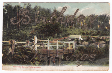 Marysville & District Historical Society
Postcard (item) - Colour tinted postcard, Nicholas John Caire, Marysville Bridge, Victoria, Austr, 1878-1904
One of a series of postcards of photographs taken by socialite photographer Nicholas John Caire.One of a series of postcards of photographs taken by socialite photographer Nicholas John Caire. N.J. Caire had a great love for the area in and surrounding Marysville and in the late 1800's took many photographs of Marysville and its surrounds. N.J. Caire was born in 1837 in Guernsey. He arrived in Adelaide about 1860 along with his parents who encouraged his early interest in photography. He opened a studio in Adelaide in 1867 after traveling extensively throughout the Gippsland taking photographs. After marrying in 1870 he moved to Talbot in Victoria until 1876 when he opened a studio in the Royal Arcade in Melbourne. After 1885 N.J. Caire gave up his city work and made his home in South Yarra and devoted the rest of his life to outdoor photography, specializing in the bush, the gullies and the mountains of south-eastern Victoria.Birthday/ Greetings POST CARD This Space may be Used/ for Correspondence The Address Only to be/ Written Here. 88421 Dear Ivy/ Wishing you/ many happy/ returns of/ the day/ from Reggie Miss Ivy Bastian/ Helston/ Fenwick Street/ Nth Carlton c1918 2nd Bridge The postage stamp has been removed. Helen Boach?marysville, victoria, nicholas john caire, bridge scene, 88421, postcard, souvenir -
 Marysville & District Historical Society
Postcard (item) - Colour postcard, Nicholas John Caire, Scene Watt's River, Fernshaw, 1858-1918
One of a series of postcards of photographs taken by socialite photographer Nicholas John Caire. N.J. Caire had a great love for the area and in the late 1800's took many photographs of Marysville and its surrounds.One of a series of postcards of photographs taken by socialite photographer Nicholas John Caire. N.J. Caire had a great love for the area in and surrounding Marysville and in the late 1800's took many photographs of Marysville and its surrounds. N.J. Caire was born in 1837 in Guernsey. He arrived in Adelaide about 1860 along with his parents who encouraged his early interest in photography. He opened a studio in Adelaide in 1867 after traveling extensively throughout the Gippsland taking photographs. After marrying in 1870 he moved to Talbot in Victoria until 1876 when he opened a studio in the Royal Arcade in Melbourne. After 1885 N.J. Caire gave up his city work and made his home in South Yarra and devoted the rest of his life to outdoor photography, specializing in the bush, the gullies and the mountains of south-eastern Victoria. POST CARD This Space may be used for Correspondence (FOR ADDRESS ONLY) Orange one penny postage stamp with an image depicting Queen Victoria Date stamp/ 8.3.06/ 4AM/ MELBOURNE/ 14 7.3.06 My Dear Em/ I received your kind/ note and will be very pleased/ to go out & see you tomorrow/ but cannot say what/ train I will catch as/ I do not know how/ they run. I will try/ not to miss the train/ though. I heard Vic was/ down will be glad to see/ her love to you both/ Yours in health Mary. Mrs Tribeau/ "Hazel Dell"/ Connell Street/ Hawthornwatt's river, fernshaw, victoria, nicholas john caire, postcard, souvenir -
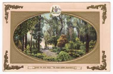 Marysville & District Historical Society
Postcard (item) - Colour postcard, Nicholas John Caire, "Amidst the Gum Trees." "The Bush Hermit, Marysville.", 1858-1918
A postcard of a photograph taken by socialite photographer Nicholas John Caire. N.J. Caire had a great love for the area and in the late 1800's took many photographs of Marysville and its surrounds.One of a series of postcards of photographs taken by socialite photographer Nicholas John Caire. N.J. Caire had a great love for the area in and surrounding Marysville and in the late 1800's took many photographs of Marysville and its surrounds. N.J. Caire was born in 1837 in Guernsey. He arrived in Adelaide about 1860 along with his parents who encouraged his early interest in photography. He opened a studio in Adelaide in 1867 after traveling extensively throughout the Gippsland taking photographs. After marrying in 1870 he moved to Talbot in Victoria until 1876 when he opened a studio in the Royal Arcade in Melbourne. After 1885 N.J. Caire gave up his city work and made his home in South Yarra and devoted the rest of his life to outdoor photography, specializing in the bush, the gullies and the mountains of south-eastern Victoria. POST CARD A.G.J. AFFIX/ STAMP THIS SPACE MAY BE USED/ FOR COMMUNICATION. THE ADDRESS ONLY TO BE/ WRITTEN HERE. Printed in Saxony COPYRIGHT. To Dear Emily/ With every loving/ Wish for many/ happy birthday/ with love from me/ Myrtlemarysville, victoria, george, george locke, nicholas john caire, cumberland valley, hermit, postcard, souvenir -
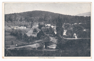 Marysville & District Historical Society
Postcard (item) - Black and white postcard, Nicholas John Caire, Township of Marysville, 1858-1918
One of a series of postcards of photographs taken by socialite photographer Nicholas John Caire. N.J. Caire had a great love for the area and in the late 1800's took many photographs of Marysville and its surrounds.One of a series of postcards of photographs taken by socialite photographer Nicholas John Caire. N.J. Caire had a great love for the area in and surrounding Marysville and in the late 1800's took many photographs of Marysville and its surrounds. N.J. Caire was born in 1837 in Guernsey. He arrived in Adelaide about 1860 along with his parents who encouraged his early interest in photography. He opened a studio in Adelaide in 1867 after traveling extensively throughout the Gippsland taking photographs. After marrying in 1870 he moved to Talbot in Victoria until 1876 when he opened a studio in the Royal Arcade in Melbourne. After 1885 N.J. Caire gave up his city work and made his home in South Yarra and devoted the rest of his life to outdoor photography, specializing in the bush, the gullies and the mountains of south-eastern Victoria. POST CARD The Address to be written on this side This space may be used for Correspondence/ within the Commonwealth at 1d. rate./ Foreign, charged ordinary letter rate. St. Fillans/ Narbethong This is the/ little village we/ visited last week/ E.L. Mrs R.D. Cole/ Mozart Villa/ Bethanga One penny Victorian postage stamp Date Stamp/ Illegible Date Stamp/ JA 16/ 6/ VICTORIA/ Illegiblemarysville, victoria, nicholas john caire, postcard, souvenir -
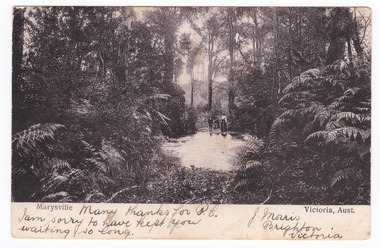 Marysville & District Historical Society
Postcard (item) - Black and white postcard, Nicholas John Caire, Marysville Victoria, Aust, 1858-1918
One of a series of postcards of photographs taken by socialite photographer Nicholas John Caire. N.J. Caire had a great love for the area and in the late 1800's took many photographs of Marysville and its surrounds.One of a series of postcards of photographs taken by socialite photographer Nicholas John Caire. N.J. Caire had a great love for the area in and surrounding Marysville and in the late 1800's took many photographs of Marysville and its surrounds. N.J. Caire was born in 1837 in Guernsey. He arrived in Adelaide about 1860 along with his parents who encouraged his early interest in photography. He opened a studio in Adelaide in 1867 after traveling extensively throughout the Gippsland taking photographs. After marrying in 1870 he moved to Talbot in Victoria until 1876 when he opened a studio in the Royal Arcade in Melbourne. After 1885 N.J. Caire gave up his city work and made his home in South Yarra and devoted the rest of his life to outdoor photography, specializing in the bush, the gullies and the mountains of south-eastern Victoria. Many thanks for P.C./ I am sorry to have kept you/ waiting so long. J. Morris/ Brighton/ Victoria POST CARD [THIS SPACE MAY BE USED FOR COMMUNICATION] ]FOR WRITING ADD (rest has been removed when stamp was removed) Mr Herman Frock/ Petersgaard/ Langebak Street/ Denmark Date Stamp/ MELBOURNE/ FEB 2?/ 4.33/ 1906 Date Stamp/ MASNEDSUND/ KALLEHAVE/ 24.3.06.1.4 Stamp/ BILL HOPKINS COLLECTION/ 21 KENSINGTON PARK ROAD W11/ NOTTING HILL GATE LONDON marysville, victoria, nicholas john caire, bill hopkins collection, postcard, souvenir -
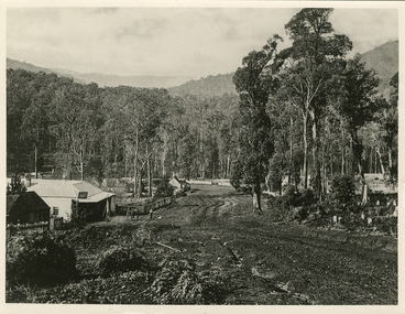 Marysville & District Historical Society
Photograph (Item) - Black and white photograph, Nicholas John Caire, c1880-1884
A copy of an early black and white photograph of Murchison Street in Marysville in Victoria taken by Nicholas John Caire.A copy of an early black and white photograph of Murchison Street in Marysville in Victoria taken by Nicholas John Caire. Murchison Street was named for Roderick Impey Murchison who was one of the most distinguished geologists of the 19th century. His liberality and social position plus the pride he took in his science were of immense value in furthering the cause of learning in Britain. Nicholas John Caire was born in 1837 in Guernsey. He arrived in Adelaide about 1860 along with his parents who encouraged his early interest in photography. He opened a studio in Adelaide in 1867 after traveling extensively throughout the Gippsland taking photographs. After marrying in 1870 he moved to Talbot in Victoria until 1876 when he opened a studio in the Royal Arcade in Melbourne. After 1885 Nicholas John Caire gave up his city work and made his home in South Yarra and devoted the rest of his life to outdoor photography, specializing in the bush, the gullies, and the mountains of south-eastern Victoria. LES HARSANT/ HEALESVILLE Entrance to Marysville/ from Nicholas Caire photo - c.1880-84 See Pitkethly, N.J. Caire, Landscape Photographer Pithkethly, Rosanna, Vic. 1988; plate 17murchison street, marysville, victoria, nicholas john caire, roderick impey murchison, geology, geologist -
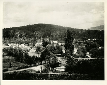 Marysville & District Historical Society
Photograph (Item) - Black and white photograph, Nicholas John Caire, c1900
A copy of an early black and white photograph of Marysville in Victoria taken by Nicholas John Caire.A copy of an early black and white photograph of Marysville in Victoria taken by Nicholas John Caire. N.J. Caire had a great love for the area in and surrounding Marysville and in the late 1800's took many photographs of Marysville and its surrounds. N.J. Caire was born in 1837 in Guernsey. He arrived in Adelaide about 1860 along with his parents who encouraged his early interest in photography. He opened a studio in Adelaide in 1867 after traveling extensively throughout the Gippsland taking photographs. After marrying in 1870 he moved to Talbot in Victoria until 1876 when he opened a studio in the Royal Arcade in Melbourne. After 1885 N.J. Caire gave up his city work and made his home in South Yarra and devoted the rest of his life to outdoor photography, specializing in the bush, the gullies and the mountains of south-eastern Victoria. Photography - Caire, N.J. Town of Marysville In: Victorian Views 1905 - Album 224. P.24 National Library of Australiamarysville, victoria, nicholas john caire -
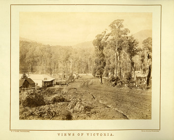 Marysville & District Historical Society
Photograph (Item) - Black and white photograph, Nicholas John Caire, Views of Victoria, Unknown
An early black and white photograph of the main road in Marysville in Victoria taken by Nicholas John Caire.An early black and white photograph of the main road in Marysville in Victoria showing the Keppels Australian Hotel which was built and opened by the Keppel Family in 1865. The Keppels Australian Hotel was the first hotel to be opened in Marysville. The Keppel Family were among Marysville's earliest pioneering families. This photograph was taken by Nicholas John Caire. N.J. Caire had a great love for the area in and surrounding Marysville and in the late 1800's took many photographs of Marysville and its surrounds. N.J. Caire was born in 1837 in Guernsey. He arrived in Adelaide about 1860 along with his parents who encouraged his early interest in photography. He opened a studio in Adelaide in 1867 after traveling extensively throughout the Gippsland taking photographs. After marrying in 1870 he moved to Talbot in Victoria until 1876 when he opened a studio in the Royal Arcade in Melbourne. After 1885 N.J. Caire gave up his city work and made his home in South Yarra and devoted the rest of his life to outdoor photography, specializing in the bush, the gullies and the mountains of south-eastern Victoria. N.J. CAIRE, PHOTOGRAPHER ROYAL ARCADE, MELBOURNEmarysville, victoria, keppels australian hotel, keppel family, nicholas john caire, photograph -
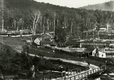 Marysville & District Historical Society
Photograph (Item) - Black and white photograph, Nicholas John Caire, 1883
An early black and white photograph of the township of Marysville in Victoria.An early black and white photograph of the township of Marysville in Victoria. This photograph of Marysville was taken by Nicholas John Caire in 1883. Nicholas John Caire was born in 1837 in Guernsey. He arrived in Adelaide about 1860 along with his parents who encouraged his early interest in photography. He opened a studio in Adelaide in 1867 after traveling extensively throughout the Gippsland taking photographs. After marrying in 1870 he moved to Talbot in Victoria until 1876 when he opened a studio in the Royal Arcade in Melbourne. After 1885 Nicholas John Caire gave up his city work and made his home in South Yarra and devoted the rest of his life to outdoor photography, specializing in the bush, the gullies, and the mountains of south-eastern Victoria. nicholas john caire, marysville, victoria -
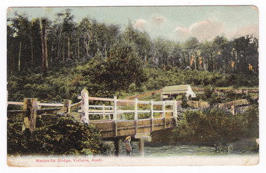 Marysville & District Historical Society
Postcard (Item) - Colour tinted postcard, Nicholas John Caire, Marysville Bridge, Victoria, Austr, 1878-1904
One of a series of postcards of photographs taken by socialite photographer Nicholas John Caire.One of a series of postcards of photographs taken by socialite photographer Nicholas John Caire. N.J. Caire had a great love for the area in and surrounding Marysville and in the late 1800's took many photographs of Marysville and its surrounds. N.J. Caire was born in 1837 in Guernsey. He arrived in Adelaide about 1860 along with his parents who encouraged his early interest in photography. He opened a studio in Adelaide in 1867 after traveling extensively throughout the Gippsland taking photographs. After marrying in 1870 he moved to Talbot in Victoria until 1876 when he opened a studio in the Royal Arcade in Melbourne. After 1885 N.J. Caire gave up his city work and made his home in South Yarra and devoted the rest of his life to outdoor photography, specializing in the bush, the gullies and the mountains of south-eastern Victoria.POST CARD This Space may be Used/ for Correspondence The Address Only to be/ Written Here. 88421 Dear Miss McNair./ We arrived home/ quite safely on Sat./ The children met/ us with Fran and/ Auntie Ethel at the/ Circular Quay. All/ were well and real/ glad to have us home/ again. We were so sorry/ we were too late/ for the train. We thought/ we saw Mr Mr McNair walking from/ the train. Love to ????/ Kisses for Ollie from A.M.G. Miss McNair/ Wattle Street/ Bendigo/ Victoriamarysville, victoria, nicholas john caire, bridge scene, 88421, postcard, souvenir -
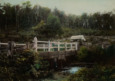 Marysville & District Historical Society
Photograph (Item) - Colour tinted photograph, 1878-1904
A copy of an early colour tinted photograph of a wooden bridge in Marysville in Victoria.A copy of an early colour tinted photograph of a wooden bridge in Marysville in Victoria. This photograph was taken by Nicholas John Caire between 1878 and 1904. Nicholas John Caire was born in 1837 in Guernsey. He arrived in Adelaide about 1860 along with his parents who encouraged his early interest in photography. He opened a studio in Adelaide in 1867 after traveling extensively throughout the Gippsland taking photographs. After marrying in 1870 he moved to Talbot in Victoria until 1876 when he opened a studio in the Royal Arcade in Melbourne. After 1885 Nicholas John Caire gave up his city work and made his home in South Yarra and devoted the rest of his life to outdoor photography, specializing in the bush, the gullies, and the mountains of south-eastern Victoria. nicholas john caire, marysville, victoria -
 Federation University Historical Collection
Photograph - Art Student, University of Ballarat Student study, c2005, c2005
Federation University Australia was established on 1 January 2014. Formerly known as the University of Ballarat, its enabling legislation was the University of Ballarat Amendment (Federation University Australia) Act 2013. Although formally created as a University in 1994, the University of Ballarat has a lineage back to 1870 with the establishment of the School of Mines Ballarat, making it the third institution of higher learning to be established in Australia and the first to be established in regional Australia. On 1 January 1994, Ballarat University College became the University of Ballarat and in 1998 the University merged with three TAFE Institutes to become a dual sector institution with multiple campuses. On 1 January 2014, the University of Ballarat amalgamated with the Monash University Gippsland Campus to form Federation University Australia. The Gippsland Campus also had a long lineage dating back to 1928 with the establishment of the Yallourn Technical School which became a predecessor institution to the Gippsland College of Advanced Education formed in 1968. In 1990, it was renamed the Monash University College and in 1993 became the Gippsland Campus of Monash University. In 2016, Federation University Australia announced plans to take possession, over a two-year period, of Monash’s Berwick Campus in the south-east corridor of Melbourne. Federation University Australia, or FedUni, is headquartered in Ballarat and offers programs in Higher Education and Vocational Education and Training to regional Victoria and beyond. The University’s commitment to educational and social equity, teaching excellence, research distinction, environmental sustainability and regional capacity building has enabled it to develop in a way that draws on its proud heritage to inform its future. Its regional character sets a framework for the University’s priorities but does not constrain it from serving wider community interests, nationally and internationally. The name Federation University Australia was chosen to convey the scope and capacity of an expanded regional university with a federated network of campuses.Colour photograph of students on the grass outside the Union Building on Mt Helen Campus.federation university, mount helen campus, students, alumni, art, painter -
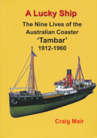 Mission to Seafarers Victoria
Book, Nautical Association of Australia Inc, A Lucky Ship – Nine Lives of Australian Coaster Tambar 1912-1960, 2013
This high-quality book is the extraordinary story of an ordinary little ship that had a long and eventful life. Perhaps few Australian coasters have had a more interesting and varied history. Built in Scotland in 1912 for the North Coast Steam Navigation Company, Tambar worked as a lifeline to isolated river and island communities, first in New South Wales, then for the Tasmanian Government and Holymans in Bass Strait (King Island) and as the last steamer serving the Gippsland Lakes. In between she even spent a few years in Papua New Guinea. When World War II broke out, Tambar was commissioned into the RAN as an auxiliary minesweeper, but after the terrible Darwin air raid in 1942 became the first vessel of the newly formed Salvage Board, later assisting in the search for survivors of the Battle of the Coral Sea. Returning to Bass Strait in 1944 for a few more years, she then spent the 1950s on standby as a salvage vessel in Melbourne, working on Merilyn, Terawhiti, E.J. Fairnie, and River Burnett. Craig Mair grew up in Grangemouth, Scotland where Tambar was built, and became interested after inheriting a builder's model from his father. He has consulted thousands of records, including the ship's logs, tracked down witnesses, and assembled over 100 photographs and maps to give a unique insight into Tambar's story, and coastal Australia in the middle decades of the twentieth century, before roads took over the transport task. Besides many colourful stories of shipwrecks and strandings, strange cargoes, salty characters, exotic places, wartime air raids, and salvage jobs, the book includes a definitive account of the worst Second World War 'friendly fire' incident in Australian waters in Moreton Bay in 1942.250 pages, Appendices, Bibliography and Indices, extensively illustratednon-fictionThis high-quality book is the extraordinary story of an ordinary little ship that had a long and eventful life. Perhaps few Australian coasters have had a more interesting and varied history. Built in Scotland in 1912 for the North Coast Steam Navigation Company, Tambar worked as a lifeline to isolated river and island communities, first in New South Wales, then for the Tasmanian Government and Holymans in Bass Strait (King Island) and as the last steamer serving the Gippsland Lakes. In between she even spent a few years in Papua New Guinea. When World War II broke out, Tambar was commissioned into the RAN as an auxiliary minesweeper, but after the terrible Darwin air raid in 1942 became the first vessel of the newly formed Salvage Board, later assisting in the search for survivors of the Battle of the Coral Sea. Returning to Bass Strait in 1944 for a few more years, she then spent the 1950s on standby as a salvage vessel in Melbourne, working on Merilyn, Terawhiti, E.J. Fairnie, and River Burnett. Craig Mair grew up in Grangemouth, Scotland where Tambar was built, and became interested after inheriting a builder's model from his father. He has consulted thousands of records, including the ship's logs, tracked down witnesses, and assembled over 100 photographs and maps to give a unique insight into Tambar's story, and coastal Australia in the middle decades of the twentieth century, before roads took over the transport task. Besides many colourful stories of shipwrecks and strandings, strange cargoes, salty characters, exotic places, wartime air raids, and salvage jobs, the book includes a definitive account of the worst Second World War 'friendly fire' incident in Australian waters in Moreton Bay in 1942.naa, australian national line, interest group, moreton bay, tambar, coaster, ships -
 Bairnsdale RSL Sub-Branch Inc.
Commonwealth War Graves Commission, Her Majestry,s Stationary Office by the Campfield Press, Their Name Liveth Vol VI Part II, 1968
Some Pictures of War Cemeteries of South -East Asia,The Pacific Islands and Japan 1914-1918 and 1939-1945Red covered book Their name Liveth on top of cover Seal of Commonwealth War Graves Commission under TitleTheir Name Liveth Commonwealth War Graves Commissionjapan, war, east, port, islands, new, guinea, south, cemeteries, asia, pacific, fiji, caledonia, adelaide, rabaul, lea, morsby, labuan, yokohama, kranji, singaporechangi, kanchanaburi, thailand, thanbyuzayat, burma -
4th/19th Prince of Wales's Light Horse Regiment Unit History Room
Regimental Scrap Book: 1990-1999, 2009
Archival quality A3 loose leaf slip case containing memorabilia documents, cuttings and photos about the Regiment for the period 1990-1999. Contents include:Training, Ceremonial, social activities. Hansard 18 Oct 1990 re future of the Regiment. Threats to the Regiment. Chief of General Staff Commendation to A Squadron 4/19 PWLH for assistance with flood emergency in Gippsland April 1990. Meritorious Unit Commendation to Prince of Wales Light Horse Troop while attached to 173 US Airborne Brigade, South Vietnam 1965/66. Freedom of City of Melbourne May 1992. 50th Birthday of Regiment. Closure of Traralgon Depot 1998.ceremonial, training, vietnam war, history 4 19 prince of wales s light horse, freedom of city melbourne, freedom of city traralgon, traralgon army depot, commendations, gippsland floods -
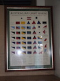 4th/19th Prince of Wales's Light Horse Regiment Unit History Room
Colour Patch Display, Frontier Military History Services, Australian Light Horse Colour Patches of the 1st AIF 1915-1920 & AMF/CMF 1921-1940's, 24/07/2010
Display board of replica cloth colour patches, mounted in glass fronted wooden frame. Colour patches displayed are those of : 1st Cavalry Division HQ (CMF) Desert Mounted Corps HQ 2nd Cavalry Division HQ (CMF) HQ 1st Light Horse Brigade (AIF & CMF) HQ 2nd Light Horse Brigade (AIF & CMF) HQ 3rd Light Horse Brigade (AIF & CMF) HQ 4th Light Horse Brigade (AIF) HQ 5th Light Horse Brigade (AIF & CMF) HQ 4th Light Horse Brigade (CMF) HQ 6th Light Horse Brigade (CMF) 1st Light Horse Regiment / 1st Royal NSW Lancers 5th Light Horse Regiment / 5th Wide Bay & Burnett Light Horse 8th Light Horse Regiment / 8th Indi Light Horse Regiment 4th Light Horse Regiment / 4th Corangamite Light Horse Regiment 14th Light Horse Regiment / 14th West Moreton Light Horse Regiment 18th Adelaide Lancers 4th Light Horse Regiment / 1st Aust Div Mounted Regiment / 2nd ANZAC Mounted Regiment / 22nd Corps Mounted Regiment. 2nd Light Horse Regiment / 2nd Moreton Light Horse Regiment 6th Light Horse Regiment / 6th NSW Mounted Rifles 9th Light Horse Regiment / 9th Flinders Light Horse Regiment 11th Light Horse Regiment / 11th Darling Downs Light Horse Regiment 15th Light Horse Regiment / 15th Northern River Lancers 21st Riverina Light Horse 13th Light Horse Regiment / 2nd Aust Div Mounted Regiment / 1st ANZAC Mounted Regiment / Aust Corps Mounted Regiment / 13th Gippsland Light Horse Regiment 3rd Light Horse Regiment / 3rd South Australian Mounted Rifles 7th Light Horse Regiment / 7th Australian Horse 10th Light Horse Regiment / 10th Western Australian Mounted Infantry 12th Light Horse Regiment / 12th New England Light Horse Regiment 17th Prince of Wales Light Horse Regiment 22nd Tasmanian Mounted Infantry 11th Light Horse Regiment / 4th Aust Div Mounted Regiment / 24th Gwydir Light Horse Regiment 1st Machine Gun Squadron / 25th Light Horse (MG) 2nd Machine Gun Squadron / 16th Hunter River Lancers 3rd Machine Gun Squadron / 20th Victorian Mounted Rifles 4th Machine Gun Squadron / 26th Light Horse (MG) 5th Machine Gun Squadron / 19th Yarrowee Light Horse 23rd Barossa Light Horse Regiment 12th Light Horse Regiment / 5th Aust Div Mounted Regiment 1st Light Horse Field Ambulance 2nd Light Horse Field Ambulance 3rd Light Horse Field Ambulance 4th Light Horse Field Ambulance 5th Light Horse Field Ambulance 4th Signal Troop / 4th Light Horse brigade 6th Mobile Veterinary Section /1st Light Horse Brigade 7th Mobile Veterinary Section / 2nd Light Horse Brigade 8th Mobile Veterinary Section / 3rd Light Horse Brigade 9th Mobile Veterinary Section / 4th Light Horse brigade 10th Mobile Veterinary Section / 5th Light Horse Brigade 5th Signal Troop / 5th Light Horse Brigade 1st Signal Squadron / NZ & Aust Mounted Div Signal SquadronColour Patch Display No 39. Includes detailed notes about history, usage and design of colour patchesworld war one, ww1, army, aif, insignia, heraldry, light horse, militia, badges, colour patches, cmf -
 Warrnambool and District Historical Society Inc.
Brass Plate, Warrnambool Chamber of Commerce
The Chamber of commerce was commenced in Warrnambool in March 1888 to consider firstly what could be done to assist the dairy industry which at the time was facing record low prices for its butter. Co-operatives had been started in Gippsland around that time and it was decided to start co-operative dairy factories at Woodford, Panmure and Framlingham, shortly followed by the Warrnambool Butter and cheese factory at Allansford. The Chamber over the next thirty years covered many business issues such as trading hours, transport, and public holidays but also put forward ideas which related to water and sewerage matters.ideas were even put forward in 1907 regarding utilising the Hopkins Falls to generate power As an organisation it has waxed and waned in Warrnambool with various names but all working towards improving trade and business opportunities in the town. A link to one of Warrnambool's organisations which over the decades has worked to improve the prosperity of the townRectangular brass plate with text stamped and infilled with black.Six screw holes. Fine bevelled edge.Warrnambool Chamber of Commerce. Regd Office.warrnambool, warrnambool chamber of commerce, commerce in warrnambool -
 Orbost & District Historical Society
programs, 1961
The Snowy River Shire was a local government area in the Australian Alps region of New South Wales, Australia from 1939 until May 2016. It was named after the Snowy River that runs through it. Prior to 1936, it had been named as Dalgety Shire since establishment in 1906. This opening of the Monaro - Gippsland Road took place on 4th May 1961. There had long been a movement in Monaro for the construction of a road to connect Monaro and Gippsland, via Inglebyra and Black Mountain. The only track was for stock, made by pioneers many years ago, and it was very circuitous. It was stated at a meeting at Dalgety that the road would open up large areas for settlement for grazing, and for timber suitable for bridgé building. The road would assist stock deal ing between Monaro and Gippsland. It would also considerably shorten the distance from Victoria for tourists visiting Canberra and Kosciusko. A committee was formed to put the proposal before the Dalgety Shire Council in the 1930s.This item is a useful research tool.Four copies of a road opening program. It has black print on white. There are black / white photographs, historical details and details of the official opening.program monaro-road snowy-river-shire