Showing 1160 items
matching yarra river -- melbourne
-
 Eltham District Historical Society Inc
Document - Folder, Newman, Charles
British army officer Major Charles Newman was an early settler on the Yarra River at Templestowe after serving in India in the East India Company. Later be married and moved to Tasmania, farming at Black Brush near Pontville. In 1835 he came to the Port Phillip District and explored the Yarra River, returning with his family. David Crockett and Hazel Poulter researched, respectively, Charles Newman and the Templestowe area, identifying the Newman house, Pontville, on the Yarra banks. David Crockett also researched James and Anne Anderson. Contents Newspaper article: "David fills in the gaps", Diamond Valley News, 16 December 1986.29 October 1985, p62. Story of Charles Newman and of David Crockett and Hazel Poulter's researches. Letter, A (Tony) B Owen to Eltham Historical Society, 12 March 2018, enclosing information about Major Charles Newman. Email, Eltham District Historical Society to Tony Owen, acknowledging receipt of information about Major Charles Newman. Photocopy of pages from "Glimpses of Life in Victoria", pp38-43. Flier, "Heritage Events in Nillumbik, 2005". Photocopy of pages from unidentified volume, chapter headed "The Bush", and part chapter IV "Bushrangers". Warrandyte Historical Society publication "The Wurundjeri Clan of the Kulin". Whitehorse Manningham Heritage Network search results for "Andersons Station on the Yarra Yarra", "A brief history of Warrandyte", "The branch is broken", "Melbourne's historic home", "Land with infamous past", "Charles Newman's original grave at Monckton", and "Site of Major Newman's land". Photocopy of pages from "Templestowe - a folk history", Hazel Poulter, 1985,: "The squatter, Major Charles Newman".Newspaper clippings, A4 photocopies, etccharles newman, british east india company, templestowe vic, warrandyte vic, david crockett, hazel poulter, james anderson, anne anderdon, a b owen, wurundjeri clan of the kulin, andersons station on the yarra river -
 Eltham District Historical Society Inc
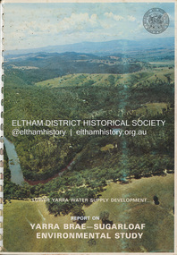
Book, Melbourne Metropolitan Board of Works, Lower Yarra Water Supply DeVelopment: Report on Yarra Brae-Sugarloaf Environmental Study, April 1974
environmental study, melbourne metropolitan board of works, report, sugarloaf reservoir, water catchment area, water supply, yarra brae dam, yarra river valley -
 Eltham District Historical Society Inc
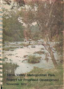
Book, Melbourne Metropolitan Board of Works, Yarra Valley Metropolitan Park : report for proposed development : a recreation, conservation and landscape planning study for the Melbourne and Metropolitan Board of Works, Metropolitan Parks Division / by Scott and Furphy Engineers Pty Ltd, Landscape Division, November 1979
melbourne metropolitan board of works, yarra river, yarra river valley, yarra valley metropolitan park -
 Eltham District Historical Society Inc
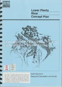
Book, Brett Cheatley et al, Lower Plenty River Concept Plan; Maroondah Pipetrack - Greensborough to Yarra/Plenty Confluence; Draft Volume B, Resource Description and Issues, February 1991
concept plan, melbourne metropolitan board of works, plenty river, report -
 Eltham District Historical Society Inc
Photograph, Fay Bridge, Yellow Box Gum tree near junction of Main Yarra Trail and Mullum-Mullum Trail, Templestowe, 7 July 2019
Situated in the wetlands on the trail opposite the Pontville Homestead, former home of Major Charles Newman and across the Yarra River from Sweeneys Flats, Eltham. Newman also purchased Allotment 5, Section 2 (in Ely Street, Eltham) at public autction on 17 September 1851. It was the only Section 2 allotment purchased at the firts Elthan Town Allotments public auction.fay bridge collection, sweeneys flats, 2019-07-07, major charles newman, mullum mullum creek, pontville homestead, significant tree, yellow box gum (eucalyptus melliodora) -
 Eltham District Historical Society Inc
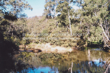
Photograph, Fay Bridge, Swimming spot in Yarra River off Laughing Waters Road, Eltham near Caitlin's Retreat, n.d
fay bridge collection, caitlin's retreat, laughing waters, swimming pool -
Eltham District Historical Society Inc
Document - Folder, Panton, Joseph Anderson
Joseph Anderson Panton (1831-1913) came from Scotland to Australia in 1851. In Bendigo, he was appointed assistant gold commissioner 1852 and senior commissioner 1854. Over the years, he served as magistrate at Jamieson-Wood's Point, Anderson's Creek, Heidelberg, Geelong and Melbourne. He owned land on the Yarra River and Panton Hill is named for him. Contents Map: J A Panton's landholding with surrounding landholders. Printout and photocopy: Panton, Joseph Anderson, Australian Dictionary of Biography entry. Notes: Joseph Anderson Panton, brief biographical notes. Research Enquiry Form: Vivienne Worthington, seeking sources of information regarding Joseph Anderson Panton, 14 June 2017. Email and associated documents: Michael Kennedy seeking assistance of Eltham Gateway Action Group regarding proposed felling of manna gum tree near bridge across Diamond Creek, on land once held by Joseph Anderson Panton. Newspaper article: "Historic painting might be lost to Victoria," The Age, 22 October 1985. Painting by Joseph Anderson Panton of Captain William Lonsdale's house, Victoria's first Government House, to be in forthcoming auction. Newspaper clippings, A4 photocopies, etcjoseph anderson panton, william b burnley, w walsh, r hall, r a davidson, j orford, b speers, a speers, william bell, t baillie, d mcloughlin, t prior, g e hodgkins, n rodda, w r belcher, g d boursiquot, j p imley, t b darling, h g jones, t sweny, r lane, w gordon, a e morris, d w thring, j carfrae, thomas sweeney, michael kennedy, vivienne worthington, william crozier, j frank, p carrucan, panton hill -
 Eltham District Historical Society Inc
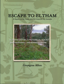
Book, Georgina Allen, Escape to Eltham: A report on the Lanes who left Limerick for Australia, 2013
ESCAPE TO ELTHAM traces the family of John and Anna Lane who lived in Shanagolden in County Limerick during the early and middle parts of the 1800s. They lived during a time of conflict and famine. This story follows the movements of their son, Richard, and daughter, Anne, who migrated to Australia. The marriage of Anne to Tobias Butler and Richard's life establishing his farm on the Yarra River in the 1850s are explored. Marriage, children, deaths and a murder in 1861 are changes forced on the family. Richard's son, Patrick, marries a young Bridget Carrucan but when the global recession of the 1890s decimates Patrick's businesses he heads to the arid Western Australian goldfields to 'make his fortune'. The large family follows and settles in Boulder where the behaviour of a couple of the boys gets them into scapes with the law. This story celebrates the tenacity of a family whose members left adversity in Ireland hoping for a kinder life in Australia.john lane, anna lane, richard lane, patrick lane, bridget carrucan -
Eltham District Historical Society Inc
Document - Folder, Porter, John
John Porter owned land at the junction of the Plenty and Yarra Rivers, leased to Thomas Mundy. Contents Photocopies: Victorian Parliamentary Papers, 1864-1865, Vol, 3, No. 22, "Reports of Collectors of Agricultural Statistics", pp95-96. Handwritten notes: On George Porter, John Alfrey, Newspaper clippings, A4 photocopies, etcjohn porter, plenty river, yarra river, thomas mundy'henry stooks, john brown, diamons creek, aitken's creek, evelyn county, george porter, john alfrey -
 Eltham District Historical Society Inc
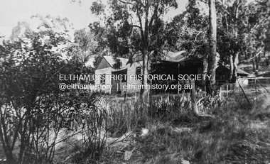
Photograph - Digital copy of photograph, Former Griffith family home, Banoon Road, Eltham, c.1955
Former family home of Mr. Frederick Eldred (Fred) Griffith in the 1950s, where present day Griffith Park is situated on the Yarra River at Eltham. Fred Griffith was also a Councillor (1945, 1951-1953) and former Shire President (1951) of the Shire of Eltham. Faye Walker (nee Harris) spent her first ten years living in the house. She recalls "there was a huge tin shed to the rear but toward the east of the house. I assume this is what people were thinking of when reference was made to the ‘’packing shed’. When I was small in the 50s, the shed was no longer being used for fruit packing but by the Griffith family as storage. Many of the pear trees remained but were no longer a commercial venture. We used to sneak up to the shed to read the National Geographic Magazines."griffith park, eltham, frederick eldred griffith, faye walker (nee harris) collection -
 Eltham District Historical Society Inc
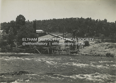
Photograph - Black and White Print, J.E. Barnes, The old water wheel, Warrandyte, c.1920
Josiah Earl BARNES (Australian, 1858–1921) was a noted WW1 photographer who took many photographs of departing troopships and men. The Australian War Memorial holds around 1,436 negatives and prints by J.E. Barnes. His daughter, D. Barnes (married name Smyth) was also a photographer and lived in Diamond Creek from around 1910 to circa 1940.david smyth collection, warrandyte, warrandyte battery, yarra river -
 Eltham District Historical Society Inc
Photograph - Black and White Print, J.E. Barnes, The Yarra at Yarra Glen, c.1920
Josiah Earl BARNES (Australian, 1858–1921) was a noted WW1 photographer who took many photographs of departing troopships and men. The Australian War Memorial holds around 1,436 negatives and prints by J.E. Barnes. His daughter, D. Barnes (married name Smyth) was also a photographer and lived in Diamond Creek from around 1910 to circa 1940.david smyth collection, yarra glen, yarra river -
 Eltham District Historical Society Inc
Photograph - Black and White Print, J.E. Barnes, Yarra River, Warrandyte / Eltham, c.1920
Josiah Earl BARNES (Australian, 1858–1921) was a noted WW1 photographer who took many photographs of departing troopships and men. The Australian War Memorial holds around 1,436 negatives and prints by J.E. Barnes. His daughter, D. Barnes (married name Smyth) was also a photographer and lived in Diamond Creek from around 1910 to circa 1940.david smyth collection, eltham, warrandyte, yarra river -
 Eltham District Historical Society Inc
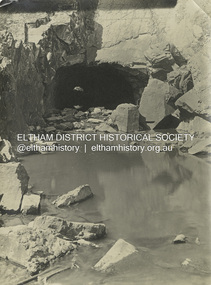
Photograph - Black and White Print, J.E. Barnes, Warrandyte Tunnel, c.1920
Josiah Earl BARNES (Australian, 1858–1921) was a noted WW1 photographer who took many photographs of departing troopships and men. The Australian War Memorial holds around 1,436 negatives and prints by J.E. Barnes. His daughter, D. Barnes (married name Smyth) was also a photographer and lived in Diamond Creek from around 1910 to circa 1940.david smyth collection, pound bend tunnel, warrandyte, yarra river -
 Eltham District Historical Society Inc
Photograph - Black and White Print, D. Barnes, The old water wheel, Warrandyte, c.1920
Josiah Earl BARNES (Australian, 1858–1921) was a noted WW1 photographer who took many photographs of departing troopships and men. The Australian War Memorial holds around 1,436 negatives and prints by J.E. Barnes. His daughter, Beatrice Dorothy Barnes (married name Smyth) was also a photographer and lived in Diamond Creek from around 1910 to circa 1940.david smyth collection, warrandyte, warrandyte battery, yarra river -
 Eltham District Historical Society Inc
Photograph - Black and White Print, D. Barnes, Warrandyte Tunnel, c.1920
Josiah Earl BARNES (Australian, 1858–1921) was a noted WW1 photographer who took many photographs of departing troopships and men. The Australian War Memorial holds around 1,436 negatives and prints by J.E. Barnes. His daughter, Beatrice Dorothy Barnes (married name Smyth) was also a photographer and lived in Diamond Creek from around 1910 to circa 1940.david smyth collection, warrandyte, pound bend tunnel, yarra river -
 Eltham District Historical Society Inc
Photograph - Black and White Print, D. Barnes, The River Yarra, Warrandyte, c.1920
Josiah Earl BARNES (Australian, 1858–1921) was a noted WW1 photographer who took many photographs of departing troopships and men. The Australian War Memorial holds around 1,436 negatives and prints by J.E. Barnes. His daughter, Beatrice Dorothy Barnes (married name Smyth) was also a photographer and lived in Diamond Creek from around 1910 to circa 1940.david smyth collection, warrandyte, yarra river -
 Eltham District Historical Society Inc
Photograph, Not Just a Pretty Place, Aleks Danko (2000), Lennister Farm, Eltham South, 2000c
Not Just a Pretty Place acknowledges the cultural significance of this site for the residents of Nillumbik Shire and for the Wurrundjeri community. Historically the confluence of rivers have particular importance as these were sites where rituals and ceremonies took place. The carved bluestone form presents an oversize river pebble that echoes the spirit of the water and draws attention to this location as a meeting place an landmark. Awarded the 2000 Nillumbik Art in Public Places Award and situated behind Lennister Farm near Yarra ParkColour photograph printaleks danko, eltham, lennister farm, yarra park -
 Eltham District Historical Society Inc
Journal, Peter Doughtery, ArtStreams: News in arts and cultural heritage; Vol. 1, No. 2, Dec 1996/Jan 1997, 1996
Vol. 1, No. 2 Dec 1996/Jan 1997 CONTENTS ADVENTURE WITH COLOUR Teenage cancer patients challenge their illness with art 3 CD REVIEWS New music by local musicians 5 LIVE AND LET LIVE 20 years of environmental living 6 AUSTRALIA REVISITED Artist Charles Reddington ponders live 30 years on 8 POETRY REVIEW Anne Delaney looks at new work by Jennifer Harrison and Jordie Albiston 11 PHOTOGRAPHY Katherine Jones aims at hard edges 16 IMAGES FROM A DARK PAST Holocaust survivor paints out a traumatic part of his life 18 MORALITY OF JUSTICE The Truth Game - a play by Ray Mooney 21 ART FROM THE HEART An exhibition that crosses boundaries 22 SHORT STORY New story from an emerging writer 25 ART IN THE CEMETERY Darebin launches a new project to decorate its new mausoleum 28 LISTINGS Artists, performers and galleries 29 KEYWORDS 895 Main Road, 1994 Moet et Chandon Fellowship, Adventure with Colour, Alan Bonney, Alan Constable, Alun Leach-Jones, Amada Laming, Anne Connor & Associates, Anne Delaney, Anthony Day, Art Streams Magazine, Artist-in-residence, Arts by the Waters, Arts project Australia, Auschwitz, Banyule Jazz Festival, Barbara Veheary, Bend of Islands Conservation Association (BICA), Bend of Islands Estate, Bend of Islands, Bill Downing, Bulleen Art & Garden Centre, Bulleen Nursery, Caffe Poco, Carlton Courthouse Theatre, Catani Boulevard, Catherine Oxley Reserve, Charles Reddington, Charlie Dowley, Cheryl Daye, Chris McAuliffe, Clifton Pugh, Colin Lanceley, Cornelia Selover, Creativitie et Handicap Mental (CREAHM), Cynthia Hardman, Cyril Tawney, Damian Eyre, Daniel Lillford, Danuta Michalska, Darebin Arts and Entertainment Centre, Darebin City Council, Department of Fine Arts, Donald Campbell, Dora Zable, Dorothy Berry, dunmoochin, E.H. Cameron, Edward (Ned) Haughton, Edward Car, Elizabeth Vercoe, Eltham High School, Eltham Living and Learning Centre, Environmental Living Zone (ELZ), Eric Bogle, Eucalypso, Felix Tuszynski, Food For All Seasons, Frank Hodgkinson, Fulli Andrinopoulos, Gallery of Georges of Collins Street, Gallery of Slavic Art, Glen Agnes Bend of Islands Estate, Glen Agnes Estate, Gongflers drive, Greg O'Leary, Harold (Jimmy) Fuller, Helen O'Grady Children's Drama Academy, Henley Road, Ian Doolan Hamilton, Ian Gawler, Inside Out/Outside In, Ironbark Road, Janice McBride, Jennifer Harrison, Jennifer McGregor, Jessie Agnes Haughton, Jimmy Pike, Joan Blakey, John Mackay Northe, John Rasmussen, Jordie Albiston, Julian Martin, Kangaroo Ground, Katherine Jones, Kelvin Heffernan, Kew Coattage, Kitty Ginter, Lavita Mossop, Les darcy, Les Gyori, Life with Jane, Lorraine Larter, Luc Boulange, Luciana Giardina, Manningham Artspace, Manningham City Council, Mariann Moxon, Mark Capozzi, Mark Chapman, Mark Wilkinson, Maxine Ryder, Melbourne Police Pipe Band, Mick Woiwod, Mike O'Rourke, Monica Burns, Montsalvat, Myra Hilgendorf, Nancye Ball, Page family, Pam Crohan, Pam Dougherty, Poetry, Preston Public Cemetery, Ray Mooney, Richard Haese, Robert Hughes, Robyn Kirkpatrick, Roger Lemke, Ron Hanson, Sandra Harvey, Shire of Eltham Office site, Shire of Healesville, Shire of Nillumbik, Shire Offices, Sounds by the Waters, Stelio Costa, Steven Tynan, Steven Worrell, Stewart Whiffin, Sue Howard, Sue Whiffin, Sugarloaf Reservoir, Sydney Ball, The Art of Australia, The Mews, The Truth Game, Tom Fantl, Tony Inglese, Tuszynski Survey Exhibition, University of Melbourne, Valerio Ciccone, victorian artists supplies, Watson Creek Bridge, Watsons Creek, Wayne Marnell, Woody Guthrie, Yarra Brae Dam, Yarra River"Peter Dougherty has been involved in the local art scene for many years. As publisher and editor of the arts magazine Artstreams, his comments on the various branches of the arts are widely respected. His "The Arts" column in the Diamond Valley Leader presents a brief summary for a much wider cross section of the local community. Peter also operates his own gallery and the Artstreams Cafe at the St Andrews market. Peter has a wealth of knowledge about present day and historical aspects of local art and artists." - Eltham District Historical Society Newsletter No. 161, March 2005Colour front and back cover with feature articles and literary pieces with photographs and advertisements printed in black and white. 36 pages, 30 cm. Vol. 1, no. 1 (Nov. 1996) - Vol. 10, no. 5 (summer ed. 2005/06) art streams, feliz tuszynski, elizabeth vercoe, eucalypso, bend of islands, charles reddington, jennifer harrison, jordie albiston, katherine jones, anne bonney, mick woiwood, anne connor, anne delaney, ray mooney, pam dougherty, arts project australia, lavita mossop, preston public cemetery, helen o'grady children's drama academy, bulleen nursery -
 Eltham District Historical Society Inc
Calendar, Nillumbik Community Calendar 1996: Nillumbik The Places and the People, 1995
Community Project. One of a series of calendars which the Shire of Eltham and the Shire of Nillumbik published annually Photography by Graham Hosking Photography. Monthly calendar printed in landscape mode, with feature photograph and template of dates for each of the 12 months presented. Includes advertisements. Back of the calendar includes a list of emergency numbers.calendar,1996,shire of nillumbik,research primary school,eltham north adventure playground,edendale gateway,tony trembath,eltham leisure centre,diamond valley railway,kangaroo ground pony club,eltham community and reception centre,eltham community centre,shire of nillumbik,swimming pool,yarra river,, diamond creek trail,yarrambat golf course,sugar loaf reservoir,map -
 Eltham District Historical Society Inc
Journal, Peter Doughtery, ArtStreams: News in arts and cultural heritage; Vol. 2, No. 1, Feb-Mar 1997, 1997
Vol. 2, No. 1, Feb-Mar 1997 CONTENTS MEDALS AND MODERNISM A retrospective look at the cultural impact of the Melbourne Olympics 3 CD REVIEWS 6 NEW HORIZONS Judy Jacques takes a new direction 6 LA MAMA 30 YEARS ON Liz Jones at the helm 10 PAST AS POST CUBISM Annita Furey on Heather Shim men 14 GRAPE GRAZING FESTIVAL Food, wine and music in the Yarra Valley 16 SHORT STORY Fantasia on a cup of coffee 18 WHAT'S ON A round-up of events for February 22 WHO'S TEACHING WHAT Classes in the region 24 FRANCES DUFFY RETROSPECTIVE An artist who extended the boundaries of tonalism 26 ANDY WARHOL AND THE CAN OF SOUP More than 15 minutes of fame 27 A ‘DUTCH’ FESTIVAL COMES TO ST ANDREWS 28 LISTINGS Artists, performers and galleries 29 "Peter Dougherty has been involved in the local art scene for many years. As publisher and editor of the arts magazine Artstreams, his comments on the various branches of the arts are widely respected. His "The Arts" column in the Diamond Valley Leader presents a brief summary for a much wider cross section of the local community. Peter also operates his own gallery and the Artstreams Cafe at the St Andrews market. Peter has a wealth of knowledge about present day and historical aspects of local art and artists." - Eltham District Historical Society Newsletter No. 161, March 2005Colour front and back cover with feature articles and literary pieces with photographs and advertisements printed in black and white. 36 pages, 30 cm. Vol. 1, no. 1 (Nov. 1996) - Vol. 10, no. 5 (summer ed. 2005/06) 1956 melbourne olympics, 1956 olympics, 1995 eltham arts ball, a.d. (archie) colquoun, abu baku, adams of north riding, afandi siyo, albert namatjira, alice (1956), andy warhol, annita furey, anthony dymke, art streams magazine, ballarat school of mines, bathing in the dark, bob sedergren, bob valentine, bourbo's belly, brian brown quntet, bulleen art & garden centre, cafe margot, charles blackman, christine edwards, circushead, clifton pugh, cottlesbridge, council amalgamation, cuddlefish, dave pithouse, david lord, david tolley, dawn sime, dione mcintyre, dixon's creek, edward grigoryan, eltham college concert band, eltham wiregrass gallery, erika mcgilchrist, fergusson winery, food for all seasons, frances duffy, fred williams, frenzi, geoff achison, geoff mainwaring, graeme bell, grape grazing festival, half caste child, heather shimmen, hoodangers, isobel lindsay, james wakeling, janette geri, john brack, john mcall, john murphy, jordie albiston, judy jacques, kath mckinnon, katherine's silly women, kelly 1956, ken harrison, kevin borland, kim harriss quartet, la mama theatre, lauurie dawes, leonard french, lighthouse, liz jones, lloyd jones, lothlorien, lovegroves, lovey's estate, luxum, maelstrom, max meldrum, may grigg, michelle nicolle, mighty servant, mirka mora, miss suzannah espie, moma, montsalvat jazz festival, moonee valley drifters, moonlight shadow, museum of modern art at heide, mystery train, the melbourne jazz band, nicole eveleigh, nigel shipley, olympomania, peter mcintyre, phyllis murphy, pip avent, portrait of georges mora (1956), ray horsfield, red shed theatre company, reed's gallery, richardson house (1955), river house (1955), robin boyd, sandro donatti, secret of the west wind, seville, shantell vineyard, shedlevellers bush band, shirley bourne, sigmund jorgensen, sir william dargie, soul sister swing, sydney nolan, that handsome couple, the band who knew too much, the broken fence (1956), the gusset rustlers, the rhonda movement, the russian gypsey jazz quartet, three amigos, victorian artists supplies, warburton, wholefood delights, yarra valley grape grazing festival, yellow dog jazz band, yering station, art streams -
 Eltham District Historical Society Inc
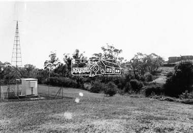
Photograph, Upper Yarra Dam, Spring Tour, 22 Oct 1995, 22/10/1995
EXPLORING THE UPPER YARRA (Newsletter No. 105, November 1995, by Bettina Woodburn) We enjoyed the Spring Excursion, this year "Exploring the Upper Yarra" - in spite of the constant rain and the countryside under the cloud cover, especially in the valleys, being mainly shiny shades of green. The occasional fields of buttercups, clumps of arum lilies and splendid rhododendron and other flowering bushes became very special. The Cobb and Co coach was warm and a cosy retreat as we zig-zagged on the highways and byways to glimpse the Yarra River, upstream and down, its secret places, and particularly the many bridges. Russell excelled as 'Poet Laureate', reading from Dacre Smyth's book. This 1979 publication includes paintings of all the bridges along the river with poems and brief descriptions of each one. Some of the bridges are in out of the way places and are not very well known. We looked forward to hearing the poetry as much as seeing the ' constructions'…Big Pat (was he short or tall, lean or fat? He did win the two hundred pound reward for discovering gold and had the creek named after him), about the 'Eddies'?, and the disliked 'meccano' bridge in Warburton, etc. etc. The hot roast lunch in the old Reefton Hotel was also most welcome. It was easy to imagine it peopled by miners and early settlers. Starting by crossing the new (1974) concrete bridge at Warrandyte we headed through Wonga Park with views to the Christmas Hills and to the escarpment of the Yering Gorge, which causes flood waters to back up through the Yarra Glen plain, so avoiding disasters downstream. At the end of a long driveway we found the wooden, privately owned Henley Bridge (1935 after the 1934 floods). This facilitates access to different parts of Henley Farm and to Lilydale. Everard Park, named after Blanche Shallard's father, a State Member for 17 years, below the Highway Yarra crossing was in need of care. It is 10 miles from Yarra Glen by road but, as "Yarra Marra” canoeists well know, 32 winding miles down by water. After more delightful countryside scenes we joined the Warburton Highway at Woori Yallock. From the old Railway Station at Launching Place the Centennial Trail for walkers, cyclists and ' horse riders has replaced the rails. The line from Lilydale was opened in 1901, and the last diesel freight train ran to Warburton in 1965. It continued to rain as we had morning tea in Warburton in a shelter between footbridges. From here we continued upstream past the Bridge to O'Shannasy Lodge and Reservoir, Starvation Creek, and the Peninsular tunnel (miners dug it as at Pound Bend) which we visited (scrambling down those steps!) on our return after lunch. Our furthermost point was the Upper Yarra Dam Reserve (and vast catchment area). Finished in 1957 after ten years work and 100 years after Yan Yean, it supplies much of Melbourne's water. After crossing the 30m Launching Place Bridge to the Eltham side of the Yarra and Healesville, we saw in the distance the Yarra Glen Timber Trestle Bridge over the river flats "the longest for years in the land it was said!" Harry's dream of "better weather over the Divide" unfortunately didn't come true, but I'm sure we 36 members will retain happy memories of a day that was wet and green and filled with Bridges. Bettina Woodburn - October 1995 Record of the Society's history of activities - Spring 1995 excursionColour photographshire of eltham historical society, activities, upper yarra dam, henley bridge -
 Eltham District Historical Society Inc
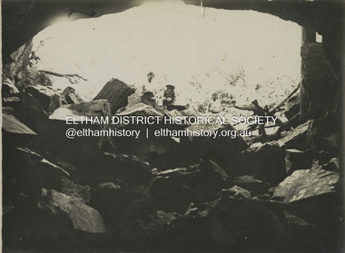
Photograph, Sketch of man on bridge over creek, 1971
Sketch of a man with a fishing pole standing on a bridge over a creek, stream or river in a bush setting. Unidentified artist and location.This photo forms part of a collection of photographs gathered by the Shire of Eltham for their centenary project book, "Pioneers and Painters: 100 years of the Shire of Eltham" by Alan Marshall (1971). The collection of over 500 images is held in partnership between Eltham District Historical Society and Yarra Plenty Regional Library (Eltham Library) and is now formally known as 'The Shire of Eltham Pioneers Photograph Collection.' It is significant in being the first community sourced collection representing the places and people of the Shire's first one hundred years.Digital imagesepp, shire of eltham pioneers photograph collection, fishing, creek, sketch, tranquil, unidentified, other areas, bush, outdoors, country life -
 Eltham District Historical Society Inc
Negative - Photograph, Floodwaters, Diamond Creek, Eltham, 1934
The Diamond Creek in flood near the Main Road bridge at Eltham, Victoria. The Yarra also was in flood. In early December 1934 the "Greatest flood in the history of the Yarra" occured, according to The Argus newspaper. Bridges and houses were swept away with hundreds of people left homeless across the state. The historic 1934 flood of the Diamond Creek and Yarra River set the criteria for future planning with respect to flood water rise. Noted on reverse of print - Copied by Hugh Fisher, 82 Lygon St., BrunswickThis photo forms part of a collection of photographs gathered by the Shire of Eltham for their centenary project book,"Pioneers and Painters: 100 years of the Shire of Eltham" by Alan Marshall (1971). The collection of over 500 images is held in partnership between Eltham District Historical Society and Yarra Plenty Regional Library (Eltham Library) and is now formally known as the 'The Shire of Eltham Pioneers Photograph Collection.' It is significant in being the first community sourced collection representing the places and people of the Shire's first one hundred years.Digital image 4 x 5 inch B&W Neg (2 frames on one neg) Print 9 x 15.5 cmOn reverse of print - "Copied by Hugh Fisher, 82 Lygon St., Brunswick" (for Shire of Eltham)sepp, shire of eltham pioneers photograph collection, eltham, floods, 1934 flood, diamond creek (creek), floodwater -
 Eltham District Historical Society Inc
Photograph, Plenty River at end of Palara Court, Montmorency, c.September 1966, 1966c
Black and white photographic printOriginally located in a Filmpro King Size Prints processing envelope $3.01 Shire of Eltham 9/9/66 and noted as Calrossie Ave area and crossed out Eltham-Yarra Glen Road, Bridge Street to Elsa Court existing conditions mid 1967montmorency, palara court, plenty river -
 Eltham District Historical Society Inc
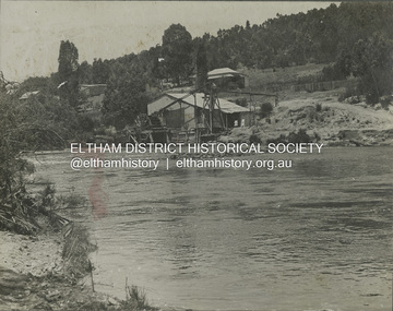
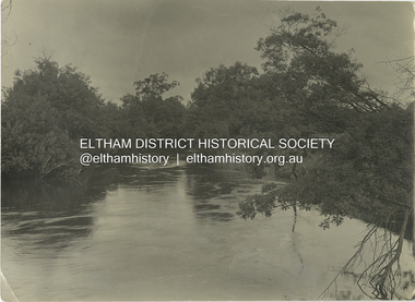
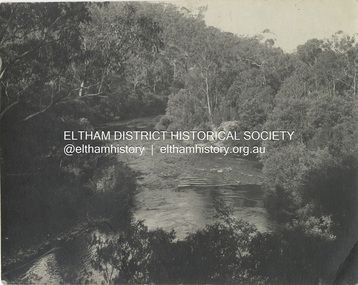
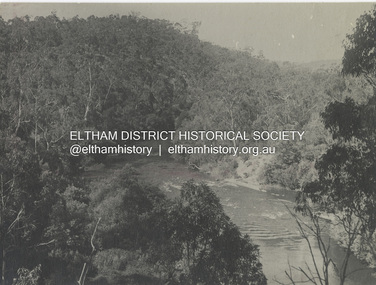
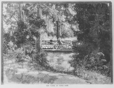
Negative - Photograph, Australasian Sketcher, The Yarra at Yarra Glen, 1889
"As the train on its journey from Melbourne to Healesville crosses the Yarra-flats, many glimpses are caught of the Yarra, sometimes between large belts of gumtrees, and splashing over boulders with is bosum covered with bubbles, dancing with sunlight, and racing each other until lost in the dark shadows of the wattles. Another turn catches it in a sombre mood, stealing slowly beneath some rustic bridge, whereon stands a patient fisherman waiting for a fish, which if the bait be correct, comes pretty frequently. Our illustration depicts one of these pretty nooks, and a very good idea is given of our picturesque river before it is polluted and turned into a sewer at Prince's Bridge."This photo forms part of a collection of photographs gathered by the Shire of Eltham for their centenary project book,"Pioneers and Painters: 100 years of the Shire of Eltham" by Alan Marshall (1971). The collection of over 500 images is held in partnership between Eltham District Historical Society and Yarra Plenty Regional Library (Eltham Library) and is now formally known as the 'The Shire of Eltham Pioneers Photograph Collection.' It is significant in being the first community sourced collection representing the places and people of the Shire's first one hundred years.Digital image 35mm Negativesepp, shire of eltham pioneers photograph collection, yarra glen, steels creek, cave hill -
 Eltham District Historical Society Inc
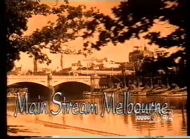
Film - Video (VHS), Screen Sound Australia, Main Stream Melbourne - The River Yarra on film and The Prize by Tim Burstall, 2004
... Main Stream Melbourne - The River Yarra on film and The...Main Stream Melbourne - The River Yarra on film (Screen... melbourne Main Stream Melbourne - The River Yarra on film (Screen ...Main Stream Melbourne - The River Yarra on film (Screen Sound Australia, 2004) and The Prize (Eltham Films, Tim Burstall ,1960) Combining footage from more than 90 early newsreels, documentaries and short films which additionally features almost 200 photographs and illustrations - shows locals fishing and swimming in the river, holding canoe races and lazing at boathouses. Also included is Tim Burstall's 1960 short film, The Prize, which tells the story of a boy, played by his then six-year-old son Tom, and his adventures with a kid goat. The film, shot on the Yarra, won a bronze award at the 1960 Venice Film Festival. Of specific interest, scenes from Warrandyte, Montsalvat footage from 1965, Heidelberg School Artists' Trail, Koornung School (1947) in North Warrandyte, Tim Burstall and The Prize (1960) with scenes on Brougham Street Bridge, and Yarra River scenes at Morrison's Breakwater at Eltham and the Bend of Isles at Kangaroo Ground.VHS Video cassette, 130 minutes. Converted to MP4 file format 02:16:11, 1.54GBthe prize (film), tim burstall, yarra river, warrandyte, brougham street bridge, montsalvat, bend of islands, heidelberg school artists trail, koornong school, morrisons breakwater, video recording -
 Eltham District Historical Society Inc
Film - Video (VHS), IMP Productions, The Shire of Etham - The Evergreen Shire (Series 69, Item 4), c.1985
Shire of Eltham Archives: Series 69, Item 4 This video was produced for the Shire of Eltham by IMP Productions and provides a description of the shire, 277 square km on a north/northeast axis, some 25 km northeast of the centre of Melbourne with a population of around 40,000. Scenes include Yarra River, rural settings and urban settings, housing estates, Shillinglaw Cottage, Pigeon Bank at Kangaroo Ground, the Eltham Railway Trestle Bridge with reference to the fight by locals in the 1970s to save it from replacement, Montsalvat, mudbrick making and its use as a building material, the use of mudbrick in the Eltham Community Centre blending harmoniously with the environment. Emphasises people living in the area due to the qualities of life provided. Also the Living and Learning Centre, St Andrews Markets and other local markets, the Eltham Leisure Centre, cricket and horse riding at Eltham Lower Park, the Infant Welfare Centre (part of the Eltham War Memorial), how residents are mindful of protecting their historical heritage, the CBA bank and Allwood House at Hurstbridge, Tracey Naughton about the Eltham "As we are" Community Banner project and the “River of Life banner”, the Parks and Gardens office in the former Police Residence building (now the Local History Centre), Alistair Knox Park, road planning and types of roads, tree canopy, Peck's Dam, green carparks, road drainage, Gordon Ford's garden and natural landscapes, and Were Street shops in Montmorency. Planning for shopping facilities and carparks with a population of 40,000 growing to 55,000, Arthur Street Mall and carpark, local village feel in the shopping centre. Councillors and Council staff featured include Mary Grant, Bob Manuell, Rodney Roschellor, John Cohen, Alan Baker. Also scenes of Commercial Place, Diamond Valley Railway, Eltham Galley, Riverclay and canoeing on the Yarra intermingled with images of the shire from the Shire of Eltham Pioneers Photograph collection.VHS Video cassette Converted to MP4 file format 00:11:56; 79MBshire of eltham, video recording, shire of eltham archives, alistair knox park, allwood house, arthur street, arthur street mall, bob manuell, canoeing, carparks, cba bank, commercial place, council staff, councillors, cr. mary grant, cricket, diamond valley railway, eltham community banner project, eltham community centre, eltham galley, eltham leisure centre, eltham living and learning centre, eltham lower park, eltham railway trestle bridge, eltham war memorial, gordon ford garden, horse riding, housing estates, hurstbridge, infant welfare centre, john cohen, kangaroo ground, local history centre, montmorency, montsalvat, mudbrick, parks and gardens, peck's dam, pigeon bank, police residence, river of life banner, riverclay, road drainage, road planning, rodney roschellor, shillinglaw cottage, shire of eltham pioneers photograph collection, st andrews market, tracey naughton, tree canopy, were street, yarra river, alan baker