Showing 4504 items matching " surveys"
-
 Bendigo Historical Society Inc.
Map - HEATHCOTE : COUNTY OF BENDIGO, 19-2-1942
... Drawn and reproduced at the Department of Lands and Survey, Melbourne. 19-2-1942. Price 2/-. (number 90 in map cupboard 1)...Drawn and reproduced at the Department of Lands and Survey, Melbourne. 19-2-1942. Price 2/-. (number 90 in map cupboard 1) Map HEATHCOTE : COUNTY OF BENDIGO ...Map. Heathcote, County of Bendigo. County of Dalhousie, McIvor Creek,Wallan and Bendigo Railway, By authority H.E. Daw, Government Printer, Melbourne. Drawn and reproduced at the Department of Lands and Survey, Melbourne. 19-2-1942. Price 2/-. (number 90 in map cupboard 1)H.E. Daw, Government Printer, Melbourne.map, bendigo, heathcote -
Bendigo Historical Society Inc.
Map - RAVENSWOOD, COUNTIES OF BENDIGO & TALBOT, 12-12-22
... Photo-Lithographed at the Dept. of Lands and Survey, Melbourne by W.J.Butson 12-12-22, Price1/-. ...Photo-Lithographed at the Dept. of Lands and Survey, Melbourne by W.J.Butson 12-12-22, Price1/-. ...Map, Ravenswood, Counties of Bendigo & Talbot, Shelbourne, Walmer, Harcourt, Sutton Grange, Mandurang, Lockwood.By Authority A.J.Mullett, Govt. Printer, Melbourne. Photo-Lithographed at the Dept. of Lands and Survey, Melbourne by W.J.Butson 12-12-22, Price1/-. (number 87 in map cupboard 1)A.J.Mullett. Govt. Printer, Melbourne.map, bendigo, ravenswood -
 Federation University Historical Collection
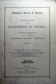
Book, Prodromus of the Palaeontology of Victoria, 1877 (exact)
... At head of title: Geological Survey of Victoria. Illustrations, plates in b/w; 41 p. ...At head of title: Geological Survey of Victoria. Illustrations, plates in b/w; 41 p. ...This publication consists of many Decades which contain "figuers and descriptions of the fossil organic remains to be used for the determination of the geological ages of the different geological formations of the country." (p. 3). Frederick McCoy was born in Dublin, Ireland in 1817. He was a Professor of Natural Sciences, University of Melbourne 1854-1899. McCoy lectured in geology, zoology, chemistry, mineralogy, geography and botany. In 1858 He became the Director of the National Museum of Victoria and the President of the Royal Society of Victoria in 1864. In 1888, McCoy was awarded FRS for work in Palaeontology in Ireland, England and Australia. He died in his office while correcting examination papers in 1899.A Paperback cover book. Decade v. Title is written in black on front cover and on title page. At head of title: Geological Survey of Victoria. Illustrations, plates in b/w; 41 p. It includes figures and descriptions of Victorian Organic Remains and contents of Decades on back cover.Stamped Ballarat East Public Library"australia palaeobotany, victoria palaeontology, geological survey of victoria, frederick mccoy, organic remains, ballarat east library, ballarat east public library -
 Federation University Historical Collection
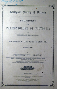
Book, John Ferres, Government Printer, Prodromus of the Palaeontology of Victoria Decade vi, 1878 (exact)
... At head of title: Geological Survey of Victoria. Illustrations, plates in b/w; 42 p. ...At head of title: Geological Survey of Victoria. Illustrations, plates in b/w; 42 p. ...This publication consists of many Decades which contain "figuers and descriptions of the fossil organic remains to be used for the determination of the geological ages of the different geological formations of the country." (p. 3). Frederick McCoy was born in Dublin, Ireland in 1817. He was a Professor of Natural Sciences, University of Melbourne 1854-1899. McCoy lectured in geology, zoology, chemistry, mineralogy, geography and botany. In 1858 He became the Director of the National Museum of Victoria and the President of the Royal Society of Victoria in 1864. In 1888, McCoy was awarded FRS for work in Palaeontology in Ireland, England and Australia. He died in his office while correcting examination papers in 1899.A Paperback cover book. Decade VI. Title is written in black on front cover and on title page. At head of title: Geological Survey of Victoria. Illustrations, plates in b/w; 42 p. It includes figures and descriptions of Victorian Organic Remains and contents of Decades at back of the book.australia palaeobotany, victoria palaeontology, geological survey of victoria, frederick mccoy, organic remains, john ferres -
 Federation University Historical Collection
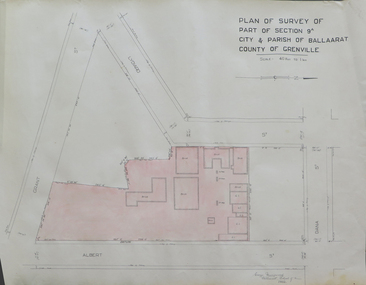
Plan, Plan of Survey of Part of Section 9A City & Parish of Ballarat County of Grenville (Albert Street frontage), 1932
... Plan of Survey of Part of Section 9A City & Parish of Ballarat County of Grenville (Albert Street frontage)....1) Plan of SMB showing Albert, Grant, Lydiard and Dana streets, on paper with colored highlights undertaken by Ballarat School of Mines student George Murrowood in 1932 .2) Hand written page by George Murrowood, of technical description of land surveying Grade II 1932...John Trade Building was built on the Albert Street Frontage. ballarat school of mines surveying george murrowood albert street alumni m.b. john building architectural plan .1) Plan of SMB showing Albert, Grant, Lydiard and Dana streets, on paper with colored highlights undertaken by Ballarat School of Mines student George Murrowood in 1932 .2) Hand written page by George Murrowood, of technical description of land surveying Grade II 1932 Plan of Survey of Part of Section 9A City & Parish of Ballarat County of Grenville (Albert Street frontage) Plan Plan George Murrowood ...The M.B. John Trade Building was built on the Albert Street Frontage..1) Plan of SMB showing Albert, Grant, Lydiard and Dana streets, on paper with colored highlights undertaken by Ballarat School of Mines student George Murrowood in 1932 .2) Hand written page by George Murrowood, of technical description of land surveying Grade II 1932ballarat school of mines, surveying, george murrowood, albert street, alumni, m.b. john building, architectural plan -
Southern Sherbrooke Historical Society Inc.
Map, Dept of land s & Survey, Dandenong Ranges Area Sheet 28, Jan-56
... Aerial survey map of parts of Gembrook, Monbulk and Naree Worran parishes (Victoria). ...Dept of land s & Survey...Ringwood D2C or 849D2C, Zone 7 Dandenong Ranges Area Sheet 28 Map Dept of land s & Survey ...Owned by David Walker, previously of Menzies Creek. Given by him to Rex Breen in 2001 for donation to society.Aerial survey map of parts of Gembrook, Monbulk and Naree Worran parishes (Victoria). Scale: 10 chains to 1 inch, contour interval 20 feet. Shows Menzies Creek and parts of Kallista, Clematis, Selby and Belgrave South. Ringwood D2C or 849D2C, Zone 7"16563" in pen on top left corner of reverse. -
 Bendigo Historical Society Inc.
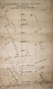
Plan - New Chum and Bellevue Railway Reserve
... Written on top of plan: 'Underground Survey of Mines Sandhurst, New Chum and Railway Reserve Co. ...Written on top of plan: 'Underground Survey of Mines Sandhurst, New Chum and Railway Reserve Co. ...Transverse plan of New Chum and Bellevue Railway Reserve Co. mines, drawn on off-white paper. Written on top of plan: 'Underground Survey of Mines Sandhurst, New Chum and Railway Reserve Co. Plan forms part of the Margaret Roberts Collection of mining records. margaret roberts, gold, gold mine, bendigo, new chum and bellevue railway reserve -
 Bendigo Military Museum
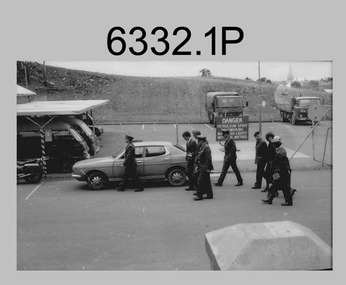
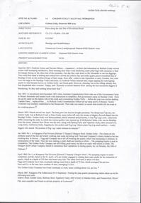
Photograph - Visit by the Minister for Defence to the Army Survey Regiment, Fortuna, Bendigo, c1984
... Visit by the Minister for Defence to the Army Survey Regiment, Fortuna, Bendigo...He later moved on to Victorian state politics, serving as Treasurer from 2000 to 2007 and Premier from 2007 to 2010. Key Army Survey Regiment personnel identified include COL Alex Laing, the Director of Survey from 1983 to 1988 and CO LTCOL Jorge Gruszka who led the unit from 1982 to 1985. ...This is a set of 22 photographs of a visit to the Army Survey Regiment, Bendigo circa 1984, by Mr Gordon Scholes AO, who was the Minister for Defence. ...Army Survey Regiment...Visit by the Minister for Defence to the Army Survey Regiment, Fortuna, Bendigo Photograph Visit by the Minister for Defence to the Army Survey Regiment, Fortuna, Bendigo Army Survey Regiment ...This collection of 22 photos was most likely taken in 1984. Mr Gordon Scholes AO was the Minister for Defence in the Hawke Government from 1983 to 1984. It’s evident in these photos he was taken on a tour through the production areas. Mr John Brumby AO at this time was the Federal Member for Bendigo. He later moved on to Victorian state politics, serving as Treasurer from 2000 to 2007 and Premier from 2007 to 2010. Key Army Survey Regiment personnel identified include COL Alex Laing, the Director of Survey from 1983 to 1988 and CO LTCOL Jorge Gruszka who led the unit from 1982 to 1985. The rank of the senior officer is not known, however would have been a Major-General or above, due to the presence of the aide-de-camp (female captain). This is a set of 22 photographs of a visit to the Army Survey Regiment, Bendigo circa 1984, by Mr Gordon Scholes AO, who was the Minister for Defence. The photographs were printed on photographic paper and are part of the Army Survey Regiment’s Collection. Photographs .1P to .11P, .14P to .17P and .19P to .22P were scanned at 600 dpi. Photographs .12P to .13P and .18P were scanned at 300 dpi. .1) - Photo, black and white, c1984. L to R: unidentified, Mr John Brumby AO, Mr Gordon Scholes AO CO LTCOL Jorge Gruszka, unidentified, D-SVY COL Alex Laing, unidentified (x3). .2) - Photo, black and white, c1984. L to R: unidentified, CO LTCOL Jorge Gruszka AO, Mr John Brumby AO, Mr Gordon Scholes AO, unidentified (x4), D-SVY COL Alex Laing. .3) - Photo, black and white, c1984. L to R: unidentified (x2), Mr John Brumby, unidentified, CO LTCOL Jorge Gruszka AO, Mr Gordon Scholes AO, CAPT Danny Galbraith. .4) - Photo, black and white, c1984. L to R: unidentified, CO LTCOL Jorge Gruszka AO, Mr Gordon Scholes AO Mr John Brumby AO, unidentified. .5) - Photo, black and white, c1984. L to R: unidentified, Mr Gordon Scholes AO, unidentified, CO LTCOL Jorge Gruszka AO Mr John Brumby AO, unidentified. .6) - Photo, black and white, c1984. L to R: MAJ Daryl Hockings CSM, unidentified (x2). .7) - Photo, black and white, c1984. L to R: CAPT Danny Galbraith, unidentified (x2), Mr John Brumby AO, unidentified, CO LTCOL Jorge Gruszka AO, Mr Gordon Scholes AO, unidentified (x2). .8) - Photo, black and white, c1984. L to R: unidentified, Mr Gordon Scholes AO, CO LTCOL Jorge Gruszka AO, MAJ Daryl Hockings CSM, D-SVY COL Alex Laing, unidentified. .9) - Photo, black and white, c1984. L to R: unidentified, Mr John Brumby AO, CAPT Bob John, CO LTCOL Jorge Gruszka, Mr Gordon Scholes AO, unidentified (x2), MAJ Graham Baker, unidentified, MAJ Daryl Hockings CSM. .10) - Photo, black and white, c1984. L to R: Mr John Brumby AO, CAPT Bob John, Mr Gordon Scholes AO, unidentified (x2), MAJ Graham Baker, unidentified, MAJ Daryl Hockings CSM. .11) - Photo, black and white, c1984. L to R: unidentified, CO LTCOL Jorge Gruszka, Mr Gordon Scholes AO, unidentified (x2), MAJ Graham Baker, unidentified (x2). .12) - Photo, black and white, c1984. L to R: unidentified, CO LTCOL Jorge Gruszka, Mr Gordon Scholes AO. .13) - Photo, black and white, c1984. L to R: unidentified, Mr John Brumby AO, Mr Gordon Scholes AO, D-SVY COL Alex Laing, CO LTCOL Jorge Gruszka. .14) - Photo, black and white, c1984. L to R: unidentified, Mr Gordon Scholes AO, unidentified media, D-SVY COL Alex Laing, unidentified, CO LTCOL Jorge Gruszka, unidentified media (x2). .15) - Photo, black and white, c1984. L to R: unidentified, D-SVY COL Alex Laing, unidentified (x2), Mr Gordon Scholes AO, unidentified media (x3). .16) - Photo, black and white, c1984. L to R: unidentified (x5), CO LTCOL Jorge Gruszka, Mr Gordon Scholes AO. .17) - Photo, black and white, c1984. L to R: unidentified (x2), D-SVY COL Alex Laing, unidentified (x3), CO LTCOL Jorge Gruszka, Mr Gordon Scholes AO, Mr John Brumby AO. .18) - Photo, black and white, c1984. L to R: unidentified, CO LTCOL Jorge Gruszka, Mr Gordon Scholes AO. .19) - Photo, black and white, c1984. L to R: unidentified, CO LTCOL Jorge Gruszka, Mr John Brumby AO, D-SVY COL Alex Laing, unidentified, Mr Gordon Scholes AO, unidentified (x2). .20) - Photo, black and white, c1984. L to R: D-SVY COL Alex Laing, unidentified (x2). .21) - Photo, black and white, c1984. L to R: Mr John Brumby AO, unidentified, D-SVY COL Alex Laing, unidentified. .22) - Photo, black and white, c1984. L to R: unidentified (x3), Mr Gordon Scholes AO, Mr John Brumby AO, CO LTCOL Jorge Gruszka. .1P to .22P – no annotationsroyal australian survey corps, rasvy, army survey regiment, army svy regt, fortuna, asr -
 Flagstaff Hill Maritime Museum and Village
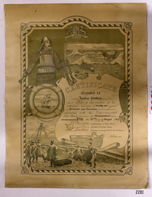
Award - Certificate of Service, F. W. Strahle, James Patten, 23-08-1907
... Strahle at the request of the Department of Lands & Survey, Melbourne, Victoria. During his time of service, James Patten was awarded a medal and certificate by the Royal Humane Society of Australasia for his bravery. ...SIGNATURES: [Commissioner of Public Works], [Secretary of Public Works], [Engineer in charge of Ports and Harbours Melbourne] "Lithographed at the Dept of Lands & Survey - Melb/ by F.W. Strahle, 23.6.07"...Department of Lands & Survey...Strahle Department of Lands & Survey Department of Life-Boat Service James Patten ...This certificate acknowledges 21 years of service given by James Patten, one of the original 1859 Lifeboat Warrnambool as a boatman and bowman. At the time, all retiring Volunteer lifeboatmen were honoured with this award. It was made as a lithograph that was created by F. W. Strahle at the request of the Department of Lands & Survey, Melbourne, Victoria. During his time of service, James Patten was awarded a medal and certificate by the Royal Humane Society of Australasia for his bravery. Patten and his friend Joseph Lowe, who couldn't swim, were with their friend James Ferrier in a boat on the Hopkins River, Warrnambool, when their boat capsized. Ferrier made it to shore, and Patten tried unsuccessfully to hold onto Lowe and bring him to shore. The event occurred on 18th April 1890. The images on the Certificate show a collage of rescue events performed by the lifesavers; a shipwreck rescue in progress, lifeboat conveying five boatmen using two oars each, and a bowman standing at the bow, a linesman wearing a life jacket and holding a rescue line, a lifesaver ring with images of three sailing ships inside it, a shipwreck near shore, a woman and girl in shallow water, a rescue using a breeches buoy on the lifeline, two rescuers walking towards the survivor, rescue crew wearing waterproof clothing, a rocket machine with a pulley to bring the survivor in a breaches buoy to shore, and a rescue crew member holding a flare. Volunteers at the time received a small payment, or 'retainer'', for their practices and a payment of gratitude for the rescues they attended. Across the years between 1856 to 1979 the combined service in Victoria saved 260 lives. Amazingly, some of the volunteers could not even swim.This certificate shows the State and Local Government's appreciation for the years of service spent by in the endeavour to save lives in peril in and on the local waters in the early 20th Century. The lithographed design depicts the many skills and services performed by the lifesavers of the era.Certificate of Service, unframed, awarded to James Patten on 23rd August 1907, recognising his 21 years of service with the original Warrnambool Life Boat Service as a Boatman and Bowman. Certificate is on rectangular, cream paper, lithographed design, printed and handwritten. Letterhead with the Royal Coat of Arms of the United Kingdom and a French motto. Images depict lifesaving crew, lifeboat, rescue equipment and a rescue in progress. The border is waves inside of frame of looped rope. Signatures of Commissioner of Public Works, Secretary of Public Works, and Engineer in charge of Ports and Harbours, Melbourne. Printed from a lithograph produced by F.W. Strahle on 23rd June 1907.MOTTO: "Dieu Droit Et Mon, Ni Soit Qui Mal y" TREXT: "Certificate granted to James Patten as a mark of appreciation of his esteemed services of 21 years as Boatman and Bowman connected with the Departmental Life-Boat service at Warrnambool - dated the 23rd day of August 1907." SIGNATURES: [Commissioner of Public Works], [Secretary of Public Works], [Engineer in charge of Ports and Harbours Melbourne] "Lithographed at the Dept of Lands & Survey - Melb/ by F.W. Strahle, 23.6.07"flagstaff hill, warrnambool, flagstaff-hill, maritime museum, maritime village, shipwreck-coast, flagstaff hill maritime museum & village, james patten, life-saving, lifesaving, rescue, bravery, drowning, joseph lowe, james ferrier, hopkins river, boat accident, certificate of service, 1890, 1907, bowman, boatman, departmental life-boat service, life-boat service, lifeboat service, august 1907, commissioner of public works, public works, ports and harbours melbourne, lands & survey melbourne, f w strahle, lithograph, 1856-1979, 260 lives saved, victorian volunteers, lifeboatmen, retired lifeboatmen -
 Bendigo Military Museum
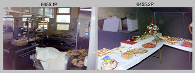
Photograph - Army Survey Regiment SGT’s Mess Summer Ball – Dinner, c1990
... Army Survey Regiment SGT’s Mess Summer Ball – Dinner...This is a set of 14 photographs taken at the Warrant Officer and Sergeant’s Mess Summer Ball held at the Army Survey Regiment (ASR), Fortuna Villa circa 1990. ...This is a set of 14 photographs taken at the Warrant Officer and Sergeant’s Summer Ball held at the Army Survey Regiment, Fortuna Villa circa 1990. ...Army Survey Regiment...Royal Australian Survey Corps RASvy Army Survey Regiment Army Svy Regt Fortuna ASR .1P to .14P – There are no annotations. ...This is a set of 14 photographs taken at the Warrant Officer and Sergeant’s Mess Summer Ball held at the Army Survey Regiment (ASR), Fortuna Villa circa 1990. Photos of personnel and their guests was taken during the dinner and social mingling outside the SGT’s Mess. The Ball and Dinner was held in the gardens of Fortuna Villa and in temporary 20’ x 30’ Army tents set up on the roadway in front of the transport compound. Australian Army Catering Corps staff provided the catering. Refer to item 6454.24P for additional photographs taken at the Summer Ball. An additional 21 photos of less historical value have been scanned but not published.This is a set of 14 photographs taken at the Warrant Officer and Sergeant’s Summer Ball held at the Army Survey Regiment, Fortuna Villa circa 1990. The colour photographs are on 35mm negative film and are part of the Army Survey Regiment’s Collection. The photographs were scanned at 96 dpi. .1) - Photo, colour, c1990. Dinner preparation in SGT’s Mess kitchen. .2) - Photo, colour, c1990. Dinner buffet presentation inside 20’ x 30’ Army tent. .3) - Photo, colour, c1990. Dinner buffet. L to R: June Danger, WO1 Gary Warnest, Terry Danger, Judy Warnest, RSM WO1 Graham Ragless, unidentified guest. .4) - Photo, colour, c1990. Dinner buffet. Unidentified guests and Australian Army Catering Corps staff. .5) - Photo, colour, c1990. Dinner. Unidentified members and guests. .6) - Photo, colour, c1990. Dinner. L to R: members and guests (x3), SSGT Doug Carswell, unidentified guests (x4). .7) - Photo, colour, c1990. Dinner. SSGT Paul Davis and his partner Julie. Unidentified guests in background. .8) - Photo, colour, c1990. Dinner. L to R: SSGT Dennis Learmonth, unidentified guests (x3), MAJ Ray Redman, unidentified guests (x9). .9) - Photo, colour, c1990. Dinner. SGT Trevor Clark with his partner. .10) - Photo, colour, c1990. Dinner. L to R: unidentified guests (x3), WO1 Allan Virtue with his partner, unidentified guests (x6). .11) - Photo, colour, c1990. Dinner. L to R: unidentified members and guests (x4), SSGT Steve Hill CSM, unidentified guest. .12) - Photo, colour, c1990. Unidentified steward serves drinks at SGT’s Mess bar. .13) - Photo, colour, c1990. L to R: SSGT Noel McNamara, SGT Peter Peterson unidentified guests (x2) at OR’s Mess bar. .14) - Photo, colour, c1990. L to R: unidentified guest, WO1 Barry Lutwyche OAM, SSGT Noel McNamara, unidentified members and guests (x3), SGT Peter Peterson, unidentified guests (x2) outside SGT’s Mess..1P to .14P – There are no annotations.royal australian survey corps, rasvy, army survey regiment, army svy regt, fortuna, asr -
 Bendigo Military Museum
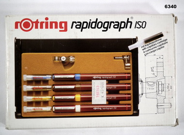
Equipment - Rotring Rapidograph Iso Pen set, Circa 1980
... Used extensively within the Royal Australian Survey Corps for the compilation of maps and for map overlay production. ...Royal Australian Survey Corps RASvy Fortuna Army Survey Regiment Army Svy Regt ASR Rotring box Rapidograph Iso pen set with four pens in a plastic case and two compass adaptors. ...Used extensively within the Royal Australian Survey Corps for the compilation of maps and for map overlay production. These pens produced lines of consistent line widths for cartographic ink work and these replaced the earlier "Crow Quill" ink nib pens. These pens were donated by 310762 WO1 PJ Presser (dec) who served in the Royal Australian Survey Corps from 11 Feb 1970 - 12 Feb 1990.Rotring box Rapidograph Iso pen set with four pens in a plastic case and two compass adaptors. Pen sizes: 0.25mm, 0.35mm, 0.50mm, 0.70mm, with instructionsroyal australian survey corps, rasvy, fortuna, army survey regiment, army svy regt, asr -
 Bendigo Military Museum
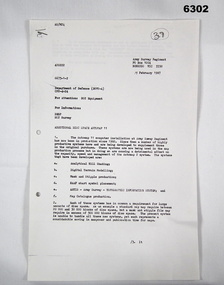
Letter - Army Survey Regiment - Letter of request for additional computer disk space for Automap 2, Army Survey Regiment, 19 Feb 1987
... Army Survey Regiment - Letter of request for additional computer disk space for Automap 2...Automap 2 was the Army Survey Regiment's computerized Mapping system. ...Army Survey Regiment...Royal Australian Survey Corps RASvy Fortuna Army Survey Regiment Army Svy Regt ASR "A Spurling, Computer Operations Manager for CO" Two page letter, foolscap size, Stapled top left corner Army Survey Regiment - Letter of request for additional computer disk space for Automap 2 Letter Army Survey Regiment - Letter of request for additional computer disk space for Automap 2 Army Survey Regiment ...Automap 2 was the Army Survey Regiment's computerized Mapping system. This letter is a request for an additional 700 Mb of computer disk space for the Automap 2 System because of newly developed applications. Those applications were: Analytical Hill shading, Digital Terrain Modelling, Mask and stipple Production, RAAF Chart symbol Placement, ASTIS - Army Survey - Topographic Information System, and, Map Catalog Production.Two page letter, foolscap size, Stapled top left corner"A Spurling, Computer Operations Manager for CO"royal australian survey corps, rasvy, fortuna, army survey regiment, army svy regt, asr -
Kew Historical Society Inc
Archive (series) - Subject File, Victoria Park : Concept Management Plan, Research Papers, 2004, 2004
... Chapter 6 of Sanderson's report was a Survey and Assessment of Landscapes. Included was a brief survey of Victoria Park in Kew, which is bordered by High Street and Adeney Avenue. ...Chapter 6 of Sanderson's report was a Survey and Assessment of Landscapes. Included was a brief survey of Victoria Park in Kew, which is bordered by High Street and Adeney Avenue. ...Graeme Butler & AssociatesProject FilesProvenance OrderRed cardboard wallet containing historical research by Graeme Butler, heritage architect, into the history of Victoria Park, Kew. The file also includes a draft Victoria Park Concept Master Plan, 2004. The research includes memoranda, maps, photocopies of plans, forms, notes, aerial photos, and sundry references.graeme butler - heritage architect, victoria park - kew (vic), heritage studies - kew (vic.)graeme butler - heritage architect, victoria park - kew (vic), heritage studies - kew (vic.) -
 Glenelg Shire Council Cultural Collection
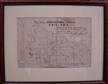
Map - Map of Drik-Drik, 1865
... Front: Plan of the Agricultural Area of Drik-Drik L.2556/Prepared by the Board of Lands and Works in accordance with the "Amending Land Act 1865". Lands and Survey Office, Melbourne 11th May 1865. (printed, upper centre). ...Lands and Survey Office, Melbourne...Map Map of Drik-Drik Lands and Survey Office, Melbourne ...Displayed at History House.Print of map pasted onto board, mounted and framed under glass. Buff-coloured mount. Mahogany stained moulded wood frame, black inner frame.Front: Plan of the Agricultural Area of Drik-Drik L.2556/Prepared by the Board of Lands and Works in accordance with the "Amending Land Act 1865". Lands and Survey Office, Melbourne 11th May 1865. (printed, upper centre). Back: Duncan Hedditchmap, drik drik, plan, geography, cartography -
 Ringwood and District Historical Society
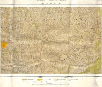
Map, Geological Survey of Victoria - County of Evelyn, Published June 1893
... Geological Survey of Victoria - County of Evelyn, Published June 1893...McColl, Minister of Mines, June 1893. Surveyed by R.A. Moon, Field Geologist, under the supervision of R.A.F. ...McColl, Minister of Mines, June 1893. Surveyed by R.A. Moon, Field Geologist, under the supervision of R.A.F. ...Markings include soil and rock types, alluvial gold workings, quartz reefs.Published under the direction of A.W. Howitt F.G.S. Secretary for Mines. The Hon J.H. McColl, Minister of Mines, June 1893. Surveyed by R.A. Moon, Field Geologist, under the supervision of R.A.F. Murray, Govt Geologist. Lithographed by J. M. Coakley. -
 Bendigo Military Museum
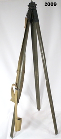
Equipment - HELIOGRAPH TRIPOD, Heliograph Tripod Legs, c. 1940 - 1945
... Note: Item 6482 is a Heliograph that was mounted onto a tripod such as this when it was used for surveying....Note: Item 6482 is a Heliograph that was mounted onto a tripod such as this when it was used for surveying. military equipment - army Heliograph Signals Stamped on one wooden leg: '15629' Stamped on the top plate: 'D(upwards arrow)D, 0 with an upwards arrow through it, 3(upwards arrow)0' Stamped on one brass leg fitting: 'STAND LAMP OR HELIO A MKlll' Tripod with wooden legs painted in jungle green. ...Tripods similar to this were used in both WW1 and WW2. Note: Item 6482 is a Heliograph that was mounted onto a tripod such as this when it was used for surveying.Tripod with wooden legs painted in jungle green. The legs are attached to the apex with tarnished brass fittings, each secured with brass screws. Metal reinforcing plates protect the pointed end of each leg. A brass plate sits at the apex with a threaded rod positioned to allow the attachment of a heliograph or signal light. A khaki webbing shoulder strap for carrying the item is secured to one of the legs. At the bottom end of the strap is a webbing loop used to secure the tripod legs when closed. Stamped on one wooden leg: '15629' Stamped on the top plate: 'D(upwards arrow)D, 0 with an upwards arrow through it, 3(upwards arrow)0' Stamped on one brass leg fitting: 'STAND LAMP OR HELIO A MKlll'military equipment - army, heliograph, signals -
 Bendigo Military Museum
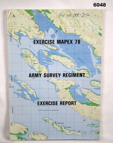
Administrative record - Army Survey Regiment - Exercise Mapex 78, Mar 1979
... Army Survey Regiment - Exercise Mapex 78...The exercise was designed to test the Army Survey Regiment in an intensive production phase of 30 days duration....Army Survey Regiment...Royal Australian Survey Corps RASvy Fortuna Army Survey Regiment Army Svy Regt ASR Top right hand corner of front cover "File on 788-2-14" A4 soft covered booklet, printed map of part of the Kimberley region of Western Australia on front and back covers, staple bound Army Survey Regiment - Exercise Mapex 78 Administrative record Army Survey Regiment - Exercise Mapex 78 Army Survey Regiment ...Exercise Report on exercise Mapex 78. The exercise was designed to test the Army Survey Regiment in an intensive production phase of 30 days duration.A4 soft covered booklet, printed map of part of the Kimberley region of Western Australia on front and back covers, staple boundTop right hand corner of front cover "File on 788-2-14"royal australian survey corps, rasvy, fortuna, army survey regiment, army svy regt, asr -
 Bendigo Military Museum
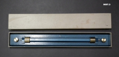
Instrument - Ruler Parallel Rolling 18" with box, Department of Defence Australia, 1944
... Used by Army Survey Units to quickly draw parallel lines for map production since 1944. ...Royal Australian Survey Corps RASvy Fortuna Army Survey Regiment Army Svy Regt ASR Ruler engraved with " A.L. ...Used by Army Survey Units to quickly draw parallel lines for map production since 1944. A similar 15" version is at item 6231..1 A Brass 2.5" (6.5cm) wide Ruler 18" (46cm) long with brass rollers. .2 Ruler is enclosed in a cardboard protective box. .3 Box with lid.Ruler engraved with " A.L. FRANKLIN SYDNEY "royal australian survey corps, rasvy, fortuna, army survey regiment, army svy regt, asr -
 Bendigo Military Museum
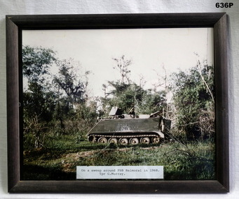
Photograph - PHOTOGRAPH VIETNAM, FRAMED, 1968
... Photo taken by Geoff Murray No 3411521, Vietnam 3 Cav Regt 27.11.67 to 22.10.68, Survey Corp 15.10.69 to 15.10.70. Refer 638P....Bendigo Military Museum 37 - 39 Pall Mall Bendigo goldfields Photo taken by Geoff Murray No 3411521, Vietnam 3 Cav Regt 27.11.67 to 22.10.68, Survey Corp 15.10.69 to 15.10.70. Refer 638P. ...Photo taken by Geoff Murray No 3411521, Vietnam 3 Cav Regt 27.11.67 to 22.10.68, Survey Corp 15.10.69 to 15.10.70. Refer 638P.Colour photo, Vietnam showing an APC in the jungle. Label at bottom details time and place, frame is black wood.fsb coral, vietnam, apc’s -
 Bendigo Military Museum
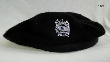
Headwear - BERET & BADGE, 1960’s
... Beret and badge issued to Geoffery Charles Murray No 3411521, Vietnam 3 Cav Regt 27.11.67 to 22.10.68, Survey Corp 15.10.69 to 15.10.70....Bendigo Military Museum 37 - 39 Pall Mall Bendigo goldfields Beret and badge issued to Geoffery Charles Murray No 3411521, Vietnam 3 Cav Regt 27.11.67 to 22.10.68, Survey Corp 15.10.69 to 15.10.70. military-equipment Beret armoured corp “Kent pure wool large” Black Woolen Beret with a Silver Armoured Corp Badge Headwear BERET & BADGE ...Beret and badge issued to Geoffery Charles Murray No 3411521, Vietnam 3 Cav Regt 27.11.67 to 22.10.68, Survey Corp 15.10.69 to 15.10.70.Black Woolen Beret with a Silver Armoured Corp Badge“Kent pure wool large”military-equipment, beret, armoured corp -
 NMIT (Northern Melbourne Institute of TAFE)
Report: Market Research - NMIT, Market research 1998: Findings and recommendations, 1998
... This market research surveyed groups in Industry, the general public, faculty staff, and student focus groups. ...NMIT (Northern Melbourne Institute of TAFE) This market research surveyed groups in Industry, the general public, faculty staff, and student focus groups. ...This market research surveyed groups in Industry, the general public, faculty staff, and student focus groups. It makes recommendations for future developments at NMIT. 6 sets of findings and recommendations, each group stapled together. Housed in manilla folder.On cover "Market research 1998", on printed copy "Staffroom".market research, nmit, -
Port Melbourne Historical & Preservation Society
Document - Various items relating to Holy Trinity Anglican Church, Port Melbourne, 1940s
... Appears to be house to house survey of owner/occupiers/children. Any relationship to church and number of children...Appears to be house to house survey of owner/occupiers/children. Any relationship to church and number of children Religion - Anglican (Holy Trinity) B Bainbridge (in pencil on front cover) Large gren/blue folder with darker shade binding and corners. ...Found among Holy trinity items . Appears to be house to house survey of owner/occupiers/children. Any relationship to church and number of childrenLarge gren/blue folder with darker shade binding and corners. Lists of Holy Trinity and other people .01 confirmation record 14.07.1941 .02 confirmation record 04.09.1946 .03 Finance record 31.12.1977 .04 two sheets of assorted information .05 Listing of Port Melbourne streets, numbers and names of residents - typed .06 Listing of Port Melbourne streets, numbers and names of residents - hand writtenB Bainbridge (in pencil on front cover)religion - anglican (holy trinity) -
 Stawell Historical Society Inc
Book, Peter Cabena, Heather McRae & ElizabethBladin, The Lands Manual - A Finding guide to Victorias Lands Records 1836-1983, 1989
... The Purpose of this manual is to describe the documentary archives of the Department of Crown Lands and Survey (Lands Department) and Explain, how they can be used for historical research...Stawell Historical Society Inc 46 Longfield St Stawell grampians The Purpose of this manual is to describe the documentary archives of the Department of Crown Lands and Survey (Lands Department) and Explain, how they can be used for historical research stawell The Lands Manual A Finding guide to Victorian Lands Records 1836-1983 Written by Peter Cabena, Heather McRae & Elizabeth Baldin Yellow card Cover Black Print and B/W Photo of two wooden buildings The Lands Manual - A Finding guide to Victorias Lands Records 1836-1983 Book Peter Cabena, Heather McRae & ElizabethBladin Alliance Printing Company Pty, Ltd ...The Purpose of this manual is to describe the documentary archives of the Department of Crown Lands and Survey (Lands Department) and Explain, how they can be used for historical researchYellow card Cover Black Print and B/W Photo of two wooden buildings The Lands Manual A Finding guide to Victorian Lands Records 1836-1983 Written by Peter Cabena, Heather McRae & Elizabeth Baldinstawell -
 Bendigo Military Museum
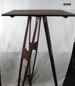
Instrument - Survey Plane Table with Tripod, Circa 1910
... Survey Plane Table with Tripod...The Plane Table is a surveying device used in surveying and mapping to provide a level surface on which to make drawings, charts or maps. ...The Plane Table is a surveying device used in surveying and mapping to provide a level surface on which to make drawings, charts or maps. ...A Plane Table consists of a smooth wooden table surface (with metal strengthening supports) mounted on a sturdy base. The base, a three-legged Tripod, is designed to support the table over a specific point on land. The connection between the tabletop and the adjustable Tripod legs permits the user to level the table precisely, using bubble levels in a horizontal plane regardless of the roughness of the terrain. The Plane Table is a surveying device used in surveying and mapping to provide a level surface on which to make drawings, charts or maps. An alidade, with or without a telescope located on the tabletop is used to sight features and draw angles to that feature. Using these lines to the same feature from different setup locations it is possible to locate that feature on the map. Plane Tabeling was widely used by the early members of the Australian Survey Corps and in both World Wars. It remains a simple and effective tool to teach the fundamentals of mapping and surveying. It was simple to use and was reasonably robust and portable. See also item 6489.2 for the Plane Table Alidade.A wooden Plane Table with alloy fittings to strengthen and support the table top. The table is fixed to a three-legged wooden Tripod with cast alloy fittings and metal pointed tips.royal australian survey corps, rasvy, fortuna, army survey regiment, army svy regt, asr, 4 fd svy sqn, school of military survey -
 Bendigo Military Museum
Administrative record - Malayan Survey Records in Australia 1944, C. Noble, August 1944
... Malayan Survey Records in Australia 1944...Part 1 - Introduction, Part 2 - Topographical Maps, Part 3 - State Maps and Special Maps, Part 4 - Trigonomical Data etc, Part 5 - Johore Revenue Survey Sheets, Part 6 - General Recommendations....FARELF Malaya Royal Australian Survey Corps RASvy Fortuna Army Survey Regiment Army Svy Regt Land Headquarters Cartographic Coy Hand written in blue biro, "also mentioned in Brigadier Hotine's Letter" 12 x randomly numbered A4 photocopied pages stapled in top left hand corner Malayan Survey Records in Australia 1944 Administrative record Malayan Survey Records in Australia 1944 C. ...The first two pages behind the cover sheet describes a Catalogue of maps in storage at FARELF on Singapore Island prior to the Japanese Invasion. This report deals with the results of examination and assessment of the Malayan Survey Records brought out of Malaya a few days before the fall of Singapore in February 1942 and now stored in safe custody by LHQ Cartographic Coy in Bendigo, Victoria, Australia. The Report was written by C. Noble, Colonial Survey Service (Malaya) in August 1944. The report was prepared as a result of a request from the Secretary of State for the Colonies, through the High Commissioner for the United Kingdom. The Terms of Reference were: "To undertake a complete stocktaking and overhaul of the Malayan Survey Records in Australia and for the preparation of a full report for the information of the Colonial Office and that of the Malayan Civil Affairs" The report was prepared in six parts. Part 1 - Introduction, Part 2 - Topographical Maps, Part 3 - State Maps and Special Maps, Part 4 - Trigonomical Data etc, Part 5 - Johore Revenue Survey Sheets, Part 6 - General Recommendations.12 x randomly numbered A4 photocopied pages stapled in top left hand cornerHand written in blue biro, "also mentioned in Brigadier Hotine's Letter"farelf, malaya, royal australian survey corps, rasvy, fortuna, army survey regiment, army svy regt, land headquarters cartographic coy -
 Bendigo Military Museum
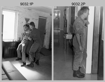
Photograph - Staff Activities – Lithographic Squadron, Army Survey Regiment, Fortuna, Bendigo, Staff Activities – Lithographic Squadron, Army Survey Regiment, Fortuna, Bendigo, c1990
... Staff Activities – Lithographic Squadron, Army Survey Regiment, Fortuna, Bendigo....This collection of 32 photos was most likely taken in Lithographic Squadron at the Army Survey Regiment, Fortuna, Bendigo, circa 1990. ...This is a set of 32 photographs of Lithographic Squadron and staff from other squadrons undertaking various tasks at the Army Survey Regiment, Fortuna, Bendigo, 1990. The photographs are on 35mm negative film and scanned at 96 dpi. ...Army Survey Regiment...Staff Activities – Lithographic Squadron, Army Survey Regiment, Fortuna, Bendigo. Photograph Staff Activities – Lithographic Squadron, Army Survey Regiment, Fortuna, Bendigo Army Survey Regiment ...This collection of 32 photos was most likely taken in Lithographic Squadron at the Army Survey Regiment, Fortuna, Bendigo, circa 1990. The photos were taken in the Camera, Contacting Printing BARCRO, Print Room and Production Control work areas, as well as outside the buildings. Although these photos are not annotated most personnel are positively identified. Photo 6032.23 is an enlargement of 6072.5P. See item 9042.12P for more photos of Lithographic Squadron staff activities.This is a set of 32 photographs of Lithographic Squadron and staff from other squadrons undertaking various tasks at the Army Survey Regiment, Fortuna, Bendigo, 1990. The photographs are on 35mm negative film and scanned at 96 dpi. They are part of the Army Survey Regiment’s Collection. .1) - Photo, black & white, c1990, L to R: SGT Frank Lenane, SPR Shane ‘Soupy’ Campbell. .2) - Photo, black & white, c1990, SGT Dale Hudson. .3) - Photo, black & white, c1990, L to R: SGT Paul Baker, SSGT Peter Imeson, SSGT Allan Virtue. .4) - Photo, black & white, c1990, L to R: SGT SGT Bob Garritty, WO2 Bill Jones. .5)- Photo, black & white, c1990, CPL Pat Drury submitting a work request. .6) - Photo, black & white, c1990, SGT Steve Burke. .7) - Photo, black & white, c1990, WO2 Rob Bogumil. .8) - Photo, black & white, c1990, L to R: SPR Nick van der Zwan, SPR Damien Cole, in foreground – SPR Andrew Morrison-Evans, SPR Greg Howell. .9) - Photo, black & white, c1990, L to R: WO2 Rob Bogumil, SGT Paul Baker, SPR Damien Cole, CPL Chad Hardwick. .10) - Photo, black & white, c1990, L to R: SGT Paul Baker, SGT Brian Fauth. .11) - Photo, black & white, c1990, SSGT Ian Nichols. .12) - Photo, black & white, c1990, Unidentified. .13) - Photo, black & white, c1990, L to R: CPL Lance Strudwick, SGT Steve Burke, unidentified, SGT Gary Kerr, SSGT Ian Nichols. .14) - Photo, black & white, c1990, SPR Andrew Morrison-Evans. .15) - Photo, black & white, c1990, CPL Warren ‘Waldo’ Shirley. .16) - Photo, black & white, c1990, L to R: SGT Steve Burke, WO2 Bill Jones, unidentified. .17) - Photo, black & white, c1990, SSGT Peter Imeson. .18) - Photo, black & white, c1990, SGT Frank Lenane. .19) - Photo, black & white, c1990, SGT Brian Fauth. .20) - Photo, black & white, c1990, LT Craig Hersant. .21)- Photo, black & white, c1990, CPL Pat Drury submitting another work request. .22) - Photo, black & white, c1990, SPR Greg Howell. .23) - Photo, black & white, c1980s, L to R: SPR Colin Yeats, SPR Graeme Spong, CPL Peter Dillon, duplicate of 6072.5P. .24) - Photo, black & white, c1990, SGT Bob Garritty. .25) - Photo, black & white, c1990, WO2 Rob Bogumil. .26) - Photo, black & white, c1990, L to R: SGT Steve Burke and SPR Darren ‘Barney’ Maher’s novel technical solution to a jammed laminator. .27) - Photo, black & white, c1990, Newly promoted CAPT Colin Cuskelly epaulettes in readiness to receive his Captain’s rank. .28) to .30) - Photo, black & white, c1990, L to R: CPL Warren ‘Waldo’ Shirley, SGT Graham Hales. .31) - Photo, black & white, c1990, LCPL Nicole Midgley. .32) - Photo, black & white, c1990, L to R: unidentified (x2).No personnel are identifiedroyal australian survey corps, rasvy, fortuna, army survey regiment, litho -
 Ballan Shire Historical Society
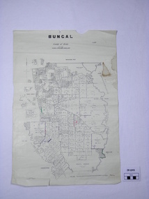
Map - Map. Bungal, Department of Lands and Survey, Bungal, County of Grant, 09/09/1926
... Lithographed at the Department of Lands and Survey. Melbourne by W. J. Butson on 9.9.1926. ...Department of Lands and Survey....Department of Lands and Survey. ...A map of Bungal in the 1920's showing the allotments, and the size, with the names of the residents. It shows the roads and the Western and Eastern Moorarbool River, and the Whipstick State Forest.Cream coloured map of Bungal in the County of Grant, bounded by the the East Moorarbool River on the East, and the State Forest on the South. It is marked with the scale of chains and the number L.358. Lithographed at the Department of Lands and Survey. Melbourne by W. J. Butson on 9.9.1926. It shows the land allotments with names of owners.Coloured pen marks and circled numbers on various areas. Price 2 shillings marked on bottom right hand edge.bungal, kerrit bareet, egerton, lal lal, borhoneyghurk, bungeeltap, ballark, yaloak, gorong, moorarbool west -
 Bendigo Historical Society Inc.
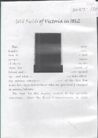
Archive - GOLDFIELDS OF VICTORIA IN 1862, 1862
... Goldfields of Victoria in 1862. A comprehensive survey of Victoria's goldfields in 1862 in response to two questions " then occupying a considerable share of public attention in the colony. ...Goldfields of Victoria in 1862. A comprehensive survey of Victoria's goldfields in 1862 in response to two questions " then occupying a considerable share of public attention in the colony. ...DVD. Goldfields of Victoria in 1862. A comprehensive survey of Victoria's goldfields in 1862 in response to two questions " then occupying a considerable share of public attention in the colony. The first was whether the older fields were showing signs of exhaustion; and he second was the social condition of the miners engaged upon them. -
 Bendigo Historical Society Inc.
Document - GOLDEN GULLY ALLUVIAL WORKINGS
... Information from David Bannear's Bendigo goldfields survey....Information from David Bannear's Bendigo goldfields survey. Document GOLDEN GULLY ALLUVIAL WORKINGS ...Golden Gully alluvial workings, Diamond Hill area, site number 1.1. Document has map/grid references, parcel number and location - runs along Woodward Road. History from 1851 to 186 detailed. . Information from David Bannear's Bendigo goldfields survey. -
 Bendigo Historical Society Inc.
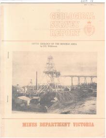
Document - CAROL HOLSWORTH COLLECTION: 1977 GEOLOGY OF THE BENDIGO AREA
... Sixteen page booklet Geological Survey Report, Mines Department Victoria. ...History House 11 Mackenzie Street Bendigo goldfields BENDIGO Mining geological survey report Sixteen page booklet Geological Survey Report, Mines Department Victoria. ...Sixteen page booklet Geological Survey Report, Mines Department Victoria. 'Geology of the Bendigo Area' by H.E. Wilkinson. Photo of Lansell's 222 Mine on the New Chum Line, Bendigo. Tallest poppet head on the field, approximately 38 m high, with a shaft depth of 635 m.bendigo, mining, geological survey report