Showing 4552 items matching "historical map"
-
 Bendigo Historical Society Inc.
Photograph - 1.25,000 BENDIGO AERIAL PHOTOGRAPHS
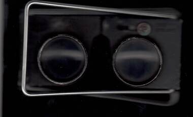
Eighteen undated coloured 1.25,000 army aerial photographs covering Bendigo city and district. [a] -( Similar to A vintage Abrams map reader -Adjustable Stereoscope) -Casella London viewing eye frame with Irving scratched into frame. Another name scratched out also. [b] WW2 Leather pouch stamped Casella London made to hold eye frame.bendigo, utilities, fortuna army mapping division -
 Bendigo Historical Society Inc.
Ephemera - LYDIA CHANCELLOR COLLECTION: EPHEMERA
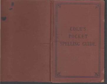
An assortment of ephemera in a plastic bag. (I) A handwritten list of concert items relating to W.W.I. (II) A Christmas gift card sent to the Pethard family. (III) Pte. W.H. Pethard A.I.F. Name tag. (IV) Lucerne post card with an unknown family message. (V) 2 empty envelopes. One has been sent from the front to Miss Lydia Pethard and has a censor stamp on it. (VI) A small cream sports meeting programme for the 2nd Aust. Inf. Brigade dated 11-6-17. (VII) A small map of Bendigo for attendees of the Independent Order of Rackabites Annual Conference held in Bendigo on March 13th to 16th, 1916. (VIII) An airgraph letter sent to Mrs. L. Chancellor from Wilf. Leech, RAAF Base, London 1944 thanking her for a hamper she sent him - through the ACF -the Australian Comforts Fund . (IX) An empty book titled 'Golden Square Methodist Girls Guild.' (X) A small brown 'Cole's Pocket Spelling Guide.'lydia chancellor, collection, ephemera, world war 1, entertainment, concert, music, australian infantry force, lucurne, post card, correspondence, communication, australian infantry brigade sports programme, independent order of rackebites, map, bendigo, airgraph, hamper, world war ii, australian comforts fund, spelling guide, education -
 Bendigo Historical Society Inc.
Book - THE RAILWAY RIOTS
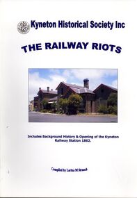
The Railway Riots, Kyneton Historical Society Inc, 52 pages with photographs and maps, includes background history & opening of the Kyneton Railway Station 1862Larina. M. Strauchbook, rural, railway -
 Bendigo Historical Society Inc.
Map - ST ARNAUD MAP, 1968
Colour map of St Arnaud district printed by Royal Australian Survey Corps 1968Royal Australian Survey Corpsmap, victoria, starnaud -
 Bendigo Historical Society Inc.
Map - RAILWAY POSTAL & TELEGRAPH MAP OF VICTORIA, 1887
Railway Postal & Telegraph Map of Victoria 1887 printed on canvas in a fold out book form with name printed on back F.L.Outtrim, in a cardboard cover with red and blue pattern.Picturesque Atlas Publishing Co Ltd Sydney & Melbournemap, victoria, railway -
 Bendigo Historical Society Inc.
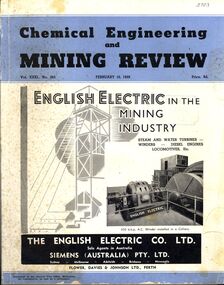
Book - CHEMICAL ENGINEERING AND MINING REVIEW, February 10th, 1939
Chemical Engineering and Mining Review February, 10th 1939 with photographs, maps and illustrations.books, technical, mining -
 Bendigo Historical Society Inc.
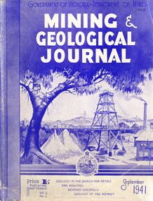
Book - MINING & GEOLOGICAL JOURNAL, September, 1941
Mining & Geological Journal September 1941, Geology in the search for metals, fire assaying, Bendigo goldfields, Geology of Yea district published half yearly by the Department of Mines Victoria contains photographs, maps and illustrations.gold, mining, journal -
 Bendigo Historical Society Inc.
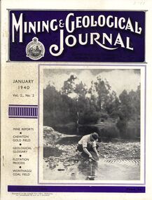
Book - MINING & GEOLOGICAL JOURNAL, 1940
Mining & Geological Journal January 1940 Vol.2 No.2 Mine reports Chewton Gold Field, Geological Glossary, Flotation Process, Wonthaggi Coal Field published hald yearly by he Department of Mines Victoria contains photographs, maps and illustrations.gold, mining, journal -
 Bendigo Historical Society Inc.
Map - GEOLOGICAL MAP: BENDIGO GOLD FIELDS
GEOLOGICAL MAP - BENDIGO GOLD FIELDS - Donated by JOHN HORWOOD. Two geological maps of the Bendigo Gold fields. The maps display , reef lines, Hills, Dams and mine locations. Also Anticlines, sinclines, shafts, alluvial deposits, contours and gullys. All items are superimposed on a map of the major roads and streets of Bendigo. The maps were printed by The Victorian Minister for Mines in 1923 and re-issued in 1936. The maps have been specifically framed and donated to The Bendigo Historical Society Inc. in May 2015 for display at Specimen Cottage. John had been a student at The School of Mines- Bendigo and found them useful as a student living in Bendigo. Prior to being framed , the maps have been kept rolled up in his home. Accession Number 309/15 Were on Display at Specimen Cottage 2015 - 2020. After all items removed from SC to the BRAC in 2021 the framed maps could not be located. Search ongoing. BP 2.3.2023Victorian Minister of Minesgoldfields -
 Bendigo Historical Society Inc.
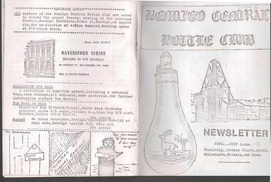
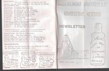
Document - JAMES LERK COLLECTION: BENDIGO CENTRAL BOTTLE CLUB NEWSLETTER
Bendigo Central Bottle Club Newsletter - James Lerk Collection (June /July 1976). Article on ''Old Inglewood'' (by Ken Arnold) - information on 1858 - 1860s with sketch map of gullies in area; Reference to bottle of T R Jones, Chemist of Bendigo (Pall Mall, near Allans Walk); list of some other bottle manufacturers in Bendigo. -
 Bendigo Historical Society Inc.
Document - JAMES LERK COLLECTION: BENDIGO CENTRAL BOTTLE CLUB NEWSLETTER
Bendigo Central Bottle Club Newsletter - James Lerk Collection (April 1976 by deduction). Reference to William Brude store owner/wine and spirit merchant. Involved in partnership in London Brewery and owned Norfolk Brewery - includes list of various bottles owned and used by William Bruce. Reference to Sheepwash being once a main thoroughfare to Bendigo (with sketch map) and information on two of the seven vineyards in area by 1855 - A. Derivan (sic) De Ravin and William Jones, Wine Merchant; article on Bendigo Breweries - reference in it to Albion Brewery, Phoenix Brewery (Pheonix sic), Lucan St Brewery, Thunder & Co, Thunders Sandhurst Brewery, A Thunder & Co, Tankard Malting Co, Bendigo Cognac Distilling Coy, Norfolk Brewery, BB Brewery, Union Brewery, Dublin Porter Brewery, Hindmarsh Brewery, Liverpool Brewery, Edinborough Brewery, Adelaide Brewery, the City Brewing Co, Anchor Brewing Co, Kent Brewery, Alpine Brewery, Sandhurst Brewery; Page listing know Bendigo aerated water manufacturers who used the Hamilton Patent - W Bruce, J Heffernam (sic) ,Hefferman?, G Pritchard, Hunter Bros, J Wharton, F G Beard, A Phillips, T Davies. -
 Bendigo Historical Society Inc.
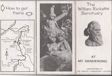
Document - LYDIA CHANCELLOR COLLECTION: THE WILLIAM RICKETTS SANCTUARY
A leaflet about the history and location of the William Ricketts Sanctuary at Mt. Dandenong. Is administered by The Forests Commission Victoria. C 1964 mapplace, public gardens, willilam ricketts sanctuary, mt. da, lydia chancellor, collection, tourism, geography, travel, map, the william ricketts sanctuary, dandenong, recreation, victoria, exploration, history, place -
Bendigo Historical Society Inc.
Map - JOHN WILLIAMS COLLECTION: PHOTO-MAP OF BENDIGO, 2007
Map, Photo-map of Bendigo,Australian Government Department of Defence,prepared and published by the Defence Imagery and Geospatial Organisation 2007.Copyright Commonwealth of Australia 2007.Australia Photomap 1:15 000. Edition 2-DIGO. WGS84.Grid 1000 metre UTM Zone 55. (number 407 in map cupboard 1)Defence Imagery & Geospatial Organisationmap, bendigo, city streets -
 Bendigo Historical Society Inc.
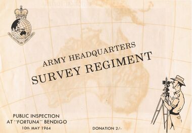
Document - ARMY HEADQUARTERS SURVEY REGIMENT, BENDIGO, 10 May, 1964
Army Headquarters Survey Regiment, Bendigo. Public Inspection at 'Fortuna', 10 May 1964. Donation 2/-. Includes photos of the Entrance Hall, Music Room and Villa. 3 army photos. In 1942 the mansion was occupied by the Australian Survey Corps and 'Fortuna' became the site of the base map production plant of the Australian Army for the remainder of the war years. During this period approximately sixteen million maps of Australian Territories and theatres of operation in the South West Pacific Area, were produced for use by the Allied Services. This function was continued as a peace time role in the post war years, and in 1951 ''Fortuna'' was purchased by the Commonwealth Government. As the largest unit of the Royal Australian Survey Corps, AHQ Survey Regiment carries out mapping in all parts of the Commonwealth and Territories including Papua and New Guinea. The Regiment is not only capable of doing its own field surveys but is responsible for the drawing and printing of map compilations from Royal Australian Survey Corps units in all States. . . . Includes map of grounds.buildings, residential, fortuna villa, army headquarters survey regiment, bendigo. public inspection at 'fortuna', 1964. photos of the entrance hall, music room and villa. mansion was occupied by australian survey corps and 'fortuna' site of the base map production plant australian army war. sixteen million maps australian territories and theatres of operation in the south west pacific area, were produced for use by the allied services. 1951 ''fortuna'' was purchased by the commonwealth government. royal australian survey corps, ahq survey regiment mapping commonwealth and territories including papua and new guinea. royal australian survey corps units in all states. map of grounds -
Bendigo Historical Society Inc.
Map - CAMPBELL COLLECTION: BENDIGO AND DISTRICT MAPS, 1982
Map. Forest Commission Victoria, Bendigo Forest District, Sub-Plan 1 District Fire Prevention Plan, Greater Bendigo Area. Prevention Strategy Plan. Shire of Marong, Shire of Huntly, Borough of Eaglehawk, Shire of Strathfieldsaye, Sailors Gully, Epsom, Jackass Flat, White Hills, California Gully, Maiden Gully, Long Gully, North Bendigo, City of Bendigo, Bendigo East, Kennington, West Bendigo, Golden Square, Quarry Hill, Flora Hill, Spring Gully, Kangaroo Flat.Base prepared 1982. (number 397 in map cupboard 1)map, bendigo, forest district -
Bendigo Historical Society Inc.
Map - CAMPBELL COLLECTION: BENDIGO AND DISTRICT MAPS, 21-8-1972
Map. Shire of Strathfieldsaye Locality Plan. Scale 1 inch=1 mile. Drawn by M.Higgs 21-8-1972, Shire of Huntly, Shire of McIvor, City of Bendigo, Shire of Marong, Shire of Maldon, Shire of Metcalfe, Lake Eppalock, Axedale Township, Strathfieldsaye Township, Melbourne to Bendigo Railway Line, Big Hill Tunnel, Mt.Herbert 1596. (number 398 in map cupboard 1)M.Higgs 21-8-1972map, bendigo, locality plan -
Bendigo Historical Society Inc.
Map - CAMPBELL COLLECTION: BENDIGO AND DISTRICT MAPS, 10-5-29
Map. Mandurang, Scale 20 chains to an inch. Total area 5746 acres. Kennington, Township of Mandurang. To accompany my report of 10-5-29 R. Marshall, Forest assessor. Drawn by I.M.K. (number 399 in map cupboard 1)I.M.K.map, bendigo, allotments -
Bendigo Historical Society Inc.
Map - CAMPBELL COLLECTION: BENDIGO AND DISTRICT MAPS, 6-4-28
Map. Sedgwick, Parishes of Strathfieldsaye, Lyell, and Sedgwick. Scale 20 chains to 1 inch. Total area 5372 acres. Prepared in W.P.B. from C.L.and A. Plans by W.J.Galbraith 6-4-28. (number 400 in map cupboard 1)W.J.Galbraith.map, bendigo, agricultural lands -
Bendigo Historical Society Inc.
Map - CAMPBELL COLLECTION: BENDIGO AND DISTRICT MAPS, 1962
Map. Mandurang, County of Bendigo. Scale 40 chains to 1 inch. Sandhurst, Strathfieldsaye, Sedgwick, Sutton Grange, Ravenswood, Lockwood, Township of Kangaroo Flat, Township of Mandurang. By Authority A.C. Brooks, Government Printer, Melbourne. Drawn and Reproduced at the Department of Lands and Survey, Melbourne,1962, Price 2/-. (number 401 in map cupboard 1)A.C. Brooks, Government Printer.map, bendigo, allotments -
Bendigo Historical Society Inc.
Map - CAMPBELL COLLECTION: BENDIGO AND DISTRICT MAPS, March 1947
Map. Mandurang, County of Bendigo, Sandhurst, Strathfieldsaye, Sedgwick, Sutton Grange, Ravenswood, Lockwood. Scale 40 chains to 1 inch. Drawn and reproduced at the Department of Lands and Survey, Melbourne, March 1947, price 2/-. By Authority : J.J. Gourley, Government Printer, Melbourne. (number 402 in map cupboard 1)J.J. Gourley, Government Printer.map, bendigo, allotments -
Bendigo Historical Society Inc.
Map - CAMPBELL COLLECTION: BENDIGO AND DISTRICT MAPS, June 1953
Map. Marong, County of Bendigo, Scale 40 chains to 1 inch. Woodstock, Leichardt, Nerring, Sandhurst, Lockwood, Shelbourne. Drawn and reproduced at the Department of Lands and Survey, Melbourne, Victoria. By Authority : W.M. Houston, Government Printer. June 1953. Price 2/-. (number 403 in map cupboard 1)W.M. Houston, Government Printer.map, bendigo, agricultural lands -
Bendigo Historical Society Inc.
Map - CAMPBELL COLLECTION: BENDIGO AND DISTRICT MAPS, August 1952
Map. Nerring, County of Bendigo, Yarraberb, Neilborough, Leichardt, Marong, Sandhurst, Huntly. Scale 20 chains to 1 inch. Drawn and reproduced at the Department of Lands and Survey, Melbourne, Victoria, August 1952. Price 2/-. By Authority J.J. Gourley, Government Printer, Melbourne. (number 404 in map cupboard 1)J.J. Gourley, Government Printermap, bendigo, allotments -
Bendigo Historical Society Inc.
Map - CAMPBELL COLLECTION: BENDIGO AND DISTRICT MAPS, 1963
Map. Sedgwick, County of Bendigo. Scale 20 chains to 1 inch. Strathfieldsaye, Eppalock, Lyell, Mandurang, Sutton Grange, County of Talbot. By Authority A.C. Brooks,Government Printer, Melbourne. Drawn and reproduced at the Department of Lands and Survey, Melbourne.1963. Price 2/-. (number 405 in map cupboard 1)A.C. Brooks, Governmenr Printer, Melbourne.map, bendigo, allotments -
Bendigo Historical Society Inc.
Map - CAMPBELL COLLECTION: BENDIGO AND DISTRICT MAPS, 11-2-37
Map. Parish of Shelbourne, County of Bendigo. Scale 40 chains to 1 inch. Drawn and reproduced at the Department of Lands and Survey, Melbourne, Victoria. Price 2/-.11-2-37. By Authority H.J. Green, Government Printer, Melbourne.H.J. Green, Government Printermap, bendigo, agricultural lands -
Bendigo Historical Society Inc.
Map - BENDIGO, 1916
Map. Bendigo, Gunbower, Gladstone, Talbot, Dalhousie, Rodney, Jarklan, Calivil, Hayanmi, Mitiamo, Wanurp, Pannoobamawm, Bamawm, Millewa, Ballendella, Janiember West, Janiember East, Pompapiel, Talambe, Dingee, Milloo, Pannoomilloo, Rochester West, Yarrayne, Salisbury, Yallook, Tandarra, Kamarooka, Warragamba, Diggorra, Minto, Bridgewater, Yarraberb, Neilborough, Whirrakee, Egerton, Elmore, Nolan, Goornong, Bagshot, Huntly, Derby, Leichardt, Nerring, Tarnagulla, Woodstock, Marong, Sandhurst, Wellsford, Bendigo, Axedale, Strathfieldsaye, Eppalock, Kimbolton, Lyell, Sedgwick, Mandurang, Lockwood, Ravenswood, Shelbourne, Laanecoorie. Price 3/-. Smaller map of State of Victoria. Lithographed at the Department of Lands and Survey, Melbourne. 1916. Scale : Two miles to one inch. Map was in book form. (number 62 in map cupboard 1)map, bendigo, bendigo -
Bendigo Historical Society Inc.
Map - AXEDALE, COUNTIES OF BENDIGO & RODNEY, 1961
Map, Axedale, Counties of Bendigo & Rodney.Axe Creek, Campaspe River, Longlea Railway Station, Axedale Railway Station, Wallan & Bendigo Railway.Township of Axedale. By authority A.C.Brooks, Govt. Printer, Melbourne.Drawn and reproduced at the Dept. of Lands and Survey, Melbournd. Price 1/-. 1961. (number 61 in map cupboard 1)A.C.Brooks, Government Printer, Melbourne.map, bendigo, axedale -
Bendigo Historical Society Inc.
Map - AXEDALE, COUNTIES OF BENDIGO & RODNEY, 8-2-26
Map, Axedale, Counties of Bendigo & Rodney, Wellsford, Strathfieldsaye, Eppalock, Knowsley, Weston, Muskerry, Ellesmere, Town of Axedale, Longlea Railway Station, Axedale Railway Station, Wallan & Bendigo Railway. Campaspe River.Axe Creek. By authority H.J.Green, Govt. Printer. Photo-Lithographed at the Dept. of Lands and Survey, Melbourneby W.J.Butson 8-2-26. Price 1/-. (number 60 in map cupboard 1)H.J.Green, Govt. Printer.map, bendigo, axedale -
Bendigo Historical Society Inc.
Map - DERBY : COUNTY OF BENDIGO, 1959
Map. Derby, County of Bendigo, Inglewood, Tarnagulla, Woodstock, Leichardt, Bridgewater, Loddon River, Bendigo Railway, Calder Highway, Maldon to Bridgewater Road.By authority A.C. Brooks, Government Printer, Melbourne. Drawn and reproduced at the Department of Lands and Survey, Melbourne, 1959. Price 5/-. (number 59 in map cupboard 1)A.C. Brooks, Government Printer, Melbourne.map, bendigo, derby -
Bendigo Historical Society Inc.
Map - DIGGORRA : COUNTY OF BENDIGO, 26-6-36
Map. Parish of Diggorra, County of Bendigo, Parish of Ballendella, Parish of Pannoobamawm, Pannoomilloo, Rochester West, Warragamba, Minto, Egerton, Elmore, Northern Railway to Echuca, Elmore and Cohuna Railway, Township of Elmore. By authority H.J. Green, Govt. Printer. Photo-Lithographed at the Deptartment of Lands and Survey, Melbourne. 26-5-36. (number 58 in map cupboard 1)H.J. Green, Govt. Printer.map, bendigo, diggorra -
Bendigo Historical Society Inc.
Map - DIGGORRA PARISH : COUNTY OF BENDIGO, 6-9-21
Map. Parish of Diggorra, County of Bendigo, Parish of Bamawm, Rochester West, Pannoomilloo, Warragamba, Minto, Egerton, Elmore, Northern Railway, Parish of Ballendella. Elmore /Cohuna Railway. Photo-Lithographed at the Department of Lands and Survey, Melbourne by W.J. Butson, 6-9-21, Price 1/-.. By authority A.J. Mullett, Government Printer. (number 57 in map cupboard 1)A.J. Mullett, Government Printer.map, bendigo, diggorra