Showing 19558 items matching " east"
-
 Eltham District Historical Society Inc
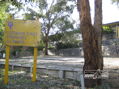
Photograph, Liz Pidgeon, Eltham East Primary School, Grove Street, 27 December 2011, 27 December 2011
Prior to major development changes to schoolBorn Digitaleltham, grove street, eltham east primary school -
 Eltham District Historical Society Inc
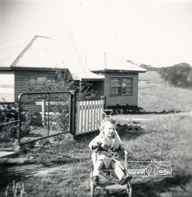
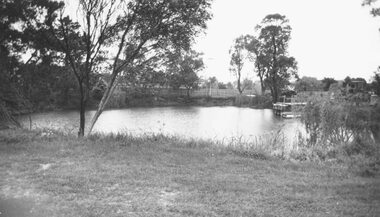
Photograph, View across 36 Beattie Street, Montmorency built by Stan Rushbrook looking south east. John Landy approx 1 year old, c.1952, 1952c
Digital copy of black and white photograph38 beattie street, montmorency, john landy, stan rushbrook -
 Kiewa Valley Historical Society
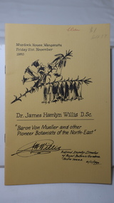
Booklet - Book - Reference Botany - North-east Victoria, Baron Von Mueller and other Pioneer Botanists of the North-East by Dr. James Hamlyn Willis D.Sc
This small booklet is the transcript of the annual McKay Memorial Oration, given at Murdock House, Wangaratta on the 21st November 1980 by Dr. James Hamlyn Willis D.Sc. - Retired Deputy Director of Royal Botanic Gardens South Yarra 21st November 1980.The subject of the Oration was "Baron Von Mueller and other Pioneer Botanists of the North East" (of Victoria). This included the Kiewa Valley and surrounding mountains.Small yellow booklet of 12 pagesName written on cover: C. Roper. Also: $1botanists, dr. james hamlyn willis, wangaratta oration 1980 -
 Kiewa Valley Historical Society
Booklet - Brochures - Alpine Shire Industry, Alpine Agriculture - An Industry Profile of North East Victoria
A brochure produced by the Alpine Shire to attract Agri' business to the Shire following the demise of the tobacco Industry in the 1990s.Part of the development of industry in the Alpine Shire which includes the Kiewa Valley.High quality brochure with a coloured shiny cardboard cover with 28 high gloss coloured pages enclosed. Two copies.alpine shire, agriculture, industry -
 Eltham District Historical Society Inc
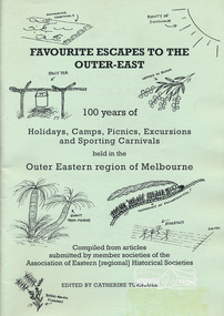
Book, Association of Eastern Historical Societies, Favourite Escapes to the Outer-East edited by Catherine Turnbull, 2002
Compiled from articles submitted by member societies of the Association of Eastern [regional] Historical Societies58 p. : ill. ; 30 cm.ISBN 0957788088lillydate, fern tree gully, yarra flats, gulf station, smiths gully, doncaster, narre warren, gembrook, eltham, blackburn lake, surrey hills, warrandyte, bayswater, yarra glen, queenstown, marysville, waverley, wonga park, bend of islands, dandenongs -
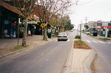
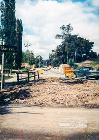 Eltham District Historical Society Inc
Photograph, Looking east along Main Rd towards Research at intersection to entrance for Eltham Barrel (now Kalbar Rd) C.1980
One of a set of display images thought to be produced by the Shire of Eltham c.1979-1987Illustrative of services provided by former Shire of ElthamColour photograph 20 x 29 cm mounted on green-painted chipboard 28 x 35.5 cm (string on back for hanging)Title printed on label adhered to board below photograph (replaced June 2017)eltham, main road, eltham, road, eltham barrel -
 Eltham District Historical Society Inc
Photograph, Brougham Street Eltham looking east to Susan Street
Colour photograph of Brougham Street factory areabrougham street, eltham, susan street -
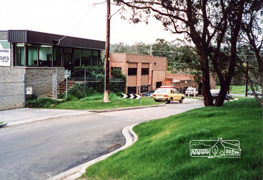
 Eltham District Historical Society Inc
Photograph, Research/Eltham East
Colour photograph of view south along transmission line easement from former Eltham Barrel site, Main Roadresearch, eltham east, main road, kalbar road, transmission lines, eltham barrel -
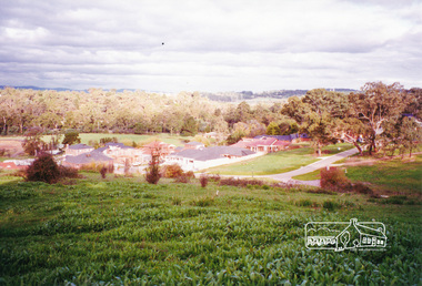 Eltham District Historical Society Inc
Photograph, View from Porter Street, Eltham to south east, c.1994, 1994c
Colour photograph of view southeast from Porter Street, Eltham c.1994 showing new housing development on Riverview Estate formerly Fabbro farm.porter street, eltham, riverview estate, m fabbro -
 Eltham District Historical Society Inc
Photograph, Heidelberg-Kinglake Road, Hurstbridge; looking north east towards Kinglake
Two colour photographs taken near the location of the present roundabout intersection of Anzac Road (on right) and Arthurs Creek Road (on left) with the Heidelberg-Kinglake Road at Hurstbridge. [37�38'14.8"S 145�11'39.6"E -37.637459, 145.194322]main street, kinglake road, heidelberg/kinglake road, hurstbridge -
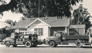 Eltham District Historical Society Inc
Photograph, Hugh Fisher, Eltham Fire Station, east side of Main Road, 1950s, 1950s
The Eltham Fire Station was opened in 31 April 1935. Years later the building was removed and erected for use of 1st Research Scout Group in Research Park by the early 1970s to make way for the Eltham Village Complex which was under construction by 1971. The Research Scout Hall was destroyed by fire in 2002.Black and white photographPhoto by Hugh Fischer, c.1950seltham, fire station, main road -
 Warrnambool RSL Sub Branch
Book, WARS OF THE 20TH CENTURY. WW1, WW2. KOREA, VIETNAM, THE MIDDLE EAST WARS
Hard back with dust coverAuthors David Shermer, Ronald Heiferman, S. L. Mayer Publisher Octopus Books 1975 ISBN 0 7064 0434 3 -
 Streatham and District Historical Society
Book, Mininera East State School 1990
-
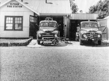 Eltham District Historical Society Inc
Photograph, George W. Bell, Eltham Fire Station, east side of Main Road, c.Jan 1964
The photograph was taken (and donated) by George W. Bell during the period of fire, c.1963-c.1964. The actual fire station was built c.1930 and was in use till c.1964 when a new fire station was built on the opposite side of Main Road. The building, originally situated just south of Arthur Street, on Main Road was ultimately relocated in 1970 to Research Park for use by the 1st Research Scout group. The site is now part of the current Coles supermarket and Eltham Village complex. The Fire Trucks are an Austin STU (small town unit) on the left and an Austin urban pumper on the right. This photo forms part of a collection of photographs gathered by the Shire of Eltham for their centenary project book,"Pioneers and Painters: 100 years of the Shire of Eltham" by Alan Marshall (1971). The collection of over 500 images is held in partnership between Eltham District Historical Society and Yarra Plenty Regional Library (Eltham Library) and is now formally known as 'The Shire of Eltham Pioneers Photograph Collection.' It is significant in being the first community sourced collection representing the places and people of the Shire's first one hundred years.Digital imageaustin stu fire truck, austin urban pumper, eltham, eltham fire brigade, fire station, fire truck, george w. bell, motor vehicles, shire of eltham pioneers photograph collection -
 Eltham District Historical Society Inc
Photograph, Margaret Ball, Looking east up Arthur Street from Main Road, Eltham, c.June 1999, 1999
The Margaret Ball (Pre 1960s Houses) Collection was a personal project initiated to mark the year 2000 and arose as a result of the disappearance of many pre-1960s parts of Eltham due to development. Approximately 200 pre-1960s style houses that were left in Eltham between Main Road and east to Bible Street, between Cecil Street to the north and south to Dalton Street were photographed in late 1999. Not all of the houses could be photographed; some because the garden or trees blocked the view of the house, others because of rubbish or cars were in the way, some because people were working on the house or in the gardens at the time.Colour photographic print eltham, houses, streets, margaret ball (pre 1960s houses) collection, arthur street -
 Eltham District Historical Society Inc
Photograph, Between Kangaroo Ground and Panton Hill looking east from near Flat Rock Road towards Kangaroo Ground-St Andrews Road, 1995, 1995
Colour photographflat rock road, kangaroo ground, kangaroo ground-st andrews road -
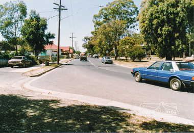
 Eltham District Historical Society Inc
Photograph, Russell Yeoman, Bridge Street looking east from Adam Crescent, Eltham, 1960s, 1960s
Digital file only; created from original colour positive slide transparencystreets, eltham, bridge street, adam crescent, russell yeoman collection -
 Eltham District Historical Society Inc
Photograph, Peter Pidgeon, Brougham Street, Eltham, looking east from intersection with Bolton Street, 13 November 2017, 13/11/2017
North bound lane closure. Born Digitalbolton street, bolton street upgrade, eltham, streets, brougham street, southernwood -
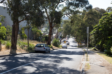
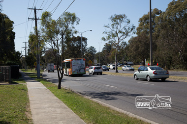 Eltham District Historical Society Inc
Photograph, Peter Pidgeon, Main Road looking east towards Fitzsimons Lane roundabout during Bolton Street upograde, 13 November 2017, 13/11/2017
North bound lane closure. Born Digitalbolton street, bolton street upgrade, eltham, streets, main road, fitzsimons lane -
 Ringwood and District Historical Society
Photograph, Ringwood Elderly Citizens Club, Ringwood East early 1970
Black and White Photograph. Date derived by comparing to later photo of same buildingNo Inscriptions. -
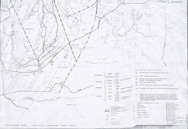 Ringwood and District Historical Society
Map - Maps, Geological Map Donvale to Chirnside Park, also Victorian Railways Maps of Hawthorn to Lilydale Line incl Ringwood to East Ringwood - 1881
Faint photocopies of sections of larger maps. Geological map includes location of mine shafts circa 1920.Victory Shaft, North Victory Shaft, South Caledonia Shaft, Caledonia Shaft, North Caledonia Shaft, Black Swan Shaft, Reward Shaft, Consols Shaft, Blocks Shaft, Devonshire Shaft, Crown Shaft, Yarra Tunnel Reef Working, Bright's Shaft, Kingwood Antimony Company Shaft (Boardman's Shaft), Southern Shaft. -
 Ringwood and District Historical Society
Envelope, Packet: School 1451 (at Ringwood East) and Ringwood 2997. History of Schools in Ringwood. Mr Edward Cass first teacher
School no.1451 1874-1894; Cass, E.F.; School 1451 moved to SS3284 Dandenong in 1900; 4 acres of old site sold to C.Molloy; "A History of Schools in Ringwood" 4 pages +Additional Keywords: Cass, E.F. / Molloy, C. -
 Ringwood and District Historical Society
Photograph, Ringwood Reserve, East Corner, Looking south to the "Mail" office, mid 1960's
4 copies of same photograph with various inscriptionsTyped below one photograph, "Ringwood Reserve, 1963. Looking south Rusty Roof is "Ringwood Mail". 1966. Another has "Ringwood Oval Looking South. Rusty Roof is "Mail"Office in Adelaide St. Area No Eastland. 1965 on reverse. Another two have dates of 1962. -
 Ringwood and District Historical Society
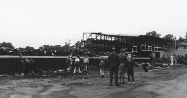
Photographs, Eastwood State School, Alexander Road, Ringwood East, severely damaged by fire - 2 May, 1970
Printed below photograph, "Eastwood State School fire - 1970". Written on backing sheet, "See page 6 Ringwood Mail, 1/7/1970". -
 Ringwood and District Historical Society
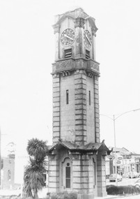
Photograph, Ringwood Clock Tower in original Position, Looking North East possibly 1960's
None. -
Ringwood and District Historical Society
Envelope, Packet: St Francis de Sales School, East Ringwood. 1958 Opening
St. Francis de Sales newspaper cutting account of opening -
 Ringwood and District Historical Society
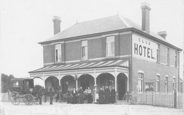
Photograph, Club Hotel, Mount Dandenong Road, (East) Ringwood in 1897
Black and white photograph.(several copies) of brick hotel with veranda. Horse and card outside and group of people standing in front of veranda.Typed below one photograph, "Club Hotel Mt. Dandenong Rd. 1897". Another adds "Incorporated in present structure". A third copy is labelled "Mrs Sweeney", possible owner. -
 Ringwood and District Historical Society
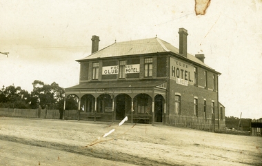
Photograph, Club Hotel, Mount Dandenong Road, (East) Ringwood, Circa 1900
Brick hotel with veranda. Sign above veranda reads "De Beer's Club Hotel" Sign on side of building reads, "Club Hotel - De Beer"(De Beer added to original Club Hotel sign - See item #2819 for earlier photo)Was H006. Photographed by "The Studio of Ringwood" -
 Ringwood and District Historical Society
Photograph, Old clayhole in Dublin Rd. Military Depot grounds, East Ringwood (undated)
Written below photograph, "Old clayhole in Dublin Rd. Military Depot grounds". -
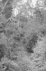 Ringwood and District Historical Society
Photograph, Mullum Creek from bridge in Warrandyte Rd. Looking East 1970
From bridge in Warrandyte Road. See DB Item 2957 for later photo, same scene, with bridge identified.Typed below photograph, "Mullum Creek 1970 from bridge"