Showing 972 items matching "c. north"
-
 Eltham District Historical Society Inc
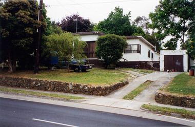
Photograph, Margaret Ball, 89 Pitt Street, Eltham, c. June 1999, 1999
The Margaret Ball (Pre 1960s Houses) Collection was a personal project initiated to mark the year 2000 and arose as a result of the disappearance of many pre-1960s parts of Eltham due to development. Approximately 200 pre-1960s style houses that were left in Eltham between Main Road and east to Bible Street, between Cecil Street to the north and south to Dalton Street were photographed in late 1999. Not all of the houses could be photographed; some because the garden or trees blocked the view of the house, others because of rubbish or cars were in the way, some because people were working on the house or in the gardens at the time.Colour photographic print eltham, houses, streets, margaret ball (pre 1960s houses) collection, pitt street -
 Eltham District Historical Society Inc
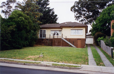
Photograph, Margaret Ball, 93 Pitt Street, Eltham, c. June 1999, 1999
Owner: Arthur and Lillian AstridgeThe Margaret Ball (Pre 1960s Houses) Collection was a personal project initiated to mark the year 2000 and arose as a result of the disappearance of many pre-1960s parts of Eltham due to development. Approximately 200 pre-1960s style houses that were left in Eltham between Main Road and east to Bible Street, between Cecil Street to the north and south to Dalton Street were photographed in late 1999. Not all of the houses could be photographed; some because the garden or trees blocked the view of the house, others because of rubbish or cars were in the way, some because people were working on the house or in the gardens at the time.Colour photographic print eltham, houses, streets, margaret ball (pre 1960s houses) collection, pitt street -
 Eltham District Historical Society Inc
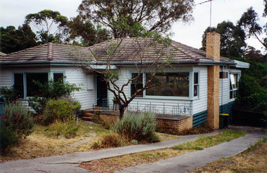
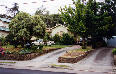
Photograph, Margaret Ball, 98 Pitt Street, Eltham, c. June 1999, 1999
The Margaret Ball (Pre 1960s Houses) Collection was a personal project initiated to mark the year 2000 and arose as a result of the disappearance of many pre-1960s parts of Eltham due to development. Approximately 200 pre-1960s style houses that were left in Eltham between Main Road and east to Bible Street, between Cecil Street to the north and south to Dalton Street were photographed in late 1999. Not all of the houses could be photographed; some because the garden or trees blocked the view of the house, others because of rubbish or cars were in the way, some because people were working on the house or in the gardens at the time.Colour photographic print eltham, houses, streets, margaret ball (pre 1960s houses) collection, pitt street -
 Eltham District Historical Society Inc
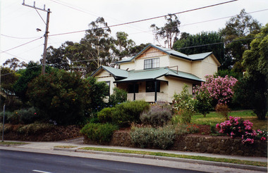
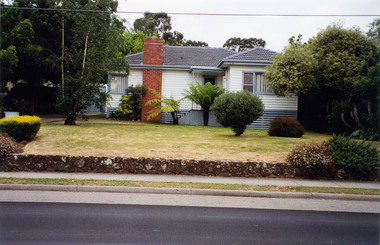
Photograph, Margaret Ball, 101 Pitt Street, Eltham, c. June 1999, 1999
Owner: Edward McColl; The original part of the dwelling was constructed around 1926/27. Second storey added in 1998.The Margaret Ball (Pre 1960s Houses) Collection was a personal project initiated to mark the year 2000 and arose as a result of the disappearance of many pre-1960s parts of Eltham due to development. Approximately 200 pre-1960s style houses that were left in Eltham between Main Road and east to Bible Street, between Cecil Street to the north and south to Dalton Street were photographed in late 1999. Not all of the houses could be photographed; some because the garden or trees blocked the view of the house, others because of rubbish or cars were in the way, some because people were working on the house or in the gardens at the time.Colour photographic print eltham, houses, streets, margaret ball (pre 1960s houses) collection, pitt street -
 Eltham District Historical Society Inc
Photograph, Margaret Ball, 103 Pitt Street, Eltham, c. June 1999, 1999
The Margaret Ball (Pre 1960s Houses) Collection was a personal project initiated to mark the year 2000 and arose as a result of the disappearance of many pre-1960s parts of Eltham due to development. Approximately 200 pre-1960s style houses that were left in Eltham between Main Road and east to Bible Street, between Cecil Street to the north and south to Dalton Street were photographed in late 1999. Not all of the houses could be photographed; some because the garden or trees blocked the view of the house, others because of rubbish or cars were in the way, some because people were working on the house or in the gardens at the time.Colour photographic print eltham, houses, streets, margaret ball (pre 1960s houses) collection, pitt street -
 Eltham District Historical Society Inc
Photograph, Margaret Ball, 105 Pitt Street, Eltham, c. June 1999, 1999
Owner: Edward McCollThe Margaret Ball (Pre 1960s Houses) Collection was a personal project initiated to mark the year 2000 and arose as a result of the disappearance of many pre-1960s parts of Eltham due to development. Approximately 200 pre-1960s style houses that were left in Eltham between Main Road and east to Bible Street, between Cecil Street to the north and south to Dalton Street were photographed in late 1999. Not all of the houses could be photographed; some because the garden or trees blocked the view of the house, others because of rubbish or cars were in the way, some because people were working on the house or in the gardens at the time.Colour photographic print eltham, houses, streets, margaret ball (pre 1960s houses) collection, pitt street -
 Eltham District Historical Society Inc
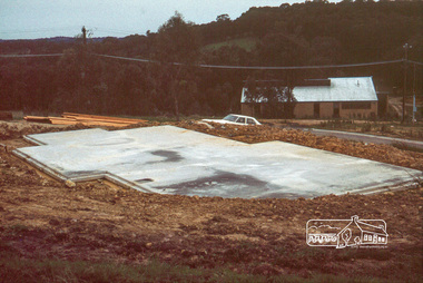
Photograph, Concrete slab from north elevation
14 Stokes Place (Lot 83) was the home of Peter and Carla Vermey. The land was purchased in May 1979 and construction commenced September 1979. The home was built by Peter and Carla Vermey after the developer, Macquarie Builders went bankrupt. Sold October 2017 by Morrison and Kleeman Real Estate. Stokes Place was part of the Stokes Orchard Estate which was developed from the break-up of the the orchard owned by Frank Stokes who lived on the northeast corner of Nyora Road and Eucalyptus Road. His daughter Beryl advised that the Shire had levied a rate assessment on individual parcels of land within the orchard which became unaffordable resulting in its sub-division and sell off. The Stokes Orchard Estate was developed by Macquarie Builders in two stages starting with stage 1 in 1976. Stokes Place was part of Stage 2 in 1979. The Estate was bounded between Nyora Road, Eucalyptus Road, Diosma Road and Stokes Place. The original orchard only just reached the left most portions of Stokes Place and did not go fully up to Diosma, rather to just beyond the extant of Stokes Place. Stokes Place was known within the family as "The Oats" as that is where they grew oats. Frank Stokes moved to Eltham c.1945 after visiting Harold Bird to view his orchard, located diagonally opposite Stokes Orchard from the intersection of Eucalyptus Road, Pitt Street and Nyora Road. It was on Harold Bird's recommendation that Frank purchased the land.The Stokes Orchard Estate collection is typical of housing developments of the late 1970s and 1980s. It was one of the earliest estates in Eltham following the nearby Woodridge Estate development.Digital fileScanned by EDHS from 49 x 35mm colour transparencies provided on loanstokes place, eltham, stokes orchard, stokes orchard estate, streets, houses, peter and carla vermey -
 Eltham District Historical Society Inc
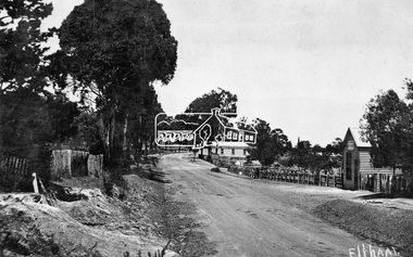
Negative - Photograph, Tom Prior, Main Road near Eltham Railway Station, c.1910
View looking south along Main Road, Eltham from near present day Luck Street. On the immediate right is a fence with the words “Hot Water” painted on it followed by William J Capewell’s butcher shop, then the slaughter yard and saleyards with the entrance access to the railway station. Contained within the saleyards facing the street, a small shelter with the name H.H. Clark upon it. Horace Harold Clark was the son of Eltham State School’s first Head Teacher, David George Clark. As well as being a farmer, he was an Estate Agent and conducted auction sales, presumably from this shelter. The large weatherboard building on the corner (opposite present-day Arthur Street) with signs for Summer Drinks and Hot Water painted on the side is Luther and Ada Haley’s General Store and Bakery, built 1902. This was the first building in what is now Eltham’s present shopping town centre. Haley previously ran the General Store and Bakery on the corner of Main Road and York Street until his lease expired and the premises were bought by Mrs Sarah Burgoyne in 1902. The store later was known as Staff's Store. In the distance approximately mid-way between the Butcher shop and the Bakery are the tops of what appears to be two cypress trees, which could well be the trees in front of the Shillinglaw Cottage facing Main Road. On the eastern (left) side of Main Street is Haley’s Paddock, which was used on occasions for community picnics. Capable of holding 10,000 people, with ample shade and hilly surroundings it was an ideal place for any community gathering such as the State Schools’ Picnic in 1904. Picture dated as c.1910 based on similar picture published in the Weekly Times, Feb. 1912. Kerb and channelling added 1923. Cross Ref: 610 (looking north), 611 (later stage), 613. Same as 705 (though in better condition)This photo forms part of a collection of photographs gathered by the Shire of Eltham for their centenary project book,"Pioneers and Painters: 100 years of the Shire of Eltham" by Alan Marshall (1971). The collection of over 500 images is held in partnership between Eltham District Historical Society and Yarra Plenty Regional Library (Eltham Library) and is now formally known as the 'The Shire of Eltham Pioneers Photograph Collection.' It is significant in being the first community sourced collection representing the places and people of the Shire's first one hundred years.Digital image 4 x 5 inch B&W Neg 120 format B&W negative (spare)shire of eltham pioneers photograph collection, eltham, main road, butcher, eltham railway station, railway station, w.j. capewell, baker, eltham town centre, general store, luther haley, reynolds prior collection, shops, haley's paddock, hot water, m.m. clark, sign, summer drinks, eltham sale yards, eltham slaughter yard, staffs general store -
 Eltham District Historical Society Inc
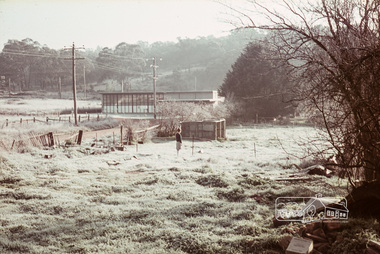
Photograph, Russell Yeoman, Frosty morning, 66 Susan Street, Eltham, c.1965, 1965c
Now the site of the Eltham Skate Park; Susan Street north of Bridge Street has since been renamed as an extension of Brisbane Street.Digital file only; created from original colour positive slide transparencyeltham, streets, susan street, eltham skate park, russell yeoman collection -
 Eltham District Historical Society Inc
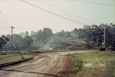
Photograph, Russell Yeoman, Para Road, c.1969, 1969c
Looking north from behind the Lower Plenty shops at Main Road and Para Road.Digital file only; created from original colour positive slide transparencystreets, lower plenty, para road, russell yeoman collection -
 Eltham District Historical Society Inc
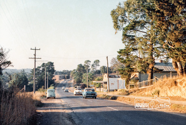
Photograph, Michael Aitken, Main Road, Eltham, c.1967, 1967c
Looking north from near Bridge Street. York Street on right.Digital file only Photo scanned from the collection of Michael Aitken on loan to EDHS, 13 Feb 2018michael aitken collection, postcards, eltham, main road, shillinglaw cottage, shillinglaw trees, york street, bakery -
 Orbost & District Historical Society
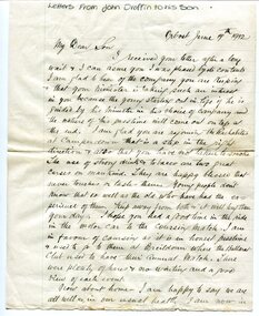
Document - letters and newspaper 'Death Notice', 1912
These letters were written and sent by John Draffin to his son. John Draffin came to Australia as a child with his parents from the north of Ireland . He came to Orbost in 1894 and was Shire Secretary from then until 1910 His children were Andrina, Eva, George, Maggie, Sally and Nellie.John Draffin was a prominent Orbost citizen involved in many community activities. This item is a useful research tool.Hand-written correspondence, on ruled paper. Central horizontal fold, some foxing on edges.draffin family, john draffin, george draffin, east gippsland shire councillor, northern ireland heritage, c.1900s -
 Ringwood and District Historical Society
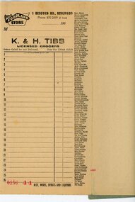
Financial record - Order book, K & H Tibb, licenced grocers, Ringwood (Victoria) - C 1960
Grey covered book, part used, perforated original and duplicate pages, blue carbon copy sheets, preprinted shopping list down right hand side of page, cardboard backing.Page heading - Your Foodland Store, 1 Bedford Road Ringwood Phone 870-2699 (2 lines) -
 Ringwood and District Historical Society
Photographs, Awaiting Cataloguing: Unframed photographs Parkwood Secondary College - Deb Balls etc 1986-2012, 1995 - 2000
Parkwood Secondary College 1986 - 2012 various framed pictures; 3880/1 Framed picture Parkwood Secondary College Debutantes 1996; 3880/1 Framed picture Parkwood Secondary College Debutantes 1997; 3880/2 Framed picture Parkwood Secondary College Debutante Ball 1999; 3880/2 Framed picture Parkwood Secondary College Debutante Ball c.2000; 3880/3 Framed picture Parkwood Secondary College Debutante Ball 1995; 3880/3 Framed picture Parkwood Secondary College Debutante Ball 2000; 3880/4 Framed picture Parkwood Secondary College Year 12 1999; 3880/4 Framed picture Parkwood Secondary College Parkwood hosts Shoyo Senior High School, Hyogo Japan 1999; 3880/5 Framed picture Parkwood Secondary College Miscellaneous - former 1984 graduate Shelly O'Donnell - Basketball Achievements 1985 - 1999; 2880/5 Framed picture Parkwood Secondary College Miscellaneous - Teasdale, J.E. former Principal -
 Ringwood and District Historical Society
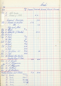
Book - Cash Book, Ringwood Art Group, Ringwood Arts Group Account book 1963-67, 1966-1967
Part of the Ringwood Art Group collection. This A/C book 1966-67Green covered book with red spine. Divided into receipts and payments -
 Ringwood and District Historical Society
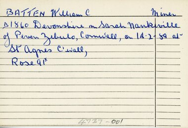
Document - Index Cards, Ringwood - Incomplete set of 17 Index Cards with names of local residents from B to J
The index cards have very brief details of each personIncomplete set of 17 small Index Cards with names of local residents from B to J, biographical information, children, residences etc. Undated, and writer unknown. Names are: Batten, William C. - Miner; Brakewell, John - Labourer Cox, Joseph - Miner Curran, John - Storekeeper Cutts, Samuel - Publican Cutts, James Bennitt - Labourer Ditchburn, William - Brickmaker Drury, John R. - Miner Dynes,Joseph - Miner Eyre,Francis - Brickmaker Hill, David Gilchrist - Labourer Hill, John - Brickmaker Hill, Will Henry - Florist Hill, Ninian C. - Grazier Howship, Charles Burton - Mount cutter (pictures) Howship, Charles Lawrence - Picture framer Jones, George J - Burnt Bridge Hotel Keeper -
 Ringwood and District Historical Society
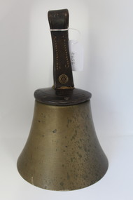
Equipment - Bell, Hand-held bell circa 1900s - possibly a school bell used in Ringwood area, 1900s
UnknownBell with leather cover and leather loop for control of ringing operation.; 'C' is embossed on loop.; Clapper is missing. +Additional Keywords: Schools - RingwoodMEARS London -
Ringwood and District Historical Society
Historical Document, Henrietta C. Walker, A House in the Foothills, 2-Mar-31
Wombolano Park was purchased by Henrietta and Frank Walker, who made many improvements to the house and garden.Article in the Australian Home Beautiful of 2-Mar-1931 about Wombolano homestead and property at Ringwood East. Pages 12,13,14,19,20,21. +Additional Keywords: Walker, Henrietta and Frank Walker"A House in the Foothills" article in The Australian Home Beautiful, 2 March 1931, pp. 12-14 and "Brick-work in the Garden" article in The Australian Home Beautiful, 1 April 1931, pp. 19-21. -
Ringwood and District Historical Society
Programme Card, Ringwood High School. Card printed for Silver Jubilee Dinner 1954 - 1979, 1959
Ringwood High School. Card printed for Silver Jubilee Dinner 1954 - 1979.; Contains names of School Council, Ladies Auxiliary Office Bearers and Principals during 1954-1958, 1958-1966, and 1968-; Ringwood High School badge is on the front. +Additional Keywords: Bennett, T. T. C / Ormandy, T.G.S. / Hodge, R.T. -
 Ringwood and District Historical Society
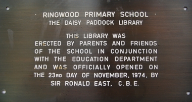
Plaque, Ringwood Primary School plaque commemorating the Daisy Paddock Library - 1974, 1974
Installed 1974. This Ringwood Primary School ceased operation c.1985. Daisy Paddock was the infant mistress at the school, and lived in Thanet Street, Ringwood.Bronze plaque, engraved, with white paint infill: 'Ringwood Primary School/ The Daisy Paddock Library'. +Additional Keywords: Paddock, DaisyRingwood Primary School/ The Daisy Paddock Library/ This library was/ erected by parents and friends/ of the school in conjunction/ with the Education Department/ and was officially opened on/ the 23rd day of November, 1974. by/ Sir Ronald East, C.B.E. -
Ringwood and District Historical Society
Rocks - Minerals, Two rocks from Ringwood Antimony Mine c 1900, c. 1900
Two rocks showing quartz, basalt and stibnite. Some yellowing due to oxides of antimony from the Ringwood antimony mine. No traces of gold however! -
 Ringwood and District Historical Society
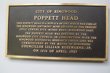
Plaque, City of Ringwood replica Antimony Mine Poppet Head commemorative plaque - 1987, 1987
Installed 12-April-1987 on the poppett head near the Ringwood Lake. It was removed c.2005.Plaque 'City of Ringwood/ Poppett Head' embossed. +Additional Keywords: Rosewarne, Lillian, Cr'City of Ringwood/ Poppett Head/ This Poppett head is a replica of one which was used at/ the Ringwood Antimony Mine located at the present/ Civic Centre Site, Mines Road, Ringwood east./ The Poppett head was erected by the/ Ringwood City Council, in conjunction with the/ Ringwood Historical Research Group, and was/ commissioned by the Mayor of Ringwood/ Councillor Lillian Rosewarne, JP/ on 12th April 1987/ -
Ringwood and District Historical Society
Bank Statements, Ringwood Primary School, Ringwood Primary School No 2997 - Bank Statements (State Savings Bank). 1961-1973, Mar-1961 to Dec-1973
Bank Statements for Ringwood Primary School No 2997.; State Savings Bank 50pp. Held in ARNOS metal binder.; School Grant A/C Mar-1961 to Dec-1973 +Additional Keywords: Enterkin, AState Savings Bank of Victoria. Works and Buildings Account. State School 2997 Ringwood. -
Ringwood and District Historical Society
Book - Books, Ringwood Pre-School enrolments, 1949 - 1953, 1946 - 1949
The book was used for recording the pre-school waiting list and enrolments c. 1946 - 1949 Bundle of 4 Embassy and VANA exercise books - Ringwood Pre-School enrolments, 1949 - 1953.Membership list for posting Pre-School -
Ringwood and District Historical Society
Photographs, Construction Stage of historical Miner's Cottage Museum completed 1983, and panoramic view of partial construction of commercial buildings on former Ringwood Market site, Seymour Street, Ringwood c.1970s. On cardboard
3964/1 15 photographs on cardboard 76cmX51cm depicting construction stages of historical Miner's Cottage Museum completed 1983; 3964/2 4 photographs on cardboard 85.5cmX22.5cm forming panoramic view of partial construction of commercial buildings on former Ringwood Market site, Seymour Street, Ringwood c.1970s -
 Ringwood and District Historical Society
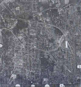
Photograph, Aerial photograph of Heathmont, Victoria - c.1960s, 1975
Aerial view of Heathmont - black and white photograph on chipboard backing. (Protected by slightly damaged plastic cover which could be removed for clearer image.)Department of Crown Lands and Survey Melbourne, Project Run 31A 27-12-1975, Lens 209 1951M ASL. -
Ringwood and District Historical Society
Envelope, Bundle of handwritten notes attributed to Mr J. McCaskill c.1940's. Mayor of Ringwood, c.1940s
Bundle of handwritten notes attributed to Mr J. McCaskill, Mayor several times between 1936 & 1948. +Additional Keywords: McCaskill, J. -
 Ringwood and District Historical Society
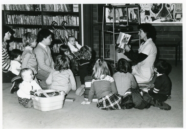
Photograph, Ringwood Library Story Time - c.1970
Adult reading a picture book to a group of children at the City of Ringwood Library, 28 Warrandyte Road, c.1970 -
 Ringwood and District Historical Society
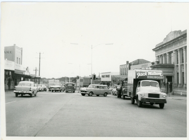
Photograph, Maroondah Highway outside Town Hall
Street scene looking west between Railway Station and Wantirna Road, including ANZ Bank, Coles Stores, State Bank, Midway Arcade, Jack Wilson - Removalist, Ringwood S.E.C., Ringwood Lamb Centre, c.1965 -
 Ringwood and District Historical Society
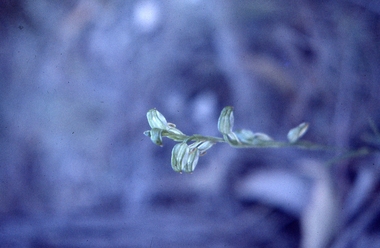
Slides, Seven slides of native plants and wild flowers taken along the Heathmont Railway Line c.1970, c.1970
Slides scanned 6-Dec-2014. Not the photos as shown in the book "Place of Many Eagles".Seven slides of native plants and wild flowers taken along the Heathmont Railway Line c.1970