Showing 273 items
matching campus map
-
 University of Melbourne, Burnley Campus Archives
Article - Photocopy, Gardens of the Horticultural Society, 1867
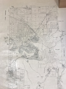
Newpaper article about progress of the gardens, plus Yarra Planning Scheme mapgardens -
University of Melbourne, Burnley Campus Archives
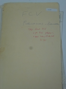
Pamphlet, Shade and character trees at Burnley, c. 2000
1. Pamphlet produced by V.C.A.H. incl. map of gardens 2. Artwork for pamphletvcah, burnley -
University of Melbourne, Burnley Campus Archives
Document, Gingko biloba trees at Burnley, c. 1943
Possibly student's work, including hand-drawn map of Australia and notes on Gingko bilobagingko biloba, trees -
Creswick Campus Historical Collection - University of Melbourne
Document, Forests Commission Victoria, A list of rare, very localised and endangered indigenous plants of Victoria, c.1982
1 Booklet and 29 maps in boxed set.Maps and Booklet -
Creswick Campus Historical Collection - University of Melbourne
Equipment, Curvimeter
Steel tool with moving wheel attached to measurement dial. For measuring distance of irregular line on maps. Cased in blue box with clear lidEquipment -
Creswick Campus Historical Collection - University of Melbourne
Still Image, 1952
Subject: King Lake . 6 brown envelopes marked Run 3, 4, 7, 7a, 8, 9 containing c. 80 prints. 1 section of a topographical map marked State Aerial Survey. Stored in a brown cardboard file box marked King Lake Run No.3 - 9. (x9). Photos commissioned by Forests Commission Victoria.Aerial Photographs -
Creswick Campus Historical Collection - University of Melbourne
Still Image, 1968
Subject: Creswick 1968 Project . 1 x annotated map in envelope marked Run 3 No's 30 - 38 with runs marked up from aerial phtographs flown 1956 - 1968 on drafted plan of Creswick Plantations. 1 x topographical map marked Creswick with annotation "Mapsheet key diagram". 1 x topographical map marked Ballarat annotated with a grid of numbers. 13 brown envelopes marked Run 1 -3 No. 21 - 38 (missing sequences) of c.44 prints total. Mix of black and white and colour. Range of dates. Stored in a brown cardboard file box marked Creswick 1968 Project.Aerial Photographs -
Creswick Campus Historical Collection - University of Melbourne
Map, 1980
Arboretum plant census locality mapsMap -
Creswick Campus Historical Collection - University of Melbourne
Map, 1923
Creswick proposed extension, 25-5-1923.Cloth map -
 Creswick Campus Historical Collection - University of Melbourne
Manuscript
These items are notes and maps by K.J SimpfendorferDocuments -
Creswick Campus Historical Collection - University of Melbourne
Equipment
This is a six drawer horizontal map cabinet.Equipment -
Creswick Campus Historical Collection - University of Melbourne
Map, 1923
Includes detail of Plantation layout and plantings at the time and later plantings (1930's) in pencil.Map -
Creswick Campus Historical Collection - University of Melbourne
Map, 1937-1942
Linen backed topographical Maps - Victoria. 26 folding mapsMapsSchool of Botany, Univerity of Melbourne -
Creswick Campus Historical Collection - University of Melbourne
Map, 1937-1942
Linen backed topographical Maps - Victoria. 21 folding mapsMapsSchool of Botany, Univerity of Melbourne -
Creswick Campus Historical Collection - University of Melbourne
Maps, 1967 - 1972
Maps of various subjects: Gunbower Island 1972. Barmah Forest 1967. Survey maps from aerial photography 1971 _Narnargoon.Tonimbuk. Gilwell & Beenak.Maps -
 Creswick Campus Historical Collection - University of Melbourne
Map, Creswick, 1943
Dept of Lands and Survey map of Creswick and county of Talbot. 2 linen backed sheets rolled into white cardboard cylinderMaps -
Creswick Campus Historical Collection - University of Melbourne
Map, c.1930?
30 topographical maps, etc dating from 1930's. Subjects: Bendigo, Bendock, Castlemaine, Colbinabbin, Corio, Creswick, Dartmoor, Daylesford, Dunolly, Geelong, Gembrook, Glenmaggie, Juliet, Kaye, Maryborough, Murchison, Ringwood, Stratford, WalhallaMapsSchool of Botany, Univerity of Melbourne -
 Whitehorse Historical Society Inc.
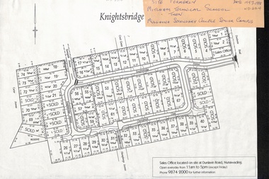
Map, Knightsbridge Estate, Nunawading, Ca 1997 - 1998
Plan of subdivision of former Mitcham Technical School and later Mullauna Secondary College Senior Campus - Knightsbridge Estate.land subdivision, knightsbridge estate, mitcham technical school, mullauna secondary college, senior campus, cherrybrook close, nunawading, knightsbridge avenue, sunnyside avenue, crest grove, dunlavin road, mitcham, carter avenue, humphreys avenue -
 Whitehorse Historical Society Inc.
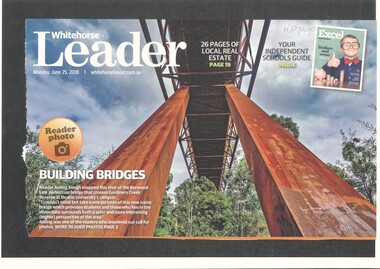
Article, Burwood Link Pedestrian Bridge, 2018
Sketch map of location of potteries in the area bounded by Middleborough, Springfield, Mitcham Roads and Burwood Highway.Photograph of the Burwood Link Pedestrian Bridge at Gardiners Creek Reserve provided by Whitehorse Leader reader Aisling Keogh.Sketch map of location of potteries in the area bounded by Middleborough, Springfield, Mitcham Roads and Burwood Highway.deakin university burwood campus, burwood link pedestrian bridge, gardiners creek reserve -
 Vision Australia
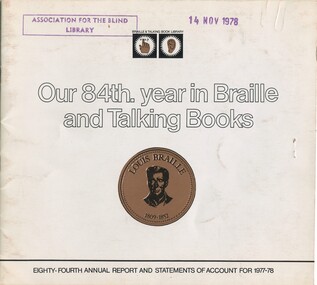
Administrative record - Text, Our 84th year in Braille and Talking Books: eighty-fourth annual report and statements of account for 1977-78, 1978
Annual report of the Braille & Talking Book Library including Minutes of the AGM, Board of Director's Report, President's report and financial statements. Items also included are: acknowledgement of the work on Thomas Luxton as foundation president, having a stand at the Royal Melbourne Show, acknowledgement of Joan Cunnington for working 50 years as a transcribing and producing the most volumes (789) of any transcriber, display of a thermoform map designed by 2nd year Architecture students of the Melbourne University campus, Sir Paul Hasluck winning the Braille Book of the Year award, first edition of Library Talk audio magazine, congratulations from the Federation of Blind Citizens on providing 2 track cassettes, retirement of Alice McClelland and Geoffrey Wilson, and a delegate attending the Australian and New Zealand Association of Teachers of the Visually Handicapped conference,1 volume of illustrations and textbraille and talking book library, annual reports -
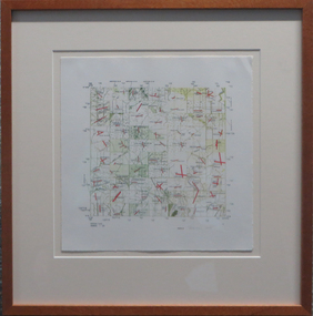
 Federation University Art Collection
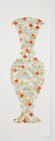
Artwork, other - Handcut & Collaged maps on paper, 'Survey Vessel I' by Carole Wilson, 2008
Carole WILSON (1960- ) Born Canberra, Australia Carole Wilson undertook undergraduate studies at the Canberra School of Arts and Phillip Institute of Technology. She completed a Graduate Diploma in Education at the University of Ballarat in 1987, and a Doctor of Philosophy in 2000. She has chosen central motifs in her work, which she incorporates throughout a series. The urn has been a unifying motif in Wilson's map work and testifies to the way in which function drives form across cultures. Carole's work is held in many public collections including the National Gallery of Australia, the Powerhouse Museum, State Library of Victoria and a number of regional Victorian galleries. Her posters are in museum collections in Finland, Moscow and Poland. In 2001 Dr Wilson was awarded a Doctor of Philosophy (Visual Art) from the University of Ballarat (Now Federation University). She graduated with a Graduate Diploma in Education from University of Ballarat in 1987, and a Diploma of Art from the Phillip Institute of Technology (RMIT) in 1984. Carole Wilson lectures at Federation University Australia: 2010- Senior Lecturer in Visual Arts, Honours and Research Degrees Co-ordinator 2009-2011 Lecturer in Studio Practice and Postgraduate Co-ordinator 1999-2008 Lecturer in Visual Arts (Sessional) This item is part of the Federation University Art Collection. The Art Collection features over 2000 works and was listed as a 'Ballarat Treasure' in 2007. Donated through the Australian Government's Cultural Gifts Program by Anne M. Drum, 2011art, artwork, carole wilson, maps, urn, alumni, available, staffmember -
 Federation University Art Collection
Work on paper - artwork, Susanna Castledon, 'Untitled' by Susanna Castledon
Susanna CASTLEDON (1968 - ) Born London, England Arrived Australia 1977 This item is part of the Federation University Art Collection. The Art Collection features over 2000 works and was listed as a 'Ballarat Treasure' in 2007.parallel prints, printmaking, map, susanna castledon -
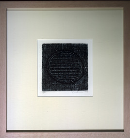 Federation University Art Collection
Print, 'Collagraph 3' by Carole Wilson, 2007
Carole WILSON (1960- ) Born Canberra, Australia Carole Wilson undertook undergraduate studies at the Canberra School of Arts and Phillip Institute of Technology. She completed a Graduate Diploma in Education at the University of Ballarat in 1987, and a Doctor of Philosophy in 2000. She has chosen central motifs in her work, which she incorporates throughout a series. The urn has been a unifying motif in Wilson's map work and testifies to the way in which function drives form across cultures. Carole's work is held in many public collections including the National Gallery of Australia, the Powerhouse Museum, State Library of Victoria and a number of regional Victorian galleries. Her posters are in museum collections in Finland, Moscow and Poland. In 2001 Dr Wilson was awarded a Doctor of Philosophy (Visual Art) from the University of Ballarat (Now Federation University). She graduated with a Graduate Diploma in Education from University of Ballarat in 1987, and a Diploma of Art from the Phillip Institute of Technology (RMIT) in 1984. Carole Wilson lectures at Federation University Australia: 2010- Senior Lecturer in Visual Arts, Honours and Research Degrees Co-ordinator 2009-2011 Lecturer in Studio Practice and Postgraduate Co-ordinator 1999-2008 Lecturer in Visual Arts (Sessional) This item is part of the Federation University Art Collection. The Art Collection features over 2000 works and was listed as a 'Ballarat Treasure' in 2007. Carole Wilson lectures at Federation University Australia: Framed collograph by Carole Wilson. art, artwork, wilson, carole wilson, available -
 Federation University Art Collection
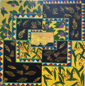
Painting - Artwork, [Untitled]
Under the direction of lecturer Raymond Thomas five students of Koorie Studies at the Gippsland Centre for Art and Design created this work. The were Vickie Turvey, Robyn Yates, Kellie Parsons, Melissa Fenton, Deanna Mobourne.A large canvas with indigenous plants, and Aboriginal animal motifs. If you can assist with information about this artwork, or the artist, please use the comment box below. artwork, artist, gippsland campus, aboriginal, kangaroo, emu, fish, clan map, vickie turvey, robyn yates, kellie parsons, melissa fenton, deanna mobourne, koorie studies -
Federation University Art Collection
Printmaking - Collograph, Fusea, Janine, The Map is in the Brain
This item is part of the Federation University Art Collection. The Art Collection features over 1000 works and was listed as a 'Ballarat Treasure' in 2007.art, artwork -
University of Melbourne, Burnley Campus Archives
Book - Report, E.B. Littlejohn, Victoria 1944 State Regional Boundaries Committee Report on Regional Boundaries, 1944
See paper catalogue for complete contents. Item formerly property of E.B. LittlejohnReport includes maps of Regions for Planning and Development, geographical, weather, power, water resources, crops, livestock, etc.e.b. littlejohn, planning, development, regions -
University of Melbourne, Burnley Campus Archives
Plan - Coloured plan, Plan of Burnley Gardens, 1929?
Layout of gardens, farm buildings, orchard, etc. overlaid on part of Lands Department map. See paper catalogue for full descriptionPart of larger plan (Lands Department Parish Plan). Partly hand-drawn. Area bounded by Yarra River, Swan St, Glen Iris railway line. Shows Burnley Gardens layout, handwritten amendments and explanation of existing and proposed structures including: Pavilion, sketch of unbuilt Administrative Building, poultry yard, contours of old orchard, sketch for Plant Research Institute, ditch, silo, milking shed, laying pens. See aboveburnley gardens, pavilion, burnley school of horticulture, farm buildings, poultry -
University of Melbourne, Burnley Campus Archives
geological survey - Map, Maps of Geelong and Portarlington areas, 1963
A. Coloured geological survey map of Geelong area: showing sedimentary and igneous rock formations and contours. B. Coloured geological survey map of Portarlington, Victoria. By Dept. Of Mines, Melbourne.geological survey, geelong, portarlington -
University of Melbourne, Burnley Campus Archives
Plan - Photocopy, Wendy Varcoe, Killamont, 1907? 1980?
Larger plan is probably of original fencing and drains from C.B. Luffman's layout. Killamont is the only known surviving private garden designed by Luffman.(1907).Photocopies of 2 hand drawn maps/plans of the garden at "Killamont." Drawn by Wendy Varcoe. Garden designed by C. B. Luffmann. (Also see B10.0040 Conservation Analysis and other C.B. Luffmann files in Box 75 A .)gardens, killamont, wendy varcoe, charles bogue luffman -
University of Melbourne, Burnley Campus Archives
Plan - Photocopy, Contour Map 1891, 1891
Photocopy of plan showing contour lines from Yarra River. Shows Pavilion and Principal's Residence but not much of the garden design. From Central Plan Office Dept. of Natural Resources.yarra river, pavilion