Showing 215 items matching "dunes"
-
 City of Kingston
Photograph - Colour, 1993
Carrum is a suburb in the City of Kingston bordered by the Patterson River in the north and Kananook Creek in the south. To the east the suburb is adjacent to Patterson Lakes. The Carrum Station was opened in 1882, when the railway line from Mordialloc was extended to Frankston. In the early 20th century, it was a destination for holidaymakers occupying tents and cabins. The area now consists of older housing and over time there have been many new housing developments.Carrum is located in the area that was originally part of the Carrum Carrum Swamp. The district had originally been the home of the Bunerong people who fished, gathered food and found refuge in the sand dunes. The Swamp was drained in 1879 when the Patterson Cut was formed and became known as Patterson River. Apart from local farmers, fishermen and hotel-keepers, there were few permanent residents until the early 20th century when it had become popular as a beach resort. In the 1920s and 1930s the area became occupied by more permanent residents.Laminated aerial colour photograph of Carrum and Patterson Lakes in the City of Kingston. The photograph also includes Kananook Creek and the northern section of Seaford. Prominent features include Roy Dore Reserve, Carrum Primary School, Patterson River Secondary College, Keast Park Seaford, the Seaford Swamp Drain and a section of Downs Estate situated on the traditional lands of the Bunurong people.Black type on white adhesive sticker: No. 7140 Black type of white adhesive sticker: 31-1-93 Black handwritten ink (marker): * [an asterisk] Yellow circular adhesive stickerpatterson lakes, seaford, carrum carrum swamp -
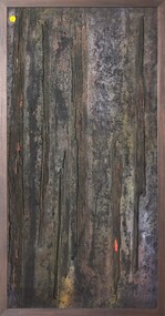 Merri-bek City Council
Mixed media - Callistemon charcoal and ink on marine ply, Brian McKinnon, Bush Fire I “Redgum Sleeper”, 2019
-
 Lakes Entrance Historical Society
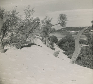
Photograph - Sand hummocks c1952 Lakes Entrance Victoria, L Carpenter, 1952 c
sand hummocks showing drifting sand overwhelming a stand of coastal banksia trees.Black and white photograph of sand hummocks showing drifting sand overwhelming a stand of coastal banksia trees. Part of western end of township across Cunninghame Arm in distance Lakes Entrance Victoria. Also three black and white photographs showing sandrifts on hummocks overwhelming coastal banksia trees and other vegetation . c1952sand dunes, vegetation, environment -
 Lakes Entrance Historical Society
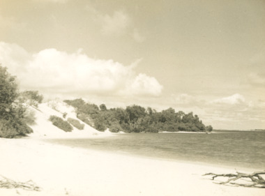
Photograph - Sand hummocks Lakes Entrance Victoria c1952, L Carpenter, 1952 c
Black and white photograph of an area of the sand hummocks known locally as Hill 60 Sandy beach and lake in foreground Lakes Entrance Victoria. Also two black and white photographs taken from sand hummocks looking west down Cunninghame Arm c1952 township, topography, gippsland lakes, sand dunes -
 Lakes Entrance Historical Society
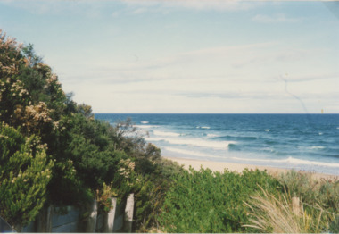
Photograph - Red Bluff, 1992
Colour photograph taken from the base at the Red Bluff looking to the south east shows low shrubbery on higher elevation above sandy beach, surf breaking with ocean beyond Lake Tyers Victoriaocean, waterways, sand dunes