Showing 1808 items matching "planning and development"
-
 Ringwood and District Historical Society
Booklet, What house is that? A Guide to Victoria's Housing Styles
The Heritage Council was the funder of the project and it was produced by the Department of Planning and Community DevelopmentYellow covered booklet with photographs and printing of design features with coloured schemes for houses from Early Victorian to Post War Modern. 31 pages forward by Hon. Justin Madden MLC Minister for planning. -
 Eltham District Historical Society Inc
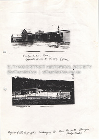
Document - Property Binder, 825 Main Road, Eltham
Photocopy photographs Evelyn Hotel Eltham and Eltham Swimming Pool, images owned by Garreth Burges. Elevations west, north, south, east, of proposed development by Germano Architects. Floor plans of proposed development by Germano Architects. Newspaper article: Council to reject apartments plan, Diamond Valley News, 20 May 1998, Nillumbik Council meeting, protestors against 25 unit development from Eltham Gateway Action Group. Newspaper public notice: Diamond Valley Leader 1 March 2006, Notice of Application for a Planning Permit, by Germano Architects. Newspaper article: Building at long last, Diamond Valley Leader, 3 September 2008, Nillumbik Council approved development plans.main road, eltham, property, businesses, evelyn hotel eltham, eltham swimming pool, eltham gateway action group, germano architects -
 Whitehorse Historical Society Inc.
Pamphlet, A History of Nunawading Arts Council 1964-1985, 1985
A History of Nunawading Arts CouncilA History of Nunawading Arts Council 1964-1985,as told by Max Grant. A year by year account is given of the Nunawading Festival and the various orginations involved. Planning and development of the Nunawading Arts and Entertainment Centre is included. There is a list of Office Bearers for the period.A History of Nunawading Arts Council art exhibitions, art festivals, nunawading festival, nunawading arts council, nunawading arts & exhibition centre -
 University of Melbourne, Burnley Campus Archives
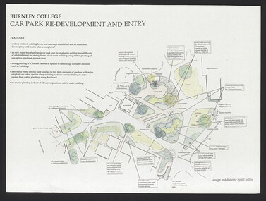
Plan, Burnley College Car Park Re-development and Entry, 1993-1998
(1) Coloured plan, Concepts for discussion by Phil Tulk 27.11.97. (2) As above dated 15.5.98. (3) Coloured rough plan. (4) 1 tracing paper, 1 coloured paper copy and 2 copies, Burnley College Car Park Re-development and Entry by Jill Kellow. (5) Notes for discussion. (6) Site Plan VCAH Carpark Landscape Graphics Assignment No 1 by Ken Wallace, March 1993. Scale 1:100.jill kellow, phil tulk, ken wallace, vcah, car park, rockery, main entrance -
 University of Melbourne, Burnley Campus Archives
Plan, Victorian College of Agriculture and Horticulture - Burnley Site Plan, 1986
Given to Archives by Jim Galea (Staff 1985-87).Prints and paper copies of plan of Burnley Campus by Fresco Color Group No 60 337-A dated February 1986. Scale 1:500. (1) 3 prints of the plan, 1 small, 2 larger (1 with legend and grid). (2) Tracing paper copy, no legend, no grid. (3) Paper copy, legend and grid, of Ornamental Garden Area. (4) "Drawing Orchard Site Plan," grid and legend printed, the rest hand drawn. (5) Film and paper copies without grid and legend. N.B. 11.0716, Further development of Plan. vcah, burnley, fresco color group, orchard, burnley gardens -
 Greensborough Historical Society
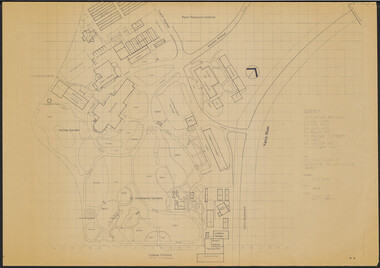
Planning Document, Banyule City Council, Site plan of Greensborough 1997, 28/07/1997
Site plans for the area bounded by Flintoff Street; Grimshaw Street; Main Street and Para Road Greensborough. these plans show the area before the development of Watermarc.This plan shows central Greensborough before the Watermarc developmentSet of 8 site plansgreensborough, greensborough swimming pool -
 Melbourne Tram Museum
Document - Report, City of Melbourne, "Fisherman's Bend Vision - the next chapter in Melbourne's growth story September 2016", Sep. 2016
... Planning ...Report - 44 pages, A4 card cover perfect bound titled "Fisherman's Bend Vision - the next chapter in Melbourne's growth story September 2016", with a photo of Docklands, looking west. Published jointly by the City of Melbourne, City of Port Phillip and the State Government following on from Draft document of 2013. Has a table of contents. Looks at the Strategic Directions for the development of the area, Has a sketch of a tram in Plummer St, Wirraway. Refers to a website www.fishermansbend.vic.gov.au on the rear cover - active as at 18/5/2020.trams, tramways, city of melbourne, city of port phillip, fishermen's bend, new tramway, public transport, development, planning -
 Federation University Historical Collection
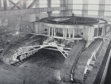
Book, Sudtralasian Institute of Mining and Metallurgy, Latrobe Valley Brown Coal Resources: Geology, Exploration and Open Cut Mining Methods, 1960, 1960
Red hard covered book. Block Prints on white pages, and sections of the Yallourn-Morwell field and the Yallourn Coal Field Includes the following chapters: * Contribution of the Minerals Industry to the Development of Australia by G.R. Fisher (including Gold, Broken Hill Field, Coal, Copper, Tin) * PLanning and Development of the Brown Coal Open Cuts of the State Electricity Commission of Victoria by E.D.J. Stewart * Geology of the Latrobe Valley Coalfield by C.S. Gloe * Developments in Equipment USed for Overburden Removal and Coal Winning in the Brown Coal Industry by H.C.G. Rodgers / J.M. Alexander * Development of Methods for Use of Punch Cards in the Recording of Drill Clogs in the Exploration for Brown Coal by H.E.C. Beernon-fictionyallourn, morwell, loy yang, brown coal, latrobe valley, aus imm, australian institute of mining and metallurgy, ausimm -
 Kew Historical Society Inc
Flyer - 60 Pakington Street, Kew
Subdivision plans and real estate flyers/brochures reveal a number of aspects of urban development and history. The Kew Historical Society's collection of these plans, as well as advertisements extracted from magazines, cover key aspects of community development and architectural history of Kew and Kew Eat as well as surrounding suburbs. While most of the plans in the collection were gifted to the Society by the former City of Kew, a number of other plans and advertisements have been donated by individuals, of which this is an example. Single page illustrated flyer, advertising 60 Pakington Street, Kew for sale. Annotation in pen and ink at right.neville collection, 60 pakington street -- kew (vic.), real estate advertisements -- kew (vic.) -
Kew Historical Society Inc
Flyer - 45 Pakington Street, Kew
Subdivision plans and real estate flyers/brochures reveal a number of aspects of urban development and history. The Kew Historical Society's collection of these plans, as well as advertisements extracted from magazines, cover key aspects of community development and architectural history of Kew and Kew Eat as well as surrounding suburbs. While most of the plans in the collection were gifted to the Society by the former City of Kew, a number of other plans and advertisements have been donated by individuals, of which this is an example.Single page illustrated real estate flyer advertising 45 Pakington Street, Kew for sale by auction. Annotation in pen and ink at rightpeter neville, real estate advertisements -- kew (vic.), 45 pakington street -- kew (vic.) -
Kew Historical Society Inc
Plan - Tramway Estate, Camberwell North, 1937
Subdivision plans and real estate flyers/brochures reveal a number of aspects of urban development and history. The Kew Historical Society's collection of these plans, as well as advertisements extracted from magazines, cover key aspects of community development and architectural history of Kew and Kew Eat as well as surrounding suburbs. While most of the plans in the collection were gifted to the Society by the former City of Kew, a number of other plans and advertisements have been donated by individuals, of which this is an example.Single page subdivision plan listing properties for sale in the Tramways Estate, Camberwell North. The large estate was bounded by Doncaster Road, Burke Road, Marwan Avenue, Maud Street, Severn Street, and extended over Glass's Creek at Mayland's Avenue. Within the plan, lots 3 to 342 are listed as lots. The plan includes annotations in ink indicating the prices realised by a number of lots. A key explains that lots with an 'H' represent a house, whereas the 37 shaded lots represent those being offered by this agent. subdivision plans -- camberwell (vic.), tramways estate -
Kew Historical Society Inc
Plan - Subdivisional Sale of 11 Villa Sites, East Kew, 1939
Subdivision plans and real estate flyers/brochures reveal a number of aspects of urban development and history. The Kew Historical Society's collection of these plans, as well as advertisements extracted from magazines, cover key aspects of community development and architectural history of Kew and Kew Eat as well as surrounding suburbs. While most of the plans in the collection were gifted to the Society by the former City of Kew, a number of other plans and advertisements have been donated by individuals, of which this is an example.Single page residential subdivision plan advertising house lots for sale, in what was then designated as East Kew but is now Kew, in the following streets: Burke Road, Enfield Street. The flyer includes a smaller locality plan at right. Information on the flyer indicates that the land was previously owned by the Melbourne & Metropolitan Tramways Board.subdivision plans -- kew (vic.), enfield street -- kew (vic.), burke road -- kew (vic.) -
Kew Historical Society Inc
Plan - Camberwell Panorama Estate, 1923
Subdivision plans and real estate flyers/brochures reveal a number of aspects of urban development and history. The Kew Historical Society's collection of these plans, as well as advertisements extracted from magazines, cover key aspects of community development and architectural history of Kew and Kew Eat as well as surrounding suburbs. While most of the plans in the collection were gifted to the Society by the former City of Kew, a number of other plans and advertisements have been donated by individuals, of which this is an example.Promotional brochure for the Camberwell Panorama Estate. The four page bifold handout advertises 216 home sites bounded by Bulleen Road, The Nook, Fortuna Avenue, and Doncaster Road. Other streets in the subdivision include: Sunburst Avenue, The Moor, and Macedon Avenue. The brochure has been damaged at some time in the past and so masking tape obscures the tram on page 1. Page 2 includes the plan of the subdivision, page 3 information about the site and a locality plan, while page 4 includes photographs and terms of sale. subdivision plans -- balwyn north (vic.), camberwell panorama estate -
Kew Historical Society Inc
Plan - Saxonwood Estate, Doncaster [East]
Subdivision plans and real estate flyers/brochures reveal a number of aspects of urban development and history. The Kew Historical Society's collection of these plans, as well as advertisements extracted from magazines, cover key aspects of community development and architectural history of Kew and Kew Eat as well as surrounding suburbs. While most of the plans in the collection were gifted to the Society by the former City of Kew, a number of other plans and advertisements have been donated by individuals, of which this is an example.Undated, multi-page subdivision plan advertising lots for sale bounded by Blackburn Road, George Street, Windermere Avenue, and Saxonwood Drive in what is currently Doncaster East. Other streets in the subdivision include: Mowbray Court, Stafford Court, Rugby Court, and Robin Hood Court. The front page includes a Birdseye view of the estate which identifies existing and projected civic amenities, as well as the estate's relationship to surrounding suburbs and the city centre. Red crosses on the detailed plan of lots on page two indicate those that have been sold. The final page includes a locality plan. saxonwood estate -- doncaster east (vic.), subdivision plans -- doncaster east (vic.) -
Kew Historical Society Inc
Plan - Charteris Estate, Ivanhoe [East], 1927
Subdivision plans and real estate flyers/brochures reveal a number of aspects of urban development and history. The Kew Historical Society's collection of these plans, as well as advertisements extracted from magazines, cover key aspects of community development and architectural history of Kew and Kew Eat as well as surrounding suburbs. While most of the plans in the collection were gifted to the Society by the former City of Kew, a number of other plans and advertisements have been donated by individuals, of which this is an example.Original 4-page bifold handout advertising 43 residential lots for sale in the Charteris Estate subdivision in Ivanhoe [now classified as Ivanhoe East]. This brochure was created to sell the third section of the estate which it labels as 'The Most Superb Section'. Streets within the subdivision include: Burke Road North, McArthur Road, Castella Street, and the Government Boulevard. In addition to the overall plan spread across pages 2 and 3, each page includes a number of interesting photographs including: a number of the new Burke Road Bridge, a sports ground, Hoyts Picture Theatre in Ivanhoe, a croquet ground, and Ivanhoe shopping centre [named Motor Cross Junction].charteris estate - east ivanhoe (vic), subdivision plans -- ivanhoe east (vic.), d.c. mcarthur, charterisville -
Kew Historical Society Inc
Plan - Pointed Firs Estate, Camberwell North, 1936
Subdivision plans and real estate flyers/brochures reveal a number of aspects of urban development and history. The Kew Historical Society's collection of these plans, as well as advertisements extracted from magazines, cover key aspects of community development and architectural history of Kew and Kew Eat as well as surrounding suburbs. While most of the plans in the collection were gifted to the Society by the former City of Kew, a number of other plans and advertisements have been donated by individuals, of which this is an example.Original multi-page sales brochure of the Pointed Firs Estate, advertised as located in Camberwell North, but now in Balwyn North. The 4-page bifold brochure includes promotional material as well as a detailed plan of the 28 lots for sale, a photograph of the locality with the plan overlaying it, as well as aerial photos and street views. The estate included lots in Doncaster Road, Thackeray Street, Houghton Street, an dMaud Street. pointed firs estate -- balwyn north, subdivisions -- balwyn north (vic.) -
Kew Historical Society Inc
Booklet - Old Kew Golf Links Estate, 1926
Subdivision plans and real estate flyers/brochures reveal a number of aspects of urban development and history. The Kew Historical Society's collection of these plans, as well as advertisements extracted from magazines, cover key aspects of community development and architectural history of Kew and Kew Eat as well as surrounding suburbs. While most of the plans in the collection were gifted to the Society by the former City of Kew, a number of other plans and advertisements have been donated by individuals, of which this is an example.8-page brochure advertising 80 residential home sites for sale in a subdivision called the 'Old Kew Golf Links Estate'. These sites had historic importance in Kew's history as they had previously belonged to Kodak Pty Ltd who were refused permission by Kew Council to use the land for industrial development. The estate, advertised was advertised as being within five miles of Melbourne. The brochure is notable as it includes photographs of Kew East Primary School, the former Kew Golf Club clubhouse, and 'The Moorings' Boathouse (aka Chipperfield's Boat House). The aerial photograph, overlaid with names of notable sites, on the final page is of interest as it shows the area before the intrusion of the Eastern Freeway, which resulted in changing the course of a section of the Yarra River. old kew golf links estate, subdivision -- kew (vic.), subdivisions -- kew east (vic), chipperfield's boathouse, kew east primary school, kew golf club -
Kew Historical Society Inc
Plan - Willsmere Park Estate, Kew, 1926
Subdivision plans and real estate flyers/brochures reveal a number of aspects of urban development and history. The Kew Historical Society's collection of these plans, as well as advertisements extracted from magazines, cover key aspects of community development and architectural history of Kew and Kew Eat as well as surrounding suburbs. While most of the plans in the collection were gifted to the Society by the former City of Kew, a number of other plans and advertisements have been donated by individuals, of which this is an example.Original 4-page, bifold subdivision plan of the Willsmere Park Estate, Kew. The 1926 land sale advertised '40 superb villa allotments' on the 'Yarra Heights'. Streets within the subdivision included: Willow Grove, Kilby Road, Elm Grove and Belford Road. The double page spread on pages 2 and 3 shows the detailed plan of the 40 lots, surrounded by public parkland [Willsmere Park] and the Kew Golf Links. By the time that this version of the plan was released, only the lots on Willow Grove and Kilby Road remained. willsmere park estate -- kew (vic.), subdivisions - kew (vic.), subdivisions -- kew east (vic.), willsmere park -- kew east (vic.) -
Kew Historical Society Inc
Booklet - Yarraleen Estate, Bulleen, c.1966
Subdivision plans and real estate flyers/brochures reveal a number of aspects of urban development and history. The Kew Historical Society's collection of these plans, as well as advertisements extracted from magazines, cover key aspects of community development and architectural history of Kew and Kew Eat as well as surrounding suburbs. While most of the plans in the collection were gifted to the Society by the former City of Kew, a number of other plans and advertisements have been donated by individuals, of which this is an example.Original 8-page booklet advertising a new residential development in Bulleen entitled 'Yarraleen'. The glossy multi-colour brochure includes historic and contemporary photographs of the Yarra Valley, graphic designs of potential residential development, photographs of key facilities (Marcellin College, Golf links, local swimming holes, the Beaver Swim School, Carey Grammar School Oval and grandstand, shopping strips, and farmland).subdivisions -- bulleen (vic.), yarraleen estate -
Kew Historical Society Inc
Plan - 30 Choice Home Sites in Kilby Road, Meldrum Street and Fairway Drive, 1965
Subdivision plans and real estate flyers/brochures reveal a number of aspects of urban development and history. The Kew Historical Society's collection of these plans, as well as advertisements extracted from magazines, cover key aspects of community development and architectural history of Kew and Kew Eat as well as surrounding suburbs. While most of the plans in the collection were gifted to the Society by the former City of Kew, a number of other plans and advertisements have been donated by individuals, of which this is an example.Original 4-page, bifold brochure, one of two in the collection, of home sites created following the creation of the Eastern Freeway which separated a section of land owned by the Kew Golf Club from the main course. The new estate featured 30 lots in Meldrum Street, Kilby Road and Fairway Drive. subdivisions -- kew east (vic.), subdivisions -- kew (vic.), kew golf club -
Kew Historical Society Inc
Plan - 30 Choice Home Sites in Kilby Road, Meldrum Street and Fairway Drive, 1965
Subdivision plans and real estate flyers/brochures reveal a number of aspects of urban development and history. The Kew Historical Society's collection of these plans, as well as advertisements extracted from magazines, cover key aspects of community development and architectural history of Kew and Kew Eat as well as surrounding suburbs. While most of the plans in the collection were gifted to the Society by the former City of Kew, a number of other plans and advertisements have been donated by individuals, of which this is an example.Original 4-page, bifold brochure, one of two in the collection, of home sites created following the creation of the Eastern Freeway which separated a section of land owned by the Kew Golf Club from the main course. The new estate featured 30 lots in Meldrum Street, Kilby Road and Fairway Drive.subdivisions -- kew east (vic.), subdivisions -- kew (vic.), kew golf club -
Kew Historical Society Inc
Plan - Burke Road Junction Estate, East Kew, 1940
Subdivision plans and real estate flyers/brochures reveal a number of aspects of urban development and history. The Kew Historical Society's collection of these plans, as well as advertisements extracted from magazines, cover key aspects of community development and architectural history of Kew and Kew Eat as well as surrounding suburbs. While most of the plans in the collection were gifted to the Society by the former City of Kew, a number of other plans and advertisements have been donated by individuals, of which this is an example.Original 4-page bifold brochure advertising the Burke Road Junction Estate in Kew East. Advertised for sale in 1940, the estate comprised 16 'Central Allotments' fronting High Street, Kilby Road, and Glass Street. Pages 1 & 4, the front and back covers, includes a panoramic photograph of the junction which features a number of shops still extant, but also with buildings long demolished and redeveloped. These include the petrol station and the dairy on the southeast and southwest corners of Burke Road and High Street/Doncaster Road. The dairy includes a statue of a cow on its roof. Pages 2 & 3 include a detailed plan of the estate. subdivisions -- kew east (vic.), burke road junction estate -
Whitehorse Historical Society Inc.
Document, Municipal Chambers, Nunawading, 23/07/2001 12:00:00 AM
Papers relating to applications for Council permits, objections and VCAT hearingsPapers relating to applications for Council permits, objections and VCAT hearings concerning development of 360-362 Whitehorse Road, Nunawading, and of 13 Walkers Road, Nunawading. Includes maps, plans, photos and architectural assessment of 360 Whitehorse Road by Andrew Ward.Papers relating to applications for Council permits, objections and VCAT hearings associated planning consultants, arrowsmith, valda, nunawading and district historical society, municipal chambers, whitehorse road, nunawading, no 360, no 362, walkers road, no. 13, victorian civil and administrative tribunal, ward, andrew, city of whitehorse -
Port Melbourne Historical & Preservation Society
Audio - PMHPS Meeting, Fairstar, Robert PRADOLIN and Rob JELL, Glen Stuart, 1996
Recording of PMHPS meeting on 22.01.1996. Recorded by Glen STUART at the Liardet Community Centre. Speakers were Robert PRADOLIN of Faristar and Rob JELL, consultant to Faristar. Discussing plans for HMAS Lonsdale site development. Recording duration 01:11:17built environment - commercial, faristar, sandridge lagoon, robert pradolin, rob jell -
Port Melbourne Historical & Preservation Society
Audio - Radio 3LO program excerpts, Sandridge City Development plan, 1991 - 1993
Various excerpts from 3LO radio prgrams, including Ranald McDONALD interviewing Jim KENNAN and Doug AITKEN interviewing Mark BIRRELL about Sandridge City Development (Bayside Plan) Recording duration 47:09. Approx 1991 and 1993town planning - proposals shelved - bayside, jim kennan, mark birrell, sandridge city development co pty ltd, scdc -
 Greensborough Historical Society
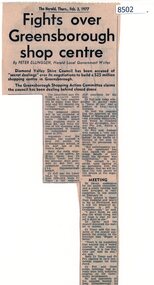
Article - Newspaper Clipping, The Herald, Fights over Greensborough shop centre, 03/02/1977
This article covers some of the issues when the development of Greensborough Plaza was in the planning stages in 1977.Shows local resistance to the building of a large shopping complex in Greensborough.News article, black textgreensborough plaza, shire of diamond valley, bob fell -
 Greensborough Historical Society
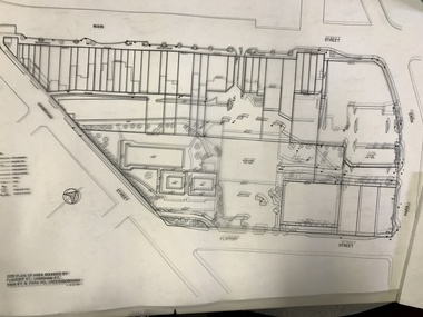
Plan, Plan of Manatunga Circuit Greensborough subdivision, 1970_
Plan of Manatunga Circuit subdivision. Prepared by O'Connor and Beveridge (land surveyors) for Development Underwriting (developers). Plan of subdivision. Part of Crown Portion 3. Parish of Nillumbik, County of Evelyn.An original example of a subdivision plan in the expanding suburb of Greensborough. The 1960s and 1970s saw this area develop from a rural farming area to a suburb.Plan of subdivision. Printed on buff paper, hand coloured. Mounted on cardboard. Includes 2 small cards attached.Various handwritten comments. Small cards from Survey Branch, Office of Titles.greensborough, manatunga circuit, diamond creek road, plenty river drive -
 Bendigo Historical Society Inc.
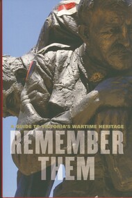
Book - REMEMBER THEM, 2009
Rember Them a guide to Victorias's wartime heritage, a 308 page hardcover book containing photographs in colour & black & white and maps. Funded by the Government of Victoria and produced by the Veteran's unit, Dept of Planning and Community Development. Published by Hardie Grant Books Prahran.Government of Victoriabook, wartime heritage, victoria's wartime heritage, war memorials. -
Victorian Aboriginal Corporation for Languages
Folder, Maori Language Commission, He Taonga te Reo, 2002
Folder includes Matariki booklet, A guide for Iwi and Hapu to the preparation of long-term Maori Language development plans, 2 copies Promoting Positive Attitudes to the Maori Language in the classroom, stickers and leaflets and Putanga 5, Nama 3 Hotoke 2003 leaflet.multilingualism, education, bilingualism, language transmission -
 Greensborough Historical Society
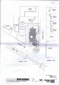
Plan, brucehenderson architects, Plans for proposed development at Devonshire and Lambourne Roads Watsonia 2004, 2004_01
Amended plans for a mixed use development corner Devonshire Road and Lambourn Road Watsonia in 2004.23 p., black & white and colour plans with covering letterwatsonia, lambourn road watsonia, devonshire road watsonia