Showing 234 items matching "plant form"
-
 Eltham District Historical Society Inc
Photograph - Digital Photograph, Marguerite Marshall, Jesse Tree playing the Didgeridoo and Swiss Hang Drum at St Andrews Market, 29 March 2008
Published: Nillumbik Now and Then / Marguerite Marshall 2008; photographs Alan King with Marguerite Marshall.; p175 It’s Saturday morning and thousands of people are visiting St Andrews Market at the corner of Heidelberg-Kinglake Road and Proctor Street. It’s hard to find a park. Cars are banked up along the narrow road and crammed in a nearby parking area. Yet, at the market, people look relaxed and happy amongst the yellow box gums on the site where the Wurundjeri people used to gather. Stone artefacts unearthed there by Koorie researcher, Isabel Ellender, indicate the site was once a Wurundjeri meeting place, according to Aboriginal Affairs Victoria. Acoustic sounds mingle with quiet conversations. A guitarist blows a mouth organ while his bare toes tickle chimes. A tiny busker, perhaps five years old, plays a violin while sounds of a harp emerge from the hall. One stallholder, selling delicious-looking pastries, chats to another in Spanish, then to me in broad Australian. ‘I was born in Fitzroy but my mother came from Mexico and my dad from Serbia,’ she smiles. A New Zealander fell in love with Mongolia and now imports their hand-made embroidered clothes and Yurts (tents) and runs adventure tours. A young woman visited Morocco and when friends admired the shoes she bought, she decided to import them and sell them at the market. Oxfam sells Fair Trade toys and clothes and displays a petition to Make Poverty History. Other stalls sell Himalayan salt, jewellery made from seeds from northern Australia, glass paper-weights from China as well as locally grown vegetables, flowers and organic freshly baked bread. A woman sits in a state of bliss under the hands of a masseur. Another offers Reiki or spiritual healing. A juggler tosses devil sticks – ‘not really about the devil,’ he smiles. This skill was practised thousands of years ago in Egypt and South America he says. At the Chai Tent people lounge on cushions in leisurely conversation. The idea for the market was first mooted among friends over a meal at the home of famous jazz and gospel singer Judy Jacques.2 Jacques remembers a discussion with several local artists including Marlene Pugh, Eric Beach, Les Kossatz, Ray Newell and Peter Wallace. ‘We decided we wanted a meeting place, where all the different factions of locals could meet on common ground, sell their goodies and get to know one another,’ Jacques recalls. They chose the site opposite another meeting place, St Andrews Pub. A week later Jacques rode her horse around the district and encouraged her neighbours to come along to the site to buy or sell. On February 23, 1973, about 20 stallholders arrived with tables. They traded ‘second-hand clothes, vegetables, meat, cheese, eggs, chickens, goats, scones, tea, garden pots and peacock feathers’. Now around 2000 people visit each Saturday. People usually linger until dusk. The market – with around 150 stalls of wares from a wide variety of cultures – stands alongside Montsalvat as the most popular tourist attraction in Nillumbik. By the 1990s St Andrews Market was in danger of being loved to death, as the site was becoming seriously degraded. The market was spreading in all directions and the degradation with it. A local council arborist’s report in 1994 noted exposed tree roots from erosion and compaction. The Department of Sustainability and Environment threatened to close the market if the degradation was not rectified. After many months of research, discussions and lobbying by a few residents, the council formed a Committee of Management, with an Advisory Committee, and introduced an Environment Levy. The State Government, the council and the market, funded terracing of the site to stop erosion, and retain moisture and nutrients. Vehicles were excluded from some sensitive areas and other crucial zones reserved for re-vegetation. Volunteers planted more than 3000 locally grown indigenous species. The old Yellow Box trees fully recovered and are expected to give shade for many years to come.This collection of almost 130 photos about places and people within the Shire of Nillumbik, an urban and rural municipality in Melbourne's north, contributes to an understanding of the history of the Shire. Published in 2008 immediately prior to the Black Saturday bushfires of February 7, 2009, it documents sites that were impacted, and in some cases destroyed by the fires. It includes photographs taken especially for the publication, creating a unique time capsule representing the Shire in the early 21st century. It remains the most recent comprehenesive publication devoted to the Shire's history connecting local residents to the past. nillumbik now and then (marshall-king) collection, didgeridoo, jesse tree, st andrews market, swiss hang drum -
 Eltham District Historical Society Inc
Photograph - Digital Photograph, Alan King, Blue Lake, Plenty Gorge Park, 2008
A quarry was transformed into the Blue Lake. Published: Nillumbik Now and Then / Marguerite Marshall 2008; photographs Alan King with Marguerite Marshall.; p179 The dramatic steep-sided Plenty Gorge lies along the divide of two geological areas, and separates the Nillumbik Shire and the City of Whittlesea. On the Nillumbik side are undulating hills and sedimentary rock, and in Whittlesea, lies a basalt plain formed by volcanic action up to two million years ago. This provides the Plenty Gorge Park with diverse vegetation and habitats, making it one of Greater Melbourne’s most important refuges for threatened and significant species. The park, established in 1986, consists of around 1350 hectares, and extends 11 kilometres along the Plenty River, from Greensborough to Mernda. It provides a wildlife corridor for around 500 native plant and 280 animal species. The area’s plentiful food and water attracted the Wurundjeri Aboriginal people and then European settlers. By 1837 squatters had claimed large runs of land for their sheep and cattle. The Plenty Valley was among the first in the Port Phillip District to be settled - mainly in the less heavily timbered west - and was proclaimed a settled district in 1841.But by the late 1880s, the settlers’ extensive land clearing for animal grazing, then agriculture, depleted the Wurundjeri’s traditional food sources, which helped to drive them away. Many Wurundjeri artefacts remain (now government protected), and so far 57 sites have been identified in the park, including scarred trees, burial areas and stone artefacts. Pioneer life could be very hard because of isolation, flooding, bushfires and bushrangers. Following the Black Thursday bushfires of 1851, basalt was quarried to build more fire-resistant homes. Gold discoveries in the early 1850s swelled the population, particularly around Smugglers Gully; but food production made more of an impact. In the late 1850s wheat production supplanted grazing. In the 1860s the government made small holdings available to poorer settlers. These had the greatest effect on the district, particularly in Doreen and Yarrambat, where orchards were established from the 1880s to 1914. Links with a prominent early family are the remains of Stuchbery Farm, by the river’s edge bounded by Smugglers Gully to the north and La Trobe Road, Yarrambat, to the east. The Stuchberys moved to the valley in 1890, and the family still lives in the area. In 1890, Alfred and Ada first lived in a tent where four children were born, then Alfred built the house and outbuildings around 1896. They planted an orchard, then a market garden, and developed a dairy. The family belonged to the local Methodist and tennis communities. Their grandson Walter, opened the Flying Scotsman Model Railway Museum in Yarrambat, which his widow, Vi, continues to run. Wal was also the Yarrambat CFA Captain for 22 years until 1987. Walter sold 24 hectares in 1976 for development - now Vista Court - and in 1990, the remaining 22.6 hectares for the park. Remaining are an early stone dairy and remnants of a stone barn, a pig sty and a well. Until it was destroyed by fire in 2003, a slab hut stood on the Happy Hollow Farm site, at the southern end of the park. The hut is thought to have been built in the Depression around 1893. This was a rare and late example of a slab hut with a domestic orchard close to Melbourne. Emmet Watmough and his family first occupied the hut, followed by a succession of families, until the Bell family bought it around 1948. There they led a subsistence lifestyle for 50 years, despite encroaching Melbourne suburbia. The Yellow Gum Recreation Area includes the Blue Lake, coloured turquoise at certain times of the year. Following the 1957 bushfires, this area was quarried by Reid Quarries Pty Ltd for Melbourne’s first skyscrapers, then by Boral Australia. However in the early 1970s water began seeping into the quarry forming the Blue Lake and the quarry was closed. The State Government bought the site in 1997 and opened it as a park in 1999.This collection of almost 130 photos about places and people within the Shire of Nillumbik, an urban and rural municipality in Melbourne's north, contributes to an understanding of the history of the Shire. Published in 2008 immediately prior to the Black Saturday bushfires of February 7, 2009, it documents sites that were impacted, and in some cases destroyed by the fires. It includes photographs taken especially for the publication, creating a unique time capsule representing the Shire in the early 21st century. It remains the most recent comprehenesive publication devoted to the Shire's history connecting local residents to the past. nillumbik now and then (marshall-king) collection, blue lake, plenty gorge park -
 Eltham District Historical Society Inc
Photograph - Digital Photograph, Marguerite Marshall, Stuchbery Farm dairy, 14 March 2008
Stuchbery Farm was situated on the Plenty River bounded by Smugglers Gully to the north and La trobe Road, Yarrambat, to the east. Alan and Ada Stutchbery moved to the valley in 1890, first living in a tent where four children were born. Alfred built a home and outbuildings around 1896. They planted an orchard, then a market garden and developed a dairy. Published: Nillumbik Now and Then / Marguerite Marshall 2008; photographs Alan King with Marguerite Marshall.; p179 The dramatic steep-sided Plenty Gorge lies along the divide of two geological areas, and separates the Nillumbik Shire and the City of Whittlesea. On the Nillumbik side are undulating hills and sedimentary rock, and in Whittlesea, lies a basalt plain formed by volcanic action up to two million years ago. This provides the Plenty Gorge Park with diverse vegetation and habitats, making it one of Greater Melbourne’s most important refuges for threatened and significant species. The park, established in 1986, consists of around 1350 hectares, and extends 11 kilometres along the Plenty River, from Greensborough to Mernda. It provides a wildlife corridor for around 500 native plant and 280 animal species. The area’s plentiful food and water attracted the Wurundjeri Aboriginal people and then European settlers. By 1837 squatters had claimed large runs of land for their sheep and cattle. The Plenty Valley was among the first in the Port Phillip District to be settled - mainly in the less heavily timbered west - and was proclaimed a settled district in 1841. But by the late 1880s, the settlers’ extensive land clearing for animal grazing, then agriculture, depleted the Wurundjeri’s traditional food sources, which helped to drive them away. Many Wurundjeri artefacts remain (now government protected), and so far 57 sites have been identified in the park, including scarred trees, burial areas and stone artefacts. Pioneer life could be very hard because of isolation, flooding, bushfires and bushrangers. Following the Black Thursday bushfires of 1851, basalt was quarried to build more fire-resistant homes. Gold discoveries in the early 1850s swelled the population, particularly around Smugglers Gully; but food production made more of an impact. In the late 1850s wheat production supplanted grazing. In the 1860s the government made small holdings available to poorer settlers. These had the greatest effect on the district, particularly in Doreen and Yarrambat, where orchards were established from the 1880s to 1914. Links with a prominent early family are the remains of Stuchbery Farm, by the river’s edge bounded by Smugglers Gully to the north and La Trobe Road, Yarrambat, to the east. The Stuchberys moved to the valley in 1890, and the family still lives in the area. In 1890, Alfred and Ada first lived in a tent where four children were born, then Alfred built the house and outbuildings around 1896. They planted an orchard, then a market garden, and developed a dairy. The family belonged to the local Methodist and tennis communities. Their grandson Walter, opened the Flying Scotsman Model Railway Museum in Yarrambat, which his widow, Vi, continues to run. Wal was also the Yarrambat CFA Captain for 22 years until 1987. Walter sold 24 hectares in 1976 for development - now Vista Court - and in 1990, the remaining 22.6 hectares for the park. Remaining are an early stone dairy and remnants of a stone barn, a pig sty and a well. Until it was destroyed by fire in 2003, a slab hut stood on the Happy Hollow Farm site, at the southern end of the park. The hut is thought to have been built in the Depression around 1893. This was a rare and late example of a slab hut with a domestic orchard close to Melbourne. Emmet Watmough and his family first occupied the hut, followed by a succession of families, until the Bell family bought it around 1948. There they led a subsistence lifestyle for 50 years, despite encroaching Melbourne suburbia. The Yellow Gum Recreation Area includes the Blue Lake, coloured turquoise at certain times of the year. Following the 1957 bushfires, this area was quarried by Reid Quarries Pty Ltd for Melbourne’s first skyscrapers, then by Boral Australia. However in the early 1970s water began seeping into the quarry forming the Blue Lake and the quarry was closed. The State Government bought the site in 1997 and opened it as a park in 1999.This collection of almost 130 photos about places and people within the Shire of Nillumbik, an urban and rural municipality in Melbourne's north, contributes to an understanding of the history of the Shire. Published in 2008 immediately prior to the Black Saturday bushfires of February 7, 2009, it documents sites that were impacted, and in some cases destroyed by the fires. It includes photographs taken especially for the publication, creating a unique time capsule representing the Shire in the early 21st century. It remains the most recent comprehenesive publication devoted to the Shire's history connecting local residents to the past. nillumbik now and then (marshall-king) collection, ada stuchbery, alan stuchbery, dairy, stuchbery farm, farm buildings, yarrambat, plenty gorge park -
 Eltham District Historical Society Inc
Photograph - Digital Photograph, Alan King, Diamond Creek, Barak Bushlands, Eltham, 2008
A habitat corridor and it strengthens the community. Published: Nillumbik Now and Then / Marguerite Marshall 2008; photographs Alan King with Marguerite Marshall.; p185 Barak Bushlands lie west of the Diamond Creek on the corner of Falkiner Street and busy, noisy Main Road. They form part of an important habitat corridor linking the Yarra River to the Kinglake National Park.1 Manna Gums, tawny frogmouths and platypuses are some of the indigenous plants and animals that have made their home there. The bushlands are the result of more than nine years of hard work by the local community with the Nillumbik Council, to transform a degraded flood plain into this refuge of natural beauty. In 1997, shortly after moving into the new Riverside Estate on Falkiner Street, Eltham, several residents noticed the sorry state of the Diamond Creek and surrounding area. Part of it was used as a cow paddock and although small patches of vegetation survived, the area was infested with weeds, rabbits, rubbish and drainage from the housing estate. At various times the 4.4 hectares had been used as a market garden and for shire stock piles. The residents began to restore the area by revegetating land along the Diamond Creek. In 1998 they established the Friends of the Diamond Creek Falkiner Street Reserve2 and 35 families joined from the 90-house Estate. Carolyn Mellor, as the Friends’ Land Manager, undertook a four-year horticulture course to guide this massive project for a volunteer organisation. Since 1999, she has been the Friends’ President. In 1999 the Friends urged the Nillumbik Council to undertake a feasibility study into establishing a wetland system and urban forest. Work began in 2002 with Nillumbik Council funding the project, supplemented by government grants. The Friends also received grants from Melbourne Water and Parks Victoria. Aided by the Friends and other community members, the Council created the Barak Bushlands consisting of a forest, a wetland, a bridge, a path and open space. The beautiful wetland treats most of the estate’s stormwater runoff. Storm water is filtered through plants in the wetland ponds then is released slowly into the billabong, before flowing into the Diamond Creek. The wetland also helps to minimise flooding and the improved water quality provides a flora and fauna habitat. The Friends and other volunteers planted more than 27,000 plants, more than one third of which they grew from seeds they collected at Lower Eltham and Wingrove Parks. Eltham High School students planted thousands of these through a Year Eight program introduced for this purpose. Other groups who assisted were: Green Corps, local Scouts and Guides – 2nd Montmorency, 1st Diamond Creek and 1st Eltham Cub Packs, Eltham College students, Eltham East Primary School, Landcare members, Eltham Lions Club and the Eltham Baptist Church. To maintain enthusiasm for the mammoth task, the Friends and other volunteers ‘adopted’ trees to water and wrote their names on the stakes. In 2004, to recognise the area’s original occupiers, the reserve was named Barak Bushlands. William Barak, who lived from 1824 to 1903, was the last chief of the Yarra Yarra tribe of the Wurundjeri-willam people. Traces of these original inhabitants remain in scar trees (bark sections removed to make a shield or canoe). That same year the Friends’ group was a finalist in the prestigious Federal Government, Banksia Environmental Awards. The Friends have also participated in Clean Up Australia, removing tonnes of rubbish and regularly testing the billabong, wetland and creek, for pollutants. For years the Friends, together with the Australian Platypus Conservancy, have tagged, measured and checked the health of platypuses from the Diamond and Mullum Mullum Creeks. With Latrobe University the Friends have conducted night walks to view owls, possums, bats and sugar gliders. Challenges for the council and the Friends continue with a large rabbit population, some vandalism, weed eradication and maintenance. However, thanks to this community effort, locals can now escape confined urban living on small blocks of land and enjoy the beauty of indigenous plants and animals. Working together has also strengthened the local community,This collection of almost 130 photos about places and people within the Shire of Nillumbik, an urban and rural municipality in Melbourne's north, contributes to an understanding of the history of the Shire. Published in 2008 immediately prior to the Black Saturday bushfires of February 7, 2009, it documents sites that were impacted, and in some cases destroyed by the fires. It includes photographs taken especially for the publication, creating a unique time capsule representing the Shire in the early 21st century. It remains the most recent comprehenesive publication devoted to the Shire's history connecting local residents to the past. nillumbik now and then (marshall-king) collection, barak bushlands, diamond creek (creek), eltham -
 The Beechworth Burke Museum
Photograph - Stereoscopic Photograph, c1900
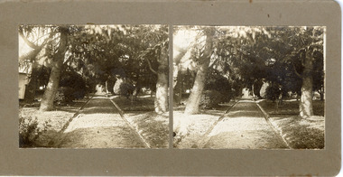
The gardens of Ovens District Hospital were laid out and planted by R H Jenkyns in 1874. Over 200 species of trees and shrubs were planted, including several large Himalayan Cedars (Cedrus deodora), a Coast Redwood (Sequoia sempervirens), rare Scots Pine (Pinus sylvestris), Pencil Cedar (Juniperus virginiana), Bunya Bunya Pines (Araucaria bidwillii), a Purple-leaved Dutch Elm (Ulmus x hollandica 'Purpurascens'), American Ash (Fraxinus americana), Pinus radiata, and numerous Populus alba trees and suckers. The gardens were considered integral to the healing process, also including orchards and kitchen gardens. In the 1880s, tourists flocked to Beechworth as the area became recognised as a health resort and picturesque beauty spot. Although the hospital closed in 1940, and parts were subsequently demolished, the gardens remain and form part of the site's listing on the Victorian Heritage Register. This photograph is part of a collection of items held by the Burke Museum relating to Ovens District Hospital. At the time of being built, the Ovens District Hospital was the only hospital between Melbourne, Victoria, and Goulburn, New South Wales, treating patients from all of north-east Victoria, including Indigo Shire.Black and white stereoscopic photograph mounted on card.Reverse: 97-2292 / View up centre path of Hospital / A03177 / BMM3177 / Note: A03178 / View of the central path of the Ovens Hospital / (Church St) Beechworthovens hospital, hospital garden, gardens and parks, ovens district hospital -
 Mont De Lancey
Book, D.W. Chandler Ltd, D.W. Chandler General Hardware Ltd. Catalogue, 1937
A comprehensive 1937 catalogue of general hardware for household and farm use for buyers to order in Melbourne and rural cities in Australia. The company was established in 1876. This is the 49th issue.A comprehensive thick catalogue book: D.W. Chandler General Hardware Ltd. Catalogue established 1876 which has a very decorative busy front cover with green, burgundy and cream colours for the title, full details of the contents, address, Registered Trademark, phone numbers and more. It is bound on the spine with red tape, 27.5 Inside on the left front end paper are details about Chandler's mail orders, a map of the Melbourne city location and addresses for Melbourne, Fitzroy and country cities. Opposite is a NOTICE page, explaining prices were current at the time of issue, (October 1937) with several altered prices since printing. Pp. 180 with four thin blue paper Order Forms at the back; two which have been filled in and two with a child's scribble on them. There is a comprehensive four page Index at the back. Hundreds of black and white drawings of hardware items and general life of the times are included throughout. Inserted in the catalogue are four dried plants or flowers, a small leaflet which shows illustrations and information about "Rega" spraying nozzles with diagrams and handwritten prices. A leaflet of a Parts Price List for Stewart No.1 Clipping machine and clipping heads. A copy of a D. W. Chandler Ltd Fitzroy order dated 12 March 1937 for "Ringlock" Fencing. On page 146 is a light blue thin paper Note for P146 about models of Churchill's and Jeffery's guns. Attached to this paper with cellotape is a typed copy dated 10/11/37 for an order for Square Iron Tanks to be delivered by rail. The back cover has advertising for "Perfect" Welded Fencing from Chandler's hardware stores. There is a manufactured hole by the publisher in the top left hand corner to hang it for future reference.non-fictionA comprehensive 1937 catalogue of general hardware for household and farm use for buyers to order in Melbourne and rural cities in Australia. The company was established in 1876. This is the 49th issue. social history, australian history, history, hardware, catalogues, objects, tools -
 Melbourne Tram Museum
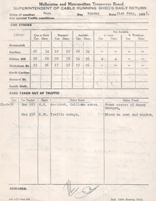
Administrative record, Melbourne & Metropolitan Tramways Board (MMTB), "Supt cable running sheds daily return", 1938
Administrative record - "Superintendent of cable running sheds daily return" for MMTB dated 21/2/1938 - form 21A of 11/37. Give details of the weather, traffic conditions, depot tram cars - cars and dummies, and their availability. Lists 2 cars taken out of service - issues or accidents. Would have been compiled from individual depot reports. The rear of the sheet has been used to prepare a report by K L Mackenzie on applicants for the Compressed Gas Plant attendant at Clifton Hill depot. The Compressed Gas plant was part of the equipment installed to provide gas for the buses during the early stage of the Second World War. Names listed are: Hence, Wrigly, Maynard, Fay, Coates, Stephens, Lyons, Langton, and C J M Campbell. See item 7521, 7517 and 7518 for similar reports. Yields information the mmtb cable tram allocation and events at cable tram running sheds - 1938.Completed preprinted quarto form with typed information with hand writing on rear.tramways, trams, mmtb, depots, daily reports, cable trams, clifton hill, compressed gas, buses -
 Melbourne Tram Museum
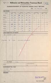
Administrative record, Melbourne & Metropolitan Tramways Board (MMTB), "Supt running sheds daily return", 1925
Administrative record - "Superintendent electric running sheds' daily return" for MMTB dated 4/5/1925 - form 71. Give details of the weather, traffic conditions, depot tram cars - bogie and single truckers Lists 1 car taken out of service - defective or accidents, provides detail of the status of fire services at depots, and watchmen's tell tales. Would have been compiled from individual depot reports. The rear of the sheet has been used to prepare a report by K L Mackenzie on applicants for the Compressed Gas Plant attendant at Clifton Hill depot. The Compressed Gas plant was part of the equipment installed to provide gas for the buses during the early stage of the Second World War. Names listed are: Hence, Wrigly, Maynard, Fay, Coates, Stephens, Lyons, and Langton. See item 7521, 7516 and 7518 for similar reports. Yields information the mmtb cable tram allocation and events at electric tram running sheds - 1925 and the compressed gas system attendants.Completed preprinted foolscap form with typed information and hand writing on the rear.tramways, trams, mmtb, depots, daily reports, cable trams, clifton hill, compressed gas, buses -
 Bacchus Marsh & District Historical Society
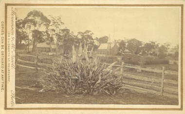
Photograph, Agave Americana plant with view of Anglican and Presbyterian Churches in background, Bacchus Marsh 1883
This image appears to have been created to depict this good size Agave Americana plant, also known as the 'Century Plant'. Agaves are an introduced species to Australia. Their local propagation in Victoria is mentioned in Victorian newspapers as early as the 1850s. By the 1870s they appear to have become fairly common but still relatively novel. The side by side view of the Holy Trinity Anglican and Saint Andrews Presbyterian Churches forms an interesting frame for this botanical study. On the far right of the image in the background can be seen the Presbyterian Church Manse built in 1858 and demolished in the 20th century.Small sepia 'carte de viste' style unframed photograph on card with gold border framing photograph. Housed in the Jeremeas Family Album which contains photographs of Bacchus Marsh and District in 1883 by the photographers Stevenson and McNicoll. In the foreground of this image is an Agave Americana plant growing alongside a post and rail fence. In the background can be seen the Anglican Holy Trinity Church on the left and Saint Andrews Presbyterian Church on the right.Printed On the front: Stevenson & McNicoll. Photo. 108 Elizabeth St. Melbourne. COPIES CAN BE OBTAINED AT ANY TIME. On the back: LIGHT & TRUTH inscribed on a banner surmounted by a representation of the rising sun. Copies of this Portrait can be had at any time by sending the Name and Post Office Money Order or Stamps for the amount of order to STEVENSON & McNICOLL LATE BENSON & STEVENSON, Photographers. 108 Elizabeth Street, MELBOURNE. stevenson and mcnicoll 1883 photographs of bacchus marsh and district, churches bacchus marsh, holy trinity anglican church bacchus marsh, holy trinity church of england bacchus marsh, saint andrews presbyterian church bacchus marsh, plants, agaves, exotic plants, agave americana -
 Villa Alba Museum
Document, Dr James Broadbent, The Garden: A Report, 2005
Villa Alba’s garden is a reconstruction, but in its design it is as accurate to its late nineteenth century form as the available evidence and Xavier College’s requirements, allowed. This is so, despite the 1890s garden having been progressively destroyed, built on and reformed as a hospital garden during the third quarter of last century. Yet, with its combination of preserved architectural and some archaeological features, and a largely accurate re-created form, Villa Alba’s new garden is a major interpretational component of the property which allows the visitor to comprehend its original design and functions and provides an essential historical context for the house as a major suburban villa.Introduction / p1.Features of Heritage Significance / p1-2. Garden Reconstruction (The Flower Garden, South East Shrubbery, The East lawn, The Back or North Garden and Fernery, Privy Fishpond and Conservatory Area, Planting as at 19/7/2001 and later, The Replanting of the Garden, works Awaiting Completion: Stage 2 of Garden Plan) / p2-7.non-fictionVilla Alba’s garden is a reconstruction, but in its design it is as accurate to its late nineteenth century form as the available evidence and Xavier College’s requirements, allowed. This is so, despite the 1890s garden having been progressively destroyed, built on and reformed as a hospital garden during the third quarter of last century. Yet, with its combination of preserved architectural and some archaeological features, and a largely accurate re-created form, Villa Alba’s new garden is a major interpretational component of the property which allows the visitor to comprehend its original design and functions and provides an essential historical context for the house as a major suburban villa.villa alba museum, dr james broadbent, 2005, heritage gardens, garden reconstruction, conservation analysis, conservation report -
 Eltham District Historical Society Inc
Work on paper - Folio, Register of Significant Trees, Shire of Eltham, c.1993
In 1983, the National Trust advised the Shire of Eltham that it was investigating a number of trees within the shire which had been nominated for recording the Register of Significant Trees of Victoria. The trees involved were described in the Shire of Eltham Historical Society Newsletter No. 29, March 1983 as follows:- 1. Eucalyptus melliadora (Yellow box) . a) An outstanding mature specimen 42 metres high in Laughing Waters Road, Eltham. b) Another mature specimen in Arthurs Creek road, Hurstbridge is reported to be the tree under which the bushranger Robert Bourke was tied after he shot and killed Henry Hurst in 1866 . 2. Quercus robur (English Oak). a) "Donaldson's Oak", Donaldsons Road, Kangaroo Ground was planted by John Donaldson from seed collected from Windsor Great Park in 1878. b) "Wippells Oak". This now misshapen tree is located on the St. Andrews Road near the Kangaroo Ground Fire Station. Its origins may have been similar to Donaldson's Oak, and as a young tree it apparently slipped from higher up the hill during wet weather. Both oaks are of local historical importance. 3. Eucalyptus globulus (Blue Gum). A large mature specimen at the corner of the Kangaroo Ground-St. Andrews Road and Bakehouse Road, Panton Hill. 4. Plantanas acerifolia (Plane tree) A number of trees forming the Avenue of Honour to Eltham's First World War soldiers along Main Road between Dalton and Pitt Streets, Eltham. 5. Pinus canariensis (Canary Island Pine), Pinus pinea, (Stone pine) and Cedras altlantica, (Cedar) These trees are located at the Hurst family graves in the grounds of the Hurstbridge Pre-school Centre. In 1991 the Shire of Eltham introduced controls into its planning scheme to protect sites of architectural, historic or conservation interest and significant trees. The controls were approved by the Minister for Planning and Housing. As advised in the Shire of Eltham Historical Society Newsletter No. 78, May 1991, a planning permit is required to demolish or alter any listed building or to destroy, lop or remove any listed tree. Provision is made for comments to be obtained from the National Trust or Historic Buildings Council in considering any applications. The buildings and trees listed were: Buildings: 250 Bolton Street Eltham (former Walter Withers home) "Rosehill" - Bonds Road Lower Plenty St Andrews Church of England - St Andrews "Montsalvat" - Hillcrest Avenue Eltham St Margarets Church and former vicarage - Pitt Street Eltham Presbyterian Church - Kangaroo Ground Parks and Environment Office (former police quarters) Main Road Eltham Former Court House - Main Road Eltham "Shillinglaw Cottage" - Main Road Eltham "The Robins" - Kangaroo Ground Road Warrandyte Trees: "Donaldsons Oak" - Donaldsons Road Kangaroo Ground Yellow Box - Laughing Waters Road Eltham Yellow Box - Arthurs Creek Road Hurstbridge Wippells Oak - St Andrews Road Kanqaroo Road Pines and Cedar - Hurst family cemetery Greysharps Road Hurstbridge Yellow Box - Parsons Road Eltham A large Blue Gum at Panton Hill has been listed but has recently died (1991). In 1993 work by Council Parks and Environment staff and volunteers resulted in the preparation of a Significant Tree Register listing forty-one trees or groups of trees. According to Shire of Eltham Historical Society Newsletter No. 91, March 1993, a similar number remained to be assessed for inclusion in the register. There is a wide range of indigenous and planted trees on private and public land and extending through the Shire of Eltham from Lower Plenty to Kinglake. Most can be viewed from publicly accessible locations. The Significant Tree Register lists 41 trees or groups of trees throughout the Shire. It contains a wide range of naturally occurring and planted trees. They have been assessed according to eleven criteria including size, age, rarity, historical value and the like. The list includes large old Red Gums at Lower Plenty, historic Oaks at Kangaroo Ground and Mountain Ash at Kinglake. The register includes a set of slides showing each tree. Garry Bartlett of the Council's Parks and Environment Section and Faye Shepherd were extensively involved in establishment of the register (Newsletter No. 93, November 1993). In 1999 Niliumbik planners prepared an amendment to the Planning Scheme to provide protection for approximately 200 of the places listed in the heritage studies and also in the Significant Tree Register commenced by the Eltham Council (Eltham District Historical Society Newsletter No. 127, July 1999. In 2004, The Register of Significant Trees was presented to the Eltham District Historical Society by Nillumbik Shire Council as part of a wider collection of of its memorabilia of the former Eltham Shire Council (EDHS Newsletter No. 159, July 2004. Album of loose handmade paper sheets contained within a handmade slip cover constructed of handcrafted card with encapsulated flora material (flowers, vines, ferns) and tinted. Each page also contains an embedded/adhered fern leaf also tinted with lacqueur or similar, text as appropriate in ink by hand calligraphy. Each page also has a white protective sheet cut to size and adhered to back surface with sticky tape and folded over face of page. Pages variously have photographs and coloured masks adhered with a gum resin. Over time much of this resin has let go and photos/masks have been reattached using acid free archival safe adhesive. 15 pages 41 x 29 cm inclusive of 3 blank pages. Slip case 42 x 30 x 1 cm; face cover of slip case has broken off at left hand margin as insufficient depth/flexibility for contents.arthurs creek road, blue gum (eucalyptus globulus), canary island pine (pinus canariensis), couties road, donaldsons oak, donaldsons road, eltham, english oak (quercus robur), eucalyptus melliodora, graysharps road, hurst tree, hurstbridge, ironbark (eucalyptus tricarpa), ironbark hill, kangaroo ground, kangaroo ground-kinglake road, laughing waters road, panton hill hotel, panton hill, parsons road, significant trees register, sonia van bodegraven, sonjart, stone pine (pinus pinea). atlantic cedar (cedrus atlantica), wippells oak, yellow box gum (eucalyptus melliodora), yellow box gum -
 Bendigo Historical Society Inc.
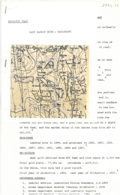
Document - ALBERT RICHARDSON COLLECTION: NEW RED, WHITE AND BLUE CONSOLIDATED MINE, GOLDEN SQUARE
Two-page document plus map showing location of the New Red, White and Blue Consolidated mine on the Sheepshead Line of Reef. Information on the mine is given in the following areas: location plant, early history, its role as a leading mine, its prominence, its closure, gold production. References are provided. Document forms part of research referred to in Albert Richardson's paper 2264.70.bendigo, mining, new red white and blue mine -
 Bendigo Historical Society Inc.
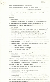
Document - ALBERT RICHARDSON COLLECTION: GREAT EXTENDED HUSTLERS, TRIBUTE
Four-page typed document with information on the Great Extended Hustlers mine on the Hustlers line of reef. Formed in 1865 closed down in 1925. The mine was located a little to the south of the intersection of Hustlers Road and Anderson Street, North Bendigo. The mine plant and overall history of the mine is detailed in the document. The poppet head was steel, 70 ft high. Rear legs set on top of low mullock heap. Gold was first discovered here in 1853 by Jonathan Harris, who was later joined by two coloured men to whom he later sold out. They in turn sold out to a one-armed man, J. Hustler and Messrs. Latham and Watson. The poppet heads of the Great Extended Hustlers were later removed, and the extra 15 ft of the front lets cut to the Stanfield mine at Long Gully. From there to the Wattle Gully Mine at Chewton.bendigo, mining, great extended hustlers -
 Bendigo Historical Society Inc.
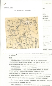
Document - ALBERT RICHARDSON COLLECTION: NEW MOON MINE, EAGLEHAWK
Four-page typed document with map, detailing the history and plant of the New Moon Gold Mine on the Garden Gully line of reef. The mine was located approximately one mile north of Eaglehawk Town Hall. The depth of the shaft was 2,400 ft. The mine was first formed in 1867. The signaling system in the mine was electric with a telephone service which connected the engine driver with the plat chamber. At most mines, when the men were below the surface, the men could signal to the driver, but he could not communicate with them. Total gold production from the mine was 230,601 ozs.bendigo, mining, new moon mine -
 Bendigo Historical Society Inc.
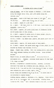
Document - ALBERT RICHARDSON COLLECTION: GREAT SOUTHERN GOLD MINE, GARDEN GULLY LINE OF REEF
Three-page document detailing information on the Great Southern Gold Mine on the Garden Gully line of reef. The main shaft was located in Quarry Hill, approximately 120 yards southeast of Gladstone Street and 66 yards from Peel Street. The main shaft was 2,546 feet plus winze of 180 ft. The poppet legs were wooden with a tall row landing brace. Large pithead pulleys. Boilers of the Cornish flue type by Roberts and Sons Bendigo. Winding engine by A. Harkness & Co., Bendigo. The plant was a 'splendid example of workmanship in Bendigo Foundries. The winding engine capable of hauling from more than 4,000 feet.' The company was formed in 1876 and disposed of its assets to Bear Bros. In 1918, the last crushing was in 1924.bendigo, mining, great southern gold mine -
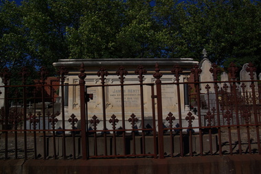 Ballarat Heritage Services
Photograph - Digital photographs, L.J. Gervasoni, Henty Memorial in Boroondara General Cemetery, c2005-2015
The Boroondara General Cemetery is registered by Heritage Victoria. The Henty's were some of the earliest settlers in Victoria.From Heritage Victoria Statement of Significance Last updated on - December 15, 2005 What is significant? Boroondara Cemetery, established in 1858, is within an unusual triangular reserve bounded by High Street, Park Hill Road and Victoria Park, Kew. The caretaker's lodge and administrative office (1860 designed by Charles Vickers, additions, 1866-1899 by Albert Purchas) form a picturesque two-storey brick structure with a slate roof and clock tower. A rotunda or shelter (1890, Albert Purchas) is located in the centre of the cemetery: this has an octagonal hipped roof with fish scale slates and a decorative brick base with a tessellated floor and timber seating. The cemetery is surrounded by a 2.7 metre high ornamental red brick wall (1895-96, Albert Purchas) with some sections of vertical iron palisades between brick pillars. Albert Purchas was a prominent Melbourne architect who was the Secretary of the Melbourne General Cemetery from 1852 to 1907 and Chairman of the Boroondara Cemetery Board of Trustees from 1867 to 1909. He made a significant contribution to the design of the Boroondara Cemetery Boroondara Cemetery is an outstanding example of the Victorian Garden Cemetery movement in Victoria, retaining key elements of the style, despite overdevelopment which has obscured some of the paths and driveways. Elements of the style represented at Boroondara include an ornamental boundary fence, a system of curving paths which are kerbed and follow the site's natural contours, defined views, recreational facilities such as the rotunda, a landscaped park like setting, sectarian divisions for burials, impressive monuments, wrought and cast iron grave surrounds and exotic symbolic plantings. In the 1850s cemeteries were located on the periphery of populated areas because of concerns about diseases like cholera. They were designed to be attractive places for mourners and visitors to walk and contemplate. Typically cemeteries were arranged to keep religions separated and this tended to maintain links to places of origin, reflecting a migrant society. Other developments included cast iron entrance gates, built in 1889 to a design by Albert Purchas; a cemetery shelter or rotunda, built in 1890, which is a replica of one constructed in the Melbourne General Cemetery in the same year; an ornamental brick fence erected in 1896-99(?); the construction and operation of a terminus for a horse tram at the cemetery gates during 1887-1915; and the Springthorpe Memorial built between 1897 and 1907. A brick cremation wall and a memorial rose garden were constructed near the entrance in the mid- twentieth century(c.1955-57) and a mausoleum completed in 2001.The maintenance shed/depot close to High Street was constructed in 1987. The original entrance was altered in 2000 and the original cast iron gates moved to the eastern entrance of the Mausoleum. The Springthorpe Memorial (VHR 522) set at the entrance to the burial ground commemorates Annie Springthorpe, and was erected between 1897 and 1907 by her husband Dr John Springthorpe. It was the work of the sculptor Bertram Mackennal, architect Harold Desbrowe Annear, landscape designer and Director of the Melbourne Bortanic Gardens, W.R. Guilfoyle, with considerable input from Dr Springthorpe The memorial is in the form of a small temple in a primitive Doric style. It was designed by Harold Desbrowe Annear and includes Bertram Mackennal sculptures in Carrara marble. Twelve columns of deep green granite from Scotland support a Harcourt granite superstructure. The roof by Brooks Robinson is a coloured glass dome, which sits within the rectangular form and behind the pediments. The sculptural group raised on a dais, consists of the deceased woman lying on a sarcophagus with an attending angel and mourner. The figure of Grief crouches at the foot of the bier and an angel places a wreath over Annie's head, symbolising the triumph of immortal life over death. The body of the deceased was placed in a vault below. The bronze work is by Marriots of Melbourne. Professor Tucker of the University of Melbourne composed appropriate inscriptions in English and archaic Greek lettering.. The floor is a geometric mosaic and the glass dome roof is of Tiffany style lead lighting in hues of reds and pinks in a radiating pattern. The memorial originally stood in a landscape triangular garden of about one acre near the entrance to the cemetery. However, after Dr Springthorpe's death in 1933 it was found that transactions for the land had not been fully completed so most of it was regained by the cemetery. A sundial and seat remain. The building is almost completely intact. The only alteration has been the removal of a glass canopy over the statuary and missing chains between posts. The Argus (26 March 1933) considered the memorial to be the most beautiful work of its kind in Australia. No comparable buildings are known. The Syme Memorial (1908) is a memorial to David Syme, political economist and publisher of the Melbourne Age newspaper. The Egyptian memorial designed by architect Arthur Peck is one of the most finely designed and executed pieces of monumental design in Melbourne. It has a temple like form with each column having a different capital detail. These support a cornice that curves both inwards and outwards. The tomb also has balustradings set between granite piers which create porch spaces leading to the entrance ways. Two variegated Port Jackson Figs are planted at either end. The Cussen Memorial (VHR 2036) was constructed in 1912-13 by Sir Leo Cussen in memory of his young son Hubert. Sir Leo Finn Bernard Cussen (1859-1933), judge and member of the Victorian Supreme Court in 1906. was buried here. The family memorial is one of the larger and more impressive memorials in the cemetery and is an interesting example of the 1930s Gothic Revival style architecture. It takes the form of a small chapel with carvings, diamond shaped roof tiles and decorated ridge embellishing the exterior. By the 1890s, the Boroondara Cemetery was a popular destination for visitors and locals admiring the beauty of the grounds and the splendid monuments. The edge of suburban settlement had reached the cemetery in the previous decade. Its Victorian garden design with sweeping curved drives, hill top views and high maintenance made it attractive. In its Victorian Garden Cemetery design, Boroondara was following an international trend. The picturesque Romanticism of the Pere la Chaise garden cemetery established in Paris in 1804 provided a prototype for great metropolitan cemeteries such as Kensal Green (1883) and Highgate (1839) in London and the Glasgow Necropolis (1831). Boroondara Cemetery was important in establishing this trend in Australia. The cemetery's beauty peaked with the progressive completion of the spectacular Springthorpe Memorial between 1899 and 1907. From about the turn of the century, the trustees encroached on the original design, having repeatedly failed in attempts to gain more land. The wide plantations around road boundaries, grassy verges around clusters of graves in each denomination, and most of the landscaped surround to the Springthorpe memorial are now gone. Some of the original road and path space were resumed for burial purposes. The post war period saw an increased use of the Cemetery by newer migrant groups. The mid- to late- twentieth century monuments were often placed on the grassed edges of the various sections and encroached on the roadways as the cemetery had reached the potential foreseen by its design. These were well tended in comparison with Victorian monuments which have generally been left to fall into a state of neglect. The Boroondara Cemetery features many plants, mostly conifers and shrubs of funerary symbolism, which line the boundaries, road and pathways, and frame the cemetery monuments or are planted on graves. The major plantings include an impressive row of Bhutan Cypress (Cupressus torulosa), interplanted with Sweet Pittosporum (Pittosporum undulatum), and a few Pittosporum crassifolium, along the High Street and Parkhill Street, where the planting is dominated by Sweet Pittosporum. Planting within the cemetery includes rows and specimen trees of Bhutan Cypress and Italian Cypress (Cupressus sempervirens), including a row with alternate plantings of both species. The planting includes an unusual "squat" form of an Italian Cypress. More of these trees probably lined the cemetery roads and paths. Also dominating the cemetery landscape near the Rotunda is a stand of 3 Canary Island Pines (Pinus canariensis), a Bunya Bunya Pine (Araucaria bidwillii) and a Weeping Elm (Ulmus glabra 'Camperdownii') Amongst the planting are the following notable conifers: a towering Bunya Bunya Pine (Araucaria bidwillii), a Coast Redwood (Sequoia sempervirens), a rare Golden Funeral Cypress (Chamaecyparis funebris 'Aurea'), two large Funeral Cypress (Chamaecyparis funebris), and the only known Queensland Kauri (Agathis robusta) in a cemetery in Victoria. The Cemetery records, including historical plans of the cemetery from 1859, are held by the administration and their retention enhances the historical significance of the Cemetery. How is it significant? Boroondara Cemetery is of aesthetic, architectural, scientific (botanical) and historical significance to the State of Victoria. Why is it significant? The Boroondara Cemetery is of historical and aesthetic significance as an outstanding example of a Victorian garden cemetery. The Boroondara Cemetery is of historical significance as a record of Victorian life from the 1850s, and the early settlement of Kew. It is also significant for its ability to demonstrate, through the design and location of the cemetery, attitudes towards burial, health concerns and the importance placed on religion, at the time of its establishment. The Boroondara Cemetery is of architectural significance for the design of the gatehouse or sexton's lodge and cemetery office (built in stages from 1860 to 1899), the ornamental brick perimeter fence and elegant cemetery shelter to the design of prominent Melbourne architects, Charles Vickers (for the original 1860 cottage) and Albert Purchas, cemetery architect and secretary from 1864 to his death in 1907. The Boroondara Cemetery has considerable aesthetic significance which is principally derived from its tranquil, picturesque setting; its impressive memorials and monuments; its landmark features such as the prominent clocktower of the sexton's lodge and office, the mature exotic plantings, the decorative brick fence and the entrance gates; its defined views; and its curving paths. The Springthorpe Memorial (VHR 522), the Syme Memorial and the Cussen Memorial (VHR 2036), all contained within the Boroondara Cemetery, are of aesthetic and architectural significance for their creative and artistic achievement. The Boroondara Cemetery is of scientific (botanical) significance for its collection of rare mature exotic plantings. The Golden Funeral Cypress, (Chamaecyparis funebris 'Aurea') is the only known example in Victoria. The Boroondara Cemetery is of historical significance for the graves, monuments and epitaphs of a number of individuals whose activities have played a major part in Australia's history. They include the Henty family, artists Louis Buvelot and Charles Nuttall, businessmen John Halfey and publisher David Syme, artist and diarist Georgiana McCrae, actress Nellie Stewart and architect and designer of the Boroondara and Melbourne General Cemeteries, Albert Purchas.Digital imagescemetery, boroondara, kew, gatehouse, clock, tower, clocktower, heritage, memorial, henty, james henty -
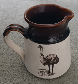 Ballarat Heritage Services
Ceramic - Jug, Emu Jug by Albury Pottery, c1980s
Albury Pottery was established in the late 1970s to supply pottery for the party plan company Cooperware, a spin-off from Faberware. Located in Hudson Crescent, Lavington, the pottery was managed by Rudolph Dybka until 1983, then by Ron Petch, who had previously worked as sales manager for Cooper Pottery, one of Cooperware's UK suppliers. By the mid-1980s, the pottery had four throwers and a further 5-6 employees, and was specialising in stoneware with distinctive ribbed forms and light blond glazes. In 1985, the pottery was sold to the NSW Government as a workers' cooperative, and Petch moved to Old Ballarat Pottery as production manager. In 1987, the Petch's bought back into the business with partners Pat and Ken Snape, moving to slip casting, doubling the operating area, opening a terracotta plant in a separate location and establishing a tourism presence in the Old Cheese factory between Albury and Wodonga. As the business grew it took on more partners and this proved problematic in a declining market for production pottery. The Petch's pulled out in 1991 and the pottery closed shortly afterwards. (CC BY NC SA Judith Pearce, accessed https://www.flickr.com/groups/1281707@N21/discuss/72157629392131982/, 15 October 2024.)A ceramic jug with a brown top, and an emu on a white ground.albury pottery, emu -
 Bendigo Historical Society Inc.
Document - BENDIGO AMALGAMATED GOLDFIELDS NO LIABILITY - PROSPECTUS OF BENDIGO AMALGAMATED GOLDFIELDS N. L
1. Printed Prospectus of Bendigo Amalgamated Goldfields No Liability dated 1917. The Company was being formed amongst other things to acquire 38 of the principal Mining Properties contiguous to one another and situated in the heart of the Bendigo Goldfield. Properties are listed. Itmes include List of Assets, Liabilities, Future of Company, a short report on the Central Area of the Bendigo Goldfield by E C Dyason, B. Sc., B M E, Yields from Bendigo Goldfields, Financial Results from Bendigo Mining, The Bendigo Goldfield-Resources of the 'Central Area' (Abridged) by V Pabst, Report on Plant and Machinery by Andrew Harkness, Summarised Report on the Properties within the'Central Area' Bendigo Goldfield, Schedule of Properties to be Acquired, Plan of Leases and a Form of Application. 2. Share Certificate ( photocopy of original ) : ' Flora McKell of Melbourne is a member of the above named Company ' and has forty shares paid up to ten shillings each. Signed Angus Mackay Director, W. Stanfield, Secretary. Dated 24th June 1921.document, gold, bendigo amalgamated goldfields n l, bendigo amalgamated goldfields no liability, prospectus of bendigo amalgamated goldfields no liability, l v lansell, h m leggo, w angliss, e c dyason, commonwealth bank of australia, ward & co, furner & brownhill, laurie & hodgetts, corrie & co, w stennard, h hawkins, clarke & co, f douglas jones, arthur phillips, j h craig, a capper moore, j g stanfield, norman picot, v pabst, h y north, walter weddell, lea butler birch, george h green, mccoll rankin & stanistreet, elden h kirkwood, geo j keogh -
 Bendigo Historical Society Inc.
Document - MINING IN BENDIGO COLLECTION: THE BENDIGO GOLDFIELD
Handwritten notes on the Deborah Mine, the North Deborah, The Central Deborah, the New Chum Railway, Eueka Extended and the South Belle Vue. Mentioned in the noes are: Depth of shaft, Formed, Closed, Best Gold, production and plant.document, gold, mining in bendigo, mining in bendigo, the bendigo goldfield, deborah mine, north deborah, central deborah, new chum railway, eureka extended, south belle vue, shenandoah, shamrock, rourke and henderson's claim -
 Geoffrey Kaye Museum of Anaesthetic History
Painting, Jeannie Petyarre, Medicine Leaves, 2005
An unframed square acrylic-on-canvas painting in tones of green and white forming an abstract botanical pattern that radiates out from the centre. A renowned Anmatyerre artist from Utopia, Northern Territory, Petyarre’s work carries more than pigment—it holds a lineage of care. These sweeping, rhythmic brushstrokes represent Kurrajong leaves and other medicinal plants traditionally gathered and prepared by women healers. Passed from grandmother to granddaughter, these practices are a form of medicine beyond the clinical. They speak of country, ceremony, and community. They evoke breath, movement, and the cyclical nature of wellbeing. Hand painted on reverse. "JEANNIE PETYARRE 60X60" Handwritten on reverse. "(Sister of Gloria Petyarre) / "Medicine Leaves" 2005. / Presented to ANZCA by Prof. Michael Cousins 16/6/06"oil paint, acrylic paint, floral, floral design, botanical design, abstract art, indigenous artists, first nations artists, australian artists, australian art -
 Geoffrey Kaye Museum of Anaesthetic History
Weapon - Blow pipe, Mah Meri, c. 1936
Used by the Mah Meri people, Kuala Langat, Selangor (Malaysia), 1936. While Malaysian, this blow-gun is analogous to that used by Indigenous groups from South America with curare. The gun is of bamboo, with a highly polished inner tube of the same. The darts are reeds, made directional by knobs of a tudor wood, with poison made from the ipoh tree and the Strychnos vine The blowpipe examined in this report consists of a long bamboo tube with engraved floral motifs on the outside and a second bamboo tube inside. The mouthpiece is attached to the inner tube and the whole piece can be removed from the outer casing. There is a quiver, filled with darts, a small poisons receptacle, and a single dart and hollow bamboo tube, stored outside the quiver. The objects were donated as a whole to the museum in 1948 by Dr Thomas Edward Marshall. The engravings on the outer case originate from the Mah Meri community in Kuala Langat, Selangor, Malaysia. The floral ‘motif is of a vine with small incisions to reflect the properties/identity of the plant (poisonous/harmful)’. These motifs are generally handed down through the generations and can be used for kinship identification. They are also believed to enhance the performance of the blowpipe. The outer casing is made up of several pieces of bamboo fused together. Broken or damaged blowpipes were not discarded. Broken sections of a pipe could be removed and replaced as required, and the observably different bamboo sections suggest this has taken place at some point. Sap from the perah tree is used to seal or glue the pieces together and the glue is reversible by heating. The Mah Meri created a poison from the ipoh tree for use in hunting. The poison acted swiftly to kill the animal and did not result in secondary poisoning. The way in which the Mah Meri hunted is analogous with other blowpipe hunting practices elsewhere in the world. Blowpipe hunting practices represent a starting point for the introduction of standardised muscle relaxants into surgery during the 20th Century. In parts of South America, plant poisons were used to tip the darts and kill prey. These poisons are known as curare. The crucial ingredient in curare was Chondrodendron tomentosum root. Raw curare formed the basis for Intocostrin, the first standardised, mass produced muscle relaxant. The introduction of muscle relaxants dramatically changed surgery, allowing for more precise surgery and better patient outcomes. Bamboo blowpipes can be found in many museum and heritage collections, particularly those with strong colonial origins or influence. Blowpipes from Borneo seem to be well represented, along with those from Guyana. Blowpipes from Malaysia appear to be less common. More research is required to establish the rarity or representativeness of the blowpipe. Ownership of the blowpipe can be traced back from the museum to Dr Thomas Marshall. It has also been established the blowpipe’s point of origin is among the Mah Meri people of Kuala Langat, near Kuala Lumpur. There is no information regarding the way in which Marshall came into possession of the blowpipe. Provenance cannot be fully established. Despite these difficulties, the blowpipe represents a full set of hunting implements. It is accompanied by a quiver, also decorated with a floral motif, a set of bamboo darts, and a poison receptacle. The quiver also has a waist strap which enabled the owner to strap it to themselves, preventing its loss while hunting. Each object within the set is in good condition, although the inner tubing is beginning to split lengthwise and should not be removed from its outer casing. While the blowpipe and accompanying objects are not of South American origin, the techniques and poisons used are analogous and this object has high interpretative capacity. Hollow bamboo blowpipe with mouthpiece at one end. Two different types of organic fibre have been used at difference points along the shaft to secure different segments of the blowpipe. The item consists of two tubes a thin and unpolished inner tube that has degraded and can no longer be removed, and a polished and decorated outer casing. The outer casing is made up of different sections of polished bamboo, some pieces have developed a deep red hue which is likely the result of prolonged polishing and regular heating over many years, other sections are a lighter yellow indicating that they are newer pieces of bamboo. The entire outer tube is covered in a varied sequence of genomic patterns. The exact meaning of these patterns is unknown however they are passed down through family lineage, the exact family of origin is unknown. Connected to the mouthpiece if it is removed from the inner casing is a piece of cloth with the numbers 2241 written in black ink, their purpose is unknown.curare, malaysia, bamboo -
 Ballarat Heritage Services
Ceramic - Australian Studio Pottery, Platter by Grant Finck
Grant FINCK (1958 - ) Born Edanhope, Victoria Grant Finck's professional career as a sculptor and ceramicist started inthe late 1970s. In 1991 he successfully completed post-graduate studies at the Victorian College of the Arts. Grant Finck spent years as a ceramicist, mastering the precise discipline of clay and fire and developing a strong eye for form. In 1978 he establied a pottery in Portland, Victoria. 1985 he established a ceramics workshop and art gallery at Phillip Island, Victoria. In 1989 he was assistant to sculptor Peter Corlett. A well thrown platter with fine brushwork depicting plants. Marjed in the base FG.grant finck, platter, australian studio pottery -
Bendigo Historical Society Inc.
Document - Great Extended Hustler's mines, April, 2014
Seven men were killed at the Great Extended Hustler's mine disaster on 2nd May 1914 by an explosion of dynamite occurring as the men were waiting at the plat to ascend the mine at the end of their shift. No blame was attached to anyone in the findings of the inquisition. It was unknown what caused the dynamite to explode. Three page typed document written by Albert Richardson. First page: Great Extended Hustler's including. Great Extended Hustlers Tribute of Pups Shaft, Hustler's line of reef. Mine formed in 1865, closed down 1925 or 1926. Locality, area of lease, depth of shaft, plant , early history, prominent and leading mines and best gold obtained from the mines is discussed. Poppet heads of the Great Extended Hustlers to the Stanfield mine at Long Gully and then to the Wattle Gully mine at Chewton.great extended hustlers, goldmining, accident, quartz, mining, k.k. mine, comet mine, hustler's line of reef, old comet, united hustler's, redan, poppet head, chewton, stanfield gold mine, wattle gully gold mine -
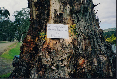 Wooragee Landcare Group
Photograph, 5 September 2004
Wooragee Landcare was formed in 1989 to promote sustainable conservation and land-use practices in the North-East region of Victoria. The organisation's work has included public awareness and education campaigns to control invasive, introduced species and protect native wildlife, such as campaigns to replant native plant species to improve soil integrity and restore habitat for flora and fauna. The organisation has drawn on the work of a variety of Government and academic experts to ensure best practice approaches are utilised. This photograph was taken at Riverview Farm, Victoria on Sunday the 5th of September as part of a day trip by the Wooragee Landcare Group. The event was about looking at land use on small farms and as a social get-together for the Group. Wooragee was also researching how small landholders could run some enterprises around the time of the trip. This photograph is a great example of the type of events that Wooragee Landcare Group has organized, while educating the public about the importance of land use management.Landscape colour photograph printed on gloss paper. Reverse: WAN NA E0NA2N2. NNN+ 4 4240/ [PRINTED] (No. 24) / 377wooragee, wooragee landcare group, wooragee landcare's collection, land use, social, riverview farm, animals, pests, indigo shire, tatong, samaria, north-east victoria