Showing 317 items matching "taylor, george"
-
 Brown Hill Progress Association Inc.
Document, List of Bus and Char-a-Banc Plying for Hire, 1923, 1923
A charabanc or "char-à-banc" is a type of horse-drawn vehicle or early motor coach, usually open-topped, common in Britain during the early part of the 20th century. It has "benched seats arranged in rows, looking forward, commonly used for large parties, whether as public conveyances or for excursions." It was especially popular for sight-seeing or "works outings" to the country or the seaside, organised by businesses once a year. The name derives from the French char à bancs ("carriage with wooden benches"), the vehicle having originated in France in the early 19th century. In Australia a modern similar type of bus or motorcoach, with a lateral door for each row of seats, survived up to the 1970s and was referred to as side loader bus; but all or most of them were not open-topped. (Wikipedia)Two pages relating to buses, char-a-bancs and trams in Ballaratbus, tram, char-a-banc, john lucas, john j. mckenna, hugh williams, a.b. smith, thomas pascoe, h.g. whiteley, walter hearne, thomas james, george skinner, sydney stapleton, hugh george lake, oscar cruikshank, robert taylor, thomas powell, wilmot, j.p. bennett -
 Hume City Civic Collection
Container - Flagon - wine, END OF AN ERA - WORKS DEPOT, pre 1994
The flagon with port was issued to recognise the end of the Shire of Bulla Works Depot. The port was from the Mt Aitken Estates in Gisborne. Public Works previously administered by the Shire of Bulla went out to private tendering.A cream and brown glazed flagon with sloping sides. The lower half of the flagon is cream with brown printing. The upper half and neck is brown. There is a black unbroken seal over the cork and the port is still in the flagon. On the front there is the Shire of Bulla insignia and on the back: the Shire of Bulla logo with the list of all employees of the Works Depot.on front: END OF AN ERA / (Shire of Bulla Insignia) / WORKS DEPOT / REMEMBER / "Safety is no Accident" shire of bulla, works depot, mt aitken vineyards, vineyards, ackland, b, adams, s, aksalih, b, aquilina, r, bartley, p, beavis, a, bell, f, bentley, k, bernard, c, birrell, s, bishop, o, brabander, p, brown, n, clements, p, coundon, j, coundon, k, culhane, n, davis, d, farquahar, s, forster, m, gardner, t, gibbings-johns, r, green, k, hamilton, m, healy, p, houston, k, kostantinidis, m, lumsden, b, mazza, s, mazza, e, moxham, s, higgs, j, laws, g, bailey, n, acton, b, fitzmaurice, n, lee, m, hewson, t, lumsden, d, bryant, p, jankovic, d, riley, p, mott, b, naughton, p, olson, a, peavey, r, pittaway, b, morgan, s, morton, j, markman, o, lagana, f, ivakovic, m, jamieson, d, podolczak, n, prestage, d, pullen, p, pyke, b, richards, k, russell, r, sartore, a, schaffer, s, schembri, l, service, t, smith, b, taylor, n, thom, m, thomas, c, travers, k, travers, p, turner, r, tyquin, e, tyquin, k, tyquin, t, watts, j, wilson, h, whitworth, l, withers, d, george evans collection -
 Old Colonists' Association of Ballarat Inc.
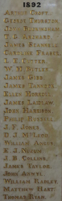
Photograph - Photograph - Colour, Marble Honour Boards listing benefactors to the Ballarat Old Colonists' Associations
The Old Colonists' Hall opened in 1887.Marble Honour Boards listing benefactors to the Ballarat Old Colonists' Associations. The name was added to the boards the year of the donors death. 1892 Arthur Croft George Thurston John Buckingham T.G. Archard James Scannele Caroline Fraser L.E. Cutter W.H. Butler James Gibb James Tannock Ellen Horroll James Laidlaw John Harrison Philip Russell J.F Jones D.J. McLeod William Angus E.J. Nuzum J.B. Collins James Taylor John Anwyl William Radley Matthew Hart Thomas Ryan 1897 William Taylor Joseph Langfon W.C. Phillips Henry Dobson Peter Brose Edwin Parr John Magor Natale D'Angri Lawson Ure James Malcolm Robert Sim W.J. Clarke F.N. Martin William Kelly Edward Hrose Francis Edwards William Kay James Simpson J.R. Hopkins W. Booth 1898 John Peart J.J. Cahir Joseph Betts Thomas Rowlands George Brown Rudolph Stephens James Houston John McPhee Alban Atwood David Fitzpatrick L.H. Kopke Henry Morrison William Bones Henry Morris 1899 Alexander Miller David McNaught C.W. Langtree John Twentyman Nathaniel Trench Adam Bennett James Gay C.B. Retallack James Richardson Thomas Hawkins John Taylor D.F. Stalker William Laplau John Jarvie J.E. Morris James Harrison J.S. Paterson Henry Leggo W.J. Seeley Charles Stewart James Vigar J.J. Cahir Joseph Betts Thomas Rowlands George Brown Rudolph Stephens James Houston John McPhee Alban Atwood David Fitzpatrick L.H. Kopke Henry Morrison William Bones Henry Morris 1900 Peter Le Page W.H. Barnard George Perry George Eason James Ivey 1903 James Miller Matthew Morgan William Norman G.G. Graham John Griffiths Richard Ince John Wallace John Blight J.W. Mills C.E. Jones John Noble Wilson David Mitchell William Walner David Munroe John English David McDonald William Saunders William Dougall A.T. Morrison Thomas Wilson M.C. Donnelly James Fry John Haworth Edward Newman E.F. McElroy J.H. Reed Helen Trounson E.A. Miller Alexander Ross Alexander Taylor H.A. Comber 1909 John Blyth Charles Tunbridge Henry Gore Walter Owen Charles Rowsell Edward Elliott Charles Robinson T.J. Wills R.S. Hager Henry Fields T. Paterson William Woodridge A. Morrah Adam Scott J.C. Shepherd J. Holland J. Cochran G. Lovitt J. Haig G. Sharp J. Dulfer R. Davidson E. Lillingston T. Raw 1911 W.H. Uren John Paterson H.J. Summerscales James Oddie W.H. Malyon T.E. Gill Agnes D. McIntosh John Wright Andrew Byrne Thomas Greenwood H.W. Morrow James Lambert E.E. Eberhard John Reid T.W. Purdue H.J. Symons John Lynch 1915 William Bell D.B. Wheeler Richard Baker M.L.C. W.B. Bradshaw Betsy F. Graham A.J. Hare C.V. Day J.P. Smart Lieutenant Colonel A.H. White Dr R.C. Lindsay Andrew Cant T.C. Coates E. Goodwin Thomas Lyle 1916 James Long John King Junior G.A. Brown C.E. House G.T. Jones Hon. R.T. Vale J.G. Tucker H. Baber J. Lammin D. Lillingstone George Becher Laurence Clark William Brazenor A. Clinton William Little W.B. Bannerman J.H Peady James Lamb 1917 J.C. Charles Joseph Fields John McPhail John Lombard Thomas Lyle H.L. Pobjoy E.E. Llewellyn E.C. Dermer John M. Bickett Hon. J.Y. McDonald Capt. J.W. Pearce. M.C. Joseph Pounder 1918 Lieutenant E.S. Holgate Grace Valkins J.C. Brough Thomas Mitchell George Buchanan J.H. Ward T. Davey A.B. Berry Corporal L.J. Malin G.H. Abrams James Tyler 1919 T.C. Anderson Agnes Murray G. Donaghy F. Opie Thomas Bodycomb Harry D. Davies John Clarke R.L. Medwell G.N. Robinson Isaiah Pearce A.R. Tunbridge H.C. Handford F.G. Fraser F. Carver J.S. Douglas Hon. Alfred Deakin T.J. McConnellarthur croft, george thurston, john buckingham, t.g. archard, james scannele, caroline fraser, l.e. cutter, w.h. butler, james gibb, james tannock, ellen horroll, james laidlaw, john harrison, philip russell, j.f jones, d.j. mcleod, william angus, e.j. nuzum, j.b. collins, james taylor, john anwyl, william radley, matthew hart, thomas ryan, william taylor, joseph langfon, w.c. phillips, henry dobson, peter brose, edwin parr, john magor, natale d'angri, lawson ure, james malcolm, robert sim, w.j. clarke, f.n. martin, william kelly, edward hrose, francis edwards, william kay, james simpson, j.r. hopkins, w. booth, john peart, j.j. cahir, joseph betts, thomas rowlands, george brown, rudolph stephens, james houston, john mcphee, alban atwood, david fitzpatrick, l.h. kopke, henry morrison, william bones, henry morris, alexander miller, david mcnaught, c.w. langtree, john twentyman, nathaniel trench, adam bennett, james gay, c.b. retallack, james richardson, thomas hawkins, john taylor, d.f. stalker, william laplau, john jarvie, j.e. morris, james harrison, j.s. paterson, henry leggo, w.j. seeley, charles stewart, james vigar, j.j. cahir, joseph betts, thomas rowlands, george brown, rudolph stephens, james houston, john mcphee, alban atwood, david fitzpatrick, l.h. kopke, henry morrison, william bones, henry morris, 1900, peter le page, w.h. barnard, george perry, george eason, james ivey, james miller, matthew morgan, william norman, g.g. graham, john griffiths, richard ince, john wallace, john blight, j.w. mills, c.e. jones, john noble wilson, david mitchell, william walner, david munroe, john english, david mcdonald, william saunders, william dougall, a.t. morrison, thomas wilson, m.c. donnelly, james fry, john haworth, edward newman, e.f. mcelroy, j.h. reed, helen trounson, e.a. miller, alexander ross, alexander taylor, h.a. comber, john blyth, charles tunbridge, henry gore, walter owen, charles rowsell, edward elliott, charles robinson, t.j. wills, r.s. hager, henry fields, t. paterson, william woodridge, a. morrah, adam scott, j.c. shepherd, j. holland, j. cochran, g. lovitt, j. haig, g. sharp, j. dulfer, r. davidson, e. lillingston, t. raw, w.h. uren, john paterson, h.j. summerscales, james oddie, w.h. malyon, t.e. gill, agnes d. mcintosh, john wright, andrew byrne, thomas greenwood, h.w. morrow, james lambert, e.e. eberhard, john reid, t.w. purdue, h.j. symons, john lynch, william bell, d.b. wheeler, richard baker m.l.c., w.b. bradshaw, betsy f. graham, a.j. hare, c.v. day, j.p. smart, lieutenant colonel a.h. white, dr r.c. lindsay, andrew cant, t.c. coates, e. goodwin, thomas lyle, james long, john king junior, g.a. brown, c.e. house, g.t. jones, hon. r.t. vale, j.g. tucker, h. baber, j. lammin, d. lillingstone, george becher, laurence clark, william brazenor, a. clinton, william little, w.b. bannerman, j.h peady, james lamb, 1917, j.c. charles, joseph fields, john mcphail, john lombard, thomas lyle, h.l. pobjoy, e.e. llewellyn, e.c. dermer, john m. bickett, hon. j.y. mcdonald, capt. j.w. pearce. m.c., joseph pounder, lieutenant e.s. holgate, grace valkins, j.c. brough, thomas mitchell, george buchanan, j.h. ward, t. davey, a.b. berry, corporal l.j. malin, g.h. abrams, james tyler, t.c. anderson, agnes murray, g. donaghy, f. opie, thomas bodycomb, harry d. davies, john clarke, r.l. medwell, g.n. robinson, isaiah pearce, a.r. tunbridge, h.c. handford, f.g. fraser, f. carver, j.s. douglas, hon. alfred deakin, t.j. mcconnell -
 Old Colonists' Association of Ballarat Inc.
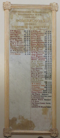
Photograph - Photograph - Colour, Clare Gervasoni, Ballarat Old Colonists' Association Marble Benefactors Board, c1887
The marbles in the foyer of the Old Colonists' Hall feature many names associated with the membes of the Old Colonists' Association of Ballarat.Ballarat Old Colonists' Association Marble Benefactors Board. DONATIONS J.P. Murray James Bishop John Shaw David Ham Thomas Bath T.T, Hollway Richard Mitchell S.W.J. Clark Dr J.K. Richards H.C. Handford T.H. Shattock Dr W.A. Spring Donald McKay J.T. Smith BEQUESTS J.G. Taylor Thomas Blackett Philp Windmiller Joseph Roff Peter Hume James Francis Hannah Rennard Sarah Smythe David McNaight W.P. Martin Jane Wilson Edwin Brewer W.E. Ballhausen John Church J.P. Murray Charles Tinworth Henry Josephs M.A. Winsby Chris Heinz Andrew Munro John Wright Thomas Paterson J.H. Ward George Crombie Mary A. Nicol R.D. McINtosh Richard Mitchell J.S. Miller S.W.J. Clark Endowment W.J. Irwin Francis L. Jones A. Farrer Louisa Strange J. Permewan Feederick Reid Joe White Bequest L.J. Wilson Perpetual Trust G. Sutherland Hilton White Bequest I.E. Reid Ian Rollo Currie Foundation I. Dodds Lancelot W. Wilson Trust old colonists association, benefactors, honour board, j.p. murray, james bishop, john shaw, david ham, thomas bath, t.t, hollway, richard mitchell, s.w.j. clark, dr j.k. richards, h.c. handford, t.h. shattock, dr w.a. spring, donald mckay, j.t. smith, j.g. taylor, thomas blackett, philp windmiller, joseph roff, peter hume, james francis, hannah rennard, sarah smythe, david mcnaight, w.p. martin, jane wilson, edwin brewer, w.e. ballhausen, john church, j.p. murray, charles tinworth, henry josephs, m.a. winsby, chris heinz, andrew munro, john wright, thomas paterson, j.h. ward, george crombie, mary a. nicol, r.d. mcintosh, richard mitchell, j.s. miller, s.w.j. clark endowment, w.j. irwin, francis l. jones, a. farrer, louisa strange, j. permewan, feederick reid, joe white bequest, l.j. wilson perpetual trust, g. sutherland, hilton white bequest, i.e. reid, ian rollo currie foundation, i. dodds, lancelot w. wilson trust, ian g. bishop -
 Southern Sherbrooke Historical Society Inc.
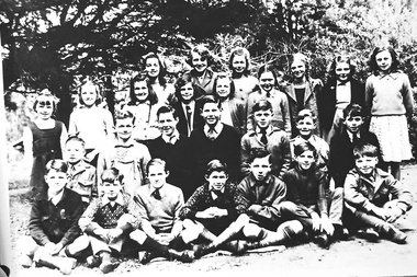
Photograph, Menzies Creek State Schooll, 1948-50
A photograph of students from Menzies Creek State School, 1948-50. Includes: - Carol King, Grace Alton, Jill King, Pauline Edwards, Pat Billing, Dorothy Madigan, - Betty Glossop, Pat Smith, Moina Worrell, Joy Tresize, Jenny Gibbs, Diana Richards, - Roy Taylor, Raymond Kidd, Buntie Merkell, David Robinson, Geoff Johns, Michael King, Graeme Robinson, - ?, George Frazetto, Gary Merkell, Master Merkell, Brian Alton, Sam Frazetto, and Vern Beauchamp. -
 Ballarat Tramway Museum
Document - List, Dave Kellett, "Welfare Club Payment", 23/04/1953 12:00:00 AM
Yields information about the SEC Ballarat tram employees names for 23/4/ 1953. Has a strong association with the list Author. Also demonstrates the administration of a locally based welfare fund.Carbon copy of a hand written list dated 23-4-1953 of 59 people on the front and two on the rear showing payment to the Ballarat Tramway "Welfare Club Payment". Payment appears to total 12 pounds 4 shillings. See also Reg item 6312 for a June 1952 list. Handwritten on ruled paper which has been folded into four. Note: - this list may also include depot employees. List compiled from the .xls file compiled by Peter Waugh. The ones listed as record 6312 only below. Bath Percy Carl Motorman 1949 1971 6312 Birch Harold Reginald Conductor 1949 1963 6312 Black E. 1953 6312 Carter T. 1953 6312 Courtney R. 1953 6312 Davies A. 1953 6312 Diamond Leo Motorman 1953 1954 6312 Donald James Frederick 1949 1963 6312 Dynon J. 1953 6312 Ellis Alfred Lewis Motorman 1942 1968 6312 Hall Keith William Conductor 1953 1954 6312 Harry D. 1953 6312 Hutchins K. 1953 6312 Jolly A. 1953 6312 Jordan R. 1953 6312 Kellett Alfred Joseph Tramway employee 1949 1971 6312 McGann N. 1953 6312 Menzies J. 1953 6312 Mills I. 1953 6312 Morgan Colin George 1953 1963 6312 Morris N. 1953 6312 Oliver R. 1953 6312 Pinkard M. 1953 6312 Spencer M. 1953 6312 Taylor H. 1953 6312 Thompson Arthur Frederick Mark 1953 1954 6312 Vicars A. 1953 6312 Wapshott Herbert William 1953 1954 6312 Weeks John Herbert Motorman 1953 1954 6312 Wellard Graham Charles 1953 1954 6312 Young S. 1953 6312 These people have more than one entry into the data base T. Dunstan H. Grundell G. Hall H. Hawkes A. Jeffreys D. Kellett H. Knight H. Lorensini H. McWilliams A. McWilliams R. Mason A. Mercer R. Nestor H. Preston S. Reynolds H. Smerdon G. Satchell R. Turnbull A. Vicars W. Ward L. Walker L. Wellard S. Young T, Young J. Menzies F. Edmonds S. Edmonds F. Callahan N. Clark L. Godsell N. McLachlan F. Brown J. Myers On rear "Welfare Club Payment"sec, ballarat, personnel, welfare, crews -
 Bendigo Historical Society Inc.
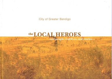
Book - IAN DYETT COLLECTION: THE LOCAL HEROES
66 page booklet titled The Local Heroes real people, real lives, real stories… Front cover is off white at the top and patterned yellow shades at the bottom with the title in the centre, City of Greater Bendigo above. Background to the Local Heroes Project, drafted by Dr Gan Che ng PhD. MA. Inside the front cover. Photos, names of Students, Principal and Teachers of Bendigo South East College Team, Catholic College Bendigo Team, Eaglehawk Secondary College Team, Girton Grammar School Team and Weeroona College Bendigo team are in the front of the book. There is information about the project. Photo and information about Simmon Pang - Project Initiator/Photographer. Foreword by The Hon. Martin Dixon MP - Minister for Education Victoria with photo and Foreword - Cr Lisa Ruffell - Mayor of the City of Greater Bendigo. The following pages have a short synopsis and photo of Barry Ackerman - Expert in the Rubber Industry & Twice Mayor, Joanne Baker - Founder of Righteous Pups Australia, Linda Beilharz OAM - Intrepid Adventurer, Valerie Broad OAM - Founder & Artistic Director of Youth Choir, Paul Chapman - Co-Founder of The Australian Turntable Company, Susanne Clarke - Passionate about Community Engagement, Patrick (Pat) James Connolly - Bendigo Amateur Boxing Club Coach, Robert Jackson (Cookie) Cook - Founder of Horizon House, Geoff Curnow - Farmer & Community Volunteer, Merna Curnow - Farmer & Agricultural Consultant, Jenny Dawson - Accounting & Banking, Laura Dusseljee - Choir Director & Music Teacher, Ian Maxwell Dyett JP - Life Dedicated to Volunteering, Donald James Erskine - Founder of Industrial Conveying Australia, James Victor Evans - Teacher, Historian & Actor, Rod Fyffe - Champion of Arts & Culture, Richard Guy OAM - banker & Philatelist, Edwin Richard (Dick) Hazeldene OAM - Chicken Farmer to Poultry Entrepreneur, Robert (Rob) Hunt AM - Head of Bendigo Adelaide Bank and Founder of Community Banking Model, Russell Goldfield Jack AM - Founder of Golden Dragon Museum, Jack Kelly - Teacher Sharing Experience, Ian George Mansbridge - Farmer, Accountant & Banker, Ken Marchingo - Instigator of Haven; Home Safe, Elizabeth (Beth) McKerlie OAM - Dedicated to Scouting, Gordon McKern OAM - Founder of McKern Steel, Sharelle McMahon - Netballer Extraordinaire, Lola Mary Miller AM BEM - Teacher of Health & Physical Education, Julie Millowick - Accomplished Photographer, Educator & Artist, Dennis Reginald O'Hoy - Academic & Historian, Margaret O'Rourke - A Champion for Connected Communities, Karen Quinlan - Director of Bendigo Art Gallery, Jonathan William Ridnell - Broadcaster, Leon Maxwell Scott OAM - Business Entrepreneur & Rotary Volunteer, Margot Elizabeth Spalding - Co-founder of Jimmy Possum Designer Furniture, Wendy Diane Stavrianos - Painter, Sculptor & Installation Artist, Jack Taylor OAM JP - An Eaglehawk Legend, Wes Vine - School Principal & Vigneron, Lynn Warren - Aboriginal Elder, Raymond James Wild - A Plumber's Story, Diana Williams - Founder of Fernwood Fitness and John Wolseley - International Artist. The back cover also has small photos and the names of people mentioned.ian dyett collection - the local heroes, city of greater bendigo, dr gan che ng, la trobe ubiversity bendigo, bendigo south east college, catholic college bendigo, eaglehawk secondary college, girton grammar school, weeroona college bendigo, simmon pang, the hon martin dixon mp, cr lisa ruffell, bendigo art gallery, city of greater bendigo, the capital - bendigo's performing arts centre, la trobe university australia, catholic kiocese of sandhirst, haven home safe, the hotel shamrock bendigo, hazendene's, bendigo & district aboriginal co-operative, mr baillieu myer ac, bendigo advertiser, australian broadcasting corporation, bendigo chinese association inc - lion team, wannik dance academy dancers, bendigo forever young choir, bendigo youth choir -
 Bendigo Historical Society Inc.
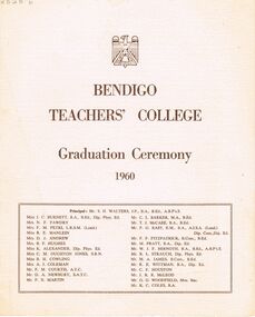
Document - LA TROBE UNIVERSITY BENDIGO COLLECTION: BENDIGO TEACHERS' COLLEGE GRADUATION CEREMONY 1960
A cream document titled "Bendigo Teachers' College Graduation Ceremony 1960". The front page also contains a list of the staff working at the college. They are Mr. S. H. Walters (Principal), Miss J. C. Burnett, Mrs. N. F. Fawdry, Mrs. F. M. Petri, Miss R. E. Manlein, Mrs. D. J. Andrew, Mrs. B. F. Hughes, Miss K. Alexander, Miss C. M. Oughton Jones, Miss B. H. Cowling, Mrs. A. J. Coleman, Mr. F. M. Courtis, Mr. D. A. Newbury, Mr. F. X. Martin, Mr. C. L. Barker, Mr. T. J. McCabe, Mr. F. G. East, Mr. P. F. Fitzpatrick, Mr. M. Pratt, Mr. W. J. F. Bernoth, Mr. R. L. Strauch, Mr. M. A. James, Mr. R. E. Wittman, Mr. C. F. Houston, Mr. J. R. R. McLeod, Mr. G. G. Woodfield and Mr. K. C. Coles. The inside cover contains the "Significance of the Ceremony" and "Order of the Ceremony". Mr. F. M. Courtis welcomed the visitors whilst the Principal read the College Charge. The 'Graduation Book' was presented to Mr. A. L. Harris Inspector of Schools by Miss J. C. Burnett.The final roll call for 1960 was read by Mr. C. L. Barker. Congratulations were offered by The Mayor of Bendigo Cr. R. H. Wilson,J. P., Cr. T. A. Drechsler President of Strathfieldsaye Shire and Mr. G. Salathiel, Head Teacher of Gravel Hill State School. Finally the Occasional Address was presented by Mr. F. H. Brooks Assistant Director of Education. The following page contains a list of "Students of 1958-1960 Trained Infant Teacher's Certificate" - Marjorie May Allen, Janice Helen Ashman, Grada Ali Bos, Joan Margaret Busfield, Barbara Joan Cameron, Shirley Margaret Cribbes, Marcia Ann Davison, Margaret Mary Frances Dick, Lorraine Jean MacIntosh Goddard, Beverley Lorraine Goudie, Jennifer Joy Hamilton, Maureen Margaret Hunt, Shirley Joyce Innocent, Monica McKenna, Eileen Bernadette Mulvahil, Nola Ellen Parker, Jeanette Mary Pearson, Maureen Anne Pentland, Elaine Denise Pochon, Marian Judith Rechter, Marilyn Joy Rose, Catherine Shiels, Margaret Evelyn Stevenson, Rosemary Sutherland, Patricia Helen Tassicker, Eileen Monica Tuohey, Robin Elizabeth Walters, Patricia Ann Wenn and Ethel Dawn Whitelock. The back page contains a list of "Students of 1959-1960 Trained Primary Teacher's Certificate". - Kathleen Anne Algie, Ian Armstrong, Lorna Constance Barbour, Ronald Lindsay Bell, Michael Laurence Brown, Ross Ernest Brown, Graeme Lambden Budd, Duncan Leslie Thomas Cameron, Peter Morgan Clutterbuck, Joan Christine Connor, Allen William Cornelius, Glenys Elaine Cussins, Jean Elizabeth Davis, Denis William DeCann, Robert Alain Denham, Janet Carmel Doyle, Patricia May Edwards, Walter Kenneth Espagne, Fay Iris Evans, Brenda Gertrude Farrell, Malcolm George Ferguson, Elizabeth Joyce Fitzgerald, Kevin Joseph Foley, Barbara Violet Forrester, Lawrence Joseph Ginnivan, Peter Murray Graham, Thelma Elaine Grist, Dorothy Robyn Haines, William Jon Hall, Patricia Jeanette Hancock, Robert John Harris, William Ian Hart, Lorraine Moira Holmes, Lynette Ann Ireland, Morris Raymond Jackman, Christine Jackson, Margaret Nancy Jackson, Nanette Elizabeth Johnson, Trevor John Kellam, Robert Bruce Kemp, Ross Eliot Koochew, Henry Francis Lean, Janet Bobbie Leabeter, Rosemary Elizabeth Lowe, Graeme Stanley Lucas, Joy Patricia Maxwell, Terence Michael Mulvihill, George Alan Murdoch, Kevin Michael Murphy, Ann-Marie McCallum, Helen June Nixon, Kerry Joy O'Brien, William John O'Connell, Christine Lynette Olsen, William Stanley Page, Janice Anne Preston, John Stuart Reed, William Francis Reeves, Gary Desmond Robbins, Peter John Schlitz, Donald John McIntosh Shadforth, Gavin James Smith, John Archibald Spark, Illar Streimann, Janice Margaret Taylor, Ian Leonard Thornton, Rosemary Fay Wait, Russell Gilbert Walker, James John Wallis, Clare Mary Ward, David Ross Wiedermann, and Stephen Wilkinson.bendigo, education, bendigo teachers' college graduatio, la trobe university bendigo collection, collection, bendigo teachers' college, bendigo, education, teaching, teachers, students, graduation, tertiary education, graduation ceremony, history, book, bendigo teachers' college staff, graduands, graduates, bendigo teachers' college students, teacher training -
 Bendigo Historical Society Inc.
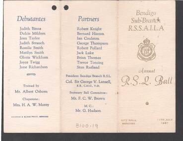
Document - R.S.L. BENDIGO COLLECTION: ANNUAL R.S.L. BALL 1957
Three copies of the Bendigo Sub-branch R.S.S.A.I.L.A. Annual R.S.L. Ball held at the City Hall, Bendigo on 11th July 1957. Card is cream with gold print on the front and a gold RLS badge. Other printing is blue. The inside of the tri-fold card has a Dance Program of 28 dances and a space for Autographs. The other side has the Debutantes: Judith Binns, Dulcie Mildren, Joan Taylor, Judith Strauch, Rosalie Smith, Marilyn Smith, Gloria Wickham, Joyce Twigg and June Richardson. Trained by Mr Albert Osborn. Chaperone: Mrs H A W Morey. Partners: Robert Knight, Bernard Hinton, Ian Coulston, George Thompson, Robert Pollard, Jack Luke, Brian Thomas, Trevor Tonzing and Stan Rutland. President Bendigo Branch R.S.L. Col Sir George V Lansell, K.B., C.M.G., V.D. Secretary Ball Committee: Mr F C W Brown. M.C.: Mr G Hudson. Printed by Hocking & Sloan Print, Bendigo.Hocking & Sloan Print, Bendigoevent, social, annual ball, r.s.l. bendigo collection - annual r.s.l. ball 1957, judith binns, dulcie mildren, joan taylor, judith strauch, rosalie smith, marilyn smith, gloria wickham, joyce twigg, june richardson, mr albert osborn, mrs h a w morey, robert knight, bernard hinton, ian soulston, george thompson, robert pollard, jack luke, brian thomas, trevor tonzing, stan rutland, col sir george v lansell, mr f c w brown, mr g hudson, hocking & sloan print -
 Bendigo Historical Society Inc.
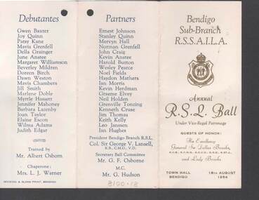
Document - R.S.L. BENDIGO COLLECTION: ANNUAL R.S.L. BALL 1954, 18th August, 1954
Two copies of the Bendigo Sub-branch R.S.S.A.I.L.A. Annual R.S.L. Ball held at the Town Hall, Bendigo on 18th August 1954. Guests of Honour were His Excellency General Sir Dallas Brooks, K.C.B., K.C.M.G., K.C.V.O., D.S.O., K.ST.J., and Lady Brooks. Card is cream with gold print on the front and a gold RLS badge. Other printing is blue. The inside of the tri-fold card has a Dance Program of 28 dances and a space for Autographs. The other side has the Debutantes: Gwen Baxter, Joy Quinn, Patsy Kane, Mavis Grenfell, Della Grainger, June Anstee, Margaret Williamson, Beverley Mildren, Doreen Birch, Dawn Weston, Mavis Chambers, Jill Smith, Marlene Doble, Myrtle Hassett, Jennifer Mahoney, Barbara Lazenby, Joan Taylor, Elaine Escon, Wilma Adams and Judith Edgar. Trained by Mr Albert Osborn. Chaperone: Mrs L J Warner. Partners: Ernest Johnson, Stanley Quinn, Mervyn Hall, Norman Grenfell, John Craig, Kevin Anstee, Harold Button, Wesley Pearce, Noel Fields, Haydon Mathers, Ian Morris, Kevin Herdman, Graeme Elvey, Neil Holden, Grenville Tonzing, Kenneth Cruse, Jim Thomas, Keith Kelly, Leo Janssen and Ian Hughes. President Bendigo Branch R.S.L: Col. Sir George Lansell, K.B., C.M.G., V.D. Secretary Ball Committee: Mr G F Osborne. M.C. Mr G Hudson. Printed by Hocking & Sloan Print, Bendigo.Hosking & Sloan Print, Bendigoevent, social, annual ball, r.s.l. bendigo collection - annual r.s.l. ball 1954, his excellency general sir dallas brooks, lady brooks, gwen baxter, joy quinn, patsy kane, mavis grenfell, della grainger, june anstee, margaret williamson, beverley mildren, doreen birch, dawn weston, mavis chambers, jill smith, marlene doble, myrtle hassett, jennifer mahoney, barbara lazenby, joan taylor, elaine escon, wilma adams, judith edgar, mr albert osborn, mrs l j warner, ernest johnson, stanley quinn, mervyn hall, norman grenfell, john craig, kevin anstee, harold button, wesley pearce, noel fields, haydon mathers, ian morris, kevin herdman, graeme elvey, neil holden, grenville tonzing, kenneth cruse, jim thomas, keith kelly, leo janssen, ian hughes, col sir george v lansell, mr g f osborne, mr g hudson -
 Bendigo Historical Society Inc.
Document - CATHERINE REEF UNITED CLAIMHOLDERS GOLD MINING COMPANY SHAREHOLDERS
Entry No. 621 on page 856. Entry is a list of the Catherine Reef United Claimholders Gold Mining Company Shareholders with their address and the number of shares they hold. Manager was Thomas Eyre and the Company Office was at Peg Leg Gully, Eaglehawk. Names of Shareholders are: John Abern, Simon Albert, James Allen, William Allen, Alexander Anderson, William Anderson,Harry Leigh Atkinson, William Bannerman, Adolphus Barnett, Adolphus Robert Barnett, Alexander Bayne, Adam Beattie, Robert Bell, Gottfried Bermann, William Boncher, James Branagan, Carl Brecht, Frederick William Brinkmeyer, William Ruthford Brown, Joseph Burgoine, Thomas Burgoine, Thomas Burrows, Joseph Butler, John Thomas Caldwell, Philip Carr, Mary Jane Chantler, James Cobb, Edward Cook, Edward F Cooper, James Crameri, George Cudden, Jacob Ludwig Culmsec, Gustav Damkohler, Ellen Dithmer, William Dixon, William Doig, Robert Campbell Dow, Adam George Dunlop, Andrew McBride Dunlop, Hugh Ellis, Thomas Eyre, Richard Philip Eyre, William Farnsworth, Matthew Fawcett, Frederick John Fleming, John Forrest, Andrew Frei, Robert Gilmour, James Gray, Fordinand Gremelsbecher, Robert Grieve, John Grieve, William Grose, George Hagger, Andrew Hamilton,Hans Truchen Hansen, Thomas Harding, Abraham Harkness, Alexander Hay, Joseph A C Helm, John Hoole, George Hoole, Edward Hunt, Thomas Huston, Henry Jackson, Samuel Jackson, Eli James, Robert Jeffrey, Carl Heinrich Jensen, George Foster Johnson, Richard Kevern, William Kimber, Martin Kircher, Hay Kirkwood, Henry Koch, John Lamperd, Mary Anne Lawley, Charles Letheby, Joseph Lowery, Ninjan Mailor, William Marshall, Robert Marshall, Henry Adolphus Medlicott, John Mitchell, William Moore, Susan Murray, Andrew McGrigor, John Steele McNair, Thomas McCormack, Peter Nielson, William Parry Nicholls, Henry Boyns Nicholas, George Nicholson, John Noble, Daniel Noonan, John O'Keeffe, David Purves, William Rea, William Usher Reavely, Francis Robinson Reay, John Bellew Richards, Samuel Richardson, William Robinson, Henry John Rowe, Thomas Ruberg, John Rule, Thomas Rule, Joseph Rutherford, Edward B Ryal, John Snaith Rymer, Philip Seeber, Ferdinand Sahlberg, John Thomas Sanders, Edward Saunders, Charles Selwyn Savage, Charles Sayer, John Scanlon, William Schafer, James Sherson, William Simpson, Antony Smith, Samuel Snowdon, Peter Sorensen, Anders Neilsen Sorensen, Frederick Stahl, David Chaplin Sterry, James Steward, Louis Straub, Robert Suggett, George Suggett, John Talbot, Marion Taylor, John Thomas, Joseph Thomson, Thomas Treloar, William Trimble, George Turner, Alfred Wainwright, Charles Wallin, John Watson, Joseph Watson, Richard John Webb, Frederick Whitaker, John William Williams, Henry Williams, Robert Wills, Christian Weiss, John Wilson, William Winter, George Wisemann, Joseph Wood, James William Wood, Edward Wrixon, Thomas Young and Henry Young. Witness to Signature was J D Crofts.mining, business, shareholders, catherine reef united claimholders gold mining company shareholders, thomas eyre, mining partnerships limited liability act 1860, john abern, simon albert, james allen, william allen, alexander anderson, william anderson, harry leigh atkinson, william bannerman, adolphus barnett, adolphus robert barnett, alexander bayne, adam beattie, robert bell, gottfried bermann, william boncher, james branagan, carl brecht, frederick william brinkmeyer, william ruthford brown, joseph burgoine, thomas burgoine, thomas burrows, joseph butler, john thomas caldwell, philip carr, mary jane chantler, james cobb, edward cook, edward f cooper, james crameri, george cudden, jacob ludwig culmsec, gustav damkohler, ellen dithmer, william dixon, william doig, robert campbell dow, adam george dunlop, andrew mcbride dunlop, hugh ellis, thomas eyre, richard philip eyre, william farnsworth, matthew fawcett, frederick john fleming, john forrest, andrew frei, robert gilmour, james gray, fordinand gremelsbecher, robert grieve, john grieve, william grose, george hagger, andrew hamilton, hans truchen hansen, thomas harding, abraham harkness, alexander hay, joseph a c helm, john hoole, george hoole, edward hunt, thomas huston, henry jackson, samuel jackson, eli james, robert jeffrey, carl heinrich jensen, george foster johnson, richard kevern, william kimber, martin kircher, hay kirkwood, henry koch, john lamperd, mary anne lawley, charles letheby, joseph lowery, ninjan mailor, william marshall, robert marshall, henry adolphus medlicott, john mitchell, william moore, susan murray, andrew mcgrigor, john steele mcnair, thomas mccormack, peter nielson, william parry nicholls, henry boyns nicholas, george nicholson, john noble, daniel noonan, john o'keeffe, david purves, william rea, william usher reavely, francis robinson reay, john bellew richards, samuel richardson, william robinson, henry john rowe, thomas ruberg, john rule, thomas rule, joseph rutherford, edward b ryal, john snaith rymer, philip seeber, ferdinand sahlberg, john thomas sanders, edward saunders, charles selwyn savage, charles sayer, john scanlon, william schafer, james sherson, william simpson, antony smith, samuel snowdon, peter sorensen, anders neilsen sorensen, frederick stahl, david chaplin sterry, james steward, louis straub, robert suggett, george suggett, john talbot, marion taylor, john thomas, joseph thomson, thomas treloar, william trimble, george turner, alfred wainwright, charles wallin, john watson, joseph watson, richard john webb, frederick whitaker, john william williams, henry williams, robert wills, christian weiss, john wilson, william winter, george wisemann, joseph wood, james william wood, edward wrixon, thomas young, henry young, j d crofts -
 Bendigo Historical Society Inc.
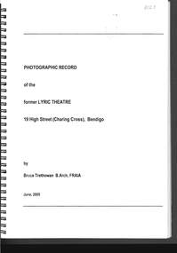
Document - PHOTO RECORD OF THE FORMER LYRIC THEATRE
Spring bound photographic record of the former Lyric Theatre, 19 High Street (Charing Cross), Bendigo, by Bruce Trethowan, B.arch, FRAIA, dated June, 2005. A letter in the front of the document mentions as part of the Bendigo Bank Development, it was necessary to demolish the former Lyric Theatre. Before doing so, the Bank commissioned a heritage architect to produce a photographic record of the building. It is addressed to Mr Jim Evans, President, Bendigo Historical Society and dated 10 August 2005. The beginning has the Historical Background, Building Description and three pages of Plans and Elevations. There are sixty colour photographs of the building depicting the front outside of the building, other outside photos and a number of the interior.buildings, commercial, former lyric theatre, photographic record of the former lyric theatre, bruce trethowan, gallagher jeffs consulting, gallagher jeffs pty ltd, jim evans, bendigo bank development, ted gallagher, richard hasseldine, city of greater bendigo planning department, keogh & austen, state savings banks, sydney smith and ogg, godfrey and spowers, colonial life building, johnson morley warehouse, j g austen, muioof building eaglehawk, george austen, backhaus building, allawah, william cowling, taylor, soilleux, overend, plaza theatre, backhaus trust, princess theatre, the annals of bendigo vol 8 p163, the annals vol 8 p180, fernwood women's health club, bendigo real estate -
 Bendigo Historical Society Inc.
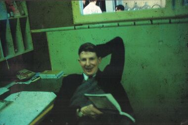
Photograph - PETER ELLIS COLLECTION: BRIT STAFF OFFICE IN ANALYTICAL LAB
Colour photograph taken at BRIT with small piece of paper attached to bottom of photograph reads Staff Office in Analytical Lab. 1968 Organic Chem. Lecturers Brian Taylor in front (also taught 'Scientific German'), George Ooi's head viewed through window, Gary Gately on the left. Photo by John Adeney.bendigo, institutions, brit -
 Bendigo Historical Society Inc.
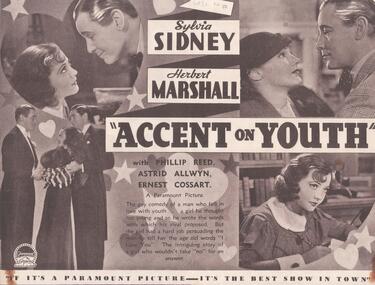
Programme - THEATRES COLLECTION: PLAZA THEATRE PROGRAMMES
Thirteen programmes for the Plaza theatre. 1) ''Accent on Youth'' with Sylvia Sidney and Herbert Marshall. 2) ''Transatlantic Merry-go-Round'' with Nancy Carroll and Gene Raymond. 3) ''We Live Again'' with Anna Sten and Fredric March. 4) ''Lilies of the Field'' with Winifred Shotter and Anthony Bushell. 5) ''Carnival in Spain'' with Marlene Dietrich, Lionel Atwill, Cesar Romero. 6) '' Kid Millions'' with Eddie Cantor and Ann Sothern. 7) ''The Mighty Barnum'' with Wallace Beery. 8) ''All the King's Horses'' with Mary Ellis and Carl Brisson. 9) ''Behold my Wife'' with Sylvia Sidney and Gene Raymond. 10) '' Without Regret'' with Elissa Landi, Paul Cavanagh, Kent Taylor and Frances Drake. 11) '' Clive of India'' with Ronald Colman and Loretta Young. 12) ''Texas Trail'' with William Boyd, Russell Hayden, Judith Allen, George Hayes. 13) ''Danny Boy'' with Ronnie Hepworth, Frank Forbes-Robertson, Dorothy Dickson, Cyril Ritchard.entertainment, theatre, plaza -
Kew Historical Society Inc
Journal, Kewriosity : March 1992
Kew Festival Special Edition [16pp] / p1. Looking for deregulation in North America / Janet Dore p2&3. Mayor's Comment / Cr Daryl Oldaker p3. New Parking signs / p4. Disabled parking permits / p5. Long term parking p5. Girl Guides & Brownie Guides of Kew / p5. Anyone for tennis? [East Kew Uniting Church] / p5. Football in Kew / p5. New Principal at Hew High School [Alan Taylor] / p6. Trinity Grammar Open Day / p6. Youth Leadership Course / p7. Caritas Christi Hospice Awareness Week / p7. Kew Youth Arts Festival [programme of events] / pp8-9. Diary Dates for March [1992] / p10. Kew Festival Concert at Holy Trinity / p10. Direct Line 2 [Kew Cottages] / p11. Kew Recreation Centre 383-407 High Street, Kew / p11. Healthy fun activities / p11. Free bike identification / p12. Feet feature / p12. New courses at Kew Community House / p13. Kew Junction Commercial Centre / p14. Fundraisers extraordinaire [St. George’s Hospital Kew Ladies’ Auxiliary] / p14. Vale - John Hogan Gervasoni J.P. 1929-1992 / p15. Draft Gaming Machine Policy / p15. Revealing Villa Alba - Open Days / p16.Kewriosity was a local newsletter combining Kew Council and community news. It was published between November 1983 and June 1994, replacing an earlier Kewriosity [broad] Sheet (1979-84). In producing Kewriosity, Council aimed to provide a range of interesting and informative articles covering its deliberations and decision making, together with items of general interest and importance to the Kew community and information not generally available through daily media outlets.non-fictionKew Festival Special Edition [16pp] / p1. Looking for deregulation in North America / Janet Dore p2&3. Mayor's Comment / Cr Daryl Oldaker p3. New Parking signs / p4. Disabled parking permits / p5. Long term parking p5. Girl Guides & Brownie Guides of Kew / p5. Anyone for tennis? [East Kew Uniting Church] / p5. Football in Kew / p5. New Principal at Hew High School [Alan Taylor] / p6. Trinity Grammar Open Day / p6. Youth Leadership Course / p7. Caritas Christi Hospice Awareness Week / p7. Kew Youth Arts Festival [programme of events] / pp8-9. Diary Dates for March [1992] / p10. Kew Festival Concert at Holy Trinity / p10. Direct Line 2 [Kew Cottages] / p11. Kew Recreation Centre 383-407 High Street, Kew / p11. Healthy fun activities / p11. Free bike identification / p12. Feet feature / p12. New courses at Kew Community House / p13. Kew Junction Commercial Centre / p14. Fundraisers extraordinaire [St. George’s Hospital Kew Ladies’ Auxiliary] / p14. Vale - John Hogan Gervasoni J.P. 1929-1992 / p15. Draft Gaming Machine Policy / p15. Revealing Villa Alba - Open Days / p16.publications -- city of kew (vic.), kewriosity, council newsletters, community newsletters -
 Expression Australia
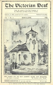
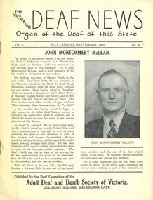
Newsletter, The Victorian Deaf - March-April 1930
Under the auspices of the Deaf Committee of the Adult Deaf and Dumb Society of Victoria - Edited by A. Hull assisted by R. H. LambertThe significance of these newsletters is in the detail of information they contain about the people and activities of the Deaf community in Victoria and interstate.Vol. 1 No. 2 March-April 1930; Size 21.5cmHx14cmWthe victorian deaf, n. armstron, a. c. muir, mr hesketh, andrew clarke, w. bond, w. p. muir, d. piper, a. wilson, g. moore, s. johnson, rev. w. moss, e. newbigin, mrs lewis, mrs s. moss, d. piper, mrs c. e. frewin, j. m. johnston, w. ashby, j. mclean, o'gorman, hawkins, fisher, j. hennessy, h puddy, a. graham, mrs s. ferguson, jean solomon, g mortimer, mrs crompton, taylor, hickey, hatley, salvado, hart, tonkin, george ashley, colin johnsf. cummins, sutherland, utber, boortz, bert hague, walter bladier, winnie gladman, eileen o'gormans. moss, c. ball, r. cram, holmes,j. m. johnston, w. wood, r. h. lambert, f. kendall, o'bryan, g. b. mortimer, e. johnston, mrs e. r. peacock, empson, e. stephens, r. dow, alice smith, b. heggie, w. anderson, guilds, hosckey club, lacross club, victorian deaf and dumb institution, c. f. crosby -
 Expression Australia
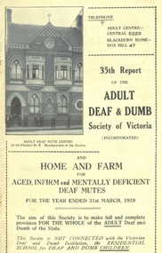
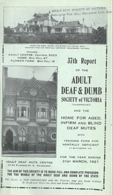
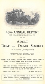
Annual Report, 35th Report of the Adult Deaf and Dumb Society of Victoria 1919
The Adult Deaf and Dumb Society of Victoria, now known as Vicdeaf, (the Victorian Deaf Society), was founded in 1884 as the Victorian Society for Promoting the Spiritual and Temporal Welfare of the Adult Deaf and Dumb. The provisional committee being Mr W Bates, Mr J M Bruce, Mr J D Gowan, Mr Edwin Newbiggin, Mr C M Officer, M. L, A., and the Rev. W. Moss. The Adult Deaf and Dumb Mission's objects were: 1. To provide the means for religious worship and instruction for the adult deaf and dumb of Victoria 2. To visit the deaf and dumb in their homes, especially when sick or in distress 3. To assist the deaf and dumb of good character in obtaining suitable employment 4. To provide technical and other education for the adult and dumb 5. To give pecuniary assistance to adult deaf and dumb who are in needThe Annual Reports of the Adult Deaf and Dumb Society are historically significant providing insight into the history of the evolving Deaf Community in Victoria. They are a annual 'snapshot' of the year with references not only to the progress of the Society but also to the significant people and events within the Deaf Community.Cream Cover, Size 21.5Hx13.5W, 56 pagesarthur stanley, w. g. mcbeath, e. r. peacock, r. j. oehr, h. l. walters, m. l. miller, john higgins, g. g. mercy, harold w. bickford, george brown, a. macaulay caldwell, w. a. dickins, f. e. frewin, j. m. johnston, r. h. luff, h. sumner martin, george vial, ernest j. d. abraham, r. dow, e. empson, l. fletcher, d, hickey, a. graham, mrs c. robertson, e. r. smith, mrs a. wilso, mab dow, ivy cole, j. craig, john cronin, alex williamson, adam c. muir, w. taylor, s. moss, m. g. b mortimer, blackburn, deaf workers club, ramblers club, j. johnston, m. maloney, lacrosse, cricket, t. a. nelson, a suthersland, w. a. paterson, n. amos, j. leber, j. cariss, alfred peacock, mrs abraham, g. rees, s. w. showell, w. warren, isabella fister, nora kennedy, -
 Expression Australia
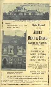
Annual Report, 36th Report of the Adult Deaf and Dumb Society of Victoria 1920
The Adult Deaf and Dumb Society of Victoria, now known as Vicdeaf, (the Victorian Deaf Society), was founded in 1884 as the Victorian Society for Promoting the Spiritual and Temporal Welfare of the Adult Deaf and Dumb. The provisional committee being Mr W Bates, Mr J M Bruce, Mr J D Gowan, Mr Edwin Newbiggin, Mr C M Officer, M. L, A., and the Rev. W. Moss. The Adult Deaf and Dumb Mission's objects were: 1. To provide the means for religious worship and instruction for the adult deaf and dumb of Victoria 2. To visit the deaf and dumb in their homes, especially when sick or in distress 3. To assist the deaf and dumb of good character in obtaining suitable employment 4. To provide technical and other education for the adult and dumb 5. To give pecuniary assistance to adult deaf and dumb who are in needThe Annual Reports of the Adult Deaf and Dumb Society are historically significant providing insight into the history of the evolving Deaf Community in Victoria. They are a annual 'snapshot' of the year with references not only to the progress of the Society but also to the significant people and events within the Deaf Community.Cream Cover, Size 21.5Hx13.5W, 64 pagesdr j. f. mackeddie, e. r. peacock, r. j. oehr, h. l. walters, m. l. miller, john higgins, g. g. mercy, harold w. bickford, george brown, a. macaulay caldwell, w. a. dickins, j. ewing, f. e. frewin, j. m. johnston, r. h. luff, h. sumner martin, george vial, ernest j. d. abraham, r. dow, e. empson, l. fletcher, d, hickey, a. graham, mrs c. robertson, e. r. smith, mrs a. wilson, mab dow, ivy cole, j. craig, john cronin, alex williamson, adam c. muir, w. taylor, s. moss, m. g. b mortimer, blackburn, deaf workers club, ramblers club, j. johnston, lacrosse, cricket, a sutherland, w. a. paterson, n. amos, mrs abraham, douglas abraham, a. mclellan, gladman, hughes, tyzzer, elwyn, hull, damman, bentley, bruce caughey, potter, pugh -
 Expression Australia
Annual Report, 37th Report of the Adult Deaf and Dumb Society of Victoria 1921
The Adult Deaf and Dumb Society of Victoria, now known as Vicdeaf, (the Victorian Deaf Society), was founded in 1884 as the Victorian Society for Promoting the Spiritual and Temporal Welfare of the Adult Deaf and Dumb. The provisional committee being Mr W Bates, Mr J M Bruce, Mr J D Gowan, Mr Edwin Newbiggin, Mr C M Officer, M. L, A., and the Rev. W. Moss. The Adult Deaf and Dumb Mission's objects were: 1. To provide the means for religious worship and instruction for the adult deaf and dumb of Victoria 2. To visit the deaf and dumb in their homes, especially when sick or in distress 3. To assist the deaf and dumb of good character in obtaining suitable employment 4. To provide technical and other education for the adult and dumb 5. To give pecuniary assistance to adult deaf and dumb who are in needThe Annual Reports of the Adult Deaf and Dumb Society are historically significant providing insight into the history of the evolving Deaf Community in Victoria. They are a annual 'snapshot' of the year with references not only to the progress of the Society but also to the significant people and events within the Deaf Community.Green Cover, Size 21.5Hx13.5W, 66 pagesdr j. f. mackeddie, e. r. peacock, r. j. oehr, j. dudley, m. l. miller, john higgins, harold w. bickford, george brown, t. dudley, f. e. frewin, j. m. johnston, r. h. luff, h. a. sinclair, george vial, ernest j. d. abraham, r. dow, e. empson, d, hickey, mrs w. a. paterson, mrs pierce, mrs e. johnson, mrs a. wilson, mab dow, j. craig, john cronin, alex williamson, adam c. muir, w. taylor, s. moss, m. g. b mortimer, blackburn, deaf workers club, ramblers club, j. johnston, lacrosse, cricket, a suthersland, w. a. paterson, n. amos, mrs abraham, douglas abraham, a. mclellan, nunawading shire council, queensland adult deaf and dumb mission, new south wales adult deaf and dumb society, south australian deaf and dumb mission, alex collins, sam ferguson, mr and mrs burge, victor harding, jane huish, a. kidd -
 Expression Australia
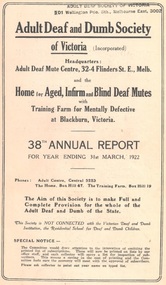
Annual Report, 38th Report of the Adult Deaf and Dumb Society of Victoria 1922
The Adult Deaf and Dumb Society of Victoria, now known as Vicdeaf, (the Victorian Deaf Society), was founded in 1884 as the Victorian Society for Promoting the Spiritual and Temporal Welfare of the Adult Deaf and Dumb. The provisional committee being Mr W Bates, Mr J M Bruce, Mr J D Gowan, Mr Edwin Newbiggin, Mr C M Officer, M. L, A., and the Rev. W. Moss. The Adult Deaf and Dumb Mission's objects were: 1. To provide the means for religious worship and instruction for the adult deaf and dumb of Victoria 2. To visit the deaf and dumb in their homes, especially when sick or in distress 3. To assist the deaf and dumb of good character in obtaining suitable employment 4. To provide technical and other education for the adult and dumb 5. To give pecuniary assistance to adult deaf and dumb who are in needThe Annual Reports of the Adult Deaf and Dumb Society are historically significant providing insight into the history of the evolving Deaf Community in Victoria. They are a annual 'snapshot' of the year with references not only to the progress of the Society but also to the significant people and events within the Deaf Community.Pink Cover, Size 21.5Hx13.5W,20 pagesdr j. f. mackeddie, e. r. peacock, r. j. oehr, j. dudley, m. l. miller, john higgins, harold w. bickford, f. e. frewin, j. m. johnston, r. h. luff,w. a. paterson, h. a. sinclair, george vial, ernest j. d. abraham, r. dow, e. empson, d, hickey, mrs w. a. paterson, margaret gibson, lydia sanders, mrs e. johnson, mrs a. wilson, mab dow, j. craig, john cronin, alex williamson, adam c. muir, w. taylor, s. moss, m. g. b mortimer, blackburn, deaf workers club, ramblers club, j. johnston, lacrosse, cricket, a suthersland, w. a. paterson, n. amos, mrs abraham, douglas abraham, a. mclellan, w. b. anderson, c. graham, d. white, j. m. jjohnston, h. mckenzie, v. tyzzer, n. webb, j. williams, o. tyzzer, d. m. kilpatrick, n. amos, a. williams, g. newnham, i. kennedy, a. tyzzer, a. stewart, j. mclean, r. durham, n. ormsby, mrs goddard, c. smith, h. taggart, mr brett, -
 Expression Australia
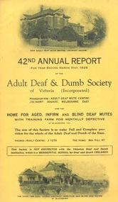
Annual Report, 42nd Report of the Adult Deaf and Dumb Society of Victoria 1926
The Adult Deaf and Dumb Society of Victoria, now known as Vicdeaf, (the Victorian Deaf Society), was founded in 1884 as the Victorian Society for Promoting the Spiritual and Temporal Welfare of the Adult Deaf and Dumb. The provisional committee being Mr W Bates, Mr J M Bruce, Mr J D Gowan, Mr Edwin Newbiggin, Mr C M Officer, M. L, A., and the Rev. W. Moss. The Adult Deaf and Dumb Mission's objects were: 1. To provide the means for religious worship and instruction for the adult deaf and dumb of Victoria 2. To visit the deaf and dumb in their homes, especially when sick or in distress 3. To assist the deaf and dumb of good character in obtaining suitable employment 4. To provide technical and other education for the adult and dumb 5. To give pecuniary assistance to adult deaf and dumb who are in needThe Annual Reports of the Adult Deaf and Dumb Society are historically significant providing insight into the history of the evolving Deaf Community in Victoria. They are a annual 'snapshot' of the year with references not only to the progress of the Society but also to the significant people and events within the Deaf Community.Gold Cover, Size 21.5Hx13.5W, 42 pagesearl of stradbroke, dr j. f. mackeddie, e. r. peacock, j. dudley,m. l. miller, r. j. oehr, o. r. macdonald, charles w. campbell, j. m. griffiths, mrs c. luke, henry masterton, mrs henry masterton, lady mcfacharn, e. r. peacock, h. sumner martin, g. g. mercy, mrs w. g. stephens, dr w. j. craig, dr. heyer, harold w. bickford, f. e. frewin, j. m. johnston, r. h. luff, w. a. paterson, s. l. massina, george vial, ernest j. d. abraham, rose dow, e, empson ,mrs abraham, douglas abraham, a. mcellan, m. g. b. mortimer, a. sutherland, e johnson, w. a. paterson, j. cariss, f. rees, n. amos, mrs w. pierce, mrs a. wilson, margaret gibson, lydia sanders, mrs gladman. mrs j. johnston, d. hickey, w. b. anderson, j. bladier, p. o'gorman, adam c. muir, s. moss, w. taylor, j. pierce, blackburn, jeanes, kemble, moore, peters, tyzzer, hunt, paul, johnston, noonan, -
 Expression Australia
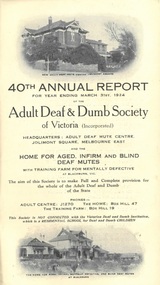
Annual Report, 40th Report of the Adult Deaf and Dumb Society of Victoria 1924
The Adult Deaf and Dumb Society of Victoria, now known as Vicdeaf, (the Victorian Deaf Society), was founded in 1884 as the Victorian Society for Promoting the Spiritual and Temporal Welfare of the Adult Deaf and Dumb. The provisional committee being Mr W Bates, Mr J M Bruce, Mr J D Gowan, Mr Edwin Newbiggin, Mr C M Officer, M. L, A., and the Rev. W. Moss. The Adult Deaf and Dumb Mission's objects were: 1. To provide the means for religious worship and instruction for the adult deaf and dumb of Victoria 2. To visit the deaf and dumb in their homes, especially when sick or in distress 3. To assist the deaf and dumb of good character in obtaining suitable employment 4. To provide technical and other education for the adult and dumb 5. To give pecuniary assistance to adult deaf and dumb who are in needThe Annual Reports of the Adult Deaf and Dumb Society are historically significant providing insight into the history of the evolving Deaf Community in Victoria. They are a annual 'snapshot' of the year with references not only to the progress of the Society but also to the significant people and events within the Deaf Community.Pink Cover, Size 21.5Hx13.5W, 36 pagesearl of stradbroke, dr j. f. mackeddie, e. r. peacock, j. dudley,m. l. miller, r. j. oehr, john higgins, dr w. j. craig, dr. heyer, harold w. bickford, george brown, e. r. frewin, j. m. johnston, r. h. luff, w. a. paterso, h. a. sinclair, george vial, ernest j. d. abraham, rose dow, e, empson ,mrs abraham, douglas abraham, a. mcellan, m. g. b. mortimer, a. sutherland, e johnson, w. a. paterson, j. cariss, f. rees, n. amos, mrs w. pierce, mrs a. wilson, margaret gibson, lydia sanders, mrs gladman. mrs j. johnston, d. hickey, w. b. anderson, j. bladier, p. o'gorman, adam c. muir, s. moss, w. taylor, blackburn, n. webb, g. damman, t. peters, e. jackson, f. johnson, e. crockford, j. leber, e. thompson, w. b. anderson, g. bates, s. jeanes, d. carr, mrs a. c. muir, mrs w. a. paterson, r. h. watson, mrs w. burge, d. nolan, g. woods, miss phillips, cricket, lacrosse -
 Expression Australia
Annual Report, 43rd Report of the Adult Deaf and Dumb Society of Victoria 1927
The Adult Deaf and Dumb Society of Victoria, now known as Vicdeaf, (the Victorian Deaf Society), was founded in 1884 as the Victorian Society for Promoting the Spiritual and Temporal Welfare of the Adult Deaf and Dumb. The provisional committee being Mr W Bates, Mr J M Bruce, Mr J D Gowan, Mr Edwin Newbiggin, Mr C M Officer, M. L, A., and the Rev. W. Moss. The Adult Deaf and Dumb Mission's objects were: 1. To provide the means for religious worship and instruction for the adult deaf and dumb of Victoria 2. To visit the deaf and dumb in their homes, especially when sick or in distress 3. To assist the deaf and dumb of good character in obtaining suitable employment 4. To provide technical and other education for the adult and dumb 5. To give pecuniary assistance to adult deaf and dumb who are in needThe Annual Reports of the Adult Deaf and Dumb Society are historically significant providing insight into the history of the evolving Deaf Community in Victoria. They are a annual 'snapshot' of the year with references not only to the progress of the Society but also to the significant people and events within the Deaf Community.Pink Cover, Size 21.5Hx13.5W, 40 pagese. r. peacock, j. dudley,m. l. miller, r. j. oehr, o. r. macdonald, charles w. campbell, j. m. griffiths, mrs c. luke, henry masterton, mrs henry masterton, lady mcfacharn, e. r. peacock, h. sumner martin, g. g. mercy, mrs w. g. stephens,,,h. , dr w. j. craig, dr. may, harold w. bickford, f. e. frewin, j. m. johnston, r. h. luff, w. a. paterson, s. l. massina, george vial, ernest j. d. abraham, rose dow, e, empson ,mrs abraham, douglas abraham, a. mcellan, m. g. b. mortimer, adam c. muir, s. moss, w. taylor, j. pierce, blackburn, cricket, lacrosse, -
 Expression Australia
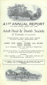
Annual Report, 41st Report of the Adult Deaf and Dumb Society of Victoria 1925
The Adult Deaf and Dumb Society of Victoria, now known as Vicdeaf, (the Victorian Deaf Society), was founded in 1884 as the Victorian Society for Promoting the Spiritual and Temporal Welfare of the Adult Deaf and Dumb. The provisional committee being Mr W Bates, Mr J M Bruce, Mr J D Gowan, Mr Edwin Newbiggin, Mr C M Officer, M. L, A., and the Rev. W. Moss. The Adult Deaf and Dumb Mission's objects were: 1. To provide the means for religious worship and instruction for the adult deaf and dumb of Victoria 2. To visit the deaf and dumb in their homes, especially when sick or in distress 3. To assist the deaf and dumb of good character in obtaining suitable employment 4. To provide technical and other education for the adult and dumb 5. To give pecuniary assistance to adult deaf and dumb who are in needThe Annual Reports of the Adult Deaf and Dumb Society are historically significant providing insight into the history of the evolving Deaf Community in Victoria. They are a annual 'snapshot' of the year with references not only to the progress of the Mission but also to the significant people and events within the Deaf Community.Green Cover, Size 21.5Hx13.5W, 40 pagesearl of stradbroke, dr j. f. mackeddie, e. r. peacock, j. dudley,m. l. miller, r. j. oehr, o. r. macdonald, charles w. campbell, j. m. griffiths, mrs c. luke, henry masterton, mrs henry masterton, lady mcfacharn, e. r. peacock, h. sumner martin, g. g. mercy, mrs w. g. stephens,,,h. , dr w. j. craig, dr. heyer, harold w. bickford, f. e. frewin, j. m. johnston, r. h. luff, w. a. paterson, s. l. massina, george vial, ernest j. d. abraham, rose dow, e, empson ,mrs abraham, douglas abraham, a. mcellan, m. g. b. mortimer, a. sutherland, e johnson, w. a. paterson, j. cariss, f. rees, n. amos, mrs w. pierce, mrs a. wilson, margaret gibson, lydia sanders, mrs gladman. mrs j. johnston, d. hickey, w. b. anderson, j. bladier, p. o'gorman, adam c. muir, s. moss, w. taylor, j. pierce, blackburn, amos, driscoll, hughes, bragg, peters, tyzzer, robertson, leber, kemble, honor, rees, muir, allison, cullis, brooks, hawkins, vivian, herlihy, elwin, ashby, thompson, pollock, smith, burke, yates, -
 Expression Australia
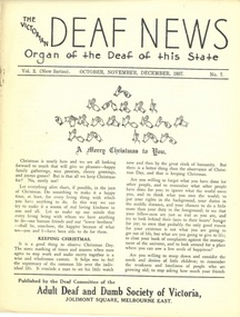
Newsletter, The Victorian Deaf News July-August-September 1937
Published by the Deaf Committee of the Adult Deaf and Dumb Society of Victoria'The Victorian Deaf News' Newsletter is a significant publication as an historical record giving and insight into the people, activities and events of the Deaf Community in Victoria.Vol. 2 No. 6 1937; Size24.5cmHx19cmW; 16 pagesjohn montgomery mclean, may clarke, mrs e. bryan, rev w. h. johnson, a. aird, alice cove, t. a. nelson, ellen whitlow, rose dow, rowe, james, edgar h. peacock, international congress of the deaf and dumb, basketball, lorrie ellis,george mcguinness, bernice cardwell, clarence r. jose, j. m. johnston, w. a. ross, alice c. graham, blackburn home, sllen adcock, hobson, white, ian anderson, rivers, norman may, muriel smith, james, jack reid, ray kemble, ambrose moloney, norma rawlins, j. boortz, taylor, ernest reynolds, e. sturcke, w. duncan, ian hinton, betty doyle, dick white, claude lyfield, alex collins, jack stewart, willie chapmanw. crush, harry puddy, d. scott, alice guest, cove, thomas alexander nelson, ellen whitlow, -
 Expression Australia
Newsletter, The Victorian Deaf News October-November-December 1937
Published by the Deaf Committee of the Adult Deaf and Dumb Society of VictoriaThe Victorian Deaf News' Newsletter is a significant publication as an historical record giving and insight into the people, activities and events of the Deaf Community in Victoria.Vol. 2 No. 7 (New Series), October November December 1937; Size 24.5cmHx19cmW; 12 pagesa. c muir, f. e. frewin, r. h. luff, m. g.g.b. mortimer, mrs crompton, bremner, hobson, james abraham, e. r. noble, j. m. johnston, h. puddy, burnie johnson, mrs j. e. muir, betty wilkinson, alex anderson, olive minton, robert hamilton, mona stevens, j. waters, james anderson, newbury, b. chaffey, a. stokes, james ashley, j. h. cross, h. r. gillett, j. o'gormanvictorian deaf and dumb institution, w. a. paterson, s. ferguson, len treffene, g. quantock, francis owen, ossie quinton, vincent buttacavoli, byron taylor, william allen, harold ahchow, a. w. sutherland, bill donnelly, z. bragg, m. cross, margy sandon, george oakley, w. utber, w. chapman, hopkins, frank williams -
 Clayton RSL Sub Branch
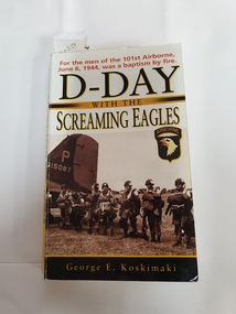
Non-fiction book, D-Day with the Screaming Eagles
101st Airborne June 6 1944 George E. Koskimaki is a former paratrooper who jumped into Normandy on June 6, 1944, as General Maxwell Taylor’s radioman. He went on to become a preeminent historian of the 101st Airborne Division, having interviewed hundreds of fellow veterans for their firsthand accounts. He currently lives in Northville, Michigan non-fiction novel written by 101st Airborne paratrooper...soft cover non-fiction bookhighlighting noted and some personal notes visible on some pages. -
 Surrey Hills Historical Society Collection
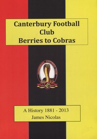
Book, Canterbury Football Club Berries to Cobras - A History 1881-2013, 2013
74p./ This history is more about the people that have been through this club than the statistics. It is about the larrikins, characters, the bad boys, the fun times, the friendships forged over a lifetime, the comedians, the stalwarts and the snake oil salesmen.74p./ This history is more about the people that have been through this club than the stats. It is about the larrikins, characters, the bad boys, the fun times, the friendships forged over a lifetime, the comedians, the stalwarts and the snake oil salesmen.canterbury football club, australian foortball teams, (mr) brian coleman, shrublands, balwyn road, canterbury, malone's hotel, (mr) brendan allen, (mr) don allsop, (mr) don alsop, (mr) glen archer, (mr) nicholas ardley, (mr) r ashton, (mr) w j atkinson, (mr) a austin, (ms) sue bach, (mr) bob bailey, (mr) ted bailey, (mr) lindsay baillie, (mr) - bakaitis, (mr) s bakaitis, (mr) d banks, chris barras, (mr) p bates, (mr) s bates, (mr) steve bates, (mr) n bell, (mr) a beveridge, (mr) k blandthorn, (mr) bill blezard, (mr) a blood, (mr) b boag, (ms) eileen bogan, (mr) r bogan, d bradley, (mr) a briggs, (mr) e brown, val brown, (mr) j byrne, (mr) a callaway, (mr) alan callaway, (mr) m carroll, (mr) m clark, (mr) c clarke, (mr) r coleman, (mr) ron coleman, l connaughton, (mr) l coultard, (mr) peter curran, (mr) n dartnell, (mr) d dell, (mr) david dell, (mr) m demko, (mr) m dosser, (mr) alec dowling, (mr) m dowwer, (mr) w dundas, (mr) r eade, (mr) n eddy, (mr) noel, (mr) gary evans, (mr) d fleming, (mr) m fleming, p fleming, (mr) j foote, (mr) john foote, (mr) l foote, (mr) les foote, (mr) t fraser, (mr) basil gibson, (mr) i gibson, (mr) gary giles, (mr) l giles, (mr) k gill, (ms) m gill, (mr) bob goode, (mr) w a gordes, (mr) m gordon, (mr) mark gordon, (mr) r gracie, (mr) mark gray, (mr) k griffiths, (mr) b gwynne, (mr) peter gwynne, (mr) dick hamer, (mr) a hams, (mr) wayne handley, (mr) rocky hanrahan, (mr) mick harper, (mr) john harris, (mr) don harrop, (mr) george harrop, (mr) keith harvey, (mr) - hasset, (mr) n henderson, (mr) neil henderson, (mr) c herz, (mr) c higgins, (mr) k higson, (mr) ken higson, (mr) k hodgson, (mr) keith hodgson, nugie holland, (mr) p holland, (mr) peter holland, (mr) terry holland, (mr) h honner, (mr) henry honner, (mr) g hopkins, (mr) glen hopkins, (mr) j horner, (mr) g hoskin, (mr) george hoskin, (mr) p hoskin, (mr) peter hoskin, (mr) p hughan, (mr) paul hughan, (mr) k james, (mr) keith james, (mr) f jenkins, s jenkins, (mr) w jenkins, (mr) brian johnson, (mr) j johnson, (ms) lorraine johnson, (mr) p johnson, (mr) rex johnson, (mr) darren kappler, (mr) c kennedy, (ms) h kennedy, (ms) n kennedy, (mr) richard kent, (mr) harold kinder, (mr) richard kingwell, (mr) j kitson, (mr) john kitson, (mr) andrew lamb, (mr) j lambert, (mr) doug langham, (mr) jim langham, (mr) b latimer, (mr) bruce latimer, (ms) belinda leigh, (mr) ian leith, (mr) lloyd, (mr) r lyons, (mr) a mack, (mr) a macpherson, (ms) d madden, (mr) b maguire, (mr) barry maguire, (mr) leo maguire, (mr) s manzie, (mr) s mcdonald, (mr) al mcdonnell, (mr) al mcdonell, (mr) i mckenzie, (mr) r mckenzie, (mr) rhett mckenzie, (mrs) tina mckenzie, (mr) t mcmahon, (mr) j mcnamara, (mr) r mcnamara, (mr) ray mcvilly, (mr) w mcwaters, (mr) warren mecca, (mr) g mihalidis, (mr) euan miles, (mr) r morse, (mr) ray morse, (mr) j mullalley, (mr) bill munn, (ms) elsie munn, (mr) p murphy, (mr) g musker, (mr) l nelson, (mr) leigh nelson, (mr) snowy nicolas, (mrs) myrtle nicolas, (mr) b o'brien, (mr) k o'connor, (mr) d o'sullivan, (ms) emily o'sullivan, (mr) s ogden, (mr) kevin tipping, (ms) dot pacey, (mr) pop pacey, (mr) a v paul, (ms) carol pearce, (mr) danny pearce, (mr) roger pearce, (mr) john peck, (mr) k peterson, (mr) a pickering, (mr) - pieper, (mr) k piper, (mr) j post, (mr) bob pratt, (mr) r a proctor, (mr) - reynold, (mr) l reynolds, (mr) laurie reynolds, (mr) t rigzin, (mr) - rimes, (mr) b rimes, (mr) s rosman, (mr) j ross, (mr) david rowe, (mr) tony rowe, lou salvas, (mr) geoff scash, (mr) james schulz, (mr) kenny schwind, (mr) - scuttles, (mr) stan self, (mr) a sharp, (mr) j sherwell, (mr) - simmons, (mr) k simmons, (mr) n simmons, (mr) n smith, (mr) p smith, (mr) m stals, (mr) marty stals, (mr) a stapleton, (mr) l stephenson, (mr) w taylor, (mr) j thomas, (mr) m thomas, (mr) l tipping, (mr) lindsay tipping, (ms) beryl tory, (mr) ossie tory, (mr) j tsetsenekos, (mr) george veale, (mr) a wadsworth, (mr) b walder, (mr) bud walder, (mr) rohan walmsley, (mr) j watson, (mr) jack watson, (mr) o watson, (mr) c weaver, (mr) r a williams, (mr) w g williams, (mr) geoff wilson, (mr) t wilson, (mr) - wishart, (mr) b wishart, (mr) brian wishart, (mr) r wishart, (mr) j wood, (mr) k woodford, (cr) (mr) - woodhouse, (mr) k wright, (mr) frank yarman, (mr) theo zaharopoulos -
 Surrey Hills Historical Society Collection
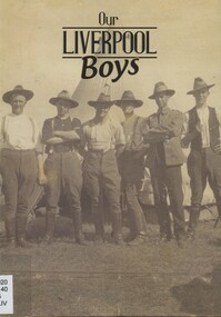
Book, Our Liverpool Boys, 2015
Sent to the collection as part of the Centenary of the ANZAC Gallipoli landing, 2015. This publication reveals the stories of everyday civilians-turned-soldiers who served in the trenches and on the front lines, highlighting their vast contribution to the war effort, including those who made the ultimate sacrifice.This publication reveals the stories of everyday civilians-turned-soldiers who served in the trenches and on the front lines, highlighting their vast contribution to the war effort, including those who made the ultimate sacrifice.world war, 1914-1918, miltary history, (mr) cecil alfred ashcroft, (mr) arthur percival attwood, (mr) thomas walter barker, (mr) george francis bell, (mr) lawrence robert hanna, (mr) charles elvin hyland, (mr) john frederick kammel, (mr) joseph harold kemp, (mr) harry boyland, (mr) james ashcroft braithwaite, (mr) walter henry brewster, (mr) william brown, (mr) charles alfred bull, (mr) william francis cloke, (mr) eric gladstone deadman, (mr) george leslie fullagar, (mr) joseph gomes, (mr) eric sydney walpole sealy-vidal, (mr) samuel kirkpatrick, (mr) nathan douglas lackie, (mr) joseph henry leach, (mr) harry learoyd, (mr) charles m mcfarline, (mr) joseph campbell mcmiles, (mr) robert mcmiles, (mr) james unison morn, (mr) edward hugh oprey, (mr) arthur salis, (mr) (henry) studley sealy-vidal, (mr) walter samuel shaw, (mr) walter samuels, (mr) samuel john southwell, (mr) geoffrey gordon steenson, (mr) eric andrew taylor, (mr) alfred charles thorn, (mr) andrew charles thorne, (mr) campbell throsby, (mr) william george waters, (mr) albert ernest wearne, (mr) thomas william garnet whitney, liverpool training camp, holsworthy internment camp -
 Surrey Hills Historical Society Collection
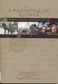
Book, A Pocketful of Acorns - This History of Canterbury Primary School : 1908-2008, c 2008
Purchased in memory of Sue Slonek, Secretary of Surrey Hills Historical Society, volunteer with the Surrey Hills Neighborhood Centre Heritage Collection (Surrey Hills historical Society Collection). A history of Canterbury Primary School written to celebrate the school's 100 year anniversary - 1908-2008A history of Canterbury Primary School written to celebrate the school's 100 year anniversary - 1908-2008canterbury primary school, primary schools, (ms) judy stewart, (mr) ian phillips, (miss) gabriela aloisio, (mrs) marjorie pitt, (miss) joan eltham, (mr) - shannon, (mr) - besant, (mrs) anne bialecki, (ms) diane western, (ms) margaret mason, (miss) hilary barr, (mrs) hilary praetz, (ms) vicki eddison, (miss) margaret kidd, (mr) don kerr, (miss) sarah pitman, (miss) linda summers, (mr) jack tanner, (miss) kate dale, (mr) strapper tanner, (ms) neva rossi, (miss) margot harris, (miss) lauren eddison, (mr) eric alway, (miss) jean alway, (miss) betty alway, (mr) thomas rule, (miss) diane fuller, (ms) barbara chapman, (ms) judy bridges, (ms) julie vango, (ms) judy pitman, (ms) joan le grand, (ms) anne lamborn, (mr) warren walsh, (ms) margaret lee, (ms) barbara gunn, (ms) christine hallman, (mr) murray haby, chris roth, (ms) sue de araugo, (ms) leslie brewer, (ms) judy jordan, sam paterson, (ms) debbie-jane andrews, (mrs) hazel young, (ms) ilse murrihy, (ms) linda summers, (mrs) georgia karatzas, (mrs) sylvia clarke, (mr) eddie clarke, (mrs) - willoughby, (mr) - hopkins, (mrs) - hopkins, (mr) graham salter, (ms) andrea thompson, (miss) - stent, (miss) - mcdonald, (mr) neville daynes, (mr) bruce margetts, (miss) doris thomas, (miss) hazel macdonald, (miss) annette mccoy, (mrs) - feldt, (miss) arwen summers, (miss) grace cameron-muller, manon merakis, terry poulton, (mr) david tolstrup, (ms) sue broadbent, (miss) florence rayment, (miss) yvonne wray, (miss) hazel jarvis, (mr) graham scott, (miss) june smith, (mrs) margaret anderson, (miss) margaret ginn, (miss) kelly jane, (mrs) patricia wion, (miss) patricia lewis, (miss) - edgoose, (mr) john merton, (ms) pauline flynn, (ms) lynne timms, (ms) marilyn taylor, (mrs) anne tonkin, (mrs) flo wilkinson, (miss) flo davies, (mr) jack hardy, (mr) john a bayford, (miss) marion greenwood-smith, (miss) - mcevitt, (miss) - ballantyne, (miss) - riseborough, (ms) (dr) kim dray, (miss) dorothy ambrose, (mrs) - lethbridge, (mrs) - le couteur, (mrs) margaret senior, (miss) margaret macgibbon, (mrs) - briggs, (mr) (major) - moloney, (mr) - poulton, (mr) adrian penniston-bird, prospect hill road, surrey hills, canterbury, canterbury road, molesworth street, highfield road, leeds street, salisbury street, (mr) patrick moloney, (mr) thomas rule, (mr) richard armitage, (mr) frank l oswell, (mr) walter g w webb, (mr) edward bright, (mr) george a allison, (mr) albert r coppin, (mr) william a lucas, (mr) alan g legg, (mr) ralph holden, (mr) dorothy ambrose, (mr) robert storey, (mr) tom neal-williams, (mr) effie miniati, (mr) geoffrey swift, (mr) - baddeley, (mrs) helen mcmillan, (miss) helen mcgibbon, (mr) don walker, (mr) howard hallo, (miss) jean cowen, (miss) felicity coleman, (miss) amanda colahan, (miss) caitlin sum, (miss) brooke webster, (miss) bridget hall, (miss) alison thompson, (mr) andrew lovitt, (mrs) barbara mihan, (miss) barbara prest, (mr) john webster, (mrs) lorna whalley, (mr) stuart margetts, (miss) elaine robinson, (mrs) nonie holman, (miss) nonie lovitt, (mr) brian webster, (mrs) alison cutter, (miss) alison horwell, (mrs) jaqueline lublin, (miss) jacqueline levy, (mrs) gilliam bell, (miss) gillian craig, pinus radiata, the secret garden, lych gate, (mr) geoff swan, talbet oaks, bedford oaks, significant trees, burgundy ash, allepo pine, golden ash, southey oaks, poulton oaks, (mr) (sgt) keith mcdowell, wattle park, (ms) caroline habgood, (mr) henry rotherham, j b cohen, (mr) (major) patrick moloney, (miss) dorothy ambrose, architects, wurundjeri william territory, (mr) - sachse, d kinnaird, builders, danks foundation, (dr) desmond gibbs, 1908, sue slonek, catherine cato, catherine charles, june smith, jenny flynn