Showing 253 items
matching victoria. port fairy
-
 Port Fairy Historical Society Museum and Archives
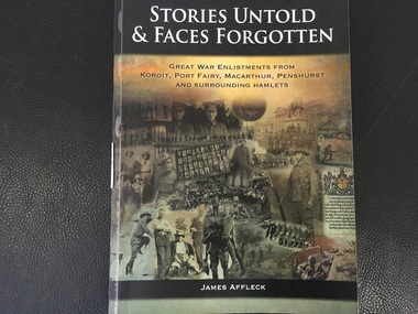
Book, Koroit and District Historical Society Inc, Stories Untold & Faces Forgotten, Volume 2
Stories Untold & Faces Forgotten, Great War Enlistments from Koroit, Port Fairy, Macarthur, Penshurst and surrounding hamlets349-653p, illustrationsnon-fictionStories Untold & Faces Forgotten, Great War Enlistments from Koroit, Port Fairy, Macarthur, Penshurst and surrounding hamletswestern victoria, soldiers, world war, 1914-1918, book -
 Port Fairy Historical Society Museum and Archives
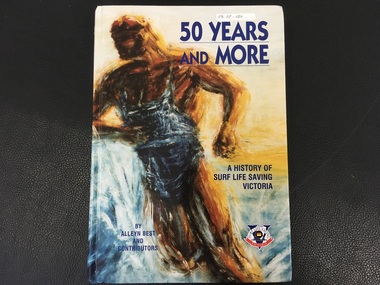
Book, Alan Best and Contributors, 50 Years and More / A History of Surf Life Saving Victoria
History of Surf Life Saving Victoria over 50 years154p. :I;;. (Some col.), maps. Ports., fascism,:non-fictionHistory of Surf Life Saving Victoria over 50 yearssurf life saving victoria, surf lifesaving (aquatic sports), history, book -
 Port Fairy Historical Society Museum and Archives
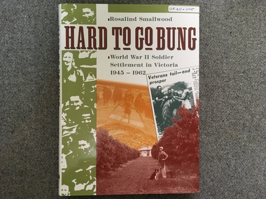
Book, Rosalind Smallwood, Hard to go bung / World War II Soldier / Settlement in Victoria / 1945 - 1962
World War Two, Settlement in Victoria 1945-1962non-fictionWorld War Two, Settlement in Victoria 1945-1962world war two, soldier, soldier settlement, book -
 Port Fairy Historical Society Museum and Archives
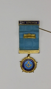
Ceremonial object - medal, Stokes and Co
H.H.Hindhaugh 1959 awarded medal Life Governorship of Freemason Homes of Victoriaenameled medal with blue grograin ribbon and bar with pin in cardboard boxLife Governor- Freemasons Home of Victoria- reverse: 67- H.H.Hindhaugh 1959h.h.hindhaugh, freemason, home, life governorship, victoria -
 Port Fairy Historical Society Museum and Archives
Photograph
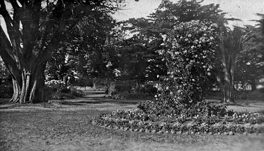
The Port Fairy Botanical Gardens were formed in 1856 making it one of the earliest gardens in Victoria. The first curator was James Prior, he was paid fifty-two pounds per annum. He was an outstanding curator having been apprenticed to the trade in England at the age of 12, his brother Edward in later years was the Curator of the Koroit Gardens. Prior retired in 1903. During the years of his curatorship Port Fairy was said to have the best gardens outside the city of Melbourne, he was constantly in touch with Baron Von Mueller and later Guilfoyle of the Royal Botanical Gardens of Melbourne. In the early years plants from all over the world were planted here with varying rates of success many of them sent by Baron Von Mueller. In the 1930’ and 40’s the gardens were still very beautiful, and the curator was Roy Manuell. The beautiful iron gates at the entrance were destroyed in the 1946 floods and were replaced in 1989 using some of the material from the original gates. From the 1950’s on the gardens went into a state of decline, much being taken up by the caravan park until in 1986, after a public meeting ‘Friends of the Gardens’ was founded when the entrance section was restored. Bless keep and white photograph of a circular flower gardengarden, flowers, paths, trees -
 Friends of St Brigids Association
Book - Saving St Brigid’s, Lane, Regina. 2014. Saving St Brigid’s. Carlton South, Victoria : Bridin Books, 2014 .242 pages, 16 unnumbered pages of plates : illustrations (some colour), maps, portraits ; 24 cm
-
Friends of St Brigids Association
Book - Men of Yesterday : A Social History of the Western District of Victoria, 1834-1890, Kiddle, Margaret. 1967. Men of Yesterday : A Social History of the Western District of Victoria, 1834-1890. Melbourne : Melbourne University Press, 1967 xviii, 573 p., 10 p. of plates : ill., ports. ; 24 cm
-
Friends of St Brigids Association
Book - Western Victoria, Its Geography, Geology, and Social Condition; the Narrative of an Educational Tour in 1857, Bonwick, James, and Charles Edward Sayers. 1970. Western Victoria, Its Geography, Geology, and Social Condition; the Narrative of an Educational Tour in 1857. Melbourne: Heinemann
-
 Flagstaff Hill Maritime Museum and Village
Document - Poster, Warrnambool Steam Navigation Co, ca.1938
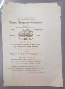
... Melbourne and the western Victoria ports of Warrnambool, Port Fairy ...This poster is typical of posters displayed by steam packet companies of the mid-19th to early 20th centuries. It advertises the passage and freight available on a local coastal trader. The steamships operated between the major ports along the western coast of Victoria between Melbourne and Portland. The traveller was not guaranteed the passage times due to possible weather changes. Discounts were offered for return trips within a month of the ticket's issue. The price of freight included 'lighterage', which was the service of a smaller vessel called a 'lighter' expressly designed to transport goods between ship and shore. This particular poster has been recreated; it advertises the services of the screw steamer SS Edina. The information on the poster applies to the years between 1871 and 1873. During that period the Master of the Edina was Captain John Thompson, the Edina was owned by the Warrnambool Steam Navigation Company and the secretary of the firm was Thos. Mackay. The passenger fares are in line with fares from that period, as seen in a display advertisement published in the Hamilton Spectator on January 17th, 1872. The 1853 Glasgow-built Screw Ship Edina had a long life. The ship served in both the Crimean War and the American Civil War. The Edina also traded in UK and European waters. The Henty family of Portland, Victoria, purchased Edina in 1863 for use as a coastal trader. The Edina had several owners and spent many years of service along the South West Coast of Victoria between Melbourne and Portland. The vessel transported passengers and freight in Port Phillip Bay, between Melbourne and Geelong, between 1880 and 1938. After 84 years of service, the Edina was renamed ‘Dinah’ and was stripped down for use as a lighter. The vessel was broken up in 1957 at Footscray, Melbourne. The remains of Edina’s hull can be found in the Maribyrnong River, Port Phillip Bay. The poster was owned by the donor's grandfather, Bruce Duff (1922-2003) who was an avid sailor and a lover of nautical history. He and his wife Mona (1924-2014) were buried in Portarlington Cemetery, Victoria. Duff would have been about 13 years old when the Edina was finally retired from service in 1938. His interest in the Edina could have come from a trip on the vessel or from watching it in operation in the ports along the coast. Duff has collected this poster as a memento of the Edina and is likely to have preserved it at a much later date when the lamination process was readily available. [Flagstaff Hill's collection includes a photograph of the Edina at the Moorabool Street Wharf, Geelong, which was in Duff's locality. The References for this poster include a link to Museum Victoria's photograph of two boys watching the Edina from a jetty.] Flagstaff Hill's Village has its own 'Examiner' Office where volunteers demonstrate the historic printing press in that building. They use original letter-type to create posters, print labels onto lolly bags and designs on fabrics. One of the volunteer printers has produced a poster closely resembling the donated poster. His replication includes a woodcut of the ship, which he skilfully crafted himself.This poster advertises the sailing of the steamer SS Edina and the information has local and State significance for its association with the trading ports of the Edina, and the associated names on the poster; Warrnambool Steam Navigation Company, Captain John Thompson and Thos. Mackay. This poster's message has a strong connection to the history of the businesses and community of Warrnambool and the people of Port Phillip Bay, where it was a passenger ferry for many years. The poster is an example of advertising used by shipping agents in the mid-19th to early 20th centuries. Its information includes the accurate costs to passengers and freighters and the type of timetable the vessels were likely to follow. The poster's connection with the Screw Steamship Edina is historically significant, as the vessel was the longest serving screw steamer in the world. The ship spent its first nine years overseas then arrived in Melbourne. The vessel's work included running the essential service of transporting cargo and passengers between Melbourne and the western Victoria ports of Warrnambool, Port Fairy and Portland. The Edina is listed on the Victorian Heritage Database VHR S199. Poster, A3 size, brown text on cream paper, laminated. Re-created poster of the Warrnambool Steam Navigation Company (Limited) advertising passage and freight on its Screw Steamship, SS Edina. It states days, times and fees for passage and freight from Warrnambool to Melbourne, and return. It names the ship's Master, Captain John Thompson and the Company's Secretary, Tho. Mackay. It displays a line drawing of a 3-masted ship with full sails.Printed image [side profile of a 3 masted vessel, bow facing left] Printed text includes "The Warrnambool Steam Navigation Company (Limited). The Company's Steam Ship "EDINA", Captain John Thompson, Will leave Melbourne for Warrnambool on Tuesdays, returning from Warrnambool every Thursday, At Five o'clock p.m. (weather permitting). FARES: Saloon £2 0 0 Steerage £1 0 0 Saloon return £3 0 0 Saloon return £1 10 00 - Children under 13 years half fares - Refreshments supplied onboard at a moderate scale of charge. Freight, including lighterage, - From Melbourne to Warrnambool - 12s per ton; from Warrnambool to Melbourne, 15s per ton. Passengers are requested to obtain their tickets at the offers, and shippers to make early application for space. Return tickets available for one month from date of issue. - THO. MACKAY, secretary. "warrnambool, shipwreck coast, flagstaff hill, flagstaff hill maritime museum, maritime museum, fair maid of judea, steam navigation, pleasure steamer, ss edina a, trade 19th century, travel 19th century, warrnambool to melbourne, warrnambool to geelong, warrnambool to port fairy, warrnambool to portland, screw steamer, coastal trader, crimean war, american civil war, gold export, h r h duke of edinburgh, warrnambool steam packet company, stephen henty, captain john thompson, chief engineer john davies, lady bay, lighter edina, port phillip bay steamers, vhr s199, dinah, warrnambool steam navigation company, advertising poster, shipping agent, flier, maritime village, flagstaff hill maritime museum & village, great ocean road, block printing, woodblock printing, relief printing, moorabool st wharf, western steam navigation company, tho. mackay, re-created poster -
 Ballarat Heritage Services
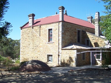
Photograph - Digital photographs, L.J. Gervasoni, Port Fairy Primary School Chimney, 2016
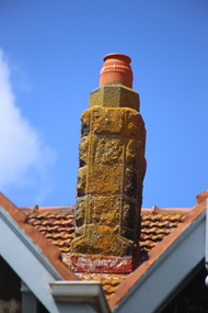
... Port Fairy, Victoria, Australia ...Digital images of chimnies at Port Fairy Primary School port fairy, state school, school, primary school, victoria, education, bluestone, heritage, chimney -
 Warrnambool and District Historical Society Inc.
Book - Books, Butterworth, Australian Argus law Reports 1960-1961, 1961
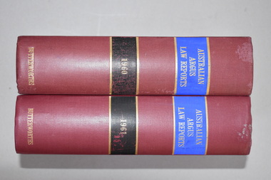
These books contain reports of the Supreme Court of Victoria in 1960 and 1961. They came from the Ardlie family, members of which have been associated with Warrnambool and legal affairs since the early 1850s. John Ardlie came to Warrnambool in 1852 as the Clerk of Courts and his son William Ardlie was a prominent lawyer in Warrnambool for over 60 years. If it is this William Ardlie’s stamp in these volumes then it was used after his death. The signature is of John Ardlie, also a lawyer in Warrnambool and Port Fairy in the later decades of the 20th century.These volumes are of interest as they are connected to members of the Ardlie family, prominent lawyers and community members in Warrnambool in the 19th and 20th centuries.These are two volumes of law reports of the Supreme Court of Victoria– hard cover books with dark green covers and spines with red and gold bands and gold print. Inside the front covers are the stamp of a Warrnambool lawyer and a signature in black handwriting.‘William Ardlie Solicitor Warrnambool’ ‘J.M.Ardlie’ ardlie family, warrnambool, history of warrnambool -
 Warrnambool and District Historical Society Inc.
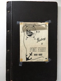
Book, History of Port Fairy
This is a typewritten account of the history of Port Fairy from 1810 to 1890. It was written by William Earle (1850 -1902). In an addenda at the back of this folder there is a note from William Earle which indicates that the booklet was written in 1896 ‘as a result of a prize offered by several residents in a Schedule issued in connection with a local Industrial Exhibition, which Prize it secured’. Does this refer to the 1896-7 Warrnambool Industrial and Art Exhibition? No evidence of this has yet been found. As this folder was given to the ShipLovers Society of Victoria Library in 1963, some ten years before Earle’s history was reprinted in 1973, it is an early copy of Earle’s original work and may have been produced in the late 19th century or early 20th century. The original material was first published by the Port Fairy Gazette in 1896.This folder is of great interest as it is an early copy of Earle’s History of Port Fairy, an important historical publication. This is a black cardboard folder containing 120 typewritten foolscap pages about the history of Port Fairy 1810-1890 (written by William Earle). Inside the front cover there is a stamp of the ShipLovers Society of Victoria Library. The front cover has a sheet of white paper stuck on with adhesive tape. It has a black and white sketch of an anchor, a sailing ship and a rope. The pages are attached to the folder with four metal studs. There is a loose sheet inside with a note about the donor of the folder and a name handwritten on the front cover. ‘W.Earle’ ‘Presented by Mr Owen, Warrnambool, May/1963’ history of port fairy, william earle, shiplovers society of victoria -
 Flagstaff Hill Maritime Museum and Village
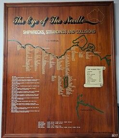
Artwork, other - Shipwreck Board, The Eye of the Needle: Shipwrecks, Stranding's and Collisions, ca 2002
The Shipwreck Board is a feature of Flagstaff Hill Maritime Museum and Village/ its subject is explained briefly in the Museum's handbook, The Flagstaff Hill Navigator, published in 2008: - "Known as the ‘Eye of the Needle’ the treacherous entrance to Bass Strait is littered with the wreckage of large international vessels and smaller sail and steam craft used in coastal trade. The vessels bringing emigrants and cargo to Australia found the western entrance to Bass Strait the most dangerous part of their voyage. They had to thread their way between the southern point of Victoria (Cape Otway) and the northern point of King Island, a stretch of water less than 90 km wide. Many smaller coastal vessels were lost at Portland, Port Fairy, Warrnambool and Apollo Bay which are not safe harbours in certain weather conditions. "The Shipwreck Board shows shipwrecks, strandings and collisions which occurred in this area up to the year 1940. Wrecks are identified by a yellow light and collisions/strandings by a green light. These lights also identify the decade the wreck occurred by lighting up when the relevant decade button is pushed. Interesting happenings of the decades are listed next to the buttons." The Shipwreck Board's demonstration of The Eye of the Needle is an interactive visual display that helps teach the perils and dangers faced by early settlers in Victoria. It tells of the vast number of lives lost. It lists the names of many infamous shipwrecks and significant events.The large stained and lacquered timber board is mounted in a timber, frame. It is painted with a small sketch of Australia, and an enlarged outline of the southern coast of Victoria, King Island and the North West coast of Tasmania. The interactive display highlights the shipwrecks, standings and collisions suffered by many vessels as they navigated the 'Eye of the Needle', a narrow stretch of Bass Strait. The locations of the Lighthouses are pinpointed. Lists of groups of ships are below the coastlines. A painted scroll shows eight major shipwrecks with the number of lives lost for each one. A table shows historical facts associated with the decades from pre-1830 to 1940. A system of coloured lights compares the decades with the vessels that suffered damage. The board was created by artist and signwriter, Alex O'Flynn Computer Signs.flagstaff hill, maritime museum, maritime village, shipwreck coast, eye of the needle, shipwreck locations, bass strait, basses strait, king island, north west tasmania, south coast of victoria, cape otway, victorian lighthouse, king island lighthouse, strandings, coastal tracers, emigrant ships, sea trade, 1930s-1940s, shipwreck board, the eye of the needle, collosions, alex o'flynn, alex o’flynn computer signs, shipwrecks of western victoria -
 Warrnambool and District Historical Society Inc.
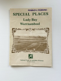
Pamphlet - Special Places Lady Bay Warrnambool, Philprint Warrnambool, 1989
This pamphlet was produced for the Warrnambool Branch of the National Trust of Australia (Victoria) for Heritage Week, April 16-23, 1989 and contains information written by Warrnambool residents about their locality. This was a co-operative venture by people with a common interest in protecting the natural environment near their home. Areas covered in the written information include: Formation of the Coast, Archaeological survey, Gunditjmara History, vegetation, history and recreational uses of the Lady Bay area. The map shows special places of interest including past and present navigational aids, sites of shipwrecks and other historical places of interest. The Warrnambool Branch of the National Trust was originally formed in March 1969 and merged with the Port Fairy Branch in late 1970. In October 1979, the Warrnambool Branch was reformed and operated into the late 1990's. This is an example of a publication produced by the Warrnambool Branch of the National Trust Australia (Victoria). It provides historical information and perspectives of the recreational uses in and around Lady Bay Warrnambool.An A2 piece of buff coloured thick paper folded into eight to make an A5 pamphlet. The front cover has green printing with the National Trust symbol of three eucalyptus leaves in green. There is a brown sepia photograph showing a view across Lady Bay with the suspension bridge across the Merri River in the foreground, Viaduct Road in the middle ground and the breakwater in the background. There is a purple inked stamp on the top right hand corner. The rear cover has brown writing and includes logos of bodies who assisted with the publication. There is a brown line drawing of the viaduct and pier at the Warrnambool Breakwater. The inside of the unfolded pamphlet contains a map of Lady Bay and adjacent area showing places of interest and shipwrecks marked in red circlesFront cover: Special Places Lady Bay Warrnambool National Trust of Australia (Victoria) Warrnambool Branch Ronald J. Cummingwarrnambool, lady bay warrnambool, national trust australia victoria warrnambool branch, heritage week 1989, lady bay shipwrecks -
Bialik College
Mixed media (Item) - Great Victorian Bike Ride
The Great Victorian Bike Ride in 2004 took place from Port Fairy to Geelong. There were 591 riders in total, Bialik College students being amongst those numbers. Please contact [email protected] to request access to this record. GVB Ride 2004; GVBR 2004 Russel Kaplanoutdoor education, 2000s, 2004, sport, bialik college, victoria -
 Flagstaff Hill Maritime Museum and Village
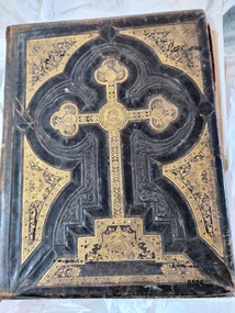
Book - Bible, Thomas Kelly & Sons, The Holy Bible - Douay Bible and Rheims Testament, 1880
The Douay (Douai) Rheims Bible is an English translation of the Latin Vulgate Bible (which had been the Latin Bible used by the Catholic Church since the 4th century). It was produced by Roman Catholic scholars in exile from Elizabethan Protestant England at the English College of Douai (then in the Spanish Netherlands but later part of France). The New Testament translation was published in 1582 at Rheims where the English College had temporarily located in 1578. The Old Testament was translated shortly afterwards but was not published until 1609-1610 in Douay (which makes it older than the King James version). The completed work was the only authorized Bible in English for Roman Catholics until the 20th Century. Its purpose was to uphold the Catholic tradition in the face of the Protestant Reformation and was produced as an alternative to the several Protestant translations then in existence. Prior to it being published, the Roman Catholic practice had restricted personal use of the Bible, in the Latin Vulgate, to the clergy. Bishop Richard Challoner issued a series of revisions (1749 - 1772) intended to make the translation more easily understandable and subsequent editions (including this one) were based upon this revision. In 1871, an edition of the Douay - Rheims Bible was published by Thomas Kelly & Sons of Philadelphia (and later, New York). Thomas Kelly described himself as a "Publisher, Printer, Binder, Lithographer and Steel Plate Engraver". In 1876, Thomas Kelly won an award (a Diploma of Honor and a Medal of Merit) for "the Best Catholic Bibles and Prayer Books" at the International Centennial Exhibition held in Philadelphia and his firm continued to print editions of the Bible throughout the 1870's but little is known of him after 1880 when this edition was published. This Bible has been in the Kermond family from 1888 until 1984 when Laurence Kermond (its last owner) died. The Kermonds were an old Warrnambool family with ties to the district going back to the mid 1840's. Joseph Kermond's mother, Catherine (1818 - 1895) and her husband John Kermond,, an ex-convict (1809 - 1877), had moved from Tasmania around 1843 and were living in the Warrnambool area in 1844 where their eldest son was born. They had six more children born at Port Fairy (or Belfast as it was then called). Catherine is buried at the Tower Hill cemetery. The last owner of the Bible was Laurence Kermond (1918 - 1984). He was the great grandson of John and Catherine Kermond and was a well known painter who lived in the Merimbula and Paynesville areas of N.S. W. and Victoria during the 1970's and early 1980's. The story of Joseph Kermond finding the Bible on a beach on the Shipwreck Coast near Peterborough on the southern coast of Victoria, Australia is plausible as it was not uncommon for items from shipwrecks to be washed ashore. However this Bible would not have come from the wreck of the Loch Ard as the dates don't align. The Loch Ard was wrecked in 1878 and this Bible was printed in 1880. It appears to have been printed for the Australian market as there is a page (with an engraved portrait) dedicated to the "Most Rev. Roger Bede Vaughan, O. S. B. Archbishop of Sydney, N. S. W.". It may also have been aimed at the Irish immigrants as the four "Family Register" pages are decorated with borders of shamrocks. The donor found the Bible in a box of secondhand books on a market stall in Gippsland and recognised its links to the Shipwreck Coast through the name of previous owners (a well-known Warrnambool name) and the story of it being found on a beach near Peterborough. This Bible is a rare example of Douay and Reims Catholic Bible of the late 19th century that was once a treasured item belonging to the Kermond family - one of Warrnambool's early settlers. It also has a most unusual story attached to it - being found (and rescued) washed up on a local beach and almost one hundred years later, being rescued again from a secondhand book stall.This Catholic Bible is an 1880 edition of a "Douay Bible and Rheims Testament", printed and published by Thomas Kelly of New York. Its full title is "The Holy Bible translated from the Latin Vulgate Diligently Compared with The Hebrew, Greek and Other Editions in Various Languages". It is revised with annotations by the Right Rev. R. Challoner D.D. The Bible has brown leather embossed front and back covers decorated with identical ornate gilt patterns and a central picture of a cross. It has two coloured illustrations and numerous black and white lithographs and engravings including portraits of past popes, events and places from Bible stories and decorative borders. The Bible includes the Old and New Testaments, approbations from Pope Pius the Sixth and Archbishops of the United States and other countries (including Archbishop Vaughan of Sydney), a Family Register with handwritten notes on births, deaths and marriages from the Kermond family (as well as a description of how they obtained the bible), a Catholic dictionary of the Bible, a history of the Holy Scriptures, a chronological list of heretics (Theological history) and a description of the "Centennial Award - Diploma of Honor and medal of Merit" won by Thomas Kelly (for the "Best Catholic Bible") at the Centennial Exhibition at Philadelphia in 1876. The Records section has a note on the Memoranda page written by William John Kennard in 1920.Spine: HOLY BIBLE Title Page: THE/ HOLY BIBLE /TRANSLATED FROM/ THE LATIN VULGATE/ DILIGENTLY COMPARED WITH/THE HEBREW, GREEK AND OTHER EDITIONS/ IN VARIOUS LANGUAGES/ THE OLD TESTAMENT WAS FIRST PUBLISHED BY THE ENGLISH COLLEGE AT DOUAY, A.D. 1600 / AND THE NEW TESTAMENT, BY THE ENGLISH COLLEGE AT RHEIMS, A.D. 1582./ REVISED WITH ANNOTATIONS/ BY THE RIGHT REV. R. CHALLONER D.D./ TOGETHER WITH REFERENCES, AND AN HISTORICAL AND CHRONOLOGICAL INDEX./ NOW CAREFULLY CORRECTED ACCORDING TO THE CLEMENTINE EDITION OF THE SCRIPTURES/ NEW YORK / THOMAS KELLY, PUBLISHER/ 17 BARCLAY STREET. / 1880 Dedication Page: DEDICATION OF THE ORIGINAL EDITION/ TO/ THAT LOYAL, RELIGIOUS AND ENLIGHTENED BODY OF MEN / THE/ CATHOLICS OF THE UNITED STATES OF AMERICA/ IN ADMIRATION OF THE STEADY ZEAL WITH WHICH THEY HAVE KEPTTHE/DEPOSIT OF FAITH/ BEQUEATHED THEM BY THEIR FOREFATHERS/ AND HANDED DOWN, WITHOUT INTERRUPTION OT ADULTERATION, TO THEIR GRATEFUL POSTERITY/ THIS EDITION/ OF THE/DOUAY BIBLE AND RHEIMS TESTAMENT/ IS / WITH GRATITUDE FOR PAST FAVORS AND HOPES OF FUTURE ENCOURAGEMENT/ MOST RESPECTFULLY ENSCRIBED. Handwritten note: ""This Holy Book was found . on the beach . near Peterborough Vic. having been washed ashore . from the wreck of the Loch Ard, (sailing ship) in the year 1888 . By .Joseph . Kermond; and presented to . his mother . Catherine Kermond , who in turn passed it - on . to her youngest . son ; one Jacob Kermond. He in turn presented . it to his son . William John Kermond , (the writer), 23/3/20)" [Original punctuation]flagstaff hill maritime museum and village, warrnambool, shipwreck coast, peterborough, kermond, kermond family, loch ard, bible, douay and rheims bible, catholic bible, thomas kelly and sons publiisher, douai, rheims, holy bible, religious bible, catherine kermond, john kermond, william john kermond' -
 Bendigo Historical Society Inc.
Document - Rocky Vale Beebe House, 2010 to 2015
The Beebe name was well-known in Bendigo in the last quarter of the 19th and the early part of the 20th centuries. From 1875, William Beebe senior, monumental mason, occupied a site in the centre on the city, in Mitchell Street opposite King Street. Death was more part of life in those days, and the Beebes were there to provide the burial monuments. Later, he took his sons into the business, which grew as Beebe and Son. Many examples of their work can be found in the local cemeteries. William Beebe senior (1830-1891) was born in Rutland, the smallest English county in 1830, to stonemason Chamberlain Beebe and Susannah Clements. William emigrated to Victoria in 1854 and after engaging on unknown works in Port Fairy, Dunkeld, and Melbourne arrived in Bendigo. His obituary records that he commenced work here on the site of the Bank of Australasia (opposite the Shamrock Hotel), which would have been no later than 1856. He took up a 13 acre selection on the site of Rocky Vale Villa in 1864 and continued to select or purchase further parcels of adjoining land until he owned some 150 acres, much of it unfit for cultivation. He was a keen gardener and had a garden and orchard around the house. William took over 20 years to build the two-story sandstone and granite house "Rocky Vale Villa". The house was constructed from sandstone sourced "from an adjacent ridge of rocks" (Bendigo Advertiser 28/9/1891). Granite from Harcourt was used for lintels and quoins. Not long before he died, William was still adding to the house. In the Codicil to his will, he states that "I have just built and completed two additional rooms to my Dwelling house situe at Inglewood Road aforesaid" (dated 19/9/1891). William died one week later on the 26th September 1891.Photographs and Historical Documents relating to Rocky Vale Villa, 7 Wicks Road, Maiden Gully, Bendigo by the Bendigo Historical Society.history, bendigo, rocky vale villa maiden gully, william beebe stonemason bendigo -
 Flagstaff Hill Maritime Museum and Village
Document - Plan, Victorian Harbours Warrnambool, Victorian Harbours, Warrnambool, Plan to Accompany Sir John Coode's Report, 28-02-1879
This plan is of great significance to the local history of Warrnambool, in particular the Breakwater and its impact on Warrnambool's maritime and trade history. The plan shows the existing jetties at the Port of Warrnambool, plus the partially erected Breakwater and proposed works to the Breakwater by both the Borough of Warrnambool Surveyor and Sir John Coode. The plan was signed 28th February 1879 by Sir John Coode. The legend at the bottom left describes the existing works and the proposed works. The Warrnambool Breakwater Sir John Coode was a British harbour engineer. He was brought to Melbourne by the Melbourne Harbour Trust to advise on works to improve the Port of Melbourne. The Victorian Government commissioned him to present a plan to complete the Warrnambool Breakwater. His original plan was too expensive so he prepared a revised plan for a shorter structure. The work was completed in 1890. The construction proved to be too short to protect adequately from the weather and didn't allow enough depth for larger vessels to come into port. The decreasing trade was further affected by siltation in the bay due to the breakwater, and the completion of the railway line. The situation of the harbour became a real problem that, by 1910, required continuous dredging. In 1914 the Breakwater was extended but proved to be a failure because the work began to subside and by 1920 about two thirds of the harbour was silted up. Alterations made in the 1920's increased the silting problem and by the 1940's the harbour was no longer used. More alterations were made in the 1950's and 1960's. The Warrnambool Breakwater is registered as a place of significance on the Victorian Heritage Database. This plan of the proposed works for the existing Warrnambool Breakwater is of great significance to the local history of Warrnambool, in particular the Breakwater and its impact on Warrnambool's maritime and trade history. The Warrnambool Breakwater is registered as a place of significance on the Victorian Heritage Database (VHR H2024). It is historically significant to Victoria as one of the most important maritime engineering projects in Victoria in the late 19th century. The Warrnambool Breakwater is of historical significance as one of the most important maritime engineering projects in Victoria in the late nineteenth century. It is evidence of Victoria's nineteenth century investment in regional port infrastructure and the development of Victorian coastal shipping. It is of significance for its association with the English civil engineer Sir John Coode, the most distinguished harbour engineer of the nineteenth century, who was brought to Victoria to advise on works to improve the Port of Melbourne, but was retained by the Government to advise on improvements to the harbours at Portland, Geelong, Port Fairy, and Lakes Entrance, as well as Warrnambool. His projects for Melbourne, Lakes Entrance and Warrnambool were major engineering projects of the nineteenth century. The breakwater is historically significant as a reminder of Warrnambool's early maritime history as a Western District port, and as one of Victoria's major 'outer ports'. While the Warrnambool Breakwater is a demonstration of the engineering skills of the nineteenth century, it also demonstrates the limitations of knowledge relating to sedimentology at the time and the confidence apparent in a number of nineteenth century plans which assumed that natural forces could be overcome or contained by engineering.Plan of Warrnambool Harbour, Port of Warrnambool, dated 28 Feb 1879. Plan shows existing Breakwater and work proposed by both Warrnambool Borough Surveyor and Sir John Coode. Plan has gold coloured quarter-dowel rods top and bottom and a metal ring at the top. Stamped with title. Signed by Sir John Coode.Stamped "VICTORIAN HARBOURS / WARRNAMBOOL / PLAN / to accompany / SIR JOHN GOODE'S REPORT / DATED 28 FEB 1879" Signature "John Coode"flagstaff hill, warrnambool, maritime museum, shipwreck coast, great ocean road, sir john coode, borough of warrnambool surveyor, plan of warrnambool, victorian harbours, warrnambool harbour, warrnambool breakwater, port of warrnambool, vhd vhr h2024, flagstaff hill maritime museum & village, maritime village, map, chart, plan, lady bay, breakwater, jetty, pier, vhr h2024, proposed works, 1879 -
 Ballarat Heritage Services
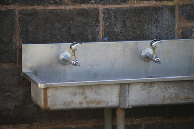
Photograph - Digital photographs, L.J. Gervasoni, Bubbler at the Port Fairy Primary School, 2016
... 14 Church Ave, Port Fairy, Vic, Victoria, Australia ...Digital image of a bubbler at the Port Fairy Primary School port fairy, state school, school, primary school, victoria, education, bluestone, heritage, bubbler, water bubbler, water fountain, drinking taps -
 Warrnambool and District Historical Society Inc.
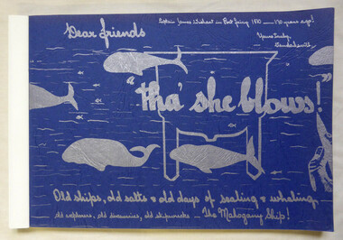
Book, Vanda Savill (1913-2005), Tha' she blows, 1980
Scrapbook style book history of early Port Fairy and PortlandThis is a paper back book of 176 pages. The pages are bound together. The cover is blue card with silver-coloured wording and illustrations of whales. There are 829 photographs and illustrations. The historical material contained in the pages is handwritten and photocopied. non-fictionScrapbook style book history of early Port Fairy and Portlandwhaling, port fairy, portland, shipwrecks -
 Flagstaff Hill Maritime Museum and Village
Map - Survey Map, F.F. McGovern, Yangery - County of Villiers, 1884
A surveyor was employed to measure the land designated as Yangery, County of Villiers, in the Borough of Warrnambool. The area on the map is similar to the earlier Farnham Survey undertaken by William Rutledge in the 1850's. Warrnambool was a Borough between 1863-1883. Coutours, waterways, sea and other significant points are shown. The distances are accurately measured. This survey map was used for planning future land sales, recreation areas and roads. WILLIAM RUTLEDGE (1806-1876) William Rutledge surveyed the land known as Farnham in southwest Victoria in 1843. His tenants made him a profitable business from working the land there. In 1863 Rutledge moved from nearby Port Fairy to Farnham and became very successful in breeding sheep, which he imported from J.R. Kirkham of Lincolnshire, England. He also bred horses on his land. The survey map of Yangery is important for its connection with renowned surveyor William Rutledge. The map shows the growth of landholders in the district when compared to the original Rutledge survey of the 1850's.Survey map of Yangery, titled "Yangery - County of Villiers". Printed on white paper, mounted on brown paper. c. 1863-1876. Comments printed on the Map include; Special Survey by William Rutledge, Photo-lithographed at the Department of Lands and Survey, Melbourne by W.J. Burson, Price 1/- [one shilling]. Scale is in Chains. Map has boundaries of Koroit Borough, Meerai, Purnim, Wangoom, Borough of Warrnambool, Mentions the Proposal of Tower HIll for Public Recreation. The map names the owners of the land at that time. Hand written pencil marks and figures and "Sauls fence" drawn on map. Hand written pencil markes and figures and "Sauls fence" drawn onto map. "For Department Use only". "Scale: 8 chains to 1 inch" flagstaff hill, warrnambool, shipwrecked-coast, flagstaff-hill, flagstaff-hill-maritime-museum, maritime-museum, shipwreck-coast, flagstaff-hill-maritime-village, county of villiers map, yangery district, w.j. burson, borough of warrnambool, koroit, purnim, meerai, wangoom, proposal of tower hill for public recreation, special survey by william rutledge, william rutledge, farnham, lincolnshire sheep, clydesdale -
 Port Fairy Historical Society Museum and Archives
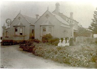
Photograph, Pt Fairy Hospital looking east 1890, 1890
... Villiers Street, Port Fairy, South West, Victoria... Photograph Australia Great Ocean Road Victoria Port Fairy ...The land for this building was granted to the Benevolent Society by James Atkinson in 1850. Tenders were called for a new "Benevolent Asylum" in 1855, the foundation stone having been laid and by 1856 the first part of the Hospital was completedBlack and white photograph New addition to the hospital with i’ts bay windows. 5 women and two men posed to the sidehospital, health service, nurses, bay window -
 Ballarat Heritage Services
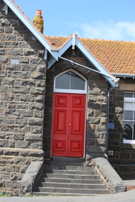
Photograph - Digital photographs, L.J. Gervasoni, Port Fairy Primary School - red doors, 2016
... Port Fairy, Victoria, Australia ...Digital imagesport fairy, state school, school, primary school, victoria, education, bluestone, heritage, red door, red, door -
Glenelg Shire Council Cultural Collection
Work on paper, (Untitled - Port Fairy Wharf)
David Williams, betweeen 1990 and 2004 self-published 18 historical sketchbooks around Victoria. These and other projects involved the creation of over 5000 paintings. David Williams is a water colourist. His book for South-eastern Victoria around the Portland area was awarded the Victorian Government History Award in 2005. Special exhibitions of David William's paintings have been held in Eaglehawk, Echuca, Bright, Glen Waverley, Myrtleford, Wandiligong, Olinda and Point Lonsdale to assist community projects.Image of a wharf with boats moored up either side. To the right of the wharf are several large Norfolk Pines. In the foreground of the image is the front part of a boat with the letters 'Jot' in blue. It is roped to the side of the wharf.Bottom right - David Williams 2004 -
 Flagstaff Hill Maritime Museum and Village
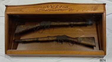
Weapon - Historic Rifles, Royal Small Arms Factory, 1877-1900
Martini-Henry Artillery Carbin rifles were made by the Royal Small Arms Factory at Enfield, Britain, from 1877 until 1900. Many were distributed to the British Colonies, including this pair, which was allocated to the Woodford Police, Victoria Police District of Warrnambool, Southwest Victoria. The Carbine model rifles were shorter than the standard rifles and more suited to mounted police and troopers. It is likely that in the early 20th century, Victoria Police replaced the two carbines with more modern firearms, and the outdated guns were stored in the stables. The rifles were left there and likely forgotten about due to changes in police staff. In 1915, police authorities announced that they would be replacing patrol horses with bicycles and would also close some smaller police stations. This affected Woodford Police Station, which closed in 1917. The forgotten firearms remained in the stables and were noticed by schoolboy Robert Jellie in 1940 and seen again in 1946. In 1995, the property was sold by the Education Department to a private owner. The Woodford Community donated the pair of Martini-Henry Carbines to Victoria Police Museum in the late 1990s for mounting and display, which was funded by the Victoria Police Historical Society Inc. The decorative wood and glass display case and frame were designed to preserve the significant history of the guns. On November 1st 1999, the display was presented to Warrnambool Police and the local community due to the historical significance of the Woodford Police Station. On March 10th, 2025, the display was transferred to Flagstaff Hill Maritime Museum and Village, where the historical story of the Martini-Henry Carbines could continue to be preserved and accessed by local families, the community, visitors to the area, and online visitors. WOODFORD POLICE: - The small settlement at Woodford was established in the 1840s around the Merri River where there was a ford across the water and, from 1848-1851, a bridge. The area was settled very early in Victoria’s history and the river crossing provided travellers with access to the early route between Port Fairy (name Belfast at that time), Warrnambool and Melbourne. Occasionally a Warrnambool police trooper would ride through Woodford and district. In December 1854, Woodford Police barracks and stables were built on the hill by the Merri River on Bridge Road east where Jubilee Park now stands. A local mounted trooper kept law and order in the area. In 1856, a lock-up was installed, and the first Woodford Police Station was in action in 1857. By 1871, the police station had been moved from the hill to land across the Merri River bridge, on the southern side of Bridge Road west, near Mill Street. In 1890, the police residence there was replaced by a stone Edwardian-style building with the stables and lock-up behind it and the old police station at the rear. The police continued to have a presence in Woodford until it was closed by the Police Commissioner in July 1917 for economic reasons. The residence was used for government housing until 1923, when it was taken over by the Education Department for the school teacher’s home. In 1995, it became privately owned. THE MARTINI-HENRY ARTILLERY CARBINE: - The Martini-Henry rifles were made in Britain from 1871 at the Royal Small Arms factory at Enfield and were stamped with the symbol of the Royal Cipher (Crown over VR) over ENFIELD to identify their origin. They were named after two of several people who helped design this method: Swiss Friederich von Martini and Scotsman Alexander Henry. The design was breach-loaded, and the inner barrel was rifled. A thumb rest was incorporated into the top right of the bullet receiver’s chamber. The small teardrop lever on the right side of the rifle showed whether the rifle was ready to be shot. In 1877, the shorter, lighter weight Carbine version of the firearm was produced for mounted troops and artillery. Its official name was “Carbine, B.L., Rifled, Martini Hanry.” The bullets were slightly lighter in weight than those used for the longer rifle. The sight position was adjusted for the shorter gun, and wings were added to the sight on the tip, making it easier to slide the rifle back into a saddle bag. Some of the later Carbines also had leather sight covers screwed to the stock to prevent them from catching on the saddle bags. The Carbines had accessories available, such as barrel extensions with bayonets and swivels for adding slings. The Martini-Henry Carbine designs were later modified to fire the British .303 ammunition. Eventually, by 1900, the Martini-Henry Carbines were replaced by the Lee Enfield gun design. The pair of Martini-Henry Carbine firearms represents policing in the early pre-1900 days of colonial settlement; Woodford was one of the first townships settled in Victoria, and it had a police presence from 1854 until 1917. The rifles and display provide a historic connection between the location of Woodford and relatives and associates. The carbine rifles show a stage in the evolution of weapon design, adapted to suit mounted troops, and adding features to streamline use and storage. The ammunition was also improved during this progression. The carbines are important for their connection to policing law and order in a remote area. They are significant for their association with the township of Woodford, which was important to travel in the southwest Victoria district, providing access across a river for a road between Port Fairy and Melbourne, and later Warrnambool, and supplying food, goods and accommodation for the travellers. A pair of mounted rifles is mounted behind glass in a timer case, accompanied by a framed display of two photographs and an account of the rifles’ history. The case and display each have a horizontal board with a gently curved edge and carved decorations added. The identical firearms are British-made Martini Henry Carbine breach-loaded rifled guns, supplied by Britain to its Colonial troops from around 1877. The rifles are lever-action, single-shot .500 calibre weapons. They have a teardrop lever on their right side. They were used by Victoria Police mounted troops at the Woodford Police Station, Victoria. The black and white photographs were taken in 1946. The left photograph has a circled area; the right photograph is an enlarged view of the circled area, showing the Woodford Police Station in detail. The printed text is on textured paper with the Victoria Police watermark. It gives a summary of the rifle’s history. There is an inscription on the left photograph. Left photograph, handwritten in white pen: “WOODFORD” Document’s print: “During the late 1840s the small town of Woodford grew around the crossing of the Merri River on the Melbourne/Port Fairy Rad. Woodford was proclaimed a township in 1854 and a police quarters was established there in 1857. The police station remained until 1917 when it was closed and police service from then on was provided from Warrnambool. The building was then used as a school residence and is now privately owned. In !940 Robert JELLIE, then a schoolboy, observed two rifles mounted on the wall of the disused stable at the rear of the old police building. Following the devastating flood of 1946 (see photograph above) the rifles were again seen in the room next to the stable but were not seen again until the building was sold by the Education Department many years later. It was a recognition of the historical value of the rifles which led to their donation to the Warrnambool Police Complex. The rifles have been authenticated by the Victoria Police Armoury as being Victoria Police issue some time before 1900. The rifles are an identical pair of the famous British-made Martini Henry, a .500 inch calibre military weapon widely used by British Colonial troops. Victoria Police and the wider community of Warrnambool are indebted to the members of the Woodford community for their fine gesture in donating the rifles for mounting so that their historical importance can be preserved and they can be displayed for generations to come. This display was funded by the Victoria Police Historical Society Incorporated, and presented on the first day of November, 1999.”flagstaff hill maritime museum and village, great ocean road, shipwreck coast, martini henry, victoria police, woodford police station, rifle, carbine, display case, british, martini henry carbine, breech-loaded, rifled, colonial, single-shot, .500 calibre, weapon, gun, 1877, troops, mounted troops, merri river, victoria police woodford, victoria police warrnambool, victoria police melbourne, police quarters, robert jellie, school residence, stable, 1946 flood, victoria police armoury, identical pair, british colonial troops, victoria police historical society incorporated, woodford, bicycles, found by a schoolboy, edwardian-style building -
 Ballarat Heritage Services
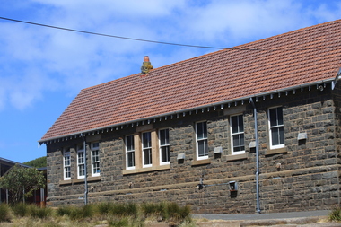
Photograph - Digital photographs, L.J. Gervasoni, Port Fairy Primary School - side view, 2016
... Port Fairy, Victoria, Australia ...Digital images of the bluestone Port Fairy Primary School.port fairy, state school, school, primary school, victoria, education, bluestone, heritage, side, port fairy primary school -
 Warrnambool and District Historical Society Inc.
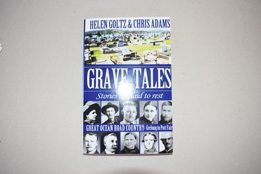
Book, Grave Tales, 2017
This book details the lives of some people of the past who are buried in cemeteries along the Great Ocean Road. Of particular interest to Warrnambool and district readers are the documented lives of Jack Denham of the La Bella shipwreck, early Warrnambool settlers, Agnes and James Ruttleton, William Sharrock, hero of the Nestor sinking, the Rutledge brothers and the Mills brothers of Port Fairy, the scientist Frank Burnet, the unionist William McLean, Dick the bushranger and Captain Pye, V.C. This book is of interest as it gives information on a variety of historical figures buried in cemeteries in the Great Ocean Road districts (Geelong to Port Fairy). It will be useful to researchers. This is a soft cover book of 290 pages. It has black and white and coloured photographs on the front and back covers and printing on the spine and back and front covers. The pages contain an introduction, 22 chapters, black and white photographs and maps and illustrations. western district of victoria, warrnambool -
 Warrnambool and District Historical Society Inc.
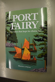
Book, Port Fairy – The Town That Kept Its Character, 2018
This book by Marten Syme is a history of Port Fairy from 1835 to 2018. The earlier histories of Port Fairy do not cover most of the 20th century and none of the 21st century. This book is a scholarly work and offers fresh perspectives on many aspects of Port Fairy history and questions some long-held views, especially on the early years of the town. Port Fairy, 293 kilometres west of Melbourne, has a rich history and is one of the earliest places in Victoria to be settled by Europeans. The author Marten Syme has written extensively on both maritime and local history and is a resident of Port Fairy. This book is of considerable significance as it is a comprehensive history of Port Fairy and complements and adds to the earlier histories of this town. It will be a very useful addition to libraries and will be a great aid to family history and local history researchers.This is a hard cover book of 295 pages. The cover is grey with gold lettering on the spine. The dust cover has white printing and an illustration with a green background with a multi-colour design of sailing ships, trees and harbour entrance. The pages of printed material are in five parts with a bibliography and an index. The book has black and white photographs, maps and other illustrative material. Signature of author (Marten A. Syme)port fairy, marten syme, port fairy -
 Flagstaff Hill Maritime Museum and Village
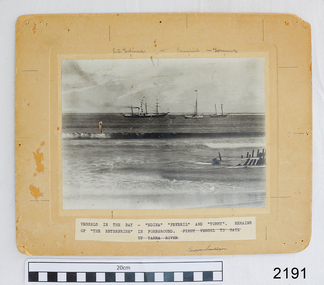
Photograph - Vessels, Sailing Ships, Vessels in the bay, 1890's
... Victoria ports of Warrnambool, Port Fairy and Portland. The SS ...The photograph, taken in the 1890s, shows sailing ships and a wreck in Lady Bay, Warrnambool. Lady Bay was once a very busy port of trade in Warrnambool and was also called the Port of Warrnambool or Warrnambool Harbour. ENTERPRISE (1847-1850) NOTE: The “Enterprise” wrecked in 1850 in Warrnambool should not be confused with John Pascoe Faulkner’s ‘Enterprise’, which was wrecked in NSW in 1847. The 58-ton schooner Enterprise was built by David Hay in Waiheke, New Zealand in 1847 and registered by owners John Watson and Edward Byam in Melbourne, Australia. She was a single-deck sailing ship with two masts, used for carrying cargo such as local agricultural produce and general commodities between Melbourne and other colonial ports. On September 14th, 1850 the Enterprise had sailed from Melbourne under the control of the ship’s Master, James Gardiner Caught, and was moored in at the Tramway Jetty in Lady Bay, laden with wheat and potatoes. The vessel rode out a south-easterly gale but eventually dragged anchor and was beached, bow first and then broadside. Buckwall, a local indigenous man, braved the heavy surf and reached the stricken vessel with a rescue line, saving all five crew on board. There were no passengers on board. The Enterprise wreck was in an area called Tramway Jetty in Lady Bay. Since then the area has become the location of Lady Bay Hotel and now, in 2019, it is in the grounds of the Deep Blue Apartments. In fact, with the constantly changing coastline through built-up sand, the wreck site is now apparently under the No 2 Caravan Park on Pertobe Road, perhaps 150 metres from the high tide. Its location was found by Ian McKiggan (leader of the various searches in the 1980s for the legendary Mahogany Ship). The Warrnambool Wreck Enterprise is listed on the Victorian Heritage Database VHR S238. DIFFERENTIATING the New Zealand Schooner “Enterprise” from John Fawkner’s “Enterprize“ Dr Murray Johns, Melbourne, says in his article The Mahogany Ship Story, “…the Enterprise, wrecked in Lady Bay, Warrnambool in 1850 ... was soon covered by sand but was exposed again after several storms in 1887. “Samples of timber were then cut from the wreck, which would then have been buried for 37 years. In November 1887 the Warrnambool Standard reported that “the timber looks sound and hard, a penknife scarcely making any impression.” “For many years there was confusion about the identity of that ship in Lady Bay. Most people believed it was the wreck of John Pascoe Fawkner’s Enterprize, which had sailed from Tasmania to Victoria bringing the pioneer settlers to Melbourne in 1835. “In fact, as I documented in 1985, the Warrnambool wreck was of an entirely different ship, also called Enterprize [Enterprise], but built in New Zealand in 1847. Fawkner’s ship had already been sold to Captain Sullivan in 1845 and was wrecked on the Richmond Pier in northern New South Wales early in 1847. “In 1985 a piece of timber from the local Enterprise, which had been kept at the Warrnambool Museum since 1892, was identified histologically as a New Zealand timber, not Tasmanian timber such as blue gum, from which Fawkner’s Enterprize would have been built in 1830. This confirmed the identity of the Warrnambool Enterprize.”[Dr. M.W. Johns later wrote an article called “The Schooner Enterprise: A Final Word on a Historic Wreck.”] ABOUT THE S S EDINA The three-masted iron screw steamer SS Edina was built in Glasgow, Scotland, in 1854 by Barclay and Curle. She was adorned with the figurehead of the ‘fair maid of Judea’. The many years of service made SS Edina famous worldwide as the longest-serving screw steamer. (The term screw steamer comes from being driven by a single propeller, sometimes called a screw, driven by a steam engine.) SS Edina’s interesting history includes English Chanel runs, serving in the Crimean Ware carrying ammunition, horses and stores to the Black Sea, and further service in the American Civil War and later, serving in the western district of Victoria as well as in Queensland and carried gold, currency and gold prospectors Australia to New Zealand. SS Edina had the privilege of being an escort vessel to H.R.H. the Duke of Edinburgh during his visit to Australia in 1867. In March 1863 SS Edina arrived in Port Phillip Bay, Melbourne and was bought by Stephen Henty, of Portland fame, to work the cargo and passenger run from Melbourne – Warrnambool – Port Fairy - Portland. After a short time of working the run from Australia to New Zealand, with passengers and cargo that included gold and currency, she returned to her Melbourne - Warrnambool – Port Fairy run, with cargo including bales of wool produced in the western district of Victoria. The Warrnambool Steam Packet Company purchased SS Edina in 1867; she was now commanded by Captain John Thompson and Chief Engineer John Davies. She survived several mishaps at sea, had a complete service and overhaul and several changes of commanders. In 1870 SS Edina was in Lady Bay, Warrnambool, when a gale sprung up and caused a collision with the iron screw steamer SS Dandenong. SS Edina’s figurehead was broken into pieces and it was not ever replaced. SS Edina was re-fitted in 1870 and was then used as a coastal trader in Queensland for a period. She was then brought to Melbourne to carry cargo and passengers between Melbourne and Geelong and performed this service from 1880-1938. During this time (1917) she was again refitted with a new mast, funnel, bridge and promenade deck, altering her appearance. In 1938, after more collisions, SS Edina was taken out of service. However, she was later renamed Dinah and used as a ‘lighter’ (a vessel without an engine or superstructure) to be towed and carry wool and general cargo between Melbourne and Geelong. In 1957, after 104 years, the SS Edina was broken up at Footscray, Melbourne. Remains of SS Edina’s hull can be found in the Maribyrnong River, Port Phillip Bay. This photograph is significant for its association with the screw steamer SS Edina, heritage listed on the Victorian Heritage Database VHR S199. She had endeared herself to the people of Port Phillip Bay as a passenger ferry, part of their history and culture. She played a significant role in the Crimean War, the American Civil War and the gold rush in New Zealand. She also served western Victoria for many years in her cargo and passenger runs. The SS Edina is famous for being the longest-serving screw steamer in the world. After spending her first nine years overseas she arrived in Melbourne and her work included running the essential service of transporting cargo and passengers between Melbourne and the western Victoria ports of Warrnambool, Port Fairy and Portland. The SS Edina was purchased in the late 1860s by the local Warrnambool business, the Warrnambool Steam Packet Co. and continued trading from there as part of the local business community. Her original ‘fair maid of Judea’ figurehead was broken to pieces in a collision with another vessel (the SS Dandenong) in a gale off Warrnambool, Victoria, in 1870. The photograph is significant for its association wreck of the Victorian Heritage Listed schooner Enterprise, VHR S238, being a New Zealand-built but Australian-owned coastal trader. The wreck was also significant for its association with the local indigenous hero, Buckawall, who saved the lives of the five crew on board. Photograph "Vessels in the Bay". Black and white photograph of several vessels in Lady Bay, Warrnambool, including some small vessels and "S.S. Edina", the "Peveril" and "Tommy", plus the remains of the wrecked vessel "Enterprise" in the foreground. Photograph is mounted on beige card with label describing the vessels, plus pencilled vessel names. There are several pin holes in each corner of the photograph. Typed label under the photograph “VESSELS IN THE BAY – “EDINA” “PEREVIL” AND “TOMMY”. / REMAINS OF “THE ENTERPRISE” IN FOREGROUND. (Also crossed out on the label “FIRST VESSEL TO SAIL UP YARRA RIVER). In pencil script above the vessels on the photograph “S.S. Edina”, “Peveril” “Tommy”. On the reverse is a printed sticker with “F-Ph 59/2 74”, red felt-tip pen “88”, green pen script repeating the text that is under the photograph on the front.flagstaff hill, warrnambool, shipwrecked-coast, flagstaff-hill, flagstaff-hill-maritime-museum, maritime-museum, shipwreck-coast, flagstaff-hill-maritime-village, enterprize, port of warrnambool, warrnambool harbour, peveril, tommy, ss edina, lighter dinah, warrnambool steam packet company, lady bay, pleasure steamer, edina, trade, travel, screw ship, coastal trader, cargo, victoria, buckawall, indigenous rescue, indigenous hero -
 Flagstaff Hill Maritime Museum and Village
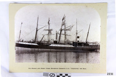
Photograph - Vessels, Sailing Ships, The Belfast and Koroit Steam Navigation Company's S.S. "Casino, 425 Ton, Late 19th to early 20th centuries
... Coast of Victoria. (Belfast is the original name for Port... Coast of Victoria. (Belfast is the original name for Port Fairy ...This black and white photograph shows the image of the coastal trading vessel S.S. Casino, with both sail masts and steam funnel. Men in hats are clearly visible on deck. The ship is in calm water and only light rigging is on the masts. Other vessels are in the background. Photograph is taken 1882-1932. The S.S. Casino was a passenger and freight steamer built in Dundee, Scotland, in 1882 for the Newcastle and Hunter River Steam Navigation Company of N.S.W. She weighed 425 tons gross with a length of 160.4 feet, beam of 24.1 feet and depth of 10.2 feet. She had saloon accommodation for 35 people, forecabin for 25 more people, and she carried 300 tons of cargo. While on her delivery journey on May 30th 1882 the S.S. Casino called in at the Port of Warrnambool for coal ., narrowly escaping going ashore in gale force winds due to the quick action of the pilot. At that time, still at anchor, she impressed the directors of the Belfast and Koroit Steam Navigation Company so much that they bought her immediately; she was ideal for trade in along the West Coast of Victoria. (Belfast is the original name for Port Fairy, South West Victoria. The Belfast and Koroit Steam Navigation Company was first managed by Messers. Saltau and Osburne and after the passing of Mr. Osburne, by produce merchants Messers H. Sautau and Sons, whose had a hay and corn store and shipping agency was on the corner of Liebig and Koroit Streets in Warrnambool. ) The S.S. Casino became “the most famous steamer to operate in Victorian waters along the West Coast” by author Jack Loney. Captain Boyd was her first Master, followed by Captain Chapman, who stayed with her 1890 until 1924. Captain W. Robertson followed for a short term, then Captain Middleton then took command 1925 - 1932. The S.S. Casino had several mishaps during her life. One was on 3rd January 1898 when she collided with the S.S. Flinders in Apollo Bay with minor damage. Another was on 24th October 1924 when she grounded on a reef at Point Hawdon near Grey River and most of her cargo (of Christmas goods) had to be dumped into the sea. Then in February 1929 she was ‘holed’ when she struck a submerged object as she entered Lady Bay, Warrnambool. On the morning of 10th July 1932, after attempting to berth at Apollo Bay jetty in heavy seas, Captain Middleton decided to take her out into the bay and wait until the seas abated. It was not realised that the anchor used to steady her as she manoeuvred to her berth had pierced her hull. She put about and headed for the beach but sank. Captain Middleton and nine others lost their lives; nine people were rescued including the two female passengers . Captain Middleton had been in charge of the S.S. Casino for seven years. He was the first ship’s Master to lose his life through shipwreck in the West Coast trade. In the years following the turn of the century the S.S. Casino remained the only regular trader with normal passenger accommodation along the West Coast. From 1882 she had made at least 2,500 voyages on the one run. Flagstaff Hill’s collection has a photograph of a portrait of Captain Chapman, , a ship model of the S.S. Casino that shows both forms of power under which she sailed, steam and sail. The ship is painted green and flies three flags. The inscription across the case of the ship model, incorrectly dated, tells the sad story of the wreck of the ship and the loss of lives on July 10th 1932 at Apollo Bay. A print in the Collection show S.S. Casino underway in heavy sea off Point Lonsdale, another two photographs show her at the Port of Warrnambool, leaving from the Breakwater in Lady Bay and another identifies the S.S. Casino as a ship from the Belfast and Koroit Steam Navigation Company. (Belfast is the original name for the township of Port Fairy). This photograph is significant because of its association with the coastal trader S.S. Casino and its significance to trade along Victoria's West Coast in the late 19th and early 20th century. It was taken 1882-1932 The wreck of the S.S. Casino is considered an important part of Victorian and Australian cultural heritage and as such has been declared and protected as an Historic Shipwreck under State and Commonwealth Law in the Commonwealth Historic Shipwrecks Act (1976). Photograph, black and white, taken 1882-1932. Foreground is vessel SS Casino, the Belfast and Koroit Steam Navigation Company's coastal trading ship. The ship, in calm water, has light rigging on its masts and also a steam funnel. One lifeboat is visible. People are on the deck. The background shows other vessels.Under the photograph "The Belfast and Koroit Steam Navigation Company's S.S. "Casino," 425 Tons"flagstaff hill, warrnambool, shipwrecked coast, flagstaff hill maritime museum, maritime museum, shipwreck coast, flagstaff hill maritime village, great ocean road, newcastle and hunter river steam navigation company, belfast and koroit steam navigation company, h. sautau and sons, s.s. casino, west coast trader s.s. casino, victorian coastal trader, captain boyd, captain w. robertson, captain chapman, captain middleton, apollo bay shipwreck, s.s. casino at lady bay warrnambool, saltau and osburne