Historical information
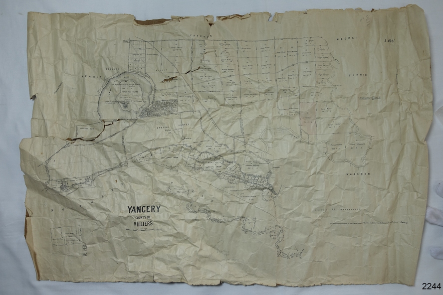
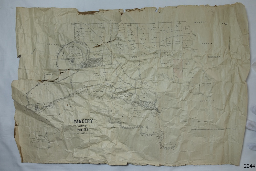
A surveyor was employed to measure the land designated as Yangery, County of Villiers, in the Borough of Warrnambool. The area on the map is similar to the earlier Farnham Survey undertaken by William Rutledge in the 1850's.
Warrnambool was a Borough between 1863-1883. Coutours, waterways, sea and other significant points are shown. The distances are accurately measured. This survey map was used for planning future land sales, recreation areas and roads.
WILLIAM RUTLEDGE (1806-1876)
William Rutledge surveyed the land known as Farnham in southwest Victoria in 1843. His tenants made him a profitable business from working the land there. In 1863 Rutledge moved from nearby Port Fairy to Farnham and became very successful in breeding sheep, which he imported from J.R. Kirkham of Lincolnshire, England. He also bred horses on his land.
Significance
The survey map of Yangery is important for its connection with renowned surveyor William Rutledge. The map shows the growth of landholders in the district when compared to the original Rutledge survey of the 1850's.
Physical description
Survey map of Yangery, titled "Yangery - County of Villiers". Printed on white paper, mounted on brown paper. c. 1863-1876. Comments printed on the Map include; Special Survey by William Rutledge, Photo-lithographed at the Department of Lands and Survey, Melbourne by W.J. Burson, Price 1/- [one shilling]. Scale is in Chains.
Map has boundaries of Koroit Borough, Meerai, Purnim, Wangoom, Borough of Warrnambool, Mentions the Proposal of Tower HIll for Public Recreation. The map names the owners of the land at that time.
Hand written pencil marks and figures and "Sauls fence" drawn on map.
Inscriptions & markings
Hand written pencil markes and figures and "Sauls fence" drawn onto map.
"For Department Use only". "Scale: 8 chains to 1 inch"
Subjects
- flagstaff hill,
- warrnambool,
- shipwrecked-coast,
- flagstaff-hill,
- flagstaff-hill-maritime-museum,
- maritime-museum,
- shipwreck-coast,
- flagstaff-hill-maritime-village,
- county of villiers map,
- yangery district,
- w.j. burson,
- borough of warrnambool,
- koroit,
- purnim,
- meerai,
- wangoom,
- proposal of tower hill for public recreation,
- special survey by william rutledge,
- william rutledge,
- farnham,
- lincolnshire sheep,
- clydesdale
References
- Australian Dictionary of Biography William Rutledge
- Warrnambool and District Historical Society Map - Farnham Survey, 1850's