Showing 10703 items matching "east melbourne"
-
 Ringwood and District Historical Society
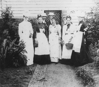
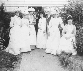
Photograph, Church of England Bazaar - East Ringwood, 1885
Black and white photograph of group of people in garden standing in front of wooden wall.Written below photograph, "C/E Bazaar - 1885" Written on backing sheet, "C of E (East Ringwood ) - 1885 (Herry). Assistants at a bazaar". -
 Ringwood and District Historical Society
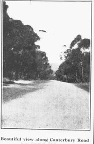
Photograph, Image used for land sale promotion of Coleman's Heathmont Estate, looking east along Canterbury Road, Heathmont, towards Bedford Road. Sale 15/12/1923 by Public Auction
Written on back of photograph, "Coleman's Heathmont Estate, looking towards Bedford Rd. Sale 15/12/1923 by Public Auction". -
 Ringwood and District Historical Society
Photograph, Bedford Road,Ringwood East, looking west from outside No.128. (House far left is No.126) - 1/9/74
Written on back of photograph, "Bedford Rd. looking west from outside No.128. (House far left is No.126 as in brochure. 1/9/74)" -
 Ringwood and District Historical Society
Photograph, South side of Bedford Road, Ringwood East, taken from outside shops on the corner of Illoura Avenue - 1/9/1974
Written on back of photograph, "Bedford Rd. looking at south side towards east from outside shops cnr. Illoura Ave. (As in brochure)" -
 Ringwood and District Historical Society
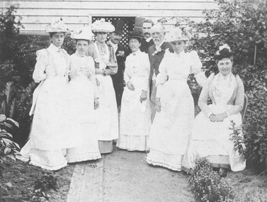
Photograph, Church of England East Ringwood - Assistants at Bazaar 1885
Black and white photograph of group standing in garden. Duplicate of item no. 208.Written on backing sheet, "Church of England, East Ringwood 1885. Mr. J. Hann on right". -
 Ringwood and District Historical Society
Photograph, Church of England, East Ringwood - Assistants at Bazaar - 1885
Written on backing sheet, "C of E, East Ringwood - Assistants at Bazaar 1885". -
 Ringwood and District Historical Society
Photograph, Lot 66 (No.5) Howard Ave, Ringwood East, taken from backyard of Lot 67 (No.3) - 1/9/1974
Written on back of photograph, "Lot 66 (No.5) Howard Ave. Taken from in backyard of Lot 67 (No.3) (8' off ground). 1/9/1974". -
 Ringwood and District Historical Society
Photograph, Image used for land sale promotion of Coleman's Heathmont Estate, looking east along Canterbury Road, Heathmont. Sale 15/12/1923 by Public Auction
Catalogue card reads, "Coleman's Heathmont Estate - 1923. Sale 15/12/1923." -
 Ringwood and District Historical Society
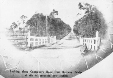
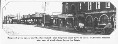
Photograph, 1925 - Ringwood East Railway Station Estate. Photo taken from subdivisional plan land sale
Catalogue card reads, "1925 - Ringwood East Railway Station Estate. Photo taken from subdivisional plan land sale." -
 Ringwood and District Historical Society
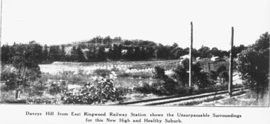
Photograph, Image used for land sale promotion of East Ringwood Railway Estate - 1925. Davey's Hill shown in the photograph later became the site of Maroondah Hospital adjoining Davey Drive, Ringwood East
Catalogue card reads, "Railway Estate 1925. Daveys Hill East Ringwood. Daveys Hill is now Maroondah Hospital ground." -
 Ringwood and District Historical Society
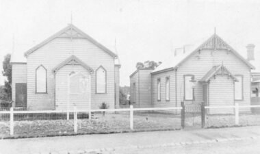
Photograph, St Stepehens Methodist Presbyterian Church, Ringwood East, 1973
Written on backing sheet, "Pres/Meth. Church. Rwd. East. 30.9.73. -
 Ringwood and District Historical Society
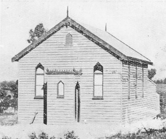
Photograph, Wesleyan Methodist Church, Ringwood East, 1887
Typed below photograph, "Wesleyan Methodist Church, Ringwood East, 1887". Written on backing sheet, "Wesleyan Methodist Church, Ringwood East, 1887. Later removed to Croydon". -
 Ringwood and District Historical Society
Photograph, Ringwood Methodist Church on site at Cnr. Melbourne St. and Whitehorse Rd 1904
Written on backing sheet, "Methodist Church on site at Cnr. Melbourne St. and Whitehorse Rd. On its removal to Greenwood Ave. Mr. J.B. McAlpin built shops on this site - land (Dimmey's) including his own estate agency." One photograph claimed church was moved to Greenwood Ave in 1916. Photograph taken in 1904. Another photograph states that the photograph is of the Methodist Church and Sunday School. Inserted in the sleeve of one of the photographs are two small postcard photographs that state they are, "Methodist Church in Main Street, Ringwood opposite railway station. See Mechanics Institute where Town Hall now stands - c1910. Photo by L. F. East". -
 Ringwood and District Historical Society
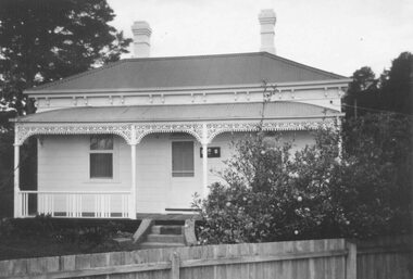
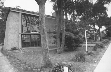
Photograph, Holy Trinity Anglican Church Ringwood East 1973
Holy Trinity Anglican Church Ringwood EastWritten on backing sheet, "Rwd. East. 30.9.73" -
 Ringwood and District Historical Society
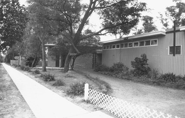
Photograph, Anglican Church, Ringwood East 1973
Written on backing sheet, "Anglican Church, Ringwood East. 30.9.73." -
 Ringwood and District Historical Society
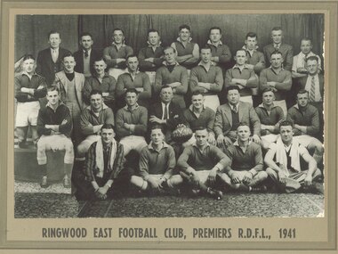
Photograph, Ringwood East Football Club, Premiers R.D.F.L., 1941 (2 photographs)
Printed below one photograph, "Ringwood East Football Club, Premiers R.D.F.L., 1941". -
 Ringwood and District Historical Society
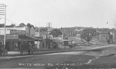
Photograph, Maroondah Highway Central, Ringwood. Whitehorse Rd. looking East from Adelaide St- 1918
Black and white photograph (3 copies- 2 large, 1 small postcard) Typed below one large photograph, "Whitehorse Rd. Looking east from Adelaide St. 1918". Image shows Falconer Grocer and Baker store on corner of Adelaide Street. -
 Ringwood and District Historical Society
Photograph, H. E. Watson's Orchard. Ringwood East. Oxford Road (undated)
Black and white photographWritten on back of photograph- "H. E. Watson's Orchard. Ringwood East. Oxford Road."agriculture -
 Ringwood and District Historical Society
Photograph, Maroondah Highway West, Ringwood- 1969. Looking east from Heatherdale Road
Black and white photographWritten on back of photograph: "May, 1969" -
 Ringwood and District Historical Society
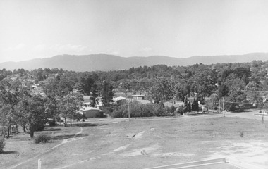
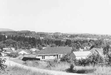
Photograph, View from Ringwood Civic Centre. East Ringwood oval can just be seen - 1973
Typed below photograph, "A view from Ringwood Civic Centre. East Ringwood oval can just be seen - 1973." -
 Ringwood and District Historical Society
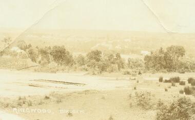
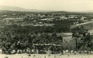
Photograph, Ringwood Birdseye - Looking towards Ringwood from later site of Civic Centre in Braeside Avenue, Ringwood East
Typed below photograph, "Looking towards Ringwood from present site of Civic Centre. Old Catholic Church which stood on Maroondah Hwy. and Mt. Dandenong Rd. intersection can be seen on right. Maroondah Hwy. can be seen where it goes past lake, also station masters residence, and houses in Pitt St. and Bedford Rd." -
 Ringwood and District Historical Society
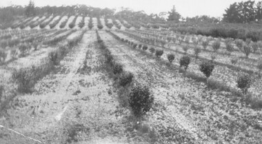
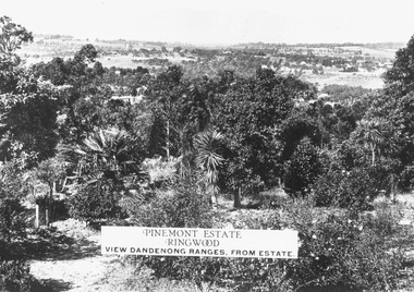
Photograph, Two images of view from Pinemont Estate, Loughnans Hill, looking east, c1930
Black and white photograph of view. Trees and bushes in foreground, orchards and mountains towards background. (2 copies)Typed on photograph, "Pinemont Estate, Ringwood. View Dandenong Ranges, from estate". Typed below photograph, "View from Loughnans Hill, looking east, c1930. Club Hotel can just be seen top right corner". -
 Ringwood and District Historical Society
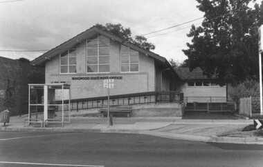
Photograph, East Ringwood Post Office, 1986
Written on back of photograph, "East Ringwood Post Office, 1986". -
 Ringwood and District Historical Society
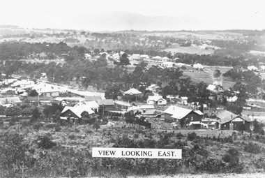
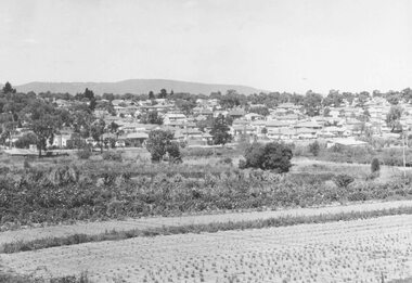
Photograph, View from Loughnan's Hill looking east c1930
Black and white photograph taken from vacant land on hill. Scene overlooks housing and trees. Mountains in background. (2 copies)Typed on photograph, "View looking east". Typed below photograph, "View from Loughnans Hill c1930. Maroondah Highway, Catholic church all top right corner". -
 Ringwood and District Historical Society
Photograph, Overlooking Ringwood from Loughnans Hill showing the antimony mine and brick works c.1914
Two postcards, same view but different reverse sides. One was made by "Empire" with a 1d postage (see description below); the other with "JB McAlpin, Estate and Financial Agent, District Government Valuer, Ringwood". A letter on one of the postcards is dated 1914 and is addressed to "Mrs. F. Palmer, c/- Mrs. E. F. Tregaskis, White Horse Road, Ringwood, via Melbourne". The letter is to her mother and the daughter's name is "Eveline". The following is written on the back of one of the enlargements, "View of Ringwood East taken from Loughnans Hill showing the antimony mine and brick works. Houses across centre are in Warrandyte Road. -
 Ringwood and District Historical Society
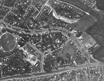
Photograph, Aerial view showing East Ringwood oval, Mount Dandenong Road, and Civic Centre, Braeside Avenue/Maroondah Hwy, c.1970
... Road Ringwood North melbourne Aerial view showing East Ringwood ...Aerial view showing East Ringwood oval, Mount Dandenong Road, and Civic Centre, Braeside Avenue/Maroondah Hwy, c.1970. -
 Ringwood and District Historical Society
Photograph, Ringwood East looking from corner Warrandyte Road and Wonga Road, 1960
Written on back of photograph, "Ringwood East looking from corner Warrandyte Road and Wonga Road, 1960". -
 Ringwood and District Historical Society
Photograph, New housing developments, New Street, 1960 viewed from railway line near Madden Street looking south-east
Written on back of photograph, "New housing settlement New Street, 1960. From railway line near Madden Street looking south-east. Dam centre foreground". -
 Ringwood and District Historical Society
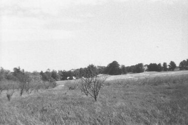
Photograph, Looking across remains of Frazer's orchard to state school, 1972
Updated Information from Bruce Frazer: This is Frazer's (not "Fraser") orchard, sold to A.V. Jennings Co. For housing development c1970. Address was "Alkoomi", Oban Rd. North Ringwood. State School 4120 was enclosed on its north & east sides by the orchard. Owned by Harold & Sylvia Frazer, 12 acres, growing mainly cherries plus plums & lemons. Photo was taken from neighbouring apple orchard (Williams) & shows street construction in the middle distance.Written on back of photograph, "Looking across remains of Fraser's orchard to state school, 1972". -
 Ringwood and District Historical Society
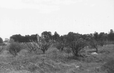
Photograph, Remains of Frazer's orchard, North Ringwood. State school on left - 1972
Updated Information from Bruce Frazer: This is Frazer's (not "Fraser") orchard, sold to A.V. Jennings Co. For housing development c1970. Address was "Alkoomi", Oban Rd. North Ringwood. State School 4120 was enclosed on its north & east sides by the orchard. Owned by Harold & Sylvia Frazer, 12 acres, growing mainly cherries plus plums & lemons. Photo was taken from neighbouring apple orchard (Williams) & shows street construction in the middle distance.Written on back of photograph, "Remains of [Fraser's] orchard. State school on left".