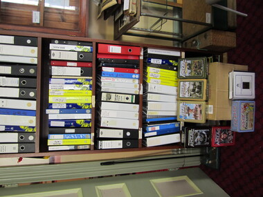
Showing 10388 items
matching plan
-
 University of Melbourne, Burnley Campus Archives
Plan, E.T. Brear, Glenferrie Primary School - Library/Art Craft Upgrade, 1987
Public Works Department, Victoria Site Plan No 87-579 A1. Scale 1:500. Drawn by E.T. Brear on 30.3.87.glenferrie primary school, e.t. brear -
University of Melbourne, Burnley Campus Archives
Plan, Residential Landscape Assignment, 1994
Tracing paper copies, 2 slightly different Base Plans drawn by J.K. On 17.03 1994 and 23.03.1994. Scale 1:100.residential, landscape design -
University of Melbourne, Burnley Campus Archives
Plan, The Oak Lawn, 1989
Tracing paper and paper copies of plan dated 20.01.1989. Scale 1:100. Sketch with grid lines. Possibly student workoak lawn, burnley gardens -
University of Melbourne, Burnley Campus Archives
Plan, Mark Burns, 3 Stage Therapy Garden Merve Irvine Nursing Home, 1996
Laminated and coloured Planting Plan by Mark Burns dated 07.10.1996, File No B33 Sheet No 3 of 4. Scale 1:100.mark burns, merve irving nursing home, landscape design, therapy garden, water features -
Federation University Historical Collection
Photograph, Technical Drawings, 07/11/1990
Examning plans for library revdelopmentbryan miller, shirley falkinder, john thomas, john sharpham -
 Greensborough Historical Society
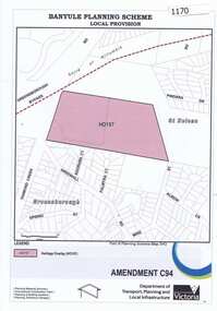
Map, Saxam Heritage Overlay, 2011_
"Saxam" was the home of the Kaye family (1886-1888) then William Santon, a former councillor and Mayor of Heidelberg. Saxam Homestead is a distinctive and substantial timber homestead built in the late 1880s as one of the notable rural properties in the St Helena area. In 2014 the house still stands but is in poor condition with most interior features removed. The site had a heritage overlay as shown. The overlay was reduced in 2014 to protect the house while allowing residential development on the site.Saxam is one of the only remaining farmhouses in the Greensborough area.Copy of map and planning scheme.saxam -
Ringwood and District Historical Society
Envelope, Packet: City of Ringwood planning reports 1990s
City of Ringwood planning reports -
 Federation University Historical Collection
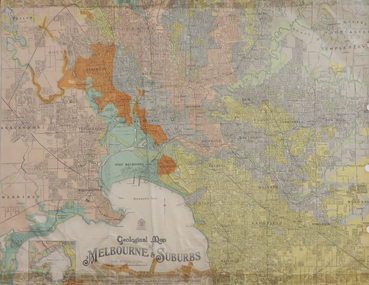
Map, Geological Map of Ascot, 1937, 1937
Coloured plan of Melbourne and suburbs.melbourne, geological, geology, caulfield, brighton, box hill, camberwell, richmond, prahran, st kilda, brunswick, coburg, keilor, braybrook, kew, hawthorn, northcote, williamstown, south melbourne -
 City of Moorabbin Historical Society (Operating the Box Cottage Museum)
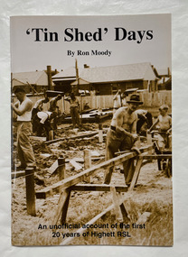
Book, Moody, Ron, 'Tin shed' days, 1997
An unofficial account of the first 20 years of Highett RSL.44 p. : plans, ports. ;non-fictionAn unofficial account of the first 20 years of Highett RSL.highett, highett rsl, returned services league of australia -
Port Melbourne Historical & Preservation Society
Document - Community Service Planning, Beris Campbell Collection, 1974 - 1993
Collection of files from Beris CAMPBELL; Port's first Social Worker. Includes local newspapers, flyers and reportsCommunity Service Planning 1992local government - city of port melbourne, health - general health, politics, public action campaigns, port melbourne citizens action group, port melbourne social welfare centre, city of south melbourne, beris campbell -
 Monbulk RSL Sub Branch
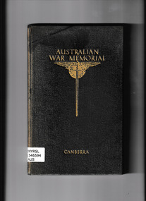
Book, Australian War Memorial, Guide to Australian War Memorial, 1941
An early guide to the Australian War MemorialIll, plans, p.107.non-fictionAn early guide to the Australian War Memorialwar memorials - australia - guidebooks, australian war memorial -
University of Melbourne, Burnley Campus Archives
Document, Additions, repairs, fencing and painting at School of Horticulture and Primary Agriculture Burnley, 1991
Tender documentation incl. plans -
University of Melbourne, Burnley Campus Archives
Document, Amenity Horticulture Orientation Walk, 1980-1990
Description of areas of Burnley with a planamenities, horticulture, burnley -
University of Melbourne, Burnley Campus Archives
Document, Development plans, 1964-1965
Notes and hand-drawn plan burnley, development, pland -
Whitehorse Historical Society Inc.
Map, Britannia Rise, 2012
Photos and plans of Britannia Rise.Photos and plans of Britannia Rise.Photos and plans of Britannia Rise.britannia rise', whitehorse road mitcham, no 569-571, mitcham railway station, eastlink, britannia mall, kenneth jones real estate -
 Ballarat RSL Sub-Branch Inc.
Folder - Ballarat Avenue of Honour
Management Strategy Plan 1997literature, ballarat rsl, ballarat -
 Brimbank City Council
Brimbank Planning Scheme Frame, 1999
Brimbank Planning Scheme Frame -
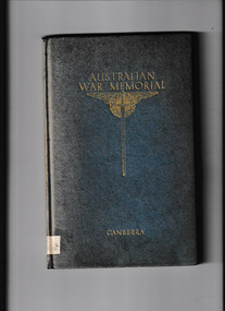 The Mrs Aeneas Gunn Memorial Library
Book, Australian War Memorial, Guide to Australian War Memorial, 1945
A guide to the Australian war memorial in CanberraIll, plans, p.114.A guide to the Australian war memorial in Canberraaustralia - war memorials, australia - military museums -
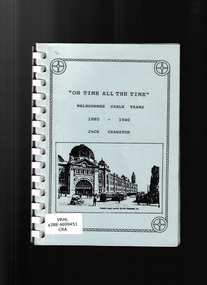 Victorian Railway History Library
Book, Jack Cranston, On time all the time: Melbournes cable trams 1885-1940, ????
Illustrations and plans of Melbournes cable trams 1885-1940.Ill, plans, p.67.non-fictionIllustrations and plans of Melbournes cable trams 1885-1940.urban transportation - melbourne, cable trams - melbourne -
Bendigo Historical Society Inc.
Document - MARKS COLLECTION: PLAN OF HOT WATER HEATER FORTUNA FOR G. LANSELL
Plan of hot water heater, Fortuna Villa, drawn on heavy paper. On top of plan in red ink 'Plan of Hot Water Heater for G.Lansell Esq for Fortuna Villa Sandhurst' Drawings show front, transverse, longitudinal, back and side elevations of heater, also back, side and front elevation of individual water heaters, including one with ornate screen. On bottom of document: floor plans of ground plan and basement. Plan stamped on RH bottom : William C. Vahland, Architect, Sandhurst.bendigo, house, fortuna villa -
 Melbourne Tram Museum
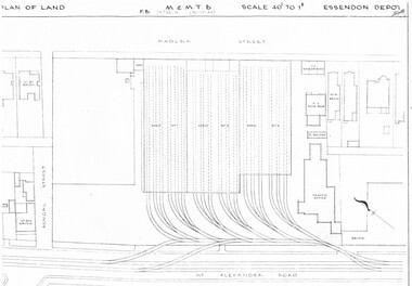
Drawing, Melbourne & Metropolitan Tramways Board (MMTB), "Essendon Depot", c1937
Set of three photocopied plans or drawings on A3 sheet of Essendon Depot - c1937 to 1944 .1 - P? - Plan showing depot block and building plan with adjacent private houses and properties - dated 30-12-1944 .2 - P8008 - Plan showing depot block and building plan with adjacent private houses and properties - dated 27-4-1937 .3 - P8089 - Detail plan of depot and offices, dated 27-4-1937 - prior to new offices being built.trams, tramways, drawings, depots, property, essendon depot -
 Melbourne Tram Museum
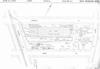
Drawing, Melbourne & Metropolitan Tramways Board (MMTB), "South Melbourne Depot", c1937
Set of five photocopied plans or drawings on A3 sheet of "South Melbourne Depot" - c 1937 .1 - P8345 - Plan of land showing MMTB land and surrounding properties. .2 - P8346 - Plan of land showing detail of offices .3 - P8347 - Plan showing detail of tram shed and adjacent buildings .4 - P8348 - Plan showing detail of buildings along the side of the block. .5 - P8349 - Plan showing details of the per way yard and associated facilities.trams, tramways, drawings, depots, property, south melbourne depot -
Port Melbourne Historical & Preservation Society
Document - File, Port Melbourne Yacht Club, 1970s - 1990s
Port Melbourne Yacht Club .01 -Sewerage connection 1975 - including plans .02 - PMYC expansion report. Original 1976 including plans and photos .03 - Rebuilding of clubhouse 1992. Including plans sport - yachting, built environment - recreational facilities -
Whitehorse Historical Society Inc.
Document, Special Council Meeting, 1994
Special Council meeting 28 Nov 1994. Notice and agendas of meetings to be held in the Council Chamber, Civic Centre, Nunawading.Special Council meeting 28 Nov 1994. Notice and agendas of meetings to be held in the Council Chamber, Civic Centre, Nunawading. Corporate Business Special Committee, Finance Special Committee and Forward Planning Committee. Includes papers re East Burwood Reserve, Nunawading Basketball Centre, East Burwood Plaza Shopping Centre.Special Council meeting 28 Nov 1994. Notice and agendas of meetings to be held in the Council Chamber, Civic Centre, Nunawading.local government, city of nunawading, east burwood reserve, nunawading basketball centre, east burwood plaza shopping centre -
 Kew Historical Society Inc
Plan - Subdivision Plan, Kewdene Estate, 1937-1939
Pru Sanderson, in her groundbreaking ‘City of Kew Urban Conservation Study : Volume 2 - Development History’ (1988), summarised the periods of urban development and subdivisions of land in Kew. The periods that she identified included 1845-1880, 1880-1893, 1893-1921, 1921-1933, 1933-1943, and Post-War Development. These periods were selected as they represented periods of rapid growth or decline in urban development. An obvious starting point for Sanderson’s groupings involved population growth and the associated economic cycles. These cycles also highlighted urban expansion onto land that was predominantly rural, although in other cases it represented the decline and breakup of large estates. A number of the plans in the Kew Historical Society’s collection can also be found in other collections, such as those of the State Library of Victoria and the Boroondara Library Service. A number are however unique to the collection.The Kew Historical Society collection includes almost 100 subdivision plans pertaining to suburbs of the City of Melbourne. Most of these are of Kew, Kew East or Studley Park, although a smaller number are plans of Camberwell, Deepdene, Balwyn and Hawthorn. It is believed that the majority of the plans were gifted to the Society by persons connected with the real estate firm - J. R. Mathers & McMillan, 136 Cotham Road, Kew. The Plans in the collection are rarely in pristine form, being working plans on which the agent would write notes and record lots sold and the prices of these. The subdivision plans are historically significant examples of the growth of urban Melbourne from the beginning of the 20th Century up until the 1980s. A number of the plans are double-sided and often include a photograph on the reverse. The advertisement for the ‘Kewdene Estate’ subdivision is pasted over a photograph of a property for sale. This is typical of the reuse of promotional materials in the period during, and subsequent to World War I. The subdivision included 14 lots bordered by Belmore Road, Birtles Street and Giles Street. On the other side of the subdivision [Glass] Creek is noted. The subdivision plan also shows part of the Outer Circle Railway and Deepdene Railway Station.subdivision plans - east kew, kewdene estate, belmore road -- kew east (vic.), giles street -- kew east (vic.) -
 Kiewa Valley Historical Society
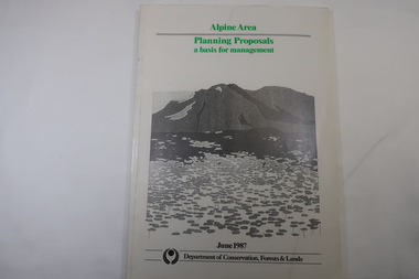
Book - Book - Alpine Area - Department of Conservation, Forests & Lands, Alpine Area / Planning Proposals / a basis for management. 1987
It is the policy of the Government that most of the State's alpine area will be proclaimed as an Alpine National Park, which would complement the Kosciusko National Park in N.S.W.. This is yet to be achieved (1987), however there is a need for sound, efficient and coordinated management based on the area's natural features, values and uses. Planning is proceeding on this basis.Victoria's alpine area is one of the State's most outstanding and spectacular natural areas. It is noted for its diverse plant and animal life, scenery, recreation opportunities and as a water catchment. This country is at the upper end of the Kiewa Valley and the planning for it is of interest to the Kiewa Valley inhabitants.White bound book with green print for title at the top, black & white picture and black print at the bottom for the name of the government authority publishing the book.143 pages with fold out map after page 7. The map is coloured green to indicate the planning area.alpine area, bogong national park, victorian department of conservation forests & lands -
 Bendigo Historical Society Inc.
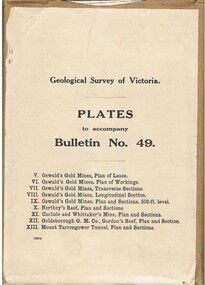
Book - MCCOLL, RANKIN AND STANISTREET COLLECTION: PLATES TO ACCOMPANY BULLETIN NO.49 MALDON GEOLOGICAL SURVEY OF VICTORIA
Book; Brown paper containers with plates (& maps) to accompany bulletin No49 of geological survey of Victoria. V Oswalds G.M. Plan of lease. VI. Oswalds G. M. Plan of workings. VII. Oswalds G. M. Transverse Sect. VIII. Oswalds G. M. Longit. Section. IX. Oswalds G. M. Plan & Sect. 500ft. Level. X. Northey's Reef plan & sections. XI. Carlisle and Whittaker's Mine Plan & Sections.XII. Goldsborough G. M. Co. Gordon's Reef, Plan & Section. XIII. Mount Tarrengower Tunnel Plan & Section.MCCOLL RANKIN & STANISTREETorganisation, industry, surveys, mccoll rankin & stanistreet -
 Federation University Historical Collection
Plans, Wimmera College of Technical and Advanced Education, 1983
.1) 14 pages bound printed plans: Developed Sketch Plans for Horsham Technical School .2) Duplicate as above wimmera college of tafe, horsham technical school, plans, architectural plan -
 Bendigo Historical Society Inc.
Administrative record - EASTER FAIR SECRETARY RECORDS, 2001
CD containing Bendigo Easter Fair secretary records for years 2001,2002, and 2003. Management Plans, financial and planning records.bendigo, institutions, easter fair -
 Bendigo Historical Society Inc.
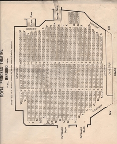
Document - ROYAL PRINCESS THEATRE COLLECTION: SEATING PLANS
Seven sheets of paper showing plans of stalls, box plan and dress circle plann of the Royal Princess Theatre - Bendigo.bendigo, buildings, princess theatre