Showing 3212 items
matching road maps
-
 Whitehorse Historical Society Inc.
Map, WW1 German Field Map, C 1915
Paper printed map of German Field positionsPaper printed map of German Field positionsmaps, world war 1914 - 1918, honybun charles -
 Whitehorse Historical Society Inc.
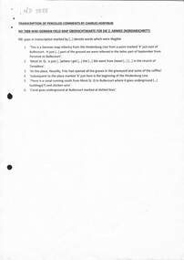
Map, Melbourne and Metropolitan Board of Works, Feb 1982
... Whitehorse Historical Society Inc. 2-10 Deep Creek Road ...Map area: North - Laburnum and Blackburn Stations East - Blackburn Lake South - bordering Canterbury Road West - Middleborough Roadnon-fictionMap area: North - Laburnum and Blackburn Stations East - Blackburn Lake South - bordering Canterbury Road West - Middleborough Roadmaps, melbourne and metropolitan board of works, parish of nunawading -
 Whitehorse Historical Society Inc.
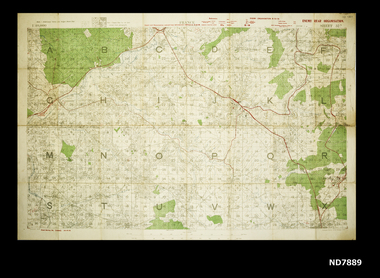
Map, WW1 map of France, 08/10/1918
Enemy Rear Organisation map Scale 1 : 40,000non-fictionEnemy Rear Organisation map Scale 1 : 40,000maps, world war 1914 - 1918 -
 Whitehorse Historical Society Inc.
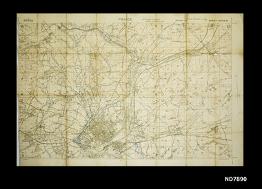
Map, Area map of France trench map, 03/02/1918
Coloured trench map of part of France Sheet 62B S.W. Scale 1 : 20,000non-fictionColoured trench map of part of France Sheet 62B S.W. Scale 1 : 20,000maps, world war 1914 - 1918 -
 Whitehorse Historical Society Inc.
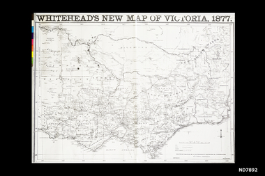
Map, Whitehead's New map of Victoria, 1877
... Whitehorse Historical Society Inc. 2-10 Deep Creek Road ...A map of Victoria produced in 1877non-fictionA map of Victoria produced in 1877map, victoria -
Whitehorse Historical Society Inc.
Map, Belgium and part of France map WW1, Nov 1917
... Whitehorse Historical Society Inc. 2-10 Deep Creek Road ...WW1 map of Ypres and Menin. Sheet 28 Edition 3 Scale 1: 40,000 Nov 1917non-fictionWW1 map of Ypres and Menin. Sheet 28 Edition 3 Scale 1: 40,000 Nov 1917world war 1914 - 1918, world war 1914 - 1918 battle of ypres, maps -
Whitehorse Historical Society Inc.
Map, Belgium WW1 map, Aug 1917
WW1 map of Belgium Edition 1. Sheet 28 S.W. and S.E. with trenches in red around the towns of Comines and Warnetonnon-fictionWW1 map of Belgium Edition 1. Sheet 28 S.W. and S.E. with trenches in red around the towns of Comines and Warnetonworld war 1914 - 1918, maps -
Whitehorse Historical Society Inc.
Map, Belgium WW1 map Edition 3, Nov 1917
WW1 map of Belgium Edition 3 Sheet 28 S.W. and S.E. Trenches in rednon-fictionWW1 map of Belgium Edition 3 Sheet 28 S.W. and S.E. Trenches in redworld war 1914 - 1918, maps -
 Whitehorse Historical Society Inc.
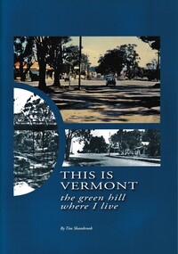
Book - Historical Study, Shambrook, Tim, This is Vermont, the green hill where I live, 2010
This book is about the history of Vermont in the Nunawading Shire from 1830s including black and white photographs, recollections and maps.This book tells the story of Vermont through pictures and diagrams from the beginnings of Vermont in the 1830's through to 2010. non-fictionThis book is about the history of Vermont in the Nunawading Shire from 1830s including black and white photographs, recollections and maps.shambrook. tim, vermont, mcclare. john -
Whitehorse Historical Society Inc.
Map, Yarran Dheran Reserve, n.d
Yarran Dheran Walking Trailnon-fictionYarran Dheran Walking Trailyarran dheran, schwerkolt cottage, walking trails -
 Whitehorse Historical Society Inc.
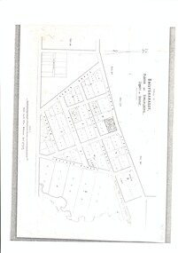
Map, Village of Ballyshanassy, 10 April 1858
... Whitehorse Historical Society Inc. 2-10 Deep Creek Road ...A map of the Village of Ballyshanassy by the Public Lands Office, Melbourne. Scale 12 chains equals 5 cmsballyshanassy -
 Whitehorse Historical Society Inc.
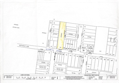
Map, 125 Separation Street, Northcote. Cadastral Map, 21/11/2001
A3 Cadastral Map of 125 Separation Street, Northcote August Schwerkolt purchased this property on 01/08/1853 where he lived and farmed the land, eventually purchasing the Mitcham property as well in 1861An A3 cadastral mapschwerkolt august -
 Whitehorse Historical Society Inc.
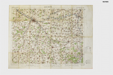
Map - Amiens France, Amiens, 1916
... Whitehorse Historical Society Inc. 2-10 Deep Creek Road ...WW1 Topograhical Map of Amiens Region, France (Allied) 1915Printed map, France 1:100,000 Ordnance Survey, Oct 1915non-fictionWW1 Topograhical Map of Amiens Region, France (Allied) 1915world war 1914 - 1918, ameins -
 Rutherglen Historical Society
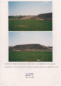
Image, W. H. Pleming, 13/10/1992
Two colour photographs printed on A4 paper with typed caption and a donor stamp. Date of photos in bottom right hand of each image.Date on images: "92-10-13" Caption below photos: "Asphelting aggregate stock piled at Springhurst at map reference 512-927, used at Springhurst on the Hume Free Way & crushed at Chiltern Quarry at map reference 671-969."hume freeway, chiltern quarry, road works -
 Lions Club of Maldon Inc.
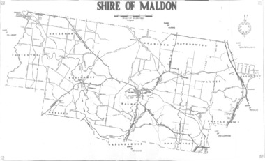
Road map, Shire of Maldon, C. 1980
... Road map... shire of maldon victoria Former Shire of Maldon Road map Shire ...Former Shire of Maldonshire of maldon, victoria -
 Whitehorse Historical Society Inc.
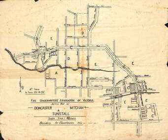
Map - Fire Underwriter's Association Sketch Map, Fire Underwriter's Association of Victoria, Doncaster, Mitcham and Tunstall, 29/4/1932
... Whitehorse Historical Society Inc. 2-10 Deep Creek Road ...Shetch map of Doncaster, Mitcham and Tunstall. Scale 1inch = 40 chainsA sketch map of Doncaster, Mitcham and Tunstall by the Fire Underwriters' Association of Victoria.non-fictionShetch map of Doncaster, Mitcham and Tunstall. Scale 1inch = 40 chainsmap, doncaster, mitcham, tunstall -
 Whitehorse Historical Society Inc.
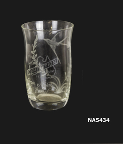
Domestic object - Glass, 1934
Belonged to donor's mother Ethel Lilian Shepherd.Drinking glass with flying bird and leaves etched on one side. Also a small map of Australia with "EXHIBITION" 1934. "From Mum to Ethel"As aboveglass -
Whitehorse Historical Society Inc.
Document - Land Auction and History, Trove Park Drive, Vermont, 1969
Subdivisional land auction documents for Trove Park Drive off Terrara Road, Vermont and history of the site, including maps and photographs.Subdivisional land auction documents for Trove Park Drive of Terrara Road, Vermont and history of the site, including maps and photographs.non-fictionSubdivisional land auction documents for Trove Park Drive off Terrara Road, Vermont and history of the site, including maps and photographs.trove park drive estate vermont, trove park drive vermont, terrara road vermont, uplands vermont, chris round, murray round -
 Bialik College
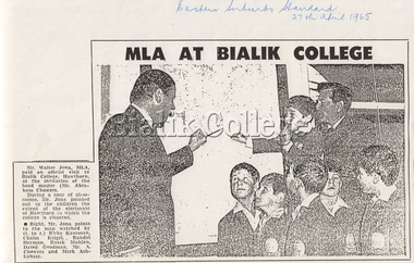
Article, 'MLA at Bialik College', The Eastern Suburbs Standard, 27 April 1965, 1965
Newspaper article 'MLA at Bialik College', published in The Eastern Suburbs Standard, 27 April 1965. The newspaper clipping states: 'Mr. Walter Jona, MLA, paid an official visit to Bialik College, Hawthorn, at the invitation of the headmaster (Mr. Abraham Chowers). During a tour of classrooms, Mr. Jona pointed out to the children the extent of the electorate of Hawthorn in which the college is situated. Right, Mr. Jona points to the map watched by (left to right) Ricky Kausman, Chaim Krigel, Roark Muhelm, David Goodman, Mr A. Chowers and Mark Ashkanasy'. Please contact [email protected] to request access to this record.shakespeare grove, 1960s -
Hume City Civic Collection
Book - Street Directory, Gregory"s Melbourne Street Directory
... and family. Joan Houston Maps Street Directory Roads Suburbs Gold ...This 1972 Gregory's Melbourne Street Directory published by Gregory's Guides & Maps Pty Ltd was used by the donor, her husband and family.A black leather removable cover with gold embossed vintage car on the front enclosing a Gregory's Melbourne Street Directory.Gold embossed vintage car on front cover.joan houston, maps, street directory, roads, suburbs -
Hume City Civic Collection
Print - Street Directory, Gregory"s Melbourne Street Directory, c1972
... Roads Maps Street Directory Gold embossed vintage car on front ...This street directory was published by Gregory's Guides & Maps Pty Ltd of 142 Clarence Street, Sydney NSW in c1972. It was used by the donor's family for many years to navigate their way around Melbourne and the metropolitan area. A street directory enclosed in a black leather detachable cover with gold embossing of a car on the front cover.Gold embossed vintage car on front of detachable cover.joan houston, streets, roads, maps, street directory -
 Mt Dandenong & District Historical Society Inc.
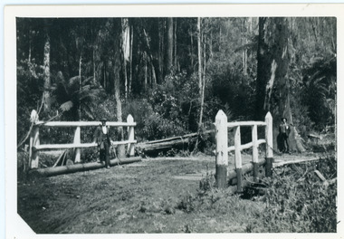
Photograph, Barber's Bridge on Olinda Creek
John Lundy-Clarke grew up in the Kalorama/Mt Dandenong area and later in life (1972-74) began to write a comprehensive history of the area working from an original settlement map in an effort to cover all areas. Barbers Bridge was named after George Barber, an early settler.Black and white photograph showing a man standing on a bridge over the Olinda Creek. 1910Handwritten n reverse: Barbers Bridge on Olinda Creek 1910. This was a ford crossed by the road after Isaac Jeeves selected allotment “C” “Jeeves Saddle” in 1871 and stopped travel through his property. The bridge has been built several times but at time of writing (1974) is replaced by a culvert consisting of two pipes two feet six inches wide. They are quite incapable of carrying the maximum flow of the creek and will be swept away.lundy-clarke, barber, barbers bridge, isaac jeeves, jeeves saddle, bridge, olinda creek -
 Mt Dandenong & District Historical Society Inc.
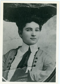
Photograph, Doris Child
John Lundy-Clarke grew up in the Kalorama/Mt Dandenong area and later in life (1972-74) began to write a comprehensive history of the area working from an original settlement map in an effort to cover all areas. William Lucas , who came from England to visit Matthew Child in the late 1870s. He purchased land from Matthew and married his daughter Catherine. They developed their property as the sporting lodge 'Glenrivers'. Their daughter Dorothea was born in 1888. She was an accomplished horsewoman who married her cousin Charles Percival (Percy) Child in 1917. Percy worked a sawmill on the creek .Black and white copy of studio portrait of Doris (Dorothea) Child (nee Lucas).Handwritten by John Lundy-Clarke on reverse: Doris Lucas “Dorothea?” Daughter of W Lucas and Catherine nee Child. Wife of Percy Child. Mother of Lois. Born 1889 died 1936 (?)dorothea lucas, dorothea child, percy child, matthew child, william lucas, catherine child -
 Mt Dandenong & District Historical Society Inc.
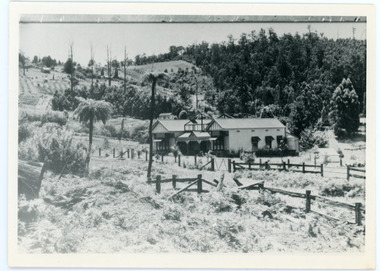
Photograph, View Up Valley At Kalorama
John Lundy-Clarke grew up in the Kalorama/Mt Dandenong area and later in life (1972-74) began to write a comprehensive history of the area working from an original settlement map in an effort to cover all areas. The building in the centre of the photograph is 'Kia-Ora' guest house. Situated on Barber’s Road, ‘Kia-Ora’ was built in 1912 by George Barber. It was later leased by a Mrs Pemberthy. “Kia-Ora’ was one of four places connected when the telephone was brought into the district in 1912. The other places were ‘Mountjoy’, ‘Cherry Farm’ and ‘Callum House’. ‘Kia-Ora’ was burnt down in 1924. Black and White copy of section of a Rose Series postcard. Shows view up the valley at Kalorama with a decorative building centre middle of photograph. Handwritten description by John Lundy-Clarke on reverse.View up valley at Kalorama from near junction of Barbers and Doughty’s Rds. “Kia Ora” guest house in centre. Paynter’s “Iona” top left with “Kalorama” to its right. About 1912. Rose Series copied by JLC 1973.kalorama, kalorama valley, john lundy-clarke, barbers road, george barber, kia-ora, guest house, iona -
 Mt Dandenong & District Historical Society Inc.
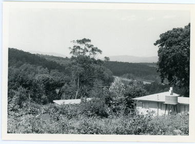
Photograph, View from George Barber's Home To His Stables
John Lundy-Clarke grew up in the Kalorama/Mt Dandenong area and later in life (1972-74) began to write a comprehensive history of the area working from an original settlement map in an effort to cover all areas. This photograph was taken by John Lundy-Clarke in 1973 to show changes to the environment sine 1905.Black and white photograph with tangled bush and small shed in foreground looking towards a cleared area. Handwritten description on reverse written by John Lundy-ClarkeView from Barbers drive to his stables close to where 1905 picture was taken. Stables in foreground. Looking towards Gap. Taken JLC November 1973.barbers road, john lundy-clarke, kalorama -
 Mt Dandenong & District Historical Society Inc.
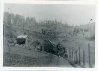
Photograph, View of the Kalorama Valley c1905
John Lundy-Clarke grew up in the Kalorama/Mt Dandenong area and later in life (1972-74) began to write a comprehensive history of the area working from an original settlement map in an effort to cover all areas. This photograph c1905 is looking up from George Barber's house 'Forest Edge' on Barbers Road. 'Forest Edge' was built c1898 and was the home of George Barber and his wife Sarah Ann (nee Richardson). The buildings in the foreground are the stables and hayshed.Black and white photograph showing two small buildings in the foreground with cleared hills behind. Handwritten decription on back by John Lundy-ClarkeA 1905 view of the Kalorama Valley towards the Gap. Barbers stables in foreground with hayshed on left. Tait’s house in centre of picture with Logans in the same fold above the hayshed. “Kalorama” is centre of Gap with Paynter’s “Iona” on its left with stables to its left. It was from one of these trees on the top left that the runaway log was cut that leaped over Barbers Road (at the top edge of the cleared land) then over Logan’s house in one bound in 1930.george barber, sarah ann barber, john lundy-clarke, forest edge -
 Mt Dandenong & District Historical Society Inc.
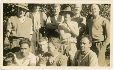
Photograph, Clint Rowse and Staff
John Lundy-Clarke grew up in the Kalorama/Mt Dandenong area and later in life (1972-74) began to write a comprehensive history of the area working from an original settlement map in an effort to cover all areas. John Lundy-Clarke has identified the photograph as being of Clint Rowse and Staff at Olinda Creek Valley in 1939. The workmen are: Back row from right: Bob Daly, Dud Page, Harry Dyson, Bill Cavell, Len Child, Ken Williams. Front row from right: Clint Rowse, Jack Clarke, Bernie Page, Jack Johnson (with dog). The Rowse family had extensive raspberry crops but later changed to flowers. Daisy Rowse married Hubert Jeeves. Black and white photograph showing a group of 10 workmen, one holding a dog.The names Lenny Child, Dyson, Page, Bob Daly, Jackie Johnston, J Clarke, Clint Rowse are handwritten on the back by John Lundy-Clarkelen child, bob daly, clint rowse, jack johnston, bill cavell, ken williams, jack clarke, dud page, bernie page -
 Mt Dandenong & District Historical Society Inc.
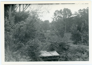
Photograph, View From Ernest Road To Site Of "Kia-Ora"
John Lundy-Clarke grew up in the Kalorama/Mt Dandenong area and later in life (1972-74) began to write a comprehensive history of the area working from an original settlement map in an effort to cover all areas. The photograph taken c1973 from Ernest Road looks over the site of the Kia-Ora guesthouse which is marked by the oalm tree that can be seen at the front of the flat roof close to the gum tree trunk. Situated on Barber’s Road, ‘Kia-Ora’ was built in 1912 by George Barber. It was later leased by a Mrs Pemberthy. “Kia-Ora’ was one of four places connected when the telephone was brought into the district in 1912. The other places were ‘Mountjoy’, ‘Cherry Farm’ and ‘Callum House’. ‘Kia-Ora’ was burnt down in 1924.Black and white photograph showing a house with water tank in right foreground and another flat roof centre foreground. There is a handwritten description by John Lundy-Clarke on the reverse.View 1973 from corner of Ernest Rd and Outlook Drive Lot 24 Village Settlement looking over the site of “Kia Ora” to the pioneers clearings. The palm tree seen above the flat roof (Rex) on left, is on the exact site of “Kia Ora”. Photo JLCernest road, john lundy-clarke, kia=ors, guest house, guesthouse -
 Mt Dandenong & District Historical Society Inc.
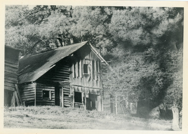
Photograph, Isaac Jeeves' Barn
Large barn built c1886 by Isaac Jeeves the younger on his property where the homestead 'Shiloah' stood. The barn was reputedly made from timbers split from only one messmate tree. Originally the home of Isaac Jeeves, brother of Ellis Jeeves, ‘Shiloah’ was enlarged to take guests in the early 1900s. It was situated close to a beautiful fern gully and Isaac and his family capitalised on this by setting out walking tracks through the ferns. They charged 1/- to walk through and this included afternoon tea in a garden setting. ‘Shiloah’ was a popular tourist attraction but the making of the Olinda Creek Road destroyed the fern gullies and, by the 1930s, it was all finished. John Lundy-Clarke grew up in the Kalorama/Mt Dandenong area and later in life (1972-74) began to write a comprehensive history of the area working from an original settlement map in an effort to cover all areas.Black and white photograph showing a large wooden structure surrounded by trees. Handwritten inscription on reverse by John Lundy-Clarke.Home of Isaac Jeeves the younger. Built about 1886 of timbers split from one messmate tree. Photo 1973isaac jeeves the younger, barn, kalorama, shiloah, messmate -
 Mt Dandenong & District Historical Society Inc.
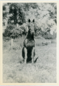
Photograph, Logan's Trick Horse
John Lundy-Clarke grew up in the Kalorama/Mt Dandenong area and later in life (1972-74) began to write a comprehensive history of the area working from an original settlement map in an effort to cover all areas. This photograph shows the 'trick horse' belonging to Robert Logan. Robert Logan settled on Lot 28 in 1896 and worked it until his death in 1936.Black and white photograph on a horse sitting in grass. Handwritten inscription on reverse by John Lundy-Clarke.1920 Logan’s trick horse on LOT 28 SECTION 1robert logan, logan, horse, kalorama, john lundy-clarke