Showing 12626 items matching " development"
-
 Eltham District Historical Society Inc
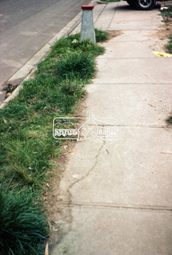
Photograph, Foothpath and kerb damage, Bainbridge Drive, Eltham, 3 Sep 1981
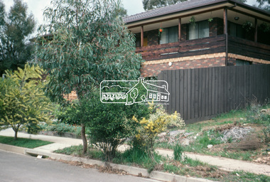
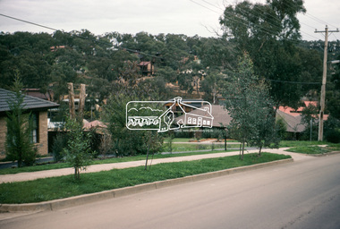
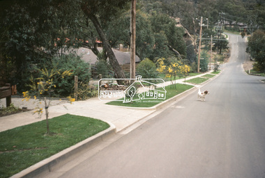
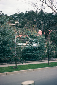
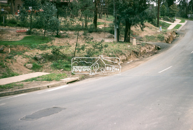
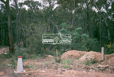
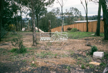
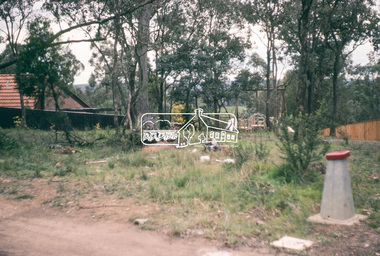
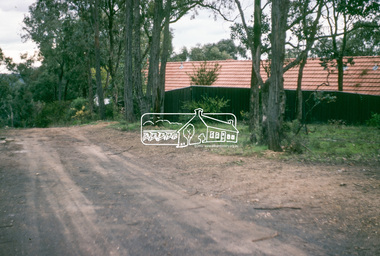
Roll of film taken by Eltham Shire Council officers of roads and houses in the Eltham East area, 3 September 1981 prior to construction of new water main; including views of existing damage to footpaths and gutters and general views of Beard Street. These images provide a perspective of housing estate developments and changes in housing styles and road development which began sweeping in from the mid 1970s with increasing urbanisation of what was once more outlying suburbs and regions.35mm colour positive transparency (1 of 28) Mount - Kodak Kodachrome Cardeltham, infrastructure, roads, bainbridge drive, footpaths and gutters -
 Eltham District Historical Society Inc
Photograph, Foothpath and kerb damage, Bainbridge Drive, Eltham, 3 Sep 1981
Roll of film taken by Eltham Shire Council officers of roads and houses in the Eltham East area, 3 September 1981 prior to construction of new water main; including views of existing damage to footpaths and gutters and general views of Beard Street. These images provide a perspective of housing estate developments and changes in housing styles and road development which began sweeping in from the mid 1970s with increasing urbanisation of what was once more outlying suburbs and regions.35mm colour positive transparency (1 of 28) Mount - Kodak Kodachrome Cardeltham, infrastructure, roads, bainbridge drive, footpaths and gutters -
 Eltham District Historical Society Inc
Photograph, Foothpath and kerb damage, Madine Way, Eltham, 3 Sep 1981
Roll of film taken by Eltham Shire Council officers of roads and houses in the Eltham East area, 3 September 1981 prior to construction of new water main; including views of existing damage to footpaths and gutters and general views of Beard Street. These images provide a perspective of housing estate developments and changes in housing styles and road development which began sweeping in from the mid 1970s with increasing urbanisation of what was once more outlying suburbs and regions.35mm colour positive transparency (1 of 28) Mount - Kodak Kodachrome Cardeltham, infrastructure, roads, footpaths and gutters, madine way -
 Eltham District Historical Society Inc
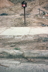
Photograph, Madine Way, Eltham, 3 Sep 1981
Roll of film taken by Eltham Shire Council officers of roads and houses in the Eltham East area, 3 September 1981 prior to construction of new water main; including views of existing damage to footpaths and gutters and general views of Beard Street. These images provide a perspective of housing estate developments and changes in housing styles and road development which began sweeping in from the mid 1970s with increasing urbanisation of what was once more outlying suburbs and regions.35mm colour positive transparency (1 of 28) Mount - Kodak Kodachrome Cardeltham, infrastructure, roads, madine way, tadema park -
 Eltham District Historical Society Inc
Photograph, Beard Street, Eltham, 3 Sep 1981
Roll of film taken by Eltham Shire Council officers of roads and houses in the Eltham East area, 3 September 1981 prior to construction of new water main; including views of existing damage to footpaths and gutters and general views of Beard Street. These images provide a perspective of housing estate developments and changes in housing styles and road development which began sweeping in from the mid 1970s with increasing urbanisation of what was once more outlying suburbs and regions.35mm colour positive transparency (1 of 28) Mount - Kodak Kodachrome Cardeltham, infrastructure, roads, beard street, frank street, shalbury avenue -
 Eltham District Historical Society Inc
Photograph, Beard Street, Eltham, 3 Sep 1981
Roll of film taken by Eltham Shire Council officers of roads and houses in the Eltham East area, 3 September 1981 prior to construction of new water main; including views of existing damage to footpaths and gutters and general views of Beard Street. These images provide a perspective of housing estate developments and changes in housing styles and road development which began sweeping in from the mid 1970s with increasing urbanisation of what was once more outlying suburbs and regions.35mm colour positive transparency (1 of 28) Mount - Kodak Kodachrome Cardeltham, infrastructure, roads, beard street -
 Eltham District Historical Society Inc
Photograph, Beard Street, Eltham, 3 Sep 1981
Roll of film taken by Eltham Shire Council officers of roads and houses in the Eltham East area, 3 September 1981 prior to construction of new water main; including views of existing damage to footpaths and gutters and general views of Beard Street. These images provide a perspective of housing estate developments and changes in housing styles and road development which began sweeping in from the mid 1970s with increasing urbanisation of what was once more outlying suburbs and regions.35mm colour positive transparency (1 of 28) Mount - Kodak Kodachrome Cardeltham, infrastructure, roads, beard street, frank street -
 Eltham District Historical Society Inc
Photograph, Beard Street, Eltham, 3 Sep 1981
Roll of film taken by Eltham Shire Council officers of roads and houses in the Eltham East area, 3 September 1981 prior to construction of new water main; including views of existing damage to footpaths and gutters and general views of Beard Street. These images provide a perspective of housing estate developments and changes in housing styles and road development which began sweeping in from the mid 1970s with increasing urbanisation of what was once more outlying suburbs and regions.35mm colour positive transparency (1 of 28) Mount - Kodak Kodachrome Cardeltham, infrastructure, roads, beard street, grove street, valonia drive, wycliffe crescent, livingstone road -
 Eltham District Historical Society Inc
Photograph, Beard Street, Eltham, 3 Sep 1981
Roll of film taken by Eltham Shire Council officers of roads and houses in the Eltham East area, 3 September 1981 prior to construction of new water main; including views of existing damage to footpaths and gutters and general views of Beard Street. These images provide a perspective of housing estate developments and changes in housing styles and road development which began sweeping in from the mid 1970s with increasing urbanisation of what was once more outlying suburbs and regions.35mm colour positive transparency (1 of 28) Mount - Kodak Kodachrome Cardeltham, infrastructure, roads, beard street -
 Eltham District Historical Society Inc
Photograph, Beard Street, Eltham, 3 Sep 1981
Roll of film taken by Eltham Shire Council officers of roads and houses in the Eltham East area, 3 September 1981 prior to construction of new water main; including views of existing damage to footpaths and gutters and general views of Beard Street. These images provide a perspective of housing estate developments and changes in housing styles and road development which began sweeping in from the mid 1970s with increasing urbanisation of what was once more outlying suburbs and regions.35mm colour positive transparency (1 of 28) Mount - Kodak Kodachrome Cardeltham, infrastructure, roads, beard street -
 Eltham District Historical Society Inc
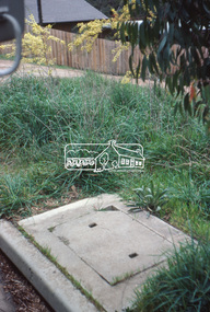
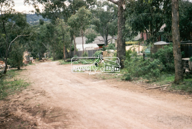
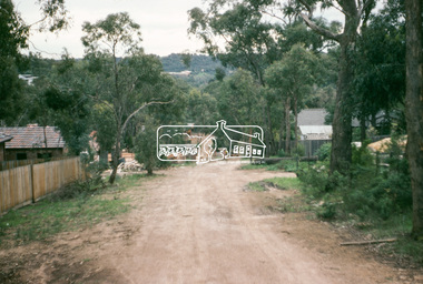
Photograph, Water Main Pipe Track (Madine Way-Bainbridge Drive), Eltham, 3 Sep 1981
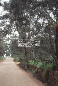
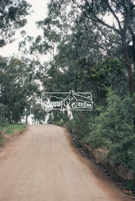
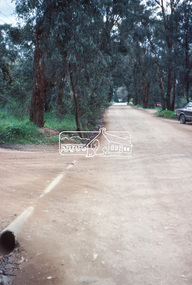
Roll of film taken by Eltham Shire Council officers of roads and houses in the Eltham East area, 3 September 1981 prior to construction of new water main; including views of existing damage to footpaths and gutters and general views of Beard Street. These images provide a perspective of housing estate developments and changes in housing styles and road development which began sweeping in from the mid 1970s with increasing urbanisation of what was once more outlying suburbs and regions.35mm colour positive transparency (1 of 28) Mount - Kodak Kodachrome Cardeltham, infrastructure, roads, bainbridge drive linear reserve, madine way, water main pipe track -
 Eltham District Historical Society Inc
Photograph, Water Main Pipe Track (Madine Way-Bainbridge Drive), Eltham, 3 Sep 1981
Roll of film taken by Eltham Shire Council officers of roads and houses in the Eltham East area, 3 September 1981 prior to construction of new water main; including views of existing damage to footpaths and gutters and general views of Beard Street. These images provide a perspective of housing estate developments and changes in housing styles and road development which began sweeping in from the mid 1970s with increasing urbanisation of what was once more outlying suburbs and regions.35mm colour positive transparency (1 of 28) Mount - Kodak Kodachrome Cardeltham, infrastructure, roads, bainbridge drive linear reserve, madine way, water main pipe track -
 Eltham District Historical Society Inc
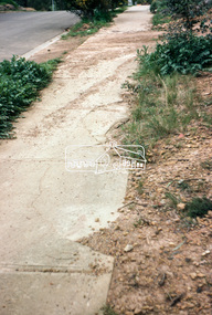
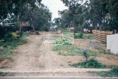
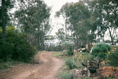
Photograph, Water Main Pipe Track (Madine Way-Eucalyptus Road), Eltham, 3 Sep 1981
Roll of film taken by Eltham Shire Council officers of roads and houses in the Eltham East area, 3 September 1981 prior to construction of new water main; including views of existing damage to footpaths and gutters and general views of Beard Street. These images provide a perspective of housing estate developments and changes in housing styles and road development which began sweeping in from the mid 1970s with increasing urbanisation of what was once more outlying suburbs and regions.35mm colour positive transparency (1 of 28) Mount - Kodak Kodachrome Cardeltham, infrastructure, roads, water main pipe track, madine way, eucalyptus road, tadema park -
 Eltham District Historical Society Inc
Photograph, Water Main Pipe Track (Madine Way-Eucalyptus Road), Eltham, 3 Sep 1981
Roll of film taken by Eltham Shire Council officers of roads and houses in the Eltham East area, 3 September 1981 prior to construction of new water main; including views of existing damage to footpaths and gutters and general views of Beard Street. These images provide a perspective of housing estate developments and changes in housing styles and road development which began sweeping in from the mid 1970s with increasing urbanisation of what was once more outlying suburbs and regions.35mm colour positive transparency (1 of 28) Mount - Kodak Kodachrome Cardeltham, infrastructure, roads, water main pipe track, madine way, eucalyptus road, tadema park -
 Kew Historical Society Inc
Flyer - 60 Pakington Street, Kew
Subdivision plans and real estate flyers/brochures reveal a number of aspects of urban development and history. The Kew Historical Society's collection of these plans, as well as advertisements extracted from magazines, cover key aspects of community development and architectural history of Kew and Kew Eat as well as surrounding suburbs. While most of the plans in the collection were gifted to the Society by the former City of Kew, a number of other plans and advertisements have been donated by individuals, of which this is an example. Single page illustrated flyer, advertising 60 Pakington Street, Kew for sale. Annotation in pen and ink at right.neville collection, 60 pakington street -- kew (vic.), real estate advertisements -- kew (vic.) -
Kew Historical Society Inc
Flyer - 45 Pakington Street, Kew
Subdivision plans and real estate flyers/brochures reveal a number of aspects of urban development and history. The Kew Historical Society's collection of these plans, as well as advertisements extracted from magazines, cover key aspects of community development and architectural history of Kew and Kew Eat as well as surrounding suburbs. While most of the plans in the collection were gifted to the Society by the former City of Kew, a number of other plans and advertisements have been donated by individuals, of which this is an example.Single page illustrated real estate flyer advertising 45 Pakington Street, Kew for sale by auction. Annotation in pen and ink at rightpeter neville, real estate advertisements -- kew (vic.), 45 pakington street -- kew (vic.) -
Kew Historical Society Inc
Plan - Tramway Estate, Camberwell North, 1937
Subdivision plans and real estate flyers/brochures reveal a number of aspects of urban development and history. The Kew Historical Society's collection of these plans, as well as advertisements extracted from magazines, cover key aspects of community development and architectural history of Kew and Kew Eat as well as surrounding suburbs. While most of the plans in the collection were gifted to the Society by the former City of Kew, a number of other plans and advertisements have been donated by individuals, of which this is an example.Single page subdivision plan listing properties for sale in the Tramways Estate, Camberwell North. The large estate was bounded by Doncaster Road, Burke Road, Marwan Avenue, Maud Street, Severn Street, and extended over Glass's Creek at Mayland's Avenue. Within the plan, lots 3 to 342 are listed as lots. The plan includes annotations in ink indicating the prices realised by a number of lots. A key explains that lots with an 'H' represent a house, whereas the 37 shaded lots represent those being offered by this agent. subdivision plans -- camberwell (vic.), tramways estate -
Kew Historical Society Inc
Plan - Subdivisional Sale of 11 Villa Sites, East Kew, 1939
Subdivision plans and real estate flyers/brochures reveal a number of aspects of urban development and history. The Kew Historical Society's collection of these plans, as well as advertisements extracted from magazines, cover key aspects of community development and architectural history of Kew and Kew Eat as well as surrounding suburbs. While most of the plans in the collection were gifted to the Society by the former City of Kew, a number of other plans and advertisements have been donated by individuals, of which this is an example.Single page residential subdivision plan advertising house lots for sale, in what was then designated as East Kew but is now Kew, in the following streets: Burke Road, Enfield Street. The flyer includes a smaller locality plan at right. Information on the flyer indicates that the land was previously owned by the Melbourne & Metropolitan Tramways Board.subdivision plans -- kew (vic.), enfield street -- kew (vic.), burke road -- kew (vic.) -
Kew Historical Society Inc
Plan - Camberwell Panorama Estate, 1923
Subdivision plans and real estate flyers/brochures reveal a number of aspects of urban development and history. The Kew Historical Society's collection of these plans, as well as advertisements extracted from magazines, cover key aspects of community development and architectural history of Kew and Kew Eat as well as surrounding suburbs. While most of the plans in the collection were gifted to the Society by the former City of Kew, a number of other plans and advertisements have been donated by individuals, of which this is an example.Promotional brochure for the Camberwell Panorama Estate. The four page bifold handout advertises 216 home sites bounded by Bulleen Road, The Nook, Fortuna Avenue, and Doncaster Road. Other streets in the subdivision include: Sunburst Avenue, The Moor, and Macedon Avenue. The brochure has been damaged at some time in the past and so masking tape obscures the tram on page 1. Page 2 includes the plan of the subdivision, page 3 information about the site and a locality plan, while page 4 includes photographs and terms of sale. subdivision plans -- balwyn north (vic.), camberwell panorama estate -
Kew Historical Society Inc
Plan - Saxonwood Estate, Doncaster [East]
Subdivision plans and real estate flyers/brochures reveal a number of aspects of urban development and history. The Kew Historical Society's collection of these plans, as well as advertisements extracted from magazines, cover key aspects of community development and architectural history of Kew and Kew Eat as well as surrounding suburbs. While most of the plans in the collection were gifted to the Society by the former City of Kew, a number of other plans and advertisements have been donated by individuals, of which this is an example.Undated, multi-page subdivision plan advertising lots for sale bounded by Blackburn Road, George Street, Windermere Avenue, and Saxonwood Drive in what is currently Doncaster East. Other streets in the subdivision include: Mowbray Court, Stafford Court, Rugby Court, and Robin Hood Court. The front page includes a Birdseye view of the estate which identifies existing and projected civic amenities, as well as the estate's relationship to surrounding suburbs and the city centre. Red crosses on the detailed plan of lots on page two indicate those that have been sold. The final page includes a locality plan. saxonwood estate -- doncaster east (vic.), subdivision plans -- doncaster east (vic.) -
Kew Historical Society Inc
Plan - Charteris Estate, Ivanhoe [East], 1927
Subdivision plans and real estate flyers/brochures reveal a number of aspects of urban development and history. The Kew Historical Society's collection of these plans, as well as advertisements extracted from magazines, cover key aspects of community development and architectural history of Kew and Kew Eat as well as surrounding suburbs. While most of the plans in the collection were gifted to the Society by the former City of Kew, a number of other plans and advertisements have been donated by individuals, of which this is an example.Original 4-page bifold handout advertising 43 residential lots for sale in the Charteris Estate subdivision in Ivanhoe [now classified as Ivanhoe East]. This brochure was created to sell the third section of the estate which it labels as 'The Most Superb Section'. Streets within the subdivision include: Burke Road North, McArthur Road, Castella Street, and the Government Boulevard. In addition to the overall plan spread across pages 2 and 3, each page includes a number of interesting photographs including: a number of the new Burke Road Bridge, a sports ground, Hoyts Picture Theatre in Ivanhoe, a croquet ground, and Ivanhoe shopping centre [named Motor Cross Junction].charteris estate - east ivanhoe (vic), subdivision plans -- ivanhoe east (vic.), d.c. mcarthur, charterisville -
Kew Historical Society Inc
Plan - Pointed Firs Estate, Camberwell North, 1936
Subdivision plans and real estate flyers/brochures reveal a number of aspects of urban development and history. The Kew Historical Society's collection of these plans, as well as advertisements extracted from magazines, cover key aspects of community development and architectural history of Kew and Kew Eat as well as surrounding suburbs. While most of the plans in the collection were gifted to the Society by the former City of Kew, a number of other plans and advertisements have been donated by individuals, of which this is an example.Original multi-page sales brochure of the Pointed Firs Estate, advertised as located in Camberwell North, but now in Balwyn North. The 4-page bifold brochure includes promotional material as well as a detailed plan of the 28 lots for sale, a photograph of the locality with the plan overlaying it, as well as aerial photos and street views. The estate included lots in Doncaster Road, Thackeray Street, Houghton Street, an dMaud Street. pointed firs estate -- balwyn north, subdivisions -- balwyn north (vic.) -
Kew Historical Society Inc
Plan - Willsmere Park Estate, Kew, 1926
Subdivision plans and real estate flyers/brochures reveal a number of aspects of urban development and history. The Kew Historical Society's collection of these plans, as well as advertisements extracted from magazines, cover key aspects of community development and architectural history of Kew and Kew Eat as well as surrounding suburbs. While most of the plans in the collection were gifted to the Society by the former City of Kew, a number of other plans and advertisements have been donated by individuals, of which this is an example.Original 4-page, bifold subdivision plan of the Willsmere Park Estate, Kew. The 1926 land sale advertised '40 superb villa allotments' on the 'Yarra Heights'. Streets within the subdivision included: Willow Grove, Kilby Road, Elm Grove and Belford Road. The double page spread on pages 2 and 3 shows the detailed plan of the 40 lots, surrounded by public parkland [Willsmere Park] and the Kew Golf Links. By the time that this version of the plan was released, only the lots on Willow Grove and Kilby Road remained. willsmere park estate -- kew (vic.), subdivisions - kew (vic.), subdivisions -- kew east (vic.), willsmere park -- kew east (vic.)