Showing 2849 items matching "wests road"
-
 Wodonga & District Historical Society Inc
Photograph - Photo - Felltimber Creek Road, Wodonga, Neil Coles, July 1984
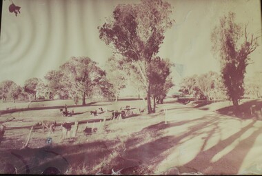
Felltimber Creek Road is on the south-eastern edge of West Wodonga. It was originally covered in bushlandA large black and white image of cows grazing in a paddock. Image is in a metal and glass frame.felltimber creek, wodonga 1980s, wodonga scenes -
 Wodonga & District Historical Society Inc
Book - Beyond the Blazing Stump, Russell Walker, 1999
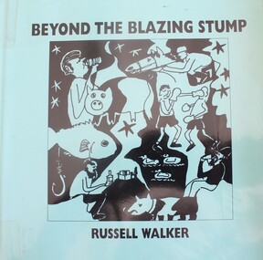
A collection of poems written over a period of 20 years, based on the author's experiences as he travelled in north eastern Victoria, NSW and southern Queensland. Many of the verses are based on events which took place at Perry's Blazing Stump Hotel at Bandiana near Wodonga, Victoria. The "Blazing Stump" got its name from the custom of early travellers bringing a log or stump to the fire to keep it burning for the next campers. The Melrose referred to in some poems is Melrose Primary School in West Wodonga.A volume of 102 pages, including an anthology of poems with illustrations.fictionA collection of poems written over a period of 20 years, based on the author's experiences as he travelled in north eastern Victoria, NSW and southern Queensland. Many of the verses are based on events which took place at Perry's Blazing Stump Hotel at Bandiana near Wodonga, Victoria. The "Blazing Stump" got its name from the custom of early travellers bringing a log or stump to the fire to keep it burning for the next campers. The Melrose referred to in some poems is Melrose Primary School in West Wodonga.australian poetry, perry's stump hotel -
 Wodonga & District Historical Society Inc
Photograph - Mann Collection Album - Wodonga, High Street West - W. Hicks & Son, Belvoir Chambers, T. B. Erlandsen & Son, 1960s
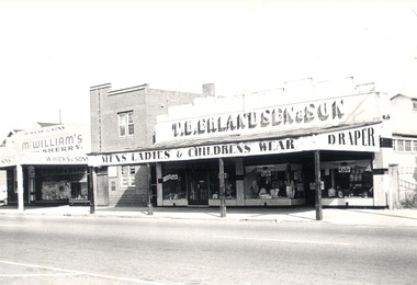
Elaine Mann was married to David Mann, a successful Wodonga businessman and community leader who passed away in Wodonga in June 2012. David was a member of the Mann family who began their business in Wodonga in 1920. Elaine was a teacher in Wodonga for many years and an active member of the community.This photo collection is of significance as it documents how the businesses and buildings in Wodonga have evolved and contributed to community throughout the late 20th century.Wodonga, High Street West Businesses including W. Hicks & Son (Wine and Spirit Merchants), T. B. Erlandsen & Son. Thorald Erlandsen purchased these premises in the 1950s. The building was previously owned by John Whan. It started out as a general store but was later extended to include a drapers. The building sold in 1966 to Manns. Verandahs with posts were banned in 1960 but had 10 years to comply. W. Hicks & Son was an old style emporium and sold everything from hardware to haberdashery, wine and spirits, and grocery lines. McHarg's Solicitors was established in 1932 when John Charles (Jack) McKenzie-McHarg opened his legal practice in High Street, Wodonga in the Belvoir Chambers. There was also a dentist Mr. N. McDonough who had rooms upstairs in the 1950s.wodonga businesses, high st wodonga, t. b. erlandsen & son, belvoir chambers -
 Wodonga & District Historical Society Inc
Photograph - Mann Collection Album - Wodonga, High Street West - T. B. Erlandsen & Son. and Terminus Hotel, C. 1980s
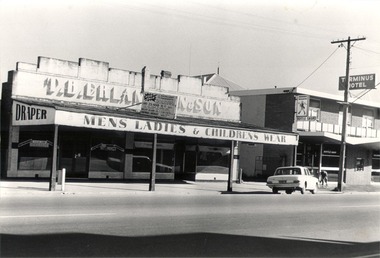
Elaine Mann was married to David Mann, a successful Wodonga businessman and community leader who passed away in Wodonga in June 2012. David was a member of the Mann family who began their business in Wodonga in 1920. Elaine was a teacher in Wodonga for many years and an active member of the community.This photo collection is of significance as it documents how the businesses and buildings in Wodonga have evolved and contributed to community throughout the late 20th century.Wodonga, High Street West Businesses including T. B. Erlandsen & Son. and the Terminus Hotel. Thorald Erlandsen purchased his premises in the 1950s. The building was previously owned by John Whan. It started out as a general store but was later extended to include a drapers. The building sold in 1966 to Manns. The Terminus Hotel was built in 1873. It was purchased by Annie and George Allen in 1879. In 1888 they added extensions including a billiard room, a dining room and 18 other rooms. After the death of her husband, Annie Allen continued to run the Terminus Hotel. She later married John Haldon and was licensee of the hotel until 1893 when the license was transferred to William Carkeek. Carkeeks owned the hotel from 1900 - 1903 and again from 1906 - 1909. It was destroyed by fire in 1998 and the building demolished in 1999. In 2021 it is the location of Tristar Medical Centre.wodonga businesses, high st wodonga, t. b. erlandsen & son, terminus hotel -
 Wodonga & District Historical Society Inc
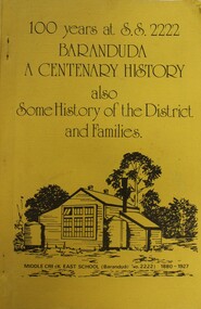
Booklet - 100 YEARS AT S.S. 2222 BARANDUDA: a centenary history, Rosemary Boyes, 1980
This booklet tells the story of Baranduda State School 2222 and was produced to celebrate its centenary. It also includes information about the history of the district and some of its pioneer families. Baranduda pastoral run was taken up in 1845 and it is thought that the name was derived from an Aboriginal expression relating to a swamp or a water rat. A few kilometres south-west there is the beginning of the Baranduda Range, of which the summit is Mount Baranduda. Baranduda was a rural hamlet with numerous German farm selectors, who came from South Australia. Beginning with the grazing of cattle and later dairying and sawmilling were added, serving markets in Wodonga and providing timber sleepers for railway construction. The primary school was opened in 1880.non-fictionThis booklet tells the story of Baranduda State School 2222 and was produced to celebrate its centenary. It also includes information about the history of the district and some of its pioneer families. Baranduda pastoral run was taken up in 1845 and it is thought that the name was derived from an Aboriginal expression relating to a swamp or a water rat. A few kilometres south-west there is the beginning of the Baranduda Range, of which the summit is Mount Baranduda. Baranduda was a rural hamlet with numerous German farm selectors, who came from South Australia. Beginning with the grazing of cattle and later dairying and sawmilling were added, serving markets in Wodonga and providing timber sleepers for railway construction. The primary school was opened in 1880.baranduda state school, education victoria, community history baranduda -
 Wodonga & District Historical Society Inc
Negative - Haeusler Glass Negatives Collection - Mrs. McFarlane at Mac's Hotel, Wodonga West
The Wodonga Historical Society Haeusler Collection provides invaluable insight into life in late nineteenth and early twentieth century north east Victoria. The collection comprises manuscripts, personal artefacts used by the Haeusler family on their farm in Wodonga, and a set of glass negatives which offer a unique visual snapshot of the domestic and social lives of the Haeusler family and local Wodonga community. The Haeusler family migrated from Prussia (Germany) to South Australia in the 1840s and 1850s, before purchasing 100 acres of Crown Land made available under the Victorian Lands Act 1862 (also known as ‘Duffy’s Land Act’) in 1866 in what is now Wodonga West. The Haeusler family were one of several German families to migrate from South Australia to Wodonga in the 1860s. This digital image was produced from one of the glass negatives that form part of the collection, probably taken by Louis Haeusler (b.1887) with the photographic equipment in the Wodonga Historical Society Haeusler Collection. Mac's Hotel, is believed to have begun in 1868. For most of its life run by William and Mary McFarlane, the son in law and daughter of Mary Ann King. In 1867 Mary Ann King had taken over the licence of the Wodonga Hotel in Sydney Road. Mac’s Hotel closed in 1891 when William withdrew his application for renewal of licence.This item is unique and has well documented provenance and a known owner. It forms part of a significant and representative historical collection which reflects the local history of Wodonga. It contributes to our understanding of domestic and family life in early twentieth century Wodonga, as well as providing interpretative capacity for themes including local history and social history.Digital image created from the Haeusler Glass negative collection. Mrs. McFarlane at Mac's Hotel. Wodonga West. wodonga pioneers, haeusler family, glass negatives, dry plate photography, sunday school west wodonga -
 Wodonga & District Historical Society Inc
Negative - Haeusler Glass Negatives Collection - Ferdinand and Gottlieb Haeusler and their half-brother August Klinge
The Wodonga Historical Society Haeusler Collection provides invaluable insight into life in late nineteenth and early twentieth century north east Victoria. The collection comprises manuscripts, personal artefacts used by the Haeusler family on their farm in Wodonga, and a set of glass negatives which offer a unique visual snapshot of the domestic and social lives of the Haeusler family and local Wodonga community. The Haeusler family embarked on the “Pauline” from Bremen, Germany in 1846. They lived in South Australia before migrating to the Wodonga West area in Victoria in 1866. Shipping records show the family who left Germany together consisted of William and his wife Johanna Eleanore Klinge nee Schultz and their children Ferdinand, Louise and Gottlieb as well as Johanna Eleanore’s children from her first marriage - Johann Wilhelm Klinge, Johanne Caroline Klinge and Johann August Klinge. Other members of the Haeusler family migrated to South Australia at a later date, settling in South Australia, Victoria and New South Wales. This digital image was produced from one of the glass negatives that form part of the collection, probably taken by Louis Haeusler (b.1887) with the photographic equipment in the Wodonga Historical Society Haeusler Collection.This item is unique and has well documented provenance and a known owner. It forms part of a significant and representative historical collection which reflects the local history of Wodonga. It contributes to our understanding of domestic and family life in early twentieth century Wodonga, as well as providing interpretative capacity for themes including local history and social history.Digital image created from the Haeusler Glass negative collection. From left, Ferdinand and Gottlieb Haeusler, with half-brother August Klinge. In the background is Gottlieb's house where Elenore and Wilhelm Haeusler lived from 1866 until their deaths.wodonga pioneers, haeusler family, glass negatives, dry plate photography, klinge family -
 Wodonga & District Historical Society Inc
Negative - Haeusler Glass Negatives Collection - Ferdinand Haeusler, Maria Klinge, Gottlieb Haeusler, Anna Werner nee Klinge and August Klinge
The Wodonga Historical Society Haeusler Collection provides invaluable insight into life in late nineteenth and early twentieth century north east Victoria. The collection comprises manuscripts, personal artefacts used by the Haeusler family on their farm in Wodonga, and a set of glass negatives which offer a unique visual snapshot of the domestic and social lives of the Haeusler family and local Wodonga community. The Haeusler family embarked on the “Pauline” from Bremen, Germany in 1846. They lived in South Australia before migrating to the Wodonga West area in Victoria in 1866. Shipping records show the family who left Germany together consisted of William and his wife Johanna Eleanore Klinge nee Schultz and their children Ferdinand, Louise and Gottlieb as well as Johanna Eleanore’s children from her first marriage - Johann Wilhelm Klinge, Johanne Caroline Klinge and Johann August Klinge. Other members of the Haeusler family migrated to South Australia at a later date, settling in South Australia, Victoria and New South Wales. This digital image was produced from one of the glass negatives that form part of the collection, probably taken by Louis Haeusler (b.1887) with the photographic equipment in the Wodonga Historical Society Haeusler Collection.This item is unique and has well documented provenance and a known owner. It forms part of a significant and representative historical collection which reflects the local history of Wodonga. It contributes to our understanding of domestic and family life in early twentieth century Wodonga, as well as providing interpretative capacity for themes including local history and social history.Digital image created from the Haeusler Glass negative collection. A family photo of Ferdinand Haeusler, Maria Klinge, Gottlieb Haeusler, Anna Werner nee Klinge and August Klinge. House in the background would have belonged to either Ferdinand or Gottlieb Haeusler.wodonga pioneers, haeusler family, glass negatives, dry plate photography, klinge family -
 Wodonga & District Historical Society Inc
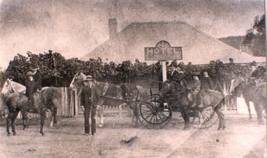
Photograph - Mac's Hotel, Wodonga, c1870s
“Mac's Hotel" in Wodonga West, one of Wodonga's earliest hotels, was owned by William Christie McFarlane who arrived in Melbourne in December 1854 from Stirling, Scotland. He spent his first three years mining for gold at Beechworth. For the next three years he was the manager of the King’s Hotel at Wooragee, which was owned by his father-in-law, Charles David King. In 1860 he bought 180 acres of land at Wodonga, eventually extending his holdings to 1,000 acres on which he farmed. He called his property “Abbey Craig” after his home in Scotland. In time he owned several properties in Wodonga, a small vineyard and 'Mac's Hotel'. Mac’s Hotel was a popular meeting place for teamsters and other travellers on the Sydney Road. It opened in the early 1860s and the license was at times in the name of W. C. McFarlane and at other times held by his wife, Mary McFarlane. William had several positions during his life in Wodonga including serving as Postmaster and conducting a Commission and Insurance Agency business. He was appointed Secretary to the first Wodonga Building Society. W. C. McFarlane also filled the position of Sheriff’s Officer, Registrar of Births and Deaths and Marriages, and Justice of the Peace. W. C. McFarlane served as a member of the Wodonga Shire Council for several years including three terms as Shire President: 1889-90, 1890-1891 and 1894-95. He passed away in Wodonga in December 1906. After his death, the license of Mac’s Hotel continued to be held by Mary McFarlane until her death in November 1910. The license was not renewed and the hotel was taken over as a residence by their son, Walter McFarlane. Unfortunately, on 25 January 1913, Walter was assisting neighbours fighting grass fires about 3 miles away when his own home was completely destroyed by fire, bringing to an end the long history of the popular hostelry, Mac’s Hotel.This image is significant because it documents an early business in Wodonga conducted by a prominent Wodonga resident.Black and white image of people standing, on horseback and in coach outside Mac' Hotel, West Wodongamac's hotel, hotels wodonga -
 Wodonga & District Historical Society Inc
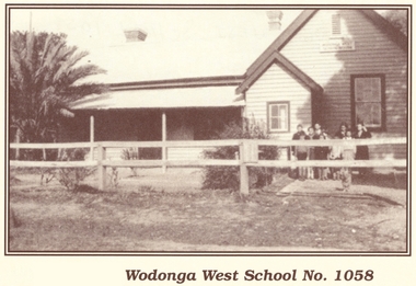
Photograph - Wodonga West School No. 1058
Wodonga West School opened on 24 January 1870 and closed on 9 May 1950. It was located near the current intersection of McKoy Street and the Hume Freeway in West Wodonga on land donated by J.W. Klinge. The school replaced an older school, “Green Hills School, which was located north of the railway line. A public telephone was installed at the school and the mail service operated from the school three days each week. In 1935 a row of 15 ornamental trees was planted along the boundary fence, one for each of the pupils at the school. When this school closed the nine remaining students were transferred to Wodonga Primary School.This image is significant because it documents the early developments in the provision of education in Wodonga, Victoria A black and white photo of a group of children standing outside the Wodonga West School building.wodonga schools, wodonga west primary school, education wodonga -
 Wodonga & District Historical Society Inc
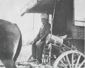
Photograph - Sikh Hawkers in Wodonga
Sikh hawkers were a regular sight throughout the Wodonga and Upper Murray district in the early 20th century. The regular visitors to the area included Pola Singh and Gambil (Gamble) Singh. Gamble Singh often camped on McKoy’s Moorefield property in West Wodonga and several other places around the district. Gamble was also a horse breeder and had several draught horses to pull his wagon. Like many of the hawkers he worked hard to send money back to support family in India. He apparently returned to India about 1950, but left some money in the Bank of NSW in Wodonga in case he returned. He allegedly died soon after and the money was eventually able to be claimed by his nephews in India. A small overlooked park in Wodonga is named the “Gamble Singh Park” in his memory. J. Flanagan who operated the Halfway Hotel commented on having as many as seven or eight bullock teams “yoked” overnight to the fence outside the hotel as well as 100 or more Indian hawkers – led by the fondly known Pola (Pollah) Singh. The hawkers returned to Wodonga annually to renew their hawkers’ license and camped on the flats, or also came to Wodonga to collect orders at the railway station to stock up their supplies. Pola Singh was often based at the Colac Colac reserve near Corryong and had on board his compatriot Isar Singh. He often acted as an intermediary between the individual hawkers and the authorities. Unfortunately, it was Pola’s habit to walk in front of his wagon at the start of each day. On the morning of 23 June 1923 his horses were restive and hard to control. They took flight and ran Pola down on the road near Cudgewa. He was rushed to the Corryong Hospital but died there a few days later, aged 65. Pola was cremated, with some of his ashes scattered in the Murray River and some returned to his homeland to be scattered in the Ganges River. His cremation was listed in the Obituary page of the Weekly Times, Melbourne on Saturday 14 July 1923. A small memorial to Pola Singh is located in the Corryong Cemetery.These images are significant because they help to document the history of the Sikh Hawkers who plied their services to Wodonga and throughout rural Australia in the late 19th and early 20th centuries.A collection of black and white images featuring Sikh Hawkers Gamble Singh and Pola Singh take in the Wodonga area.indian hawkers, sikh hawkers, gamble singh, pola singh -
 Wodonga & District Historical Society Inc
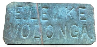
Sign - Name Plate E. Lemke Wodonga
The dairy farm of Eric Lemke and family was located on the Wodonga flats on the Murray River flood plain, west of the Union Bridge. The property was named "Waterford". They ran a large dairy herd (250 cows) and ran five milk carts to Albury to service their customers. The family bought a second property at Wodonga West, on Felltimber Creek, where herds could be rested before calving, and also as an emergency location for milking during times of flood, which sometimes lasted for several weeks at a time. At other times when the cows finished their lactation period at "Waterford" they would be walked to the Lemke property at Wodonga West, for a rest before calving. When the calves were drafted it was a matter of gathering the cows and calves and walking them back home which was an all day job. During the Depression Mr. Lemke took milk to the out-of-work men who slept under the bridges on the causeway and Mrs Lemke would make bread for them. The men would often work on the farm without wages in return for the Lemke's kindness. The Lemke Family are ranked amongst the top early settlers of the district for their perseverance during the hardships of the early days and during the Great Depression. Lemke Road on Gateway Island, Wodonga is named in their honour.This item has local significance because it came from a prominent Wodonga family business.A small metal tag used to label dairy cans on the property of Eric Lemke.E. LEMKE WODONGAe. lemke wodonga, lemke family, wodonga dairy industry, ernie lemke -
 Wodonga & District Historical Society Inc
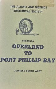
Booklet - Overland to Port Phillip Bay Journey South West, Rosemary Boyes
This publication examines the story of the epic journey of exploration by Hume and Hovell, with their party, from October to December, 1824.A small green covered booklet produced by the Albury and District Historical Society. Printed in black ink.This publication examines the story of the epic journey of exploration by Hume and Hovell, with their party, from October to December, 1824. hume and hovell, australian exploration, australia - exploration and settlement -
 Wodonga & District Historical Society Inc
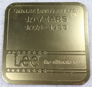
Memorabilia - Souvenir Coasters - H. D. Lee Pty. Ltd, Stephen Daly, 1983
H.D. Lee (Aust) was established in 1973 as a joint venture between Yakka Pty Ltd and Vanity Fair. In 1973 it decided to move to Albury-Wodonga, encouraged by government decentralisation assistance, lower overheads and the central location of the region. H.D. Lee opened a temporary pilot factory with 12 staff in Kiewa Street, Albury, in January 1974 while a new 50,000 sq. ft. factory for 400 staff was built on council land in West Wodonga. This was erected by local builders Zauner Construction, completed in late 1974 and began operations in April 1975. The factory became Australia’s second largest jeans manufacturer and employment in Wodonga at times exceeded 400 staff. In 1991 Yakka, which already owned 50 per cent of the H.D. Lee shares, bought out the rest. It quickly moved to reduce staff and transferred the administration to Broadmeadows. By 1997, the workforce had fallen to 110, and production of Lee and Faberge jeans, jackets and shorts gave way mostly to industrial wear.These coasters represent an industry which was a major employer in Wodonga. The establishment of H. D. Lee (Aust) was a direct result of Australian government's policy of decentralisation in the 1970s. A blue box containing 6 coasters to commemorate 10 years of H.D. Lee operations in Australia. Coasters are gold and include the Lee company logo. The box also includes information regarding the background of the manufacturer, Paul-Stephen Daly.On top half of coaster "H.D. LEE (AUST) PTY LTD /10 YEARS/ 1973-1983" Between lines of stars "Lee the ultimate jean"h.d. lee, wodonga, decentralisation, paul-stephen daly -
 Wodonga & District Historical Society Inc
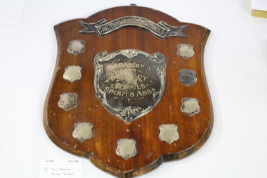
Functional object - Thomas Chubb Shield, C. 1936
The Baranduda and District School Sports Association held its first interschool sporting competition in 1936. Schools included in this association were Allan’s Flat, Bonegilla, Baranduda, Leneva, Mitta Junction, Staghorn Flat and Wodonga West. This commemorative trophy, The Thomas Chubb Shield, was donated to the Sports Association by Mr. Albert John Chubb, in memory of his father. Mr. Thomas Chubb was a successful businessman in Albury and an active supporter of many institutions and community organisations in the Albury Wodonga area. Mr. Albert Chubb actively supported school sports carnivals across the district, including being the official starter at many events.This trophy has local social and cultural significance as it provides evidence of sporting and social interaction between the small schools in the Wodonga and surrounding communities,A wooden shield presented to recognise winners of the Baranduda and District School Sports Association from 1936 to 1949. A metal hanger is attached to the top.On top metal banner "THE THOMAS CHUBB SHIELD" . On central shield "BARANDUDA /AND/DISTRICT/ SCHOOLS/ SPORTS ASSN. On small shields from top to bottom, "LENEVA 1936/ BONEGILLA 1939/ LENEVA 1941/ LENEVA 1949/ LENEVA 1948/ LENEVA 1947/ ALLANS FLAT 1940/ MITTA JUNCTION 1937"baranduda sports association, school sports, wodonga district, thomas chubb -
 Wodonga & District Historical Society Inc
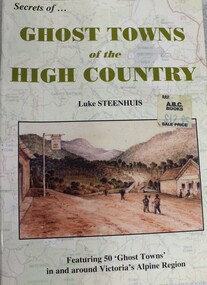
Book - Ghost Towns of the High Country, Luke Steenhuis, 1998
Stories and information about former towns in and around Victoria's Alpine Region. Towns include Boggy Creek, Brandy Creek, Brocket, Brookville, Buckland, Buckland Upper, Bulgoback, Bulltown, Hogtown, Bullumwaal, Canvastown, Cassilis, Cobbannah, Copenhagen, Dargo High Plains, Dartmouth, Deptford, Gibbo River, Gladstone, Glen Dart, Glen Valley, Glen Wills, Good Luck Creek, Granite Flat, Grant, Hinnomunjie, Howittville, Jeff Davis, Lightning Creek, Louisville, Mayford, Merrijig Creek, Mitchelldale, Mount Elmo, Nugong, Sassafras, Saltpetre, Staleyville, Stirling, Store Creek, Summer Hill, Sunnyside, Tabberabbera, Talbotville, Thiel Town, Tongio West, Waterford, Wentworth River, Winchester, Wombat, Wongungarra, Zulu Creek.non-fictionStories and information about former towns in and around Victoria's Alpine Region. Towns include Boggy Creek, Brandy Creek, Brocket, Brookville, Buckland, Buckland Upper, Bulgoback, Bulltown, Hogtown, Bullumwaal, Canvastown, Cassilis, Cobbannah, Copenhagen, Dargo High Plains, Dartmouth, Deptford, Gibbo River, Gladstone, Glen Dart, Glen Valley, Glen Wills, Good Luck Creek, Granite Flat, Grant, Hinnomunjie, Howittville, Jeff Davis, Lightning Creek, Louisville, Mayford, Merrijig Creek, Mitchelldale, Mount Elmo, Nugong, Sassafras, Saltpetre, Staleyville, Stirling, Store Creek, Summer Hill, Sunnyside, Tabberabbera, Talbotville, Thiel Town, Tongio West, Waterford, Wentworth River, Winchester, Wombat, Wongungarra, Zulu Creek.ghost towns, high country victoria, pioneers, history victoria -
 Wodonga & District Historical Society Inc
Book - Overland to Port Phillip Bay Journey South West, Rosemary Boyes, 1974
This publication examines the story of the epic journey of exploration by Hume and Hovell, with their party, from October to December, 1824non-fictionThis publication examines the story of the epic journey of exploration by Hume and Hovell, with their party, from October to December, 1824australia. exploration, hume & hovell expedition. -
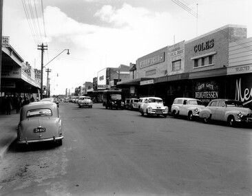 City of Kingston
Photograph - Black and white, c. 1956
... , looking west. On the right hand side of the road there are two..., looking west. On the right hand side of the road there are two... to the reverse of the photograph: COLES BENTLEIGH c. 1956 / Centre Road..., looking west. On the right hand side of the road there are two ...Black and white photograph depicting Centre Road Bentleigh, looking west. On the right hand side of the road there are two Coles stores. The one in the background is the newly opened store while the one in the foreground has been repurposed and is now a delicatessen. There are numerous cars parked on both sides of the road, including one that appears to be "double parked" on the right hand side of the road.Black and white photograph depicting Centre Road Bentleigh, looking west. On the right hand side of the road there are two Coles stores. The one in the background is the newly opened store while the one in the foreground has been repurposed and is now a delicatessen. There are numerous cars parked on both sides of the road, including one that appears to be "double parked" on the right hand side of the road.Handwritten in blue ink on a white sticker adhered to the reverse of the photograph: COLES BENTLEIGH c. 1956 / Centre Road looking west / The Old Coles store is in the foreground / and the new Coles is in the background.bentleigh, suburbs, shopping strip, cars -
 City of Kingston
Photograph - Black and white, 20 December 1945
This aerial photograph depicts the changing landscape of Cheltenham and Highett since WWII. Photographed in 1945, there is a mix of urban dwellings and industrial development and precedes the major transformation of Cheltenham with the development of the Southland shopping centre in the 1960s and expansion in the 1990s.A large part of Cheltenham was originally established as a rural market gardening community. The railway line and station brought urban development to the area and in the north, the Highett area was dominated by the Highett Gas Works. Cheltenham became a major destination for shopping in the 1960s with the opening of Southland.Aerial photograph taken in 1945 of Cheltenham and Highett within the City of Kingston. The image includes the Highett Reserve, (top right), the Methodist Children Homes (now Southland), Nepean Highway and Jamieson Street. Highett Gas Works is visible in the top left and the land now named William Fry Reserve at the intersection of Bay Road and Nepean Highway. A visible large parcel of land on the corner of Bay Road and Nepean Highway was developed in the 1990s as the west side addition to Southland. The densely vegetated area in the upper right sector of the image is now dense with housing. Tulip Grove, Heather Grove and Gilford Street are visible bottom left. This image is possibly from the collection of aerial photographs commissioned by the Department of Crown Lands and Survey and taken by Adastra Airways.Black ink: 57252 White lettering: VIC-10 57252 20.12.45 [lens information indecipherable] PROJ. No.5 MELB. METROP AREA Black pencil: 80highett, cheltenham, highett gas works, urbanisation -
 City of Kingston
Photograph - Black and white, 20 December 1945
This aerial photograph depicts the changing landscape of Cheltenham and Highett since WWII. Photographed in 1945, there is a mix of urban dwellings and industrial development and precedes the major transformation of Cheltenham with the development of the Southland shopping centre in the 1960s and expansion in the 1990s.A large part of Cheltenham was originally established as a rural market gardening community. The railway line and station brought urban development to the area and in the north, the Highett area was dominated by the Highett Gas Works. Cheltenham became a major destination for shopping in the 1960s with the opening of Southland.Aerial photograph taken in 1945 of Cheltenham and Highett within the City of Kingston. The image includes the Highett Reserve, (top right), the Methodist Children Homes (now Southland), Nepean Highway and Jamieson Street. Highett Gas Works is visible in the top left and the land now named William Fry Reserve at the intersection of Bay Road and Nepean Highway. A visible large parcel of land on the corner of Bay Road and Nepean Highway was developed in the 1990s as the west side addition to Southland. The densely vegetated area in the upper right sector of the image is now dense with housing. Tulip Grove, Heather Grove and Gilford Street are visible bottom left. This image is possibly from the collection of aerial photographs commissioned by the Department of Crown Lands and Survey and taken by Adastra Airways.Black type: Reverse lettering VIC-10 57252 20.12.45 [lens information indecipherable] PROJ. No.5 MELB. METROP AREA White lettering: Reverse writing 57252cheltenham, highett, highett gas works, urbanisation -
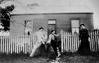 City of Kingston
Photograph - Black and white, c. 1910
The cottage was located on East Boundary Road, near Caleb Street in East Bentleigh. It was owned by Caleb Porter and occupied by Laura Johnson (centre). Also in the photograph are her sister Boletta Hansen Wold (left) and daughter Anna Marie Johnson (right). The dog's name has not been recordedPart of East Bentleigh was inside the original grant of land bought by English farmer and brewer, Henry Dendy, in 1841. He bought 5,120 acres (20.7 km2) which was bounded on the west by Port Phillip Bay, then North Road, East Boundary Road and South Road.Black and white image of three women and a dog standing outside a small weatherboard cottage with a picket fence. Round white sticker with black printed text: 140 Handwritten in red ink: 55%east bentleigh, caleb porter, laura johnson, boletta hansen wold, anna marie johnson -
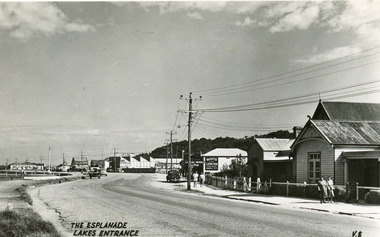 Lakes Entrance Historical Society
Postcard - Lakes Entrance, 1940c
From a wallet of miniature postcards produced by H D Bulmer for sale to touristsBlack and white small format post card of Esplanade, looking west. Buildings identified are the Club Hotel, Mitcheleson's Fancy Goods, Coate Bros Garage (later Crawford's), Broomes Auto Park, John's Milk Bar, Methodist Manse. Lakes Entrance VictoriaThe Esplanade Lakes Entrancetownship, roads and streets, retail trade -
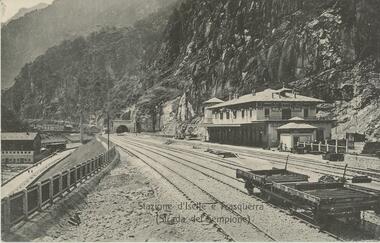 Bendigo Historical Society Inc.
Postcard - ROY AND DORIS KELLY COLLECTION: STAZIONE D'ISELLE E TRASQUERRA (STRADA DEL SEMPIONE), CARTE POSTALE, 1900-1920
Postcard, B&W photo of the railway station serving the villages of Iselle and Trasquerra in the Piedmont region of north west Italy. It was opened in 1906. The rail tracks lead to the entrance of the Simplon Tunnel in the distance. An empty flat tray carriage sits on the tracks (lower right). Part of the the Simplon road (Strada del Sempione) is shown at lower left. This road connects Italy to Switzerland.postcard, photograph, postcard, iselle, trasquerra, italy, station, simplon tunnel. -
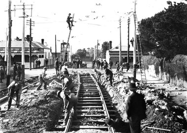 Ballarat Tramway Museum
Photograph - Geelong Tramway relaying tracks
Relaying tram tracks at the eastern end of Aphrasia St., Newtown, looking east. The location is immediately west of the Pleasant St. intersection, soon after Aphrasia St. was extended from Pleasant St. to Pakington St. so that the three sharp curves for trams into Retreat Road, Pleasant St. and then Aphrasia St. were reduced to one, from Pakington into Aphrasia St. May 1914. Note that sleepers are being used 8in the construction. All the original tracks were laid as a "stringer" construction, as seen in items 9271 and 9214, with tie bars and continuous concrete about 50cm wide under each rail. The overhead is being worked on in two ways; safely with the horse drawn tower wagon, or less so by ladder.Black and white print on paper.GSR710/25/1/8 and 25-8, written on the reverse in pencil. The No. 1 in a circle written on reverse in ink.geelong tramway, relaying stringer tram tracks in geelong, stringer tram tracks, aphrasia st. -
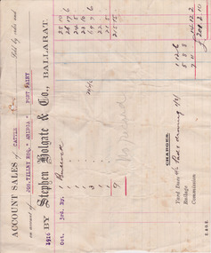 Warrnambool and District Historical Society Inc.
Document - Docket, Wilson & Anderson Jos Tilley 1916, 1916
This docket from the firm of Stephen Holgate and Co. of Ballarat gives details of this firm’s sale in 1916 of nine bullocks on behalf of Joseph Tilley of ‘Aringa’ of Port Fairy. The sale yielded £215-15-0 and, with costs of £14-12-2, the profit for Joseph Tilley was £201-2-10. Stephen Holgate established his auctioneering firm in Ballarat in the late 19th century and was an authority on sheep and cattle breeding. Joseph Tilley was farming at ‘Aringa’ in the early 20th century and also owned the Penshurst Hotel. ‘Aringa’, five miles west of Port Fairy on the Portland Road, was established by John Ritchie in 1839.This docket is of some importance as it is an original one and gives details of a 1916 sale of cattle with the names Joseph Tilley and Stephen Holgate of interest. It gives us the prices for bullocks in 1916 and the type of receipt forms used at that time.This is an original receipt for an account sale of 1916. The docket is a printed one from the firm of Stephen Holgate and Co. of Ballarat with printed blue and red lines for entering the details of the sale. The client’ s name is typed in blue type and the details of the sale are handwritten. On the back of the docket: ‘Wm Delaney from Lin Shoppee’ ‘1916’aringa, joseph tilley, stephen holgate and co. -
 Lakes Entrance Historical Society
Book, Gippsland Heritage Journal No 10, 1991
Issue 10 of a series show casing Gippsland history contains articles on Ferdomamd Mueller. Eva West. Louise Morris. Parry Okeden Family. Bungelene John Flynn. Martha Harris. Stout photographers. N J Caire and John Young Westencroft the Gippsland Road 1836settlers, photography, cemeteries -
 Bacchus Marsh & District Historical Society
Map, Plan of land purchased by the Bacchus Marsh Shire Council from Mr. T. Low for a deviation of the Melbourne to Ballarat main road. 1877
The date of this plan is 1877 and the land indicted on it required for a road deviation is shaded in blue. It adjoins the Korkuperrimul Creek on one side which indicates the land is located just a few kilometers to the west of Bacchus Marsh. Single page map showing a portion of land purchased by the Bacchus Marsh Shire from Mr Thomas Low for the purpose of a road deviation. Land held by David Robertson is also shown on the map. Scale: 2 chains to 1 inch. Part of a set of maps which are pasted into a bound volume containing 76 maps or plans in total. High resolution digital image stored on BMDHS computer network. Surveyed by W. E. Standfield, Shire Engineer, Bacchus Marsh, 12/4/77bacchus marsh roads and streets, melbourne to ballarat road -
 Ringwood and District Historical Society
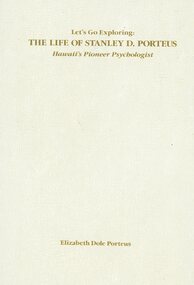
Book, Elizabeth Dole Porteus, Let's Go Exploring: The Life Of Stanley D. Porteus - Hawaii's Pioneer Psychologist, 1991
White hard covered book. Biography by daughter-in-law of Stanley Porteus, pioneer of modern psychology and one-time resident of Ringwood, Victoria. SUMMARY NOTES. Stanley David Porteus was born in Box Hill, Victoria, Australia in 1883, the only son of a Methodist minister. Like other now large suburbs of Melbourne such as Canterbury, Mitcham and Ringwood, Box Hill was a mere village. Each was surrounded by bush. He grew up like most Australian boys with a love of sport and, although lightly built, did quite well at Australian Rules football and was above average at cricket. He became a schoolteacher with the Victorian Education Department. Promotion within the department depended on experience gained at teaching in tiny rural schools so he applied for such a position at Glenaladale, on the Dargo Road, some 35 miles north west of Bairnsdale. He walked about 6 miles from the nearest railway station at Fernbank to find the school surrounded by virgin forest with only one dwelling in sight. Attached to the school were lean-to rooms that were to be his residence for the next 2 ½ years. He was fascinated by the nearby Den of Nargun and Bull Creek, which joined the Mitchell River in a deep gorge containing a profusion of rainforest vegetation. While at Glenaladale, he met Frances Evans who became his wife. To seek promotion, he left Glenaladale and taught at Leneva and Benambra. While at the latter school, he learned of a position becoming available as superintendent of special schools in Melbourne. As the available means of transport, coach and horses to Bairnsdale, then by train to Melbourne, would not get him to Melbourne before the close of applications, he borrowed a bicycle and rode through the bush to his in-laws home at Lindenow and thus made it before the deadline. He was successful in his application and it set him on a course that lead to him becoming Australia's first Clinical Psychologist. His work, particularly, the development of the Porteus Maze Test, attracted the attention of American educators and he was offered an appointment for a year at Vineland Training School in New Jersey. On a stopover in Honolulu, he was impressed to the extent that he expressed a desire to work there. Not the least of its attractions was the mix of races that offered opportunities to study psychological differences, if any, between various races. His wish was to be granted unexpectedly as he was, in 1919, invited to Honolulu to set up a Psychological and Psychopathic Clinic at the University of Hawaii. From his home in the hills north of Honolulu, on December 7th 1941, he saw the Japanese attack on Pearl Harbour. He lived there until his death in about 1980. -
 Bacchus Marsh & District Historical Society
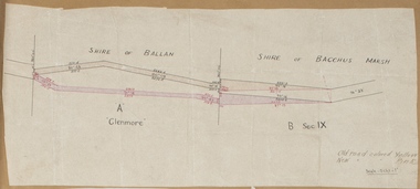
Map, Road plan deviation near Glenmore
... This plan shows a proposed deviation in the road near ...This plan shows a proposed deviation in the road near Glenmore. This is likely to have been the Bacchus Marsh to Ballan road. The precise date of the plan has not been established. Proposed deviations to the road near Glenmore appear in reports in the Bacchus Marsh Express newspaper through many decades, especially in the 1870s and 1880s. Glenmore is located 19 kilometers west of Bacchus Marsh.A single page paper map showing a plan for a road deviation near Glenmore Station. Scale 5 chains to 1 inch. Date of production unknown. Circa 1860s-1890s. The map is pasted into a bound volume containing 76 maps or plans in total. High resolution digital image stored on BMDHS computer network. Old road colored Yellow, New road colored Pinkroad plans, road construction, glenmore victoria maps -
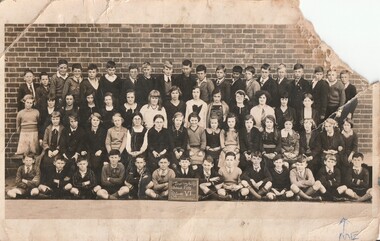 Surrey Hills Historical Society Collection
Work on paper - Photograph, Surrey Hills State School 2778, Grade 6, 1935, 1935
Information from the donor by email gives: Norma Pryde is identified as the girl in the second row on the far right. Her parents Norman & Hilda Pryde lived at 50 Broughton Road, Surrey Hills. The home was named 'Strathaven' after the town in Scotland where Norman's father came from. Norman & Hilda were married in 1923. Norma was born in 1924. Norman worked for Moran & Cato so the family moved around a lot for his work and is thought to have rented out the house from time to time. During some time in the 1920s they were listed on electoral rolls in Nyah West and then in 1942 they were listed in Hamilton. When the war ended they came back to Melbourne and in the late 1940s built a home at Blackburn. Norma married John Cleak in 1947 in Camberwell. This photo is representative of the large classes that were common in the interwar period.An original B&W postcard photo of a class taken outside against a brick wall. There are 34 boys in 2 rows. The back row of 20 boys would have been standing on a bench and in the front row the 14 boys are seated on the ground. The girls are standing in 2 rows - 14 girls in the second back row and 16 girls in the second front row. A total of 64 students. There does not appear to be a standard uniform.Front: In blue ballpoint: An arrow + ME Rear: In grey lead pencil on the LHS: "Miss N Pryde / Kitchener Rd / Croydon / Vic"; a stamp in purple ink on the RHS: "SUZANNE ET CIE PTY. LTD. / 357 COLLINS STREET / MELBOURNE." In addition a diagonal blue squiggle.surrey hills, norma pryde, norma cleak, jenny pomeray, surrey hills state school 2778, education, 1930-1939, 1935