Showing 2312 items
matching infrastructure
-
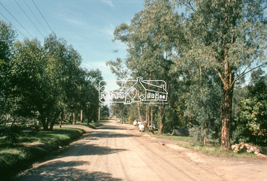
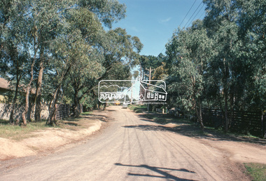
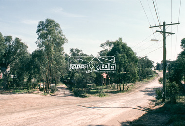
 Eltham District Historical Society Inc
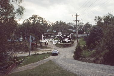
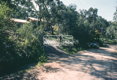
Slide, Bonds Road, Lower Plenty, Mar. 1981
One of a series of images of road infrastructure focussed on Bonds Road, Lower Plenty, the section connecting Old Eltham Road with Rosehill Road, taken by Eltham Shire Council Planning and Engineering officers. They provide perspective of the changes in housing styles and road development that began sweeping in from the mid 1970s with increasing urbanisation of what was once more outlying suburbs and regions. All images have been identified with GPS35 mm colour positive transparency (1 of 13) Mount - Kodak Kodachrome CardProcessed Mar 1981infrastructure, roads, bonds road, lower plenty, rosehill road -
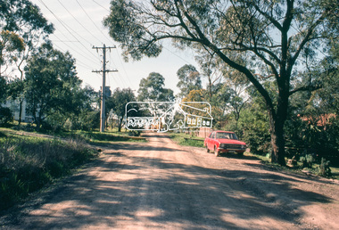
 Eltham District Historical Society Inc
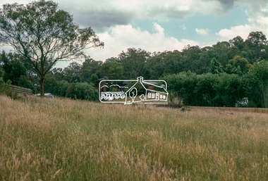
Slide, Bonds Road, Lower Plenty, Mar. 1981
One of a series of images of road infrastructure focussed on Bonds Road, Lower Plenty, the section connecting Old Eltham Road with Rosehill Road, taken by Eltham Shire Council Planning and Engineering officers. They provide perspective of the changes in housing styles and road development that began sweeping in from the mid 1970s with increasing urbanisation of what was once more outlying suburbs and regions. All images have been identified with GPS35 mm colour positive transparency (1 of 13) Mount - Kodak Kodachrome CardProcessed Mar 1981infrastructure, roads, bonds road, lower plenty, rosehill road -
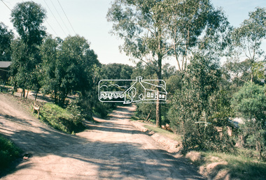
 Eltham District Historical Society Inc
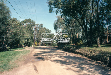
Slide, Bonds Road, Lower Plenty, Mar. 1981
One of a series of images of road infrastructure focussed on Bonds Road, Lower Plenty, the section connecting Old Eltham Road with Rosehill Road, taken by Eltham Shire Council Planning and Engineering officers. They provide perspective of the changes in housing styles and road development that began sweeping in from the mid 1970s with increasing urbanisation of what was once more outlying suburbs and regions. All images have been identified with GPS35 mm colour positive transparency (1 of 13) Mount - Kodak Kodachrome CardProcessed Mar 1981infrastructure, roads, bonds road, lower plenty, rosehill road -
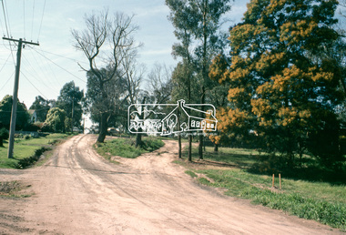
 Eltham District Historical Society Inc
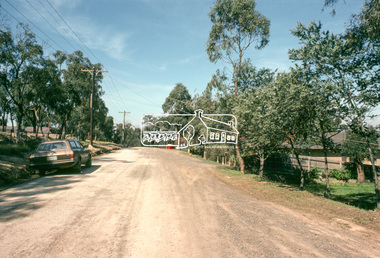
Slide, Bonds Road, Lower Plenty, Mar. 1981
One of a series of images of road infrastructure focussed on Bonds Road, Lower Plenty, the section connecting Old Eltham Road with Rosehill Road, taken by Eltham Shire Council Planning and Engineering officers. They provide perspective of the changes in housing styles and road development that began sweeping in from the mid 1970s with increasing urbanisation of what was once more outlying suburbs and regions. All images have been identified with GPS35 mm colour positive transparency (1 of 13) Mount - Kodak Kodachrome CardProcessed Mar 1981infrastructure, roads, bonds road, lower plenty, old eltham road -
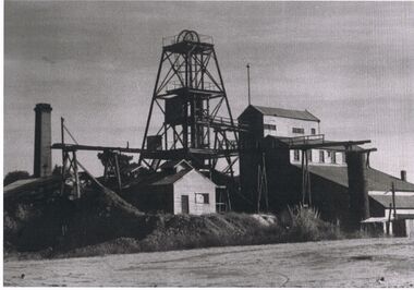 Bendigo Historical Society Inc.
Photograph - BLACK AND WHITE PHOTOGRAPH OF THE BIG DEBORAH MINE
black and white photograph of the Big Deborah mine, showing infrastructure, chimney, large steel tank. Note the absence of cables from top of the poppet to the engine room.mining, surface equipment, big deborah mine. -
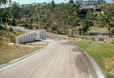
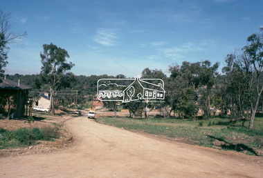
 Eltham District Historical Society Inc
Slide - Photograph, Lomic Court, Templestowe, c.Mar. 1985
Eltham Shire Council officers would benchmark road infrastructure in surrounding local government areas. In this case, a private street scheme in a new housing development on Lomic Court, Telmplestowe in what is present-day Manningham City Council. Areas of interest in the photo are the roll over concrete kerbs, brick paving and drainage.35mm colour positive transparency (1 of 15) Mount - Kodak Kodachrome Cardinfrastructure, roads, city of manningham, footpaths and gutters, housing estates, templestowe, lomic court -
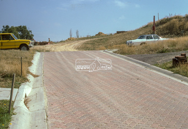
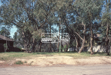
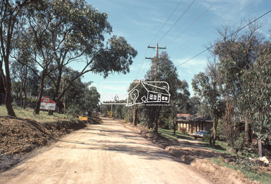
 Eltham District Historical Society Inc
Slide - Photograph, Road infrastucture, new housing development, most likely Templestowe, c.Mar. 1985
Eltham Shire Council officers would benchmark road infrastructure in surrounding local government areas. In this case, the street is most likely a private street scheme in a new housing development in what is present-day Manningham City Council. Areas of interest in the phioto are the roll over concrete kerbs, brick paving at road entrace and drainage.35mm colour positive transparency (1 of 15) Mount - Kodak Kodachrome Cardinfrastructure, roads, city of manningham, footpaths and gutters, housing estates, unidentified, templestowe -
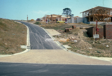
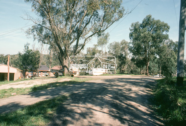
 Eltham District Historical Society Inc
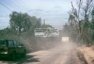
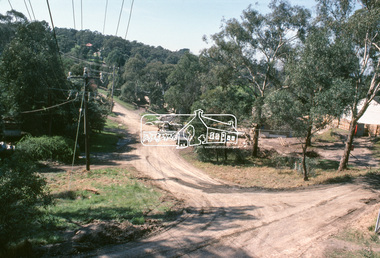
Slide, Quinn Estate from Sackville Street looking west to 'T-bowl' near Main Road, Montmorency, c.Oct. 1980
One of a series of images of roads and infrastructure focussed on the Quinn Estate in Montmorency taken by Eltham Shire Council Planning and Engineering officers. They provide perspective of the changes in housing styles and road development that began sweeping in from the mid 1970s with increasing urbanisation of what was once more outlying suburbs and regions.35 mm colour positive transparency Mount - Kodak Kodachrome CardProcessed Oct 1980roads, housing estate, infrastructure, main road, montmorency, quinn estate, sackville street, t-bowl -
 Eltham District Historical Society Inc
Photograph, Undeveloped land, Beard Street, Eltham, Dec. 1980
Roll of film taken by Eltham Shire Council officers of roads and houses in the Eltham East area in December 1980. They provide perspective of the changes in housing styles and road development that began sweeping in from the mid 1970s with increasing urbanisation of what was once more outlying suburbs and regions. Typically part of the Beard street group, a private street scheme that developed the road infrastructure commencing in February 1982.35mm colour positive transparency Mount - Kodak Kodachrome Cardeltham, housing estate, infrastructure, roads, andrews street, beard street -
 Eltham District Historical Society Inc
Photograph, Frank Street, Eltham, Dec. 1980
Roll of film taken by Eltham Shire Council officers of roads and houses in the Eltham East area in December 1980. They provide perspective of the changes in housing styles and road development that began sweeping in from the mid 1970s with increasing urbanisation of what was once more outlying suburbs and regions. Typically part of the Beard street group, a private street scheme that developed the road infrastructure commencing in February 1982.35mm colour positive transparency Mount - Kodak Kodachrome Cardeltham, housing estate, infrastructure, roads, frank street, beard street -
 Eltham District Historical Society Inc
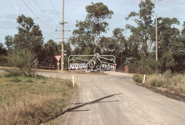
Slide, Quinn Estate, Sackville Street, Montmorency, 15 Sep. 1982
One of a series of images of roads and infrastructure taken by Eltham Shire Council Planning and Engineering officers of the Quinn Estate in Montmorency, Stage 1, Private Street Scheme during construction, September 1982. They provide perspective of the changes in housing styles and road development that began sweeping in from the mid 1970s with increasing urbanisation of what was once more outlying suburbs and regions.35 mm colour positive transparency (1 of15) Mount - Kodak Kodachrome CardProcessed 15 Sep1980housing estate, infrastructure, montmorency, quinn estate, roads, sackville street, private street scheme -
 Eltham District Historical Society Inc
Slide, Quinn Estate, Reichelt Avenue, Montmorency, 15 Sep. 1982
One of a series of images of roads and infrastructure taken by Eltham Shire Council Planning and Engineering officers of the Quinn Estate in Montmorency, Stage 1, Private Street Scheme during construction, September 1982. They provide perspective of the changes in housing styles and road development that began sweeping in from the mid 1970s with increasing urbanisation of what was once more outlying suburbs and regions.35 mm colour positive transparency (1 of15) Mount - Kodak Kodachrome CardProcessed 15 Sep1980housing estate, infrastructure, montmorency, quinn estate, roads, private street scheme, reichelt avenue -
 Eltham District Historical Society Inc
Slide, Quinn Estate, Buena Vista Drive, Montmorency, 15 Sep. 1982
One of a series of images of roads and infrastructure taken by Eltham Shire Council Planning and Engineering officers of the Quinn Estate in Montmorency, Stage 1, Private Street Scheme during construction, September 1982. They provide perspective of the changes in housing styles and road development that began sweeping in from the mid 1970s with increasing urbanisation of what was once more outlying suburbs and regions.35 mm colour positive transparency (1 of15) Mount - Kodak Kodachrome CardProcessed 15 Sep1980housing estate, infrastructure, montmorency, quinn estate, roads, private street scheme, buena vista drive -
 Eltham District Historical Society Inc
Slide, Quinn Estate, Reichelt Avenue, Montmorency, 15 Sep. 1982
One of a series of images of roads and infrastructure taken by Eltham Shire Council Planning and Engineering officers of the Quinn Estate in Montmorency, Stage 1, Private Street Scheme during construction, September 1982. They provide perspective of the changes in housing styles and road development that began sweeping in from the mid 1970s with increasing urbanisation of what was once more outlying suburbs and regions.35 mm colour positive transparency (1 of15) Mount - Kodak Kodachrome CardProcessed 15 Sep1980housing estate, infrastructure, montmorency, quinn estate, roads, private street scheme, reichelt avenue -
 Eltham District Historical Society Inc
Slide, Quinn Estate, McCarthy Grove, Montmorency, 15 Sep. 1982
One of a series of images of roads and infrastructure taken by Eltham Shire Council Planning and Engineering officers of the Quinn Estate in Montmorency, Stage 1, Private Street Scheme during construction, September 1982. They provide perspective of the changes in housing styles and road development that began sweeping in from the mid 1970s with increasing urbanisation of what was once more outlying suburbs and regions.35 mm colour positive transparency (1 of15) Mount - Kodak Kodachrome CardProcessed 15 Sep1980housing estate, infrastructure, montmorency, quinn estate, roads, private street scheme, mccarthy grove -
 Eltham District Historical Society Inc
Slide, Quinn Estate, Reichelt Avenue, Montmorency, 15 Sep. 1982
One of a series of images of roads and infrastructure taken by Eltham Shire Council Planning and Engineering officers of the Quinn Estate in Montmorency, Stage 1, Private Street Scheme during construction, September 1982. They provide perspective of the changes in housing styles and road development that began sweeping in from the mid 1970s with increasing urbanisation of what was once more outlying suburbs and regions.35 mm colour positive transparency (1 of15) Mount - Kodak Kodachrome CardProcessed 15 Sep1980housing estate, infrastructure, montmorency, quinn estate, roads, private street scheme, reichelt avenue -
 Eltham District Historical Society Inc
Slide, Quinn Estate, Reichelt Avenue, Montmorency, 15 Sep. 1982
One of a series of images of roads and infrastructure taken by Eltham Shire Council Planning and Engineering officers of the Quinn Estate in Montmorency, Stage 1, Private Street Scheme during construction, September 1982. They provide perspective of the changes in housing styles and road development that began sweeping in from the mid 1970s with increasing urbanisation of what was once more outlying suburbs and regions.35 mm colour positive transparency (1 of15) Mount - Kodak Kodachrome CardProcessed 15 Sep1980housing estate, infrastructure, montmorency, quinn estate, roads, private street scheme, reichelt avenue -
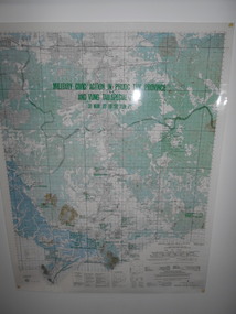 National Vietnam Veterans Museum (NVVM)
Map, Military Civic Action in Phuoc Tuy Province
Laminated map of civil action in Phuoc Tuy Province and Vung Tau Special Zone in the period of March 1970 to June 1971. Details housing, schools, hospitals & infrastructure projects.civil action, phuoc tuy, vung tau -
 Whitehorse Historical Society Inc.
Article, Rowe Corp excels again, 1992
Nunawading electrical contractor, Rowe Corporation, were runners-up in the annual electrical industry's excellence award.Nunawading electrical contractor, Rowe Corporation, were runners-up in the annual electrical industry's excellence award. They were nominated for the award improving infrastructure facilities at Melbourne International Airport.Nunawading electrical contractor, Rowe Corporation, were runners-up in the annual electrical industry's excellence award. technology, rowe corporation ltd, rowe, max, thompson, peter -
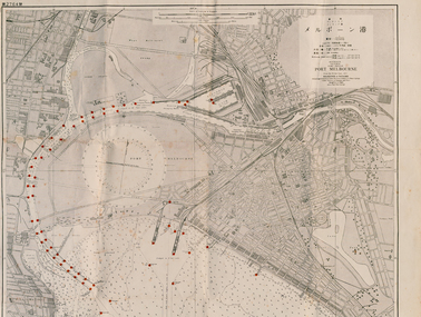 Port Melbourne Historical & Preservation Society
Map - Large map of Port Melbourne with Japanese annotation, British Chart, Port Melbourne, c 1937
Jim Sinclair was born in Cruickshank Street, Port Melbourne in 1924. During World War II Jim found this Japanese map in a network of caves near Rabaul, Papua New Guinea. He remembers '"The Japanese] had linked just about every hill with a tunnel. Concreted. Most of them were packed with stuff. I used to wander through - being very careful too, mind you!. You didn't want yourself to get blown up. I found these maps. I thought that looks familiar! It's in English with Japanese stuff on it too."A large 1937 British map of Port Melbourne with Japanese printed annotations with strategic infrastructure marked. Used during World War II. Stamp on back explains age in Japanese. war - world war ii, port of melbourne, jim sinclair, japanese -
 Eltham District Historical Society Inc
Slide, Quinn Estate, Quinn Way, Montmorency, 15 Sep. 1982
One of a series of images of roads and infrastructure taken by Eltham Shire Council Planning and Engineering officers of the Quinn Estate in Montmorency, Stage 1, Private Street Scheme during construction, September 1982. They provide perspective of the changes in housing styles and road development that began sweeping in from the mid 1970s with increasing urbanisation of what was once more outlying suburbs and regions.35 mm colour positive transparency (1 of15) Mount - Kodak Kodachrome CardProcessed 15 Sep1980housing estate, infrastructure, montmorency, quinn estate, roads, sackville street, private street scheme, quinn way -
 Eltham District Historical Society Inc
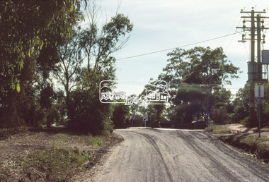
Slide, Quinn Estate, Cressy Street, Montmorency, 15 Sep. 1982
One of a series of images of roads and infrastructure taken by Eltham Shire Council Planning and Engineering officers of the Quinn Estate in Montmorency, Stage 1, Private Street Scheme during construction, September 1982. They provide perspective of the changes in housing styles and road development that began sweeping in from the mid 1970s with increasing urbanisation of what was once more outlying suburbs and regions.35 mm colour positive transparency (1 of15) Mount - Kodak Kodachrome CardProcessed 15 Sep1980housing estate, infrastructure, montmorency, quinn estate, roads, private street scheme, cressy street, nicholas lauder real estate -
 Eltham District Historical Society Inc
Slide, Quinn Estate, Reichelt Avenue, Montmorency, 15 Sep. 1982
One of a series of images of roads and infrastructure taken by Eltham Shire Council Planning and Engineering officers of the Quinn Estate in Montmorency, Stage 1, Private Street Scheme during construction, September 1982. They provide perspective of the changes in housing styles and road development that began sweeping in from the mid 1970s with increasing urbanisation of what was once more outlying suburbs and regions.35 mm colour positive transparency (1 of15) Mount - Kodak Kodachrome CardProcessed 15 Sep1980housing estate, infrastructure, montmorency, quinn estate, roads, private street scheme, mccarthy grove, reichelt avenue -
 Eltham District Historical Society Inc
Slide, Quinn Estate, Reichelt Avenue, Montmorency, 15 Sep. 1982
One of a series of images of roads and infrastructure taken by Eltham Shire Council Planning and Engineering officers of the Quinn Estate in Montmorency, Stage 1, Private Street Scheme during construction, September 1982. They provide perspective of the changes in housing styles and road development that began sweeping in from the mid 1970s with increasing urbanisation of what was once more outlying suburbs and regions.35 mm colour positive transparency (1 of15) Mount - Kodak Kodachrome CardProcessed 15 Sep1980housing estate, infrastructure, montmorency, quinn estate, roads, private street scheme, footpaths and gutters, reichelt avenue -
 Eltham District Historical Society Inc
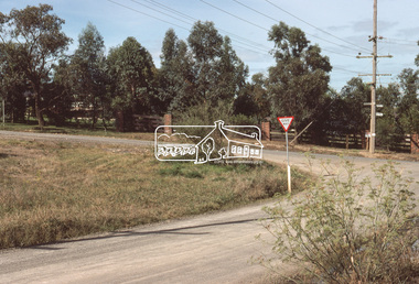
Slide, Quinn Estate, Sackville Street, Montmorency, 15 Sep. 1982
One of a series of images of roads and infrastructure taken by Eltham Shire Council Planning and Engineering officers of the Quinn Estate in Montmorency, Stage 1, Private Street Scheme during construction, September 1982. They provide perspective of the changes in housing styles and road development that began sweeping in from the mid 1970s with increasing urbanisation of what was once more outlying suburbs and regions.35 mm colour positive transparency (1 of15) Mount - Kodak Kodachrome CardProcessed 15 Sep1980housing estate, infrastructure, montmorency, quinn estate, roads, private street scheme, sackville street, t-bowl -
 Melbourne Tram Museum
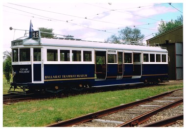
Photograph - Set of two Colour Prints, John Phillips DOI, early 1980's to mid 1990's
.1 - Colour print of Ballarat Tramway Museum W4 671 outside the Ballarat depot, following repainting to the blue colour scheme mid 1990's. Photographed by John Phillips for the Dept. of Transport. .2 - W4 671 running in Melbourne, during early 1996, on the City Circle in Spring St Melbourne, advertising the Ballarat Begonia Festival with the Princes Theatre and Holmes Colleges buildings in the background. Has number "96-35-25" on rear. Printed on Kodak paper.Each photo has on the rear a "Copyright Department of Infrastructure with details for reordering and a hand written letters "JP" unless noted above.trams, tramways, ballarat, btm, w4 class, spring st, tram 671, city circle