


Historical information
Jim Sinclair was born in Cruikshank Street, Port Melbourne in 1924.
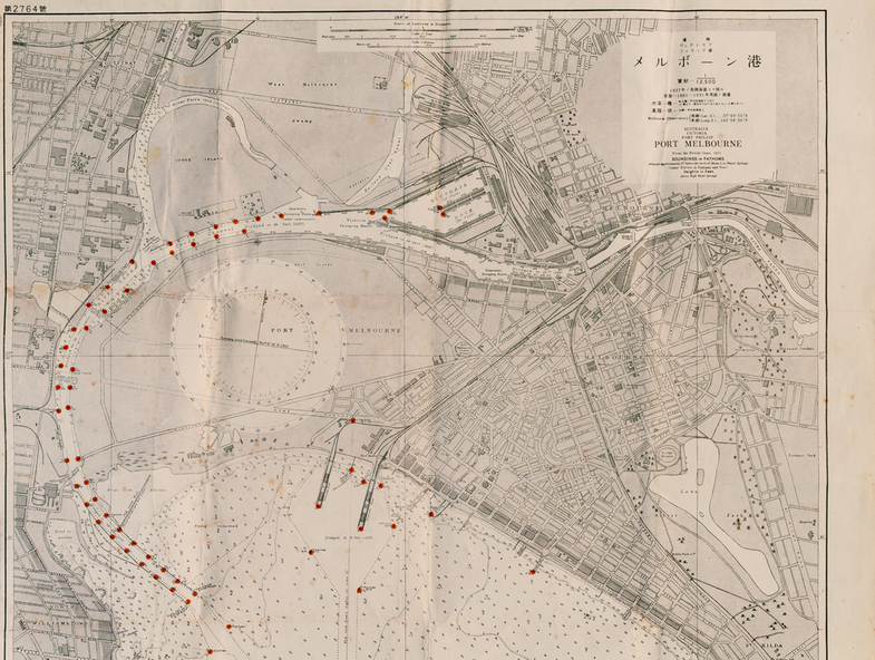
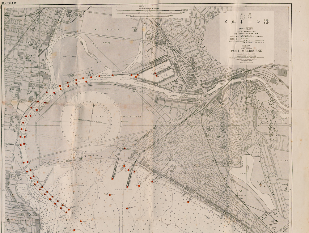
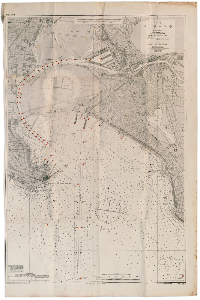
During World War II Jim found this Japanese map in a network of caves near Rabaul, Papua New Guinea. He remembers '"The Japanese had linked just about every hill with a tunnel. Concreted. Most of them were packed with stuff. I used to wander through - being very careful too, mind you!. You didn't want yourself to get blown up. I found these maps. I thought that looks familiar! It's in English with Japanese stuff on it too."
Physical description
A large 1937 British map of Port Melbourne with Japanese printed annotations with strategic infrastructure marked. Used during World War II. Stamp on back explains age in Japanese.
Subjects
References
- Interview with Jim Sinclair Janet Bolitho and John May interviewed Jim Sinclair about growing up in Port Melbourne and his life in general. 9 September 2020.