Showing 14724 items matching "country"
-
 Eltham District Historical Society Inc
Document - Survey Plan, Country Roads Board, SP 6559-6560, Eltham-Yarra Glen Road; Elsa Ct to Luck St, 1957
1957 C.R.B. Plan of Survey of Part of Crown Portion 13 Section 4 and Crown Allotment 1 Section 1 Parish of Nillumbik, County of Evelyn Eltham-Yarra Glen Road, Shire of Eltham Shows Surveyor field notes, property ownership and building type and construction.eltham-yarra glen road, country roads board, eltham, main road, survey plan, 1957, a.m. & a.a. iowerson, a.mcg. hepburn, cecil street, coffee lounge, diamond street, e.g. murrell, elsa court, h.b. woodhead, j.c. & s.i. harding, la ronde, luck street, r.m. & v.m. white, r.n. mowatt, the board of land & works, w.g. hains, neil webster collection -
 Eltham District Historical Society Inc
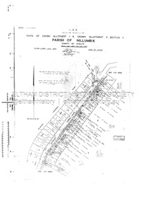
Document - Survey Plan, Country Roads Board, SP 6561, Eltham-Yarra Glen Road; Park Rd to Bellevue Rd, 1957
1957 C.R.B. Plan of Survey of Parts of Crown Allotment 1 & Crown Allotment F, Section II Parish of Nillumbik, County of Evelyn Eltham-Yarra Glen Road, Shire of Eltham Shows Surveyor field notes, property ownership and building type and construction.eltham-yarra glen road, country roads board, eltham, main road, survey plan, 1957, a.r. thomas, b. & b.d. hearn, b.g. anderson, bellevue road, e.m. pitts, f.a. m. macrae, g.e. & b. moulder, j. bromley, j.m. & s.g. johnstone, k.f. pitts, l.c. docksey, m. & e.c.w. baart, m.p. bromley, n.r. ord, p.j. & g.e. murphy, park road, r.a. bruce, r.a. macbeth, r.w. shearing, railway road, s.e. & y.p. houghton, w.k. bell, w.s.r. & f.n. toley, neil webster collection -
 Marysville & District Historical Society
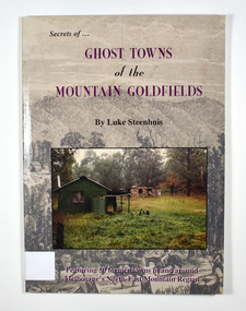
Book - Paperback book, Ghost Towns of the Mountain Goldfields, 1999
Ghost towns of the mountain goldfields in VictoriaPaperback. Cover has a drawing depicting horses, both ridden and pack, walking along a forest track on their way to a small town. There are heavily forested mountains in the distance. Overlaid onto the drawing is a modern photograph of an old stone building. In the foreground is a green timber building with a water tank and verandah. It is all set in the clearing in the middle of a forest.Stamp of the Marysville & District Historical Society Inc / P.O. Box 22 / Marysville 3779 Also the inscription: To Alma / Thanks for your help / Signature / LS / November 1999gold, gold mining, gold town, ghost town, victoria, australia, history -
 Bendigo Military Museum
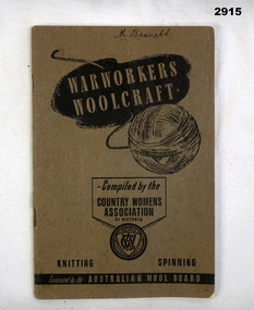
Book - BOOK, CWA, Country Women's Association, Vic, Warworkers Woolcraft, c.1930
Book belonged to Melba Bennett, her story is on notes enclosed with worksheet.Book, khaki soft cover with title on black panel on front which is illustrated with black line drawing of a ball of wool. 32 pages of knitting patterns for items suitable for soldiers.Front cover: “M Bennett” , also handwritten on top of 1st page.books - collections, handcraft - knitting, cwa -
 Bendigo Military Museum
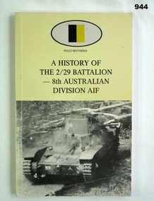
Book, 2/29 Battalion AIF Association, A History of the 2/29th Battalion - 8th Australian 8th Division, AIF, 1991
Book, soft cover, black print on front, back & spine. Black & white photograph of military tank & 2/29 Battalion colour patch on front cover with light yellow colour background. 224 cut plain pages, illustrated black & white photographs. Handwritten in black in on title page: To Bill Toan Thanks for getting me (nice and pissed in Singapore) Feb 1992 My son Peter joins me in sending best wishes Kind regards Clem Sheppard. Donated by Bgo Y Mens Club In black ink on front page: RSL Stampbooks, military history -
 Phillip Island and District Historical Society Inc.
Book, RATCLIFFE, Dorothy Una (Una McGrigor Phillips), book of the microcosm
Labelled 'Cowes Free Public Library', 'Presented by Mrs. McGrigor Phillips (Dorothy Una Ratcliffe) to the Public Library, Cowes, Phillip Island'. -
Phillip Island and District Historical Society Inc.
Book, RATCLIFFE, Dorothy Una (Una McGrigor Phillips), Swallow of the sea : pages from a yacht's log, 1937
Labelled 'Presented by Mrs McGrigor Phillips (Dorothy Una Ratcliffe) to the Public Library, Cowes, Phillip Island', 'Cowes Free Public Library'. Loose flier inside front cover '42 Ann Street, Edinburgh 4, June 1956, with good wishes from D.U. McGrigor Phillips'. Stamped 'Cowes Free Public Library'. -
 Greensborough Historical Society
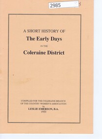
Pamphlet, Leslie Emerson et al, A Short history of the early days in the Coleraine district, by Leslie Emerson, 1953_
Notes relating to Major Mitchell's survey in 1836, Henty Family involvement in the Western District and beginnings of the town of Coleraine in 1839.Eight page pamphlet with pink covercoleraine -
 Eltham District Historical Society Inc
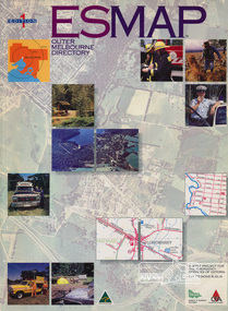
Book, Country Fire Authority Mapping Association Inc, ESMAP - Outer Melbourne Directory, 1991
Outer Melbourne directory of information for emergencies with maps of the state and major towns217 p. : maps ; 30 cm.ISBN 0646065661emergency services victoria -
 Federation University Historical Collection
Book, The Architecture Club, Recent English Architecture, 1947, 1947
Blue hardcover book with numerous illustrations.english architecture, ballarat technical art school, the architecture club -
 Victorian Aboriginal Corporation for Languages
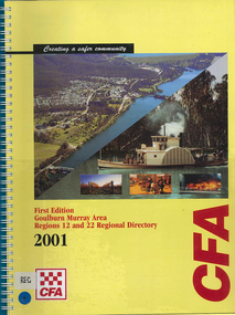
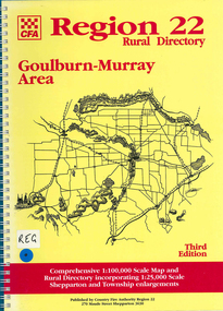
Map, Country Fire Authority, Goulburn Murray Area regions 12 and 22 regional directory, 2001
mapsgoulburn river, fire protection districts, northern victoria -
 Victorian Aboriginal Corporation for Languages
Map, Country Fire Authority, Region 22 rural directory Goulburn-Murray area, 1997
mapsgoulburn region, fire protection, emergency services, victorian maps, directories -
 Victorian Aboriginal Corporation for Languages
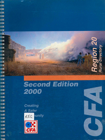
Map, Country Fire Authority, Region 20 rural directory, 2000
mapskerang, regional maps, atlas, fire protection -
 Victorian Aboriginal Corporation for Languages
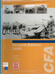
Map, Country Fire Authority, Region 6 rural directory, 2000
maps, b&w photographscolac, lismore, cressy, lake corangamite, camperdown, terang, cobden, peterborough, port campbell, apollo bay, forrest, victorian regional maps, fire protection -
 Victorian Aboriginal Corporation for Languages
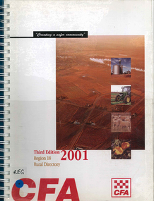
Map, Country Fire Authority, Region 18 rural directory, 2001
Maps, colour photographsswan hill, mildura, mallee, fire protection, emergency services, victorian regional maps -
 Victorian Aboriginal Corporation for Languages
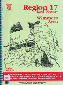
Map, Country Fire Authority, Region 17 rural directory : Wimmera area, 1997
mapshorsham, wimmera, west wimmera, hindmarsh, yarramback, grampians, fire protection, emergency services, victorian regional maps -
 Victorian Aboriginal Corporation for Languages
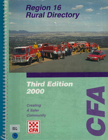
Map, Country Fire Authority, Region 16 rural directory, 2000
maps, colour photographsararat, fire protection, emergency services, maps, victorian regional maps -
 Victorian Aboriginal Corporation for Languages
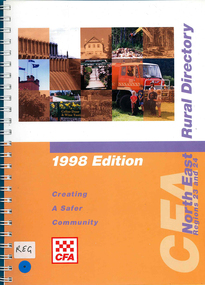
Map, Country Fire Authority, Regions 23 and 24 north east rural directory, 1998
mapswodonga, albury, wangaratta, benalla, maps, victoria, fire protection -
 Victorian Aboriginal Corporation for Languages
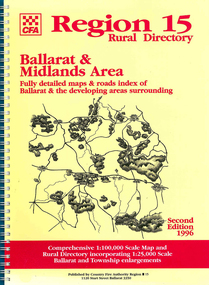
Map, Country Fire Authority, Region 15 rural directory : Ballarat &? Midlands Area : fully detailed maps &? roads index of Ballarat &? the developing areas surrounding, 1996
mapsballarat, fire protection, victorian regional maps, emergency services -
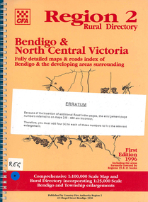 Victorian Aboriginal Corporation for Languages
Map, Country Fire Authority, Region 2 rural directory : Bendigo &? North Central Victoria: fully detailed maps &? roads index of Bendigo &? the developing areas surrounding, 1996
mapsbendigo, loddon, fire protection, victorian regional maps, directories -
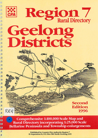 Victorian Aboriginal Corporation for Languages
Map, Country Fire Authority, Region 7 rural directory Geelong districts, 1996
Shows roads, railway, power lines, buildings and emergency locations. Lists property owners.mapsgeelong, regional victoria, fire protection -
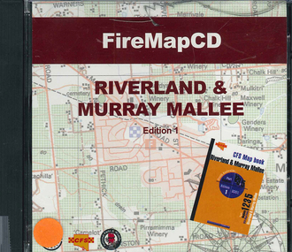 Victorian Aboriginal Corporation for Languages
CD-ROM, Country Fire Services South Australia, FireMapCD Riverland &? Murray Mallee, 2001
The area covered by this map is the same as the CFS Riverland & Murray Mallee Map Book. The area covered adjoins the Mount Lofty Ranges map book on the eastern boundary at Murray Bridge, north to Morgan and east to Renmark and the State Border. It extends southwards to join the northern boundary of the Lower South East map book at Padthaway.CD-ROMfire protection, victorian maps -
Stawell Historical Society Inc
Map - Laminated Map, Country Fire Authority, Mt Lubra and Deep Lead Fires Estimated Perimeters 2005 - 2006, 17/3/2006
Huge Fire Event in Grampians started by lightning strike at Mt Lubra on 19/1/2026 during a prolonged dry period. Stawell Deep Lead fire 31/12/2005 just three weeks earlier. Two people died on Moyston / Pomonal Road. Huge stork and feed loss.Coloured Laminated Map of Fire SpreadCFA GIS Services Community Safety -
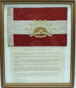 Ringwood RSL Sub-Branch
Souvenir - WW2 pennant, Made locally in country (Middle East), 1941
Believed to be brought home by L/Sgt John Wharton VX24447Car pennant 1 Australian Corps HQ Red and white flag with Rising Sun in the centreBeneath flag is a history of the pennant. Flag was made for a Generals car on or about 14 July 1941. -
Moorabbin Air Museum
Book - THE ROYAL AIR FORCE IN PICTURES, COUNTRY LIFE
-
 Otway Districts Historical Society
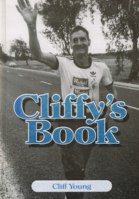
Book, High Country Publishing, Cliffy's Book
ISBN 064623241 Cliff's story of his racing career in his own words.Zappelli "Best Wishes, Cliff Young" -
 Wodonga & District Historical Society Inc
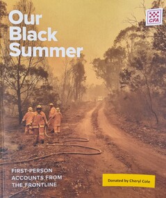
Book - Our Black Summer - First Person Account from the Frontline, Country Fire Authority, 2023
The 2019 - 2020 fire season, which became known as "Black SUmmer" was long and difficult for the CFA, emergency services and communities across the eastern seaboard of Australia, especially in northeastern and eastern Victoria. By its conclusion more than 8,200 CFA volunteers had contributed to the fire response in Victoria and another 2,288 CFA volunteers had been deployed interstate. THe bushfires burned 1.5 million hectares, destroyed more than 400 homes, 6,800 livestock and thousands of native animals. Tragically 5 people also lost their lives. The fires took their toll physically and psychologically.This book provides an insight into the challenges faced by so many in their efforts to protect communities and was produced as part of the recovery process from this horrific event.A publication by the CFA giving detailed information, images, maps and photographs about the bush fires which blazed across Victoria and southern New South Wales from November 2019 until brought under control in February 2020.non-fictionThe 2019 - 2020 fire season, which became known as "Black SUmmer" was long and difficult for the CFA, emergency services and communities across the eastern seaboard of Australia, especially in northeastern and eastern Victoria. By its conclusion more than 8,200 CFA volunteers had contributed to the fire response in Victoria and another 2,288 CFA volunteers had been deployed interstate. THe bushfires burned 1.5 million hectares, destroyed more than 400 homes, 6,800 livestock and thousands of native animals. Tragically 5 people also lost their lives. The fires took their toll physically and psychologically.This book provides an insight into the challenges faced by so many in their efforts to protect communities and was produced as part of the recovery process from this horrific event.black summer bushfires, cfa volunteers, bushfires australia -
 Wodonga & District Historical Society Inc
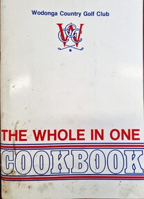
Book - The Whole in One Cook Book, Wodonga Country Golf Club Associates, 1985
A collection of recipes donated and compiled by the Wodonga Country Golf Club Associates as a fundraising venture in 1985.A small booklet including a collection of recipes and local advertising.A collection of recipes donated and compiled by the Wodonga Country Golf Club Associates as a fundraising venture in 1985.wodonga country golf club, cookbook -
 Wodonga & District Historical Society Inc
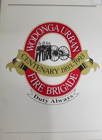
Book - Wodonga Urban Fire Brigade Centenary 1893- 1993, Country Fire Authority Victoria, C. 1993
The Wodonga Fire Brigade was founded in 1893 from a need to protect life and property in what was a small town straddling the Melbourne-Sydney railway line. This book traces the first 100 years of its development and service to the community.The Wodonga Fire Brigade was founded in 1893 from a need to protect life and property in what was a small town straddling the Melbourne-Sydney railway line. This book traces the first 100 years of its development and service to the community.history wodonga urban fire brigade, cfa wodonga -
Federation University Historical Collection
Book, Wendy Jacobs et al, Maldon Conservation Study, 1977, 1977
Brown soft covered book of 94 pages. It includes pull out maps and plans. conservation, maldon, planning, john templeton, porcupine flat, tarrengower, mining, architecture, town and country planning board, wendy jacobs, miles lewis, elizabeth vines