Showing 853 items matching "surveyors"
-
 Tatura Irrigation & Wartime Camps Museum
Book, Adolf Wilke, 15 September 1944 - 1 May 1946
Surveyors book compiled by POW Adolf Wilke who was lecturer in surveying at Camp 13, Murchison.Handmade hard cover, hand stitched book consisting of figures and plans in ink and pencil. 69 numbered pages.adolf wilke, surveying, camp 13 surveying -
Creswick Campus Historical Collection - University of Melbourne
Equipment, 1920s
Surveyors compass in wooden box used up until the 1940s. The box trimmings date to the 1920s.Equipment -
Whitehorse Historical Society Inc.
Map, Municipality of Nunawading, c1950
Plan No 234, compiled and photo-lithographed at the Melbourne and Metropolitan Board of Works under the direction of G.R. McGowan, Chief Surveyor.Plan No 234, compiled and photo-lithographed at the Melbourne and Metropolitan Board of Works under the direction of G.R. McGowan, Chief Surveyor. Covers the area each Side of Canterbury Road from Orchard Grove to Vernon Street. Includes detail of creeks.Plan No 234, compiled and photo-lithographed at the Melbourne and Metropolitan Board of Works under the direction of G.R. McGowan, Chief Surveyor. blackburn south, gardiners creek, blackburn, blackburn creeklands -
 Greensborough Historical Society
Article, Anne Paul, Robert Hoddle - Chains and Grids in Terra Nullius, January 2024
Article about Robert Hoddle, his work as a surveyor in early Melbourne and the use of the 'chain' to measure distance.14 page article text and illus.melbourne history, robert hoddle -
 Greensborough Historical Society
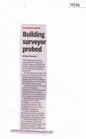
Newspaper Clipping, Diamond Valley Leader, Building surveyor probed, 01/03/2017
The building surveyor responsible for Diamond Creek’s plagued Rangeview Estate is being investigated by the Victorian Building AuthorityNews article 1 page, black text.diamond creek, building surveyor, investigation -
 Queenscliffe Maritime Museum
Instrument - Protractor in a flat square wooden box
instrument used by J P Larkin, government marine surveyor in the 20s and 30s in Port Phillip and queenscliffBrass drawing circle - a protractor in a flat square wooden boxsurvey instruments, j p larkin -
 Otway Districts Historical Society
Photograph, Railway survey camp, c.1901, c.1901
Six surveyors and a horse posing outside five tents somewhere on the Beech Forest line in approximately 1901.Photograph, B/W. Railway survey camp, Beech Forest line.survey camp; beech forest; railways; -
 Orbost & District Historical Society
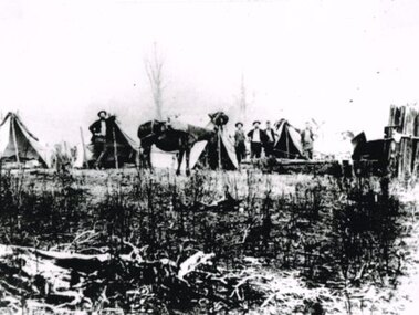
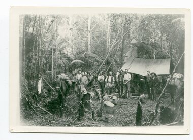
black / white photograph, 1897
Link with item 1178. This is a surveyors' camp in the McCulloch Ranges, Murrangowar, April, 1897. Included in the photograph are: L. Thorn; Pearson; L. Coburn, Clem Bates; Sam Blacklock with a packhorse. They were surveying for a road or railway. Surveyors were among the first European settlers to arrive in Australia. A Surveyor-General was present on the First Fleet, as well as the first two ships which landed in South Australia. These men were issued with instructions to record observations in a journal that included the country’s general appearance, its soil, flora and fauna and the customs and language of local inhabitants. The conditions they worked in were harsh and they embarked on journeys with drays carrying cumbersome surveying and camping equipment, spending months camping out in the bush and mapping the land. It was not until well into the second half of the nineteenth century that the professional training of surveyors became mandatory in Australia.This is a pictorial record of a surveyors' camp in the late 19th century.A black / white photograph of a group of men standing in front of a tent / camp in a dense bush setting.surveyor's-camp-mccullochs-ranges-murrangowar land-settlement -
 Ringwood and District Historical Society
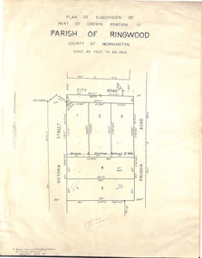
Document - Folder, Plan of Subdivision - Part of Crown Portion 11, Parish of Ringwood - undated, circa 1950s
Buff coloured survey map of subdivision glued to manilla folder. Five residential blocks bounded by City Road, Victoria Street (later Ireland Street), and Prussia Road (later Regina Street).(Surveyor) R. James Love L.S. M.I.S. (Aust) M.A.I.C. 52 Comer Street Brighton East S6 Phone XB-5928 -
 Federation University Historical Collection
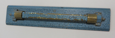
Drawing Equipment, Ruler, Straight /Parallel Lines
... surveyors ...Blue coated brass rule with straight edges. Mounted on grooved roller mounts. brass, ruler, engineers, architects, surveyors -
 Robin Boyd Foundation
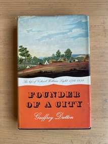
Book, Geoffrey Dutton, Founder of a City: the Life of Colonel William Light, 1960
... Surveyors ...Hardcover w/ Dust Jacketaustralian biography, south australia, surveying, surveyors, walsh st library -
 Greensborough Historical Society
Poster - Planning Document, Shire of Diamond Valley et al, Subdivision Plan # 1018 - Parish of Nillumbik, County Bourke, Crown Allotment 4 Section 15, and Crown Allotment B Section 12, Eltham North, 1981-1982
Subdivision Plan # 1018 - Parish of Nillumbik, County Bourke, Crown Allotment 4 Section 15, and Crown Allotment B Section 12, Eltham North. This subdivision plan includes Ryans Road (also known as Government Road) and St Clems Street. The developer for this subdivision is Taunton Developments and the Surveyors are Fisher Cleeland Turner & Dwyer Vic, Surveyors and Engineers.An example of hard copy subdivision plans from the Greensborough area. Mainly from the Shire of Diamond Valley era (1964-1994).Plan (single sided) mounted on heavy card. Stamped and handwritten Council permissions, dates and other details. subdivision plans, shire of diamond valley, taunton developments -
 Bendigo Historical Society Inc.
Document - W.D.MASON COLLECTION: MEMORANDUM, 31 May 1900
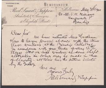
Document, W.D.Mason Collection, Memorandum from Reed, Smart ,Tappin, Architects & Surveyors, 44 Elizabeth Street, Melbourne.dated 31.5.1900 This letter is to inform that you can proceed with the stained glass windows for the Bendigo Cathedral in accordance with your tender of May 12th.business, retail, w d mason -
 Port Melbourne Historical & Preservation Society
Photograph - Mayor, councillors, town clerk and surveyor, Borough of Port Melbourne
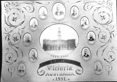
The original piece hangs outside the Council chamber.Poor photographic copy of centre panel from enormous installation piece sent to 1891 Paris international exhibition, showing Town Hall, Mayor, Councillors, Town Clerk and Surveyor, Borough of Port Melbourne. Digital image of Philip SALMON is on databaselocal government - town of port melbourne, port melbourne town hall, james john bartlett, mayors, michael tarver quinn, william henry prohasky, edward clark, arthur victor heath, phillip melville salmon, charles edward smith, james ker beck plummer, john finlay malcolmson, william richardson tarver, henry norval edwards -
 Bayside Gallery - Bayside City Council Art & Heritage Collection
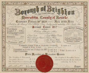
Certificate - Illuminated certificate, Brighton Municipal Certificate, 1872
bayside city council, borough of brighton, illuminated, certificate, population, rates, public buildings, wp allen, mayor, town clerk, surveyor, councillors, council, borough, county of bourke -
 Bayside Gallery - Bayside City Council Art & Heritage Collection
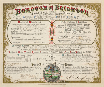
Certificate - Illuminated certificate, Hamel & Fergsuon, Brighton Municipal Certificate, 1866
bayside city council, borough of brighton, illuminated, certificate, population, rates, public buildings, mayor, town clerk, surveyor, councillors, council, borough, county of bourke, thomas crisp, cr t. crisp, census, parish of moorabbin, hamel & ferguson, coat of arms -
University of Melbourne, Burnley Campus Archives
Plan - Photocopy, Edward Owens, Contour Plan of the Town of Richmond, 1873
Photocopy of Contour Plan of the Town of Richmond prepared by M. Egan, Architect and Edward Owens, Cont. Surveyor, 25.03.1873. Plan C. Shows proposed Main Drains and Horticultural Garden. From State Library of Victorian VSL 821.08 Richmond 1873"State Library Vic." in inkdrainage, burnley horticultural gardens, m. egan, edward owens, town of richmond, contour plan -
 Queenscliffe Maritime Museum
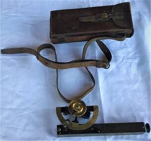
Instrument - Clinometer in leather case
Instrument used by J P Larkin, government marine surveyor active in Port Phillip and Queenscliff in the 20s and 30sA clinometer in its own leather case.T. Cooke and Sons Ltd London and Yorksurveying equipment, j p larkin -
Hume City Civic Collection
Map, Sunbury Township 1857
This is a reprint of a 1857 map of the township of Sunbury in the County of Bourke produced by the Public Records Office by courtesy of the Surveyor General in 1978.This is a reprint of a 1857 map of the township of Sunbury.sunbury, shire of bulla, sunbury township, 1850s -
 Melbourne Tram Museum
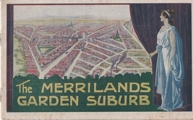
Book, T. M. Burke, "The Merrilands Garden Suburb", late 1919
Book - 12 pages with a fold out double page centre map, centre stapled, titled "The Merrilands Garden Suburb", a real estate marketing brochure for area to the west of the Reservoir rail line, known locally as Merrilands. Marketed on being a gardens suburb to the then Town Planning situation. Contains a suggested loop tram system. Has sales conditions, general information. Marketed by T. M. Burke of 340 Collin St Melbourne. Fold out surveyors map, by Saxil Tuxen, Licensed Surveyor date Oct. 1919. Shows suggested tram routes, reserves, and civic centre.trams, tramways, real estate, reservoir, proposals, new tramway, land -
 Kiewa Valley Historical Society
Photograph Farm Land, Mount Beauty Acreage before Golf Course, Circa 1950
This photograph is a "snap shot" in time circa 1950s detailing the rural environment before the effects of the Kiewa Valley Hydro Scheme altered the basic rural setting of the valley. The golfing fairway was being mapped out on previous grazing land, before the laying of a golf course, for use by the construction workers and auxiliary administration employees of the Victorian State Electricity Commission. This photograph details a dramatic period in time which saw an enormous change to the exclusively rural area of the Kiewa Valley region in the mid 1900s. This change presented both physical and mental challenges to the existing quiet rural inhabitants of the valley. The State of Victoria had to make adjustments to the changing demands imposed by population and industrial expansions. The development of cleaner energy supplies to a growing population has its downside ,which ever way the intrusion into the "natural" landscape is made.Black and white photograph detailing surveyor posts for construction of golf course. Land used, before establishment of the Mount Beauty Village, as farming/grazing cattle and viewed towards Mount Bogong and its Alpine ranges. The photo is on 200gms paper and not on photographic paper.nilmount beauty in the 1940s - 1950s, grazing in the kiewa valley, sec victoria -
Port Melbourne Historical & Preservation Society
Book - Correspondence, A V HEATH, Town Surveyor, Port Melbourne, Arthur Victor Heath, Town Surveyor, 1890 - 1894
One of two books containing tracing paper copies of letters handwritten by Town Surveyor A.V. HEATH: from approximately 1 Nov 1890 to 3 March 1894 (date of commencement is approximate because pages are missing). Also contains certificates of survey.engineering - roads streets lanes and footpaths, local government - town of port melbourne, local government - borough of port melbourne, engineering - other, arthur victor heath -
University of Melbourne, Burnley Campus Archives
Plan, Plan of Richmond Park, 1872
Plan of Richmond Park L4461. Shows Horticultural Society's Garden without extra land used for Field Station (see 11.0363, but earlier). Surveyed and drawn by A.L. Martin, Authorized Surveyor. Photo-lithographed at the Department of Lands and Survey, 6th Sept. 1872.Handwritten notes on reverse and another railway line marked in pencil.railway lines, swan street, yarra river, richmond park, horticultural society, orchard -
Federation University Historical Collection
Plan, Lease Application Field Notes No. 676. James Richardson, 28 January 1893
Foolscap size hand drawn ink plan near Morgan St and along Yarrowee Creek with State School and Weslyan Church central on page.Titled 'Correct Copy of Fieldnotes Lease Application No 676 JAMES RICHARDSON' also handwritten below this is 'Robert Davidson Surveyor 28th Jany/93' -
Port Melbourne Historical & Preservation Society
Plan - Ingles Street, Port Melbourne, 12 Jan 1866
Plans for Ingles Street showing both ground plan and longitudinal and traverse sections at Station Place, Heath, Nott and Bay Streets.Signed by surveyor Chas. Clay and James Bibby plus Thomas (Reek) Warren as witness to latter sig. Also a no: 355/H1 added later.engineering - roads streets lanes and footpaths, charles clay, thomas (reek) warren, james bibby -
 Ringwood and District Historical Society
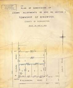
Map - Plan of Subdivision, Part of Crown Allotments 39 and 40 Section C, Township of Ringwood, County of Mornington - (Undated - circa 1930s)
Copy of land title map on light cardboard backing showing layout and size of 6 allotments in Illoura Road (later Illoura Avenue) and Alexandra Road, Ringwood East, Victoria. Rubber stamp imprint in top left corner - D.H. Oliver, Civil Engineer & Licensed Surveyor, Bellevue Street Lilydale, Phone Lilydale 91. -
 Eltham District Historical Society Inc
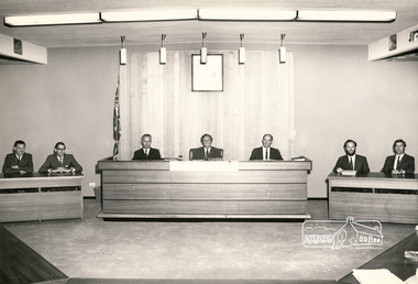
Photograph, Shire of Eltham Senior Staff, 1971, 1971
Formal photograph of Shire of Eltham Senior Staff, in Shire of Eltham (Main road Eltham, now demolished). From left: George Newton (Building Surveyor), Martin Verhoevan (Deputy Shire Engineer), John McDonald (Shire Engineer), Geoff Dreverman (Shire President), Max Watson (Shire Secreatary), Tony Roberts(?) (Deputy Shire Secretary) and Barry Gaudin (Chief Health Surveyor)Black and white print 25.5 cm x 20.5 cmA2206 Hugh Fisher 82 Lygon St, Brunswick 3057 38-3040 6 York St, Eltham 3095 439-9046 councilors, shire of eltham, george newton, martin verhoevan, john mcdonald, geoffrey dreverman, max watson, tony roberts, barry gaudin -
Lakes Entrance Historical Society
Album - East Gippsland Album
Twenty six images c 20 x 25 cm purchased from Apple Lea Craft Shop, W.T Dawson District Surveyor, C. W. Ligar Surveyor General of Victoria. North Arm, Jemmy.s Point, S.S Wyralla,Yacht Nyama, Kalimna Hotel, Whiters Camp Park, Metung, P.S. Tanjil, S.S. Gippsland, S.S. Burrabogie, S.S. J.C.D, White covered album containing 49 images of early East Gippsland Victoriawaterways, islands, townships -
 Eltham District Historical Society Inc
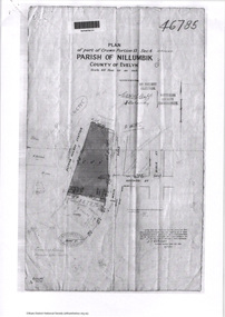
Document - Photocopy, Survey Fleld Notes of Part of Crown Portion 13, Section 4 at Eltham, Parish of Nillumbik, County of Evelyn, 7 May 1925
Portion of land bounded by: Main Road, Eltham Railway Station Application 46785 J.T. Robinson, Surveyor, 7 May 1925application 46785, arthur street, bible street, eltham, eltham railway station, luck street, main road, map, survey plan -
 Orbost & District Historical Society
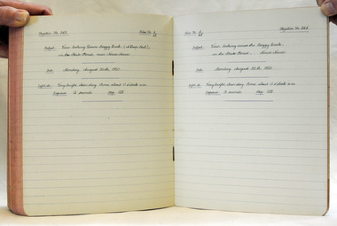
book, August 1919
These record were made by William Hunter. William Hunter (1893-1971), resident of Tatura and Mallacoota, was a soldier, surveyor and amateur naturalist.This item is associated with William Hunter.Two lined page book with back covers glued together. They contain hand-written astronomical observations and records of photographs taken. There is a blotter inside.hunter-william astronomy