Showing 2868 items
matching victoria's coast
-
 Dutch Australian Heritage Centre Victoria
Book, Waar Mens en Tijger Buren (Where Men and Tigers are Neighbours), 1962
The author had been part of the Dutch Administration in the former Dutch East Indies, including a role as Governor of Sumatr'a East Coast. His tales bear witness to a deep appreciation and love of the country.Hardcover book of short stories concerning life in the former Dutch East Indies.Author L.C. Westenenk Published by H.P.Leopolds Uitgeverij N.V. Den Haag -
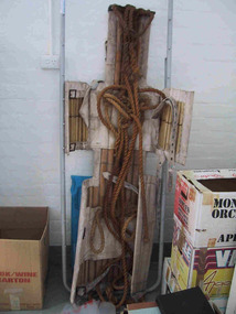 Parks Victoria - Wilsons Promontory Lightstation
Stretcher
Made of canvas and bamboo slats with hemp ropes, adjustable canvas straps and metal buckles and rings, the rescue stretcher was used for carrying an injured person. According to the Powerhouse Museum, the stretcher and was ‘designed to support and carry an injured person in circumstances where the person has to be lifted vertically’. Known as the ‘Neil Robertson stretcher’, it was developed in the early 1900s by John Neil Robertson as a lightweight rescue device and was modelled on Japanese bamboo litters. An identical stretcher is held in Sydney’s Powerhouse Museum and is thought to date between c.1967 and 1999. The museum’s statement of significance for the unique stretcher elaborates on its cultural values: The canvas is wrapped around the patient and secured with strong canvas straps. A lifting rope is attached to a ring above the patient's head, while a guideline is tied near the ankles and used to stop the stretcher swaying as it is hoisted up. This style of stretcher was specifically designed for use on ships, where casualties might have to be lifted from engine-room spaces, holds and other compartments with access hatches too small for ordinary stretchers. The original name of the Neil Robertson stretcher was 'Hammock for hoisting wounded men from stokeholds and for use in ships whose ash hoists are 2 ft. 6 in. diameter'. Since those times the Neil Robertson stretcher has also been used in factories and mines and for other emergency rescue situations. It is still possible to buy this type of stretcher although the slats are now more likely to be made of wood. The example in the Powerhouse collection was amongst several items of obsolete first aid and rescue equipment donated by the electricity generation company Delta Electricity. It would have been used - or at least been on stand-by - at the company's Munmorah Power Station or the associated coal mine on the Central Coast of New South Wales. Industrial sites and mines are extremely dangerous work places. Throughout the 20th century to the present there has been a drive, especially in developed countries like Australia, to improve workplace safety. Measures taken to reduce injuries and deaths have included safer industrial equipment, safer work practices, staff training, and the ready availability of accident and emergency equipment.It was also used throughout WWI and WWII. There are two other examples of the stretcher are known in Parks Victoria heritage collections. Canvas and bamboo stretcher with straps and buckles. Hemp ropes are attached to the stretcher. -
 Parks Victoria - Wilsons Promontory Lightstation
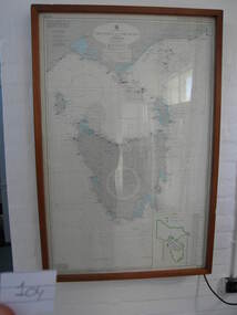
Nautical chart
Used as display in AMSA workshop foyer, Moorabbin, Vic. Nautical charts x 2 , The framed and glazed chart identifies strategic points in the notorious Bass Strait passage, which in the nineteenth century was known as the ‘Eye of the Needle’. It covers the whole of Tasmania, Bass Strait and the islands, and the lower part of Victoria with its coastline between Cape Otway and Gabo Island. The chart has an electric cord connecting it to a wall switch which enables a series of small lights to flash on strategic geographical locations.. While it is not known if it is original to Wilsons Promontory, it certainly elates to its location. A similar chart at Cape Otway shows less of Tasmania and is not electrified. Gabo Island Lightstation has two large framed charts; one is the same as the Wilsons Promontory example but without the lights and the other is entirely different, focussing on the east coast between Point Hicks and Montague Island. The Wilsons Promontory chart is unique as an illuminated version of the other charts and has first level significance if its provenance to the lightstation can be confirmed.The framed and glazed chart has an electric cord connecting it to a wall switch which enables a series of small lights to flash on strategic geographical locations.Yes -
![Drawing - Untitled [Caricature of Robert Doyle, then Leader of the Opposition in the Parliament of Victoria], John Spooner](/media/collectors/5f33390821ea670db8ae2a22/items/5fb6fb8223fe8f181870084b/item-media/5fdc14a814f04b0358ccd811/item-fit-380x285.jpg) Bass Coast Shire Council - Robert Smith Collection
Bass Coast Shire Council - Robert Smith CollectionDrawing - Untitled [Caricature of Robert Doyle, then Leader of the Opposition in the Parliament of Victoria], John Spooner
Ink drawing for newspaper cartoonTitled u.l -
Disability Sport & Recreation Victoria
Film - DVD, 2011 National Wheelchair Rugby League finals, 2011
... Disability Sport & Recreation Victoria 33-37 Hotham Street ...The DVD features footage from two matches from the 2011 season of the National Wheelchair Rugby League. The DVD features the game for 3rd/4th place, between the South Australia Sharks and Gold Coast Titans. Following this game is the championship game played between Victoria Thunder and New South Wales Gladiators. T These games were played in Adelaide.DVD Inside case.2011 National Wheelchair Rugby League Finalssouth australia sharks, gold coast titans, victoria thunder, new south wales gladiators, wheelchair rugby, darryl wingard, national wheelchair rugby league, djuro sen, george hucks -
Disability Sport & Recreation Victoria
Film - DVD, 2012 National Wheelchair Rugby final
This DVD features the gold medal match from the 2012 National Wheelchair Rugby League season. The game was between the Gold Coast Titans and South Australia Sharks. The game was played at the Sydney Olympic Sports Centre.DVD in case2012 National Wheelchair Rugby finalsydney olympic sports centre, gold coast titans, south australia sharks, wheelchair rugby, national wheelchair rugby league -
Disability Sport & Recreation Victoria
DVD, 2012 National Wheelchair Basketball League Finals, 20/06/2012
The DVD features footage from two matches from the 2012 season of the National Wheelchair Basketball League. The DVD features extended highlights from the game for 3rd/4th place, between the Sydney University Wheelkings and Dandenong Rangers. Following this game is the full recording of the championship game played between Perth Wheelcats and Wollongong Rollerhawks. These games were played in Shellharbour on the New South Wales south coast.DVD inside case2012 National Wheelchair Basketball League Finalsdjuro sen, national wheelchair basketball league, wheelchair basketball, sydney university wheelkings, perth wheelcats, wollongong rollerhawks, dandenong rangers, dylan alcott -
 Ballarat Heritage Services
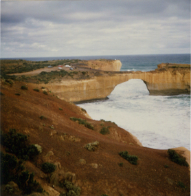
Photograph, London Bridge, Great Ocean Road, 01/1990
... Shipwreck coast Victoria Port Campbell London Bridge, pre 1990 ...London Bridge, pre 1990 was a double-spanning bridge connected to the mainland. The stack was created over hundreds of years, with the weaker layers toward the base being eroded away by wind and water to form the two bridges. The span closer to the shoreline collapsed unexpectedly on 15 January 1990, leaving two visitors, whilst uninjured, stranded on the outer span before being rescued by helicopter. Two coloured photographs of the London Bridge, on the Great Ocean Road. This photo was taken days before the collapse of the geological feature. The photographer walked across the bridge to the warning of her mother "if you go over there and it collapses you will be stuck. After the collapse it was renamed London Arch. london bridge, great ocean road, london bridge, peterborough, london arch, shipwreck coast, 12 apostles -
 Ballarat Heritage Services
Photograph - Image - Black and White, Portsea on Port Phillip Bay, c1950
... A black and white image of the coast at Portsea, Victoria.... on Port Phillip Bay, c1950 A black and white image of the coast ...A black and white image of the coast at Portsea, Victoria.beach, portsea, port phillip bay -
 Ballarat Heritage Services
Photograph, Clare Gervasoni, Rocks Near Wild Dog Creek, Apollo Bay, 24/01/2022
Colour photograph of rocks on the beach at Apollo Bay at a rocky outcrop known as Match Point.apollo bay, match point, beach, coast, rocks -
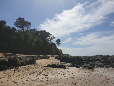
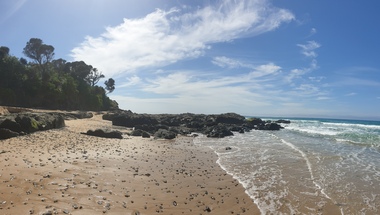 Ballarat Heritage Services
Photograph, Clare Gervasoni, Rocks Near Wild Dog Creek, Apollo Bay, 24/01/2022
Colour photograph of rocks on the beach at Apollo Bay at a rocky outcrop known as Match Point.apollo bay, match point, beach, coast, rocks -
 Ballarat Heritage Services
Photograph, Clare Gervasoni, Apollo Bay, Victoria, 24/01/2022
In 2021, the Department of Environment, Land, Water and Planning (DELWP) constructed two new groynes and a section of rock seawall at Apollo Bay to help manage the impacts of coastal erosion. The new 70-meter-long rock groynes run perpendicular to the shoreline and be located just south of the Milford St revetment and to the south of Milford Creek. Sections of rock seawall will be constructed between the two Groynes with an aim to protect the dune, walking path, cypress trees and road from erosion. Colour photograph of a coastal scene at Apollo Bay, featuring new rock groynes to protect the Great Ocean Road from erosion. apollo bay, beach, coast, groyne, rockwall -
 Ballarat Heritage Services
Photograph, Clare Gervasoni, Apollo Bay, Victoria, 24/01/2022
In 2021, the Department of Environment, Land, Water and Planning (DELWP) constructed two new groynes and a section of rock seawall at Apollo Bay to help manage the impacts of coastal erosion. The new 70-meter-long rock groynes run perpendicular to the shoreline and be located just south of the Milford St revetment and to the south of Milford Creek. Sections of rock seawall will be constructed between the two Groynes with an aim to protect the dune, walking path, cypress trees and road from erosion. Colour photograph of a coastal scene at Apollo Bay, featuring new rock wall and groynes to protect the Great Ocean Road from erosion. apollo bay, beach, coast, groyne, rockwall -
 Ballarat Heritage Services
Photograph, Clare Gervasoni, Sea Wall at Apollo Bay, Victoria, 24/01/2022
In 2021, the Department of Environment, Land, Water and Planning (DELWP) constructed two new groynes and a section of rock seawall at Apollo Bay to help manage the impacts of coastal erosion. The new 70-meter-long rock groynes run perpendicular to the shoreline and be located just south of the Milford St revetment and to the south of Milford Creek. Sections of rock seawall will be constructed between the two Groynes with an aim to protect the dune, walking path, cypress trees and road from erosion. Colour photograph of a coastal scene at Apollo Bay, featuring new rock wall and groynes to protect the Great Ocean Road from erosion. apollo bay, beach, coast, groyne, rockwall, sea wall -
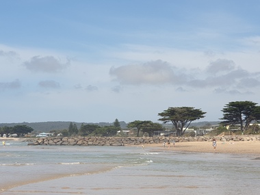
 Ballarat Heritage Services
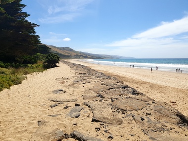
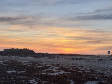
Photograph - Colour, Clare Gervasoni, Killarney Beach, Victoria, 26/12/2019
Colour photograph of Killarney Beach, Victoria at dusk..killarney beach, coast, beach -
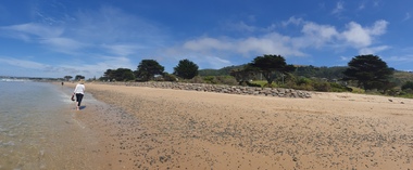
 Ballarat Heritage Services
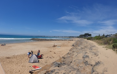
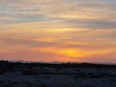
Photograph - Colour, Clare Gervasoni, Looking Towards Port Fairy from Killarney Beach, Victoria, 2018, 26/12/2019
... Killarney Beach, Victoria. killarney beach coast beach port fairy ...Colour photograph fron Killarney Beach, Victoria.killarney beach, coast, beach, port fairy -
 Kew Historical Society Inc
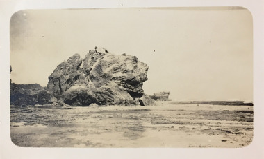
Photograph - Port Fairy Bay, c.1926
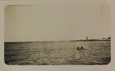
Henry Beater Christian (1886-1962) , was a descendant of one of the earliest settler families in Kew. Employed at the Kew Asylum as a 'public servant', he was a skilled amateur photographer, photographing numerous scenes in Kew and on his travels around Victoria. The majority of his photographs date from 1916 to 1929. His finest photographs are housed in two photograph albums. Digital copy of a photograph from page 23 of the 47-page photograph album containing 261 gelatinous silver images, loaned by Diane Washfold with permission given to digitise and hold a copy in our collection. In the 1920s, the photographer travelled throughout Victoria, including on the west coast from Port Campbell to Port Fairy. Trips were presumably made by train and by foot. Lynda Tieman and her team at the Port Fairy Historical Society were able to identify a number of Henry Christian's photographs of Port Fairy of which this is one. The scene is of Port Fairy Bay, with the Red lighthouse on Griffith Island on the horizon. In the foreground, two men are rowing a boat. henry beater christian (1886-1962), landscape photography, christian-washfold collection, photograph albums, port fairy bay, red lighthouse, griffith island -
 Kew Historical Society Inc
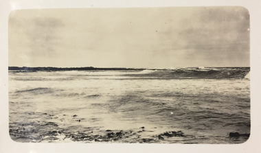
Photograph - Boarding School Beach at Port Fairy, c.1926
Henry Beater Christian (1886-1962) , was a descendant of one of the earliest settler families in Kew. Employed at the Kew Asylum as a 'public servant', he was a skilled amateur photographer, photographing numerous scenes in Kew and on his travels around Victoria. The majority of his photographs date from 1916 to 1929. His finest photographs are housed in two photograph albums. Digital copy of a photograph from page 23 of the 47-page photograph album containing 261 gelatinous silver images, loaned by Diane Washfold with permission given to digitise and hold a copy in our collection. In the 1920s, the photographer travelled throughout Victoria, including on the west coast from Port Campbell to Port Fairy. Trips were presumably made by train and by foot. Lynda Tieman and her team at the Port Fairy Historical Society were able to identify a number of Henry Christian's photographs of Port Fairy, of which this is one. The scene is of Boarding School Beach at Port Fairy and of bathing boxes on the stone reef.henry beater christian (1886-1962), landscape photography, christian-washfold collection, photograph albums, port fairy (vic.), boarding school beach -
 Kew Historical Society Inc
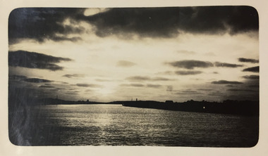
Photograph - River Moyne at Port Fairy, c.1926
Henry Beater Christian (1886-1962) , was a descendant of one of the earliest settler families in Kew. Employed at the Kew Asylum as a 'public servant', he was a skilled amateur photographer, photographing numerous scenes in Kew and on his travels around Victoria. The majority of his photographs date from 1916 to 1929. His finest photographs are housed in two photograph albums. Digital copy of a photograph from page 23 of the 47-page photograph album containing 261 gelatinous silver images, loaned by Diane Washfold with permission given to digitise and hold a copy in our collection. In the 1920s, the photographer travelled throughout Victoria, including on the west coast from Port Campbell to Port Fairy. Trips were presumably made by train and by foot. Lynda Tieman and her team at the Port Fairy Historical Society have tentatively identified a number of Henry Christian's photographs of Port Fairy, of which this is one. The scene is believed to be the River Moyne.henry beater christian (1886-1962), landscape photography, christian-washfold collection, photograph albums, river moyne, port fairy -
 Kew Historical Society Inc
Photograph - Southern Shoreline at Port Fairy, c.1926
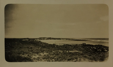
Henry Beater Christian (1886-1962) , was a descendant of one of the earliest settler families in Kew. Employed at the Kew Asylum as a 'public servant', he was a skilled amateur photographer, photographing numerous scenes in Kew and on his travels around Victoria. The majority of his photographs date from 1916 to 1929. His finest photographs are housed in two photograph albums. Digital copy of a photograph from page 23 of the 47-page photograph album containing 261 gelatinous silver images, loaned by Diane Washfold with permission given to digitise and hold a copy in our collection. In the 1920s, the photographer travelled throughout Victoria, including on the west coast from Port Campbell to Port Fairy. Trips were presumably made by train and by foot. Lynda Tieman and her team at the Port Fairy Historical Society have tried to identify a number of Henry Christian's photographs of Port Fairy, of which this is one. The scene is probably the Southern Shoreline but no obvious landmarks are observable. henry beater christian (1886-1962), landscape photography, christian-washfold collection, photograph albums, port fairy, southern shoreline -
 Kew Historical Society Inc
Photograph - McKechnie's Craigs at Port Fairy, c.1926
Henry Beater Christian (1886-1962) , was a descendant of one of the earliest settler families in Kew. Employed at the Kew Asylum as a 'public servant', he was a skilled amateur photographer, photographing numerous scenes in Kew and on his travels around Victoria. The majority of his photographs date from 1916 to 1929. His finest photographs are housed in two photograph albums. Digital copy of a photograph from page 23 of the 47-page photograph album containing 261 gelatinous silver images, loaned by Diane Washfold with permission given to digitise and hold a copy in our collection. In the 1920s, the photographer travelled throughout Victoria, including on the west coast from Port Campbell to Port Fairy. Trips were presumably made by train and by foot. Lynda Tieman and her team at the Port Fairy Historical Society have tentatively identified a number of Henry Christian's photographs of Port Fairy, of which this is one. The scene photographed was on occasions at that time knowns as McKechnie's Craigs, but now more commonly as the Craigs or Crags.henry beater christian (1886-1962), landscape photography, christian-washfold collection, photograph albums, port fairy, mckechnie's craigs, the crags, the craigs -
 Kew Historical Society Inc
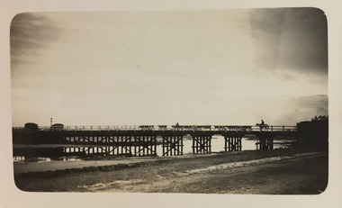
Photograph - Moyne River Bridge, c.1926
Henry Beater Christian (1886-1962) , was a descendant of one of the earliest settler families in Kew. Employed at the Kew Asylum as a 'public servant', he was a skilled amateur photographer, photographing numerous scenes in Kew and on his travels around Victoria. The majority of his photographs date from 1916 to 1929. His finest photographs are housed in two photograph albums. Digital copy of a photograph from page 24 of the 47-page photograph album containing 261 gelatinous silver images, loaned by Diane Washfold with permission given to digitise and hold a copy in our collection. In the 1920s, the photographer travelled throughout Victoria, including on the west coast from Port Campbell to Port Fairy. Trips were presumably made by train and by foot. Lynda Tieman and her team at the Port Fairy Historical Society have tentatively identified a number of Henry Christian's photographs of Port Fairy, of which this is one. The photo captures a man on a horse, believed to be Bill Digby, driving a herd of cattle across the Moyne River Bridge. The photo is shot into the man light source, leading to the bridge and those who cross it being shown in silhouette.henry beater christian (1886-1962), landscape photography, christian-washfold collection, photograph albums, moyne river bridge, port fairy (vic.), bill digby, cattle drovers -
 Kew Historical Society Inc
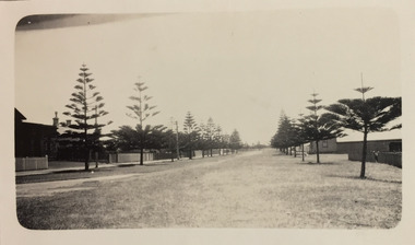
Photograph - Gipps Street, Port Fairy, c.1926
Henry Beater Christian (1886-1962) , was a descendant of one of the earliest settler families in Kew. Employed at the Kew Asylum as a 'public servant', he was a skilled amateur photographer, photographing numerous scenes in Kew and on his travels around Victoria. The majority of his photographs date from 1916 to 1929. His finest photographs are housed in two photograph albums. Digital copy of a photograph from page 23 of the 47-page photograph album containing 261 gelatinous silver images, loaned by Diane Washfold with permission given to digitise and hold a copy in our collection. In the 1920s, the photographer travelled throughout Victoria, including on the west coast from Port Campbell to Port Fairy. Trips were presumably made by train and by foot. Lynda Tieman and her team at the Port Fairy Historical Society have tentatively identified a number of Henry Christian's photographs of Port Fairy, of which this is one. The street pictured is Gipps Street, At the left is the Court House while the Belfast and Koroit Steam Navigation Company offices are on the righthenry beater christian (1886-1962), landscape photography, christian-washfold collection, photograph albums, port fairy (vic.), belfast and koroit steam navigation company, gipps street, court house -- port fairy (vic.) -
 Kew Historical Society Inc
Photograph - Battery Hill Fort at Port Fairy, c.1926
Henry Beater Christian (1886-1962) , was a descendant of one of the earliest settler families in Kew. Employed at the Kew Asylum as a 'public servant', he was a skilled amateur photographer, photographing numerous scenes in Kew and on his travels around Victoria. The majority of his photographs date from 1916 to 1929. His finest photographs are housed in two photograph albums. Digital copy of a photograph from page 23 of the 47-page photograph album containing 261 gelatinous silver images, loaned by Diane Washfold with permission given to digitise and hold a copy in our collection. In the 1920s, the photographer travelled throughout Victoria, including on the west coast from Port Campbell to Port Fairy. Trips were presumably made by train and by foot. Lynda Tieman and her team at the Port Fairy Historical Society have tentatively identified a number of Henry Christian's photographs of Port Fairy, of which this is one. A man is photographed (possibly Henry Christian) standing within the Battery Hill Fort at Port Fairy.henry beater christian (1886-1962), landscape photography, christian-washfold collection, photograph albums, port fairy (vic.), battery hill fort -
 Kew Historical Society Inc
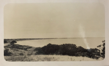
Photograph - East Beach from Battery Hill, Port Fairy, c.1926
Henry Beater Christian (1886-1962) , was a descendant of one of the earliest settler families in Kew. Employed at the Kew Asylum as a 'public servant', he was a skilled amateur photographer, photographing numerous scenes in Kew and on his travels around Victoria. The majority of his photographs date from 1916 to 1929. His finest photographs are housed in two photograph albums. Digital copy of a photograph from page 23 of the 47-page photograph album containing 261 gelatinous silver images, loaned by Diane Washfold with permission given to digitise and hold a copy in our collection. In the 1920s, the photographer travelled throughout Victoria, including on the west coast from Port Campbell to Port Fairy. Trips were presumably made by train and by foot. Lynda Tieman and her team at the Port Fairy Historical Society have tentatively identified a number of Henry Christian's photographs of Port Fairy, of which this is one. The photo is believed to be of East Beach from Battery Hill.henry beater christian (1886-1962), landscape photography, christian-washfold collection, photograph albums, east beach -- port fairy (vic.), battery point, port fairy -
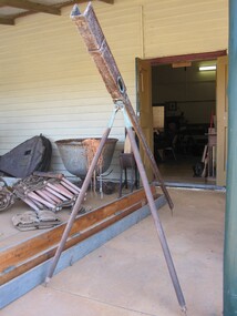 Parks Victoria - Port Campbell Rocket Shed
Rocket launcher
Rocket equipment which has been used in various lifeboat and rocket stations on the Victorian Coast. It is unclear if this is the original rocket equipment from Port Campbell. This equipment, if not original has been used in rescue operations and is identical to the equipment that has been in use at Port Campbell from C.1890 onwards.Metal, brass and timber tripod structure with a channel or trough to support the rocket. It has a pendulum and dial to measure the height trajectory. Very long wooden box with hinged lid painted a green-grey colour with four brass hinges and two rusted metal hooks. -
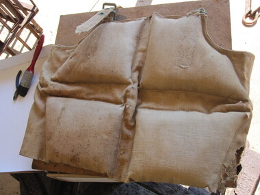 Parks Victoria - Port Campbell Rocket Shed
Life jackets
This rocket equipment has been used in various lifeboat and rocket stations on Victorian Coast. It is unclear if this is the original rocket equipment from Port Campbell. This equipment, if not original to the site, has been used in rescue operations and is identical to the equipment that was in use at Port Campbell from C.1890 onwardsTwo canvas lifejackets, one is filled with cotton or silk and the other with cork. The jackets are sewn in sections that hold either the cork or the cotton/silk. One of the lifejackets has a separate strap and brass eyelets and buckles. -
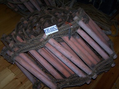 Parks Victoria - Port Campbell Rocket Shed
Rope ladders
This rocket equipment has been used in various lifeboat and rocket stations on Victorian Coast. It is unclear if this is the original rocket equipment from Port Campbell. This equipment, if not original to the site, has been used in rescue operations and is identical to the equipment that was in use at Port Campbell from C.1890 onwardsTwo rope ladders, identical in format and length. The rungs are made from another type of material. -
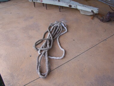 Parks Victoria - Port Campbell Rocket Shed
Rope strops
This rocket equipment has been used in various lifeboat and rocket stations on Victorian Coast. It is unclear if this is the original rocket equipment from Port Campbell. This equipment, if not original to the site, has been used in rescue operations and is identical to the equipment that was in use at Port Campbell from C.1890 onwardsFour rope strops, three are of equal length. Lengths of rope spliced or joined to form a circle of approx. 100cm diameter. The long rope is triple laid rope and the three shorter ropes are made of multiple small strings (approx.40) bound together. Use is yet to be determined.