Historical information
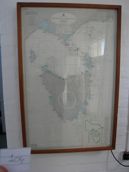
Used as display in AMSA workshop foyer, Moorabbin, Vic. Nautical charts x 2 , The framed and glazed chart identifies strategic points in the notorious Bass Strait passage,
which in the nineteenth century was known as the ‘Eye of the Needle’. It covers the whole of Tasmania, Bass Strait and the islands, and the lower part of Victoria with its coastline between Cape Otway and Gabo Island. The chart has an electric cord connecting it to a wall switch which enables a series of small lights to flash on strategic geographical locations.. While it is not known if it is original to Wilsons Promontory, it certainly elates to its location. A similar chart at Cape Otway shows less of Tasmania
and is not electrified. Gabo Island Lightstation has two large framed charts; one is the same as the Wilsons Promontory example but without the lights and the other is entirely different, focussing on the east coast between Point Hicks and Montague Island.
Significance
The Wilsons Promontory chart is unique as an illuminated version of the other charts and has first level significance if its provenance to the lightstation can be confirmed.
Physical description
The framed and glazed chart has an electric cord connecting it to a wall switch which enables a series of small lights to flash on strategic geographical locations.
Inscriptions & markings
Yes